Get PeakVisor App
Sign In
Search by GPS coordinates
- Latitude
- ° ' ''
- Longitude
- ° ' ''
- Units of Length

Yes
Cancel
❤ Wishlist ×
Choose
Delete
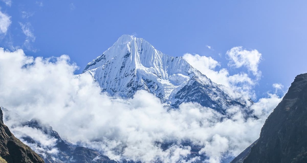
The Central Development Region is a now-defunct designated area in Nepal surrounding Kathmandu, including Langtang National Park and Gaurishankar Conservation Area in the Himalayas. It is a landscape of vast, winding canyons and jagged mountain peaks. The area includes sites of religious importance for both Tibetan Buddhists and Hindus, such as Gosainkunda Lake (4,406 m / 14,455 ft). It encompasses Nepal’s modern capital, Kathmandu, as well as the ancient capital, Bhaktapur. The region rises dramatically from the southern jungle lowlands around Chitwan National Park through the Kathmandu Valley to the mountains south of Shishapangma (8,027 m / 26,335 ft) in Tibet. There are 180 named peaks in the Central Development Region; the highest peak is Langtang Lirung (7,227 m / 23,711 ft), while the most prominent is Gauri Sankar (7,227 m / 23,406 ft)
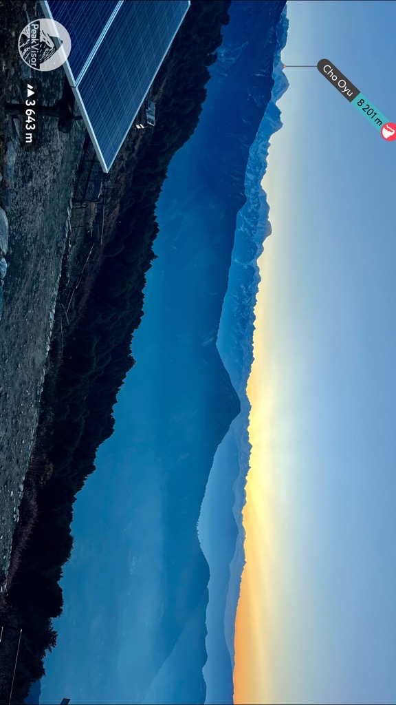
The towering Himalaya range defines Nepal’s geography, which stretches from far eastern India through China, Bhutan, and Nepal to the India-Pakistan border. Together with the Karakoram, they form the highest chain of mountains on Earth, including all 14 of the planet’s 8,000-meter summits.
These mountains are staggeringly beautiful but also make life difficult for the Nepalese. Nepal sits on the south-facing slope of the range, which captures the vast majority of the South Asian Monsoon. It’s the most robust monsoon on the planet, and the annual deluge of rain shapes the landscape into a maze of deep canyons prone to landslides. Widespread, devastating earthquakes also plague the country due to the ongoing instability created by the collision of the Indian and Eurasian tectonic plates.
The most recent was the 2015 Gorkha Earthquake, a magnitude 7.8-8.1 quake whose epicenter was just northwest of Kathmandu. The quake killed almost 9,000 people and affected anyone living in the mountains. Avalanches completely destroyed large areas of the Langtang Valley.
After the earthquake, Nepal reorganized the country from the former five development regions to the current system of provinces. The boundaries are mostly the same, but the names have changed. Until then, the Central Development Region had three zones: Bagmati, Janakpur, and Narayani.
Of these, most tourists visit the Bagmati Zone. Bagmati includes the Kathmandu Valley, the most densely-populated area in Nepal, and the Langtang Range, which features dozens of 5,000 to 6,000-meter peaks.
Jankapur Zone also covers part of the Himalayas, including the Gaurishankar Conservation Area. Gaurishankar (7,134 m / 23,406 ft) is the most prominent peak in the Central Development Region, although tourists rarely visit it.
Narayani Zone sits in the hot jungle lowlands near India. It includes Chitwan National Park, a famous destination for wildlife safaris. The park is known for its rhinoceroses, elephants, and Bengal tigers.
The biggest challenge of trekking anywhere in Nepal is transport. Roads are rough everywhere, even major highways. There is always a choice: a faster, more expensive option or a slower but cheaper option. Unfortunately, the fast way is always pricey, and the cheap way is almost always painfully slow.
Chances are, you will arrive in Nepal at Kathmandu airport. Most of the lodging in the city is in Thamel, a tourist district on the west side. You can either take a taxi from the airport (1,000-1,500 rupees) or take the green bus around the Ring Road to Ratna Park (30 rupees). From here, it’s a short walk through Asan Bazar to Thamel. Depending on traffic, a taxi may take the same amount of time as the bus.
Taxis are reliable for getting around the city, but be prepared to haggle. Drivers typically start prices anywhere from 50-100% higher than they realistically expect you to pay. Using apps like InDrive and Pathao takes much of the fuss out of negotiating. You can also catch a ride on a motorcycle, a fast, cheap (though hair-raising) option for solo travelers. Motorcycle fares are usually half what a taxi would cost.
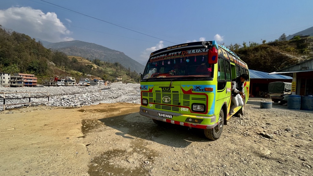
When leaving Kathmandu, you will probably depart from Gongabu Bus Park or the Tourist Bus Stand in Thamel. Buses to Langtang National Park take off just outside Gongabu on the far side of the Ring Road. The Tourist Bus Park services Pokhara. If you’re headed to Bhaktapur, you can take a public bus from Bagbazar Bus Park on the northeast corner of Ratna Park. Don’t be afraid to ask which bus you need to take. Nepalese people are incredibly helpful (sometimes to a fault).
The other option is to hire a private Jeep. This sounds much more efficient, but it mostly depends on your destination. Jeeps can get closer to some trailheads than buses. But every vehicle moves at about the same speed if you take a major highway.
So, taking a Jeep is a no-brainer if you’re headed to Sagarmatha National Park. But if you’re going to Pokhara, a Jeep won’t get you there any faster than a bus. Jeeps are much more expensive than public buses (usually five to ten times more), so think twice before you book one.
You can also fly to a lot of places from Kathmandu airport. Direct flights to Pokhara (near Annapurna), Lukla (near Everest Base Camp), and Bharatpur run daily. Short flights around Nepal cost around USD 120 but are the fastest way to get around.
The Himalayas are Nepal's true arbiters. Life in the shadow of Earth’s highest peaks depends on their moods, whether good or bad. The mountains attract tourists, a valuable economic resource. But they also destroy roadways and infrastructure with landslides, floods, avalanches, and earthquakes.
The Himalayas are the fastest-growing mountains on earth, hence the landscape's severity. Since the Indian landmass collided with Asia 40-50 million years ago, the Earth’s crust has been violently thrust skyward. By geologic standards, a mountain range rising nine kilometers in 50 million years is incredibly fast. The peaks in Nepal grow one centimeter per year.
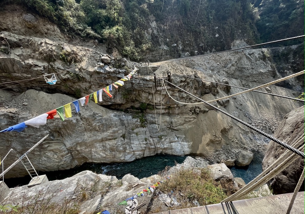
Moving that amount of rock upward produces enormous amounts of elastic force, which accounts for Nepal’s earthquakes. The range’s elevation also accounts for its sweeping glaciers, heavy monsoon rain, and subsequent landslides. You see the raw forces of erosion at work wherever you go in Nepal.
The Himalayas are diverse in terms of rock. The range is primarily igneous (granite, diorite, and gabbro) and sedimentary (dolomite, shale, and limestone) rock. Places like the Helambu Valley are full of limestone caves, many of which are sacred sites for Tibetan Buddhists.
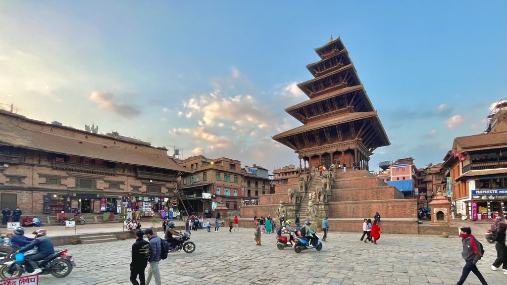
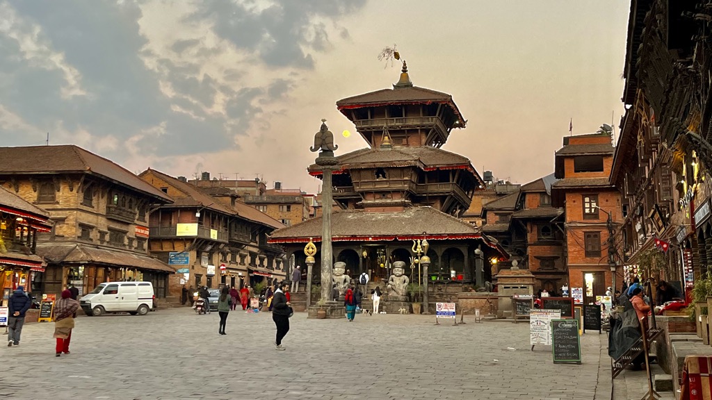
The Central Development Region is home to some of Nepal's most historically influential people and places. The Kathmandu Valley is home to the Newari, Nepal’s ancient ruling class. The group is just one of Nepal’s 125 distinct cultures but has had a sizable impact. The Newari ruled Nepal during the 500-year Malla Dynasty, a golden age in the country’s history.
One of Nepal's most worthwhile cultural destinations is the ancient city of Bhaktapur. During the Malla Empire, this was the country’s capital. It is full of fantastic Hindu temples, including the tallest in the country. You can also get authentic Newari food and see local craftspeople at work. The city is famous for clay pottery, which you’ll find drying in the sun on the cobbled streets.
But before the Mallas ruled the country, Nepal’s first inhabitants came from Tibet. Near the China border, in places like the Langtang Valley, ethnically Tibetan people (like the Tamang and Sherpa) keep their ancient cultural traditions alive.
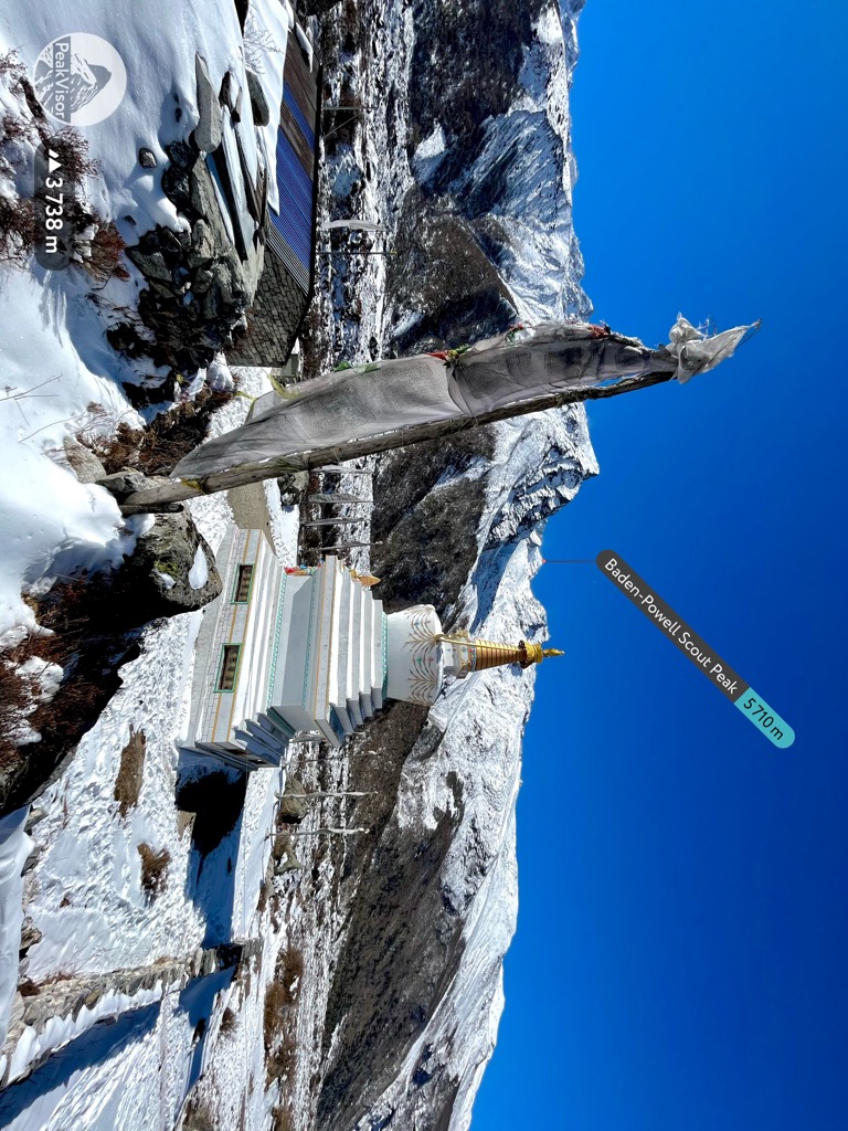
Walking through the Langtang Valley, you’re surrounded by Tibetan iconography, food, and Buddhism. Because of the strict rules for tourists in Tibet and other Tibetan areas of Nepal (like the Upper Mustang and Dolpo regions), the Langtang Valley is probably the most authentically Tibetan place outsiders can still visit without a guide.
Like any mountain range, elevation dictates Nepal’s various ecosystems. People often picture the Himalayas as a barren landscape of rock and snow, but that’s only true above 4,000 m (13,300 ft).
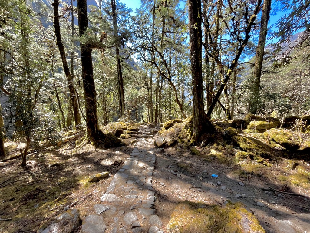
The Himalayan foothills are full of dense forests that support unique wildlife. Below that, in the lowlands near India, Nepal is a hot jungle.
Chitwan National Park is a prime example of this. In stark contrast to the cold, barren landscape of the upper Himalayas, Chitwan is a lush subtropical forest. The climate, dense vegetation, and substantial annual rainfall make it an ideal habitat for charismatic megafauna.
The park is known for its rhinos, elephants, water buffalo, crocodiles, and Bengal tigers. But it’s also home to more elusive mammals like honey badgers, hyenas, pangolins, and leopards. Chitwan is a popular safari destination and a must-see for wildlife lovers.
Gaining elevation, the jungle changes. The foothills of the Himalayas are full of bamboo forests mixed with deciduous trees. It’s common to see monkeys, deer, and monals in these areas. Moving higher, the forest becomes more temperate, mixed with more coniferous trees. It’s where large, cold-loving mammals like bears and wolves start to appear.
Beyond the pine trees is a brushy, cold landscape. The timberline is high in Nepal, usually around 3,500-4,000m. The Langtang Valley is a prime example of this sweeping, cold environment of rock and snow.
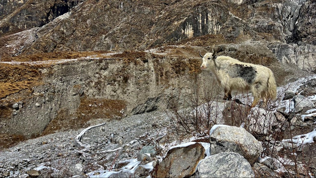
You’re almost guaranteed to see yaks grazing on the grassy hillsides above the treeline. Other animals, like marmots and Himalayan vultures, also do well in this harsh landscape.
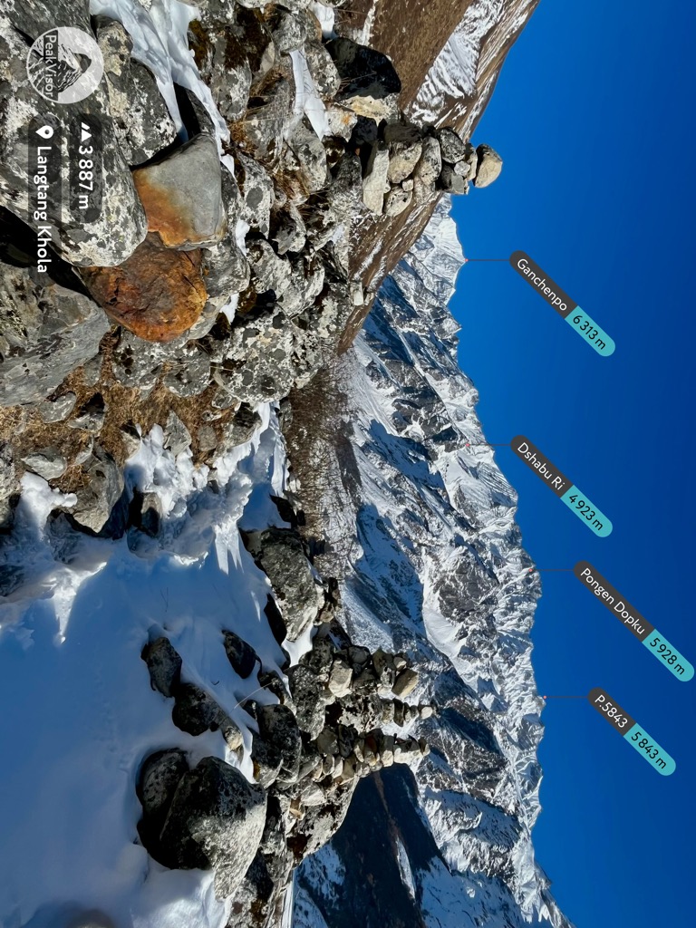
Aside from the fantastic wildlife and culture of the Central Development Region, the area is full of great hiking. There are a few destinations for multi-day trekking near Kathmandu, but the most popular and accessible in terms of transportation and logistics is Langtang National Park.
As of 2024, Langtang is one of the few remaining places in Nepal where visitors can trek without a guide. This, on its own, is a significant draw. If you prefer to hike at your own pace and make your own plans, or if you’re just budget-conscious, hiking without a guide is the way to go. Bear in mind this only applies to non-technical routes. If you want to do any climbing, you must have a guide and a TIMS card.
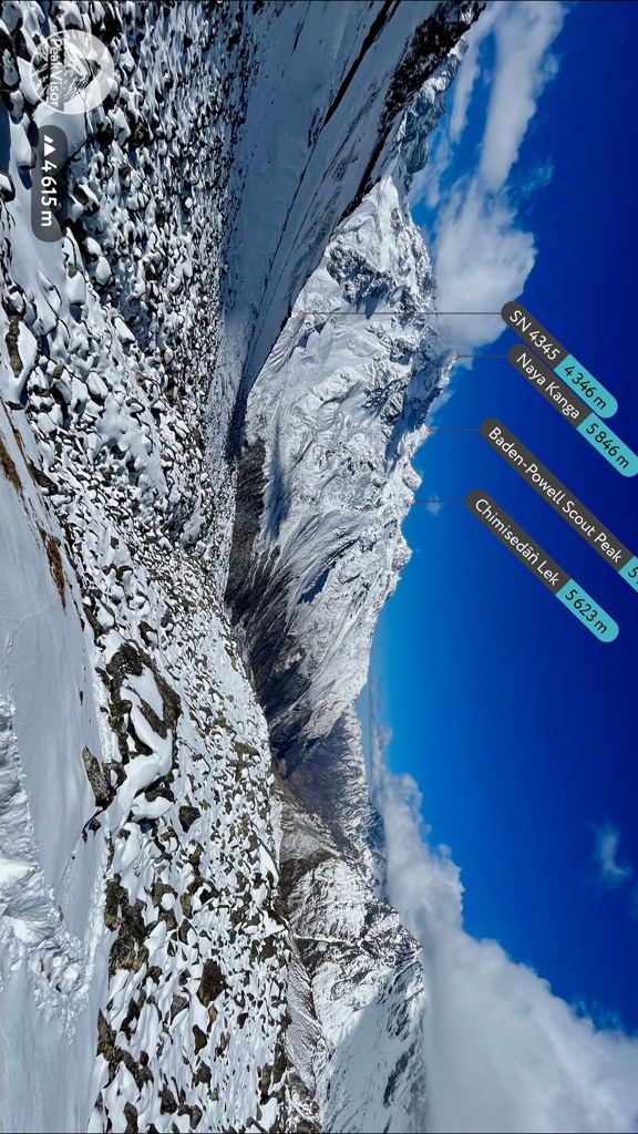
Guides are not required for non-technical treks in Langtang National Park, and trails like the Langtang Valley Trek are straightforward to navigate. However, guides can be handy for inexperienced hikers, so choose accordingly.
My advice is not to book a guide online. You will pay an inflated rate and have no way of getting to know the guide before you go. Kathmandu is full of guiding services and qualified independent guides who can get you up the mountain. If you hire a guide in person, expect to pay anywhere from 1,500-3,500 rupees ($10-25 USD) per day.
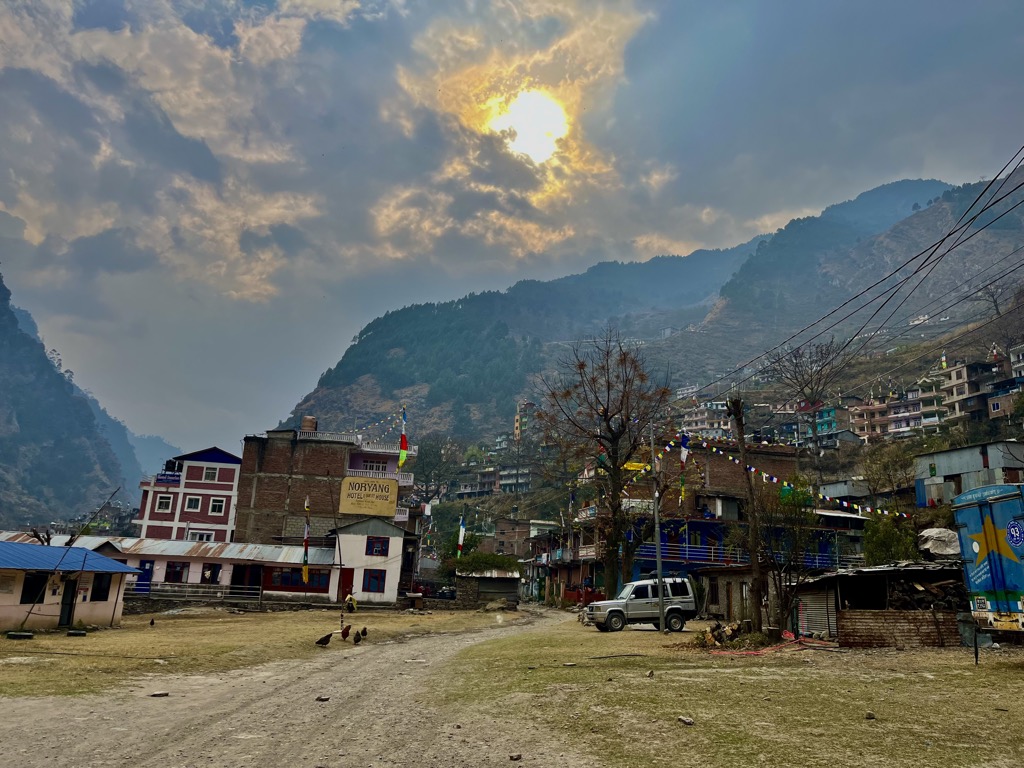
If you choose to go unguided, you’ll only need a permit for Langtang National Park. You can get this at the checkpoint in Dhunche on the bus ride to Syabru Besi or at the Tourist Service Center in Kathmandu. It costs 3,000 rupees (about USD 22). The police will also check your bag and may ask for a copy of your passport. Similarly, TIMS is not required in Gaurishankar Conservation Area. You will need to pay 3,000 rupees for an entry permit at the Tourist Service Center.
If you have a guide, you’ll also need a TIMS card. TIMS is now necessary for anyone hiking with a guide. It costs 2,000 rupees (about USD 15), and your guide should be able to get it for you.
There are two main routes into Langtang National Park for transport. You'll take a bus if you’re headed to Syabru Besi for the Langtang Valley Trek, Heritage Trek, or Gosainkunda Trek.
Buses leave at 7:30 daily. The bus stand is across the ring road from Gongabu Bus Park at Machha Pokhari Bus Stand. You’ll know you’re there when the drivers and luggage handlers start trying to lead you away from their competition. The bus to Syabru Besi is 1,000 rupees (750 to Dhunche).
If you’re headed to Helambu Valley, go to Helambu Bus Park on the northeast side of Kathmandu. If you do Gosainkunda starting in Dhunche, this is where you’ll end up on the way back.
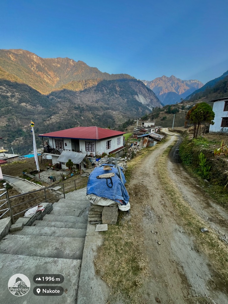
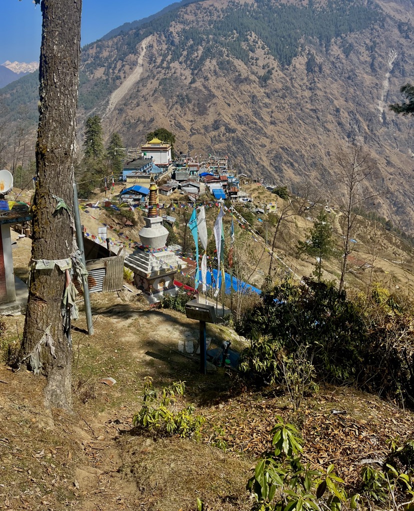
While hiking, you’ll stay in guesthouses. Langtang National Park is full of teahouses and places where you can pay for a bed and a hot meal. Any populated place is almost guaranteed to have at least one well-marked hotel or guesthouse. No reservations are required; just walk up, drop your bag, and ask for a bed.
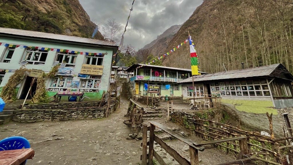
Rates vary, typically getting more expensive as you climb. In Syabru Besi, a bed runs 300-500 rupees per night. In Kyanjin Gompa, expect to pay 500-1,000 ($3.75-7.50 USD). At Gosainkunda, beds are 800-1,200 rupees.
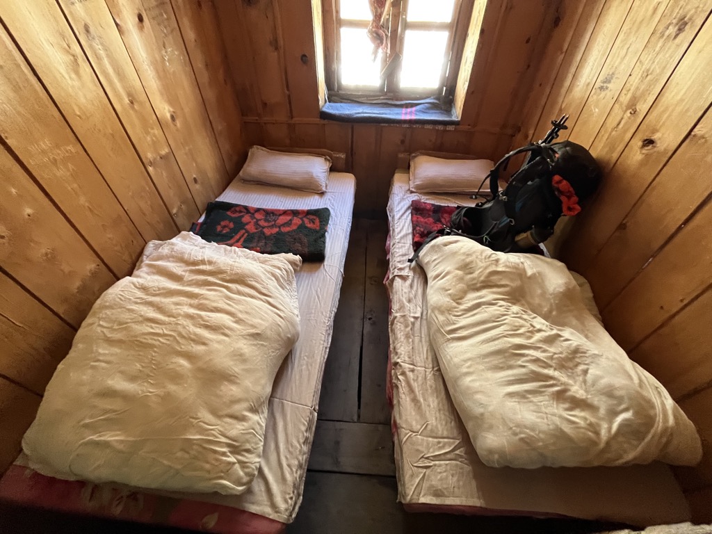
Most guest houses will give you a discount on a bed if you order all your meals from them. Depending on how much you eat (never underestimate how hungry trail days can make you), expect to spend anywhere from $20-35 per day for food and lodging on the trail. Packing snacks for lunch and coffee will keep your budget lower.
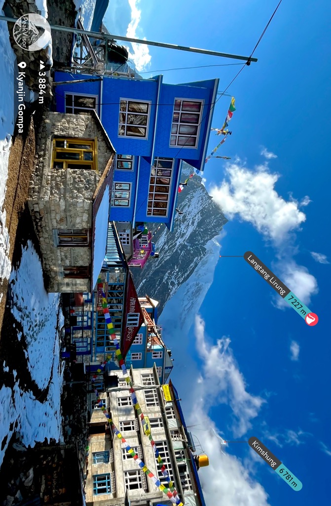
The Langtang Valley Trek is popular in Nepal for first-timers for good reason. It combines excellent views, cultural experiences, and a more remote setting than Annapurna Base Camp or Mardi Himal. Depending on your fitness and objectives, it takes anywhere from eight to 12 days, including transport days to and from Kathmandu.
First, catch a bus to Syabru Besi, an eight-to-ten-hour ordeal (bring snacks). You’ll buy your park pass in Dhunche and stay the night in Syabru. The trail crosses a suspension bridge and heads up the north side of the canyon toward Langtang Valley. As you climb, you’ll pass from bamboo forest to pine forest to alpine wilderness.
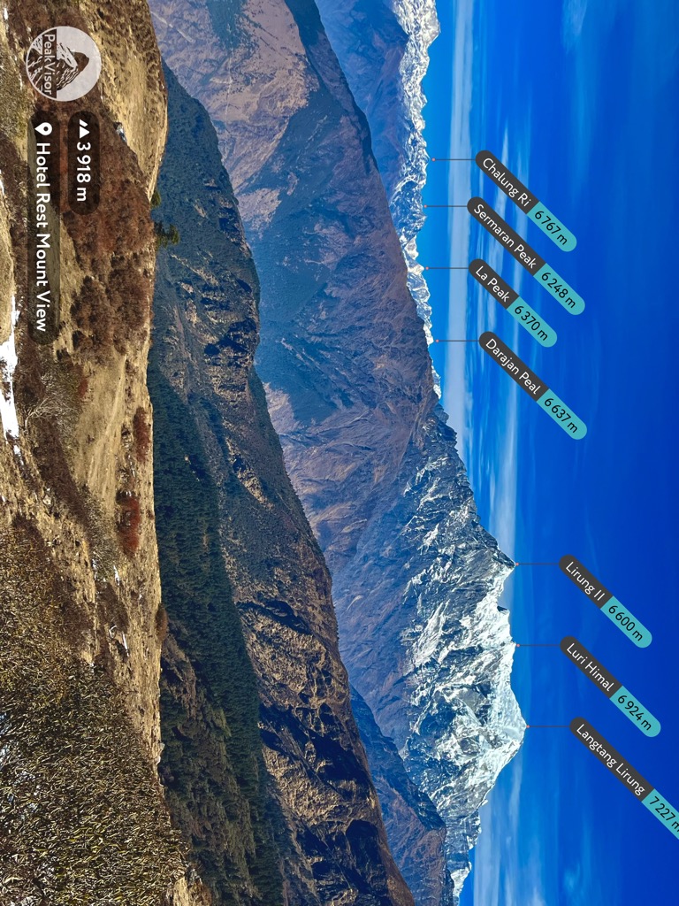
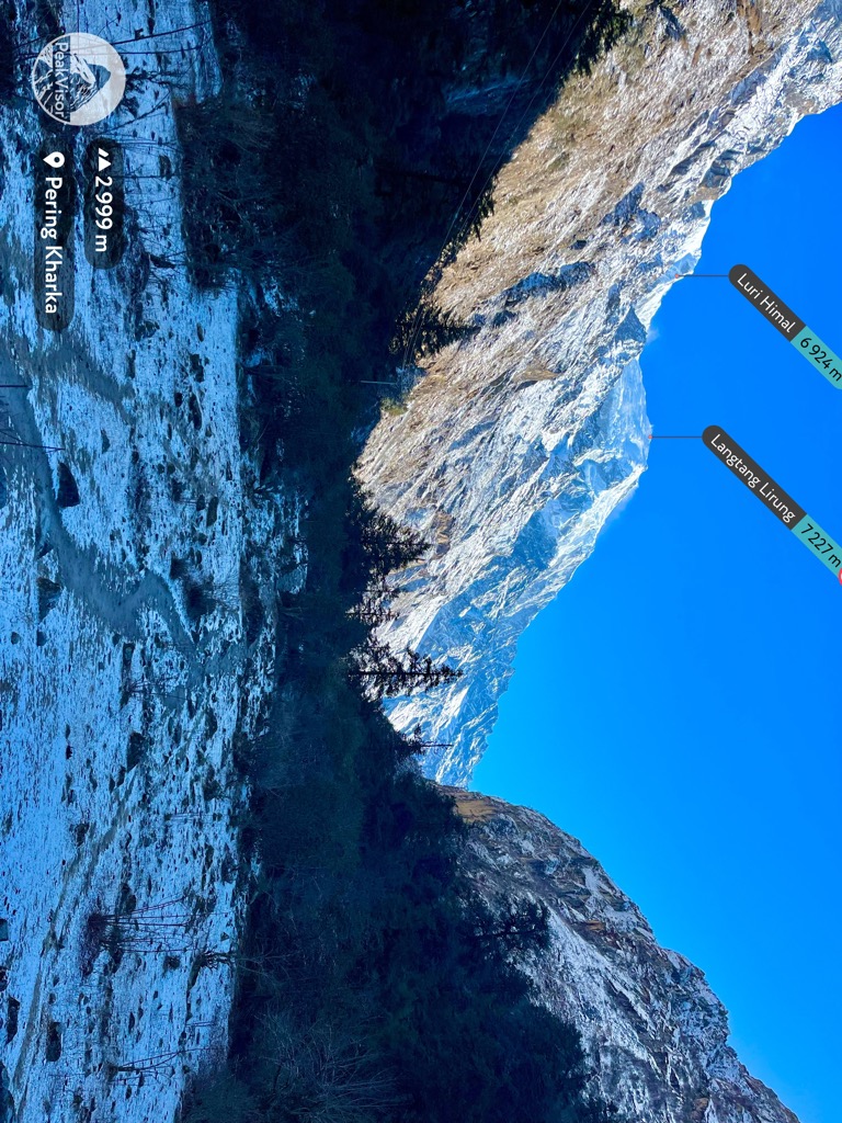
The route affords views of Lirung II (6,600 m / 21,654 ft) and Langtang Lirung (7,227 m / 23,711 ft), the highest peak in the Central Development Region. The Langtang Valley lies adjacent to Tibet, and the local people are all culturally Tibetan.
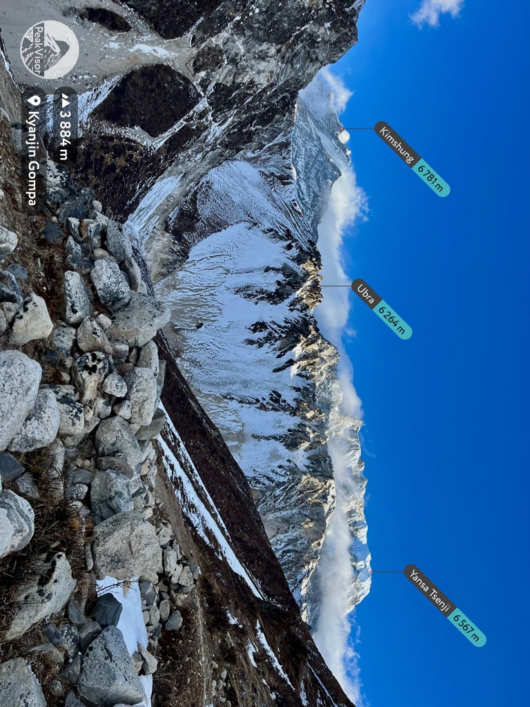
As I mentioned, this is one of the most authentically Tibetan places that Westerners can still visit without a guide. While hiking, stay on the left side of the decorated stone walls, or you may be chided by the locals. You’ll share the trail with pack donkeys wearing prayer flags and bells and domestic yaks. If you get a chance, try some Tibetan butter tea and tsampa porridge for a boost in the morning.
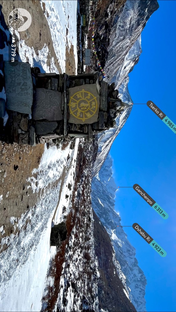
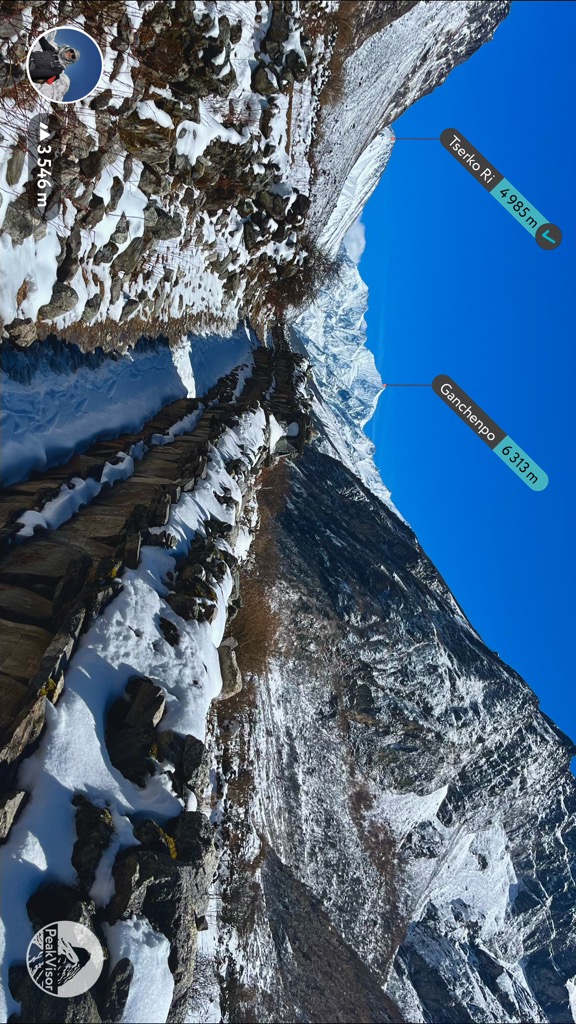
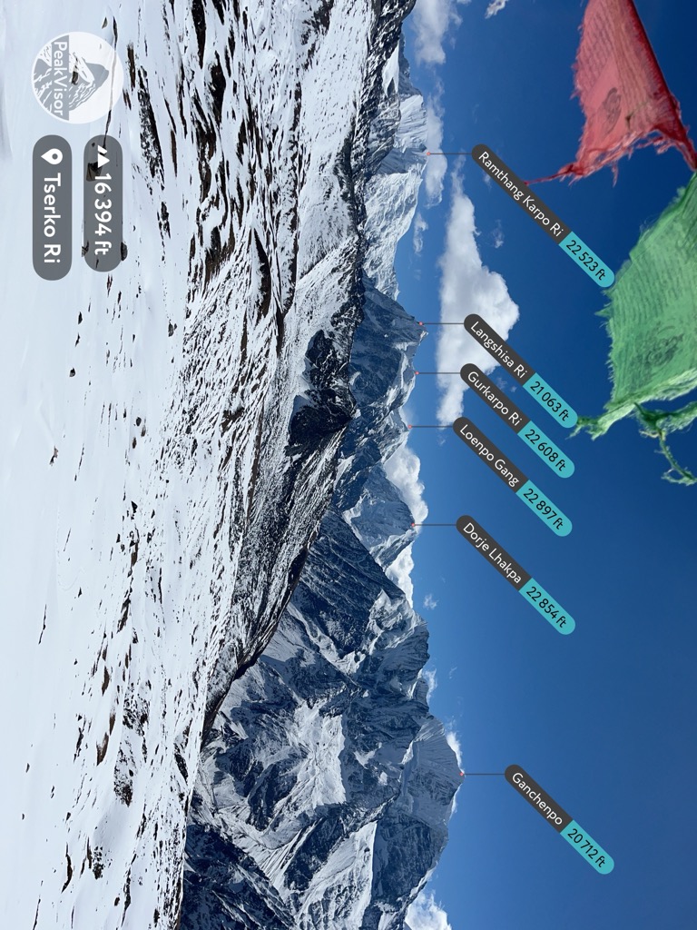
Arriving in Kyanjin Gompa, you can either turn around or tack on one of the peaks surrounding the town. The most popular option is to take a rest/acclimatization day in Kyanjin Gompa, then top out Tserko Ri (4,987 m / 16,360 ft), also called Chergori.
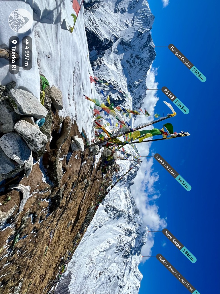
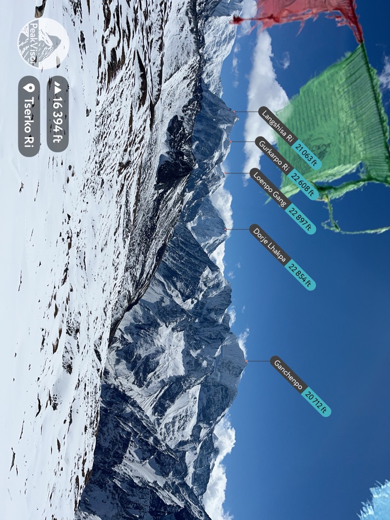
The views from Tserko Ri include dozens of 5,000 and 6,000-meter peaks, including Naya Kanga (5,846 m / 19,180 ft), Yansa Tsenji (6,567 m / 21,545 ft), Shalbachum (6,918 m / 22,697 ft), Yala Peak (5,500 m / 18,045 ft), Ganchenpo (6,313 m / 20,712 ft), Langshisha Ri (6,420 m / 21,063 ft), and Ramthang Karpo Ri (6,865 m / 22,523 ft) on the Tibet border. The climb tacks on about 1,000 m (3,300 ft) of vertical through snowy talus fields and up steep dirt track.
When you’re done marveling at the endless mountain landscape of the Himalayas (if that ever happens), head back down Langtang Valley to Syabru Besi. Buses to Kathmandu cost the same and leave at 7:30 AM.
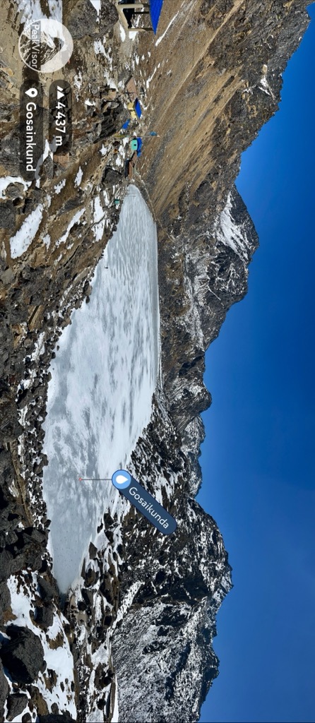
Gosainkunda is a high lake nestled near the top of Surya Pass, just under Surya Peak (5,150 m / 16,896 ft), south of the Langtang Valley. The lake is a holy place for Hindus, who believe Shiva created it when he pierced the mountain with his trident. You’ll likely see many Nepalese people and few Westerners on this trek.
There are two options for starting. If you’re only doing Gosainkunda, get off the bus in Dhunche. Or, you can do the Langtang Valley Trek, then turn south at Bamboo on the way back, and tack on Gosainkunda for a few extra days (and a lot of vertical). From Bamboo, you’ll head uphill through Thulo Syabru to Sherpa Cottage. Continue southeast through farmland to Laurebina.
But if you start in Dhunche, just head east straight up the ridge through Chandanbari to Laurebina. The last stretch to the lake follows a stone path cut into the side of a cliff, overlooking tiny alpine lakes below.
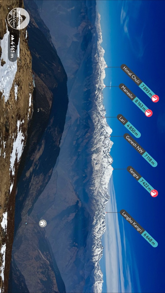
The trail to Gosainkunda is short and steep, offering sweeping vistas of the Himalayas to the west. On a clear day, you can see Annapurna I (8,091 m / 26,545 ft) and Manaslu (8,163 m / 26,781 ft) from the ridge above Laurebina. You’ll also get great views of Langtang Lirung on the way. There are several lodges at the lake, although many visitors turn around and return to Chalangpati for the night.
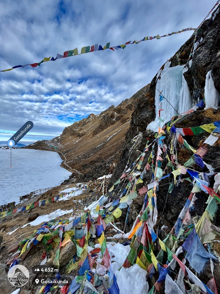
From the lake, you can turn around and go back to Dhunche or continue over Surya Pass. Be warned, the section of trail between Surya Pass and Tadepati is a grueling mix of up and down on steep, exposed stairs. But this section is much less crowded and worth the sweat.
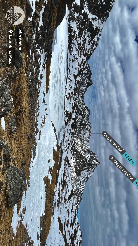
After getting to Thadepati, head downhill to Melamchigaon or Nakote. You can organize a Jeep in Melamchigaon to take you back to Kathmandu for around 1,200 rupees. Or, take the morning bus from Nakote for about 700. All told, the trail takes about a week, including transit days.
As an honorable mention, the Gaurishankar Base Camp Trek is a rarely traveled route into the heart of the Himalayas. It leads to the foot of Gaurishankar (7,134 m / 23,406 ft), the most prominent peak in the region. The route is much shorter than any of the Langtang National Park routes and considerably less crowded.
Like the Langtang Trek, you can do this without a guide. It’s is a good bet if you’re looking for a short, unique adventure near Kathmandu.
The route starts with a bus ride from Kathmandu to Singati. You can catch the bus at Ratna Park in Kathmandu for about 800 rupees. It leaves at 6:30 AM and takes around eight hours.
Starting in Singati, hike up the canyon to Simi Gaun. From here, the trail turns east (right) up a narrower box canyon through Gauri Sankar village to the village of Na.
The upper reaches of this valley are an alpine landscape of rock and snow. You’ll top out at Tsho Rolpa Lake (4,545 m / 14,911 ft), which stays frozen most of the year, before turning around and returning the way you came.
You could also continue over Tashi Lapsha Pass, enter Sagarmatha National Park, and continue to the Three Passes Trek. This alternate beginning skips the headache of driving or flying to Lukla and some of the busiest parts of the “goat trail” to Everest Base Camp.
Kathmandu is the largest city in Nepal. It’s centrally located and full of cultural wonders and great food. The central tourist district, where you can find guides and trekking equipment, is called Thamel. I recommend Hotel Yog for affordable lodging and good food.
If you choose to venture out of Thamel, check out Asan Bazar, Durbar Square, the Monkey Temple, and the Buddha Stupa. Kopan Monastery is also a must for anyone interested in Tibetan Buddhism. The main bus stations are Gongabu (buses to Langtang), Helambu (to Helambu Valley), Bagbazar (to Bhaktapur), Shorekhutte (to Bharatpur/Chitwan), and the Tourist Bus Park (to Pokhara).
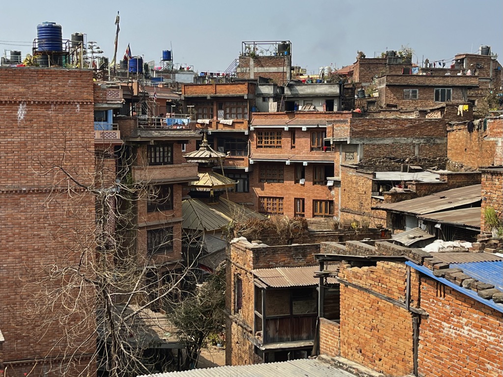
Bhaktapur sits about an hour east of Kathmandu by bus. It’s much smaller, with narrow, cobbled streets and less noise. It’s full of beautiful temples, cultural traditions, and authentic Newari food, giving a unique look into Nepal’s ancient history.
To enter the city, you must buy a tourist pass for 2,000 rupees (about USD 15). I recommend spending at least a day walking the streets—as you wander, visit Durbar Square, Pottery Square, and Dattatraya Square.
Bharatpur is the third largest city in Nepal and the nearest to Chitwan National Park. If you plan to go on a safari, your first step will be to get here. The bus from Kathmandu is about 500 rupees (USD 4). The bus back to Kathmandu leaves from Sauraha Tourist Bus Park. You can also take a flight from Kathmandu. Bharatpur sits in a hot jungle surrounded by pristine lakes and rivers full of wildlife. There are also lots of Hindu and Buddhist temples in the city that are worth your time.
Explore Central Development Region with the PeakVisor 3D Map and identify its summits.

