
Scan the QR code and open PeakVisor on your phone
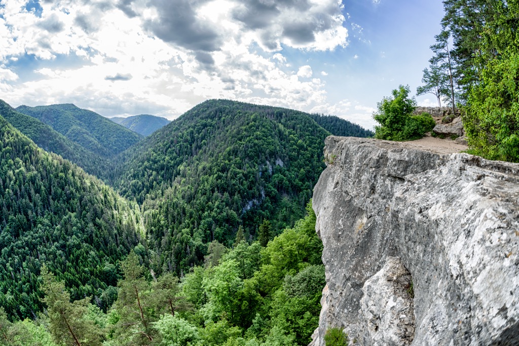
Slovak Paradise (Slovak: Slovenský raj) is a beautiful forested mountain range situated in eastern Slovakia. Amidst the forested peaks lie deep and rugged canyons along with a multitude of caves and waterfalls. There are 54 named peaks in the range. The tallest is Tresník at 1,390 m (4,395 ft) while the most prominent is Tri kopce with 202 m (663 ft) of prominence.
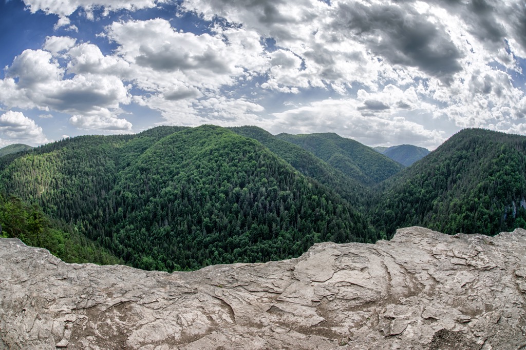
The Slovak Paradise mountain range encompasses the entire Slovak Paradise National Park. This range lies in eastern Slovakia and has 327 sq km (126 sq miles) of protection from the national park.
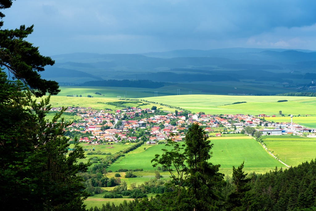
Peaks found in the range span across the Prešov Region, Banská Bystrica Region, and Košice Region. A majority of the landscape is densely forested with numerous waterfalls, creeks and streams throughout. The most important waterway in the region is the Hornád River.
Directly west of the range lies the Low Tatras, with the Slovak Ore Mountains to the south and the Hornád Basin to the north and northeast. The core of the range is part of a karst plateau, broken into smaller plateaus by deep gorges in the landscape.
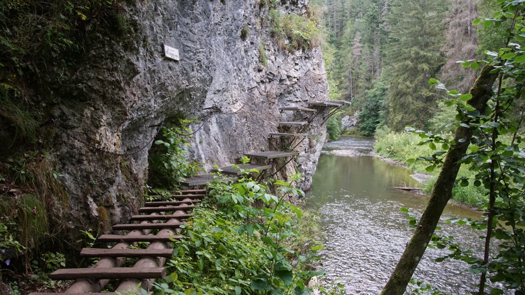
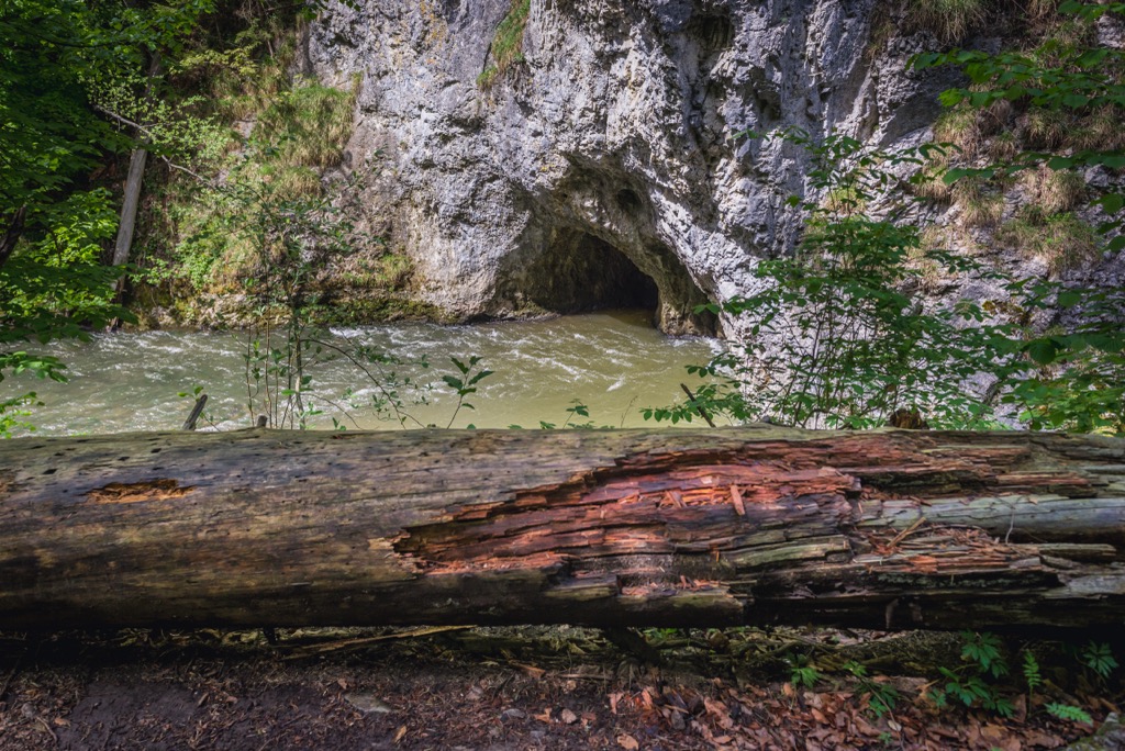
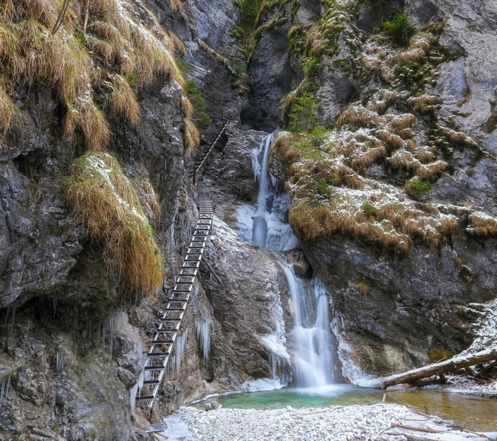
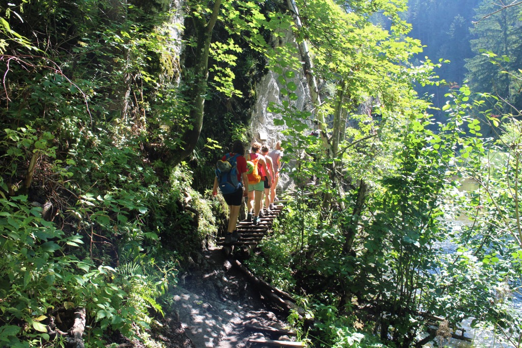
The various waterways in the range have carved out the landscape, shaping canyons, gorges, caves, and valleys. Hikes in the region are known for their plethora of raised walkways and ladders along with the multitude of waterfalls.
In some sections of the range, tree coverage begins to thin, opening up to small lakes and grassy slopes. There are over 350 caves in the range, though only the Dobšiná Ice Cave is open to the public.
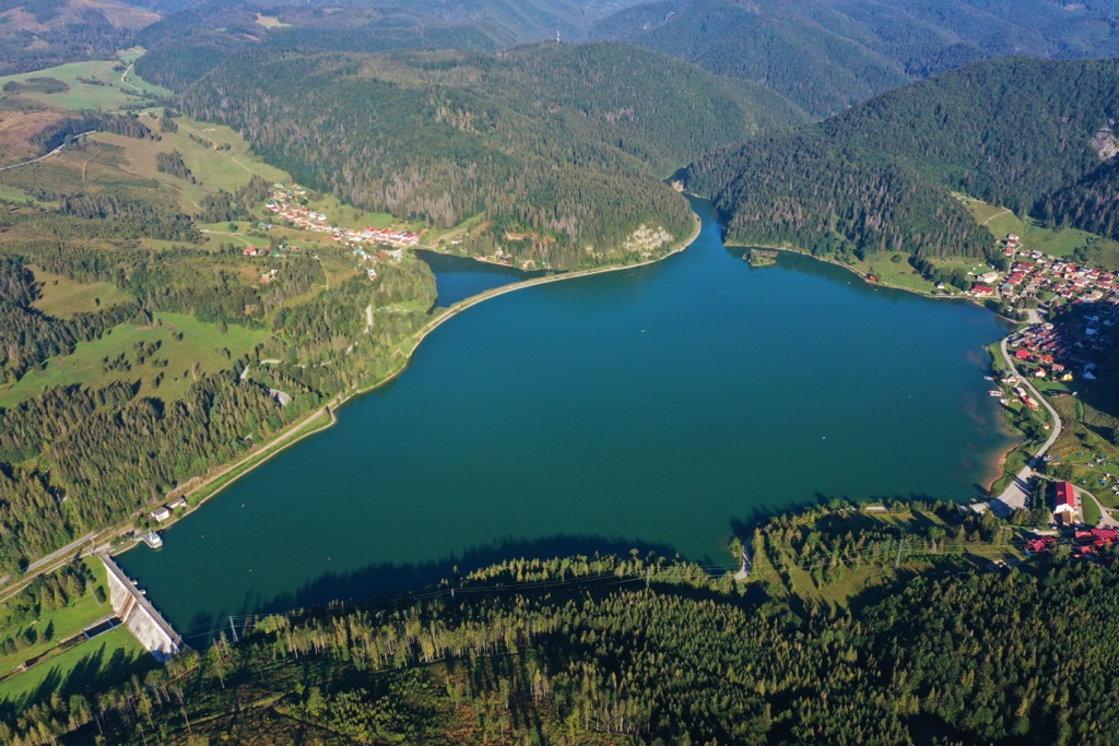
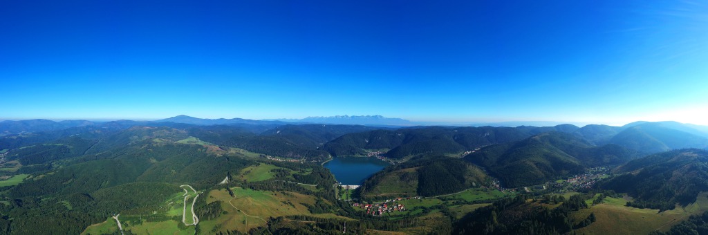
Some of the most prominent gorges include Veľký Sokol, Piecky, Suchá Belá, and Kyseľ. The largest reservoir in the range is Palcmanská Maša which is used for fishing and various water sports.
The Slovak Paradise is surrounded by numerous areas for outdoor recreation. Within the range lies the Slovak Paradise National Park while Low Tatras National Park is situated to the west. To the north lies Tatra National Park with Slovak Karst National Park to the southeast.
Slovak Paradise mountain range is part of the Spiš-Gemer Karst, a subrange of the greater Slovak Ore Mountains. This range is in turn a subrange of the Western Caparthians, a subset of the Carpathian Mountains which cover land in Slovakia, Poland, Czech Republic, Romania, Serbia, and Moldova.
The base of the Slovak Paradise was formed during the Alpine Orogeny, which took place during the Tertiary period. Around 65 million years ago the African and Eurasian tectonic plates collided with one another. This collision caused widespread pressure, thrusting the Earth’s crust upwards and laying the base for the Carpathian Mountains as well as the Alps, Pyrenees, and Himalaya.
Peaks found in the Slovak Paradise range were further shaped by faults in the region. The western section of the range was separated from the eastern section due to the Muráň fault.
This range is composed of metamorphic, igneous and sedimentary rocks, though sedimentary rock from the Mesozoic period is most prominent. Both dolomite and sandstone are present throughout the range.
The carbonate rock that formed the range is prone to karstification, which has led the range to be classified as a karstic plateau. Over the course of millions of years, the waterways in the region carved out the landscape, leaving behind the distinct valleys, gorges, and caves.
Major peaks within the range include Tresník, Tri kopce, Javorina, Remiaška, and Jabloň.
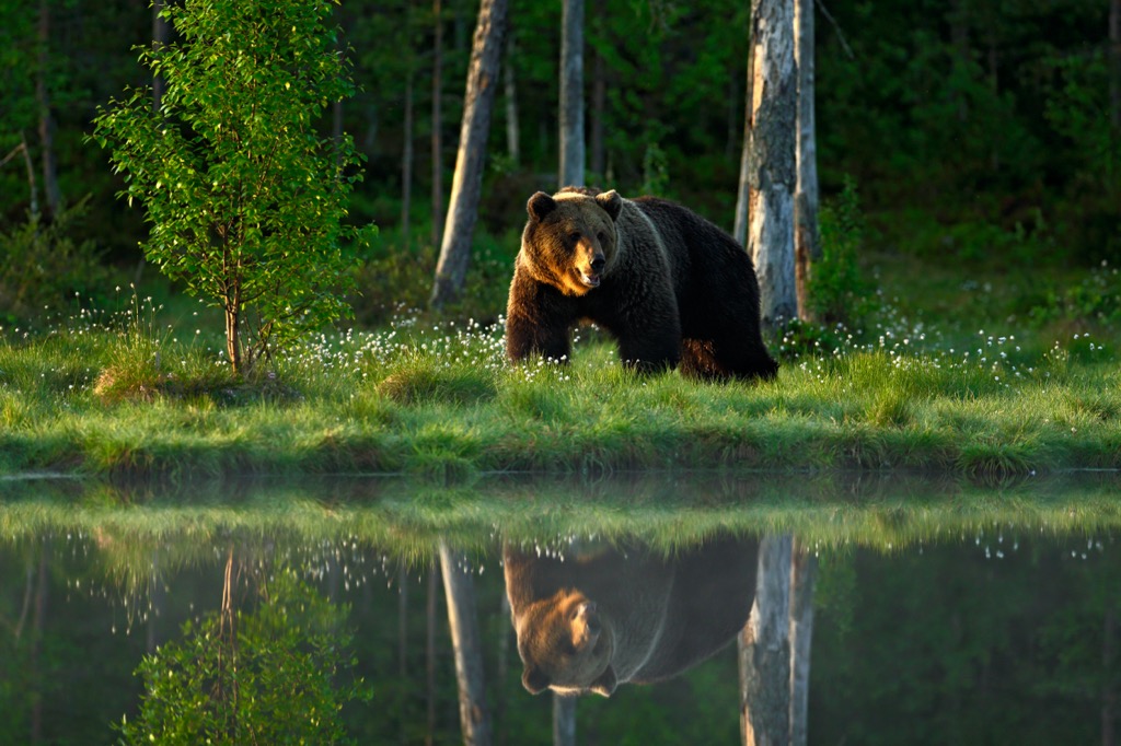
Slovak Paradise mountain range is home to a wide variety of animal species. The surrounding national park boasts the highest concentration of butterflies in the country.
Common species of mammals include the European brown bear, Eurasian lynx, European wildcat, red deer, roe deer, fallow deer, gray wolf, wild boar and Alpine chamois. Hikers may also spot common kestrel, golden eagle, or black stork amidst the range.
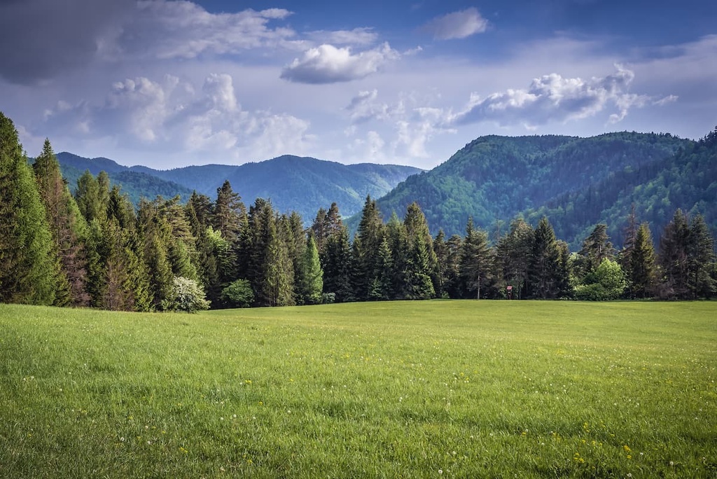
Roughly ninety percent of the range is densely forested. The most common tree species include the Norway spruce, Scots pine, and European beech, along with fir, and larch trees. Other plants in the range include the martagon lily, variegated monk’s hood, and mountain tassel flower.
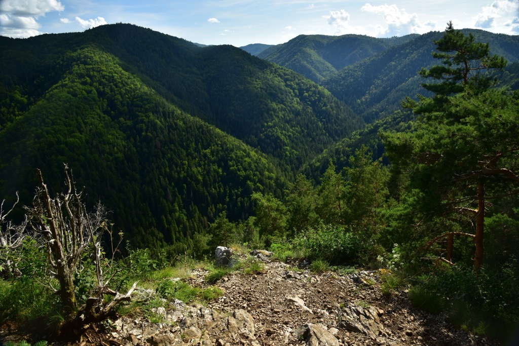
The range is also home to six endemic plant species as well as nineteen plant species endemic of the greater Western Carpathians.
The land that encompasses present-day Slovakia has been inhabited by humans for hundreds of thousands of years. Stone tools have been found in western Slovakia, dating back to the Middle Paleolithic era (200,000-80,000 BCE).
Sections of central and eastern Slovakia experienced numerous cultural shifts between 2,000-800 BCE during the Bronze Age. The Lusatian culture began to dominate as the Čakany and Velatice cultures slowly started to disappear. The prevailing culture was centered around both agriculture and trade while the production of copper began to rapidly increase.
During the rule of the Roman Empire, present-day Slovakia was home to numerous Roman outposts. After the fall of the Roman Empire, other people began to flock to the region. The Huns once occupied a region known as Pannonia, which encompassed many of the present-day countries that surround the Mediterranean Sea.
During the fifth century, Slavic tribes began to settle in present-day Slovakia. By the seventh century the region marked the base of the Samo empire. In the eighth century the Slavic state known as the Principality of Nitra ruled the region. Along with nearby Moravia, the Principality of Nitra went on to form the core of the Great Moravian Empire.
Following the fall of the Great Moravian Empire in the tenth century, the Kingdom of Hungary began its rule over the region. The oldest university in Slovakia, Academia Istropolitana, was established in 1467.
The royal house of the Habsburgs held the throne for the surrounding region until 1918 when the Slovak nation and the Czech nation joined forces to form the Czecho-Slovak Republic.
The independent Slovak State was established in 1939, though after World War II Czecho-Slovakia was reestablished. The communist rule lasted until 1989 when the Velvet Revolution prevailed.
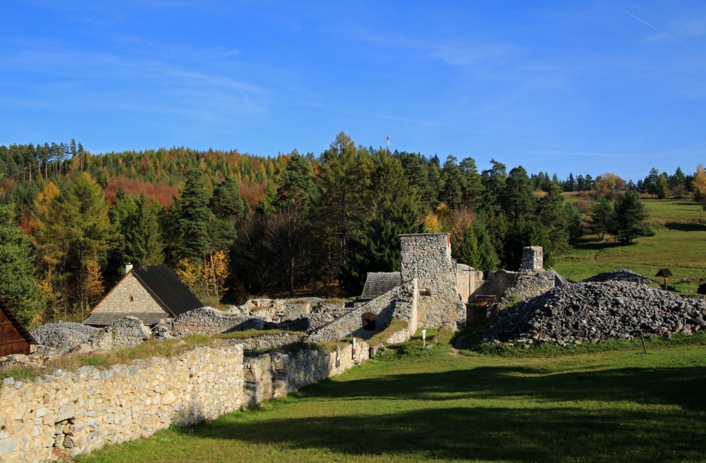
In 1890 a protected reserve was established in order to protect this mountain range and its biodiversity. The name “Slovak Paradise” first appeared in 1921 with the first protected landscape being established in 1964. In 1988, the region was classified as a national park.
Today there are nearly 300 km (186 miles) of established trails throughout the range.
Slovak Paradise is home to a plethora of hiking trails showcasing the various gorges and waterfalls in the region. Here are some of the most popular trails in the park:
Suchá Belá is one of the most well known hiking trails in the region. The route gets its name from the Suchá Belá gorge which the trail follows throughout. Hikers follow through the gorge, walking along raised platforms, bridges, and climbing numerous ladders.
One of the main features are the cascading waterfalls found along the route. Hikers should note that proper footwear is necessary as some of the structures can be quite slippery when wet. This loop trail is 9 km (5.6 miles) in length and features 504 m (1,653 ft) of total elevation gain.
Hornád Prielom - Suchá Belá Loop takes hikers along a section of the Hornád Prielom, the longest gorge in the entire range and national park. Much of the route includes raised features above the flowing water and rocky gorge.
This route begins by climbing steadily through the forested landscape, before descending gradually to the Hornád Prielom. The final 6.4 km (4 miles) of the route follow through the stunning gorge with the Hornád River rushing below. This loop trail is 16.5 km (10.3 miles) in length and features 747 m (2,450 ft) of total elevation gain.
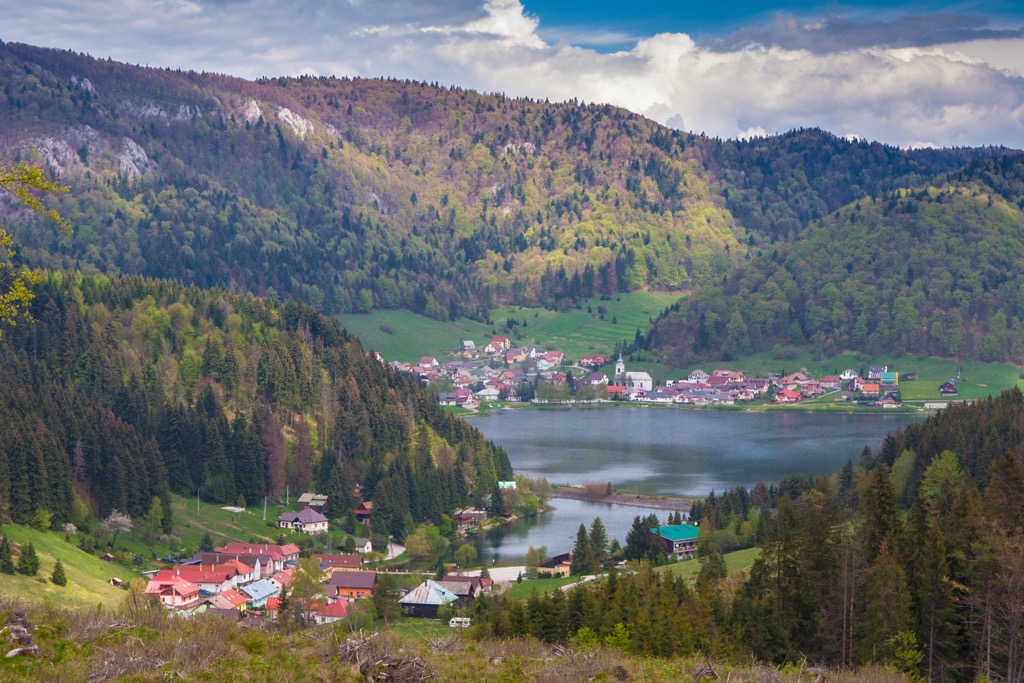
The Slovak Paradise - South Trail is a less technical route compared to many other hiking trails in the region. This trail begins along the shores of Palcmanská Maša, the largest reservoir in the range which is also a resort destination.
The trail features many gradual climbs and descents throughout, winding through the forested landscape. Some sections of the trail feature ladders to climb, though hikers are rewarded with views of various creeks, streams, and waterfalls. The loop is 10.7 km (6.7 miles) long and features 567 m (1,860 ft) of total elevation gain.
Looking for a place to stay near the Slovak Paradise range? Here are some of the best cities and villages to check out near the range:
Spišská Nová Ves is a town situated along the eastern edge of Slovak Paradise range and national park. Home to around 35,000 residents, it marks the biggest town in the Spišská Nová Ves District.
The town is situated on either side of the Hornád River, and hosts the biennial music festival known as Divertimento musicale. Other popular attractions in the region include Spiš Castle and the nearby medieval town known as Levoča.
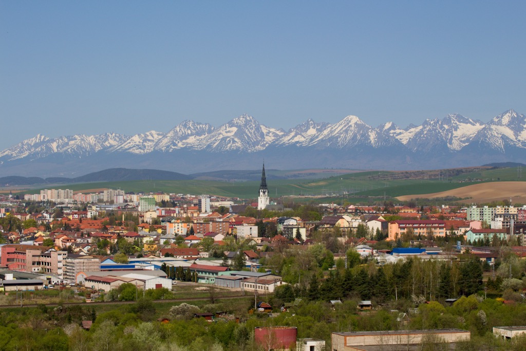
Poprad lies just north of the range and national park, situated just south of the High Tatras Mountains. The city is home to around 50,000 residents, marking the tenth largest municipality in all of Slovakia.
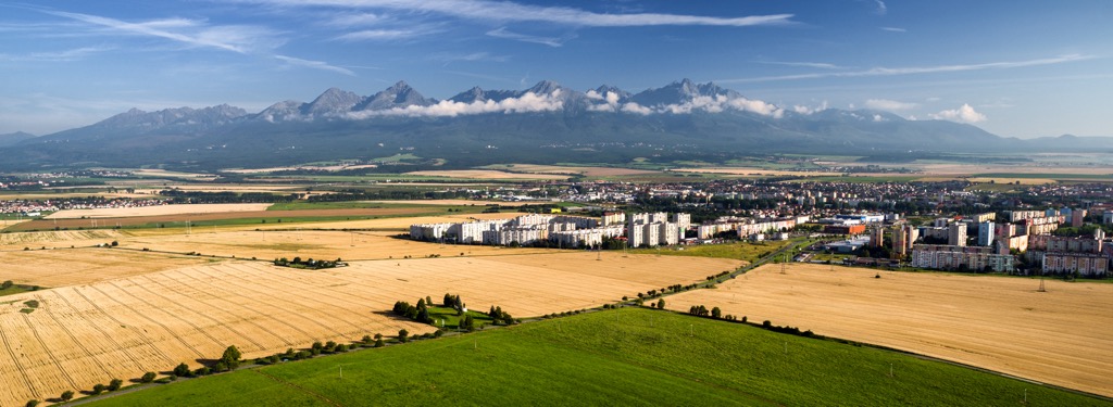
In recent decades Poprad has become better known as a gateway into the High Tatras, Tatra National Park, and Slovak Paradise National Park.
Within the city visitors can explore the historic city center, St. Egidius square and the Catholic Church of St. Egidius which dates back to the thirteenth century.
The Tatra Electric Railway connects the community into the nearby mountains for hiking, sightseeing and skiing.


