Scan the QR code and open PeakVisor on your phone
Tioga State Forest is an outdoor recreation destination located in the northern region of the US state of Pennsylvania. The forest is home to Pine Creek Gorge Natural Area which is commonly referred to as the “Grand Canyon of Pennsylvania”. Tioga State Forest contains 28 named peaks. The tallest peak is Cedar Mountain at 2,467 ft (752 m) while the most prominent is Armenia Mountain with 1,171 ft (357 m) of prominence.
Tioga State Forest encompasses 161,890 acres (65,515 ha) of terrain and it is located in the north-central part of the US state of Pennsylvania. A majority of the forest lies within Tioga County with small portions in Bradford and Lycoming counties.
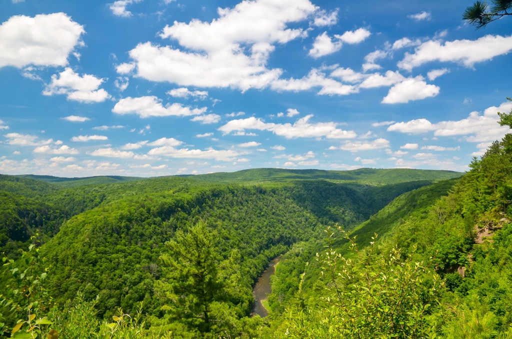
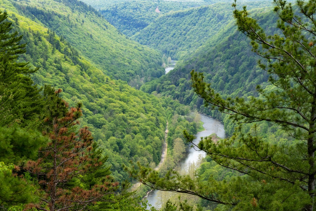
The landscape predominantly features forested rolling hills. The Pine Creek and Tioga River are the major waterways in the region along with various seasonal creeks and streams. The Pine Creek Gorge is the main feature of the region and is known as the “Grand Canyon of Pennsylvania”. The gorge is 800 feet (243 m) deep and spans an average of 2,000 feet (610 m) from rim to rim.
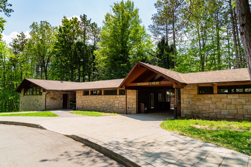
Vistas are cleared throughout the forest to provide hikers with sweeping views of the gorge and creek. Other notable bodies of water include Marsh Creek and Wilson Creek.
The forest lies within the Appalachian Mountains, which extend from the US state of Alabama up to the Canadian province of Newfoundland and Labrador. Tioga State Forest is surrounded by a network of other state forests which cover much of the Appalachians in Pennsylvania.
Additionally, Tioga State Forest is located near numerous other parks and state forests. For example, Loyalsock State Forest lies to the southeast while Little Pine State Park and Tiadaghton State Forest are to the south. Old Bull State Park and Hammersley Wild Area are situated to the west along with Cherry Springs State Park and Denton Hill State Park.
The peaks within Tioga State Forest are part of the Appalachian Mountains, which span across the eastern US and into the Canadian province of Newfoundland and Labrador.
Mountains and ridgelines found in this region, along with the rest of the Appalachian Range, began forming as early as 480 million years ago. Folding and faulting thrust the range upwards from the seafloor. Tectonic shifting led to the sea retreating, leaving behind the peaks visible today.
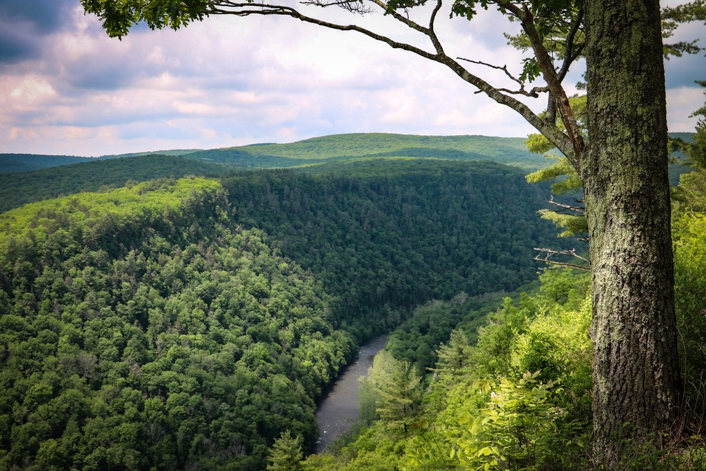
Some of the exposed rock in the Pine Creek Gorge dates back as early as 350 million years ago. The gorge itself began taking shape around 20,000 years ago. Up until the formation of the gorge, Pine Creek flowed in a northeasterly fashion.
The Laurentide Continental Glacier eventually dammed the creek with rocks, soil, and debris. This newly formed dam created a vast lake from glacial meltwater. When the lake overflowed the creek switched course and began flowing to the south, carving the deep channel known as Pine Creek Gorge.
The surrounding peaks lie within the valley and ridge section of the Appalachian Mountains while the Appalachian Plateau is situated to the west and north. Bedrock throughout the region consists of quartzites and sandstone, most of which formed during the Appalachian orogeny.
Major peaks located within Tioga State Forest include Cedar Mountain, Armenia Mountain, Mount Tom, Fahnestock Hill, and Cobble Hill.
The flora and fauna found throughout Tioga State Forest is similar to that found throughout northern Pennsylvania. The surrounding network of state parks and state forests enable a diverse array of species to flourish.
A majority of the protected region is covered in densely forested hills. Common tree species include easternhemlock, eastern white pine, balsam fir, and black spruce. Near the creeks and rivers, hikers are more likely to spot maple and chestnut trees.
During the summer months flowers bloom throughout Tioga State Forest. Some of the most popular species include dogwoods, goldenrod, asters, sumacs, and mountain laurel. Other low growing plants include milkweed, mayapples, Queen Anne’s lace, and wild carrots.
Larger mammals found in the forest include white-tailed deer and bobcats along with cottontail rabbits and ground squirrels. Wild turkeys live throughout northern Pennsylvania along with porcupines, often inhabiting the grassy sections of land.
The major waterways in the forest provide the ideal habitat for multiple species of trout. Larger birds such as bald eagles, blue herons, and wood ducks are all common along with smaller birds such as finches, sparrows, northern shrieks, and cardinals.
Humans have inhabited the region surrounding Tioga State Forest for thousands of years. This region marks part of the ancestral homelands of the Indigenous Susquehannock. Their traditional territory extends throughout what is now the northeastern US.
There were numerous tribes who lived throughout the region, many of whom lived harmoniously with one another. The nearby Susquehannock River was the focal point of many of the early Susquehannock settlements, which runs throughout central Pennsylvania, southwest of Tioga State Forest.
A majority of the Susquehannoock people lived throughout present-day Pennsylvania though other bands of the tribe both traveled and settled in the midwest. The Susequehannock people began forming unions with other nearby tribes when settlers of European descent began arriving in the surrounding region at the beginning of the seventeenth century.
Prior to joining forces with the Haudenosaunee (Iroquois Confederacy), the Susquehannock people formed alliances with the early Swedish and Dutch settlers in the region. This unified group of settlers and tribes was able to fight the colony of Maryland during the mid-seventeenth century.
Diseases brought over by the European settlers, such as smallpox and measles, drastically reduced the number of Indigneous people as they had no natural immunity to the illnesses. This decline in numbers ultimately contributed to the Haudenosaunee taking over the Susquehannock.
The US government began forcing the Susquehannock from their ancestral lands and relocated them near the Oneida Nation in present-day New York. During the mid-eighteenth century, some of the Susquehannock people were able to return to their ancestral lands in Pennsylvania.
The desire to log much of northern Pennsylvania led to the US government forcibly removing the remaining Indigenous people and relocating them onto reservations. In the late nineteenth century widespread logging and mining decimated much of the natural landscape.
Conservationists of the region feared that the forests of the region would not recover. Numerous Civilian Conservation Corps camps were scattered throughout the forest. The development of the state forest system ultimately led to the creation of the forest in 1900.
Tioga State Forest is home to numerous hiking trails, many which showcase the Pine Creek Gorge. Various campsites are also available for both car camping or backpacking. Here are a few of the trails that you can find within the forest that are worth checking out during your next visit:
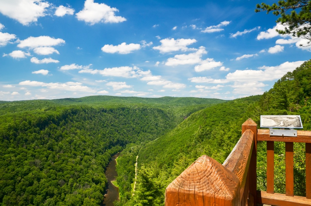
The West Rim Trail is the most well-known route in the forest and follows along the western rim of the Pine Creek Gorge. This point to point trail features stunning views of the forested hillsides, ridgelines, and the gorge.
A majority of the trail lies within the tree coverage though there are numerous viewpoints throughout. Most hikers take between two and three days to complete the route though it can also be completed in one. The point to point trail is 27.8 miles (44.7 km) in length and features 4,356 feet (1,328 m) of climbing.
The Sand Run Falls Trail is a loop trail that winds gently through the woods. Hikers can enjoy bird watching and creek sightings throughout before reaching the falls. The trail descends before reaching the waterfall which cascades down a jagged rock face. There is a small pool at the base of the falls. The loop trail is 6.7 miles (10.8 km) in length with 682 feet (208 m) of elevation gain.
The Mount Tom Loop lies at the northern edge of the Tioga State Forest. This route begins along the Pine Creek before climbing up out of the gorge to a viewpoint. Once at the rim the trail levels out and offers views of the gorge down below. This loop trail is 2.7 miles (4.3 km) in length and features 1,118 feet (341 m) of elevation gain.
Looking for a place to stay near Tioga State Forest? Here are some of the best cities and villages to check out in the region.
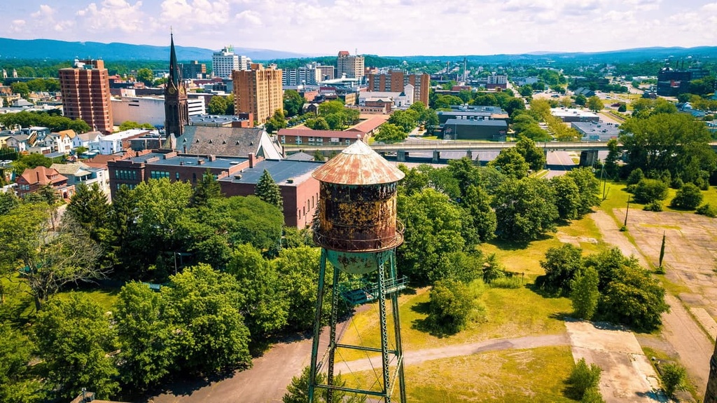
The closest city to Tioga State Forest is Williamsport, Pennsylvania. Home to around 114,000 residents, the city is the most populous in the central region of the state making it the cultural and economic hub of the region.
The size of the city, and its proximity to numerous state forests, has made it a hot spot for hikers and bikers visiting Pennsylvania. Williamsport is also home to Pennsylvania College of Technology and Lycoming College.
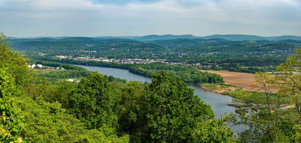
Commonly known as the birthplace of Little League Baseball, each year the city hosts the Little League World Series. The city is also surrounded by nearly 300,000 acres (121,400 ha) of state gameland, making it popular amongst hunters, fishers, and trappers.
The city of Wilkes-Barre lies to the southeast of Tioga State Forest in the Wyoming Valley of Pennsylvania. Wilkes-Barres is home to around 45,000 residents, while nearby Scranton is home to around 76,000 residents. Together the two cities create a large metropolitan area for northeastern Pennsylvania.
Originally established as a coal mining town in 1770, Wilkes-Barre lies along the Susquehannock River. The river and surrounding mountains offer a plethora of opportunities for kayaking, whitewater rafting, hiking, and mountain biking.
Some sites to check out on your next visit include the River Street Historic District, Wyoming Monument, and Luzerne County Museum. Local shops, restaurants, and art galleries can all be found in the downtown streets.