
Scan the QR code and open PeakVisor on your phone
Special Landscape Area has 69 named peaks. The highest is Hehuan Shan North Peak at 3,422 m. Other notable peaks include Hehuan Shan East Peak, Hehuan Shan and Jushan.
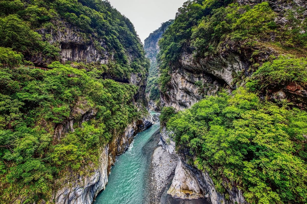
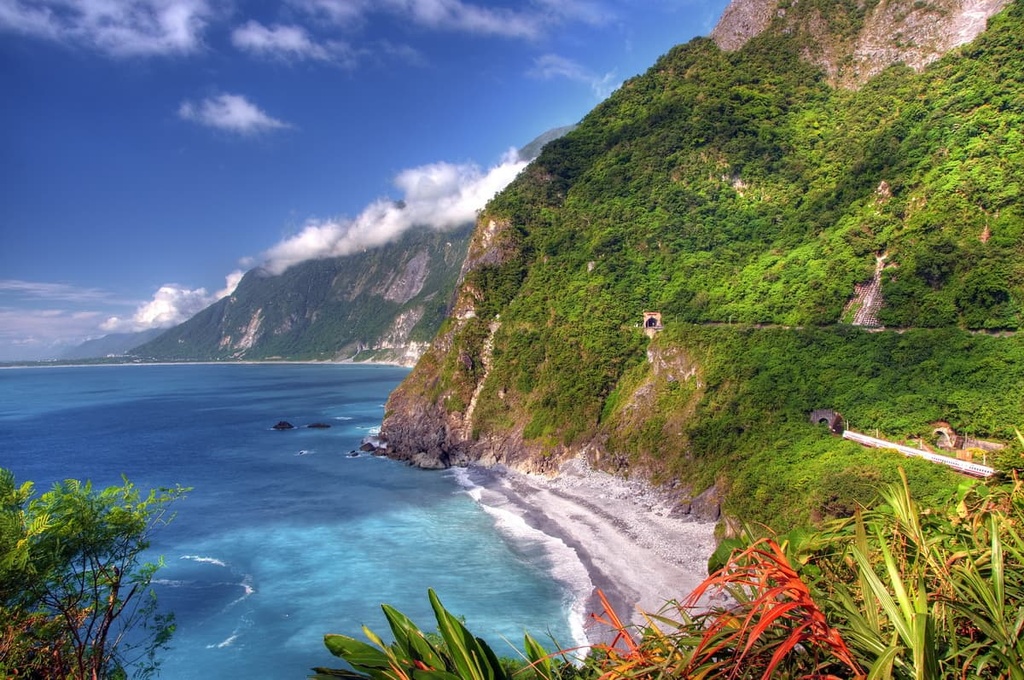
The Special Landscape Area (特別景觀區) of eastern Taiwan’s Taroko National Park (太魯閣國家公園) is renowned for its captivating, marbled gorges that rise sharply above the glistening Liwu River. There are 69 named mountains in the Special Landscape Area, the highest and most prominent of which is Hehuanshan North Peak (合歡山北峰) at 3,416 meters (11,207 ft) in elevation.
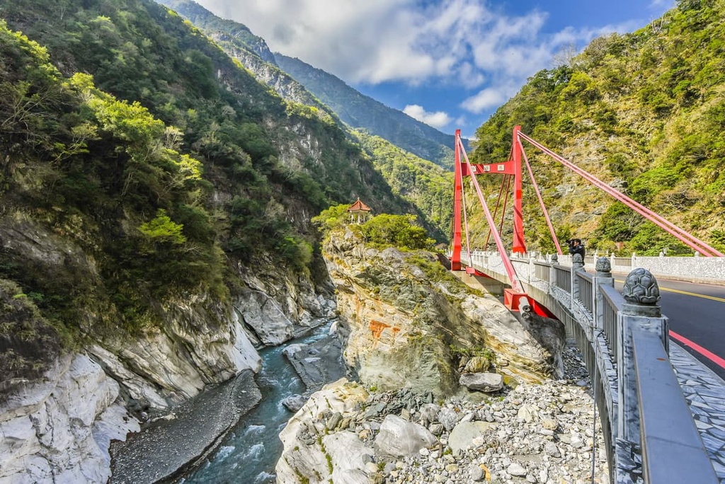
The Special Landscape Area is situated in Xiulin Township (秀林鄉) of Hualien County (花蓮縣) in eastern Taiwan. The region’s terrain is unique and remarkable as it includes sheer marble cliffs that trace the Liwu River, flourishing broadleaf flora, and grand mountains.
Taroko National Park is divided into several smaller regions. Nanhu Ecological Reserve (南湖中央尖山群生態保護區) marks the northwest territory of the park, with Qilai and the Taroko Mountains Ecological Reserve (奇萊、太魯閣山群生態保護區) flanking the southern border. The Special Landscape Area follows the central path of the Liwu River that dissects Taroko National Park into northern and southern halves.
Seven of Taiwan’s 100 tallest peaks, known as Baiyue, feature in the Special Landscape Area. These hills exceed the height of 3,000 meters (9,842 ft). The seven Baiyue are:
Due to the geographical location of the Special Landscape Area on Taiwan’s eastern coast, the turbulent annual typhoons generally thrash the region’s low-lying coastal terrain, whipping the western high-rising mountains with their knockout blow. As a result, the typhoon’s wake leaves wreckage of landslides and rockfalls in the high mountain regions of the Special Landscape Area.
The Special Landscape Area receives an average annual rainfall of 2,000 mm (79 in). The northeast monsoon brings winter showers from December to February and a smattering of spring rains in March, while summer marks the onset of the typhoons.
Nearby, Hualien City enjoys a warm annual temperature of 23.7°C (75°F). However, the Special Landscape Area’s average temperature differs according to elevation.
At 1,000 meters (3,280) in elevation, the temperature is an average of 17.5°C (63.5°F). This drops to 12.5°C (54.5°F) as the elevation increases to 2,000 meters (6,562 ft). In the high mountains above 3,000 meters (9,842 ft), the region has an average annual temperature of about 7.7°C (46°F).
Shei-Pa National Park (雪霸國家公園) sits to the west of the Special Landscape Area, while the Pacific Ocean’s roaring waves crash to the east. To the north is the Nan’ao Broadleaf Forest Nature Reserve (南澳闊葉樹林自然保留區) and to the south is the Danda Major Wildlife Habitat (丹大野生動物重要棲息環境).
The Special Landscape Area's Baiyue and smaller hills belong to the 260 km (161 mi) long mountain range called the Central Mountain Range (中央山脈). This range runs from southern Pingtung County (屏東縣) to New Taipei City (新北市).
In particular, the Special Landscape Area mostly features loose slate and metamorphic rock from the Tertiary period.
Meanwhile, in the east, the Special Landscape Area features an abundance of steep marble gorges. About 230 million years ago, this area was once underwater. Sediment gradually accumulated over time in the ocean, then lithified to form limestone. Extreme pressure and underground heat transformed the limestone into marble.
Around 3 to 4 million years ago, the island of Taiwan formed from the pressure of moving tectonic plates, forcing the underground rock to rise through the geosphere's cracks. Simultaneously, the Special Landscape Area's marble raised above the water's surface, creating sheer, sharp gorges.
Over time, rainwater and flowing rivers have weathered the marble cliffs, causing them to hollow out further, creating the sheer, near-vertical drops of great depths that we see today.
As the Special Landscape Area's elevation differs vastly, so does the plant life. Various vegetation grows throughout the Special Landscape Area. Warm-temperate broadleaf forests, subalpine coniferous woodlands, and a beautiful selection of wildflowers thrive in this environment.
In the low-lying areas, a thriving deciduous forest grows. The main tree species are Formosan alder, Phoebe formosana (Hayata), Taroko oak, and the Jiuxiong tree (Lagerstroemia subcostata). As the elevation increases, temperate coniferous trees, such as Taiwan hemlock, Taiwan cedar, and Taiwan cypress, begin to thrive.
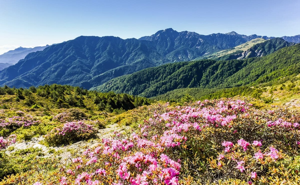
The flowering plant species of Yushan rhododendron, St. John's wort, Yushan gentian, and Taroko spiraea can be found throughout the Special Landscape Area.
At 3,000 meters (9,842 ft) and above, Yushan juniper and Taiwan fir dominate the landscape while the hardy arrow bamboo flourishes on the mountain plains.
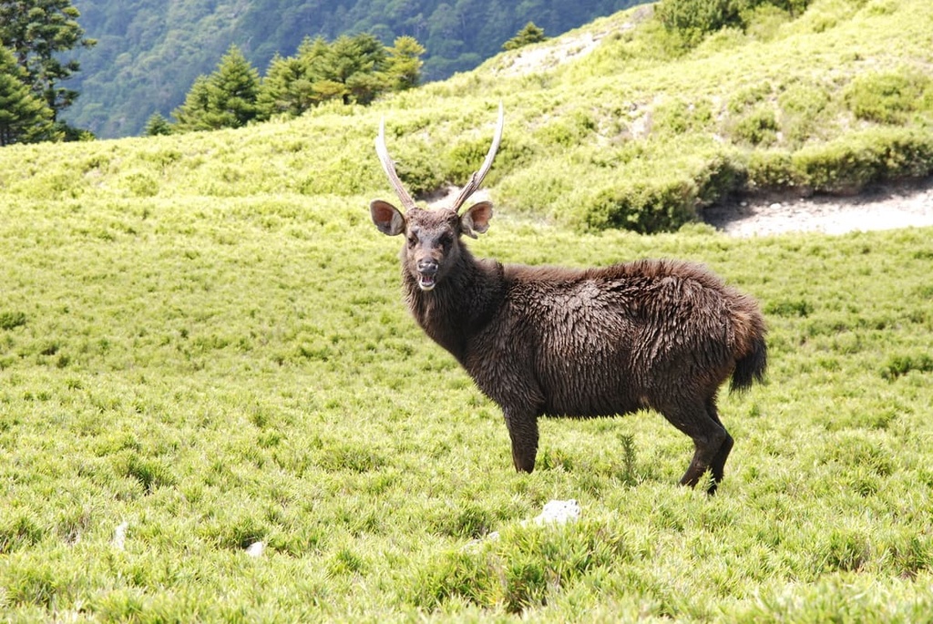
Taiwan sambar, wild boars, mountain goats, and Formosan rock macaques inhabit the Special Landscape Area’s lush forests. Visitors can spot a number of notable bird species, such as the purple finch, rock pipit, and the golden-winged warbler, in the park.
Finally, Taiwan freshwater trout and 20 other freshwater fish species can be found in the Liwu River's sapphire waters.
The Indigenous Truku people traditionally inhabited the Special Landscape Area, having moved eastward from central Taiwan in the 1600s. Initially, the Truku lived around the low-lying Liwu River; however, their territory eventually expanded to the outer lying valleys and hills of Taroko National Park.
A well-known historic event occurred in the Special Landscape Area’s territory: the Truku War. During the Japanese Occupation Era of Taiwan, the Japanese became increasingly fearsome of the bold Truku tribe, who refused to submit to the Japanese.
Wedged between Hehuanshan’s foothills, the Japanese ambushed the Truku’s Wuling Village in 1914. Wuling was a stronghold of Hualien County and overtaking Wuling made it easier for the Japanese to claim eastern Taiwan.
A total of 20,000 Japanese soldiers battled against 2,000 Truku warriors. Despite being vastly outnumbered, the Turku managed to fight the Truku War over the course of 60 days. The Japanese claimed victory over the Truku and Hualien County; however, the Truku’s courage’s legendary tale is not forgotten.
The Special Landscape Area is not short on excellent trails to hike. The most popular trails in the region include:
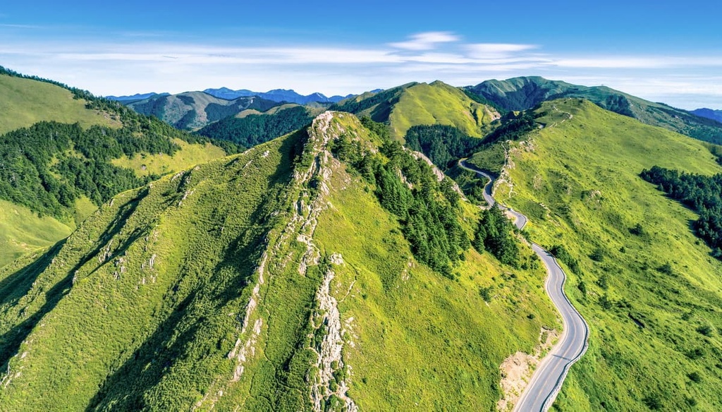
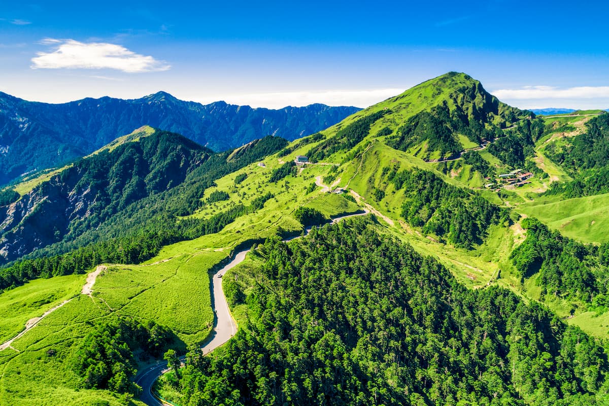
Regarded as a great Baiyue for beginners due to its gradual incline and 1.8 km (1.1 mi) trail, Hehuanshan Main Peak is a hugely popular hill to climb. Springtime is the prime season to ascend Hehuanshan’s gentle trail to witness the blossoming of Yushan rose, Yushan rhododendron, and Yushan juniper flowers.
On Hehuanshan’s summit, hikers can revel in the 360-degree panoramic view of commanding peaks jutting their pointy pinnacles above the clouds.
Hikers can admire Nanhudashan (南湖大山) and Yushan (玉山) from the summit. You can also admire the peaks of Nenggao Shan (能高山), Qilai Shan (奇萊山), Zhongyangjianshan (中央尖山), and Hehuanshan from the top of Hehuanshan Main Peak.
The Hehuanshan Main Peak Hiking Trail offers great attractions for each season. In summer, birdwatchers are treated to common sightings of the Taiwan laughing thrush and Eurasian wren. Ladybells bloom in the warmer months, adding a beautiful contrast of indigos and violets to the emerald environment.
A thick snow blanket covers Hehuanshan’s peak in wintertime, creating a white, frosty utopia. Although quite chilly during this time of year, the peak’s snowy landscape is fascinating under winter’s icy spell.
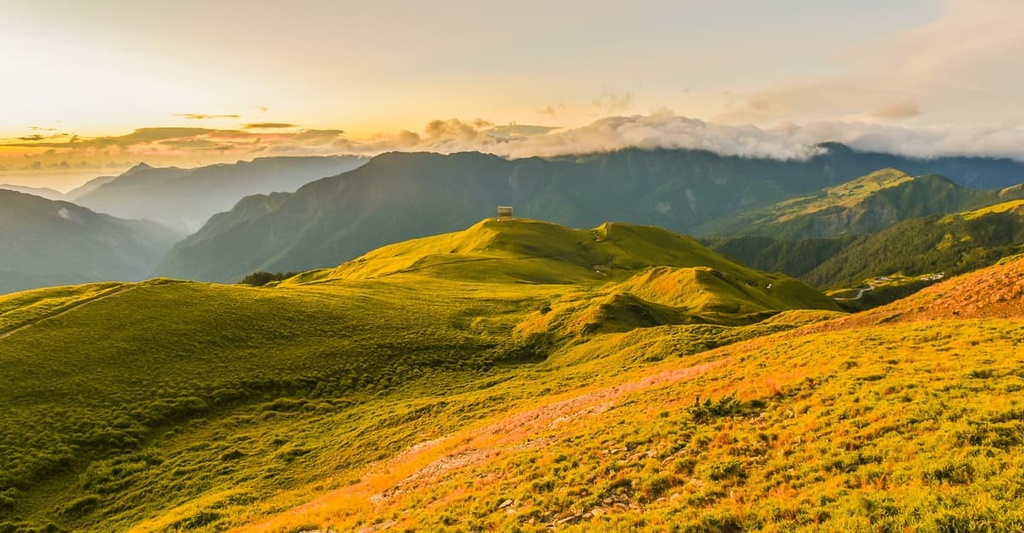
The hike to the highest hill of the Special Landscape Area, Hehuanshan North Peak Hiking Trail, is just 2 km (1.2 mi) long. However, unlike the trail Hehuanshan Main Peak, the path is not all smooth sailing.
From the start of the trail, hikers must ascend a relatively steep slope. While hikers trudge up the hill, the views begin to expand to include the flourishing rhododendrons forest that burst with vibrant red flowers in spring. The Liwu River and Hehuan Creek flow alongside Hehuanshan North Peak, too, as they meander their way into the near distance.
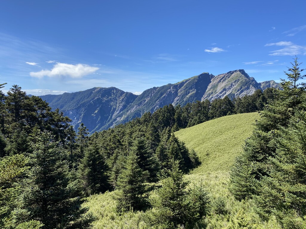
Hehuanshan North Peak is mostly exposed to the sun as alpine grasslands of arrow bamboo cover the giant peak. For this reason, the views are epic, with Hehuanshan’s surrounding Baiyue plainly in sight.
From the summit, folds of green mountain spines form a rippled sea of rugged peaks. A sizable mobile receptor stands on Hehuanshan North Peak’s summit, too, making it a prominent marker of the Special Landscape Area’s highest hill.
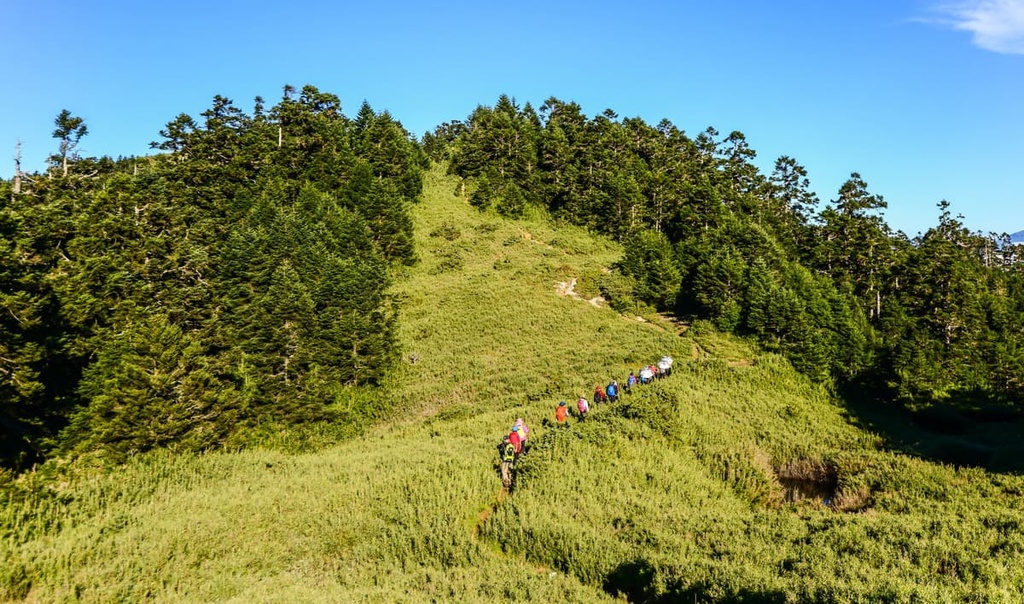
The trek to Hehuanshan West Peak is the most challenging and longest route out of Hehuan hills. The 6.7 km (4.1 mi) continuous undulating terrain becomes taxing on the hiker's legs. Unlike the trail to Hehuanshan Main Peak's summit, hikers who trek Hehuanshan West Peak must endure some physical challenge to enjoy the sublime views.
Hikers must first ascend the open, grassy meadowed hill with its signature dips and inclines. Climbing Hehaushan West Peak affords hikers a clear view of the endless rippling ridgeline of Hehuan's Baiyue. While the views are most spectacular from the summit, a continuous show of the Special Landscape Area's terrain greets determined hikers.
Like clockwork, the afternoon clouds descend upon the mountain, releasing thick fog and thus obscuring views. Therefore, the best time to climb Hehuanshan West Peak is in the morning.
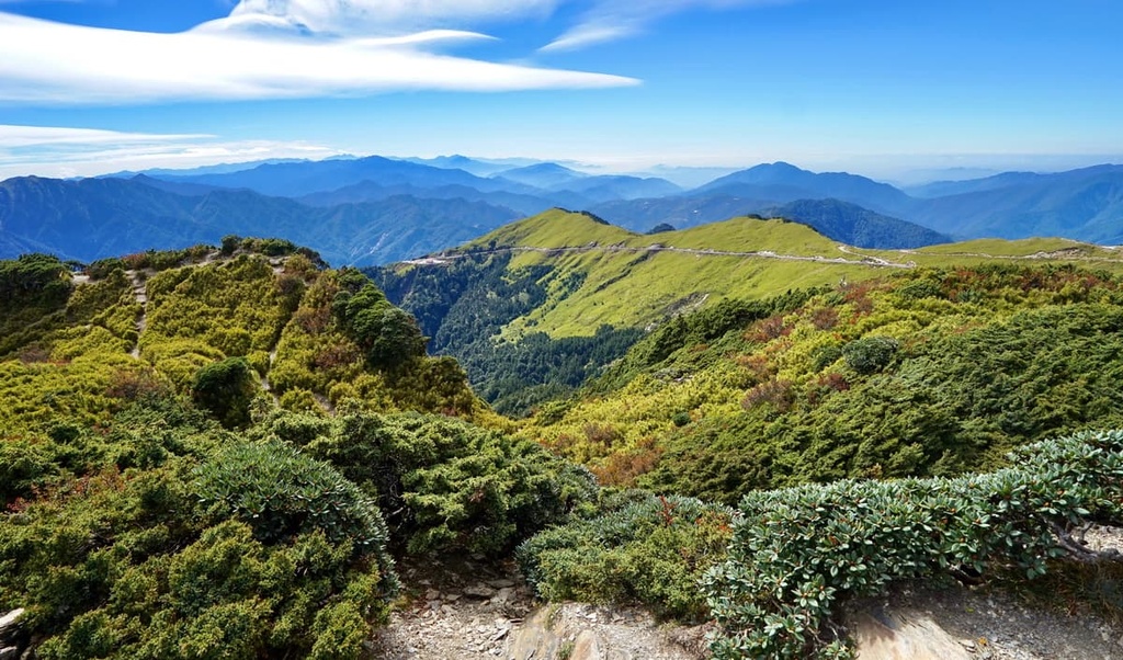
From Hehuanshan West Peak's summit, hikers can observe the nearby snow-capped Xueshan (雪山) in Shei-Pa National Park. In addition, hikers can also admire Nanhudashan's pristine alpine lake. The views from the summit include sightings of Jiayang Shan (佳陽山), Dajian Shan (大劍山), the Qilai peaks, and the surrounding Hehuan hills.
The shortest of the Hehuan routes, Hehuanshan East Peak Hiking Trail, spans only 1.1 km (0.7 mi). However, the trail has a steep elevation gain of 321 meters (1,053 ft) over a comparably short distance.
Once used as a ski track for snow sport lovers, what remains on the eastern slopes of the massif are disused cable cars that once transported eager skiers up Hehuanshan East Peak.
A thriving Taiwan fir forest grows at Hehuanshan East Peak’s base, after which arrow bamboo dominates on the endless grassy plain. Yushan rhododendrons put on a sightly show in springtime, as the delicate pink blooms complement the rippling jade outlooks and gloriously blue Taiwan sky.
Although slightly smaller than Hehuanshan North Peak, the climb to Pingfeng Shan is more demanding due to its steeper terrain and remote location. Thus, a 10 km (6 mi) arduous path leads hikers up Pingfeng Shan’s sharp slopes to its overgrown summit.
Hikers begin the two-day trek at Dayuling Mountain Pass. The first day involves a slow descent into the verdant Tatsi Kiri Valley, after which the elevation rises considerably as you hike toward a luscious Taiwan pinewood campsite. At this elevation, the environment is teeming with green, shaded woods of Taiwan hemlock, spruce, and Taiwan red pine.
After spending a restful evening at the Hehuan Gold Mine camp, the trail climbs sharply. Rope assists are attached along the rocky trail to aid hikers in pulling themselves up the cliff walls. While physically exhausting, this unshaded section affords the best views of the surrounding landscape.
From the summit you can see Qilai North Peak (奇萊北峰) and the Qilai peaks stretching behind it. Hikers can also view Yangtou Shan and Wuming Shan (無明山) to the north, with Nanhudashan located just in the distance. To the west, hikers can admire the mighty Hehuan peaks.
Finally, a dense barrage of arrow bamboo thrives below Pingfeng Shan’s summit, where alpine shrubbery obscures any views as you make your way back to the trailhead.
The gentler hill of Liwu Shan (立霧山) is a fascinating 7.2 km (4 mi) journey that wields remarkable views of the Pacific Ocean and the marble cliffs of the Special Landscape Area.
Most of Liwu Shan's trail is sheltered, as dense deciduous hardwoods flourish in the mountainous forest, preventing the glaring sun from infiltrating the damp woods. For this reason, the verdant environment abounds with various insects, such as singing cicadas, graceful butterflies, and stag beetles.
Along this hike, you can marvel at the region’s steep cliff sides. While the climb can be tricky in the rocky sections, it levels out to an even, gentle path in the forested areas.
Although lush woodlands cover Liwu Shan's peak, the views from the ridgelines are majestic. In the clearings, hikers can note the nearby verdant mountains of Baifashan (白髮山), Qianliyanshan (千里眼山), and Danzhuishan (丹錐山).
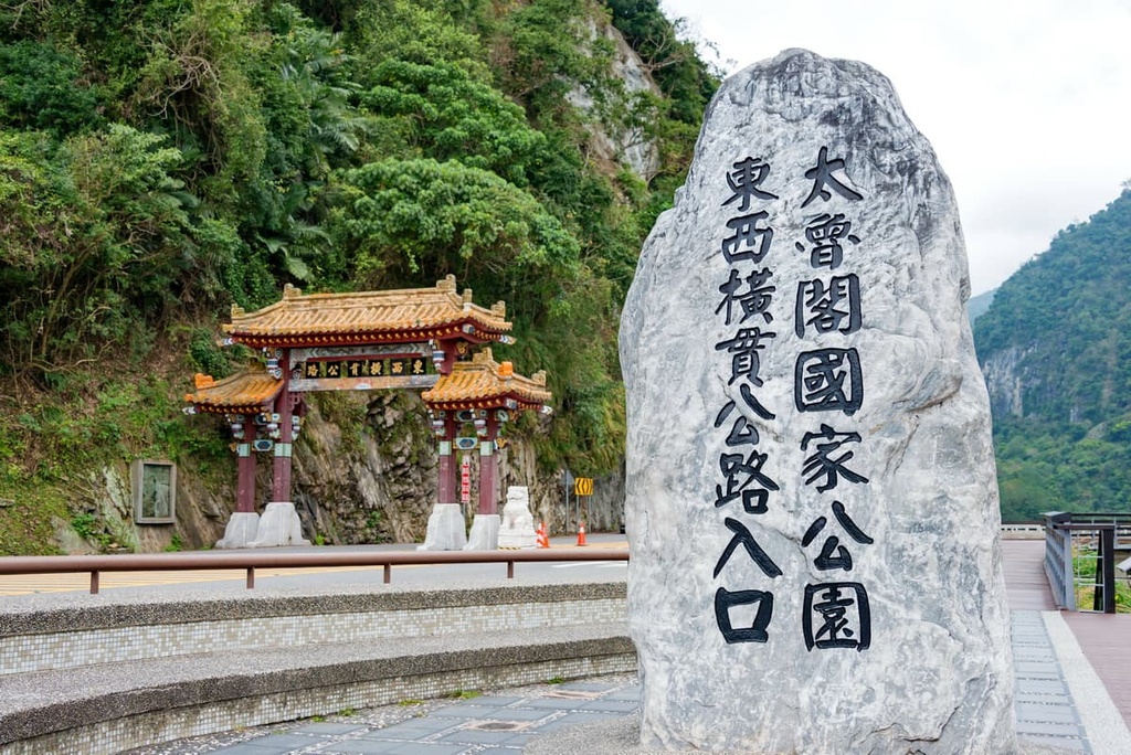
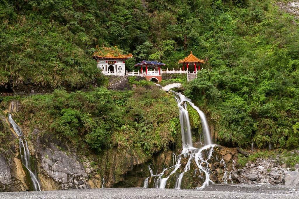
Arguably the signature trail of the Special Landscape Area and Taroko National Park, this hike features views of the captivating Eternal Spring Shrine (Changchun Shrine) sitting regally atop a roaring waterfall that flows into the Liwu River.
This relatively casual 2 km (1.2 mi) trail starts by tracing the cliff’s edge leading to the iconic Eternal Spring Shrine, which was built to respect the 226 people who died building the Central Cross Island Highway. The Central-Cross Highway, a road that passes through Taroko National Park’s unique landscape, was created to provide better access to the park’s pristine terrain.
Hikers then continue up a stairway that rises sharply to gain extraordinary views. Once at the Taroko Bell Tower, hikers have a superb bird’s eye view of snaking Liwu River and its towering marble cliffs.
A flourishing forest awaits hikers on the descent. You’ll also get to cross a suspension bridge that hovers above the gleaming turquoise Liwu River. Upon crossing the bridge, hikers can appreciate the bountiful greenery that borders the riverbanks.
Hualien City (花蓮市) and Ren’ai Township (仁愛鄉) are the two most convenient places to stay near the Special Landscape Area.
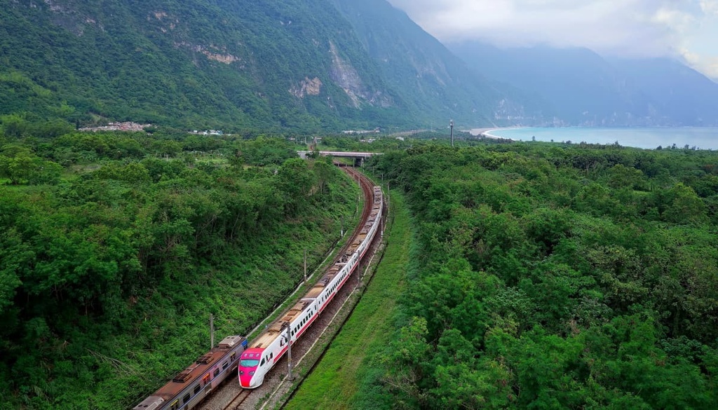
Taiwan’s remote east coast exudes rampant wildness due to its relative inaccessibility. While Taiwan’s west coast is well-connected with a network of road and rail, a singular train line connects to Taiwan’s east coast. For this reason, Hualien City retains a charming countryside appeal, with its untouched nature and slower pace of life.
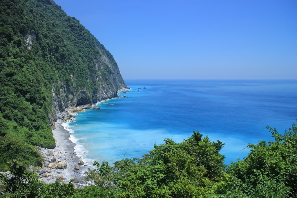
Beach lovers should head to Taiwan’s east coast for endless sandy beaches with large, crashing waves. Qixingtan Beach is a much-loved hangout for Hualien locals seeking relaxation.
Unlike Taiwan’s fine sandy bays, Qixingtan Beach is a pebble beach, which is an intriguing contrast to the norm. What is unique about Qixingtan is that Hualien City’s hills meet the ocean; thus, a walk along the pebbled strip has the cerulean Pacific Ocean waters on one side and emerald forested peaks the other side.
Qingshui Cliffs run to the Pacific Ocean, from where they rise 58 meters (190 ft) above the sparkling sea. Standing on Qingshui Cliffs offers sweeping views of the leafy emerald coast with its undulating, gentle hills that sharply dip at the coastline. In the breezy afternoon, cotton clouds descend upon the undulating land adding to the dramatic landscape.
The immaculately manicured Pine Garden overlooks Hualien’s pristine shores. It is home to a stately building that previously housed sending-off parties for Japanese kamikaze pilots. Nowadays, locals enjoy picnicking on the grassy lawn and basking in the sun while enjoying the immaculate views.
Meanwhile, the largest night market in Hualien County, Dongdamen Night Market, is sure to deliver flavor and fun. At the end of a gloriously sunny day, a trip to Dongdamen Night Market is an ideal way to end the evening. While here, tantalize your taste buds by savoring the local food of grilled corn, coffin bread, stinky tofu, and horned snails.
Ren’ai Township sits to the southwest of the Special Landscape Area near the Hehuan mountains. Staying in Ren’ai Township is a great idea if you want to venture to some of the region's many excellent attractions, too.
For example, Shei-Pa National Park is just a short drive away from Ren’ai Township. As it is home to Taiwan’s second-highest mountain, Xueshan, countless intrepid travelers wishing to summit the legendary snow-capped peak venture to Shei-Pa each year. There are numerous hiking trails on offer in the park, from lengthy week-long walks across several Baiyue to shorter, scenic trails.
Sun Moon Lake (日月潭) is a trendy tourist spot, thanks to its idyllic vibes. While here, you can take a leisurely stroll across the wooden walkway that traces the lake’s edge, allowing you to marvel at the beautiful leafy jungle lining the lake with views across the lake of the jagged peaks that expand into the distance.
Huisan Forest Recreation Area (惠蓀林場) offers an enchanting landscape brimming with abundant forests, gushing waterfalls, deep gorges, and high hills. The terrain dips as low as 500 meters (1,640 ft) rising to the highest peak at 2,419 meters (7,936 ft). Its remote location in Taiwan’s backcountry allows hikers to cherish the rippling hills increasing intensity towards the Central Mountain Range’s Baiyue of Qilai Shan and Nenggao Shan.
Additionally, the nearby Danda Major Wildlife Habitat is home to a large portion of the Central Mountain Range’s Baiyue. As the region is very remote, its nature is unspoilt; thus, various plant life and wild animals thrive in the habitat’s flourishing forests. Many lengthy treks take you into Danda’s hills, while mountain roads link the nearby Baiyue.
From Taiwan’s capital, Taipei, take the local express train (TRA) to Hualien City. The Taiwan Trip Bus 310 transports visitors from Hualien City Train Station to the Special Landscape Area.
For visitors wishing to drive themselves to the Special Landscape Area, it is a 42 km (26 mi) journey by road from Hualien City to the Special Landscape Area.


The highest peak in Special Landscape Area is Hehuan Shan North Peak, at 3,422 m.
Notable peaks in Special Landscape Area include Hehuan Shan North Peak, Hehuan Shan East Peak, Hehuan Shan, Jushan and Shimenshanbeifeng.


