Scan the QR code and open PeakVisor on your phone
Possibly one of Taiwan’s most remote regions, Dashuiku and Jianshan Special Scenic Area (大水窟、尖山特別景觀區) lies at the halfway point of the Batongguan Ancient Road. This park comprises an alpine lake, a rippling sea of dramatic peaks, and 3 named peaks. Nandashuikushan (南大水窟山) is the tallest mountain at 3,383 meters (11,099 ft), while the most prominent is Dafenjian Shan (達芬尖山) at 193 meters (633 ft).
Situated in the prominent Yushan National Park (玉山國家公園), Dashuiku and Jianshan Special Scenic Area stretches across the Taoyuan District (桃源區) of Kaohsiung City (高雄市) and Xinyi Township (信義鄉) in Nantou County (南投縣).
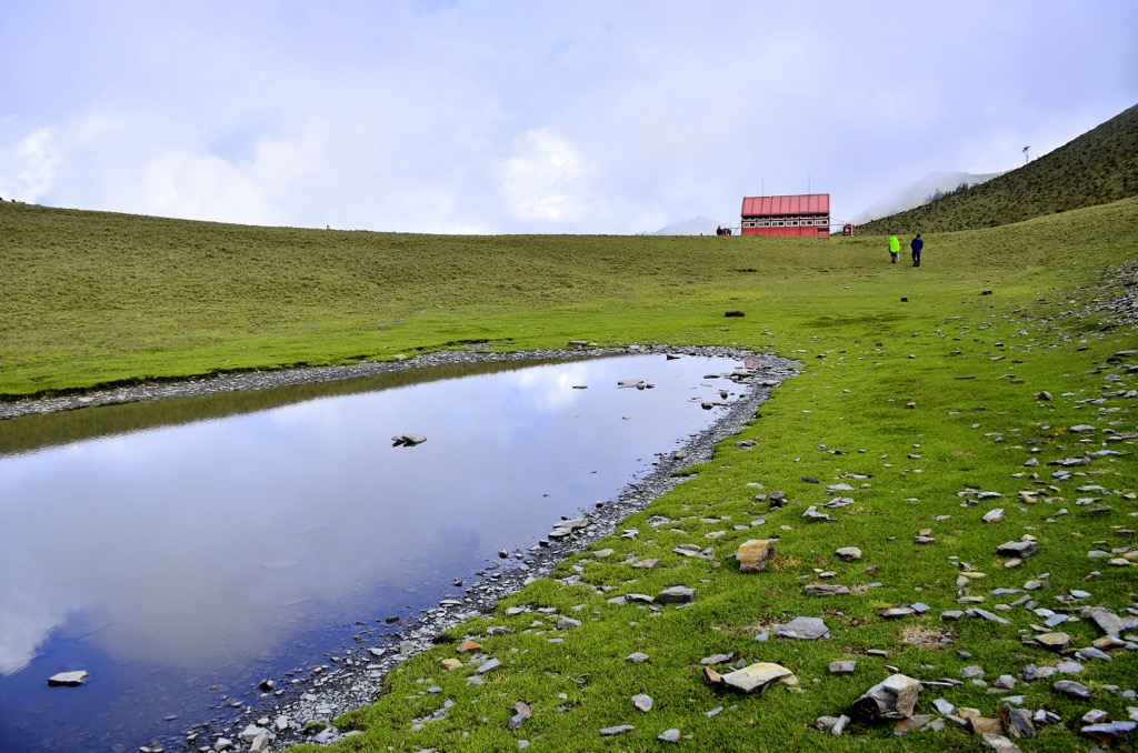
Like most areas in Yushan National Park, especially along Batongguan Ancient Road, the park is linked to the Japanese Occupation Era. Adjacent to Dashuiku Lake (大水窟池), an alpine pond situated at 3,280 meters (10,761 ft), is an old policing station constructed as part of the Batongguan Ancient Road, used to monitor the movement of the indigenous Bunun tribe they crossed the mountains.
The scenic area has an annual average temperature between 52°F to 43°F (11°C to 6°C) from 2,500 to 3,500 meters (8,202 to 11,483 ft). With the high humidity of 80% and heavy rainfall of 4,500 mm (177 in), Dashuiku and Jianshan Special Scenic Area can be cold and damp from the air moisture.
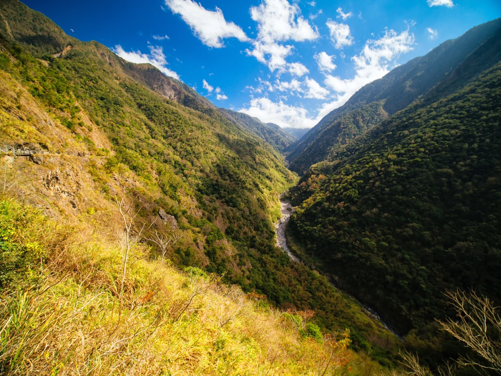
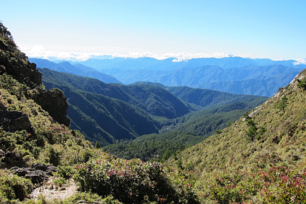
Dashuiku and Jianshan Special Scenic Area are in one of the most remote parts of Taiwan, where the rugged Central Mountain Range (中央山脈) trails its colossal corridor through Taiwan’s center. Nandashuikushan, Dafenjian Shan, and Beimian Shan belong to this giant mountain network, as do neighboring peaks of Xiuguluan Shan (秀姑巒山), Tafen Shan (達芬山), and Yushan (玉山).
Other well-known areas that surround Dashuiku and Jianshan Special Scenic Area are Yushan, Taiwan’s tallest mountain, in the northwest and Alishan National Forest (阿里山國家森林遊樂區) to the far northwest. Jiaming Lake (嘉明湖), Taiwan’s second-highest alpine pond, is in the southeast, with Xiangyang Forest (向陽森林遊樂區) in the south.
The Taiwan Central Mountain Range's formation dates to approximately three million years ago, when the Eurasian and Philippine Sea plates began to shift. This tectonic activity exerted powerful forces, causing the land to rise abruptly into towering peaks. Prior to this period, Taiwan existed as a submerged seabed, patiently awaiting its transformation into an emergent landmass.
Dashuiku and Jianshan Special Scenic Area’s rock strata comprise mainly metamorphic rock from the late Paleozoic to Mesozoic epochs.
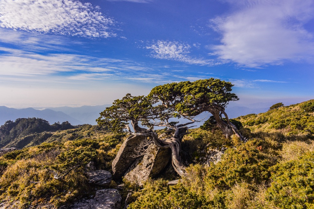
As the elevation of this region is mainly above 2,500 meters (8,202 ft), an evergreen environment of cold temperate conifers dominates the vegetation. Taiwan hemlock, pine, and Yushan juniper are the main arboreals. Between Xiuguluan Shan and Dashuiku Shan (大水窟山), there is a petrified forest of burnt and charred juniper, known as Xiuguping.
Regarding wildlife, there are 14 species of mammals, including the Taiwan black bear, the sambar deer, and the Formosan macaque. Birdlife is everpresent in the forests, with 81 recorded species with common sightings of the Taiwan goldcrest, blue jay bird, and the Mikado pheasant.
During the Mudan Incident of 1874, Japanese soldiers took revenge on Taiwan’s Paiwan tribe for murdering stranded sailors. Japanese soldiers invaded in three groups to prepare for the attack and surprise the unsuspecting Paiwan people. They created the first mountain roads in the north, middle, and south of the now Batongguan Ancient Road.
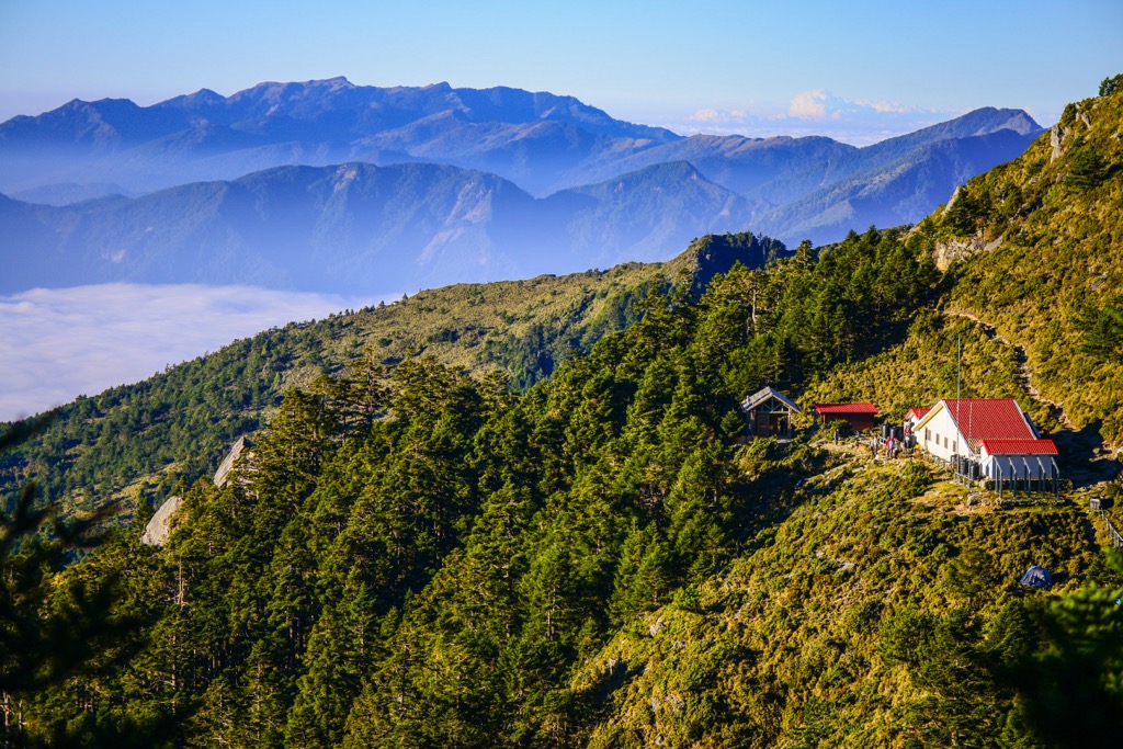
During the Japanese Occupation Era, the Batongguan Ancient Road was also established, with Dashuiku Shan as the intersection between the ancient roads of the Qing Dynasty and the Japanese. As Dashuiku is at the junction of the previous Taichung Prefecture and the Hualien Harbor Office, the Governor-General of Taiwan built a hexagonal gazebo by Dashuiku Lake to manage Taiwan’s indigenous tribes. It functioned as a checkpoint, with personnel stationed there.
The best major hiking trials and areas to discover in and around Dashuiku and Jianshan Special Scenic Area are:
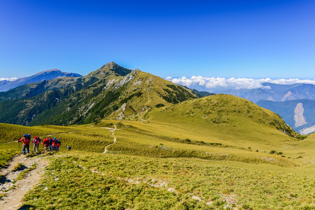
Take the shorter trek of the Batongguan Ancient Road that connects Batongguan Shan (八通關山) to Xiuguluan Shan and Dashuiku Shan. Known as the Eight Great Shows, this hike is a fraction of the lengthy mountain path, spanning only 32 km (20 mi).
The route begins at Dongpu Trailhead, where you’ll set out climbing the first hill, Batongguan Shan. During the ascent, you’ll encounter the sheer Father and Son Cliff, a colossal shale collapse on the mountainside. Guardrails and ropes make this climb safer and more accessible.
Further along the trail, you’ll pass Batongguan Yunlong Waterfall at an elevation of 1,640 meters (5,381 ft). The three-tiered cascade falls over 100 meters (3,281 ft) and is one of the most majestic in Taiwan. Returning to the climb, you’ll encounter another flowing water spectacle known as Qixi Waterfall, a seven-tiered cascade.
It’s a long trek to Batongguan Shan’s summit, which affords 360° views of the jagged terrain. You’ll notice Yushan and its surrounding peaks to the southwest and Xiuguluan Shan, the highest peak of the Central Mountain Range, to the south. It is also Taiwan’s fourth-highest peak after Yushan, Xueshan (雪山), and Yushan East Peak (玉山東峰).
On the way to Xiuguluan Shan, you’ll scramble up steep gravel slopes and tread through alpine forests of hemlock, juniper, and pine. From Xiuguluan Shan’s summit at 3,860 meters (12,664 ft), you’ll witness a sea of clouds floating across the landscape, resting below the pointy pinnacles of Taiwan’s giant peaks.
On the way to Dashuiku Shan, you’ll encounter the ashen deadwood forest of Xiuguping. Situated at 3,530 meters (11,581 ft), the fascinating remains of white trunks stripped of color looks out onto a scenery of dramatic mountains, deep valleys, and an evergreen environment of luscious greenery.
Dashuiku Shan has sprawling alpine meadows, making it easy to reach the summit. From here, you’ll enjoy sweeping vistas of Yushan’s peaks, as well as Dafenjian Shan and Tafen Shan in the south.
Following the Central Mountain Range’s prominent spine, the South Second Section Hiking Trail is a tiresome 90 km (56 mi) trek. Mostly hiking above 3,000 meters (9,843 ft), the thin air can trigger altitude sickness, with symptoms such as dizziness and fatigue.
Starting from Batongguan Shan, you’ll tread south along the lofty Central Mountain Range ridge to Dashuiku Shan, Dafenjian Shan, Tafen Shan, Lulu Shan (轆轆山), Yunfeng (雲峰), Nanshuangtou Shan (南双头山), Sancha Shan (三叉山), and finally Xiangyang Shan (紅葉山). Despite its length, the difficulty of this trek lies in the challenging terrain, as you’ll have to cross sheer ridges, descend into steep valleys, and ascend near vertical cliffs.
However, despite the trying conditions, the rewards are worthwhile; you’re constantly surrounded by a dramatic scene of rippling mountains extending far into the distance. The alpine environment of flourishing rhododendron forests, thriving birdlife, and the wispy sea of clouds rolling across the landscape is worth the exertion.
The Mabolasi Traverse, a trail within Yushan National Park, spans 94 km (58 mi). The traverse offers hikers the opportunity to ascend seven of Taiwan’s 100 tallest peaks, also known as Baiyue, each with elevations surpassing 3,000 meters (9,842 ft).
Hikers love the Mabolasi Traverse’s scenic view, showcasing Yushan near the start of the trail. Towards the end, the sight of the lush Huadong Valley (花東縱谷) fields extending westward signals the finale of a spectacular backcountry journey.
At Dongpu Trailhead, hikers encounter beautiful alpine flowers as they ascend Batongguan Shan and reach the highest peak in the Central Mountain Range, Xiuguluan Shan.
From here, proceed to Jupen Shan (駒盆山), then onto Mabolasi Shan (馬博拉斯山), notoriously known for its challenging 30 cm (12 in) narrow cliff. Advance towards Malijia Nan Shan (馬利加南山) before reaching Maxi Shan (馬西山), from where you can observe the Hai'an Range's (海岸山脈) undulating terrain. The final destination is Kaxipanan Shan (喀西帕南山), with views of Yushan and a chance to reflect on the journey from its summit.
If you enjoyed the challenge of the South Second Section Hiking Trail and Mabolasi Traverse, the Xinkang Cross Trail should be next on your hiking itinerary. You’ll climb the four giant peaks of Sancha Shan, Lianli Shan (連理山), Xinkang Shan (新康山), and Xinxian Shan (新仙山) over 27 km (17 mi), while hardly dipping below 3,000 meters (9,843 ft).
As the Xinkang Crosswalk Trail is southeast of Dashuiku and Jianshan Special Scenic Area, the overlooks will differ slightly, and you’ll enjoy sweeping views of Taiwan’s Huadong Valley.
Starting the trail at the base of Xiangyang Shan, you won’t reach the summit of this hill, but you’ll climb towards Sancha Shan. On the way, you’ll cross Xiangyang Shan’s deadwood forest known as Baimulin. Similar to Xiuguping’s ashed tree remains, a forest fire ravaged the thriving coniferous woodlands of juniper, hemlock, and fir; some of these hapless softwoods still cling to this earth as lifeless pillars of bleached wood.
From here, progress towards Jiaming Lake, Taiwan’s second-highest alpine pond. Situated on Sancha Shan’s southeast slope at 3,310 meters (10,860 ft), it’s a stunning sight as the sparkling, still water reflects Taiwan’s radiant sunshine. You may observe Taiwan sambar deer grazing on the alpine meadows.
After a short scramble, you’ll reach Sancha Shan, from where you can locate Yushan’s colossal pinnacle and look onto Xiuguluan Shan, Yunfeng, and the nearby peaks of Xiangyang Shan and Xinkang Shan.
You’ll then head to Lianli Shan, known for its dense alpine forests that obscure outlooks from the summit, before you climb to Xinkang Shan’s mountaintop, only 1.7 km (1 mi) away. From this open summit, you’ll notice the S-shaped curvature of the Central Mountain Range’s spine connecting the Baiyue of Nanshuangtou Shan, Lulu Shan, Tafen Shan, and Dafenjian Shan. While to the east, you’ll observe Taiwan’s Huadong Valley’s linear depression.
Finally, you’ll hike towards Xinxian Shan, the smallest of these four peaks, before descending below the 3,000-meter (9,843 ft) threshold and completing the trail.
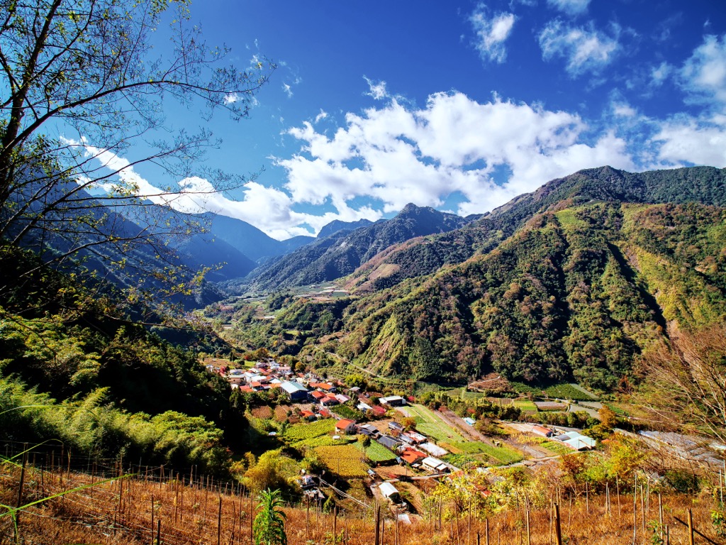
Nestled between the mighty Central Mountain Range and eastern Taiwan’s gentler Hai’an Range is a 180 km (112 mi) long basin stretching from Hualien City (花蓮市) to Taitung City (臺東市). The Huadong Valley boasts diverse vegetation, forming a landscape of cultivated natural beauty. Some of Taiwan’s most bucolic scenes unfold throughout this lush valley.
You will find vibrant orchards in this valley filled with plump, ready-to-eat fruit. Scattered throughout the valley are rice paddies that resemble pockets of pools, descending gradually like a shallow set of stairs.
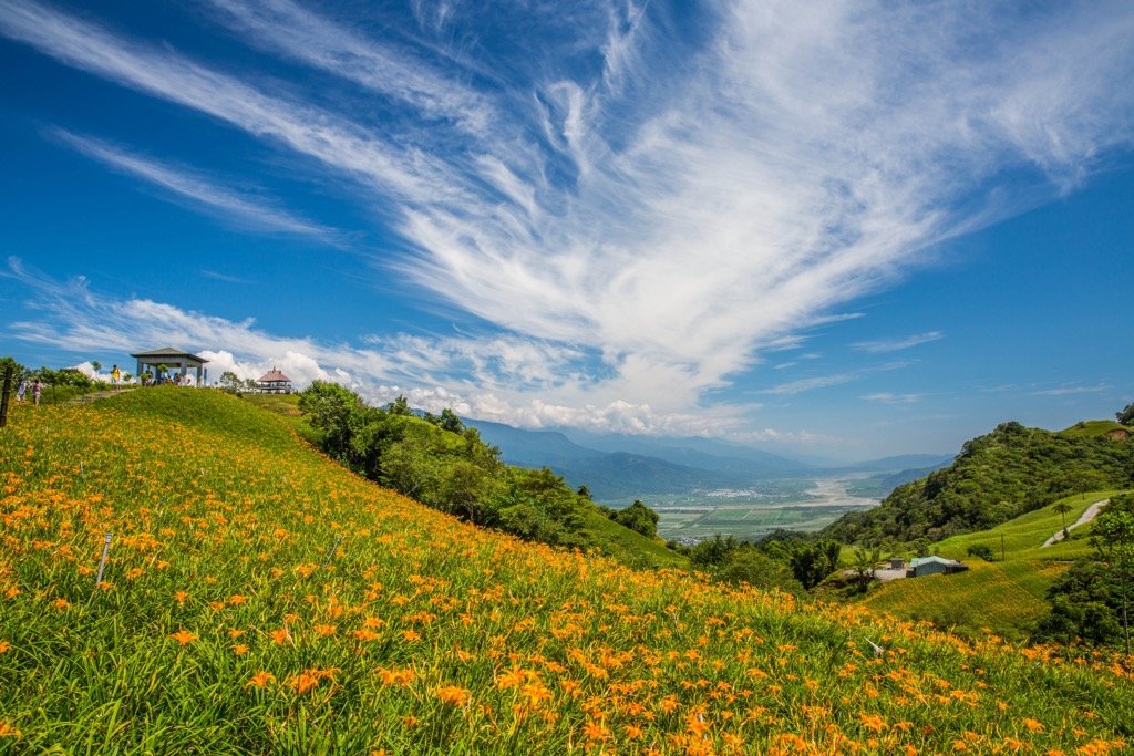
Furthermore, tea plantations enhance the scenery with endless rows of green tea plants adorning the gentle, rolling hills. A captivating sight in the valley is the lily fields, where flocks of white blooms stretch across the basin, creating a carpet of creamy florals, evoking the image of freshly fallen snow.
As Dashuiku and Jianshan Special Scenic Area lies in one of Taiwan’s most remote areas, no urban hubs are nearby. The two nearest locations where you’ll find accommodation in a small community of village life are Alishan Township (阿里山鄉) near Taiwan’s west coast and Yuli Township (玉里鎮) near the east coast. If you’re looking for bustling centers full of excitement, you’ll have to venture further afield, as these townships are small, humble, and practice a slower pace of life.
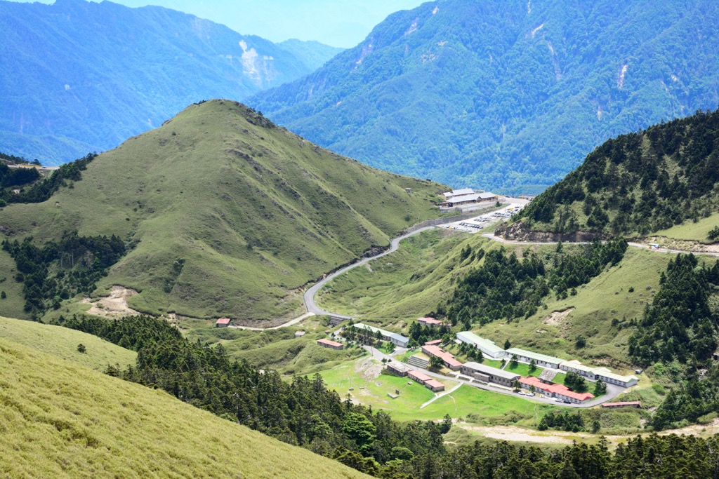
Alishan National Forest is one of Taiwan’s top scenic attractions, especially in springtime for the cherry blossoms. If you’re visiting in winter, pack warm clothes, as Alishan Township sits at an elevation of 2,000 meters (6,562 ft). As the township mostly thrives on tourism, there isn’t much else to do in this hilly region besides hiking and mountaineering.
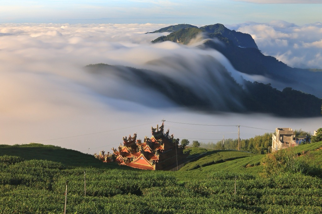
The region is famed for its spellbinding sunrise; welcome the sun’s soft rays from Zhushan Sunrise Observation Point in Alishan National Forest. Vast seas of clouds are another of Alishan’s celebrated scenes. These fluffy clouds float across the landscape, hovering below the sharp peaks. Enjoy this moment to greet the day and admire the picture-perfect scenery before you.
Alishan Forest’s cherry blossoms are an absolute must-see if you're visiting during late winter and spring. Wander the beautiful Cherry Blossom Trail, boasting over 1,000 trees bearing these pretty pastel flowers. You’ll notice Sakura blooms throughout the park, adding a soft color palette to the emerald environment.
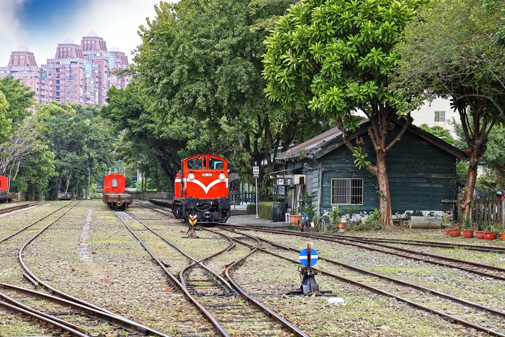
Another highly-recommended activity in Alishan National Forest is to ride the Alishan Forest Railway. Initially built to transport felled logs from the wooded highlands into low-lying Chiayi City, it is now used solely for tourism. Hop on board the old steam engine train with wooden carriages as it meanders through the dense alpine forest as you enjoy outlooks onto this pristine environment.
The rural Yuli Township is peacefully nestled between the awe-inspiring Central Mountain Range and the gentle coastal hills. Located in the heart of the Huadong Valley, Yuli showcases breathtaking landscapes. You'll enjoy staying here if you’re seeking escapes into nature, but it can get a bit boring once you’ve exhausted your active pursuits.
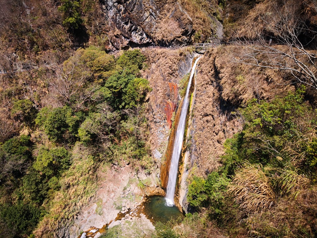
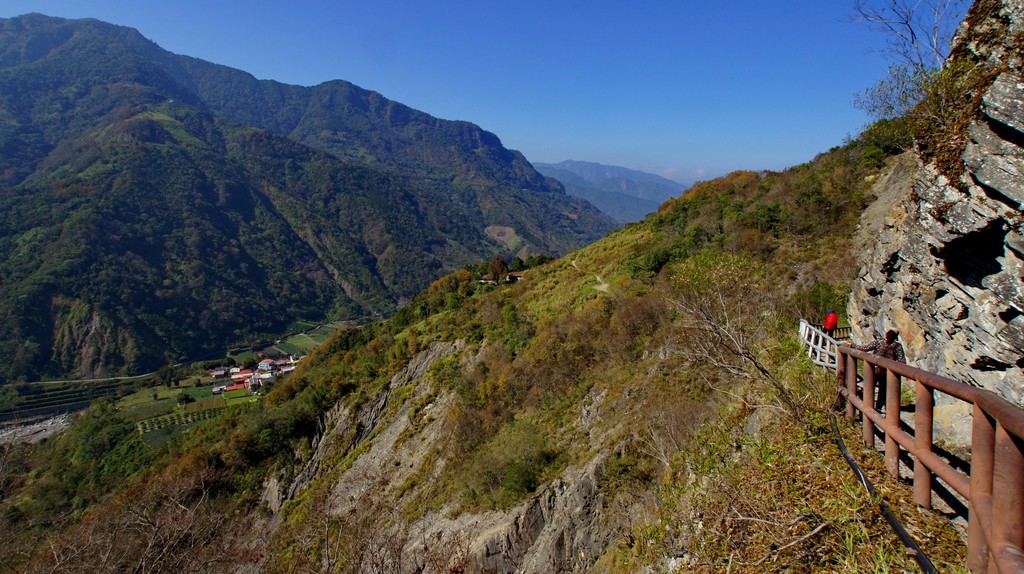
For adventurous hikers, Yuli's proximity to the Walami Trail, the eastern part of the Batongguan Yueling Ancient Road, makes it an ideal destination. Moreover, the magnificent Nanan Waterfall is near the Walami Trail starting point. The majestic waterfall, which stands 50 meters (164 feet) high, showcases a mesmerizing display of cascading frothy water.
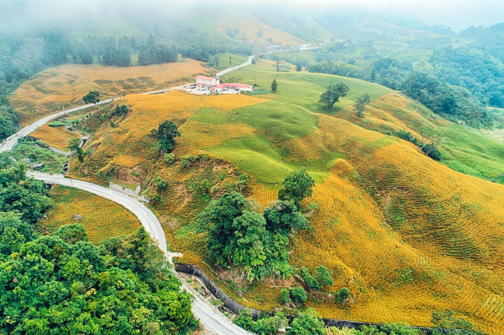
If you haven’t had enough of hiking peaks, then add Liushishishan (六十石山) to your trekking itinerary. Belonging to the smaller Hai’an Range, this hill is only 956 meters (3,136 ft) high, but it offers superb views of the Huadong Valley to the west and the Pacific Ocean to the east. Climb the hill during summer, and you’ll walk across undulating meadows of daylilies that tinge the environment with warm golden accents.
Finally, for an exhilarating trekking experience, consider visiting the picturesque Wulu Village. The village sits at an impressive elevation of 2,700 meters (8,858 ft) and is home to the Bunun community. The area is characterized by lush green pastures and stunning emerald forests, often enveloped in a perpetual mist.
Take the Taiwan High-Speed Rail (HSR) or local express train (TRA) to Chiayi City from Taiwan's major cities. From Chiayi, board the 7322 bus towards Alishan, then transfer to the 6739 bus toward Sun Moon Lake. At Tataka Visitor Centre, exit the bus near the beginning of the Dashuiku and Jianshan Special Scenic Areas.
It is also possible to rent a car or scooter from Chiayi City to reach Dashuiku and Jianshan Special Scenic Area, which is about 86 km (53 mi) away.