
Scan the QR code and open PeakVisor on your phone
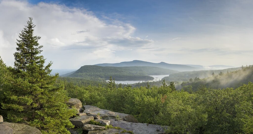
The Dry Brook Ridge Wild Forest is a mountainous area on the northern border of the Catskill Park in the US State of New York, home to 4 named peaks. The highest point in the area is Dry Brook Ridge at 3,471 ft (1,057 m).
The Dry Brook Ridge Wild Forest covers 8,900 acres (3,600 ha) of land across five separate tracts in the northeastern edge of the Catskill Park. The largest section of the wild forest and the main hiking area sits in the towns of Andes, Margaretteville, and Hardenburg in Delaware and Ulster counties.
A 7-mile-long (11.3 km) ridge bisects this area of the wild forest, between Dry Brook Ridge and Pakatakan Mountain. The other two peaks in the area, Cross Mountain and Barkaboom Mountain are located on separate tracts of land. There are no Catskill High Peaks (Catskill mountains above 3,500ft (1,066 m) in elevation) in the wild forest, but Dry Brook Ridge is almost tall enough to qualify.
In general, the terrain in the Dry Brook Ridge Wild Forest is mountainous and steep. Skiing, snowshoeing, hunting, and trapping are all allowed in the area. Mountain bikers can also use the trails in the Dry Brook Ridge Wild Forest, but they’re not maintained specifically for riders.
There’s one backcountry lean-to on the Dry Brook Ridge Trail, just past the junction with the German Hollow Trail. Primitive camping is also allowed throughout the area.
The Dry Brook Wild Forest is surrounded by other hiking areas in the Catskills and beyond. The Delaware Wild Forest, Big Indian Wilderness, and Balsam Lake Mountain Wild Forest are all nearby. Further afield, there are nearly endless hiking opportunities in the Adirondack Park in Northern New York and the Green Mountains in Vermont.
The Dry Brook Ridge Wild Forest is part of the Catskill Mountains. Unlike the other major mountain group in New York, the Adirondacks, the Catskills are a subrange of the Appalachians. More specifically, the Catskills are considered a mature, dissected plateau, a higher elevation zone that has been worn down in places by natural erosion.
The Catskill plateau sits along the western edge of the Appalachian mountains. Over millions of years in the Devonian and Mississippian periods, it was built up by sediment runoff from the nearby mountains and tectonic uplift. Most of the rocks in the Catskills today are siliciclastic, featuring mudrocks, sandstones, and conglomerates.
Over time, parts of the plateau were eroded away, producing the ridges, peaks, and valleys we see today. Glaciers, which covered the area multiple times over the last million years, had a huge effect on the landscape, grinding down mountain peaks and leaving behind large deposits of rock and glacial till. The large shale, block-type rocks found throughout the are glacially deposited.

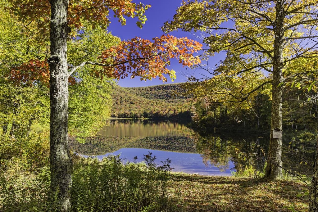
There are a total of 8 miles (12.9 km) of streams in the Dry Brook Ridge Wild Forest, but no major rivers or lakes. The highest point in the area is Dry Brook Ridge, followed by Barkaboom Mountain, Pakatakan Mountain, and Cross Mountain.
The Dry Brook Ridge area is heavily forested, with northern hardwood forests covering 80–90% of the land. The most common tree species are sugar maple, American beech, and yellow birch, with red oak, red maple, white ash, and black cherry scattered throughout. There are also stands of eastern hemlock in the area.
Before the region was set aside as a forest preserve, the Dry Brook Wild Forest was heavily logged. In these clear cut areas, Norway spruce and Scotch pine were frequently replanted.
It’s estimated that there are over 50 species of mammals, 100 species of birds, 18 species of reptiles, and 20 species of amphibians in the forest area. The largest animals in the area are deer and black bear, both of which can be hunted in the forest preserve during their respective hunting seasons.
The Catskills have been inhabited for thousands of years. The groups most prominent in the area at the time of European contact were Algonquian-speaking tribes, including the Mohicans and the Esopus.
Both groups used the Catskills for hunting, fishing, transit, and as a place to meet and trade, but didn’t settle frequently in the rugged high mountain regions. (The nearby Hudson Valley was much more heavily settled.)
When European and American colonists started to migrate further inland, the local First Nations began to face violence and pressure to leave their valuable lands. After the Revolutionary War, the new US government forced the remaining Indigenous peoples off their lands, with the many forced to resettle in what is now Wisconsin as the Stockbridge-Munsee Community.
Afterward, the Catskills became the main source of resources for local heavy industry. Large tracts of land were clear cut for the timber and charcoal industries, rivers were heavily polluted, and most of the hemlock trees in the area were stripped of their bark, which was used in the leather tanning industry at the time.
The environmental destruction in the Catskills was so extensive that when New York State began preserving forest land in the late 1800s, the area was considered too damaged to have any conservation value. The nearby Slide Mountain Wilderness was added to forest conservation legislation to settle a tax dispute, not because the state thought it was worth preserving.
After Catskill Park was first established in 1904, however, the forests began to regenerate and people began to see their value as open space.
In particular, the Catskill 3500 Club promotes hiking in the area and represents Catskill peak baggers. To gain entry, hikers must summit the 35 highest peaks in the Catskills, including re-climbing Slide, Blackhead, Balsam, and Panther Mountain in the winter for a total of 39 climbs.
The Catskill 3500 Club currently does trail maintenance in the area, along with the New York-New Jersey Trail Conference (NYNJTC).
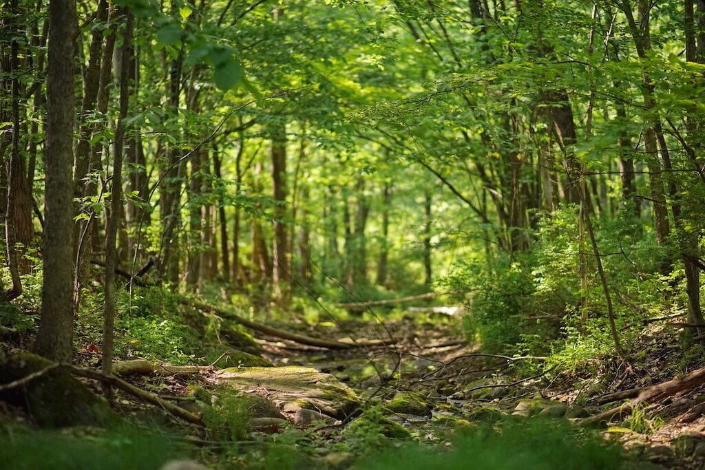
Most of the hiking in the wild forest is centered around Dry Brook Ridge in the northern end of the preserve. These trails are lightly trafficked, so they’re a great place to go if you’re trying to get away from crowds.
This trail starts from the north end of the Dry Brook Ridge parking lot and traverses the entirety of the ridge, climbing over Balsam Lake Mountain before finishing at the Balsam Lake Trailhead outside the Dry Brook Wild Forest.

While most of this hike is forested, there are good views to the west from the summit of Dry Brook Ridge. There’s also an option to shorten this hike by stopping at the Millbrook Road parking area 9.9 miles (15.9 km) down the trail.
This trail begins off Chris Long Road in Arkville and climbs steeply to meet the Dry Brook Ridge trail. If you follow the ridge for an additional 2.5 miles (4 km), you’ll reach the summit of Dry Brook Ridge.
This trail covers the best areas of the wild forest and loops you back to where you started for a great day hike.

It starts at the Huckleberry Brook parking lot and climbs to Dry Brook Ridge, where it crosses the summit before returning to the Huckleberry Loop Trail. The trail descends, follows a ridgeline, and finally comes out on Huckleberry Brook Road 0.7 miles (1.1 km) west of the trailhead.
You’ll have to walk back to the parking lot along the road for this last section of the trail. Also, be aware that the second half of the Huckleberry Loop is overgrown and difficult to follow.
Looking for a place to stay near the Dry Brook Ridge Wild Forest? Here are some of the best nearby towns to check out:
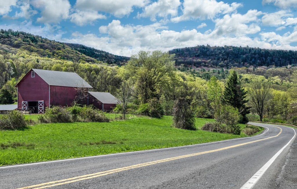
Margaretville is the closest town to the Dry Brook Wild Forest, located adjacent to it in the northwest. While it’s a small village of just 600 people, it’s actually the largest population center along the 50-mile (80 km) Catskills Scenic Byway.
There’s a Trailways bus stop in town, as well as quaint shops, restaurants, and historic buildings. In the summer, the town holds a cauliflower festival, a July carnival, and weekly farmers’ markets. One of the most popular entertainment options is Ark Bowl & BBQ, a restored bowling alley, performance space, and barbeque joint on the edge of town.
Despite being about as tiny as a mountain town can be, with just over 200 residents, Phoenicia is known all over the region as a Catskills destination.
The town is home to a railway museum and several high-end restaurants that cater to visitors. The most famous of these is Phoenicia Diner, which serves modern American fare in an old-school diner setting. There are also several great small hotels and inns in Phoenicia to check out.


