Scan the QR code and open PeakVisor on your phone
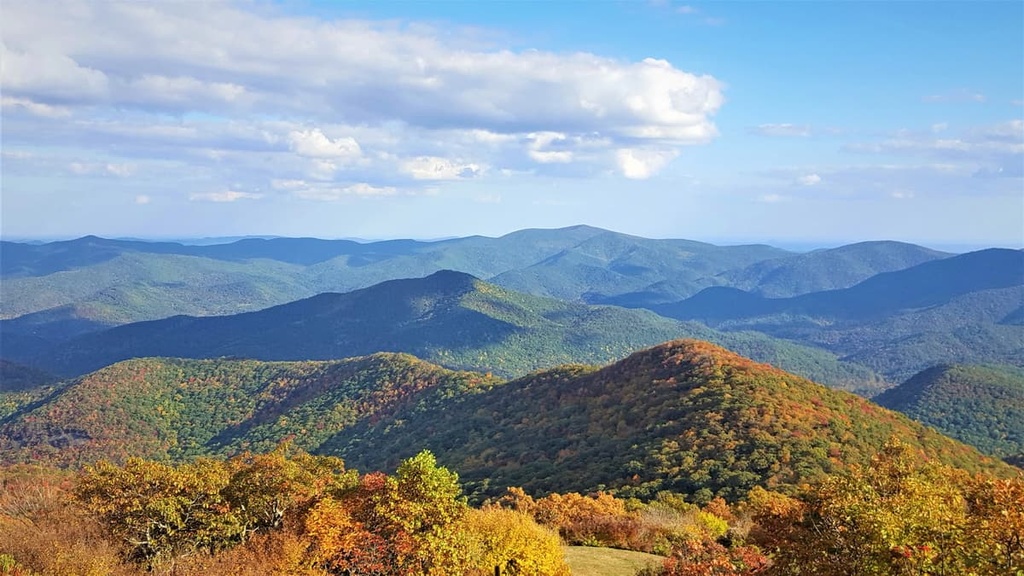
The Coopers Creek Wildlife Management Area (WMA) is one of the US state of Georgia’s largest WMAs. It lies in the northern part of the state, close to Georgia’s border with North Carolina. It is part of Chattahoochee National Forest and contains 41 named mountains, the highest and most prominent of which is Coosa Bald (4,275 ft/1,303 m).
The Coopers Creek Wildlife Management Area (WMA) is located within Chattahoochee National Forest in northern Georgia. Its more than 30,000 acres (12,141 ha) of terrain span across Fannin and Union counties, nearly reaching the state’s border with North Carolina.
The mountains found within the WMA are part of the Blue Ridge Mountains, which are in turn part of the southern portion of the Appalachian Mountains. The most prominent peaks in the region are Coosa Bald, Parke Knob, Rocky Mountain, and Pilot Mountain.
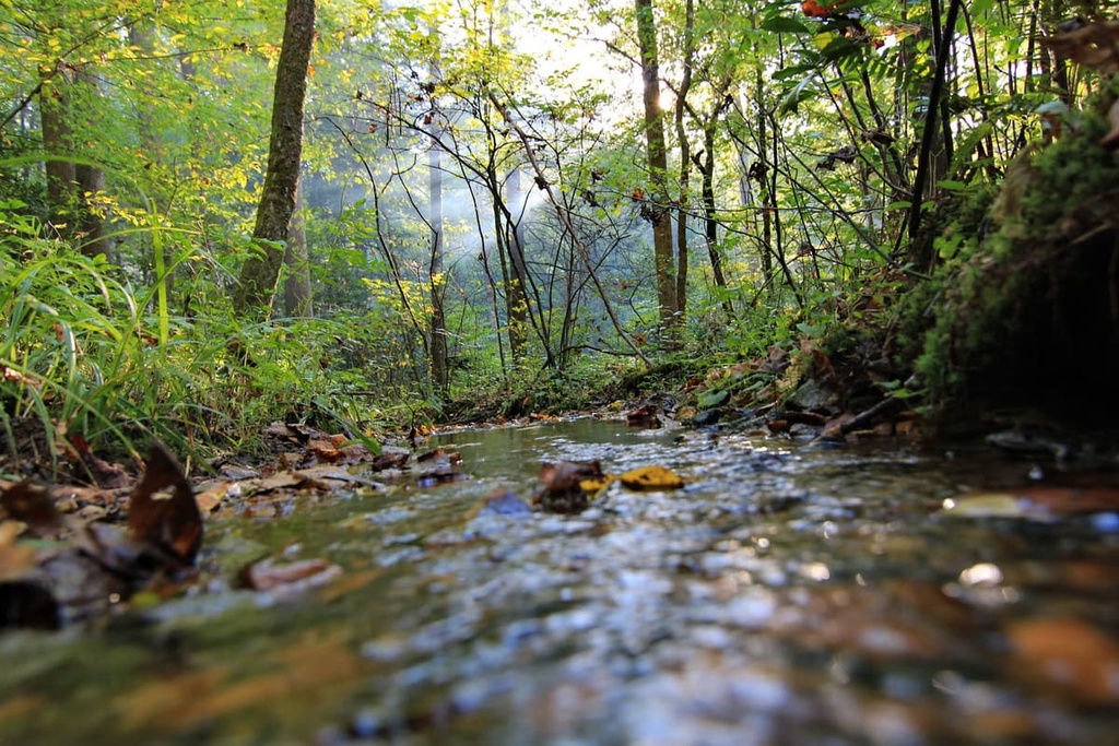
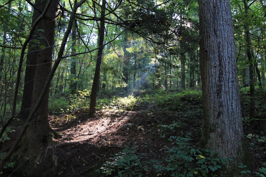
The wildlife management area was established to promote wildlife conservation in the region while also creating opportunities for hunting, fishing, and other outdoor recreation activities. There are 8 mi (12.9 km) of trails, ranging from easy to moderate, that run through the wildlife management area. Many of these trails follow old logging roads and are pleasant to walk on.
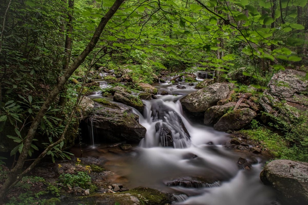
The Coopers Creek WMA borders many other protected and scenic natural areas including Vogel State Park, Blood Mountain Wilderness, Valley of the Giants, and the Cooper Creek Recreation Area.
The mountains in the Coopers Creek WMA are part of the Blue Ridge Mountains, which run from the state of Virginia southward through North Carolina and into Georgia where they cover almost 100 mi (160 km) of terrain. The range widens as it reaches Georgia, and in some places, it is up to 60 mi (97 km) wide.
The Blue Ridge Mountains are sometimes referred to as the Eastern Continental Divide. Water from the ridgeline flows eastward toward the Atlantic or west toward the Gulf of Mexico. This range is part of the greater southern section of the Appalachian Mountains.
The mountain-building processes that raised these mountains began more than 500 million years ago. During this time, the region experienced a number of tectonic events. At certain points, the tectonic plates in the area drifted apart to create shallow seas, and at other times, the tectonic plates collided. When these plates collided, they folded, faulted, and uplifted the rocks in the region to create the landscape that is now part of the Coopers Creek WMA.
In particular, the collision of the North American and African plates that formed the supercontinent Pangea around 300 million years ago also raised the Blue Ridge Mountains.
Erosion over the past 100 million years carved and sculpted the ridges and valleys that we see in the region today. Gneiss, quartzite, and schist are some of the most common rocks found in the range.
In this region of the Blue Ridge Mountains, the soil is very fertile and the average rainfall amount is high, sometimes upward of 60 in (152 cm) per year.
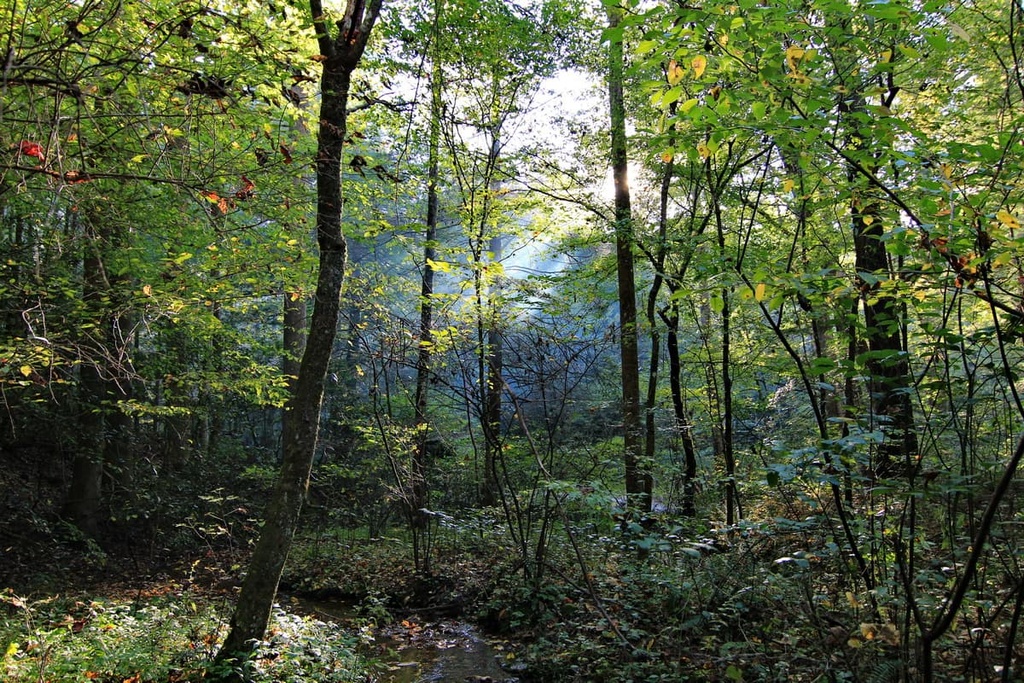
As a result, oak-hickory forests are in the majority on the mountainsides in the Coopers Creek WMA. There tend to be broadleaf deciduous forests on the wetter, northern-facing slopes of the WMA and oak forests along the ridgelines. Shrubs, grasses, heath balds, and hemlock and mixed oak-pine forests are also common in the area.
The fertile, verdant environment in the WMA supports many animals, most commonly black bears, white-tailed deer, coyotes, wild turkeys, grouse, songbirds, and a wide variety of amphibians and reptiles.
Furthermore, the Coopers Creek WMA is located along the Atlantic flyway. Due to its location along the flyway, many tanagers, thrushes, vireos, and warblers migrate through the WMA each year during their migrations.
Northern Georgia is the ancestral land of the Cherokee and Creek peoples. Archeological and cultural records suggest that the Creek and Cherokee have lived in the region since at least the 1400s, though Indigenous people have lived in the region for much longer.
However, by the late 1700s, the arrival of English, German, Irish, and other European settlers ushered in a new and brutal era for the region. The discovery of gold sparked a gold rush during the 1830s in what is now Lumpkin County (located directly to the south of Coopers Creek WMA) and White County (situated just to the east of the WMA).
The intensified focus on the region due to this gold rush, combined with the general trend in westward expansion and settlement by the US, led to the forced removal of Indigenous peoples from what is now the Coopers Creek WMA.
Many members of the Creek and Cherokee nations, alongside thousands of members of the Seminole, Chickasaw, Choctaw, Ponca, and Ho-Chunk nations, were subsequently forced to march from their homelands to what is now Oklahoma on the Trail of Tears.
In the decades that followed, several Civil War battles were fought near what is now the Coopers Creek WMA. After the war, a boom in the copper industry near the Tennessee-Georgia border led to the destruction of the region’s forests as trees were cut to fuel copper smelters. Further degradation of the forests occurred when the commercial lumber industry emerged at the end of the 1800s.
The Chattahoochee National Forest was established in 1937 to address forest degradation concerns. Nowadays, the waterways in the national forest also provide clean water for metropolitan Atlanta.
Furthermore, the Coopers Creek WMA even offers hunting opportunities for deer, bear, turkey, and small game. The area also attracts visitors who come to enjoy its many hiking, biking, and fishing opportunities.
The 8 mi (12.9 km) of trails in the Coopers Creek WMA range from easy to moderate in difficulty. Here are a few of the most popular trails to check out during your next trip to the WMA:
Note that the trails in the WMA are primarily accessible via Forest Service Road 33 near Suches, Georgia.
There are primitive camping areas located in the Coopers Creek WMA. Additionally, dispersed camping is allowed anywhere in the WMA on national forest lands unless otherwise marked.
Furthermore, the WMA is located about 20 minutes from the Cooper Creek USFS Campground, which offers a handful of designated campsites along the banks of Cooper Creek.
The campground operates year-round and reservations are required for all campers. You can make a reservation for the campground online at Recreation.gov up to 6 months in advance of your trip.
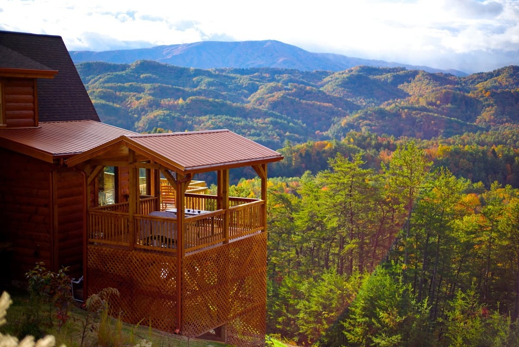
Looking for a place to stay near the Coopers Creek Wildlife Management Area? Here are some of the best cities and towns to check out during your next trip to the region.
The small community of Blue Ridge has around 1,200 inhabitants and is located an hour’s drive away from the Coopers Creek WMA.
Each year, the town hosts blues and jazz festivals, rodeos, trout fishing competitions, local parades, and Arts in the Park events. Kayaking, horseback riding, and a trip along the region’s scenic railway are all great ways to take in the area’s natural beauty while in Blue Ridge.

If you’re looking for a bite to eat during your trip to Blue Ridge, you can find comfort foods, barbecues, steakhouses, cajun flavors, and local cafés and delis in town. Hotels, motels, lodges, rental cabins, and B&Bs are all available in Blue Ridge, too, for those looking for accommodation in the area.
Atlanta is a diverse and culturally vibrant city that’s located only 2 hours and 15 minutes away from the Coopers Creek WMA by car. The city’s population is just shy of 500,000 people, though you could easily spend days exploring Atlanta's cultural and historical offerings.
There are three main areas of Atlanta: Buckhead (Uptown), Midtown, and Downtown. In Buckhead, be sure to visit the Atlanta History Center or step outside onto Path400, a green trail oasis that’s located in the city’s urban core. Meanwhile, Midtown, which is nicknamed the “heart of the arts,” is the place to be if you’re interested in theater, symphonies, the High Museum of Art, or the city’s botanical gardens.

The Downtown area of Atlanta houses the Martin Luther King, Jr. National Historical Park, the National Center for Human Rights, an aquarium, food markets, multiple venues for music and events, and sports stadiums.
There are many restaurants to choose from in Atlanta, too. While in the city, you can explore pop-ups and look for restaurants that offer seasonal and local foods. Atlanta is home to restaurants that serve up nearly any cuisine that you can think of, too, so there’s something to suit every taste and budget.
In Atlantia, you can also find a wide variety of accommodation options from luxury hotels to Airbnbs. The city is home to one of the busiest airports in the world, too, so it’s easy to get to if you’re traveling to the area from further afield.
Chattanooga has a population of just over 180,000 and is located only two and a half hours away from the Coopers Creek WMA across the state border in Tennessee. As it is surrounded by mountains, Chattanooga is one of the most scenic cities in the region.
From cruises on the Tennessee River to guided walking tours to wine and whiskey tastings, there’s plenty to do around the city. Music and arts festivals take place regularly in Chattanooga, and art lovers should check out the galleries in the city’s Bluff View Art, Northshore, and Southside districts.

When it comes to eating in Chattanooga, you can find everything from fine dining to barbecue and everything in between. Many restaurants in the city also pride themselves on using ingredients sourced from local farms.
All standard accommodation types can be found in Chattanooga, too, as can some quirkier offerings like a historic railroad sleeper car and scenic cabins that are nestled along the banks of the river.