
Share

Scan the QR code and open PeakVisor on your phone
Scan the QR code and open PeakVisor on your phone
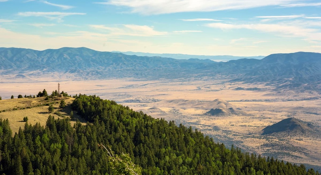
The North Magdalena Ranger District of the Cibola National Forest lies in the west-central region of the US state of New Mexico. The desert and forest landscape within the ranger district includes 36 named mountains. The highest and most prominent peak in the ranger district is Madre Mountain, which is 9,534 ft (2,906 m) tall and has 1,952 ft (595 m) of prominence.
The North Magdalena Ranger District is part of the larger Cibola National Forest. As a whole, the forest includes 1.6 million acres (647,497 ha) of terrain across the state of New Mexico. The forest is divided into four major ranger districts: Sandia, Mt. Taylor, Mountainair, and Magdalena.
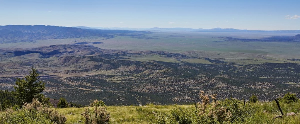
The Magdalena Ranger District encompasses over 800,000 acres (323,748 ha) of terrain and is the largest of the four ranger districts in the forest. The ranger district is further divided into three regions—north, east, and south.
Furthermore, the Magdalena Ranger District encompasses portions of four different mountain ranges: the San Mateo, Bear, Datil, and Magdalena mountains. Between the non-contiguous portions of the district lie the Plains of San Agustin.
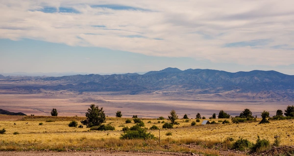
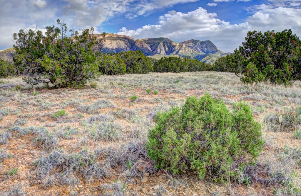
The northern portion of the Magdalena Ranger District encompasses the Datil Mountains. Here, sweeping plains are met with jagged ridgelines, rock fields, and pine forests. Rock outcroppings and volcanic rock formations are both common throughout the region.
The Rio Salado, a tributary of the Rio Grande, flows through the ranger district. Various small creeks branch off of the Rio Salado, too.
Additionally, the North Magdalena Ranger District is situated near various other areas for outdoor recreation. In particular, to the east of the ranger district lies the Sierra Ladrones Wilderness Study Area and Sevilleta National Wildlife Refuge.
El Malpais Wilderness Study Area is located to the north of the ranger district while the Gila National Forest spans out to the west and south. Other portions of the Magdalena Ranger District lie to the south of the area along with the Withington Wilderness and Apache Kid Wilderness.
The geological history of the ranger district is closely related to the various mountain ranges in the region. The four mountain ranges that pass through the Magdalena Ranger District are the San Mateo, Magdalena, Bear, and Datil Mountains.
The Datil Mountains are the most prominent range in the northern portion of the Magdalena Ranger District. Situated along the northern edge of the Mogollon-Datil volcanic field, the range extends into Socorro and Catron counties.
The mountain ranges that are located in the region, including the Datil Mountains, are fault-block ranges. Underneath the ranges lie calderas that date back 65 million years. Around 28 to 23 million years ago, these faults were lifted, leaving behind the landscape that’s visible today.
The Mogollon-Datil volcanic field is part of a volcanic belt that was most active during the Cenozoic. This discontinuous belt of volcanism spans from central Mexico up to western Texas and southwestern Colorado. The volcanic field marks the southern edge of the Colorado Plateau.
As a whole, the Colorado Plateau is known for being geologically stable. The land located directly to the south of the Magdalena Ranger District has a much more rich geologic history compared to the land that extends to the north.
Major peaks that are located within the ranger district include Madre Mountain, Tres Montosas (South Peak), Sugarloaf Mountain, Bear Mountains, and Davenport Lookout.
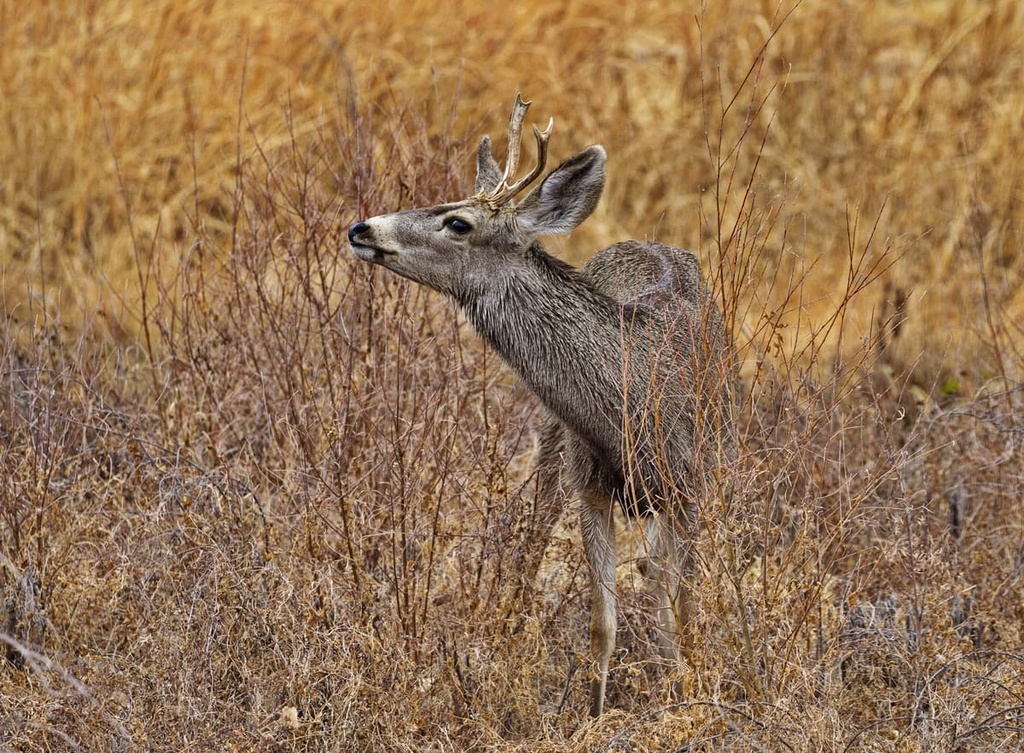
The various portions of the Magdalena Ranger District feature a variety of both flora and fauna. Larger mammals commonly found in the region include mule deer, elk, mountain lions, bobcats, coyotes, foxes, pronghorns, and black bears.
The rocky landscape of the ranger district also provides the ideal habitat for prairie dogs. Birds of prey, such as vultures, northern goshawks, kestrels, red-tailed hawks, golden eagles, bald eagles, Mexican spotted owls, and peregrine falcons are all common in the region.
At elevations above 8,000 ft (2,440 m), the forested areas of the ranger district consist primarily of species like southwestern white pine, Douglas fir, white fir, and ponderosa pine. Between 6,500 ft (1,981 m) and 8,000 ft (2,440 m) in elevation, Gambel oak and mountain mahogany are more present in the region.
The relatively small amount of rainfall that the region receives enables grasses, cacti, and various shrubs to thrive in the lower elevations of the ranger district. Some common species found in the district include blue grama grass, black grama grass, bud sagebrush, soapweed yucca, and four-winged saltbush.
The human history of the Cibola National Forest is extensive and it begins long before the arrival of European settlers in the region. Some of the cultural artifacts that have been found in the region are around 11,500 to 8,500 years old.
The Colorado Plateau area has been home to the Pueblo people and their ancestors, the Ancestral Puebloans, for nearly 4,000 years. The land throughout the Magdalena Ranger District is also part of the ancestral homelands of the Apache people.
More specifically, the ranger district is part of the traditional territory of the Jicarilla Apache, Mescalero Apache, Western Apache, and the Chiricahua Apache. The Chiricahua Apache are thought to have the most ties to the land that is now part of the Magdalena Ranger District.
Europeans began arriving in the region around 1540 CE when a group of Spaniards started traveling through the area. The Spanish eventually claimed the region as part of New Spain. It remained part of New Spain until Mexico gained independence in 1821.
Since the arrival of Europeans in the sixteenth century, the Apache have been fighting to protect and preserve their homelands in the region. At the end of the nineteenth century, the Apache people were defeated in a series of battles later known as the Apache Wars.
The US government subsequently forced the remaining Apache onto reservations. While some of these reservations were located in New Mexico, many Apache were sent to reservations in areas as far away as Oklahoma. The region was used extensively for logging and mining in the following decades.
The Cibola National Forest was originally established as a forest reserve in 1932. It was later designated as a national forest. Today, the Magdalena Ranger District is located near the reservations of many tribal nations, including the Alamo Navajo Indian Reservation and the Acoma Pueblo.
The North Magdalena Ranger District of the Cibola National Forest is home to relatively few hiking areas. However, here are some of the best trails to check out during your next trip to the region.
The Datil Well Campground Loop Trail is a small hike that features views of the Datil Mountains. This trail winds gently through forests, grassy fields, and rocky ridgelines.
It is one of the more accessible routes compared to other hiking trails in the region. This loop trail is 2.5 miles (4 km) long round-trip and it has 301 ft (92 m) of elevation gain.
The Mesa Trail #13 is a loop trail located just to the south of the Magdalena Ranger District. This trail winds steadily through the forest in the ranger district and along rugged ridgelines.
Hikers on this trail can see both rocky outcroppings and mesas. This loop route is 5.2 miles (8.4 km) long round-trip and it has 1,545 ft (471 m) of elevation gain.
The Copper Canyon Trail is an out-and-back route that climbs through a forested canyon. Though there is minimal water along the route, the trees provide ample shade throughout for hikers to enjoy. The first mile of this hike climbs steadily and gets steeper as the trail approaches the summit.
Hikers can extend this trail by 0.9 miles (1.4 km) in order to reach the summit of South Baldy. Without this side trip, the Copper Canyon Trail is 9 miles (14.5 km) long round-trip and it has 3,264 ft (995 m) of elevation gain.
Looking for a place to stay near the Magdalena Ranger District? Here are some of the best cities and villages to check out in the region.
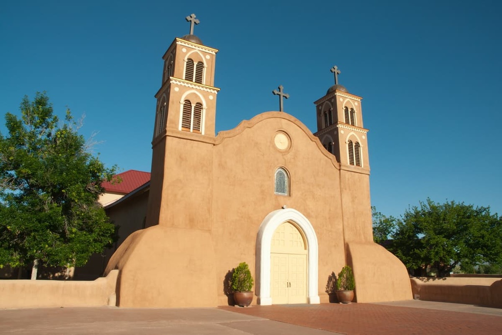
The city of Socorro is located just to the east of the ranger district. Home to around 8,400 residents, Socorro is situated in the Rio Grande Valley and is surrounded by mountain ranges. Today, the city boasts ample opportunities for rock climbing, biking, hiking, and golfing.
Tourists in the region around Socorro can visit the Mineral Museum, San Miguel Mission, and Bosque del Apache National Wildlife Refuge. Besides Cibola National Forest, visitors to Socorro can also explore the Sevilleta National Wildlife Refuge and San Lorenzo Canyon.
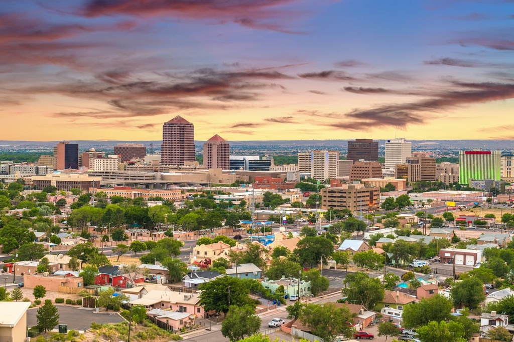
Located just over an hour to the north of Socorro lies the city of Albuquerque. The city of Albuquerque is home to around 560,000 people, which makes it the most populated city in the state of New Mexico.
Albuquerque is a bustling place that’s full of activity and excitement for visitors. For example, each October, the city hosts the annual International Balloon Fiesta, which is the world’s largest gathering of hot air balloons. Additionally, the New Mexico Museum of Natural History is situated in Albuquerque, and it showcases the history of the surrounding area.
As far as outdoor activities go, during the winter months, locals and visitors alike in Albuquerque can enjoy the Sandia Peak Ski Area, which is located just outside the city. The Sandia Peak Tramway leads to the summit of Sandia Peak itself and is one of the longest tramways in the world, so it’s well worth checking out if you’re in the area.
Explore Cibola National Forest – Magdalena Ranger District (North) with the PeakVisor 3D Map and identify its summits.


