Scan the QR code and open PeakVisor on your phone
The Inuvialuit Settlement Region is the homeland of the Inuvialuit. The region is located in northwestern Canada, primarily above the treeline, and it includes the Arctic coast and northern islands of Yukon and the Northwest Territories. There are 90 named mountains in the regions, the tallest of which is Arthur Laing Peak (1,764 m/5,787 ft) and the most prominent of which is Welcome Mountain (1,199 m/3,934 ft).
The Inuvialuit Settlement Region (Inuvialuit Nunangit Sannaiqtuaq) is the homeland of the Inuvialuit. It encompasses the Arctic coast and islands of the Northwest Territories and Yukon in northwestern Canada, The Inuvialuit Settlement Region is one of four Inuit regions of Canada, which are collectively known as Inuit Nunangat (ᐃᓄᐃᑦ ᓄᓇᖓᑦ).
The four Inuit Nunangat are:
The Inuvialuit Settlement Region encompasses 90,650 square kilometers (35,000 square miles) of northwestern Canada. It includes the subregions of the Beaufort Sea, the Mackenzie River Delta, the Yukon North Slope, and the northwest portion of the Northwest Territories.
The settlement region includes both Crown and private lands. There are 90 named mountains in the region, mostly scattered across the ranges in the Queen Elizabeth Islands. The tallest mountain in the region is Arthur Laing Peak at 1,764 m (5,787 ft) in elevation while the most prominent is Welcome Mountain. Welcome Mountain is 1,199 m (3,934 ft) tall with 741 m (2,431 ft) of prominence.
The Inuvialuit Settlement Region is a vast wilderness that includes multiple national and territorial parks. The following parks are protected within the Inuvialuit Settlement Region:
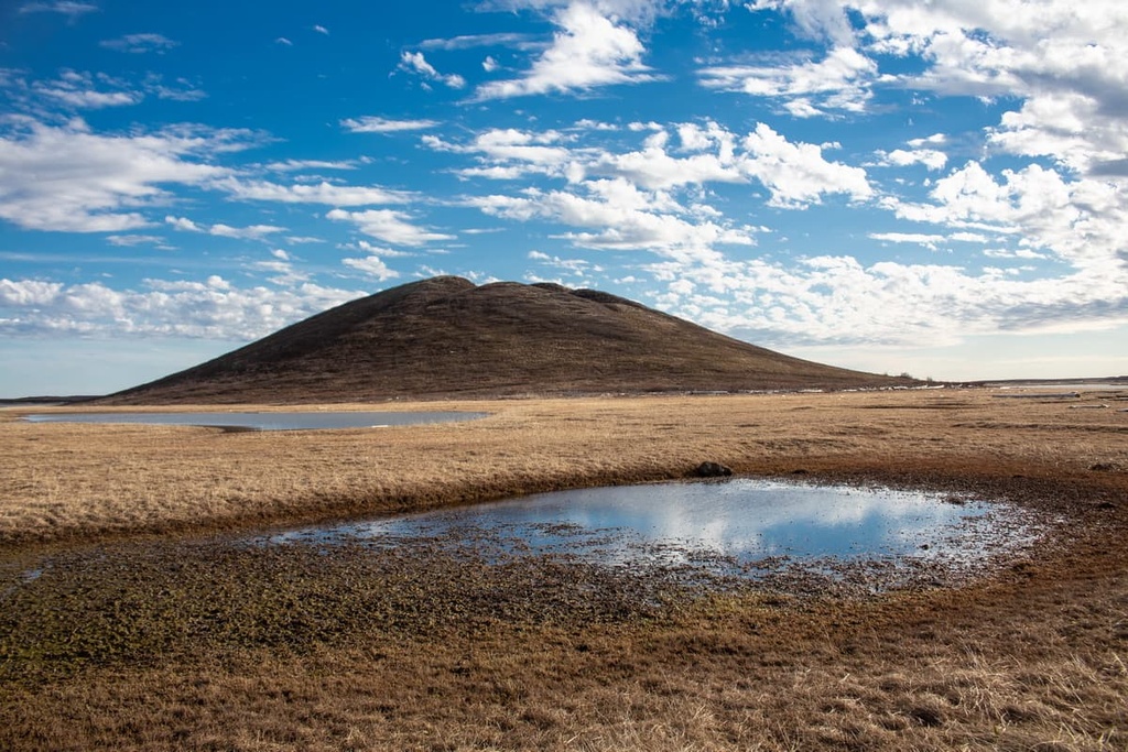
The northern reaches of the Inuvialuit Settlement Region are part of the Innuitian Mountains. Meanwhile, the southern Arctic islands and the coastline of the region is geologically part of the northwest cordillera. The northern reaches of the mainland are primarily Mesozoic rock that overlies parts of the ancient cratons that form the basis of North America.
The ancient cratons in the region are often rich in mineral deposits. The Inuvialuit Settlement Region is no exception.
The Slave and Rae Cratons (which are the underlying bedrock of the northern mainland) and the southern Arctic islands have diamondiferous kimberlite pipes and strong signs of nickel-copper-platinum mineralization. Additionally, the region is rich in coal and other fossil fuel resources.
These layers of rock began to form during the Cambrian period, when the coastal margins along the north of the Canadian Shield were depressed into an area of subsidence. Subsequently, sedimentation began to fill the depression. Nowadays, the area has a rolling topography of shale and sandstone with accents of unconsolidated sand and gravel deposits.
The Innuitian Mountains formed during the Innuitian orogeny when the North American plate moved northward.
As the continental plate moved to the north, the basin along the coastal margin was pushed up against the unyielding Canadian Shield. The margin was then compressed and immense pressure heated the rocks to the point where they could be folded. Finally the layer buckled into the mountain chain that we see today.
The mountains in the Inuvialuit Settlement Region do have some igneous and metamorphic rocks; however, most of the rock layers are sedimentary in origin. The sedimentary layers of the arctic are estimated to contain 13 percent of the world’s oil and 30 percent of the world’s natural gas reserves.
The Inuvialuit Settlement Region contains two of the five ecological zones of the Northwest Territories: the Southern and the Northern Arctic ecologies.
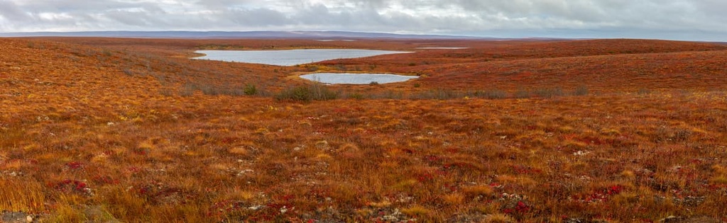
The Southern Arctic ecology extends north from the tree line to the Arctic Ocean. It is dominated by shrublands, which are filled with dwarf birch, Labrador tea, alpine bilberry, willows, sedges, cotton-grass, lichens, and mosses. The vegetation diminishes in volume and size toward the north as one gets closer to the barren coast of the Arctic Ocean.
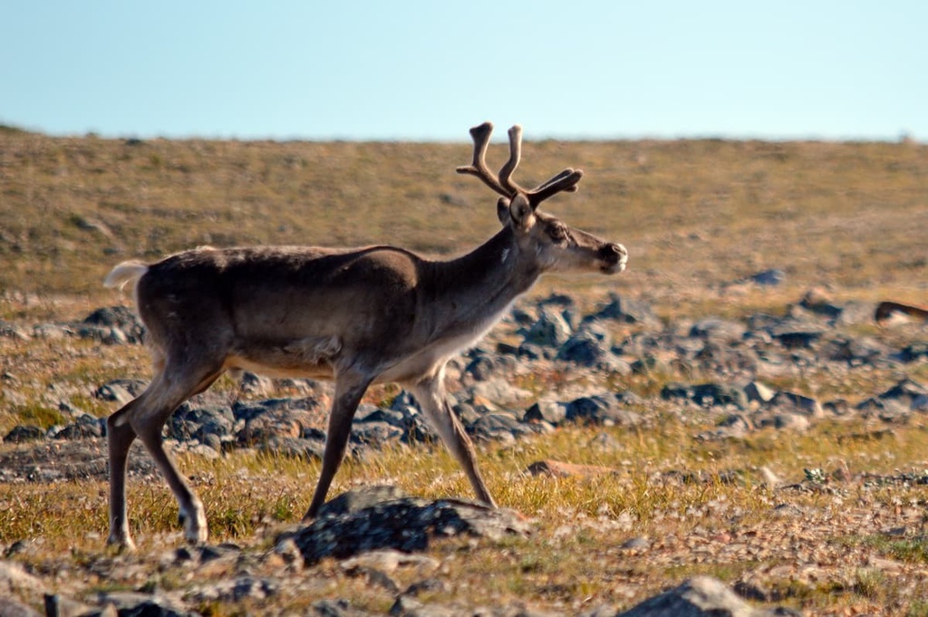
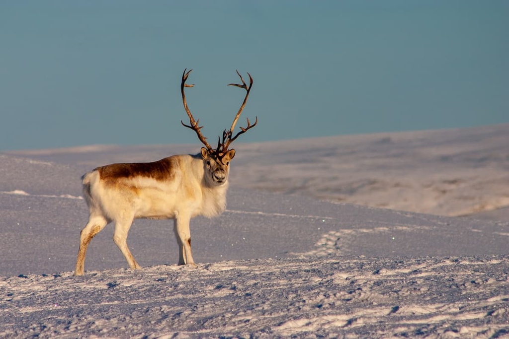
The harsh climate of the region means that the Southern Arctic is home to only about 30 species of mammals. Some of the major animals in the area include the grizzly bear, moose, caribou, Dall’s sheep, and the arctic fox. The only animal found in the region that is exclusive to the Arctic ecologies of the Southern Arctic and Northern Arctic is the polar bear.
Birds and waterfowl inhabit the areas surrounding shallow ponds and river deltas in the region because the rest of the water is too deep and too cold to grow the plants that feed these birds.
The rivers and streams of the Southern Arctic are unorganized tangles of waterways that shift regularly depending on the season. Approximately 115 different bird species nest in the Southern Arctic, too.
The islands in the Arctic Ocean make up the Northern Arctic ecological region. This area is typically dominated by barren rock or carpeted with dwarf herb, dwarf shrub, sedge, moss, and lichen.
Peary caribou are the smallest species of caribou in North America and they are only found in the Northern Arctic region. Other animals that are associated with the Arctic region include Arctic hares, Arctic foxes, polar bears and the northern collared lemming.
While there are relatively few mammals that inhabit the islands of the Northern Arctic, there are large populations of birds. Willow ptarmigan, rock ptarmigan, gyrfalcon, snowy owl, and the common raven inhabit the Arctic year-round, while other bird species migrate south for winter.
In fact, it’s believed that ancient bird populations may have sought refuge on the islands during the Pleistocene because the islands were not completely glaciated like the mainland.
According to cultural knowledge, the Inuvialuit are descended from an Inuvialuit hunter and his wife, son, and an orphan girl who built a raft to survive a great flood.
Floods are a common theme in the origin story of many Indigenous cultures in what is now called Canada. Many of the First Nations with traditional territory in western British Columbia reference floods in their origin stories, tool. Such floods may have been caused by the melting of glaciers and the bursting of glacial lakes at the end of the Pleistocene.
The origin story of the Inuvialuit continues to say that the family captured a pingo (an ice cored hill) and prevented it from sinking so that they could land on it. As the water receded, the landscape was transformed into the wild-life rich area that it is today.
Human settlement of the north likely began about 5,000 years ago when the ice sheet had melted and exposed vast stretches of arctic land. The Inuvialuit are descendants of the Thule, who migrated from the region from what is now the state of Alaska.
By the eighteenth century, the Inuvialuit were divided into eight territorial groups that were each associated with a primary winter village. At the winter village, the Inuvialuit lived in sod-driftwood houses and were sustained by their winter stores until they could leave for whaling, caribou hunting, fishing, and other harvesting activities during the summer months.
After the arrival of Europeans during the nineteenth and twentieth centuries, the Inuvialuit were active in the fur trade economy. Many Inuvialuit trapped and traded Arctic foxes with the Hudson’s Bay Company. Later, American whaling in the region stimulated an influx of people to the Yukon North Slope until the market for bowhead baleen whales crashed in 1907.
As was the case with many of Indigenous communities across Canada and the United States, the European fur trade and whaling industries that brought economic prosperity also brought epidemics of measles and smallpox as well as violence, forced labor, and forced assimilation in residential schools. All of this has led to the loss of life and language among many Inuvialuit as well as intergenerational trauma in many Inuit, First Nations, and Métis communities.
The fur trade was particularly prosperous in the North and many Inuvialuit trappers made a good living by trading with the furs of Arctic fox, muskrat, and mink. The trade continued until about the 1930s when the fur trade collapsed during the Great Depression.
That said, the many Inuvialuit are still active in the fur trade today. However, the establishment of residential schools, restrictions on the fur trade, and the advent of Arctic oil and gas expiration in recent decades, have fundamentally changed life in the North.
The Inuvialuit Settlement Region was designated in 1984 with the signing of the Inuvialuit Final Agreement by the Inuvialuit and the Government of Canada. At the same time, the Inuvialuit Regional Corporation was established to manage the lands and financial compensation owed to the Inuvialuit as part of the agreement.
Nowadays, approximately 5,400 people live in the Inuvialuit Settlement Region, more than 3,000 of whom identify as Inuvialuit. The major communities in the region are all located in Northwest Territories.
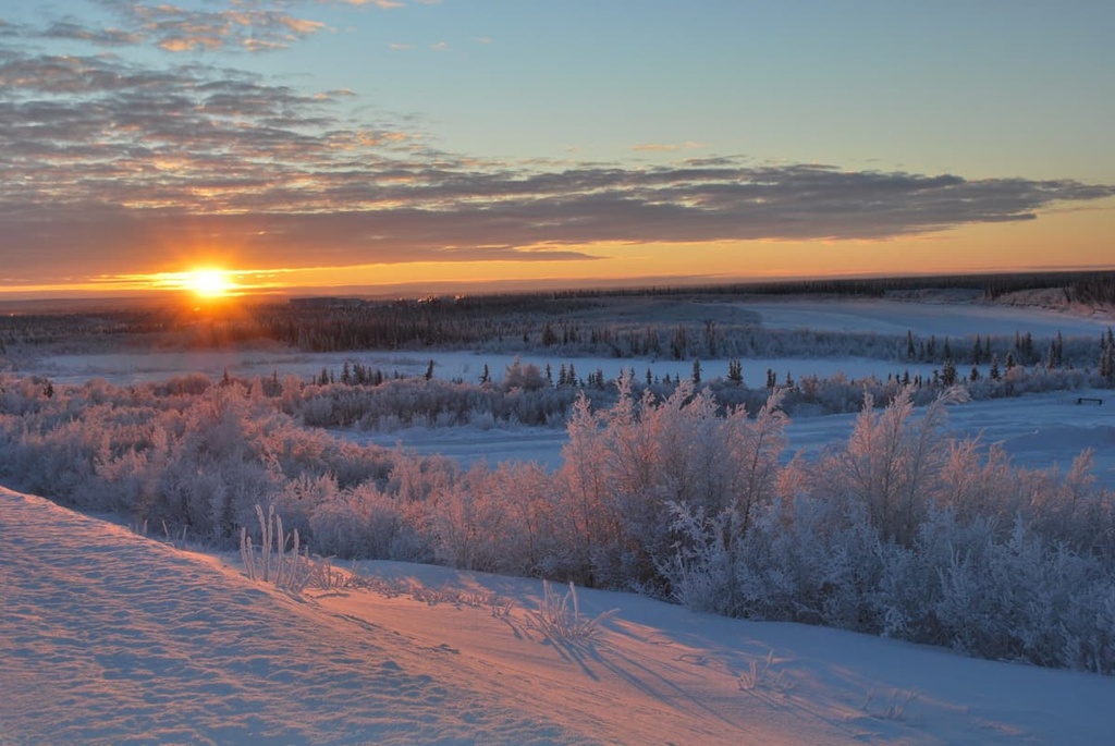
The Inuvialuit Settlement Region is located in an incredible part of the Arctic that features beautiful scenery and stunning landscapes that can only be found in the North.
The following are some of the major attractions and hiking areas in the Inuvialuit Settlement Region:
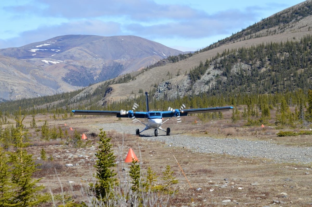
Ivvavik National Park is located along the Arctic coast of Yukon, in Canada’s north. The park contains the peaks of the British Mountains, which merge into Alaska’s Brooks Range. The Firth River, which is the oldest river in Canada, flows through mountains, canyons, and tundra of the park toward the Arctic Ocean.
The park is remote and access is limited to air transport from Inuvik. From here, you can venture to “base camp,” which has outfitters tents and catering at the cook tent.
Some of the activities in the park include hiking through the vast Arctic landscape, rafting the Firth River to the Arctic Ocean, and meeting and speaking with locals to learn their history and the history of the land.
There are several amazing things to do in Aulavik National Park. First, you can paddle the Thomsen River, the world’s northernmost navigable river, through the heart of Aulavik.
Second, you can camp anywhere you would like, so long as it’s not on archaeological and cultural sites. Third, you can hike through the untouched Arctic tundra of the park and experience its beauty first-hand.
Meaning “place where people travel” in Inuvialuktun, Aulavik is one of the most isolated parks in North America. As it includes the pristine, big-sky barrens of Banks Island, muskoxen are more numerous here than anywhere else in the world. The park is also home to the smallest of the caribou, the Peary caribou, as well as snowy owls and gyrfalcons.
Tuktut Nogait National Park is located some 170 km (102 mi) to the north of the Arctic Circle. It borders the legendary Northwest Passage. Fewer people visit Tuktut Nogait National Park each year than orbit the Earth; however, the park does have some attractions that make the trek here worthwhile.
Paddling the canyons of the Hornaday River is generally a must-do if you’ve made it to the park. There are also many birds in the park, such as peregrine falcons, tundra swans, and jaegers, to watch out for when in the area.
Additionally, the park’s landscape is filled with rolling hills and is home to some 68,000 bluenose caribou that have their calving grounds in the region. There are steep canyons and waterfalls among the three major rivers in the park, too, that are well worth checking out.
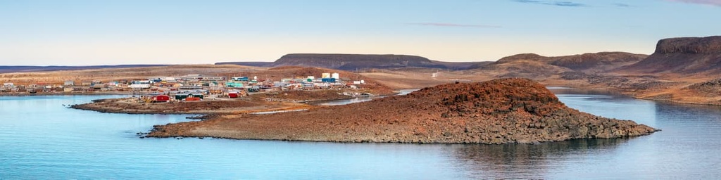
There are six communities that are considered as part of the Inuvialuit Settlement Region. The following are the major communities that are part of the Inuvialuit Settlement Region:
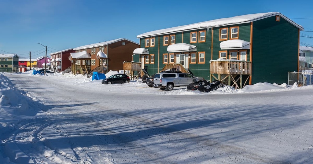
Created in 1953 as an administrative center for the surrounding region, Inuvik was the most northerly town in Canada you could drive to until 2017 when the road to nearby Tuktoyaktuk opened. Inuvik is technically adjacent to the Inuvialuit Settlement Region; however, it is considered one of the communities of the Inuvialuit.
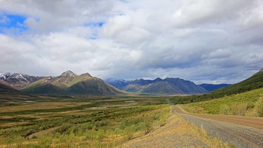
The community is located in the northwest of the Northwest Territories and it is connected to the rest of Canada by the famous Dempster Highway. Inuvik also has a regional airport that receives flights from surrounding major cities.
Some of the primary activities in and around Inuvik include hiking the Boot Lake Trail, skiing at the Ski Club, fishing the Mackenzie River by boat or ice, or golfing 24 hours a day under the midnight sun. Inuvik is the gateway to the mountainous Ivvavik National Park, Aulavik National Park on Banks Island, as well as Tuktut Nogait National Park on the coast of the western Arctic.
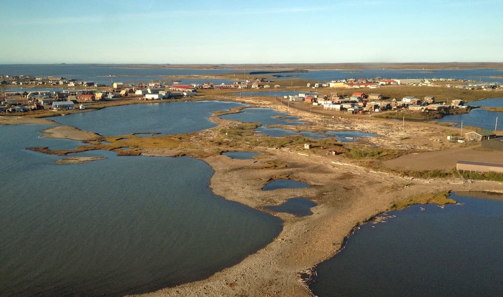
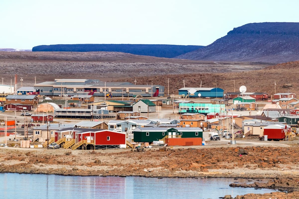
Tuktoyaktuk is located on the shores of Kugmallit Bay, near the Mackenzie River Delta. The town is situated at the Arctic tree line and is the most northerly town in Canada that you can drive to on a four-season road.
Usually referred to as ‘Tuk,’ the area has been occupied since time immemorial by the Inuit and has the historical distinction of being the first place in Canada to revert to an Indigenous name. The village is small and many people who live in the community are subsistence hunters and anglers, though many community members work in tourism or transportation, too.
Some of the attractions around Tuktoyaktuk include viewing the pingos, dipping a foot into the chilly Arctic Ocean, visiting the Lady of Lourdes ship, and learning about this link to the rest of the world and the role it played in local history.