Scan the QR code and open PeakVisor on your phone
The Sentinel Range Wilderness is an outdoor recreation destination situated in the northern region of the US state of New York. The wilderness is located in the northeastern region of Adirondack Park. The tallest mountain and most prominent mountain in the wilderness is Kilburn Mountain at 3,885 feet (1,184 m) tall with 1,699 feet (518 m) of prominence.
The Sentinel Range Wilderness is located in the northeastern region of Adirondack Park in Upstate New York. The wilderness is part of a network of protected areas which extend throughout Adirondack Park.
The protected region covers 23,874 acres (9,661 ha) of terrain and is part of the Adirondack Forest Preserve. The Sentinel Range, for which the wilderness is named after, cuts across the landscape in a northeast to southwest direction.
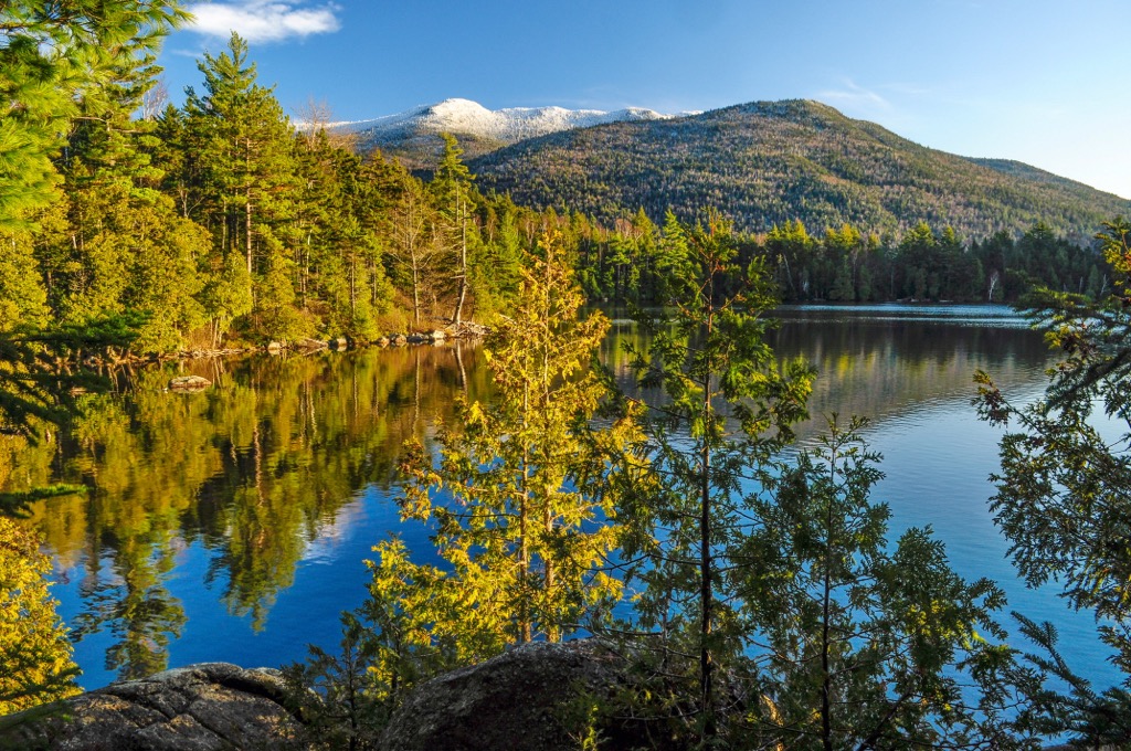
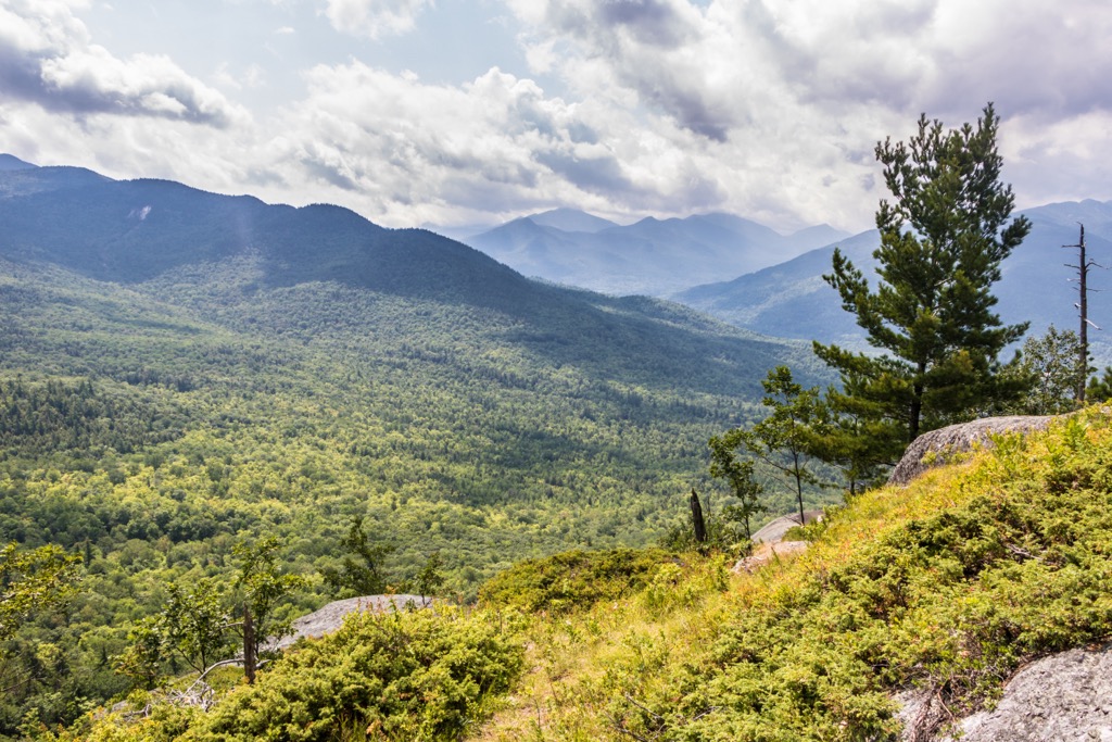
A majority of the landscape is forested, with elevations ranging from roughly 2,700 feet (823 m) up to the summit of Kilburn Mountain at 3,885 feet (1,184 m) tall. Amidst the steep hillsides and ridgelines lie a few ponds, creeks, and wetlands.
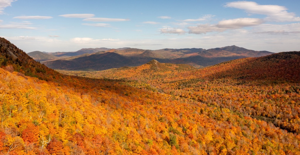
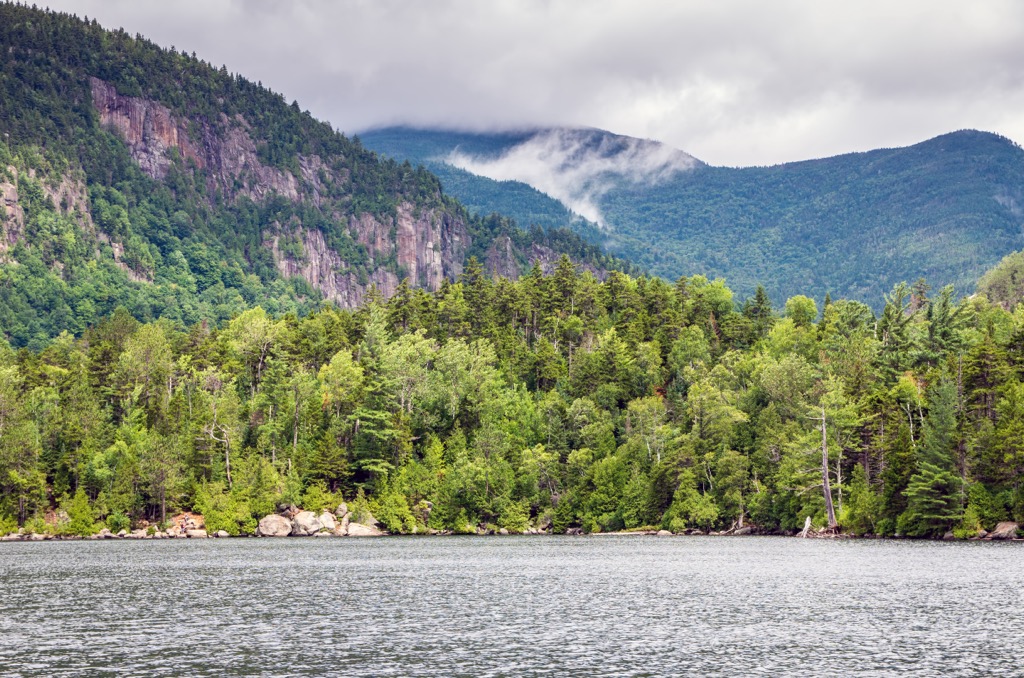
The northeastern section of the wilderness is marked by bare rock outcroppings, showcasing remnants of forest fires from several decades ago. These steep and rugged hillsides are met with numerous north and northeast facing cliffs.
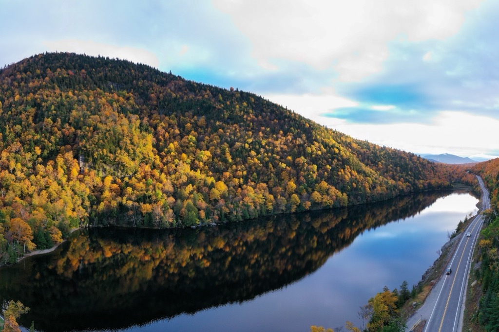
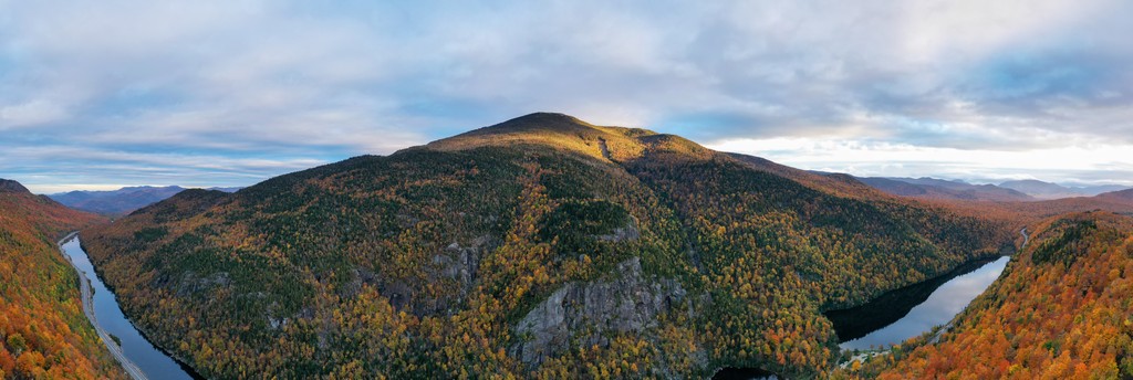
The western boundary of the wilderness is marked by the West Branch Ausable River while the East Branch Ausable River lies along the eastern edge of the wilderness. A network of ponds, wetlands, and creeks are situated in the northern stretches of the protected area.
Large ponds include Owen, Copperas, Marsh, and Winch while Round Lake, Upper Cascades Lake, and Lower Cascades Lake are situated in the southern stretches of the wilderness. Just west of the wilderness lies Lake Placid, East Lake, and West Lake.
Additionally, the Sentinel Range Wilder is located near a number of other parks and destinations for outdoor recreation. Directly west lies the Saranac Lakes Wild Forest and McKenzie Mountain Wilderness. The Wilmington Wild Forest is situated to the north while the High Peaks and Hurricane Mountain Wildernesses are located to the east.
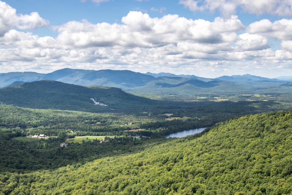
The Sentinel Range Wilderness is named after the Sentinel Range which cuts across the landscape. This mountain range lies entirely within Adirondack Park, with the park’s boundaries being loosely defined by the Adirondack Mountains.
This larger mountain range is marked by a massif that encompasses much of the northern portion of the state. The entire Adirondack Mountain range spans 5,000 sq. miles (13,000 sq. km) of terrain throughout the region. Rocks in the region date back nearly 2 billion years.
When the range began forming, it was located near the equator, along an ancient seafloor. Roughly 1.5 to 1 billion years ago, during the Grenville Orogeny, the range was slowly thrust upwards due to tectonic activity. Millions of years of tectonic activity and erosion, transformed the sedimentary rock into metamorphic rock.
A shallow sea once covered this region, roughly 600 million years ago. A hot spot beneath the Earth’s crust further thrust up the range to its current height, roughly 10 million years ago. Alternating periods of glaciation and glacial retreating, further carved out the landscape, leaving behind the steep ridgelines visible today.
A topographic map of the region makes it appear that the Adirondack Mountains are part of the surrounding Appalachian Mountains, though the two are geologically distinct. The Appalachian Mountains extend throughout the eastern US and Canada.
Major peaks that are located in the Sentinel Range Wilderness include Kilburn Mountain, Sentinel Mountain, Pitchoff Mountain, Stewart Mountain, and Slide Mountain.
Flora and fauna found in the wilderness is similar to that found throughout the surrounding Adirondack Park. Despite large storms and wildfires affecting the region in recent decades, the wilderness is brimming with biodiversity.
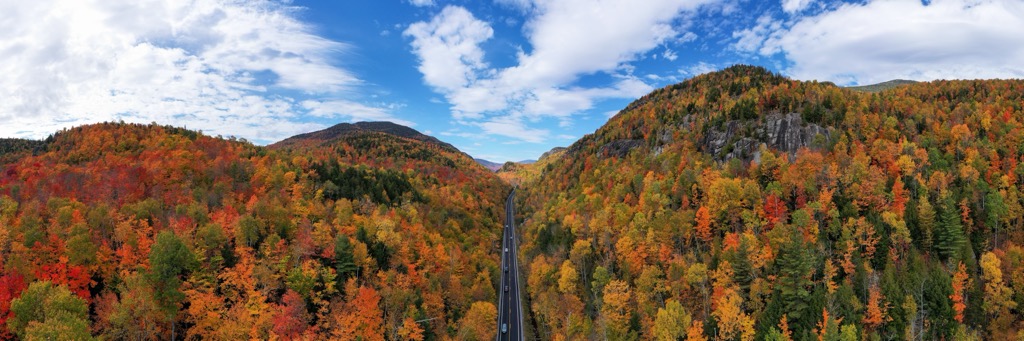
The eastern stretches of the wilderness are marked by a hardwood forest, which has grown since forest fires affected the region. This forested region is populated by American beech, sugar maple, red maple, and yellow birch.
Brooks along the eastern slopes are surrounded by a mixture of hardwood and softwood trees. Common coniferous trees at higher elevations are black spruce, red spruce, and balsam fir. Stands of white pine are found in the northern stretches of the wilderness.
Larger mammals found in the wilderness include black bears, gray foxes, red foxes, and white-tailed deer. Porcupines and raccoons are common amidst the forested landscape while beavers inhabit the waterways of the region.
Other animals commonly found in and near the waterways of the wilderness include blue herons, painted turtles, bullfrogs, and spotted salamanders. Some ponds in the region are populated with brown trout, lake trout, and brook trout.
The land within and surrounding the Sentinel Range Wilderness has been inhabited by humans for thousands of years. Artifacts uncovered in the region date back as early as 15,000 to 7,000 BCE.
While many tribes historically lived throughout the region, the Oneida (Onʌyoteˀa·ká) and Mohawk (Kanienʼkehá꞉ka) are the most prominent peoples with ancestral ties to this land. The Oneida and Mohawk would eventually go on to become two of the five original tribal nations that made up the Haudenosaunee (Iroquois Confederacy).
The Battle of Ticonderoga, also known as the Iroquois War of 1609, marked the first recorded battle between the Haudenosaunee and Europeans. The war began as a battle between the Haudenosaunee and the Innu, Algonquin, and Huron. The French eventually allied with the Huron, Innu, and Algonquin during the battle.
The increased population of Europeans also brought infectious diseases, such as smallpox and measles. These diseases decimated the Indigenous peoples who had no natural immunity to the illnesses. During the American Revolutionary War, the Oneida attempted to remain neutral but were eventually forced to work as scouts near Fort Stanwix.
The Treaty of Canandaigua was signed at the end of the eighteenth century, between the Oneida, other Haudenosaunee nations, and the US. The original treaty granted the tribes roughly 6 million acres (2.4 million ha) throughout the Adirondack Mountains. Over the following decades this land was drastically reduced by the US government to a mere fraction of the Tribe’s ancestral lands.
This reduction of land, ultimately forced the Oneida to relocate to present-day Wisconsin and parts of Canada. Today, the Oneida are organized into four nationally recognized nations, two in the US and two in Canada. This includes the Oneida Indian Nation in New York, the Oneida Nation of Wisconsin, Oneida at the Six Nations of the Grand River, and the Oneida Nation of the Thames.
In 1885, the surrounding Adirondack Park was protected by the New York State Legislature as a forest preserve. The preserve became a state park in 1892 before eventually gaining constitutional recognition. A massive storm, known as the Big Blowdown of 1950, altered the landscape in the region as winds reached speeds over 100 mph (161 kpm). The following decades also brought wildfires to the region, with remnants of these fires still being seen today.
Today, the Sentinel Range Wilderness features opportunities for hiking, camping, fishing, paddling, rock climbing, cross country skiing, snowshoeing, and ice climbing.
The Sentinel Range Wilderness is home to a number of wonderful trails for outdoor recreation. Here are a few of the trails in the forest that are worth checking out during your next visit.
This popular out and back route lies along the southern edge of the wilderness area. The trail climbs steadily through the forested landscape and can be accessed throughout the year.
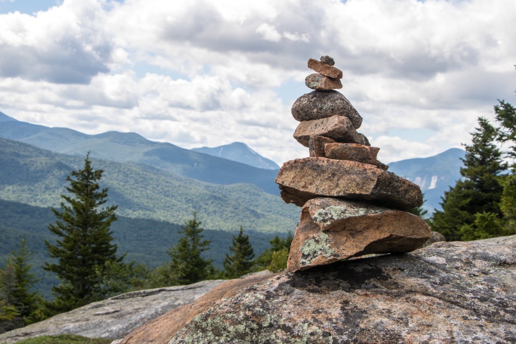
Near the top of Balanced Rock, the forested terrain opens up to offer views of the rolling hills to the south, along with views of the Upper and Lower Cascade Lakes. The out and back route is 3.2 miles (5.1 km) and features 931 feet (284 m) of elevation gain.
This point to point trail encompasses many of the major hiking routes in the wilderness. Located along the southern edge of the Sentinel Range Wilderness, the trail climbs through the mixed wood forest.
This route passes along Balanced Rock and Pitchoff Mountain before following along the main ridgeline of Pitchoff Mountain. The trail then descends steeply back down to State Hwy 73. If completed as a point to point trail, this route is 4.7 miles (7.6 km) and features 1,610 feet (491 m) of elevation gain.
Copperas Pond is located in the northern stretches of the wilderness, surrounded by other small ponds, creeks, streams, and wetlands. The trail begins by climbing steadily before opening up along the northern shores of Copperas Pond.
This out and back path to Copperas Pond is 1 mile (1.6 km) in length and features 354 feet (108 m) of elevation gain. Hikers have the option to turn around at the pond or continue along relatively flat trails to reach Owen Pond and Winch Pond.
Looking for a place to stay near the Sentinel Range Wilderness? Here are some of the best cities and towns to check out in the region.
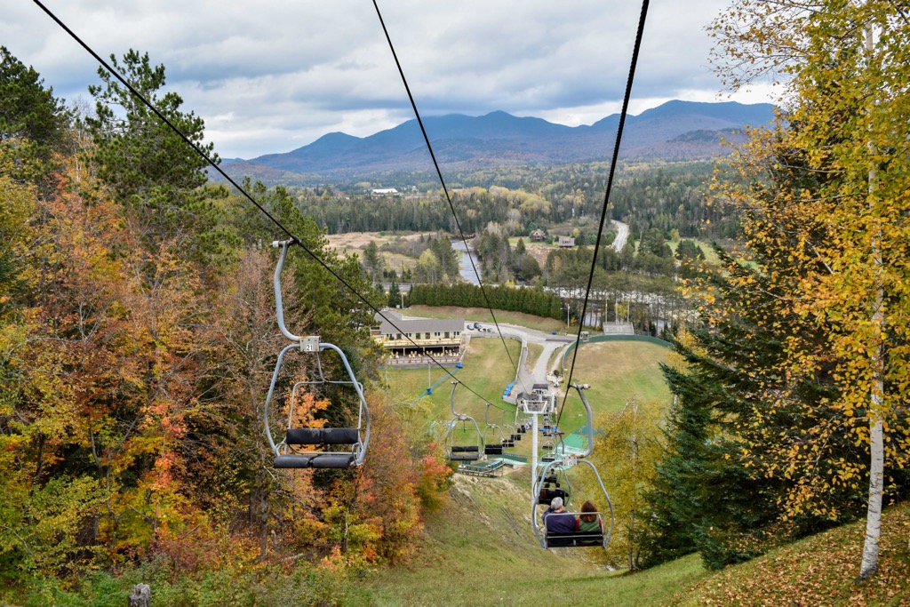
Lake Placid is a small village located just west of the Sentinel Range Wilderness, Situated along the shores of Lake Placid, the village is home to 2,200 residents, surrounded by the Adirondack Mountains.
Despite its relatively small size, Lake Placid has hosted both the 1932 and 1980 Winter Olympics, marking one of only three places in the world to host the Winter Olympic Games twice. Along with nearby Saranac Lake and Tupper Lake, Lake Placid is part of the Tri-Lakes region. Each year the city hosts the Ironman Lake Placid Triathlon, Annual winter Carnival, Lake Placid Ice Dance, Winter Empire State Games, and various other sporting events.
The downtown streets feature local shops and art galleries along with sporting goods stores and restaurants. Opportunities for year round outdoor recreation surround the quaint village of Lake Placid.
The city of Queensbury lies southeast of the wilderness, marking the closest city to the protected region. Situated between Lake George and Great Sacandaga Lake, Queensbury acts as a hub for outdoor recreation. Situated in the eastern foothills of the Adirondack Mountains, the city is home to 28,000 residents.
Every year the city hosts thousands of tourists who come to enjoy the surrounding terrain. Opportunities for hiking, swimming, canoeing, kayaking, mountain biking, and golfing surround the city. During the winter months, Queensbury is a destination for both downhill and cross-country skiing.