
Scan the QR code and open PeakVisor on your phone
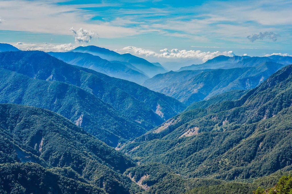
Bordering the eastern edge of Yushan National Park (玉山國家公園) in Taiwan is the unspoilt environment of the Yuli Wildlife Core Area (玉里野生動物保護區 核心區). There are 19 named mountains in the wildlife area, the highest and most prominent of which is Maxi Shan (馬西山) with an elevation of 3,443 metres (11,296 ft).
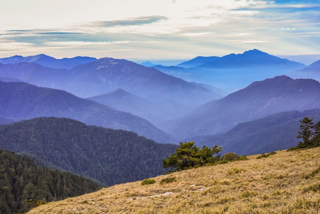
Yuli Wildlife Core Area lies on the eastern side of the Central Mountain Range (中央山脈), It is located in Zhuoxi Township (卓溪鄉) of Hualien County (花蓮縣) in eastern Taiwan. The pristine region contains high peaks, rugged terrain, and deep valleys throughout its 11,414 ha (28,204 acre) area.
That said, Yuli is just one of the many smaller regions in Yushan National Park. For example, part of Danda Major Wildlife Habitat (丹大野生動物重要棲息環境) overlaps with the northern part of Yushan National Park.
Meanwhile, the Core Resource Conservation Area (核心資源保護區) is located in the central and most mountainous region of Yushan National Park. Finally, Guanshan Major Wildlife Reserve (關山野生動物重要棲息環境) and Xinkangshan Special Scenic Area (新康山特別景觀區) are both found in the southern regions of Yushan National Park.
The Yuli Wildlife Core Area features wild, overgrown forests that are home to many wildlife species. The Taiwanese government established the wildlife conservation area in order to protect its many endangered species.
Maxi Shan marks the highest point in the reserve at 3,443 meters (11,296 ft) in elevation, while Fengping Riverbed is the lowest elevation in the reserve at 900 meters (2,952 ft).
As a result of Yuli’s array of elevations, the reserve contains three distinct climate areas. This includes subtropical conditions in low-lying areas, temperate conditions as the elevation increases, and a frigid climate from 3,000 meters (9,842 ft) and above.
Out of the 19 named mountains in the reserve, four hills are part of Taiwan's top 100 highest peaks, which are otherwise referred to as Baiyue. These four peaks are Maxi Shan, Kaxipanan Shan (喀西帕南山), Neilinger Shan (內嶺爾山), and Yixiqingma Shan (義西請馬山).

As the Yuli Wildlife Core Area lies near the Pacific Ocean, the area enjoys a warm, humid climate, and hardly any frost appears in winter. The annual average temperature is a mild 14°C (57°F) with a heavy average annual rainfall of 3,900 mm (153.5 in).
Due to the relative remoteness and inaccessibility of the region, Yuli Wildlife Core Area receives little tourism. However, for hikers wishing to trek in thriving old-growth forests with sublime outlooks onto Taiwan's backcountry, the long journey to the region is worth the reward.
Additionally, as the region is very remote, there are a number of other popular hiking areas located near the wildlife reserve.
For example, the scenic Huadong Coastal Reserve (花東沿海保護區) lies to the east of Yuli Wildlife Core Area. To the west is Yushan (玉山), Taiwan's highest peak. Danda Major Wildlife Reserve is also located to the north, while Taiwan's second-highest alpine lake, Jiaming Lake (嘉明湖), is situated to the south on Sancha Shan's (三叉山) south-eastern slopes.
Yuli Wildlife Core Area is located along the eastern branch of the Central Mountain Range. The longest massif in Taiwan, the Central Mountain Range spans 260 km (161 mi) from Pingtung County (屏東縣) in the southern part of the island to New Taipei City (新北市) in the north.
The steep terrain in the Yuli Wildlife Core Area consists of sub-metamorphic rock from the Tertiary period. Layers of slate, phyllite, limestone and marl can all be found in the reserve, too.
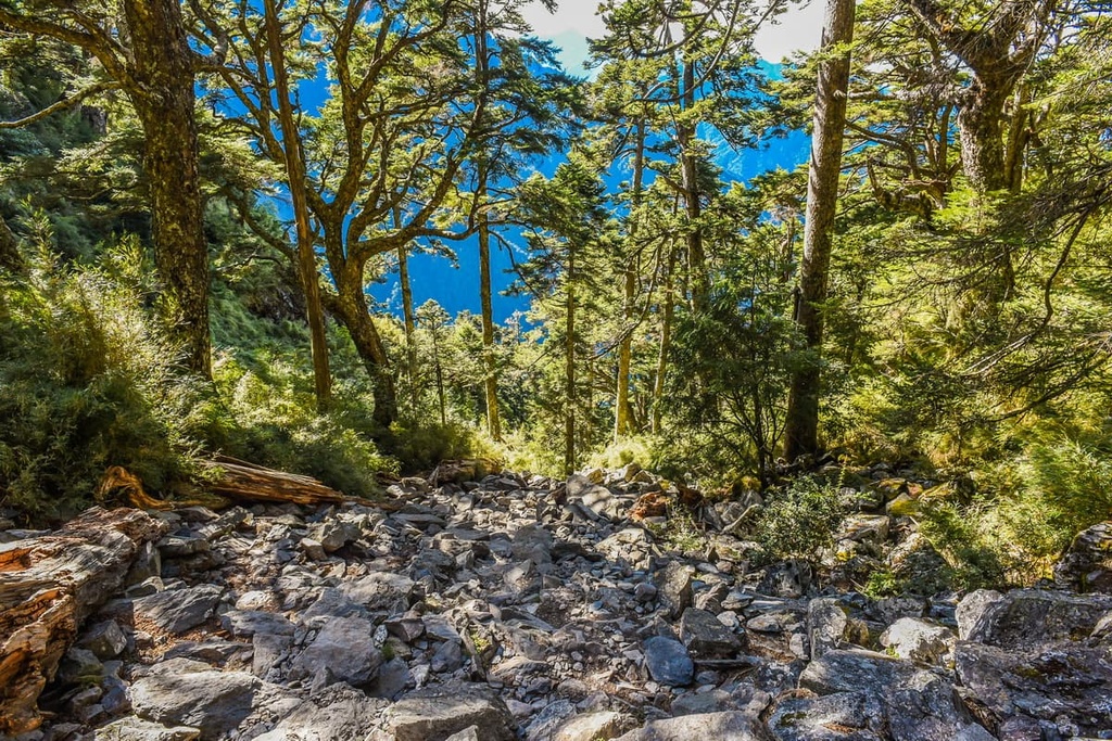
As the elevation in the reserve is quite varied, Yuli Wildlife Core Area’s ecology is both rich and diverse. Indeed, it harbors some of Taiwan’s unique and rare plants in its remote wilderness.
In the low-lying regions of Yuli Wildlife Core Area, the land is dominated by a hardwood forest of Taiwan red maple, Yushan rhododendron, and east Taiwan’s native Taroko oak (Quercus tarokoensis). Lush coniferous woodlands of Taiwan fir, Yushan juniper, Taiwan red pine, and Taiwan red cypress dominate the higher elevation forest zones of the reserve.
Many luscious ferns and hardy arrow bamboo can also be found along Yuli Wildlife Core Area’s overgrown hiking trails. There are also a number of endangered plants in the reserve, such as Taiwan incense cedar, Chinese yew, and crystal orchid.
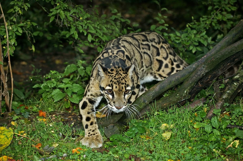
Formosan rock macaques, Taiwan sambar, and Taiwan serow are some of the 38 mammals that inhabit the Yuli Wildlife Core Area’s mountains. The endangered clouded leopard also hunts for prey in Yuli’s jungle.
Birdlife thrives in Yuli’s flourishing hills. There are approximately 65 bird species found in the reserve, including the endangered blue-bellied pheasant, emperor’s pheasant, and the bear eagle.
Amphibians and reptiles also roam the reserve. Out of the recorded amphibian and reptile species found in the area, the Mori’s tree frog and the red-banded snake are among the most notable.
In the nearby Ruisui Township (瑞穗鄉) is the Wuhe Stone Pillars, a Neolithic archeological site that dates back approximately 3,000 years. Here, two giant boulders stand facing each other. These boulders measure 5.7 meters (18 ft) and 4 meters (13 ft) in length and weigh a mighty 12 tons (11 tons) and 10 tons (9 tons), respectively.
The ancient relics have strong links to the indigenous Amis tribe. According to tribal legends, the Wuhe Stone Pillars mark the resting place of Amis' ancestors, Nakaw and Sira. Amis locals believe the pillars were once wood, but when foreigners invaded the land, the Amis fled the area and subsequently halted to erect the wooden posts.
A storm brewed shortly afterwards, and once the Amis returned to the site, they discovered that their wooden tools and the wooden pillars turned to stone. Thus, every year during the Harvest Festival, the Amis return to the Wuhe Stone Pillars to pay their respects to their ancestors.
Some of the best hiking trails and areas to visit in and around the Yuli Wildlife Core Area include:
One of Yushan National Park’s longest trails, the Mabolasi Transverse, spans 94 km (58 mi) in length. Along this trail, hikers climb seven Baiyue with elevations of over 3,000 meters (9,842 ft) each.
The Mabolasi Transverse is a popular trek as it provides hikers with a view of Yushan at the start of the hike. By the end of the trail, trekkers can also see the evergreen fields of the Huadong Valley to the west.
This hike commences at Dongpu Trailhead, which also leads hikers to Yushan. Batongguan Shan’s (八通關山西峰) grassy peak is the first Baiyue on the itinerary. A wild array of alpine flowers such as red rhododendron, foxgloves, and chrysanthemum can be seen throughout the trail.
The trail then leads north to Xiuguluan Shan (秀姑巒山), the Central Mountain Range’s highest peak. Hikers can admire the exceptional views that stretch as far as one’s vision allows on this high hill. A rugged skyline of jagged pinnacles punctuates the landscape, with Yushan’s mammoth structure in clear sight.
The trail heads further north to Jupen Shan (駒盆山) before connecting to Mabolasi Shan (馬博拉斯山). Sitting at the halfway point between Batongguan Shan and the final Baiyue of Kaxipanan Shan, Mabolasi Shan serves as a challenging midway marker thin cliff that hikers need to traverse in order to advance onwards to Malijia Nan Shan (馬利加南山).
Hikers then venture southwards towards Maxi Shan, where a red pine forest signals your arrival to Yuli Wildlife Core Area’s highest peak. To the east, hikers can observe the gentler terrain of the Hai’an Range (海岸山脈), which undulates like waves until the land meets the sea.
Further south, hikers will reach Kaxipanan Shan, the final Baiyue of the Mabolasi Transverse. Although some distance away, hikers can still observe the summit of Yushan to the east. Hikers can also look back and appreciate their entire journey, as the trail is visible from the summit.
For hikers that want a challenge the difficult ten-day South Third Section trek is a wonder to behold. This trail is approximately 104 km (64 mi) long and it takes you into the most remote section of the Central Mountain Range.
Starting from Ruisui Forest Road, hikers will begin by making their way through dense forests with towering cliffs. Along the way, hikers can spot clusters of sambar deer roaming in the wild.
After 38 km (23 mi) and three days of trekking, hikers will make their way to the summit of their first Baiyue, Danda Shan (丹大山). Reaching Danda Shan’s summit is an incredible feat, as the journey is particularly arduous.
Danda Shan’s slopes are steep and challenging. However, the view from atop is unrivaled, as a rolling sea of clouds generally rests below the summits of Neilinger Shan, Yixiqingma Shan, and Tiannankelan Shan (天南可蘭山).
Neilinger Shan is the second Baiyue to summit on this trail and the journey to its peak is a much more leisurely experience. A swarm of arrow bamboo covers the trail as you make your way to the summit. Hikers can even see Danda Shan from the top of Neilinger Shan, where it’s worth taking a break and relaxing after a challenging summit attempt.
Moving to the north, hikers must then trek to Yixiqingma Shan. While dense forest growth submerges Yixiqingma Shan’s summit, hikers can still admire the vast views from its rocky ridgelines. After a gentler climb up to Neilinger Shan, hikers are faced with steep cliffs to ascend on the way to the peak of Yixingqingma Shan.
Advancing further to the north, hikers then pass the picturesque Majiaying Valley with its undulating emerald meadows. The Majiaying River gently winds its way across the landscape as a misty vapor adds an ethereal depth to the scene.
The imposing Dongjudashan (東郡大山) awaits hikers next, eagerly expecting to humble the intrepid climber. The highest peak of the South Third Section, Dongjudashan physically wears down hikers as they ascend its sharp slopes; however, the views are pure magic. The views from the summit stretch as far as Yushan, and a rippling sea of rugged pinnacles extend even further afield.
Hikers then tackle the trail that leads to Dongluan Dashan (東巒大山), a Baiyue that offers superb vistas. From the summit, hikers can look back and admire the route that they took to the peak.
Finally, hikers must venture south, heading to Wushuang Shan (無雙山), the last Baiyue of the trail. The steepness of Wushuang Shan’s slopes ensure that hikers use the last of their energy to finish the trail. Once on the mountaintop, hikers have one last chance to glance out at the views of Taiwan’s most remote regions.
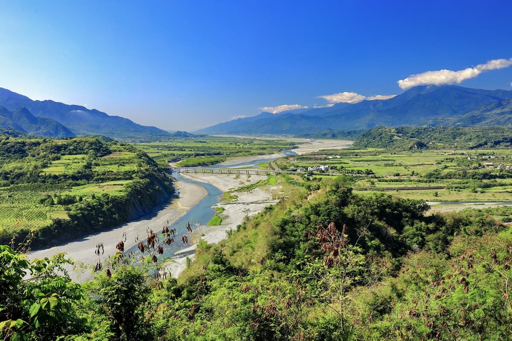
The pristine Huadong Coastal Reserve stretches between eastern Taiwan’s Hualien City (花蓮市) and Taitung City (臺東市) for 180 km (112 mi). Many believe this road is Taiwan’s most scenic drive. Drivers can easily move between the Huadong Coastal Reserve and the nearby Huadong Valley, too, as numerous junctions connect these two roads.
The Huadong Coastal Reserve boasts striking rock formations and a pristine coastline of cerulean waters. Shitiping (石梯坪) is the highlight of the Huadong Coastal Reserve. For 1 km (0.6 mi), a rocky coastline of eroded volcanic rock dominates the terrain. Eastern Taiwan’s notoriously stormy weather has weathered and shaped the stone in various unique formations that are certainly worth a visit.
Huadong Valley features emerald rolling hills that border countless rice fields. Antong Hot Springs (安通溫泉) is a popular feature of the Huadong Valley. Visitors to the hot springs can revel in the scenic beauty of the surrounding sea of rippling hills while bathing in the Antong River Valley’s aquamarine waters.
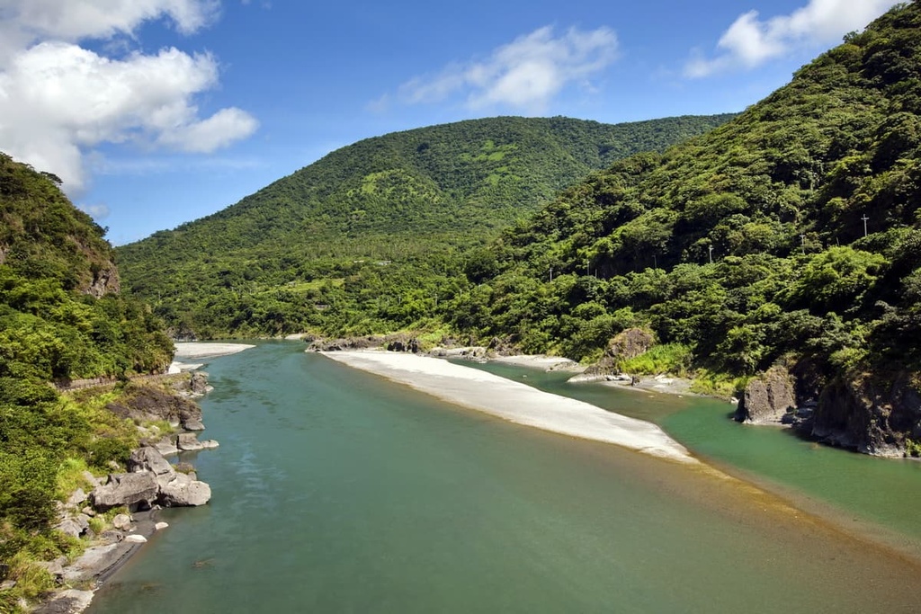
The 104 km (64 mi) Xiuguluan River (秀姑巒溪) begins on Xiuguluan Shan’s slopes before making its way through the Yuli Wildlife Core Area as it heads toward the Pacific Ocean. Due to its fast-flowing waters, it is the perfect place for the thrilling adventure of whitewater rafting.
Starting from Ruisui Township, rafters ride the Xiuguluan River’s wild waves for 24 km (15 mi) as they pass through 20 sets of rapids. The river’s elevation dips 65 meters (213 ft) along the course, allowing visitors to experience extreme adrenaline as they plunder along the rapid riverway.
The most suitable time to raft the river’s forceful foaming waters is after heavy rains, particularly in the wake of seasonal typhoons and monsoons. However, this is a river that’s best rafted alongside an experienced guide.
Also known as the Butterfly Valley, Fuyuan National Forest Recreation Area (富源國家森林遊樂區) harbors the largest group of camphor trees in Taiwan. Sitting at an elevation between 225 to 750 meters (738 to 2,460 ft), the plant life in Fuyuan’s flourishing forests consists mainly of leafy, luscious deciduous trees.
A flock of butterflies transcend the verdant valley in the warmer months of spring and summer. One of Fuyuan’s highlights is its breathtaking waterfalls, with Fuyuan Waterfall being the recreation area’s main attraction. Here, lush greenery covers the rugged cliff while the Fuyuan River descends rapidly into an aquamarine pool.
The closest cities and towns to the Yuli Wildlife Core area are Yuli (玉里鎮) and Ruisui Townships of Hualien County, both of which are situated in the picturesque Huadong Valley.
Adjacent to the Yuli Wildlife Core Area is the overgrown valley of Yuli. Flanked by mountains on either side, endless grassy fields around the township unfold before one’s eyes with the snaking Lakulaku River running alongside the region’s many emerald meadows.
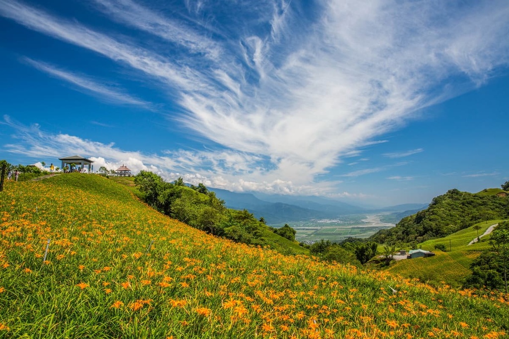
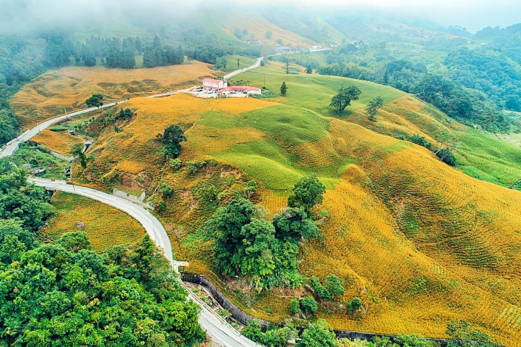
Offering excellent views of the Huadong Valley, Liushishishan (六十石山) is a magnet for visitors to Yuli who wish to admire the basin’s fertile landscape. The prime season to climb the gentle, shallow hill is in late summer and early autumn when a field of sunny daylilies bloom on the meadowed mountain.
Another scenic attraction of Yuli is the graceful Nanan Waterfall. With a height of 50 metres (164 ft), the crashing cloud of roaring rapids is a dramatic delight to witness. The surrounding ecology of various ferns and thick shrubs add another fascinating element to pristine nature.
A mere 30 km (18 mi) south of Yuli is the scenic hillside Wulu Village of the Bunun tribe. As this settlement sits at 2,700 metres (8,858 ft) in elevation, Wulu is immersed in mountain mist that adds a slightly opaque hue to the leafy environment. Pretty plum blossoms add a dimension of magenta to this emerald landscape in spring, too.
Situated to the south of Yuli Township is the beautiful area of Ruisui Township. The fierce Xiuguluan River flows through the scenic landscape of thriving tea plantations, grassy plains, and eastern Taiwan’s ever undulating terrain.
Eastern Taiwan is prized for its abundance of scenic hot springs. Ruisui Hot Spring is no exception, as luscious jade foliage encircles the township’s public baths with grassy green rolling hills dotting the surrounding landscape. Its 48°C (118°F) bubbling waters also contain a high iron content that is believed to lessen the severity of skin ailments.
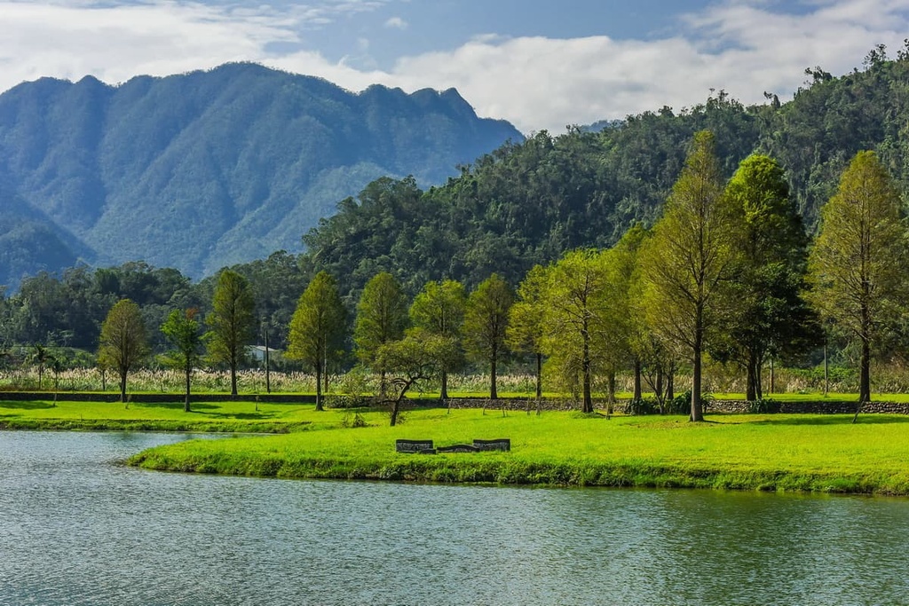
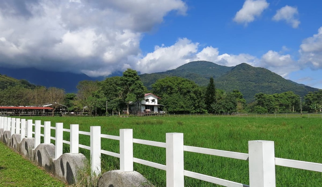
For a trip to view livestock, visitors can feed the countless cows grazing on the vast grassy fields of Ruisui Ranch. Furthermore, visitors can purchase fresh dairy products such as milk, ice cream, yogurt, and cheese at the farm stall. There is an outdoor play area for small children, as Ruisui Ranch makes a perfect day out for families.
One can smell the lingering aroma of Wuhe Tea plantations before setting sight on the lined leafy rows of tea plants. Oolong tea is the primarily produced plant of this area, and the Wuhe Tea plantation is the proud recipient of a gold medal in the 2006 World Tea Awards for its Honey Peach Black Tea. Visitors can sample the plantation’s many teas and admire its brilliant bountiful scenery of green hills and jade shrubs.
As the Yuli Wildlife Core Area lies in a remote region, public transportation is not offered to the reserve directly from the major cities. Therefore, it’s best to drive if you’re looking to visit the area.
One of the best ways to get to the area is to first take the Taiwan High-Speed Rail (HSR) or local express train (TRA) to Hualien City from Taiwan's major cities. From Hualien City, it is a 58 km (36 mi) drive to the Yuli Wildlife Core Area.


