
Scan the QR code and open PeakVisor on your phone
Snow Mountain and Dabajian Mountain Ecological Reserve (雪山、大霸尖山生態保護區) is located in northern Taiwan within the boundaries of Shei-Pa National Park (雪霸國家公園). The highest and most prominent peak in the reserve is also the second-highest peak in Taiwan, Xueshan Main Peak (雪山, also known as Snow Mountain), which stands at 3,886 metres (12,749 ft) in elevation. A total of 31 named mountains are located in Snow Mountain and Dabajian Mountain Ecological Reserve.
Snow Mountain and Dabajian Mountain Ecological Reserve is located in northern Taiwan. It spans three counties—Hsinchu (新竹縣), Taichung (台中县), and Miaoli (苗栗縣)—and it has a total land area of 209 sq km (80 sq mi).
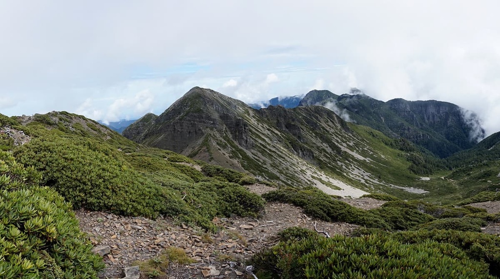
Within the reserve, a total of 10 of Taiwan’s top 100 mountains loom imposingly overhead. Some of the best-known mountains in the reserve include Dabajianshan (大霸尖山), Taoshan (桃山), Pintianshan (品田山), Chryoushan (池有山), and Kalayeshan (喀拉業山).
The tallest peak in the reserve is Xueshan Main Peak (雪山主峰). Xueshan Main Peak is part of a larger massif that contains other peaks, such as Xueshan East Peak (雪山東峰), Xueshan South Peak (雪山南峰), Xueshan Southwest Peak (雪山西南峰), Xueshan West Peak (雪山西峰), also known as Bokeer Mountain, and Xueshan North Peak (雪山北峰).
Jing Jie Shan (境界山) is the northernmost mountain in the reserve. Meanwhile, Kalayeshan (喀拉業山) is one of the largest peaks in the eastern part of the reserve and Cuichi Sancha Shan (翠池三叉山) is among the tallest peaks in the southern part of the region. Additionally, Nengjia Shan (能甲山) forms the western boundary of the reserve.
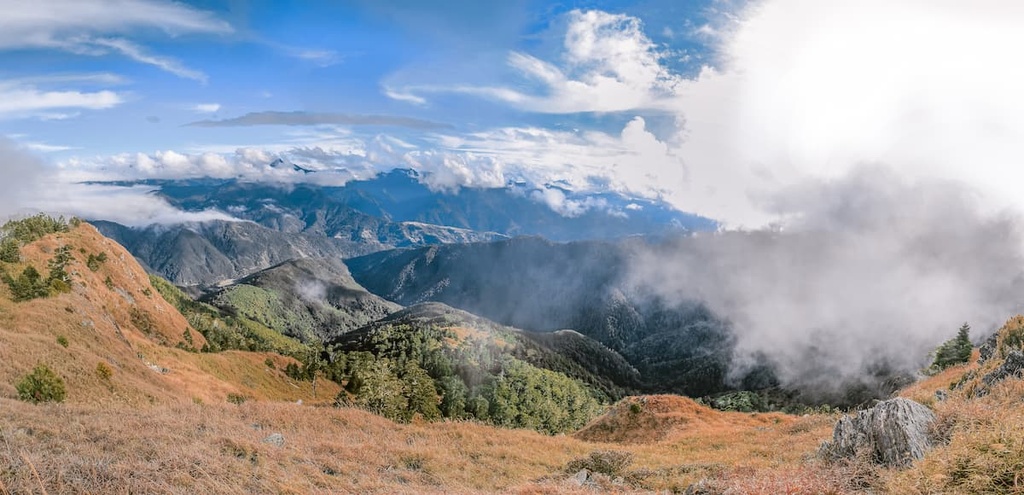
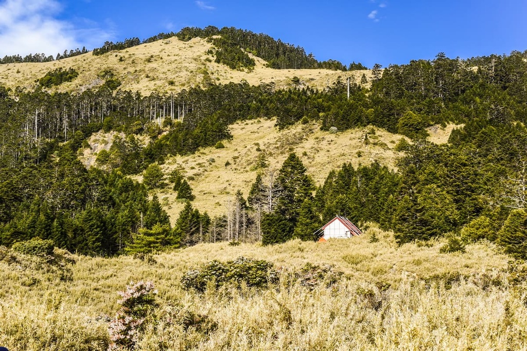
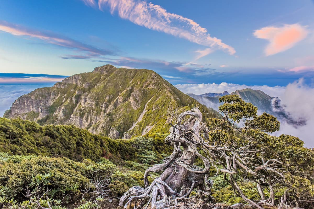
The reserve is renowned for its lofty peaks, fertile woodlands, relics from the last glacial maximum, such as glacial cirques, rare plants, and endangered wildlife. The elevation in the reserve ranges from 1,100 metres to 3,886 metres (3,609 to 12,749 ft). These lofty elevations account for the region’s crisp annual temperature of 10°C (50°F). In fact, summer temperatures in the reserve rarely reach above 16°C (60°F).
Interestingly, despite the fact that the reserve is located just 100 km (62 mi) north of the Tropic of Cancer, its temperatures are far from tropical as the region’s high elevation greatly affects its climate. Indeed, Xueshan translates to “Snow Mountain,” and its name comes from the snow-covered peak that dominates the landscape throughout most of the year.
There are also a number of other parks located near the reserve. This includes Taroko National Park (太魯閣國家公園), which is located to the east of the reserve.
Additionally, the Taiwan Strait (臺灣海峽) is situated to the west of the reserve along Taiwan’s west coast. Qilan Wildlife Reserve (棲蘭野生動物重要棲息環境) lies north of Snow Mountain and Dabajian Mountain Ecological Reserve. Meanwhile, Basianshan National Forest Recreation Area (八仙山國家森林遊樂區) is located to the south.
Snow Mountain and Dabajian Mountain are two of the most prominent mountains of the Xueshan Range (雪山山脈), one of the five chief mountain ranges in Taiwan. The Xueshan Range formed as a result of a tectonic collision between the Eurasian and Philippine Sea plates. This collision created the steep, sharp mountains that we see in the region today.
Rocks in the range are primarily sedimentary and meta-sedimentary rocks. This includes sandstones, shales, and slates that date back to the Eocene and Miocene epochs. There are also a number of high folded strata and high-angle reverse folds within the Xueshan Range, the most notable of which is the box fold on Pintianshan.
Remnants of the last glacial maximum are also present in the reserve. There are a number of features in the reserve, such as large cirques, which were carved out by the glaciers during the last glacial maximum.
The most notable glacial cirque is present below the summit of Xueshan Main Peak. This cirque is the largest in Taiwan and it is locally referred to as Glacial Cirque Number 1.
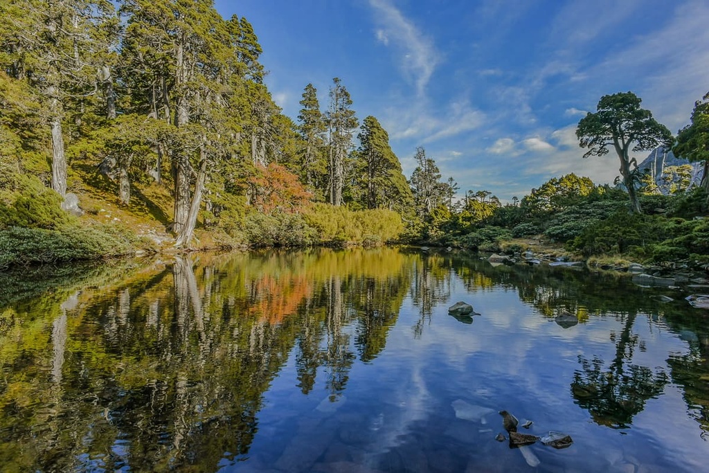
Meanwhile, Glacial Cirque Number 2 is found on the lower slopes of Xueshan North Peak, dominating the landscape with its distinctive U-shaped valley. In addition to glacial cirques, there are a number of glacial lakes in the Xueshan area, most notably at Cuei Pond (翠池), which sits on the slopes of Xueshan.
As the climate of Snow Mountain and Dabajian Mountain Ecological Reserve runs the gamut from frigid alpine conditions to warm temperate weather, the vegetation in the region also varies from alpine zones to forest and grasslands.
Endemic species, such as Yushan juniper and Taiwan fir, are present in the frigid alpine plain at elevations above 2,800 metres (9,186 ft). Yushan juniper is known to reach 10 to 12 metres (33 to 39 ft), with a circumference of 30 to 60 cm (12 to 24 in). In cases where the tree is more than 2,000 years old, the circumference of these trees can be as wide as 1 metre (3.2 ft).
Yushan juniper grows between 3,400 to 3,600 metres (11,155 to 11,811 ft), while forests of Taiwan fir flourish in the subalpine zone between 2,800 to 3,500 metres (9,186 to 11,483 ft). Yushan cane thrives on the gentle alpine frigid plain slopes. In the blistering windswept alpine inclines, the Yushan juniper’s growth is stunted, featuring more of a curved shape.
There are over 300 plant communities in the reserve. A coniferous broadleaf forest is present in the temperate zone, between the altitude of 1,500 metres to 2,000 metres (4,921 to 6,562 ft), comprising mainly of Taiwan red cypress and Chinese cork oak, while from 2,000 to 2,800 metres (6,562 to 9,186 ft) Chinese hemlock and Taiwan spruce are nurtured in this cool-temperate zone.
In terms of wildlife in the Snow Mountain and Dabajian Mountain Ecological Reserve, 30 species of mammals are present, most notably the endangered Formosan black bear and Formosan macaque. Other mammals inhabiting the area include the Taiwan serow, red and white giant flying squirrel, and the greater Chinese mole.
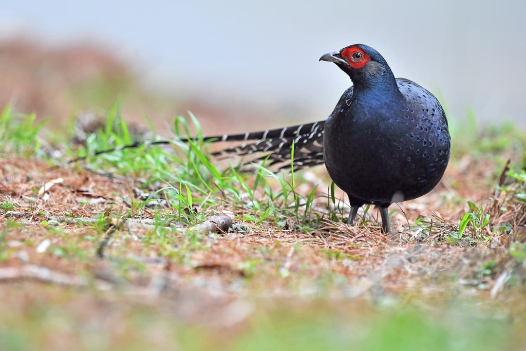
A total of 60 species of birds occupy the mountainous heavens of the reserve, such as the rare Mikado pheasant, Swinhoe’s pheasant and laughing thrush, coal tit, Mandarin duck, and Taiwan yuhina.
Another endemic endangered yet iconic species is the Formosan landlocked salmon. These fish have lived in the region since the retreat of the glaciers. Once an ocean living creature, Formosan landlocked salmon have no outlet to the sea; therefore, they have had to adjust over time to living in a lake.
Interestingly, the Formosan landlocked salmon is the only salmon that lives near the tropics. The existence of these ancient fish has long intrigued scientists; thus, ongoing studies are being conducted on the breeding and habitat preferences of these fish. These fish are also at the center of a number of environmental education and conservation programs.
Remnants of prehistoric activity from 5,000 years ago have been excavated in the elevated Snow Mountain and Dabajian Mountain Ecological Reserve regions. Examples of such uncovered artefacts are stone tools, shards of pottery, and weapons.
Around this time, 5,000 years ago, islanders from the South Pacific began migrating to Taiwan, where they settled in communities in different areas. In north and central Taiwan, the Atayal people made a home in the mountains, living at elevations between 1,000 to 1,500 metres (3,281 to 4,921 ft).
Many of the Snow Mountain and Dabajian Mountain Ecological Reserve trails were forged as hunting paths by the Atayal, who used these roads to move between mountainous regions to find food or connect with other tribes. There is still a solid Atayal presence in the area as Kailantekunshan (凱蘭特崑山), Mutelabashan (穆特勒布山) and Kalayeshan (喀拉業山) all bear Atayal names.
During the Japanese Occupation Era, the presence of Japanese officials caused tension with the Atayal people, who felt invaded by their proximity. Moreover, as the mountains held an abundance of cypress trees, the Japanese were interested in felling the trees to produce highly desired camphor oil.
As a result of wanting to succeed in this measure, without the interference of the Atayal people protecting their mountain home, the Japanese forced the Atayal to relocate to areas under police surveillance as a measure to control the Atayal people.
Evidence of such surveillance regimes can be found along the road of the Beikeng Creek and Madara Creek. Here, former police stations are located in discrete locations, hidden in bushes and long grass. These former police stations now serve as a testament to the oppression that the Atayal people faced under Japanese occupation.
Snow Mountain and Dabajian Mountain Ecological Reserve was formed on April 10, 2006. The reserve was established to protect the flora and fauna in these unique forests.
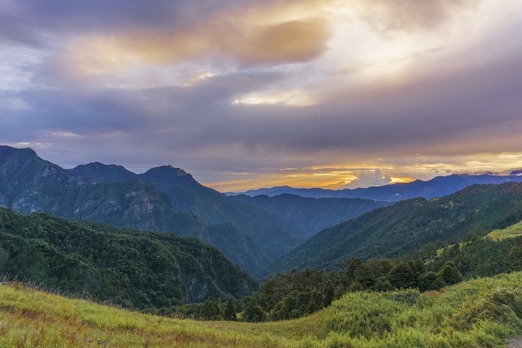
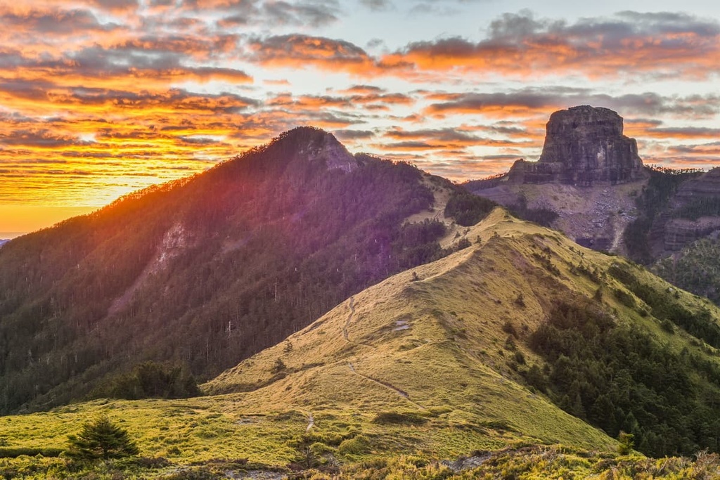
Snow Mountain and Dabajian Mountain Ecological Reserve features some challenging and stunning trekking areas. The two main treks in the reserve centre on the region’s two most important mountains: Xueshan, and Dabajian Mountain.
For hikers wanting to summit Snow Mountain without the arduous weeklong journey that the alternative route offers, the East Xue Trail will be the better and more popular option. While Snow Mountain is the second tallest mountain in Taiwan, the trail is straightforward and without much hassle as it's well-maintained. However, hikers still need to be physically fit to scamper up this steep mountain.
Since it’s best for hikers to pace themselves on this 22.5 km (14 mi) trail, the trek is usually divided into three days of walking.
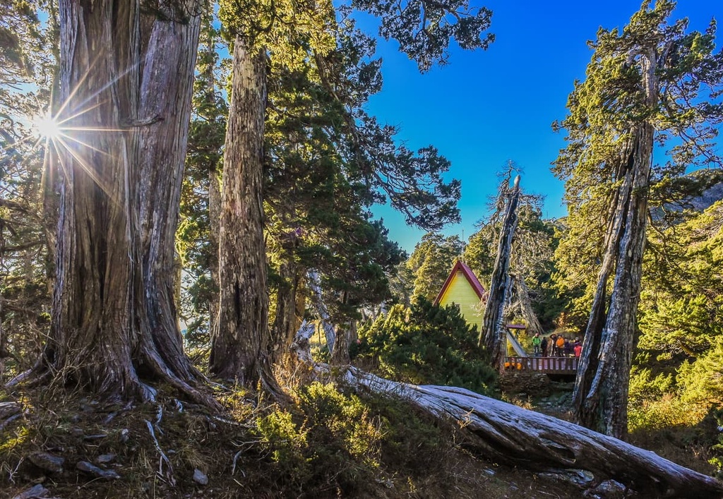
The first day starts from Wuling Recreation Area where hikers advance towards the Xueshan Trailhead. From here, hikers climb up Xueshan East Peak, the summit of which affords 360° panoramic views of the sharp mountains and deep valleys, with the Holy Ridge line connecting Xueshan and Dabajianshan in full view. Hikers will then spend the night in Sanliujiu Cabin, also known as 369 Cabin.
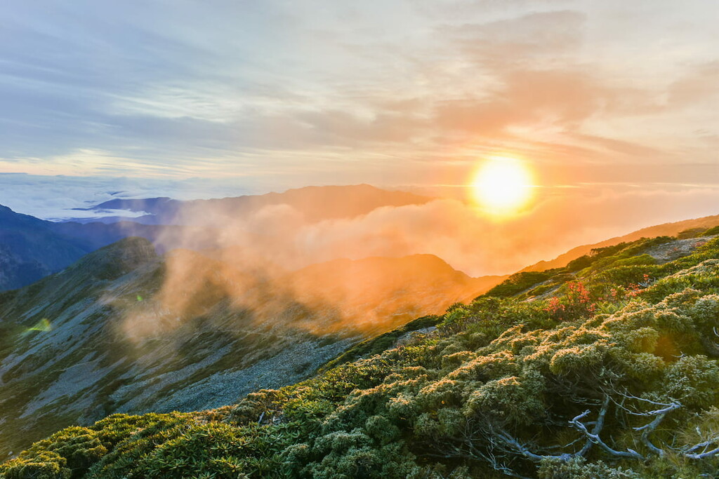
The following morning, hikers can wake up early in order to witness the glorious alpine sunrise from Xueshan Main Peak, a 3.7 km (2.3 mi) near-vertical trek to the summit. Before reaching the summit hikers encounter a forest crammed with rhododendron, which then proceeds to the coveted Glacial Cirque Number 1. Here, hikers can appreciate the drastic effects of glacial activity on this great mountain.
The last scramble up Xueshan Main Peak is above the treeline; thus, hikers will be granted pristine views of the woodlands and valleys below, as well as the lofty peaks that stand tall circling the grand mountain. Hikers will spend another night at Sanliujiu Cabin before descending to Wuling Recreation Area, completing their avid trek to Xueshan.
For the most adventurous among us, the 7-day West Xue Trail spans 28.5 km (18 mi) while summiting a multitude of peaks over 3,000 metres (9,842 ft). Hikers begin the trek from the trail on 230 Forest Road, which joins the East Xue path towards Xueshan East Peak and Xueshan Main Peak.
After Xueshan Main Peak, hikers embark towards Bokeer Mountain, passing Cuei Lake on the way. Situated at an elevation of 3,250 metres (10,663 ft), Cuei Lake is the highest alpine lake in southeast Asia. Along the elevated, lengthy trail, hikers will continue and summit Huoshishan (火石山), Dananshan (大南山), Touyingshan (頭鷹山), Qijunshan (奇峻山), Da Xueshan North Peak (大雪山北峰), Da Xueshan (大雪山), Pipidashan (匹匹達山), and Zhong Xueshan (中雪山).
This arduous trail highlights the warbled and striking Taiwan fir, Chinese hemlock, and Yushan cane that grow along the lofty ridges, sheltered and shielded against the destructive northeast monsoon by Xueshan Horst.
Additionally, hikers can marvel at the supreme grandness of Cuei Lake and appreciate the imprints from the last glacial maximum at the lower slopes of Xueshan Main Peak, where Glacial Cirque Number 1 demonstrates the strength of nature.
Also known as the Holy Ridge Trail, this 5-day trek spans from Xueshan Main Peak to Dabajian Mountain along the Holy Ridge, a ridge connecting the two great mountains. Although Dabajian Mountain is topographically linked with Snow Mountain, hikers do not summit Dabajian Mountain for safety reasons.
As the path continuously extends above 3,000 metres (9,842 ft) and crosses steep and uneven rocky surfaces, this trail is best for only the most experienced and ardent hikers. Additionally, during this trail, hikers must scramble over thin ridges with dramatic 1,000-metre (3,281 ft) drops on either side; thus, a fondness for heights is also a prerequisite for this trek.
To hike the Shengleng Trail, hikers will start at a trailhead at the Wuling Recreation Area. Here, they’ll continue to climb to an elevation of 3,000 metres (9,842 ft) and above for the next four days as they clamber up the slope of jagged boulders of Chryou Shan.
For the next four days on this trek, hikers will summit five additional mountains, including Pintianshan (品田山), Sumida Shan (素密達山), Xueshan North Peak (雪山北峰), Xueshan Main Peak (雪山主峰), and Xueshan East Peak (雪山東峰).
Along the way, hikers are usually continuously enveloped in a sea of clouds on this trail as they scramble their way across the linear-shaped path from Chryou Shan extending to Xueshan East Peak.
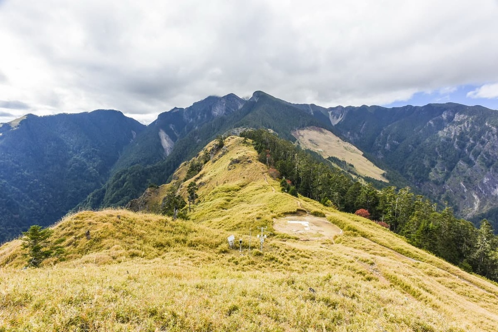
Another multi-day hike, Wuling Quadruple Trail, also known as Sixiu Trail, spans 10 km (6.2 mi) from west to east. This trek gives hikers a chance to summit the peaks Chryoushan, Pintianshan, Taoshan, and Kalayeshan over the course of about 3 days.
This trek also provides a chance to see the reserve’s great variation in vegetation. In particular, hikers will see the clusters of Chinese hemlock that populate the forests of Kalayeshan and the meadowed plains and grass-covered peak of Pintianshan.
The first day of the hike entails a steep climb up Pintianshan. The higher hikers climb, the more open the surrounding views become. During the course of this hike, you can also see the jagged peak of Zhongyang Jianshan (中央尖山) of Taroko National Park as it pierces the sea of clouds that envelop the region.
The sweeping vistas from the trail as you ascend Pintianshan include views of the Central Mountain Range, particularly from Nanhudashan (南湖大山) in the north to Yushan (玉山) in the south.
After an overnight rest, hikers will embark east towards the alpine meadow grasslands of Pintianshan. A spectacular sunrise gently soaks the scenery with a warm golden glow, unveiling tufts of white fluffy clouds softly perching on mountain peaks and granting a moment of beauty and harmony to lift any tired and dampened spirits.
Heading onwards, hikers will encounter Pintianshan's infamous U-shaped cliffs, which involve two incredibly sheer, near-vertical drops. Hikers must descend and then scale up these cliffs with rope assists to journey onward to the summit of Pintianshan.
Here, hikers are rewarded with a 360° unobstructed view that features the famous mountains of Xueshan, Dabajianshan, and Yushan. This view also includes an endless sea of jagged peaks rippling across the alpine sky.
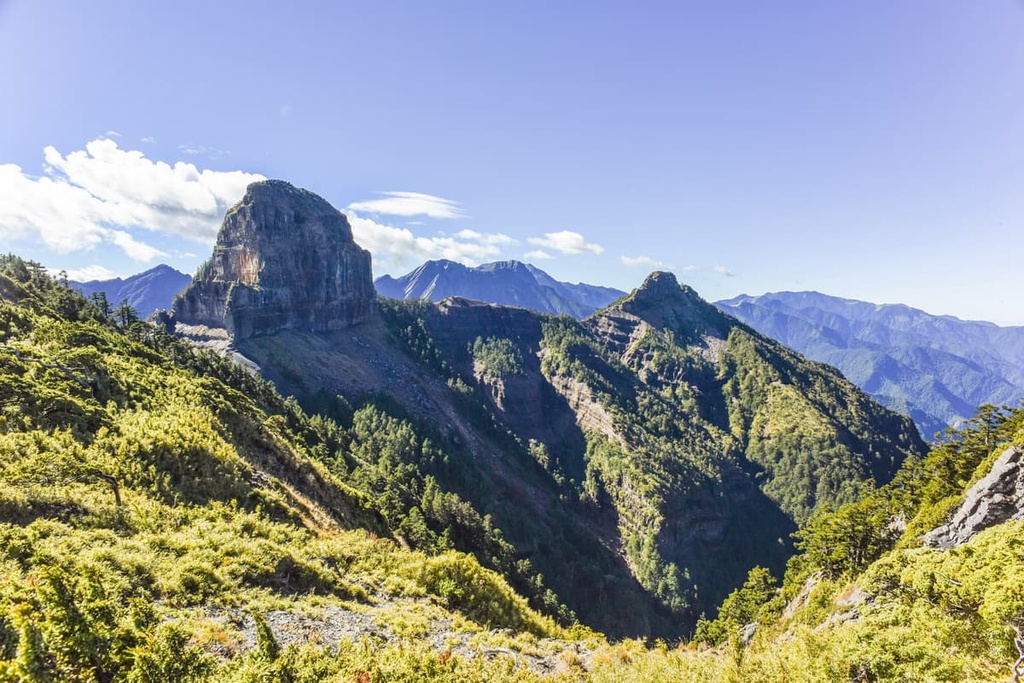
As hikers descend to Xinda Hut, their overnight stay, they continue to climb Chryoushan, which after the daunting ascent of Pintianshan, feels like a walk in the park. A burst of rhododendron flowers warmly greets hikers to the summit of Chryoushan, where hikers can appreciate the sheer cliffs of Pintianshan. From here, hikers can also observe the ominous-looking Mutelaba Shan and the Holy Ridge, with Dabajianshan and Xiaobajianshan (小霸尖山) clearly in view.
Hikers are soon met with a tricky descent of Chryoushan, which involves climbing down an uneven, slippery, rocky surface, where loose rocks can roll from underneath hikers' feet, causing them to lose their balance. After completing this challenging descent, hikers then begin the climb up Taoshan to spend the night at Xinda Hut.
On the third morning, hikers awake to begin the steep climb to Taoshan. This involves scraping up the mountain slopes in the dark until the fiery red glow of the sunrise warmly touches the landscape with daylight.
The descent of Taoshan is littered with twisting protruding roots as hikers pass a forest of pine trees and Yushan cane. After this descent, hikers will need to ascend to the Wuling Quadruple Mountains' lowest peak of Kalayeshan. From here, clear views of the Holy Ridge with Xueshan sitting to the left and Dabajianshan to the right.
This three-day trek spanning 31 km (19 mi) features a gentle forest road that leads the path up Dabajianshan. Hikers need to walk for 19 km (11.8 mi) on the Dalu Forest Road before reaching the Madara Creek Trailhead, the official trailhead of the Daba Peaks Trail.
Do note that, after Typhoon Morakot in 2008, the forestry bureau closed vehicle access to the forest road leading up to Madara Trailhead due to damage from landslides.
Hikers will then wade through a forest trail before reaching the base of Dabajian Mountain, where they will set up camp for the night. The following morning they will move onward to Xiaobajianshan, which involves climbing up a steep slope while making use of rope assists.
From the summit, hikers can look back and see the challenging trail that they followed up the mountain. During the descent, hikers embark towards Yizeshan (伊澤山) then towards Jialishan (加利山), both of which offer spectacular views of Dabajianshan and Xiaobajianshan.
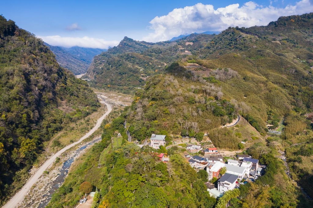
As the vast area of Snow Mountain and Dabajian Mountain Ecological Reserve stretches across three counties, there are many wonderful cities and townships for visitors to stay at during their trip to the region. The closest city to the reserve is Miaoli City (苗栗市), while the closest township is Tai’an Township (泰安鄉).
Having perfected the art of slow living, Miaoli City offers visitors the chance to experience the many attractions of city life and a relaxed and friendly vibe. The gentle city pace of Miaoli allows visitors to fall into a dreamlike, easygoing reverie while soaking up the rural charm of this enrapturing city.
There is no better way to unwind and bask in the city of slow living than to attend a morning tea and meditation session at The Global Tea Hut guided by Wu De, an American monk. In addition, the Global Tea Hut publishes a monthly magazine, Tea & Tao, which includes a free sample of environmentally friendly tea posted to subscribers.
The Miaoli Hakka Roundhouse is a museum housing exhibition on Hakka culture. Hakka is the most populous Indigenous tribe in the Miaoli area. The museum is free to enter and it offers education on Hakka customs. It is also built in a cylindrical style, mimicking the traditional Hakka tulou or walled village, which can house up to 800 people.
Adding to the theme of slow living and basking in the pleasure of performing simple tasks, strawberry picking in the nearby Dahu Township is a popular recreational activity. This activity is enjoyed by both locals and tourists who bask in the beauty of the vast fields of ripe, plump strawberries and share the enjoyment of picking and then savouring this sweet, juicy, refreshing fruit.
Additionally, the beautiful Lion’s Head Mountain, or Shitoushan, is a magnet for adventurers. There is a trail to the summit that traverses parts of both Miaoli and Hsinchu counties. However, the most picturesque part of the trail is in Miaoli, as mountainside temples dot the path, offering captivating views of the surrounding landscape.
Tai’an Township is the only indigenous community in the mountains of Miaoli. In fact, more than two-thirds of the population are members of the Atayal tribe.
One of the main attractions of Tai’an Township is the Tai’an Hot Spring. Set in the mountains and graced with the soft pink flowering of cherry blossoms in spring, Tai’an Hot Spring is rated as one of the most picturesque hot springs in Taiwan. The water is clear and odourless, and visitors can appreciate the views of Hushan and Henlongshan from the comfort of the bubbling warm springs.
A Taiwanese staple, tofu, is a much-loved delicacy that is prepared in many ways in the community. Xishuikeng Tofu Street offers handmade tofu from the many street vendors, while Atayal and Hakka cuisine is also available. Wandering down Xishuikeng Tofu Street also gives you a chance to see the ancient structure and architecture of the village.
For visitors coming from the major cities of Taipei, Taoyuan, Hsinchu, Taichung, Chiayi, Tainan, and Kaohsiung, take the Taiwan High-Speed Rail (HSR) to Miaoli HSR Station. Once there, visitors need to board the Express 101B bus, which transports passengers to the headquarters of Shei Pa National Park, from where most of the trails commence.
Alternatively, visitors can rent a car or scooter from Miaoli City to the headquarters of Shei-Pa National Park. The drive is approximately 22.5 km (14 mi) long.
However, for visitors wishing to journey to Wuling Recreation Area, where there are a number of other popular trails, the journey is substantially longer. That’s because the drive from Miaoli City to Wuling Recreation Farm is about 261 km (162 mi) long since the road has to weave its way through the mountains.
Regarding public transport to Wuling Recreation Area, it is best to take the HSR or express train (TRA) to Taipei Main Station. Afterwards, you can board the E-go bus that heads directly to Wuling Recreation Area.


tw100
ultra
taiwan-high-three
taiwan-ultras
tw100
ultra
taiwan-high-three
taiwan-ultras


