Scan the QR code and open PeakVisor on your phone
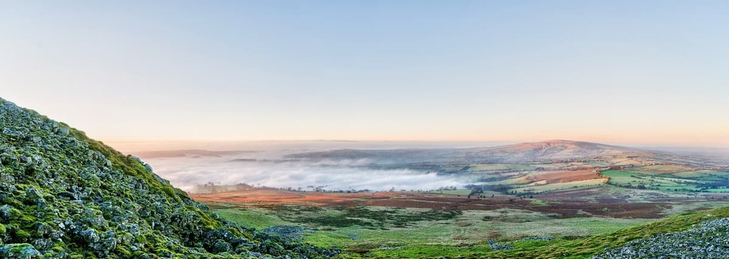
Boasting some of the best natural landscapes in the West Midlands, the Shropshire Hills Area of Outstanding Natural Beauty (AONB) is one of England’s best-kept secrets. There are 156 named summits in Shropshire Hills AONB. The highest and the most prominent summit is Abdon Burf (540 m/1,771 ft).
The Shropshire Hills AONB is a protected area of countryside that’s located in the West Midlands region of England. The AONB covers an area of approximately 310 square mi (802 sq. km). It is located entirely within the southern half of the county of Shropshire.
The Shropshire Hills is located along England’s border with Wales in an area known as the Welsh Marches. The southern half of the AONB is dominated by the Clee Hills, a hill range that runs for 15 mi (24 km) and has a low point of 300 m (984 ft).
The Clee Hills contain some of the highest points in the Shropshire Hills, including Abdon Burf (540 m/1,771 ft), a summit of Brown Clee Hill, and Titterstone Clee Hill (533 m/1,748 ft).
There are also several hill ranges to the north of the area, including the Stiperstones Range and the Stretton Hills. These ranges are home to some of the area’s most popular peaks, including the Stiperstones (536 m/1,758 ft), which is the second-highest summit in the AONB, and the Long Mynd (495 m/1,624 ft).
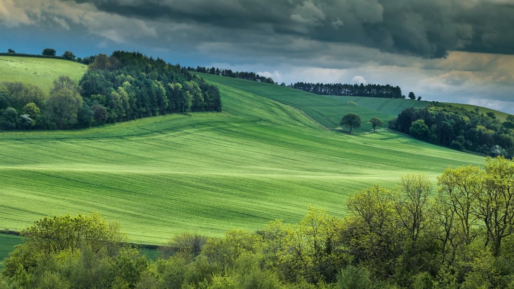
Aside from the hills, the AONB consists of a number of important natural landscapes. The Shropshire Hills AONB features heathlands, commons, moorlands, and grasslands for hikers to explore.
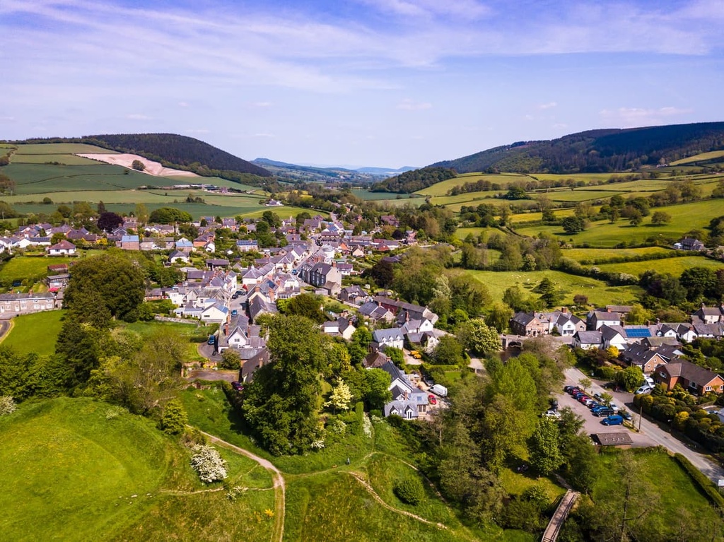
Due to its isolated location within southern Shropshire on the Welsh border, there are few significant settlements within the Shropshire Hills AONB. The largest settlement in the AONB is Church Stretton, with a population of roughly 4,600 people. Another significant community in the Shropshire Hills is Craven Arms, which has a population of around 2,300 people.
The nearest major settlements to the Shropshire Hills AONB are Shrewsbury and Telford, which are approximately 18 mi (29 km) and 25 mi (40 km) away, respectively. Birmingham, England's second-largest city, is located about 60 mi (96 km) to the east of the Shropshire Hills AONB.
The Shropshire Hills AONB is one of the most geologically diverse areas in the UK. No two mountain ranges in the area have the same geological history. In fact, rock types from almost every geological period can be found across Shropshire.
The Shropshire Hills played an important role in the development of geology. Geological investigations of the area started as early as the late eighteenth century. Early research done across the Shropshire features prominently in one of the most important early books on geology, Roderick Murchison's The Silurian System.
The AONB is also rich in minerals such as lead, coal, and iron, making it an important area for mining and quarrying. It was a particularly vital mining area during the height of the Industrial Revolution.
The ranges within the Shropshire Hills AONB run approximately from southeast to northwest and are influenced by several fault lines. Common component rock types across the Shropshire Hills include limestone, mudstones, siltstones, and sandstones.
Many of the Shropshire Hills formed when the area lay under shallow sea water. Approximately 100 million years ago during a mountain-building event called the Variscan orogeny, a continental collision caused the land to buckle and fold, creating the Shropshire Hills. The Variscan orogeny also helped shape other significant mountain ranges worldwide, including ranges in Canada, Italy, and Germany.
The oldest rocks discovered in the Shropshire Hills date back to the Precambrian period, the earliest part of Earth's history. You can find these early metamorphic rocks near The Wrekin (407 m/1,335 ft). The youngest rocks in the Shropshire Hills' bedrock date to the Early Permian period over 250 million years ago. These Early Permian rocks can be found in the southeastern part of the park.
Today, the Shropshire Hills are home to some of the highest peaks in the West Midlands. They even exceed the highest hills in the Cotswolds by approximately 200 m (656 ft). The Shropshire Hills are also home to several Marilyns (summits with a prominence of 150 m/492 ft or over).
The highest summit in the Shropshire Hills is Abdon Burf (540 m/1,771 ft) on Brown Clee Hill. Other notable and popular peaks in the Shropshire Hills AONB include the Stiperstones (536 m/1,758 ft), the Long Mynd (495 m/1,624 ft), and The Wrekin (407 m/1,335 ft).
With a mixture of uplands and downlands that support grasslands, heathlands, woodlands, and rivers, the Shropshire Hills AONB is home to a wide variety of flora and fauna. The importance of conservation in the area is clear, too, as there are approximately 126 Sites of Special Scientific Interest (SSSI) within the park’s boundaries.
The farmlands of the Shropshire Hills are among the most important habitats in the AONB. They support a significant population of rare arable bird species that was once widespread across the country. Species considered rare and endangered that are found in the region include dipper, curlew, snipe, and lapwing.
These bird species are often seen as indicators of the general health of the environment. While some species numbers are recovering, some bird species, like the ring ouzel, have almost disappeared from the Shropshire Hills.

Red kites, which were reintroduced to Wales in 1989, are beginning to expand into the Shropshire Hills. Other notable bird species in the Shropshire Hills include merlin, skylark, dipper, and peregrine falcon.
The grasslands and heathlands of the Shropshire Hills AONB provide habitats for a number of rare upland invertebrates. While hiking across the area's grasslands and heathlands, keep an eye out for grayling butterflies, small pearl-bordered fritillaries, and emperor moths.
The rivers and ponds in the Shropshire Hills contain several rare species, most notably the white-clawed crayfish and the freshwater pearl mussel. While there are not extensive wetlands in the area, the ponds of the Shropshire Hills support several fascinating species, like the great crested newt.
The Shropshire Hills are also home to several critical mammal populations. In particular, the Shropshire Hills serve as a stronghold for dormice, which are a European protected species.
Perhaps the biggest success in the Shropshire Hills is the evidence of the pine marten colonies in the AONB. Once thought to be extinct in England, pine martens have recently been spotted in the Clun Valley. Other, more common mammals in the Shropshire Hills include badger, red fox, and roe deer.
The Shropshire Hills AONB has a varied landscape supporting a range of flora. The woodlands of the Shropshire Hills are one of the main strongholds in the UK for black poplar.
One extraordinary area in the north of the AONB is called the Hollies. This area contains around 200 holly trees that are thought to be between 200 and 300 years old. At the All Saints Church in Norbury, there’s even a yew tree that’s thought to be 2,700 years old.
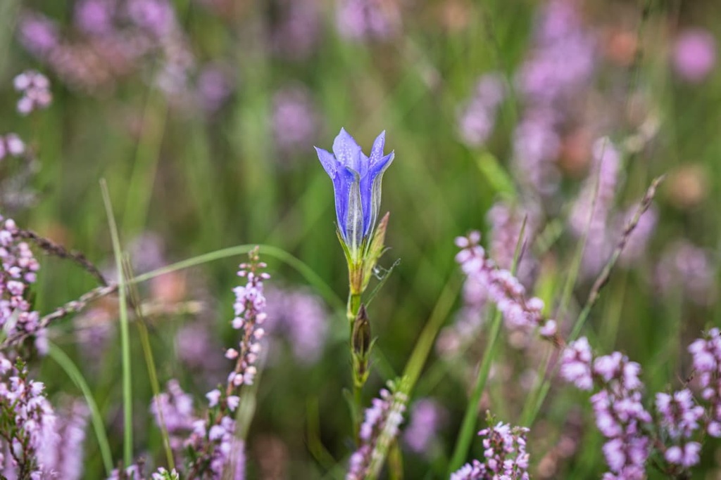
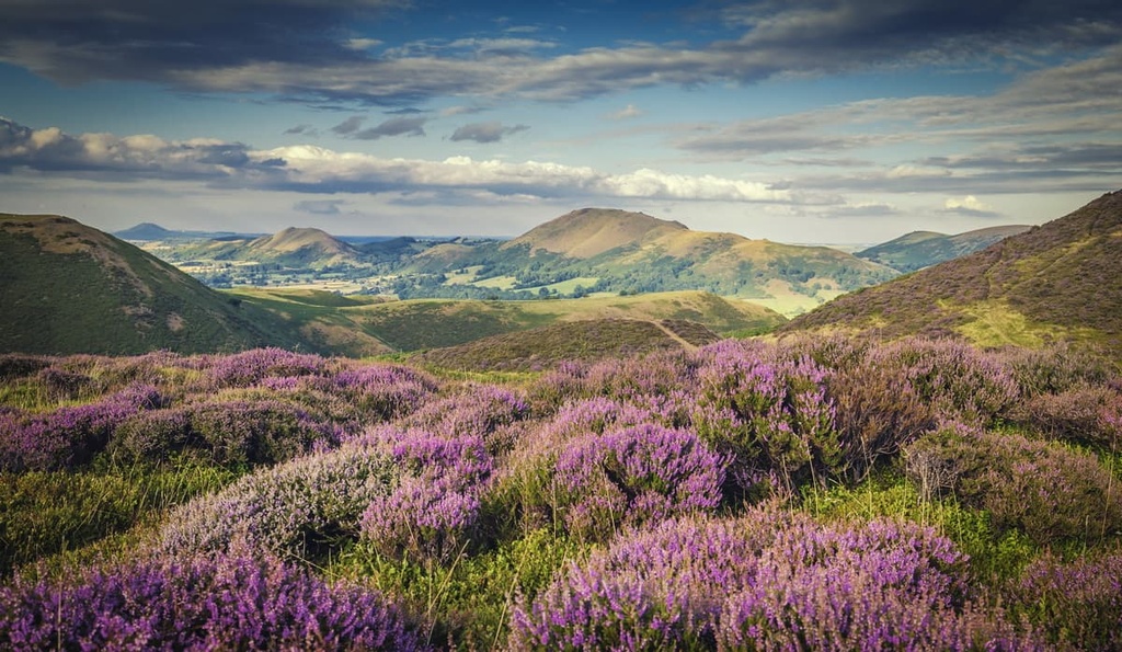
Heathlands and moorlands are common on the slopes of the Long Mynd, the Stiperstones, and the Clee Hills. These areas support some declining flower populations, including mountain pansy. Marsh gentian isn’t found anywhere else in the West Midlands than in one particular area of the Clee Hills.
Other interesting wildflowers found across the moorlands and heathlands of the Shropshire Hills include bee orchid, wild liquorice, and saw-wort. Like most of the grasslands of southern and western England, there is a rich variety of wildflowers across the area.
Humans have been living in the Shropshire Hills since before the keeping of written records.
Archeologists have discovered many monuments, including stone circles and barrows, dating back to the Bronze Age between 3,300 BCE and 1,200 BCE. You'll find 180 Ancient Scheduled Monuments across the area, most of which date back to before or during the Roman occupation of Britain.
The Shropshire Hills has a fractured history resulting from its location on the Welsh border. Following the Norman Conquest, the Shropshire Hills were constantly involved in skirmishes and border raids.
Earthworks along the Welsh border, including Offa's Dyke, are evidence of such conflicts. You can also see the Welsh influence on the area in many place names, like Cefn Einion and Clun.
Mining, quarrying, and to a lesser extent, logging, all played an important role in the recent history of the Shropshire Hills. You'll find many former mining sites on the Stiperstones and the Clee Hills that were used to mine for iron, zinc, and coal.
By the start of the Industrial Revolution, the Shropshire Hills had become the most important geological site in the UK. This was thanks to the fact that it has the most diverse rock formations in Europe. The presence of the River Severn in Shrewsbury also made transporting rock samples to other cities much easier.
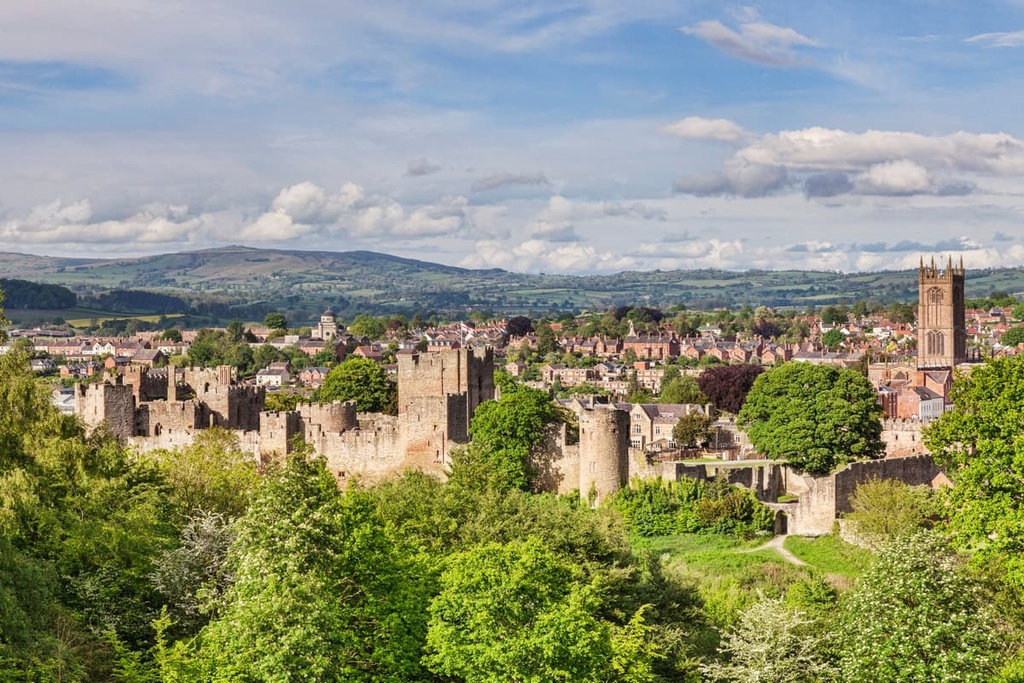
There are many castles and forts across the AONB, most of which lay in ruins. The finest ruinous castles in the Shropshire Hills include Clun Castle and Ludlow Castle, which date back to the eleventh and twelfth centuries.
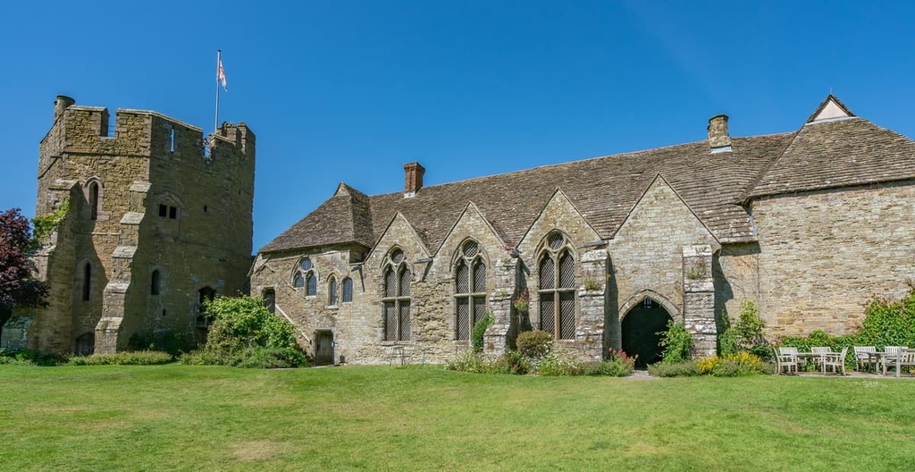
One of the biggest attractions in the Shropshire Hills AONB is Stokesay Castle. Located near Craven Arms, Stokesay Castle is considered one of the finest remaining fortified manor houses in England. The castle in its current form was constructed in the late fourteenth century.
The Shropshire Hills were designated an Area of Outstanding Natural Beauty (AONB) in 1958. It was among the first 5 AONBs to be created in the UK. It's governed by the Shropshire Hills AONB Partnership.
With its varied geology, historic sites, and rare wildlife, the Shropshire Hills provide unforgettable hiking adventures. Read on to find out about the best hiking areas in the Shropshire Hills AONB.
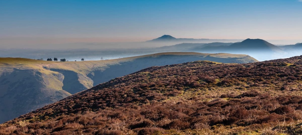
The Long Mynd (495 m/1,624 ft) is among the most popular hiking areas in the Shropshire Hills AONB thanks to its lengthy moorland plateau and distinctive shape.
Despite not containing one of the highest peaks in the Shropshire Hills, the Long Mynd and the surrounding Carding Mill Valley are home to several challenging trails.
If you're looking to climb to the Long Mynd's highest peak, Pole Bank (516 m/1,692 ft), you'll want to follow the Burway Loop. This circular trail takes hikers to the head of the Carding Mill Valley before climbing steadily uphill. It offers panoramas of Shropshire along the way.
The Burway Loop is 5 mi (8 km) long and takes 2 or 3 hours to complete. You can pick up the trail from the Chalet Pavillion in Carding Mill Valley. The entirety of the route follows either a well-defined stone path or the ancient Portway track. The path can be steep and rugged in places, so bring hiking boots.
If you're not interested in scaling the Long Mynd and would prefer to undertake a long, isolated hill walk, consider the Ratlinghope Ramble. This walk leads across the quieter west side of the Long Mynd, with a few great places to stop for a bite to eat along the way, including the Bridges pub.
The Ratlinghope Ramble is 10 mi (16 km) long and takes 4 to 6 hours to complete. You can pick up the trail from the Chalet Pavilion in Carding Mill Valley. This walk is also dog-friendly.
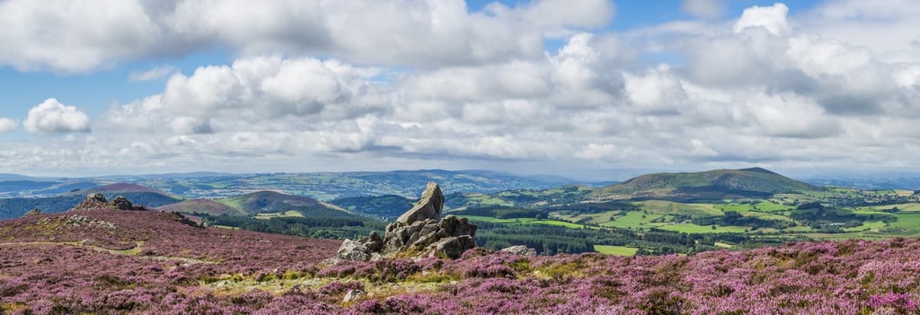
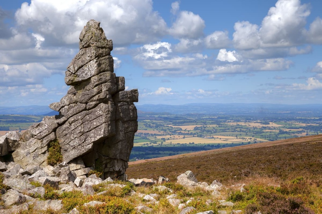
The Stiperstones (536 m/1,758 ft) is the second-highest hill in the Shropshire Hills AONB, surpassed only by Brown Clee Hill. The Stiperstones is characterized by its numerous jagged quartzite tors, which provide the hill with an instantly recognizable silhouette.

Interestingly, the Stiperstones is a National Nature Reserve. It gained this status thanks to its heather and bilberry heathlands and its rare fauna. An array of rare bird species nest in the area, including peregrine falcon and red grouse.
The Stiperstones is also famous due to the mythology surrounding the area. Around a tor known as Devil's Chair, legends state that the ghost of Wild Edric, a Saxon earl who defied the Normans in the eleventh century, rides across the hill whenever England is at risk of invasion.
One of the best ways to hike up the Stiperstones is along the Stiperstones Circular Walk, which forms part of the long-distance Shropshire Way. The walk is 5.5 mi (9 km) long and takes 2 or 3 hours to complete. You can start the walk from the Bog Visitors Centre.
This hike takes you on a ridge walk, passing several Bronze Age burial cairns. Along the way you'll also encounter several of the Stiperstones' most famous tors, including Devil's Chair, Cranberry Rock, and Mainstone Rock.
The summit of the Stiperstones provides some of the best views in the Shropshire Hills. On the return leg, you'll pass near the Hollies, an area containing over 200 holly trees that are thought to be several centuries old.
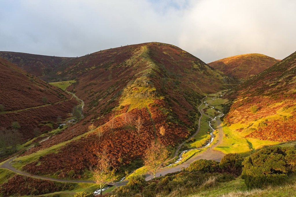
Considered one of the seven natural wonders of the Midlands, Wenlock Edge is well-worth visiting during your trip to the Shropshire Hills AONB. This 18-mile (30 km) long limestone escarpment is considered one of England's most geologically important sites, and it features several popular hiking trails. The escarpment is approximately 330 m (1,083 ft) above sea level.
One of the best walks on Wenlock Edge is the Major's Leap circular walk. The route takes its name from Major Smallman, a supporter of King Charles I who fled the Roundheads on Wenlock Edge during the English Civil War.
When surrounded, Major Smallman took a leap of faith off Wenlock Edge. Amazingly, Smallman managed to survive and brought a force back to attack the Roundheads at Wilderhope Manor. The Major's Leap walk is 3.5 miles (5.5 km) long and takes around 2 hours to complete. You can start the walk from the Much Wenlock National Trust car park.
The walk takes you up onto Wenlock Edge and through woodlands before treating you to stunning views of the Long Mynd, Caer Caradoc (459 m/1,505 ft), and The Wrekin (407 m/1,335 ft). The viewpoint for the Long Mynd is believed to be where Major Smallman jumped. The return leg is fairly uneventful, though it leads through Blakeway Coppice.
If you're looking for a casual stroll on Wenlock Edge, consider the Jenny Wind walk. This walk is around 2.2 (3.5 km) long and takes an hour or two to complete. From the Much Wenlock National Trust car park, you'll get to enjoy a leisurely walk through peaceful woodlands and past disused quarries, like Edge Wood and the Smokeyhole Quarry. Both the Jenny Wind and Major's Leap walks are dog-friendly.
Tucked away in the northernmost section of the Shropshire Hills AONB is The Wrekin (407 m/1,335 ft). Rising out of the Shrewsbury Plains, The Wrekin is a famous landmark due to its pyramidal shape and prominence compared to the surrounding landscape. The area around The Wrekin is also among the most geologically diverse regions on the planet.
As with many of the most famous Shropshire Hills, The Wrekin is steeped in folklore. According to local legends, The Wrekin was created when a vengeful giant called Gwendol Wrekin ap Shenkin ap Mynyddmawr planned to destroy the town of Shrewsbury by flooding the River Severn with dirt.
However, upon realizing how far away Shrewsbury was, the giant dropped the dirt, which became The Wrekin. Ironically, Shrewsbury is subjected to regular natural flooding from the River Severn.
There are several routes up The Wrekin, and one is a circular trail starting from the Ercall Wood Local Nature Reserve car park. The walk is 8 mi (13 km) long and takes 3 or 4 hours to complete. The route is considered challenging due to its steep sections.
The walk takes you down Ercall Lane, past the Buckatree Quarry, and through woodlands on the southern flank of Maddock’s Hill (270 m/885 ft). If you're looking for somewhere to stop halfway, there's nowhere better than the historic Halfway House.
On the slopes of The Wrekin, you'll pass between several embankments. These embankments were originally gates to a 20-acre Iron Age hillfort that was located atop The Wrekin. The top of The Wrekin is marked with a trig point. The views from the summit are sweeping, with Snowdonia and the Brecon Beacons visible on a clear day.
You'll descend The Wrekin by following the path down the hill's southern flank. The path runs between The Wrekin and Wenlock Woods on the way back to your starting point.
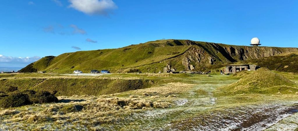
Situated in the southeastern corner of the Shropshire Hills, the Clee Hills features some of the park's highest summits. The range boasts the highest point in the Shropshire Hills, Brown Clee Hill (540 m/1,771 ft), and the third-highest point, Titterstone Clee Hill (533 m/1,748 ft). While both of these are topped with unsightly satellite relay stations, they afford some excellent views of Shropshire.
If you're looking to scale Brown Clee Hill, one of the most popular routes is along the Brown Clee Circular. This off-shoot of the Shropshire Way takes hikers on a rough walk across moorlands, past Iron Age forts, and through quaint hamlets. Most of the route leads across moorlands, so hiking boots are highly recommended.
The Brown Clee Circular is 7 mi (11 km) long and takes around 3 hours to complete. From Abdon Village Hall, you'll head along a section of the Shropshire Way before climbing uphill to Abdon Burf, Brown Clee Hill's highest point. Along the way you'll pass Abdon Clee, which was the site of medieval quarries and Iron Age forts.
You'll then walk south slightly downhill to Brown Clee Hill's minor summit, Clee Burf (512 m/1,679 ft). The route then loops back via the Nordy Banks Iron Age hill fort and returns to Abdon Village Hall.
The heavily quarried Titterstone Clee Hill is also worth visiting. Located 5 mi (8 km) to the south of Brown Clee Hill, Titterstone Clee is climbable from several different directions. This is thanks to the area's Access Land legislation, which makes the mountain plateau entirely open to the public.
The quickest way to scale Titterstone Clee is from the Titterstone Clee car park. Pass the summit of Clee Hill (467 m/1,532 ft) and walk down to the end of the road.
Then there's just a short walk over rough ground to the trig point, which marks the summit of Titterstone Clee Hill. This walk is about 1 mi (1.6 km) long and takes around 30 minutes to complete. There are also longer routes for visitors to check out, including one from the village of Cleehill.
As one of the most rural counties in England, Shropshire boasts several towns and villages where you can enjoy a relaxing vacation. Read on to find out about the main settlements in and around the Shropshire Hills AONB.
Located 20 mi (32 km) north of the Shropshire Hills is the country town of Shrewsbury. Situated on the River Severn, Shrewsbury is famous for its well-preserved historical architecture and timber-framed buildings. It contains over 600 listed buildings, including the fifteenth-century Shrewsbury Castle and the eleventh-century Shrewsbury Abbey.
Shrewsbury is a convenient spot for hikers to spend the night, too, as the Stretton Hills are only 10 mi (16 km) to the south and the Wrekin is only 14 mi (22.5 km) to the east. Popular hotels in Shrewsbury include the Lion and Pheasant Hotel and the Prince Rupert Hotel.
If you're looking for a large town near the Shropshire Hills AONB, stop off in Telford. The biggest town in Shropshire, Telford is around twice the size of Shrewsbury. Telford is home to a few interesting local attractions, like the seventeenth-century Iron Bridge and the Royal Air Force Museum.
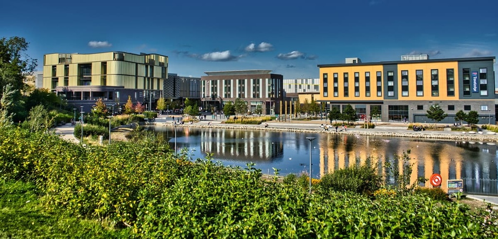
There's nowhere better to stay than Telford if you're looking to scale The Wrekin, which is just 5 mi (8 km) to the west of the town. Hikers looking to stay in Telford should check out the Telford Whitehouse Hotel or the Park House Hotel.
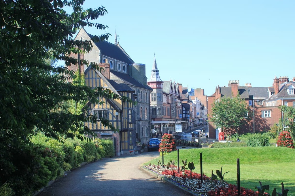
Located at the heart of the Shropshire Hills is the charming market town of Church Stretton. Nicknamed "Little Switzerland," Church Stretton is the largest settlement in the AONB. It is famous for its alpine-like scenery.
Due to its position at the center of the AONB, Church Stretton offers unfettered access to some of the best hills in the area. The Long Mynd, Caer Caradoc, and the Stiperstones are all within 10 mi (16 km) of Church Stretton. There are also several accommodation options in Church Stretton, like The Buck's Head and Victoria House.
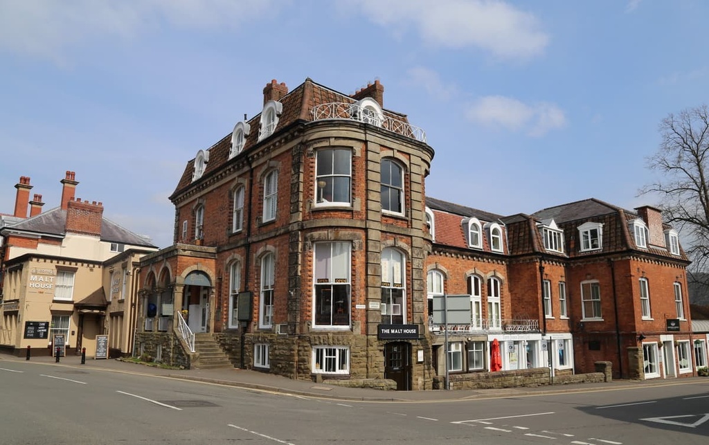
Sat on the southern boundary of the Shropshire Hills AONB is the town of Ludlow. With a population of 11,000 people, Ludlow is conveniently positioned less than 5 mi (8 km) from the Clee Hills. Ludlow is a historic settlement, and the oldest section in the community is a medieval walled town that dates back to the eleventh century.
Ludlow is undoubtedly charming and former Poet Laureate John Betjeman even described it as "probably the loveliest town in England." Accommodation options include the Charlton Arms Hotel and the Feathers Hotel.
Another popular town within the Shropshire Hills AONB is Clun. With a population of just under 700, Clun is perfect for a serene getaway. In fact, research by the Campaign for the Protection of Rural England says that Clun is one of the most peaceful towns in the country.
When you're not off scaling the Shropshire Hills, be sure to take a stroll through the ruins of the twelfth-century Clun Castle. Popular hotels in Clun include The White Horse Inn and the Sun Inn.