Scan the QR code and open PeakVisor on your phone
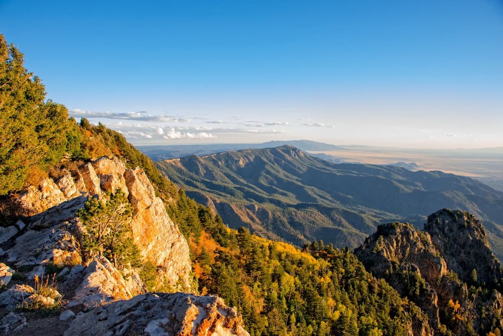
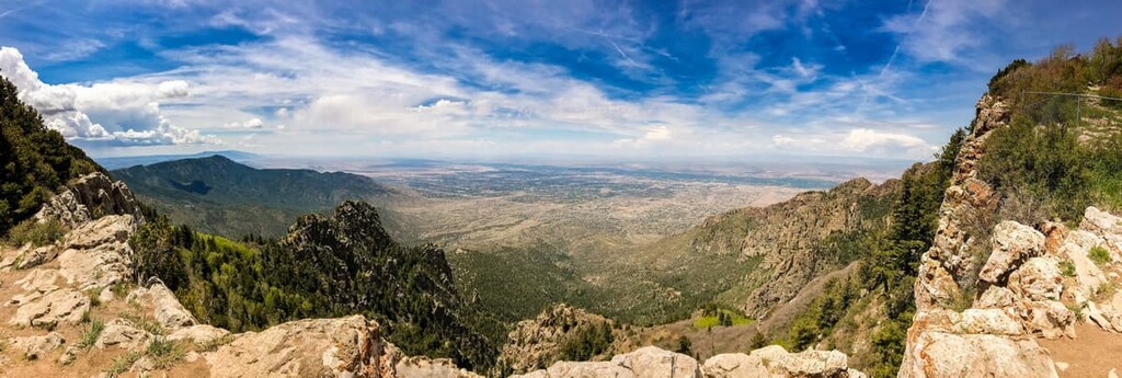
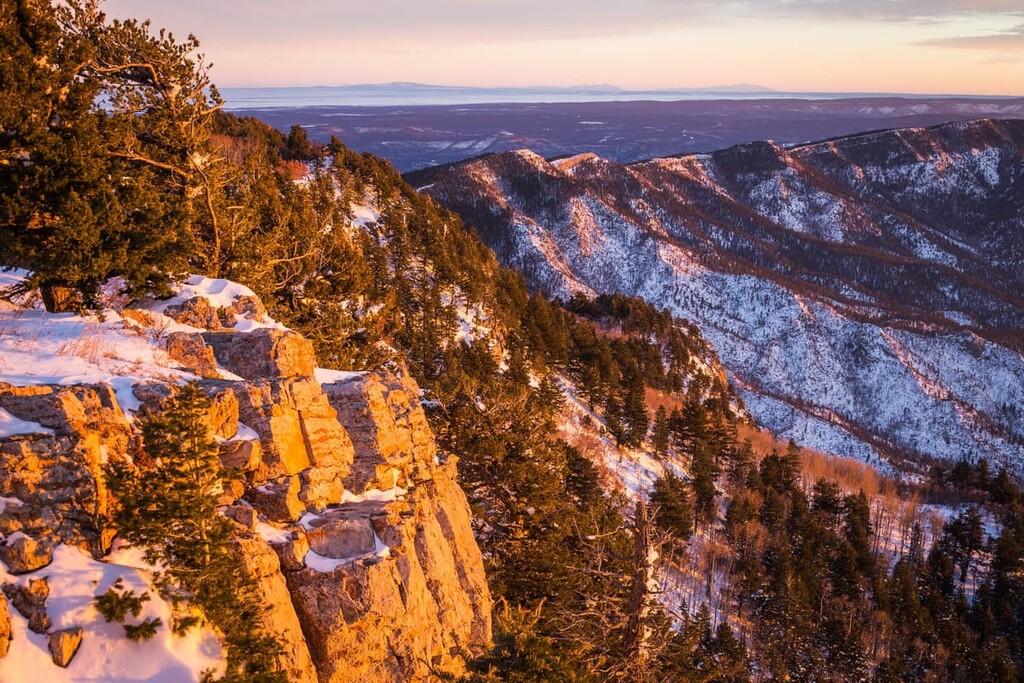
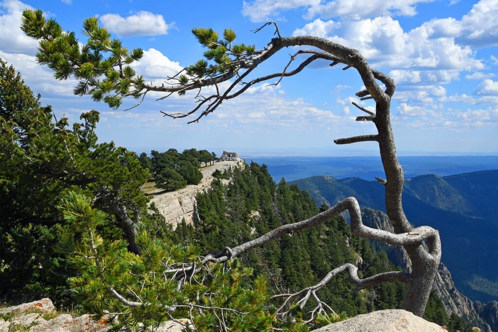
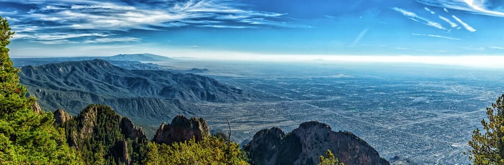
Home to rugged peaks, stunning panoramic vistas, and one of the world’s longest aerial tramways, the Sandia Mountain Wilderness is a hiker’s paradise on the outskirts of the city of Albuquerque in the US state of New Mexico. The Sandia Mountain Wilderness contains 17 named mountains, the highest and most prominent of which is Sandia Crest (Posu gai hoo-oo) at 10,679 ft (3,255 m) in elevation.
The Sandia Mountain Wilderness is a federally protected area located in the central part of the US state of New Mexico. It is located in Sandoval and Bernalillo counties on the eastern edge of the city of Albuquerque.
The wilderness contains a total of 37,877 acres (15,328 ha) of land. It is managed by the US Forest Service as part of the Cibola National Forest.
As its name suggests, the Sandia Mountain Wilderness is best known for its namesake mountain, Sandia Crest, which is also known as Sandia Peak and Posu gai hoo-oo in Southern Tiwa.
The peak’s English language name “sandia” derives from the Spanish word meaning watermelon. Meanwhile, its Southern Tiwa name Posu gai hoo-oo translates to “where water slides down the arroyo” in the language of the Sandia Pueblo (Tuf Shur Tia), whose ancestors have lived in the region since time immemorial.
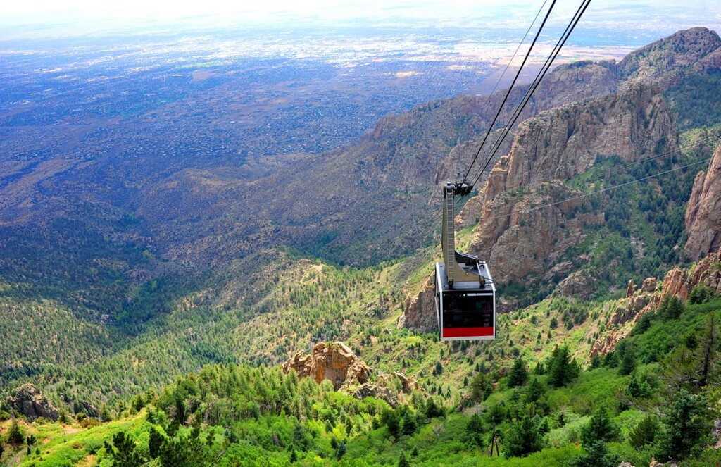
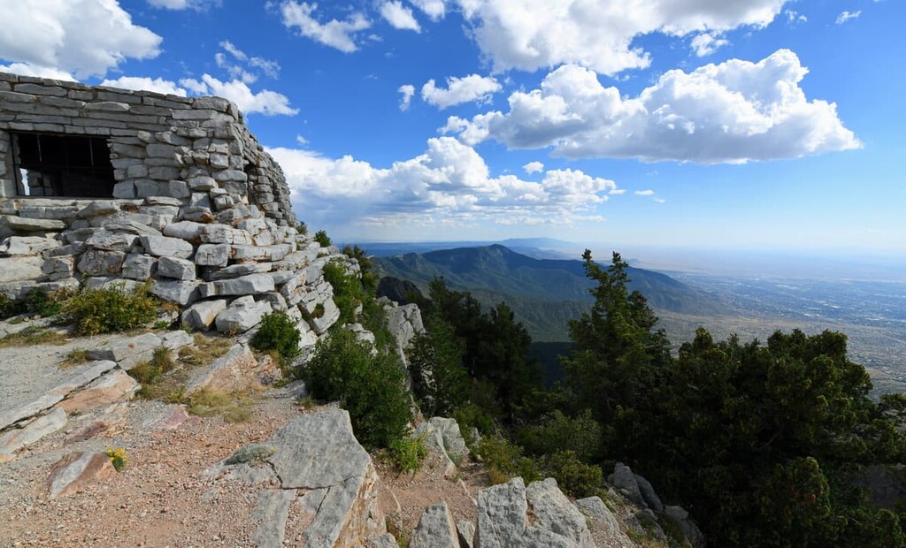
Additionally, the Sandia Mountain Wilderness is home to the famous Sandia Peak Aerial Tramway, which was constructed in 1966. The tramway stretches from the northeastern edge of Albuquerque and terminates near the summit of Sandia Crest.
At the top of the tramway, which is the second-longest in the world after the Wings of Tatev in Armenia, there are a number of great activities. This includes access to many hiking and biking trails, as well as the TEN 3 restaurant.
When compared to the relatively large expanses of federally managed land located in the northern part of New Mexico, such as the Carson National Forest and Santa Fe National Forest, the Sandia Mountain Wilderness is relatively isolated from other areas of public land. However, it is located within driving distance of places like the Manzano Mountain Wilderness to the south and Petroglyph National Monument to the west.
The peaks of the Sandia Mountain Wilderness are part of the Sandia Mountains. The Sandia Mountains are also known as Posu gai hoo-oo (Southern Tiwa), Kep’íanenemą (Northern Tiwa), Tsepe (Keres), Dził Nááyisí (Navajo), O:ku:p’į (Tewa), Kiutawe (Towa), and Chibiya Yalanne (Zuni).
The range is almost entirely located within the wilderness area. It is technically part of the larger Southwest Basins and Ranges, however the Sandia Mountains primarily formed through rifting. They are technically part of a single geologic unit that also includes the Manzano Mountains to the south.
Much of the range consists of granites, sandstones, and limestones which were uplifted alongside the formation of the Rio Grande Rift. It’s believed that the granite in the range formed approximately 1.5 billion years ago while the limestones and sandstones formed approximately 300 million years ago when the region was covered by a shallow ocean. However, the range itself didn’t form until approximately 10 million years ago.
One of the unique features of the Sandia Mountains is the range’s prominence over the landscape below. The range is isolated from most other mountain chains except the Manzano Mountains to the south. In fact, Sandia Crest has a prominence of 4,117 ft (1,255 m), which provides it with dramatic relief over Albuquerque.
Other major high points in the wilderness include North Sandia Peak, South Sandia Peak, The Needle, Whisky Peak, Hail Peak, and The Thumb.
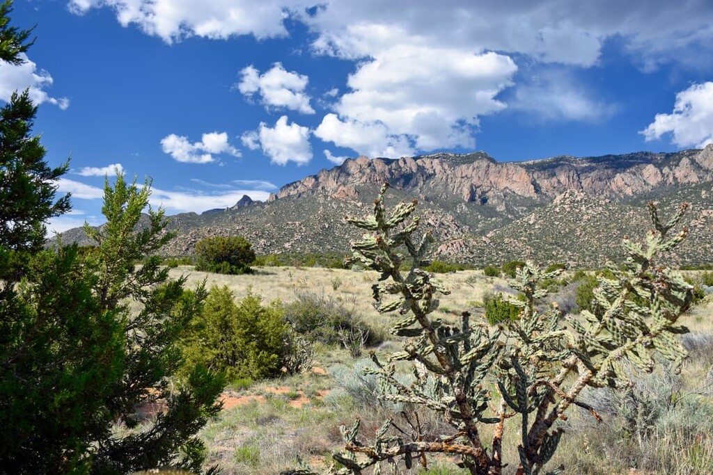
The Sandia Mountains Wilderness is almost completely located within the Arizona/New Mexico Mountains ecoregion. This region contains multiple ecosystems and plant communities that vary predominantly based on elevation and precipitation rates.
At the lowest elevation regions within the wilderness, the landscape is dominated by chaparral, desert grasslands, and juniper savanna.
Above this arid region, the ecosystems transition into a piñon-juniper-oak woodland interspersed with grassy areas This biological zone also includes some small evergreen shrubs and stunted trees such as desert mountain mahogany, gray oak, shrub live oak, and various yucca and cacti species, including the Engelmann prickly pear.
The middle elevations of the wilderness are a transition zone where stands of ponderosa pine and mixed with oaks, such as the gambel oak. Eventually the forest make-up here transitions further to feature white fir, Engelmann spruce, and the like.
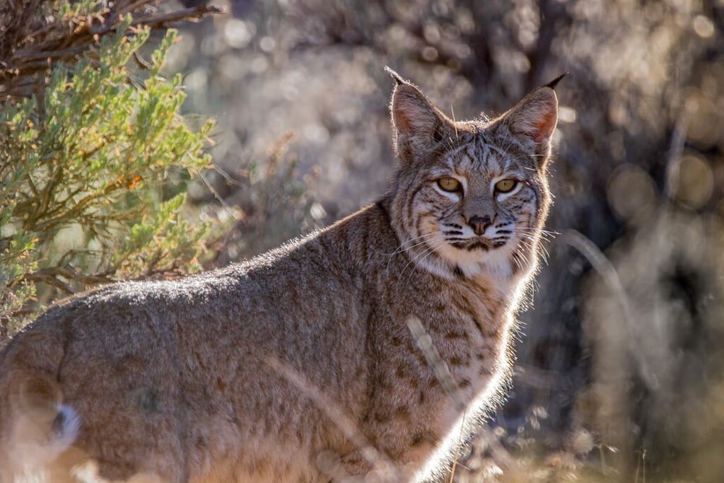
Additionally, the wilderness area is home to a plethora of wildlife. This includes black bears, bobcats, and mule deer. There have also been reports of mountain lions in the region, though sightings are not very common. The wilderness is also home to an assortment of birds, including Steller’s jays, canyon wrens, golden eagles, and greater roadrunners.
The land that is now part of the Sandia Mountain Wilderness has been home to humans for countless generations.
The region is the traditional territory and ancestral homelands for many Indigenous peoples, including the Sandia Pueblo (Tuf Shur Tia), Santa Ana Pueblo (Tamaya), San Felipe Pueblo (Katishtya), and Isleta Pueblo (Shiewhibak), among others. The contemporary Sandia Pueblo community is situated just to the west of the Sandia Mountain Wilderness.
Within the wilderness area, there are a number of important archaeological and cultural sites. One in particular, the Sandia Cave, is believed to date back some 9,000 to 11,000 years. The cave contains an array of important artefacts, including the remains of mammoths, camels, and mastodons.
The first peoples of European descent to venture into the region in and around what is now the Sandia mountain Wilderness were likely people from Spain, such as conquistador Francisco Vásquez de Coronado who traveled the region in 1540.
The Spanish sent a number of expeditions into the region during the sixteenth and seventeenth century. They established San Agustín de la Isleta Mission in 1613, just to the west near what is now Albuquerque. This was one of many missions in the region that attempted to forcibly convert Indigenous communities to Christainty.
In 1706, an outpost calle dLa Villa de Albuquerque was founded in what is now the city of Albuquerque as part of the kingdom of Santa Fe de Nuevo México. The community of San Miguel de Carnuel (now known as just Carnuel) was established just to the south of the modern-day wilderness area in 1763. It was later abandoned and re-settled in 1819.
The city of Albuquerque saw widespread growth during the nineteenth century, after the land was ceded to Mexico by the Spanish after the Mexican War of Independence in 1821. The region was later ceded to the United States after the Mexican-American War in 1848.
The US government established a number of forest reserves in the region around what is now the Sandia Mountain Wilderness in the late 1800s.
By 1927, the US Forest Service had built a dirt road that led to the top of Sandia Crest. This road was later paved in the 1960s. Technically the road lies outside the boundaries of the wilderness area, but it provides unparalleled access to the region.
Cibola National Forest, which contains the Sandia Mountain Wilderness, was established in 1931. Meanwhile, the wilderness itself was not created until the passage of the Endangered American Wilderness Act of 1978 (Public Law 95-287). The wilderness was later expanded in 1980 under Public Law 96-248 to its current boundaries.
These days, the Sandia Mountain Wilderness remains one of the most heavily visited wilderness areas in New Mexico due to its proximity to Albuquerque. Technically speaking, the Sandia Peak Ski Area and the Sandia Crest Scenic Highway are located just to the east of the wilderness area, but they provide exceptional access to the wilderness for all to enjoy.
The Sandia Mountains as a whole are home to over 200 miles (321 km) of hiking trails, including dozens of treks that are located within the wilderness area. Here are some of the top hikes to check out during your next trip to the wilderness:
Arguably the most scenic trail in the Sandia Mountain Wilderness, the La Luz Trail is an 8 mile (12.9 km) strenuous hike that climbs to the top of Sandia Crest where you get panoramic views of Albuquerque. The trail starts at the La Luz Trailhead where you will need to pay a fee for parking.
Most hikers on this trail complete the trek as a one-way adventure as they often opt to take the tram on the descent. Keep in mind that this trail, while scenic, has no water along the way. It can also be very hot on this trail, particularly during the summer months.
One of the region’s most iconic hiking trails, the South Crest Trail is a portion of the 26.5 mile (42.6 km) long Crest Trail that runs the length of the main ridge of the Sandia Mountains. The southern portion of the trail is approximately 16.1 miles (25.9 km) long from point-to-point, so it makes for a superb long day trip along the ridge of the range.
If you start at the trek’s southern trailhead at the Arrowhead Trail, you can complete this exciting hike as a one-way adventure. Doing so lets you hike to the tramway at the northern terminus of the trail, which you can use to descend down Sandia Crest and back to Albuquerque. Or, if you’re feeling adventurous, you could complete the entirety of the Crest Trail as an overnight trip.
Offering great views of the southern part of the wilderness, the Whitewash loop is a superb option for hikers that are looking to get off the beaten path. This 12.9 mile (20.7 km) trail starts at a parking area on Copper Avenue in eastern Albuquerque, just a few miles from the National Museum of Nuclear Science & History.
From the trailhead, this hike ventures into the Sandia Mountains backcountry, creating a large loop to Oso Pass. Keep in mind that this trail can be difficult to follow once you get a few miles away from the trailhead. So backcountry navigation skills are key for this hike.
The Domingo Baca Trail is a 7 mile (11.3 km) out and back trail that ventures from the Elena Gallegos Open Space parking area into the Domingo Vaca Canyon. This trail features a mix of landscapes, including sprawling desert and forested terrain.
One of the most interesting, albeit tragic, aspects of this trail is that it leads you to the crash site of TWA Flight 260. This flight departed from Albuquerque in February of 1955 and unfortunately crashed into the mountains due to an instrument malfunction. All sixteen people aboard the plane died in the crash, though wreckage of the crash is still visible along the trail.
There is a marker on the trail that serves as a memorial to the crash. All visitors are asked to respect the crash site and to leave the wreckage as is without disturbing it out of respect for the crash victims.
Beyond the crash site, it is technically speaking, possible to connect the Domingo Baca Trail to the La Luz Trail, but this requires extensive off-trail travel. Most hikers will stop to admire the view in the canyon and then head back toward the trailhead.
Looking for a place to stay near the Sandia Mountain Wilderness? Here are some of the best places to stay near the wilderness area:
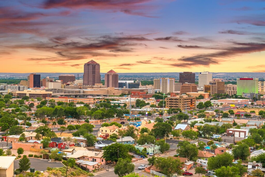
The most populous city in New Mexico, Albuquerque is a bustling metropolis that has no shortage of fun activities for visitors and locals alike. Albuquerque is home to approximately 560,000 people, which makes it one of the largest cities in the southwestern US.
Albuquerque is known for its fantastic cultural and historical sites, which include the city’s Old Town and its San Felipe de Neri Church. Additionally, the city hosts the Albuquerque International Balloon Fiesta every year in early October, which is a gathering of more than 500 hot air balloons that’s well worth checking out.
Also called the “gateway to the Turquoise Trail,” Tijeras is a small village of approximately 540 people located on the southern edge of the Sandia Mountain Wilderness. The community is situated at the intersection of two canyons and it is home to the Cibola National Forest headquarters.
Although Tijeras is small, its bustling town center is home to a number of great shops and services. You can also access the Tijeras Pueblo Archaeological Site from the town and you can hike on one of the region's many trails.
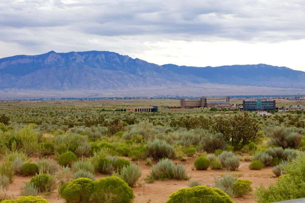
Situated to the northwest of the Sandia Mountain Wilderness, Rio Rancho is the largest city in Sandoval County. It is home to approximately 90,000 residents and it is a part of the greater Albuquerque metropolitan area.
Rio Rancho is home to Intel, which is the city’s largest employer. Its economy is driven by a number of banking, telecommunications, and technology companies, and it has become a popular tourist destination in the region in recent years.
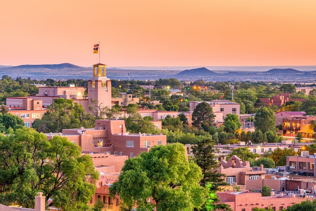
The capital and fourth-largest city of New Mexico, Santa Fe is a community of some 85,000 people located to the north of the Sandia Mountain Wilderness. Santa Fe was founded as the capital of the Kingdom of Santa Fe de Nuevo México by the Spanish conquistadors in 1610, but it has been home to Indigenous nations since time immemorial.
Santa Fe is considered to be one of the best art cities in the US, thanks to its many galleries and studios. The city is also home to the Georgia O’Keeffe Museum, as well as dozens of historic and cultural sites.