Scan the QR code and open PeakVisor on your phone
Eastern Taiwan’s garden of deciduous glory, Fuyuan National Forest Recreation Area (富源國家森林遊樂區), is home to a jungle of low-elevation trees. Bazi Shan (拔子山) is the only named peak in the forest, and it stands at an elevation of 1,660 meters (5,446 ft).
Fuyuan National Forest Recreation Area lies in the Fuyuan Village of Ruisui Township (瑞穗鄉) in Hualien County (花蓮縣) of eastern Taiwan. It contains a total of 191 ha (472 acres) of land.
The ecologically diverse Fuyuan National Forest Recreation Area contains Taiwan’s largest camphor grove and virgin broadleaf forest. It is often referred to as Butterfly Valley due to the density of butterflies that swarm its woods every spring and summer.
This low-lying forested area contains elevations that range between 225 to 750 meters (738 to 2,460 ft). Thus, the plant life in the forest is dominated primarily by hardwoods that thrive in humid temperatures. The average yearly temperature of this forest is a comfortable and warm 23°C (73°F).
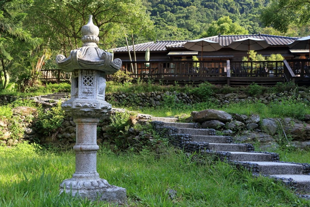
Visitors flock to Fuyuan to see its verdant woodland trails, captivating waterfalls, and its diverse wildlife. Many also visit in order to experience the tranquil and restorative effects of forest bathing. Fuyuan offers a hot spring bath surrounded by wild foliage that’s accompanied by the echoing choir of locusts and sweet birdsong for those seeking ultimate relaxation.
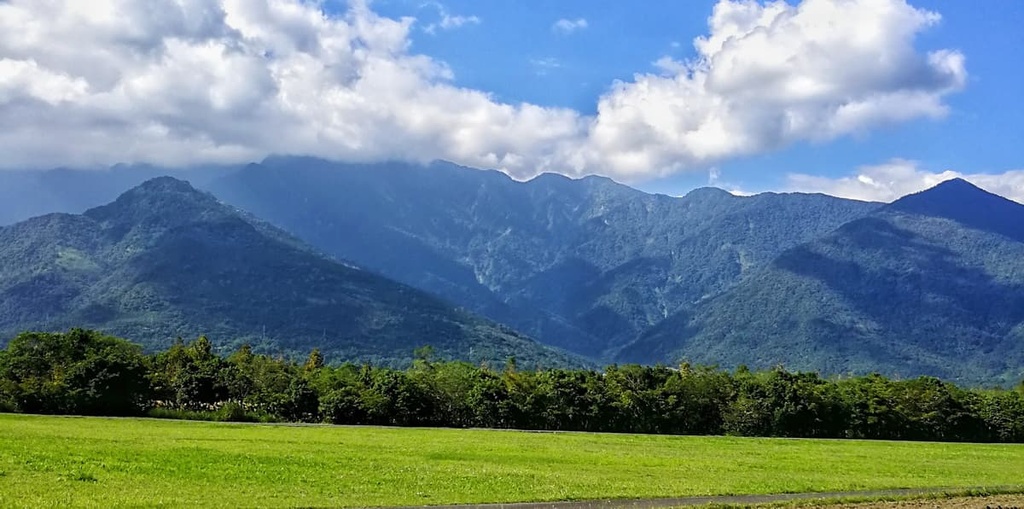
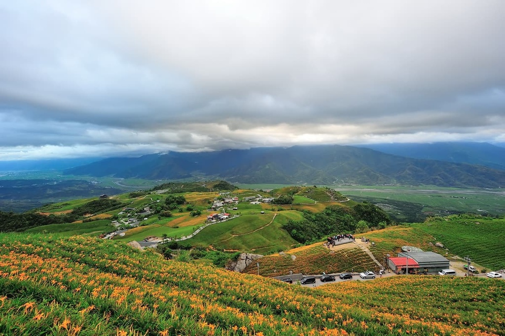
The Fuyuan River (富源溪) winds its way through the forest, adding a snaking sapphire shade to Fuyuan’s eternally emerald world. The nearby hills also undulate gently into the distance.
Wedged in Taiwan’s pristine Huadong Valley (花東縱谷), Fuyuan National Forest Recreation Area is surrounded by natural beauty. The Central Mountain Range (中央山脈) borders the forest to the west and the Hai’an Range (海岸山脈) flanks it to the east.
There are many places of interest near to Fuyuan National Forest Recreation Area. To the west is Danda Major Wildlife Habitat (丹大野生動物重要棲息環境) while the Huadong Coastal Reserve (花東沿海保護區) is located to the east.
Situated to the north of Fuyuan is Lintian Mountain Forestry Culture Park (林田山林業文化園區), once a significant logging base during the Japanese Occupation Era. The Xiuguluan River (秀姑巒溪) is a hotspot for adventurous white water rafting enthusiasts that’s located to the south of the forest.
Fuyuan’s sole peak, Bazi Shan, is part of the Hai’an Range. Also known as the Coastal Mountain Range, the Hai’an Range’s rolling hills were once underwater mounds that gained height by accumulating sediment.
While the more rugged mountains like Yushan (玉山), Xueshan (雪山), and Xiuguluan Shan (秀姑巒山) are the result of volcanic activity, eastern Taiwan’s hills are primarily sedimentary in origin.
A thriving broadleaf forest dominates Fuyuan’s forest. Tree species such as Taiwan crepe myrtle, rhododendron, banyan, and camphor can be found throughout these low-lying woodlands.

In fact, Fuyuan National Forest Recreation Area contains Taiwan’s largest camphor grove. The grove measures approximately 70 ha (173 acres) in area.
As the region is warm and humid, a wealth of epiphytes flourish in the forest, too. This includes species such as the fern Lomariopsis cochinchinensis and the weeping clubmoss.
The aptly named Butterfly Valley also contains around 30 species of butterflies, such as the blue-banded swallowtail, owl butterfly, and the broad-tailed swallowtail. Additionally, in the summertime, fireflies illuminate the night skies by twinkling like Christmas lights.
Bird watching is a popular activity in Fuyuan, too. The forest is home to birds such as the Taiwan magpie, Taiwan laughing thrush, blue tit, and yellow tit.
Fuyuan National Forest Recreation Area lies at the eastern edge of the 105 km (65 mi) Guanmen Ancient Road (關門古道). Built by the Qing Empire in 1887, the road was designed to connect Nantou County (南投縣) to eastern Taiwan via a mountain road. It was also created to oppress the indigenous Taiwanese people, particularly the Bunun, who traditionally lived in the mountains.

The Guanmen Ancient Road trails through the high Central Mountain Range, passing the summit of Guanmen Shan (關門山) to reach the eastern coast of the island. To suppress the Bunun people, the Qing Dynasty instructed troops to surveil the tribe from the road.
During the Japanese Occupation Era, the Japanese employed a similar tactic, patrolling the ancient road in order to keep a close eye on the Bunun.
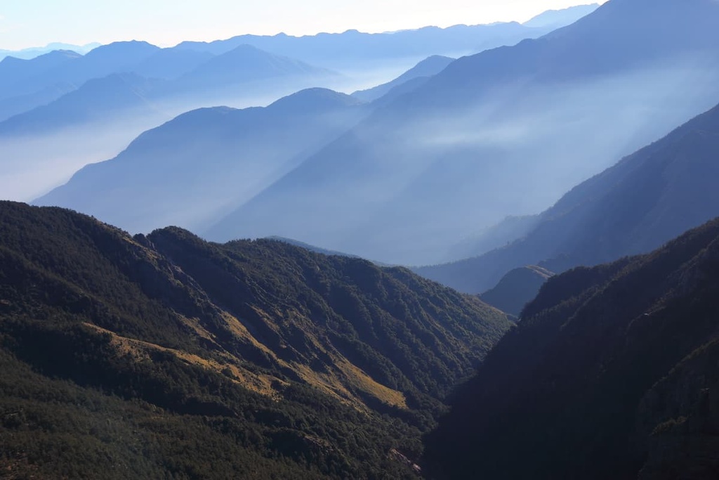
Known as ‘Taiwan’s last secret,’ the road was the last eastbound mountain passage that the Qing Empire created through the impenetrable Central Mountain Range. The Guanmen Ancient Road boasts a pristine environment of virgin forests, untouched scenery, and an unyielding mountain road of undulating terrain that provides excellent views of Taiwan’s backcountry.
Visitors are spoiled for choice when it comes to hiking in Fuyuan National Forest Recreation Area. Here are some of the best hikes and destinations to check out during your visit.
The Fuyuan Forest Trail is 8.4 km (5.2 mi) long and it takes you through dense, luscious woodlands along the Fuyuan River. This trail takes you into the pristine Fuyuan River Valley, with its giant boulders, rushing waters, and wild shrubbery.
Along the way, you’ll get to cross the Fuyuan Suspension Bridge, which takes you through a dense jungle of camphor trees and enchanting varieties of ferns. The foliage on the trail creates an emerald tunnel, transforming the otherwise sunny and exposed river to a shaded, vibrant green path of wilderness.
Visitors may spot birdlife along this leafy trail while being serenaded by merry birdsong with a backtrack of the gentle wind rustling the forest's foliage.
Many visitors also come to this trail to forest bathe in the fragrant camphor forest, which oozes with the wooded aromas of phytoncides. Walking in these leafy woodlands is believed to heal one's mental state like you would by taking a long, warm bath.
The path then crosses the famous Longyin Suspension Bridge. From here, visitors can admire the surrounding overgrown environment of hardwood forests and the meandering turquoise Fuyuan River as it glistens under the radiant Taiwanese sun. In addition, visitors can marvel at the silky Longyin Waterfall while on the bridge.
One of Fuyuan's main attractions, Longyin Waterfall, makes a 30 meter (98 ft) drop near the trail, creating a dramatic scene of nature's force in the picturesque Fuyuan Valley. A vivid rainbow generally hangs over the falls in Taiwan's ever sunny weather, thanks to the cascade's abundant vapor.
As the Fuyuan River plummets over these towering cliffs, the waterfall's misty spray charges the verdant environment with negative ions, which are believed to be a source of mental wellbeing and calm. The intense sound of water falling adds to the tranquil effects of nature's soulful music along the trail.
The trail then steepens as you venture up Bazi Shan. Visitors can admire the dense woodlands of Huanxi monkey trees (Sloanea sinensis) along this part of the trail. Bazi Shan’s summit observation deck boasts excellent views of the surrounding terrain.
Butterfly Valley is a much-loved spot, as there are many opportunities to see Fuyuan's 30 butterfly species in this area. In addition to butterflies, visitors can admire the floral gardens of rhododendron and flourishing orchards that attract these winged insects.

A chorus of crickets also adds a tranquil melody to the firefly's glow in the warm summer nights, illuminating the dark sky with golden orbs of moving light.
Fuyuan National Forest Recreation Area is one of Taiwan’s only forest areas that houses a thermal spa. Indeed, visitors can unwind by relaxing soaking in the Butterfly Valley Hot Springs.
Here, a vibrant camphor forest envelopes the hot springs, allowing visitors to feel immersed in nature and far away from their city life stressors. Visitors can soak in the steaming 60°C (140°F) water, which is infused with sodium bicarbonate minerals. This area is also particularly well known for its abundance of butterflies.
The trek down the Guanmen Ancient Road begins in Xinyi Township (信義鄉), Nantou County. This difficult 105 km (65 mi) path takes you from its lowest point at 400 meters (1,312 ft) in elevation all the way to its high point at 2,996 meters (9,829 ft) in elevation as you make your way through the Central Mountain Range.
Kashe Dashan (卡社山) is the first peak on a climber’s itinerary. Slatted slate house ruins remain in the mountains, evidence of the Bunun’s presence in these fertile forested hills. The views from Kashe Dashan and the mountain road to Lafulang Shan (拉夫郎山) are particularly amazing.
The path then dips drastically to the meandering Danda River (丹大溪), which hikers must cross to ascend Luantan Shan (巒潭山). Along this section of the trail, woods are so dense with Taiwan red pine that it’s difficult to see the sky overhead.
Hikers continuously scramble up steep slopes and carefully descend the overgrown cliffs across Tongke Shan (佟可山) to the peak of Guanmen Shan. From the summit, you can see Guanmen Beishan (關門北山), Danda Shan (丹大山), and Dongjudashan (東郡大山) in the distance.
On the way to Luntaiwen Shan (倫太文山), which is located upstream of the Danda River, is a hot spring with simmering waters that are hot enough to boil eggs! The trail then brings you to the overgrown Bazi Shan before it heads to a trailhead in Hualien County.
For vast views of the Huadong Valley, consider the leisurely Fuxing Hiking Trail. With a total distance of only 670 meters (2,198 ft), this trail makes for the perfect short day trip.
Along this trail, a thicket of bamboo emerges, creating a tunnel through the initial segment of the trail. The forest then transitions into a woodland of Taiwan red pine that obstruct any views of the surrounding area. However, citrus orchards attract butterflies to the region, a delightful sight for nature enthusiasts.
As hikers near the highest part of the trail at 320 meters (1,050 ft) in elevation, they can enjoy a sweeping panorama of the emerald rolling hills of the Huadong Valley.
The former logging village of Lintiashan (林田山) is a historical site that provides a glimpse of what life was like when forestry was at its peak in the region. Here, original Japanese structures still stand, and Taiwan officials have impeccably restored the wooden cypress buildings, making for a truly unique experience for the history buffs among us.
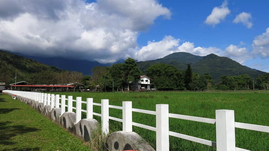
As the village is nestled in the valley of the Central Mountain Range, a dramatic landscape of imposing grand mountains encircles the town. In its heyday, the Lintian Mountain village was home to 2,000 residents; however, that number has dwindled to only 150 people due to the cessation of logging in the region.
Areas of interest at Lintian Mountain Forestry Cultural Park include Zhongshan Hall, disused railway tracks, and old train carriages. Zhongshan Hall was the Japanese town's community center, which showed films and housed social gatherings.
Japanese builders constructed the entire building from wood, from the outer shell to the décor inside. Neat wooden planks line the walls, with the floor covered with cypress timber. Wooden slats hold up the wooden paneled roof, while inside, the stage, chairs, and tables were made from cypress.
Visitors can trace the winding mountain railroads that once transported felled logs to Hualien. You can also admire the spectacular views of the low-lying forests, shaded valleys, and the grand surrounding mountains of Pinglinshan (平林山), Xiangshan (向山), and Xifenglinshan (西鳳林山) from the town.
Visitors to Fuyuan National Forest Recreation Area can opt to stay in the nearby Hualien City (花蓮市) or the smaller Ruisui Township.
Hualien City is located on Taiwan’s east coast and it provides a slow-paced, calming vibe where visitors can relax into the city’s dreamlike charm but still look forward to the countless attractions it offers.
One of Taiwan's main attractions, Taroko National Park (太魯閣國家公園), boasts an unspoiled environment of deeply cut valleys with sheer marble cliffs. The park also contains a diversity of trials, so there's something for everyone to enjoy during their stay.
While in the city, you can also check out Hualien County's largest lake, Liyu Lake (鯉魚潭).Hualien's answer to the more popular Sun Moon Lake (日月潭), Liyu Lake, reflects the nearby verdant peaks and azure skies on its calm surface. There’s also a 4 km (2.4 mi) long boardwalk that you can follow around the lake.
Hualien City is also the starting point of the 180 km (111 mi) long Huadong Coastal Reserve, which ends in Taitung City (臺東市). This reserve features a fascinating selection of rock formations, coastal hills, and ancient caves along the eastern coast of Taiwan.
For impressive views of Hualien City's coast, head to the historic and well-maintained Pine Garden. It's a grand building that once hosted farewell parties for kamikaze pilots during the Japanese Occupation Era. From the front lawns, visitors can relax with a picnic while admiring the expansive shore where the sandy bay and the Pacific Ocean merge.
Hualien is also famous for its mochi (麻糬), a sticky rice treat that resembles the chewiness of jelly sweets. Hualien's local Amis people first steam the rice, making it soft and gluey before pounding it into a paste and adding red beans, peanuts, or even fruit as its center. Flavors can range from matcha, taro, peanut, watermelon, strawberry, and mango.
A popular stop in the Huadong Valley, Ruisui Township is small in size but packs a punch for anyone that’s looking for things to do.
However, one cannot visit this jewel of a town without a relaxing soak in a thermal spa. As Ruisui Hot Springs is set in the remote Ruisui Township, the only sounds one can hear in the verdant valley are the lovely lullabies of birds, cicadas, and the gentle wind.
Alternatively, the Xiuguluan River is a well-known adventure spot near the town, and its raging rapids create the perfect environment for white water rafting. With a course of 24 km (15 mi), thrill-seekers can ride the Xiuguluan River’s wild waves through narrow canyons and verdant green riverside foliage.
A relic from the Stone Age, the Wuhe Stone Pillars are a popular historic site in Ruisui. Steeped in Amis legend, the Wuhe Stone Pillars are believed to be the ancestral home of the Amis people. Here, giant boulders of 5.7 meters (18 ft) and 4 meters (13 ft) stand tall, a true marvel for history buffs.
Visitors to Fuyuan National Forest should first make their way to Hualien City via the local express train (TRA).
Once in Hualien, take the Eastern Main Line train that heads for Fuyuan. After you arrive in Fuyuan, take the Fuyuan shuttle for 3 km (1.9 mi) to Fuyuan National Forest Recreation Area.
For those driving from Hualien, it is a 60 km (37 mi) journey to Fuyuan National Forest Recreation Area.