
Scan the QR code and open PeakVisor on your phone
Cinque Terre National Park is a land of stunning and rugged coastlines, steep mountains, and rich history located on the western coast of Italy. The park encompasses some of the most beautiful landscape within the country and is a popular tourist destination. There are 23 named mountains in the park. The tallest and most prominent is Monte Malpertuso at 819 m (2,687 ft) with 391 m (1,283 ft) of prominence.
Cinque Terre National Park (Parco Nazionale delle Cinque Terre) is situated along the northwest coast of Italy within the province of La Spezia in Liguria. The park stretches along the region’s coastline covering just 39 sq km (15 sq miles), making it one the smallest national parks in the country.
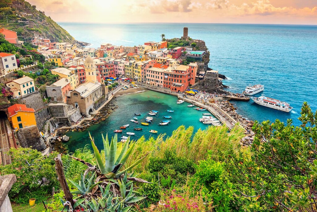
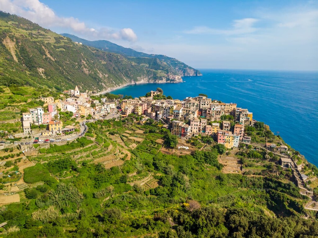
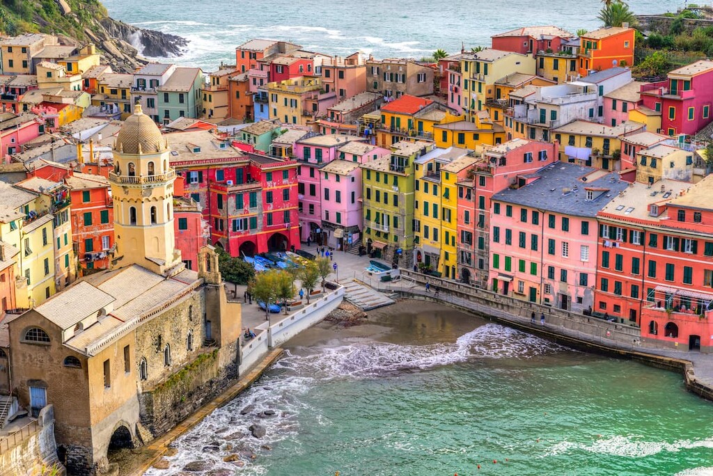
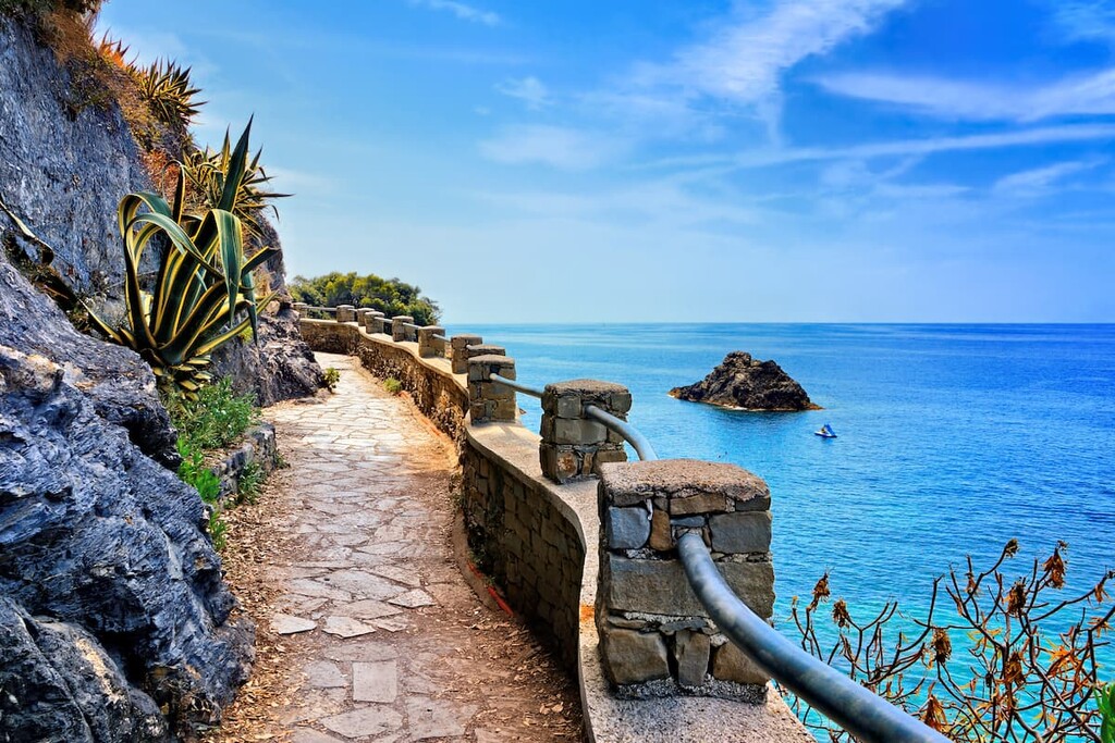
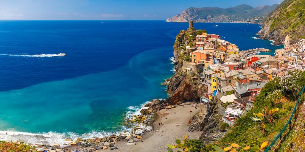
Within the park lie five coastal towns along the Ligurian coast: Riomaggiore, Manarola, Corniglia, Vernazza, and Monterosso al Mare. The national park encompasses the surrounding land and provides a network of trails that connect these small communities. The coastline marks the western boundary of the park as it is met with the rugged and steep cliffs that are typical in the region.
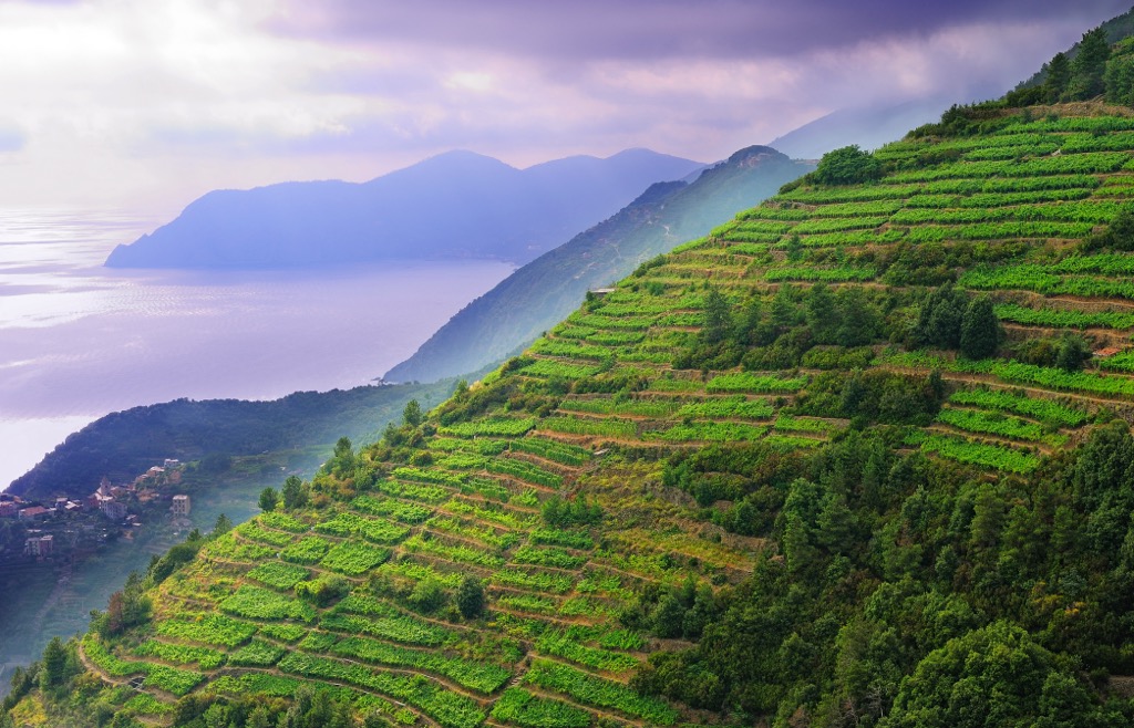
Much of the land in close proximity to the villages is terraced for agriculture purposes. The towns are nestled into small bays and pockets while the rest of the coast line drops off steeply into the ocean.
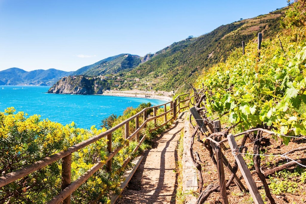
The steep and forest cliffs between the five cities have resulted in very few roads being built in the region. While agriculture can be seen in some sections of the park, the hiking trails wind through the land, climbing steeply up the coast cliffs.
Additionally, Cinque Terre National Park is located near other popular outdoor recreation areas, too. These places include Montemarcello-Magra, Regional Natural Park of the Apuan Alps, and Aveto Natural Regional Park.
Cinque Terre National Park has a rich geological history. The Maritime Alps form the western portion of the park while the Ligurian end of the Apennines dominate in the east.
The dramatic relief of these peaks are one of the defining geological features of the park. Within 5 km (3 miles) of the coastline, the peaks rise over 1,100 m (3,600 ft).
There are three major lithologic divisions within the national park: Ligurian units, Sub-Ligurian units, and Tuscan units. The peaks of the park began forming when the European Plate collided with the Tuscan sediments left by the Adriatic Plate. The inland Tuscan unit overthrusted itself leading to numerous folds in the rock.
The Ligurian unit dates back to the Jurassic through Paleogene periods and consists of preserved marine sediment. The Sub-Ligurian unit spans from the Paleocene to Miocene epochs. Today this unit is defined by marine limestone and sandstone. The Tuscan unit is situated on the northern edge of the Adriatic Plate and is 4 km (2.5 miles) thick.
Major peaks within the park include Monte Malpertuso, Monte Capri, Monte Cuna, Monte Pizzolo, and Monte Gaginara.
Despite the relatively small size of Cinque Terre National Park, the region is home to a diverse range of Mediterranean flora. Pine trees, along with cork and chestnut, can be found throughout the forested hills of the park.
The rocky environment along the coastline is home to samphire and sea cineraria. Elsewhere in the park, visitors can find lavender, rosemary, thyme, and helichrysum. Rocky environments in the park are also home to numerous other species of succulents.
Although the villages within the park are often full of tourists, the sparsely populated hillsides are home to numerous animal species. Gulls, peregrine falcons, and ravens are common throughout the park.
Mammals regularly found in the region include dormouse, marten, mole, badger, wild boar, and fox. The wild boar is known for damaging the crops of the region. Reptiles such as the common wall lizard, rat snakes, grass snack can be found throughout the park, as can various species of frogs and salamanders.
Human history in the Cinque Terre dates back to the Bronze Age, around 3300 BCE to 1200 BCE. Remains of tools and bones showcase the region's long human history. Populations in the region steadily grew during the Roman Empire.
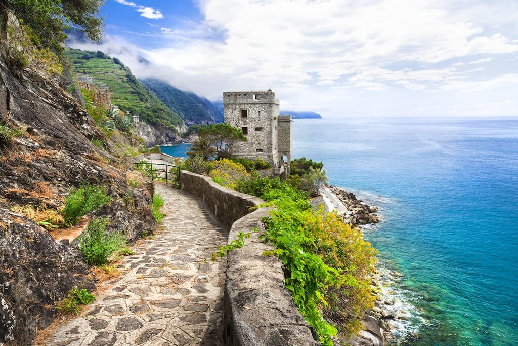
Later in the eleventh century, the region was ruled by the Obertengo family of Tuscany. It was around this time that local communities began terracing the land in order to grow crops. Watchtowers were built in the cities to help spot pirates who would often attack the cities.
During the twelfth century, the region became part of the Republic of Genoa. Around this time, it also became a prominent wine-producing region. The term Cinque Terre began being used during the fifteenth century. It translates to “Five Lands,” a reference to the five coastal villages in the region.
The production of wine in the area increased during the 1800s. When Italy was unified in 1870, the subsequent construction of many railways allowed the villages to be far more accessible to the outside world. Cinque Terre became a popular tourist destination in the 1970s after it was written about in a local travel guide.
Tourism is now an integral part of the region’s economy. Cinque Terre became a UNESCO World Heritage site in 1997 and the national park was founded in 1999.
Cinque Terre National Park is home to numerous trails and other opportunities for outdoor recreation.
The park itself is free to visit and the bulk of the park’s trails are free to access. However, the two most famous trail sections, Monterosso–Vernazza and Vernazza–Corniglia, require a paid permit to access.
The most cost-effective way to access these trails is to get a Cinque Terre Trekking Card, which you can get in the local villages. If you also want to take the train in the region, you can get the Cinque Terre Train Card, which gives you unlimited access to the train lines and to the paid trekking paths.
With that in mind, here are some of the top hiking areas to visit in the park:
The Blue Path Trail is the longest trail in the park, spanning all five cities. The point to point route spans 12 km (7.5 miles) and rises steeply up into the hills above the quaint villages.
The trail is often completed starting in Riomaggiore and ending in Monterosso. Hikers can walk through each village or take a train to bypass certain sections of trail.
The Riomaggiore Ring Trail encircles the city of Riomaggiore. This route is 3.5 km (2.2 miles) and more accessible than many of the steep trails throughout the hills of the park. Hikers are provided with views of both the dramatic cliffs and the city.
The Vernazza to Monterosso section of the Azure Trail is known for being one of the most beautiful hiking opportunities in the entire park. However this 3 km (1.9 miles) route is also one of the most difficult sections. The trail can be completed in either direction but is often started in Vernazza.
The winding trail showcases the steep cliffs that drop off one side of the trail. Vegetation can be found throughout along with viewpoints that on a clear day showcase the other cities in the nearby distance.
Looking for a place to stay near Cinque Terre National Park? Here are some of the best cities and villages to check out in the region:
The five villages in Cinque Terre National Park are excellent places to stay when visiting the region. Here’s what you need to know about each of the five villages:
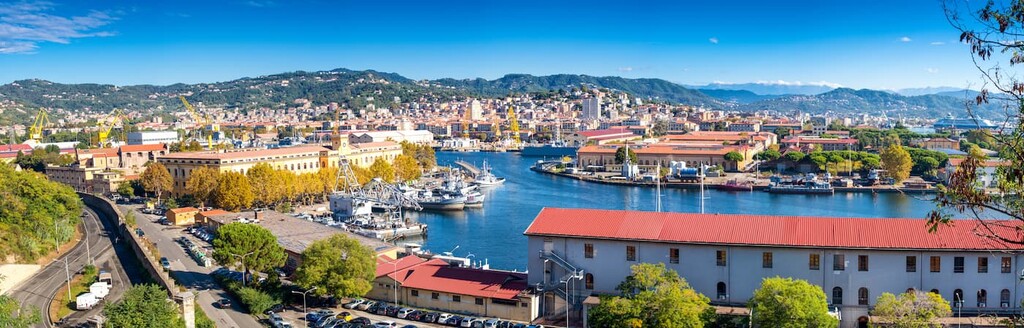
The city of La Spezia is situated on the coast just south of the Cinque Terre. The city is home to numerous hotels and is also close to Pisa, Florence, and Genoa, all of which are accessible via train.
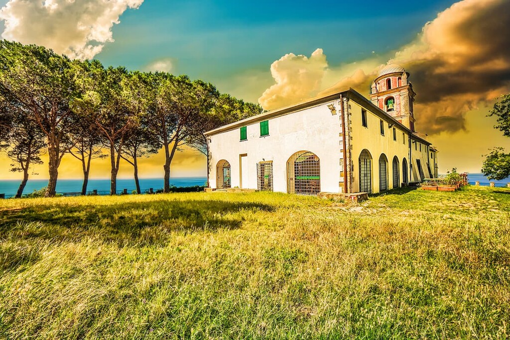
Popular tourist destinations within the city include the Basilica of Santa Maria Assunta, San Giorgio Castle, Isola Palmaria and Ponte Thaon di Revel. A short train ride will take tourists from La Spezia into any of the villages within the Cinque Terre.
The inclusion of Cinque Terre in the UNESCO World Heritage List in 1997 has added a lot of new visitors to an already popular place, which also led to the creation of a national park of the same name just two years later in 1999. Today, like Venice, it suffers from over-tourism: there are not just many visitors, but too many.
I asked an outdoor writer from northern Italy, Ivan Kuznetsov, to compile some similar places you can consider visiting as alternatives to Cinque Terre:
"No doubt all five villages that make up the Cinque Terre are incredibly interesting for the traveler—otherwise they simply wouldn’t be world-famous. But they are not absolutely unique. In Italy, you can visit many similar places, especially if you have planned a trip for the peak tourist season, which, as in other countries, falls here in the two summer months: July and August. I suggest two options.
First, you can choose one or more of the Cinque Terre-like villages near the park. All of them are also located on the coast of the Ligurian Sea on its equally picturesque shores.
However, many people have asked the same question a long time ago, so even many of these places have already become attractions—that’s how popular Cinque Terre is. So, I would advise you to go to other parts of Italy looking for something similar. As I'm from the north of Italy, I will make an example from my region.
A great alternative to the Cinque Terre in this part of the country is the eastern coast of Como Lake in Lombardy. Yes, it is also very famous, but given the greater length of the coast (40 km / 24.8 mi vs. 15 km / 9.3 mi ), you can find less touristy places here.
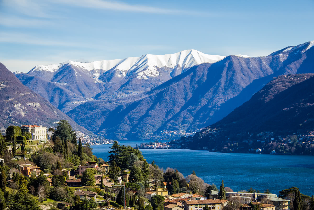
As in Liguria, on the shores of the wide and long glacial lake with high rocky shores, there are many picturesque villages, the main ones of which are (from south to north) Abbadia Lariana, Mandello del Lario, Lierna, Varenna, Bellano, Dervio, and Colico. The most touristy place of all is Varenna, from where you can get to the even more famous Bellagio village by boat, situated on a peninsula jutting out into the lake, so I would avoid it unless you want to find yourself among hundreds of other travelers.
There are three other things in common between Como Lake and Cinque Terre National Park, and about the same differences can be counted in favor of the former:
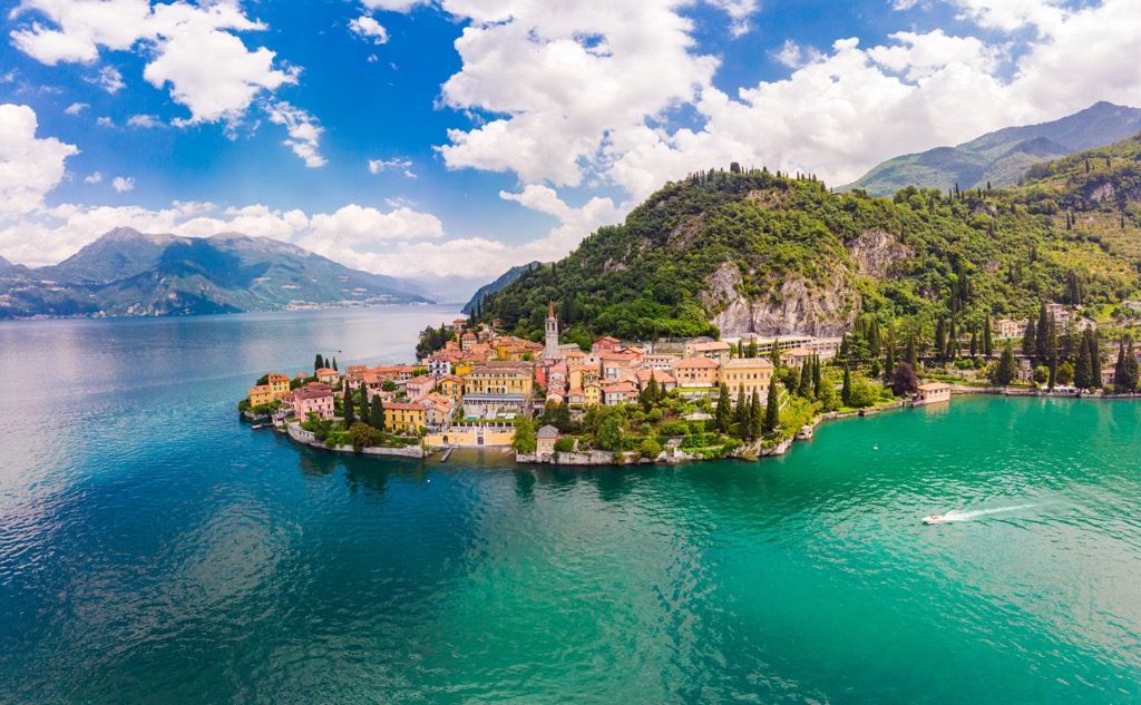
All in all, a trip to Como will give you a very similar experience, and in many moments I would even prefer a trip here than to Liguria. So, in my opinion, Como can be considered a great alternative to the place in the title of this guide. I would even call it the "Cinque Terre of Northern Italy".


