An Overnight in Whistler’s Alpine Sanctuary
Below the spire of the Garibalidi Range’s tallest mountain and cradled in a granite basin lies one of British Columbia’s most awe-inspiring alpine lakes.
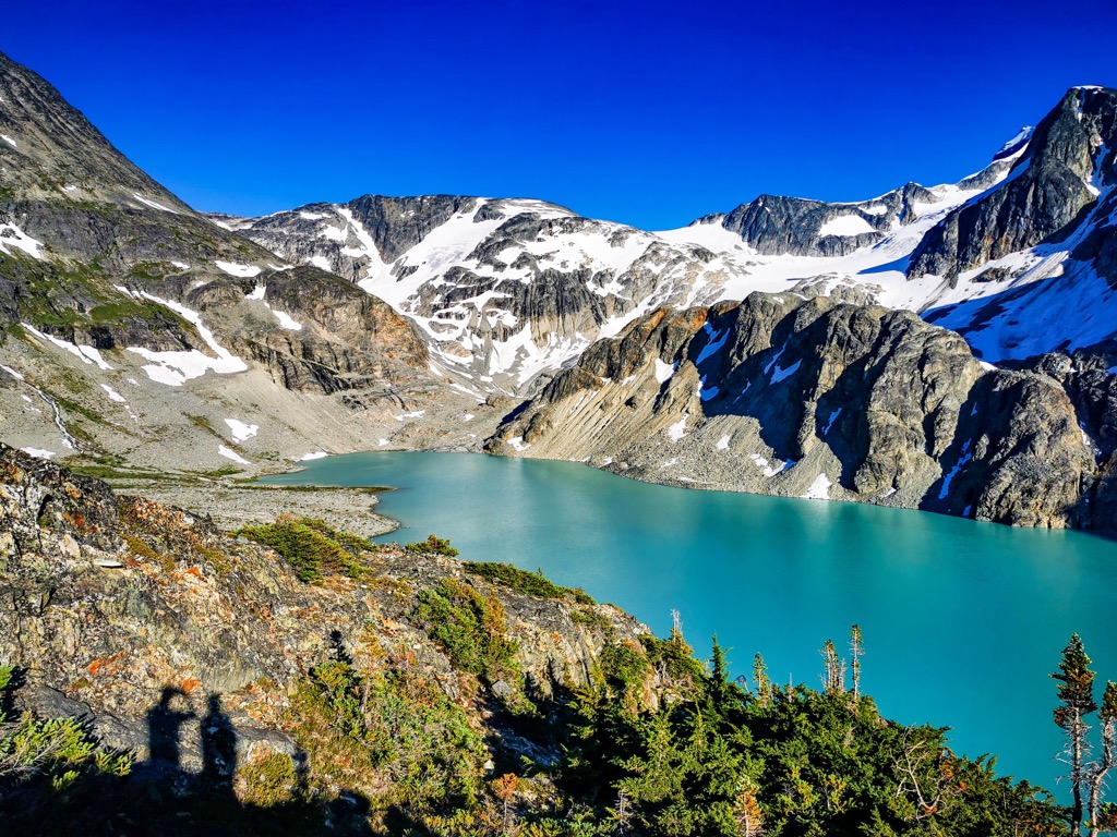
Wedgemount Lake, situated on the outskirts of the world-renowned ski town of Whistler, Canada, is nestled in a glacially carved bowl surrounded by the Wedge, Parkhurst, Rethel, and Weart Mountains.
Its rich turquoise waters, fed by the Wedgemount and Armchair glaciers, complement towering rock and snow above. The vivid array of colors is a visual spectacle, an inspiration to those fit enough to witness this alpine gem in person.
Although Whistler attracts over 3 million guests annually to explore the beauty of the Coast Mountains, few will consider tackling this monster. The hike is not for the faint of heart, especially if you’re planning an overnight at the alpine campsite. Even though it’s a short 7 km (4.3 mi) trek up, you’ll encounter a staggering 1,300 m (4,265 ft) change in elevation.
The hike starts steep and does not let up. Through old-growth forest, wildflower-filled mountainsides, and following frenzied rivers, it’s a relentless push up an average gradient of over 20%. However, once you crest over the infamous final boulder field and your eyes shift away from your feet, you’ll forget about the grueling journey as an inner peace sets in.
Whether you choose a day trip or to stay overnight at this Canadian gem, let this locally inspired guide uncover everything you need to know to plan a memorable visit to the mighty Wedgemount Lake.
Trip Planning
Given the steepness of the hike, it’s less busy, and day passes are not required. If your interests lie in overnight camping at the lake, you will need to reserve one of the 20 tent pads in two locations around the lake.
Wedgemount Lake is a serious backcountry route, and backcountry experience is required. You’ll encounter sudden and extreme shifts in weather, be exposed to bugs, wildlife, and intense sun, all while lacking cellphone service. Adequate planning is the best way to ensure a safe and enjoyable backcountry trip.
Our trip to Wedgemount Lake consisted of an overnight stay at the lake during late July. Although we started at 6:00 a.m., the temperature soared to 32°C (90°F) by 10:00 a.m., yet plummeted to 3°C (37°F) at night. The extreme temperature shifts mean you’ll need to pack for colder nighttime temperatures, even if it’s blazing hot in the valley. A warm-rated sleeping bag and a high R-value sleeping pad are essential, along with thermals and a puffy or lightweight jacket for evenings. Rain and snow are also factors; weather can shift fast in the high mountains, and you should always be prepared with a waterproof layer, even if there’s nothing in the weather forecast.
That said, another factor to consider for an overnight trip to Wedgemount Lakes is packing light. Every gram counts on this hike. Luckily for water, there’s no shortage of rivers and cold glacial streams to rely on up here. I use a Katadyn BeFree 1.0 L microfilter. It’s the best thing I’ve bought for backcountry use, allowing you to quickly filter water instead of hauling it up the mountain.
Other Items we brought:
- Lightweight 2-person tent
- Jetboil stove and fuel
- Cookware and utensils
- Dehydrated meals for dinner/breakfast
- Additional calorie-rich snacks
- Bear-proof food storage
- Garbage bags
- Headlamp
- Water filter
- Bear spray
- Sunscreen and bug spray
- Hiking poles
- Garmin inReach
- Toilet paper and essential toiletries
- Facecloth & quick-dry towel
- 2 pairs of socks
- Flipflops
- First-aid kit
The only thing I’d add, which I hadn’t acquired yet, is an ultralight backpacking chair. A sleeping pad can also do in a pinch, but after a hard climb, the last thing you want to do is sit on rocks.
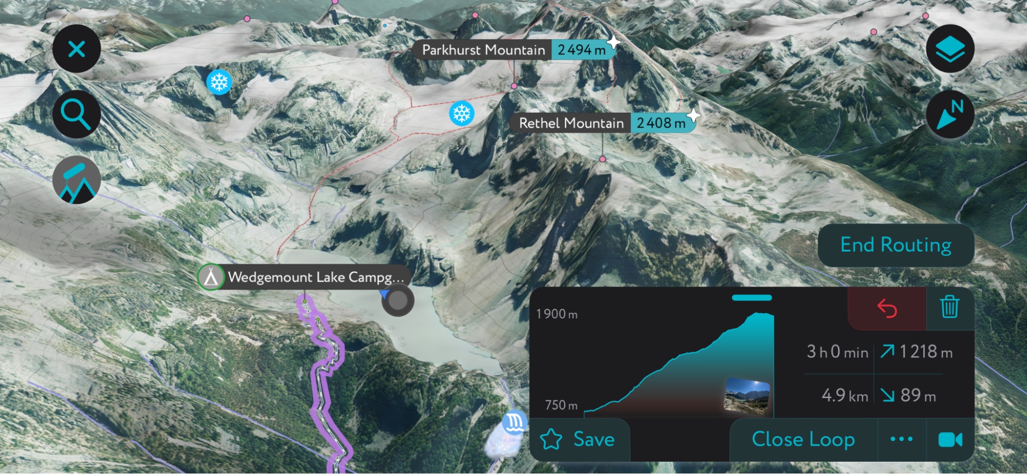
Using the PeakVisor App
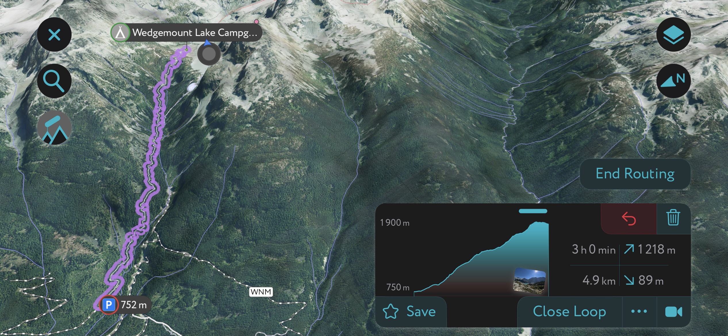
You can plan and track your adventure on our mobile app. When planning a trip, you can view all the statistics for each hike, including vertical gain, length, and estimated time to completion. You can also use our desktop planner to explore on the big screen, seamlessly saving routes to your profile on the mobile app.
In addition to Wedgemont Lake, the app is a trove of information on thousands of routes, trails, peaks, cabins, and parking areas worldwide. It’s all on here. In addition to planning your own route, as I mentioned above, you can also upload .gpx files if we don't have a trail on our servers. The PeakVisor app is available for iOS and Android; give it a shot and discover our visually stunning 3D Maps, adding a new dimension to your alpine adventures.
Getting There
Wedgemount Lake is located about 2 hours and 135 km (84 mi) north of Vancouver, Canada. Situated in Garibaldi Provincial Park, the trailhead lies 20 minutes and 14 km (8.7 mi) north of Whistler Village. From Vancouver, hop on the Sea-to-Sky Highway (Hwy 99 North) and pass through Squamish and Whistler before turning off the highway at Gravel Pit Road. Cross the first bridge, turn left on Riverside Drive, and then onto Wedge Creek Service Road.
The final stretch is a short but bumpy 2.2 km (1.4 mi) drive down an FSR. Although steep at times, clearance is adequate for most vehicles. The road ends at a sizable dirt parking lot where you can park for free.
Parking is limited, and it does fill up due to its popularity. It’s best to arrive early, but I’ve also seen people parking right on the side of the FSR. Finally, be sure to lock your vehicles as these Forest Service Road parking lots can be a target for thieves.
For food and supplies, there are numerous places to meet your needs in Squamish. Several grocery stores, outdoor shops, and a Walmart are located in the area. Whistler will still have ample shops, but you’ll end up paying a higher price tag given it’s a tourist hotspot.
Trail Overview
The Wedgemount Lake hike is deceptively short but incredibly punchy. It’s like climbing a set of stairs…that doesn’t have any steps. To the entrance of the lake, it’s about 6 km (3.7 km) one way or about 7 km (4.3 mi) to the far side and beyond to Tupper Lake. Daytrippers can expect a round-trip time of 4 to 6 hours, while backpackers can expect a 6- to 7-hour trip.
As backpackers, we took approximately 4 hours to ascend, with numerous breaks, and about 2.5 hours to descend the following morning.
The trail is a mixture of semi-maintained single track with a considerable amount of trip hazards, namely exposed roots and boulder fields near the top. There are several spots where you will rely on your hands to climb near vertical root systems (though these will never exceed 2 metres / 6 feet). Due to the amount of snowmelt and runoff that gushes through here during the spring, trail washouts can cause increased difficulty.
Once you reach the lake at 1,861 m (6,105 ft), you’ll find a 6-person hut (usually reserved for emergencies only), a covered pit toilet, and several bear caches to store your food in at night. In total, there are 20 tent pads, 10 near the hut and 10 near the lake's inlet from Armchair Glacier.
The trail and the camping area don’t tend to be overly busy, especially on weekdays. We only ran into a few hikers on the way up and saw five tents around the lake. A rather interesting nugget was that as we crested the boulder field, we encountered two professional hikers who were descending barefoot, which I found quite impressive.
The Ascent
The trail starts as a bit of a tease for what's to come. A couple of hundred metres of easy FSR quickly disappears into the old-growth forest, and the true climb begins. Armed with hiking poles, 14 kg packs, and 2 L of water, silence quickly set in as we both got into our own rhythm. The first few kilometres follow a fast-flowing river, which thankfully cooled down the surrounding area on what was poised to be the hottest day of the summer in the valley.
Deep in the underbrush, we find relief from the sun, surrounded by beautiful views of ancient cedars, mossy floors, and the occasional mushroom. Given the dryness of late July, the trail was dusty, full of bomb holes and tripping hazards.
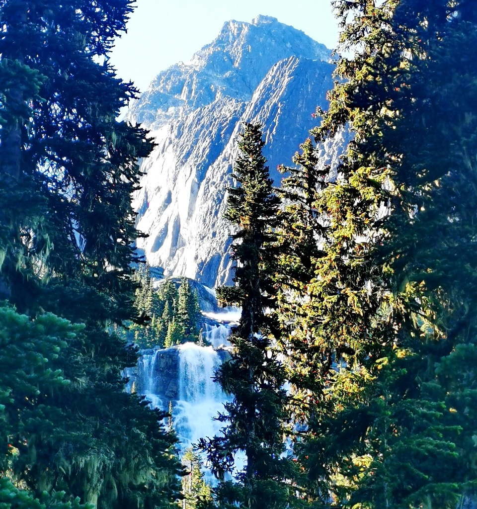
The trail eventually opens up to views of boulder fields and lush alpine valleys about halfway up, making a nice spot to stop for a much-deserved snack. Far in the distance, you can hear Wedgemount Falls crashing down the mountainside at almost 300 m (980 ft) high. This comes into view a bit later on, though only for a moment through the thick forest.
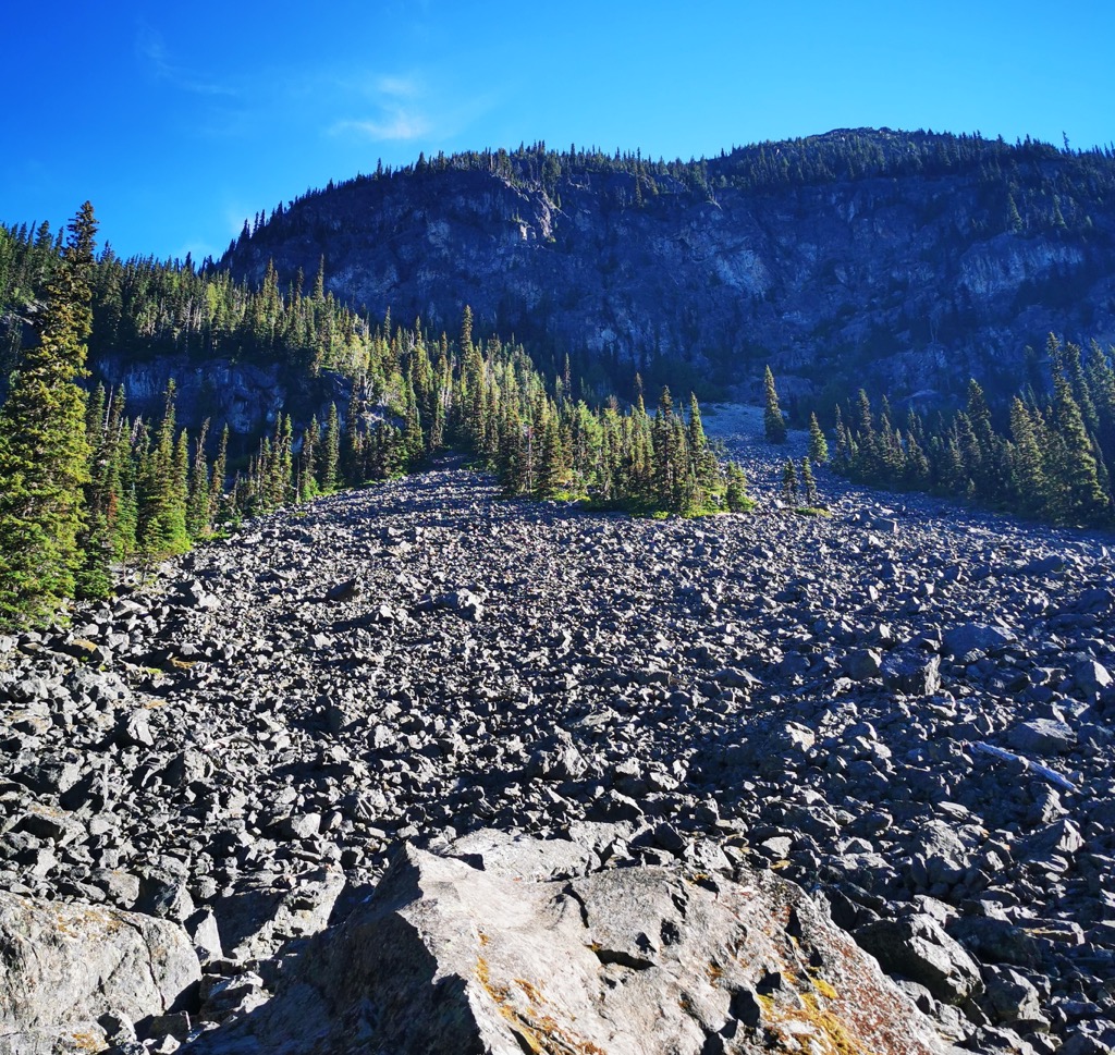
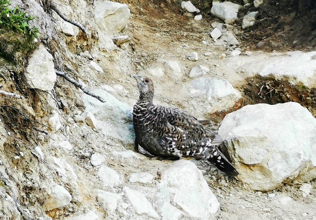
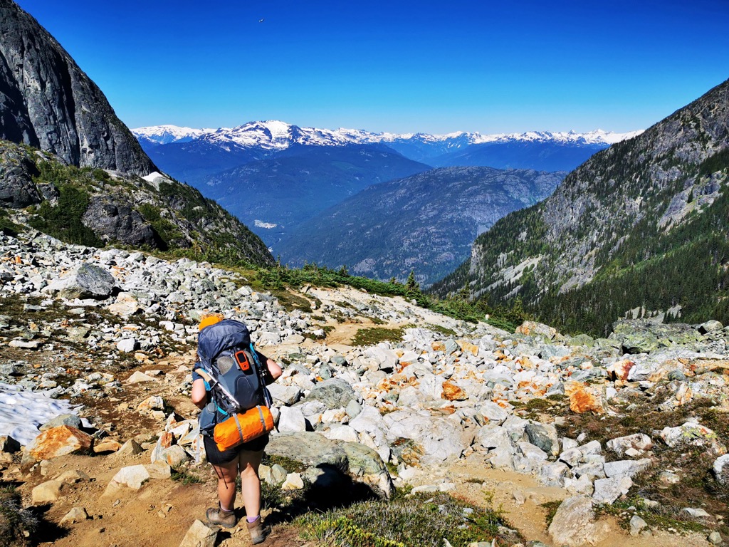
Finally, as we broke out of the forest into the alpine around the 5 km mark, my eyes darted around looking for the top of the trail. A monster of a boulder field, easily 100 m (300 ft) tall, looms ahead. It’s infamously known as the final boss of the trail and usually guarded by an aggressive ruffled grouse.
Digging deep as the sun hit solar noon, we slowly scrambled up the steep boulder field, stepping carefully to ensure our feet found solidly placed stones.
Standing at the top, gazing down at what we just accomplished was a powerful feeling. The knowledge that our reward was about to come into view fired up our cylinders, and our feet hit what seemed like the fastest cadence of the day.
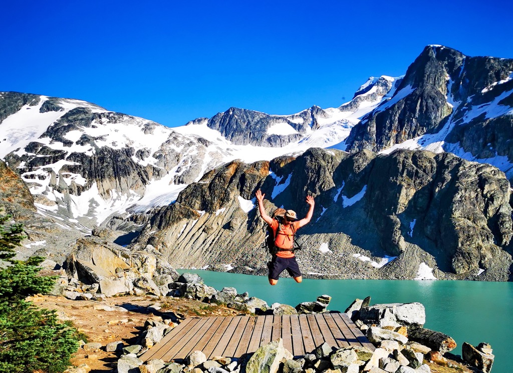
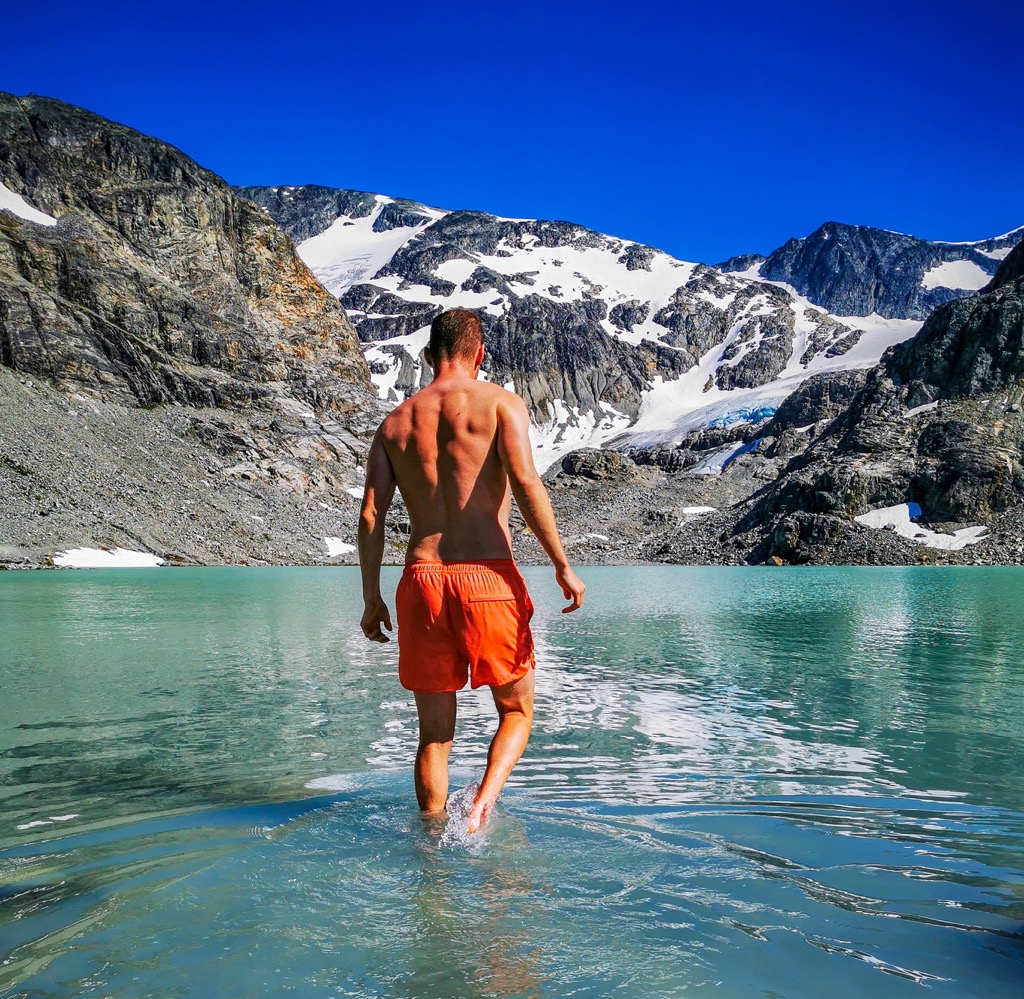
With a blistering final pace, we entered the alpine amphitheatre of Wedgemount Lake. The air cooled, the winds increased, and the area’s vastness took me by surprise.
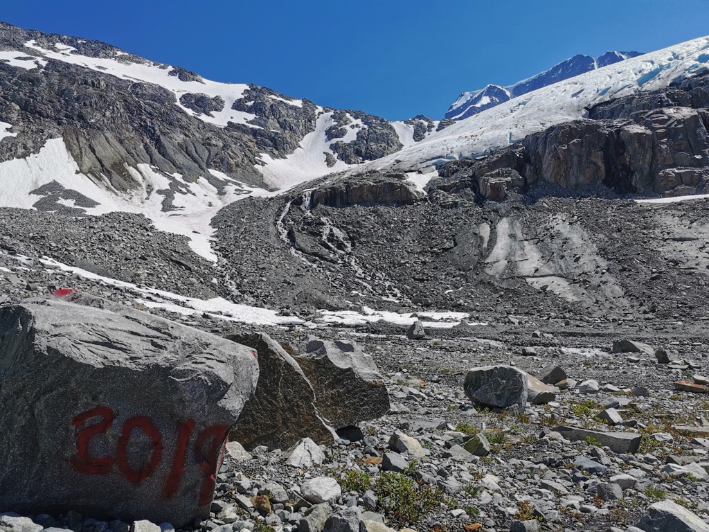
The lake and its surreal shade of glacial turquoise water glistened in the late morning sun while the black towering rock of Rethal Mountain rose straight out of the lake. Wedge Mountain loomed in the distance as the area's tallest peak (2,895 m / 9498 ft), and both Wedge and Armchair Glaciers shone with white, blue, and grey seracs. The greenery and wildflowers from the mountainsides of Mount Weart complemented the entire vista, and we stopped to take it all in.
Camping at Wedgemount Lake
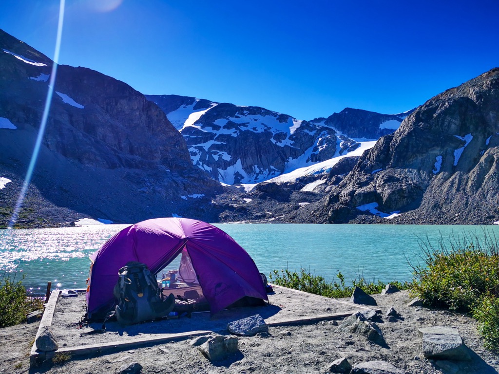
Prior to venturing out on this adventure, we had heard that camping on the far side of the lake was the best spot. Although the tent pads here were comprised of crushed gravel rather than wood, they were situated right at the lake's edge, where fresh glacial melt flowed directly into the lake. Quick lake access and cold water to filter were absolutely welcomed, not to mention the views from our tent were second to none.
We set up camp and opted for a short, yet well-deserved afternoon snooze. Even from our tent, the views of the lake and glacier made it hard to close our eyes. After a restful half hour, we popped our hiking shoes back on to explore the alpine.
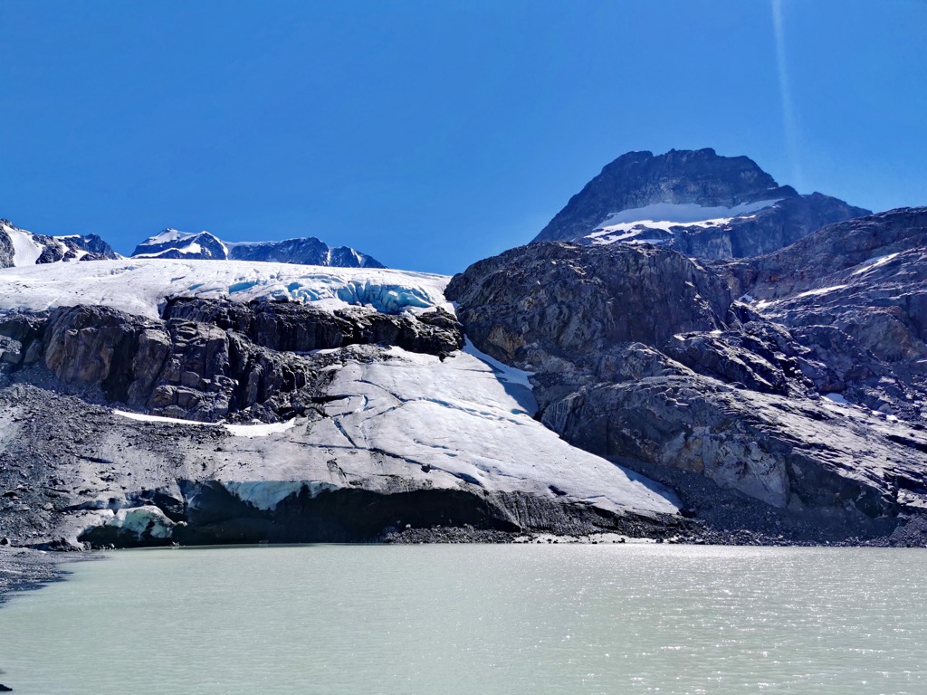
Pushing towards the far side of the lake and onto a snow-covered glacier, we made our way to Tupper Lake via the Wedgemount Glacier approach. This smaller lake sits right at the edge of the glacier, and the Wedge Mountain Spire towers above. Some people opt to summit Wedge in the summer, but it requires technical mountaineering equipment and experience.
Sunset From Rethel
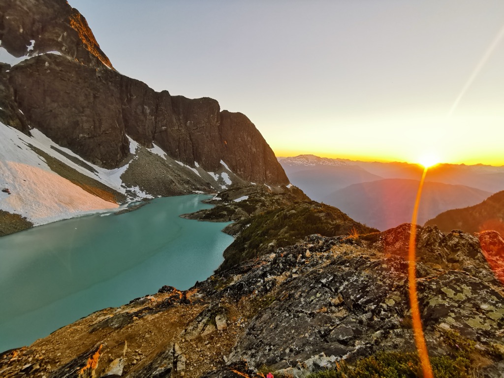
Prior to setting up camp, we eyed a high point near the west (waterfall) side of the lake, where we expected the sun to set in full view of the lake and the mountains. PeakVisor’s sun and moon tracking confirmed this suspicion. We decided this would be our spot for dinner.
Daypacks were filled with our camping stove, dehydrated meals, and enough water to hold us over for a few hours. The short 1.5 km hike followed the lake towards the hut, passing by the first campsites. There was enough of a trail that proved to us other people had the same idea as us for years.
We found the perfect spot, proceeded to cook our meals, and enjoyed one of the most beautiful sunsets of my life. As the sun moved towards the mountains, it ignited the lake with different light every minute. Once the sun dipped behind Ipsoot Mountain, the alpenglow caused the surrounding mountains to erupt in fiery reds and oranges. With the turquoise waters of Wedgemount Lake complementing the fireshow, my mind had a hard time processing the overload of beauty.
By the time we returned to camp, it was growing dark, and the fatigue from a huge day was starting to set in. The stars began to appear—as did the bugs—so we slid into our cold-rated sleeping bags and settled in for a night of holy sleep in the cool mountain air.
The Return Trip
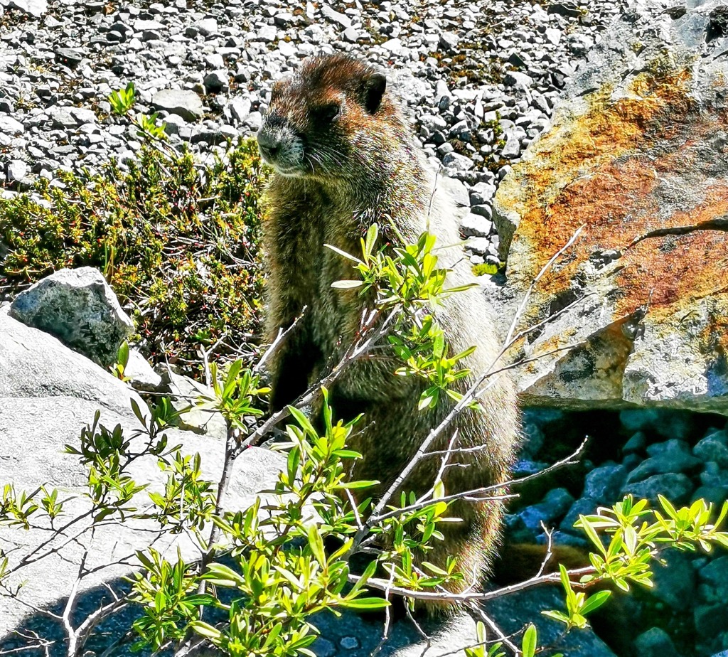
Early morning light blasted our east-facing tents earlier than I expected. A big part of me just wanted to stay wrapped in my sleeping bag. Meanwhile, the alpine landscape slowly came alive with the sounds of chattering birds, whistling marmots, and the movement of water from the lake. I opened my tent and noted the beauty of the mountains, as well as the soreness of my muscles. Magnesium supplements were welcomed this morning.
We made a hearty breakfast of oatmeal, dehydrated eggs, and coffee. Food just tastes better in the mountains. Perhaps it’s the serenity of the surroundings and the absence of technology that allow your senses to experience life here a little differently. Or maybe it’s the ravenous appetite built up over hours of strenuous exercise.
Slow mornings are usually my jam high in the alpines, but with valley temperatures expected to hit 38°C, we hoped to hit the shade of the forest canopy by 11:00 am. With lighter packs and caffeine putting us in good spirits, we hit the trail just before 10:00 am and started the descent.
Although hiking poles aren’t usually in my arsenal for hikes, I opted to bring them on this trip primarily to save the knees on the steep 1300 m vertical descent, and they did just that.
The trip down was quiet for a midsummer Thursday. We only ran into a few other hikers and three park rangers heading up for the expected holiday weekend traffic. Quick conversations of encouragement were shared as we knew the grind of those ascending.
We focused a lot on the way down due to the rock holes and webs of exposed roots, but we also motored back. We zoomed past rest spots from the previous day without batting an eye, and before we knew it, we were back on the FSR—two and a half hours from camp to car.
Conclusion
Wedgemount Lake is one of the most challenging hikes in the area. Rather than just reaching a destination, hiking and camping up here is about the sweat of the climb, the virtue of patience, and an acknowledgement of your inner strength.
High up in the Garibaldis, beauty isn’t served to you, it’s earned. Once you catch your first glimpse of turquoise waters and shimmering glaciers in this alpine sanctuary, a profound shift in perspective occurs. May you feel the peace of nature up here, the power of the earth, and be humbled by your size in this land of giants.