
Scan the QR code and open PeakVisor on your phone
The Garibaldi Neve include 41 named peaks. The highest is Castle Towers at 2,676 m. Other notable peaks include Mount Garibaldi, Atwell Peak and Dalton Dome.
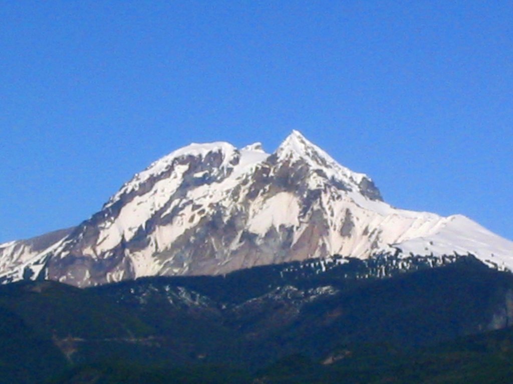
The Garibaldi Neve sits on the east side of Mount Garibaldi and spans 8,600 acres. The area is a large icefield that is located on the eastern side of Mount Garibaldi in British Columbia, Canada.
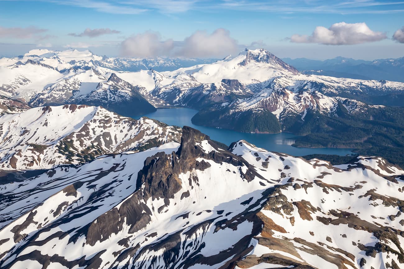
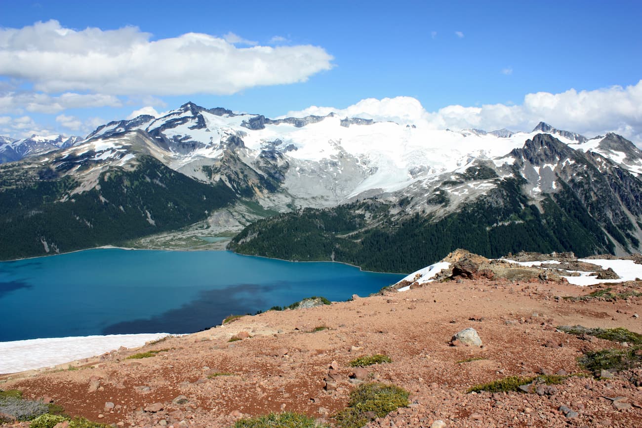
The Garibaldi Neve drains eastward into Pitt River. There are 43 named mountains in Garibaldi Neve. The highest and the most prominent mountain is Castle Towers. A triple summit mountain, Castle Towers sits on the east side of Garibaldi Lake. The entire region is characterized by high amounts of precipitation and snowfall, making it ideal for winter traversing. The Neve, large icefield, is a popular tourist destination especially during the winter months when Garibaldi Lake freezes over. Just west of the Neve is Mount Garibaldi standing at 8,786 feet. The mountain is characterized by the heavily eroded dome as it overlooks the town of Squamish, located to the west of the peak.
The most iconic route in the region is the Garibaldi Neve Traverse. Usually done over the course of 2-3 days, this ski traverse covers the entire region. It is often completed as a hut to hut traverse with stops at Elfin Lakes Shelter and then the Burton Hut or the Sentinel Bay Glaciology Huts. Although the terrain itself is easy, the route is rated as difficult due to the remoteness of much of the path. Note that this traverse is done during the winter once Garibaldi Lake has frozen over. The hike is often completed south to north, starting at Diamond Head area in Garibaldi Park, and finishing at Rubble Creek parking.
As the tallest peak in the region Castle Towers is no easy feat. The out and back trail is 21.6 miles long with 8,697 feet of elevation gain. The trail is recommended for only very experienced hikers and mountaineers. The trail starts on the Cheakamus River southeast of Whistler. Once at the top of Castle Towers, hikers have views of the surrounding valleys and Garibaldi lake below. Again, be sure that you are an experienced hiker as this hike will be a long day and require crossing glaciers so be prepared.
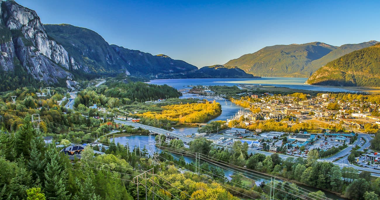
Located an hour north of Vancouver, Squamish sits on the Howe Sound surrounding by mountains. The town is known for the Sea to Sky Gondola that provides views of the mountains, Howe Sound, and Shannon Falls. Squamish is often seen as an outdoor paradise with countless mountain biking, hiking, trail running, skiing, and watersports all nearby. Due to increased cost of living in both Vancouver and Whistler, the population of Squamish continues to grow.
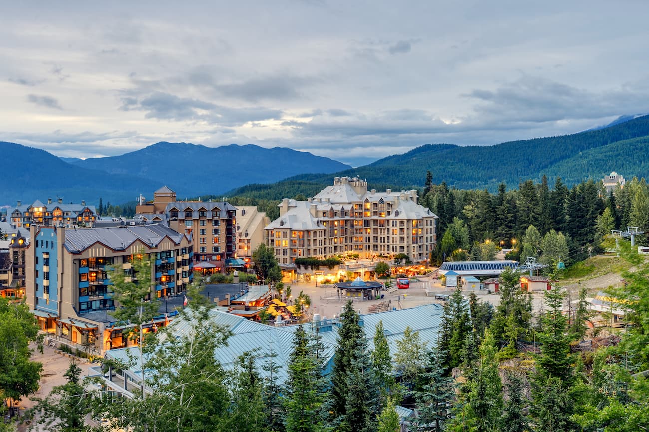
Located 90 minutes north of Vancouver, Whistler is a resort town located in the mountains. It is home to Whistler Blackcomb which is one of the largest ski resorts in North America. The town only has 13,000 residents but is busy year-round with tourists. Despite being known for the ski resort, the town is almost equally as popular in the summer months for hiking and mountain biking. Take the gondola to the top of the mountain and hike from there, or explore the numerous nearby glacier lakes.
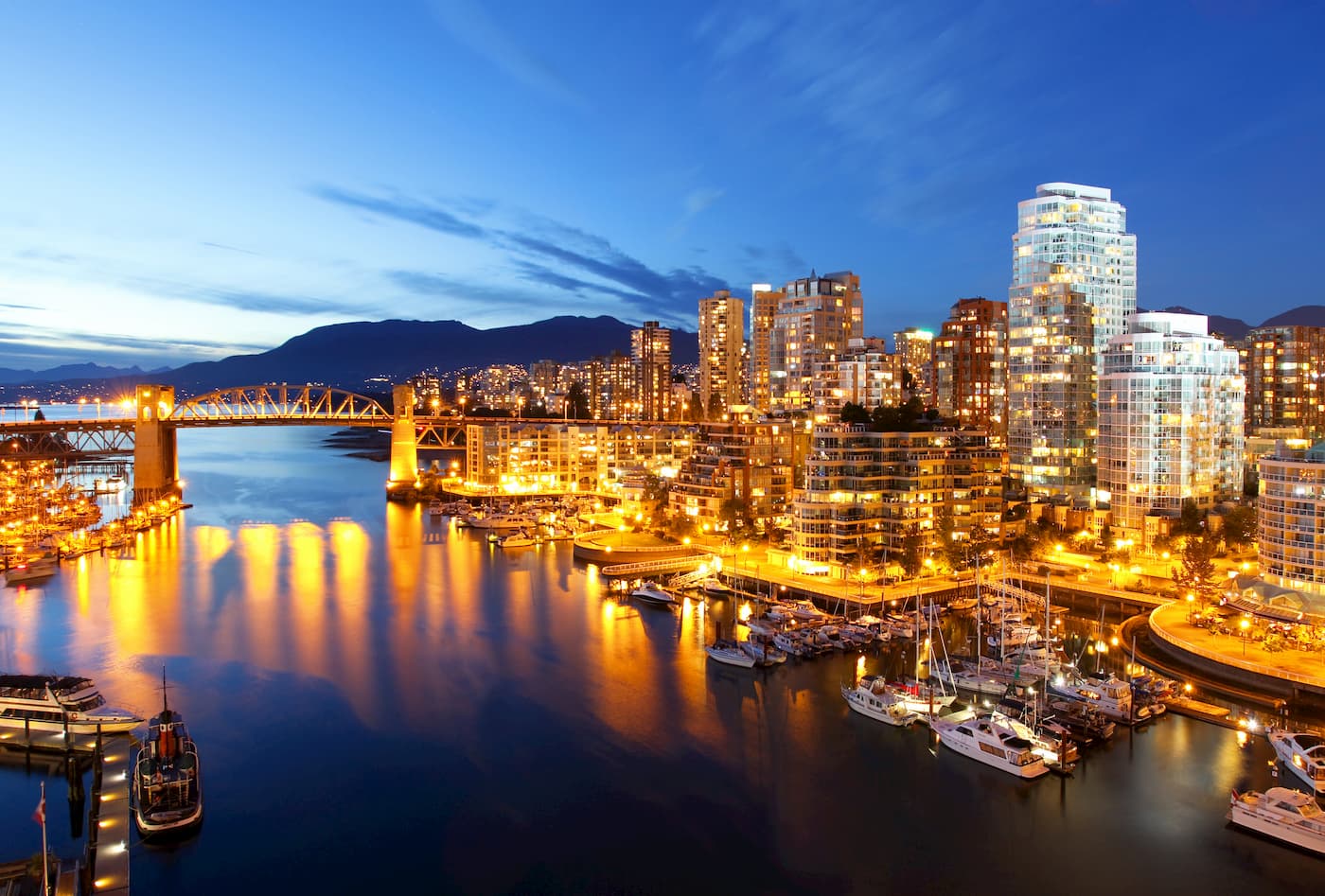
Vancouver is the third largest city in Canada and the largest city in the entire province. While the city population is 603,000, the Vancouver metro area has a population of over 2,500,000. The city is one of the most ethnically and linguistically diverse cities in Canada. The mild climate of the city, along with its abundant access to lakes, trails, and mountains, makes it a popular destination for outdoor recreation. The city is close to three ski resorts, and an abundance of hiking, running, and mountain biking trails.


glacier
volcano
cascade-volcanoes-pin
canada-sampler
glacier
volcano
cascade-volcanoes-pin
canada-sampler
The highest peak in the Garibaldi Neve is Castle Towers, at 2,676 m.
The Garibaldi Neve have 41 named peaks.


