
Scan the QR code and open PeakVisor on your phone
Hawaiʻi County is home to 425 named mountains. The highest is Mauna Kea at 4,205 m.
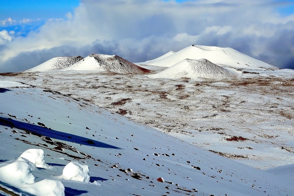
Spanning 5,087 square miles (13,175 sq. km), Hawai’i (Hawaii) County is the eponymous county encompassing the entirety of the U.S. state of Hawaii's largest island (also known as the “Big Island”). Eighty percent of the county’s area is land, while the remainder is water. Hawaii County makes up over 60% of the Hawaiian state’s total land mass, a higher percentage than any other county in the United States. Of the 425 named peaks in Hawaii County, the highest and most prominent mountain— in the county and state of Hawaii—is the inactive volcano Mauna Kea (13,796 ft / 4205 m). Mauna Kea is extremely topographically prominent (more on this below) and is also the second-highest island summit on Earth, after New Guinea’s Puncak Jaya (4,884 m / 16,024 ft).
At its widest point, the island of Hawaii is 93 miles (150 km) coast to coast. It is the third largest island in the Polynesian archipelago, following the two islands of New Zealand. Geometrically, Hawaii is best compared to a triangle, with three major coastlines: western, northeastern, and southeastern.
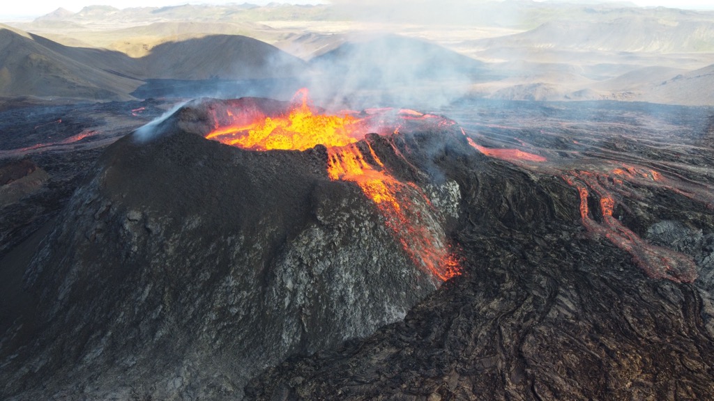
There are several factors of geographic interest in Hawaii County. For one, the island is the home of the southernmost point in the 50 United States, Ka Lae. The island is also notable for its volcanism. It was formed by five major shield volcano complexes, Kohala (5,479 ft / 1,670 m), Hualālai (8,261 ft / 2,518 m), Mauna Loa (13,678 ft / 4,169 m), Kīlauea (4,088 ft / 1,246 m), and Mauna Kea (13,796 ft / 4205 m). Two of these, Mauna Loa and Kīlauea, remain active today, contributing to the island’s continual growth.
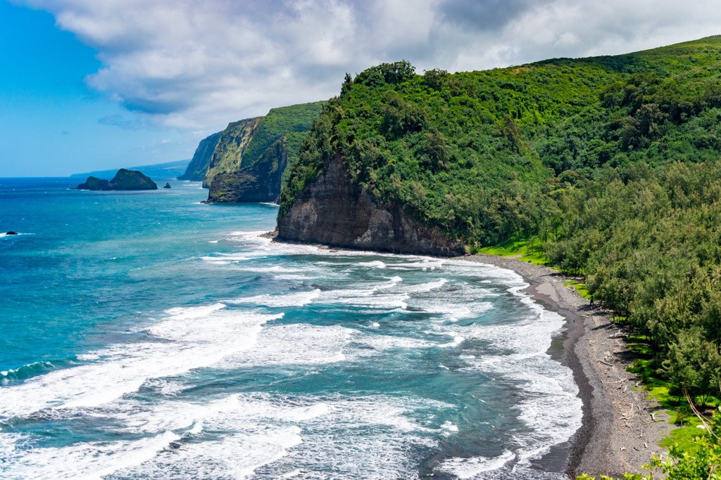
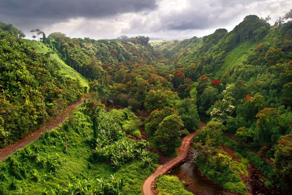
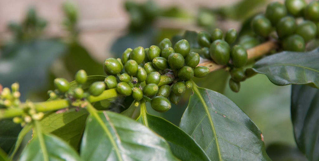
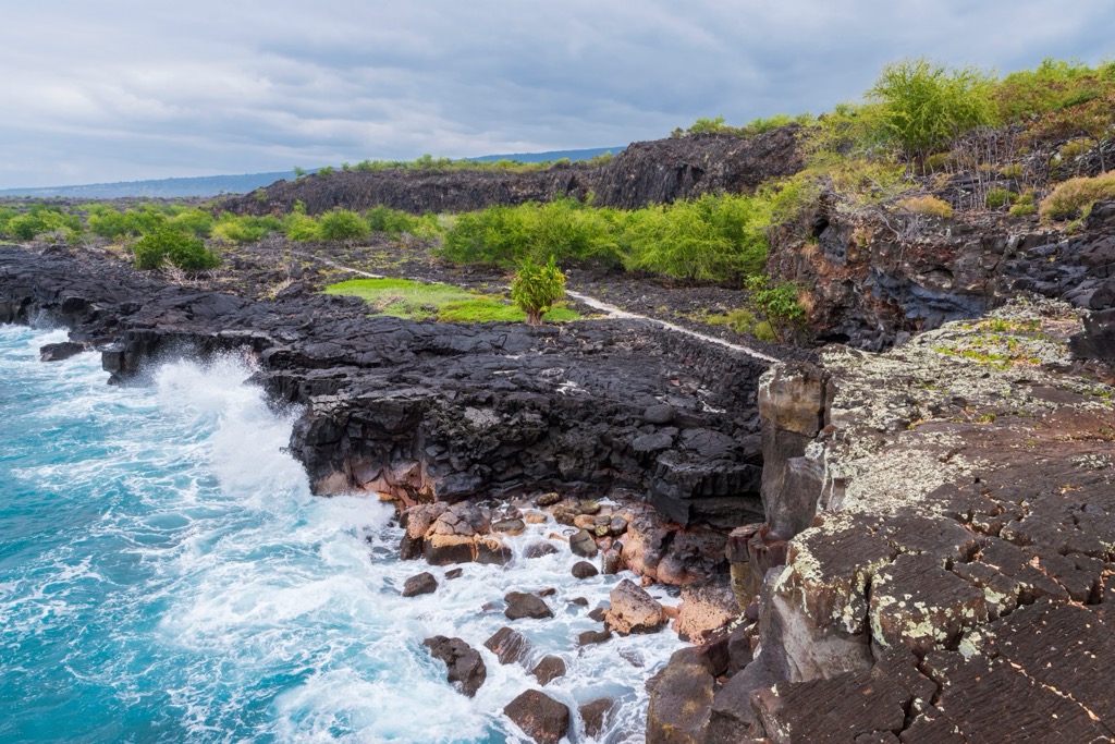
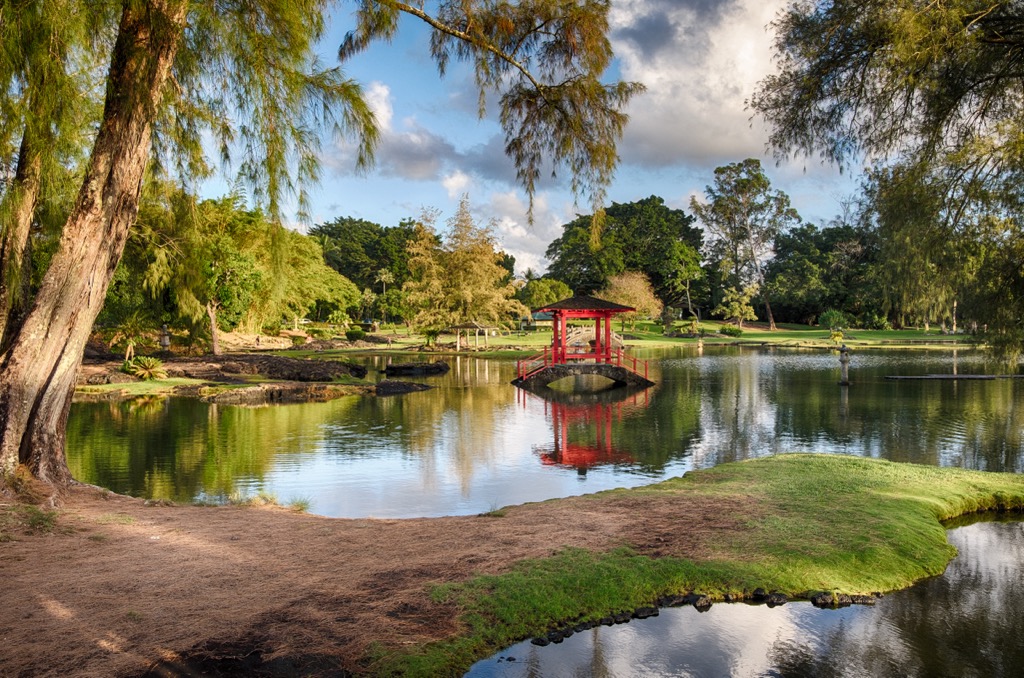
The island's eastern shore experiences heavy rainfall, fostering a lush tropical ecosystem rife with rainforests and waterfalls. In contrast, the western side is far drier and characterized by lava fields and black sand beaches. The Kona coast is renowned for its sunny weather and ideal conditions for growing coffee and sugarcane, both thriving industries in Hawaii. Hawaii is home to a plethora of protected land, most notably Hawai’i Volcanoes National Park.
Perhaps the most fascinating aspect of Hawaii’s geography is Mauna Kea, its high point. By some accounts, this inactive volcano is technically the world's tallest mountain. This is because when measured from its sea floor base to its summit, the peak’s height is 30,610 feet (9,330 m), far taller than even Mount Everest (8,849m / 29,032 ft), as the base of Everest is high above sea level.
Mauna Kea is also extremely topographically prominent. It is ranked eighth in the world by topographic isolation (the minimum distance to a point of equal elevation), after Everest, Aconcagua (6,964 m / 22,848 ft), Denali (20,308 ft / 6,190 m), Kilimanjaro (5,895 m / 19,341 ft), Puncak Jaya (4,884m / 16,024ft), Vinson Massif (4,892 m / 16,050 ft), and Mont Orohena (2,241 m / 7,352 ft).
As the discerning reader will recognize—save for Orohena—these are all “Seven Summits,” the highest peaks on each of their corresponding continents. Russia’s Elbrus (5,642m / 18,510ft) is the only missing continental high point.
The geological history of Hawaii County and the Big Island of Hawaii is a fascinating tale of volcanic activity shaped by the movement of tectonic plates over millions of years. The island owes its existence to a hotspot—a fixed point in the Earth's mantle where magma rises to the surface, creating volcanic activity. In the case of Hawaii, the hotspot has remained relatively stationary while the Pacific Plate has moved over it in a northwesterly direction.
The formation of the Hawaiian Islands began around five million years ago, with the older islands in the chain eroding and sinking beneath the ocean surface as new ones formed. The Big Island itself is the largest and youngest of the main Hawaiian Islands, and its construction is intricately tied to the activity of its two highest and largest shield volcanoes: Mauna Kea (13,796 ft / 4205 m) and Mauna Loa (13,678ft / 4,169m).
Mauna Kea (an abbreviation for Mauna a Wākea, which means “White Mountain”) began forming about a million years ago. Today, it lies dormant, having last erupted around 4,500 years ago.
Mauna Loa, on the other hand, is one of the most active shield volcanoes on Earth. Its construction started over 700,000 years ago and emerged from the sea around 400,000 years ago. It continues to grow with each eruption, most recently a cycle beginning on November 27, 2022, and ending on December 13.
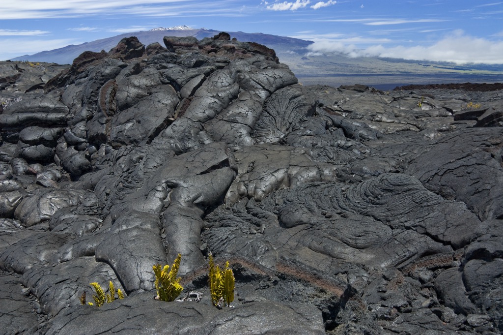
With a volume of approximately 18,000 cubic miles (75,000 cu. km) and covering a land area of 2,035 square miles (5,271 sq. km), Mauna Loa was considered the largest volcano on Earth both in volume and mass until the discovery of the undersea volcanic Tamu Massif. However, it is still the largest subaerial (above sea level) volcano.
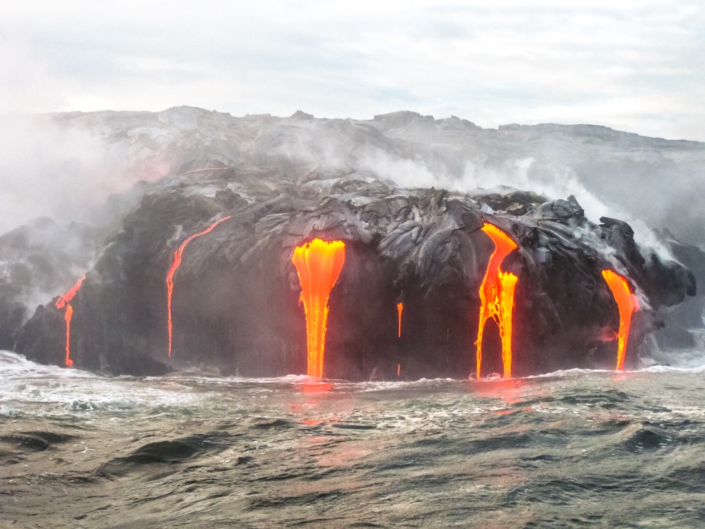
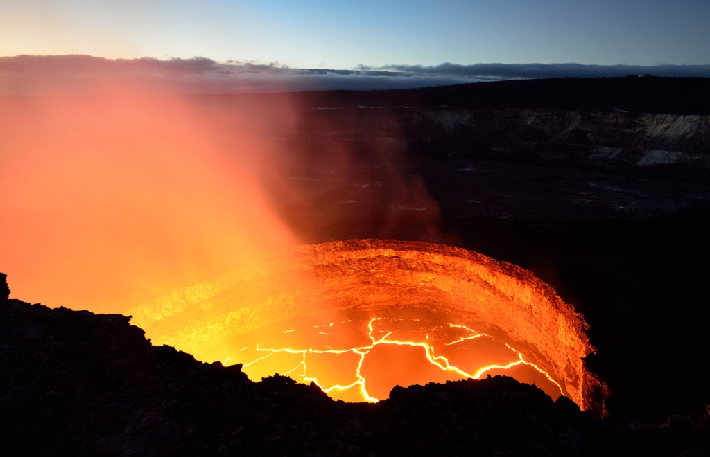
The island's southeastern aspect is dominated by Kīlauea (4,088 ft / 1,246 m), another highly active volcano known for its frequent and often effusive eruptions. Both Loa and Kilauea are partly inside the Hawai’i Volcanoes National Park. Recent volcanic activity has reshaped the landscape, with lava flows extending into the ocean, expanding the island's size over time. The Big Island is estimated to grow by around 50 acres (20 ha) per year, though during eruption years, like 2018, the island can expand by hundreds of acres.
Because of its isolation, Hawaii County (and the Hawaiian archipelago as a whole) is home to a unique and diverse array of plants and animals, many of which are found nowhere else in the world. This biodiversity is partly due to the islands' varied elevations and extensive coastline, fostering a wide range of habitats ranging from tropical rainforests to alpine mountains.
Unique types of flora include koa (Acacia koa), a native tree with distinctive sickle-shaped leaves, often found in upland forests, ʻŌhiʻa Lehua (Metrosideros polymorpha), a dominant native tree with vibrant red flowers, crucial for the island's watersheds, and the Hapuu fern (Cibotium menziesii), a large species of tree ferns that thrive in the island’s rainforests. Another notable flora is the silversword (Argyroxiphium sandwicense), a hardy shrub adapted to high-altitude environments, often seen on volcanic summits. There are over 40 species of silversword in Hawaii.
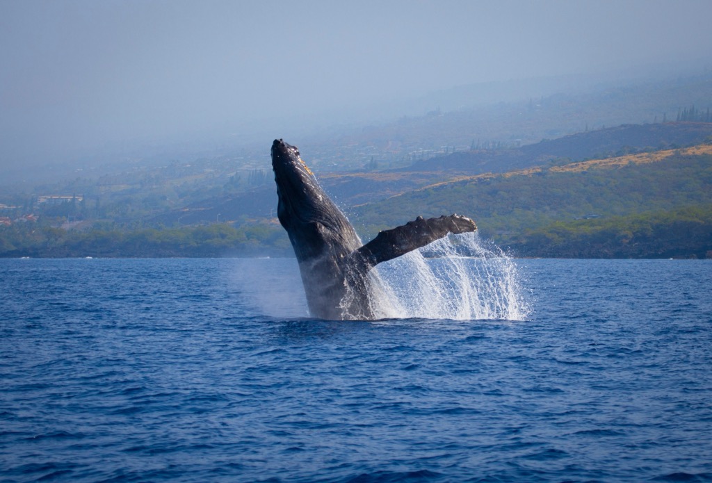
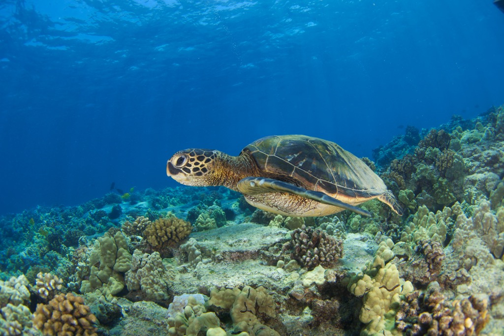
Fauna includes the nene (Branta sandvicensis), the state bird also known as the Hawaiian goose, the Hawaiian monk seal (Monachus schauinslandi), an endangered marine mammal often found basking on beaches, the Hawaiian green sea turtle (Chelonia mydas), the ‘Io (Buteo solitarius), the sole hawk species native to the Hawaiian islands, the Hawaiian hoary bat (Aeorestes semotus), and the humpback whale (Megaptera novaeangliae).
Like many regions worldwide, Hawaii struggles with varied threats to its biodiversity and natural splendor. These include invasive species (particularly detrimental on isolated, sensitive island biomes like Hawaii’s), habitat loss due to urbanization, agriculture, over-tourism, and other development activities, and the effects of climate change. Rising temperatures and sea levels, as well as subsequent changes in weather patterns, pose serious threats to the delicate ecosystems of the Big Island and its smaller siblings.
The Big Island's (Hawaii County) human history is rich and deeply rooted in the Polynesian exploration of the Pacific. The island's first inhabitants were Polynesians who traveled vast ocean distances using celestial navigation, settling on the Hawaiian archipelago around 1,500 years ago. These settlers brought a rich cultural heritage of traditional practices, language, and social structures.
The ancient Hawaiians developed a sophisticated land division system, the ahupua'a, allowing sustainable resource management across various ecological zones. A traditional ahupua’a was delineated primarily on the basis of elevation, extending from the mountains to the sea, thus encompassing at least one complete watershed and marine resources.
The island’s fertile volcanic soil supported the cultivation of taro, sweet potatoes, bananas, and other staple crops, forming the basis of the early agrarian society.
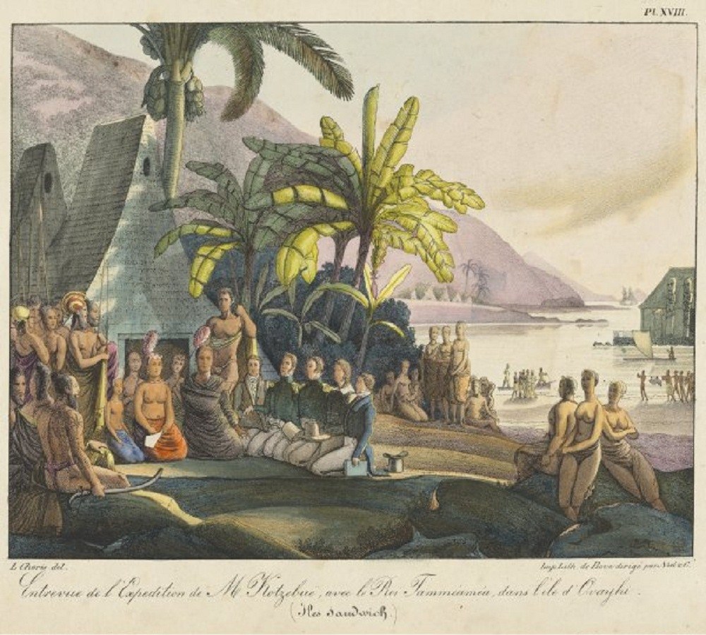
The arrival of Captain James Cook in 1778 marked the beginning of Western contact with Hawaii—and the ultimate end of its autonomy. Cook's interactions with the islanders had both positive and negative consequences. While the Hawaiians initially viewed Cook as a deity, tensions arose, leading to Cook's death in 1779 during a confrontation in Kealakekua Bay.
In the decades following Cook's arrival, European and American explorers, traders, and missionaries began arriving in Hawaii. The influx of whites led to various issues, especially the introduction of Western diseases, which had a devastating impact on the native population.
It is estimated that the archipelago’s population declined by at least a quarter of a million people—if not more—due to diseases like syphilis, tuberculosis, smallpox, and measles following contact with the West. Concurrently, European and American influence grew, impacting traditional Hawaiian governance, economy, and social structures.
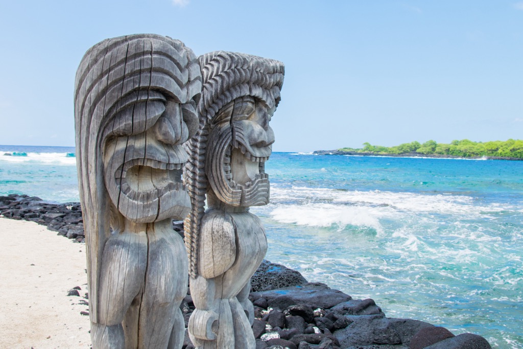
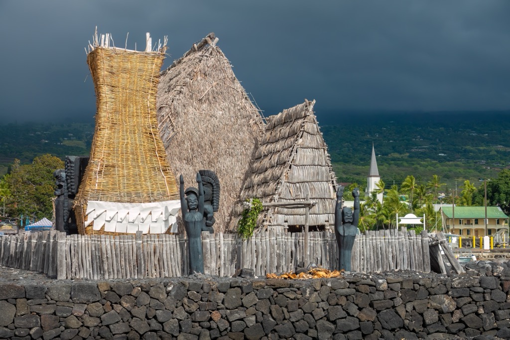
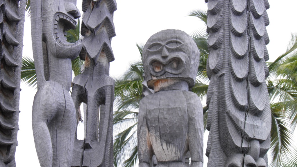
In 1795, Kamehameha I successfully unified the Hawaiian Islands under his rule after a series of battles, which included the famous Battle of Nu'uanu on Oahu. A significant cultural and religious aspect of Hawaiian life was the construction of heiau, or temples, dedicated to various deities. The Pu'ukoholā Heiau on the island’s northwestern coast, built by King Kamehameha I around this time, remains a prominent historical site on the Big Island, symbolizing the unification of the Hawaiian Islands under a single ruler.
The Kingdom of Hawaii—under the Kamehameha dynasty and based on the Big Island—endured for another 100 years. Its end began with the arrival of Christian missionaries in the early 19th century. Their work led to the conversion of many Hawaiians to Christianity and the establishment of Western educational institutions. Increasing Western interest in the island, both for its geographic location and rich natural resources, among other factors, led to an American-backed overthrow of the Hawaiian monarchy in 1893. Subsequently, the short-lived Republic of Hawaii was established with the support of American business interests. Hawaii was formally annexed by the United States five years later, though it did not become a U.S. state until 1959.
The Big Island continued to play a pivotal role in the region's economic development. The sugarcane, coffee, and pineapple industries flourished, bringing economic prosperity but also impacting the environment and traditional Hawaiian land practices. Today, the Big Island stands as a testament to the state’s complex history, blending traditional Hawaiian culture, historical landmarks, and the influences of Western exploration and colonization.
This 175-mile (282 km) trail along the Big Island’s western and southern coasts is not yet fully finished. Still, it’s accessible from multiple points along the coastline and offers an all-encompassing exploration of the island’s unique geography, ecology, and varied climes.
The Big Island’s sole national park, Hawaii Volcanoes, spans 323,431 acres (130,887 ha) and offers an intimate glimpse into the unique volcanism that shaped this island. Two notable trails include the Kilauea Iki Trail, which takes you across a crater floor, offering a close look at the still-steaming volcanic landscape, and the Devastation Trail, a short hike through vistas of the 1959 Kilauea Iki eruption aftermath.
This one-mile (1.6 km) out-and-back hike leads to the Pololu Valley overlook, providing breathtaking views of the coastline and valley.
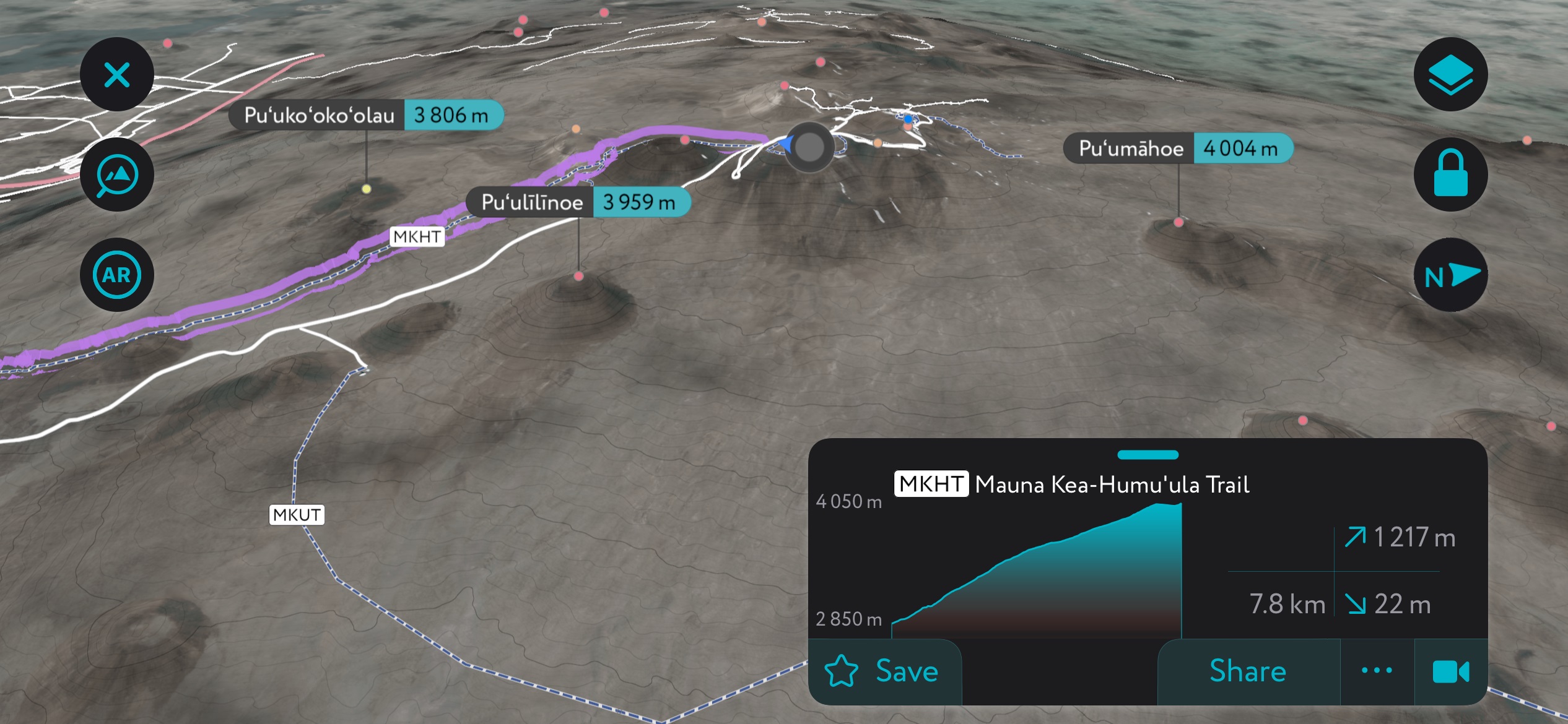
Most drive to the summit of Mauna Kea, but hiking options exist for those acclimated to high altitudes. The 13-mile (21 km) Humuʻula Trail gains nearly 5,000 feet of elevation (1,524 m), so be prepared for some huffing and puffing.
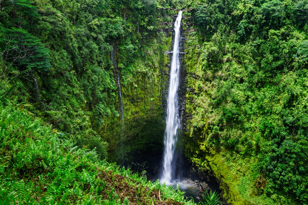
If you’re looking for waterfalls, this one’s your pick! This 0.5-mile (0.8km) loop takes you through a tropical rainforest to view the stunning Akaka Falls and Kahuna Falls.
Explore the royal grounds and the Place of Refuge—a sanctuary for those who broke Kapu laws, which in old Hawaii were punishable by death—while learning about Hawaiian history and culture. This two-mile (3.2 km) route is also known as the 1871 Trail, taking you along coastal cliffs and several ancient historic sites. It’s also a segment of the aforementioned Ala Kahakai National Historic Trail.
This 3.7-mile (6 km) out-and-back trail leads to the Captain Cook Monument (accessible by kayak or boat) and offers excellent snorkeling opportunities.
Located on the eastern side of the island, Hilo (pop. 45,000) is the island’s largest city and the oldest settlement in the entire Hawaiian archipelago. It serves as the county seat of Hawaii County. It is known for its lush landscapes, waterfalls, and the Hilo Bay. Among other notable landmarks, Hilo houses a branch of the University of Hawaiʻi, the ʻImiloa Astronomy Center, the Merrie Monarch hula festival, and the Mauna Loa Macadamia Nut Corporation.
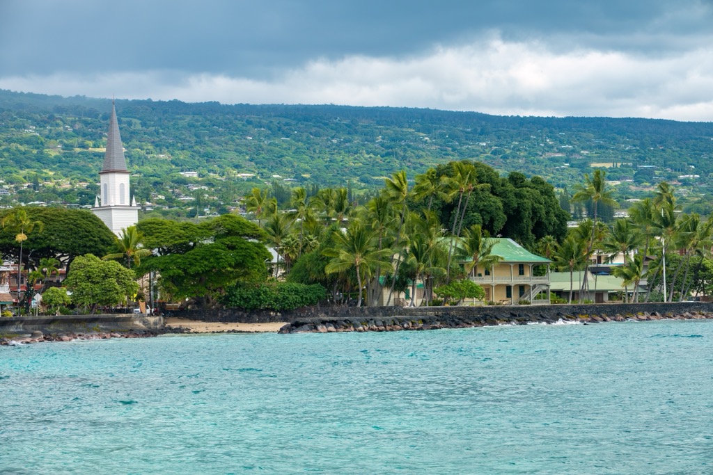
Situated on the island's western side, Kailua-Kona (pop. 23,000) was the original capital of the Kingdom of Hawaii under Kamehameha. Today, it is the second-largest settlement on the island and a popular tourist destination, with sunny weather, historic sites, and proximity to popular resorts. It is known for the annual Ironman World Championship triathlon and the Kona Coffee Festival.
Located in the upland region of the island, the landlocked Waimea (pop. 10,000), also known as Kamuela, is surrounded by cattle ranches and has a cooler climate compared to coastal areas. In fact, the Parker Ranch in Waimea is the largest private cattle ranch in the United States. The town also houses two astronomical observatories on nearby Mauna Kea (13,796ft / 4205m) and is the headquarters of the International Lunar Observatory Association.
This town (pop. 2,900) is near the historic Kealakekua Bay, where Captain James Cook met his death. The bay is now a marine life conservation district and a popular snorkeling destination.
Located on the island's eastern side, the tiny town of Pāhoa (pop. 1,000) is known for its eclectic and laid-back atmosphere. It’s also notable for its unique geological features, such as recent lava flows.


13er
ultra
volcano
hawaii-ultras
13er
ultra
volcano
hawaii-ultras
Yes. Hawaiʻi County has 425 named mountains. The highest is Mauna Kea at 4,205 m.
The highest mountain in Hawaiʻi County is Mauna Kea, at 4,205 m.
Hawaiʻi County has 425 named mountains.


