
Scan the QR code and open PeakVisor on your phone
The Pinaleno Mountains are located in southeastern Arizona in the United States and are one of Arizona’s Sky Island mountain ranges. They are part of Coronado National Forest and contain 42 peaks. With a height of 10,699 ft (3,261 m) and a prominence of 6,299 ft (1,920 m), Mount Graham is both the tallest and most prominent peak in the range. It holds the distinction of being the 20th ultra prominent peak in the lower 48 states.
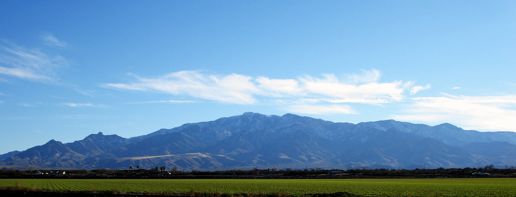
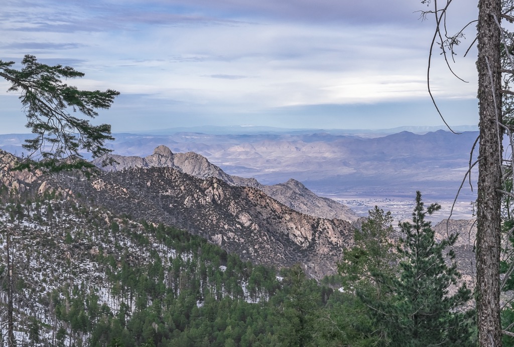
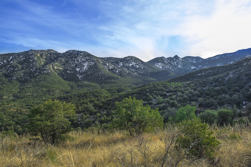
Located in southeastern Arizona northeast of Tucson, the Pinaleno Mountains are the highest of Arizona’s Sky Island mountain ranges. The mountains rise from the surrounding Sonoran Desert to 10,699 ft (3,261 m) on the summit of Mount Graham.
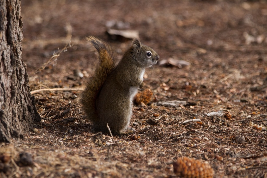
The range is part of Coronado National Forest and contains the Mount Graham Red Squirrel Refugium, a protected area set aside to preserve vital habitat for the endangered Mount Graham red squirrel.
The range serves as the headwaters for many perennial streams. Situated between the Rocky Mountains and Mexico’s Sierra Madre Occidental and with 7,000 ft (2,135 m) of elevation change, the range supports numerous botanical zones. Some isolated conditions allow for unique habitats to survive here, such as the oldest conifer stands in the southwest.
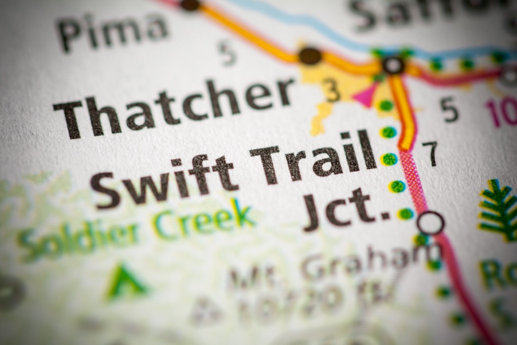
The range as a whole is sometimes referred to as Mount Graham, in which case locals call Mount Graham “High Peak”. The Swift Trail, also known as Arizona Highway 366, is a 35 miles (56 km) scenic road that climbs over 7,000 ft (2,135 m) from desert valley to alpine forest. 22 miles (35 km) of the road are paved and the rest are graded dirt. There are six campgrounds, two picnic areas, and numerous hiking trails along the way.
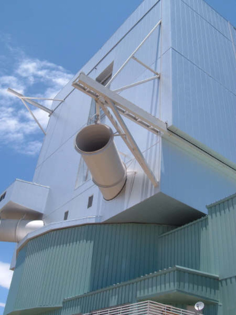
Another notable spot is the Mount Graham International Observatory. It was constructed for the ideal night sky conditions the area offers but has been controversial for two reasons. First, the observatory was built on Native sacred land. Second, environmentalists were concerned of the impact the observatory would have on vital habitat for the Mount Graham red squirrel.
The Pinaleno Mountains are part of the Southwest Basins and Ranges. This entire region has been shaped by crustal extension. It began around 35 million years ago, stretching in a northeast-southwest direction. At first the extension caused crustal rocks to thin.
As this process continued, the Earth’s crust broke into large blocks separated by faults. Some blocks uplifted to form mountain ranges while others sank as much as 2.4 miles (3.9 km) to create deep basins. Streams cutting through the landscape carried boulders, gravel, and sand into alluvial fans in the basins. In some cases, the basins are filled with debris and in other cases, new waterways have cleared passages through them.
The detachment fault related to the formation of the Pinaleno Mountains is the Safford Fault. This fault started forming around 15 million years ago during the middle of the Miocene epoch. The rocks over the fault shifted more than 4 mi (6.5 km) northeast. As they moved, the pressure from above decreased. This allowed buried Proterozoic granite and schists to rise upwards and slowly form a dome.
Pressure and friction reshaped some of the granite and gneiss into a dense and fine-grained rock called mylonite. This is common in the northeastern portion of the range. The Pinaleno Mountains do not contain economically viable sources of minerals or metals.
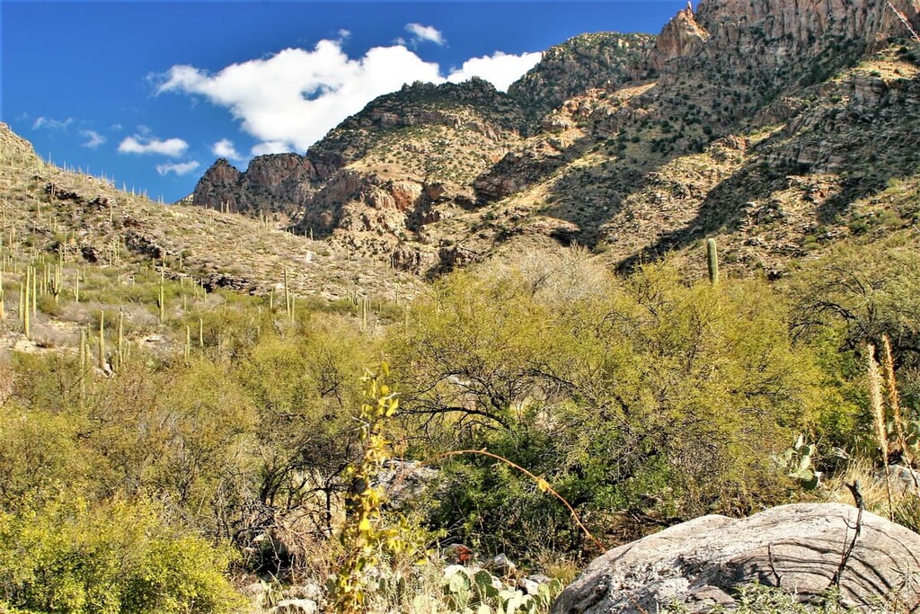
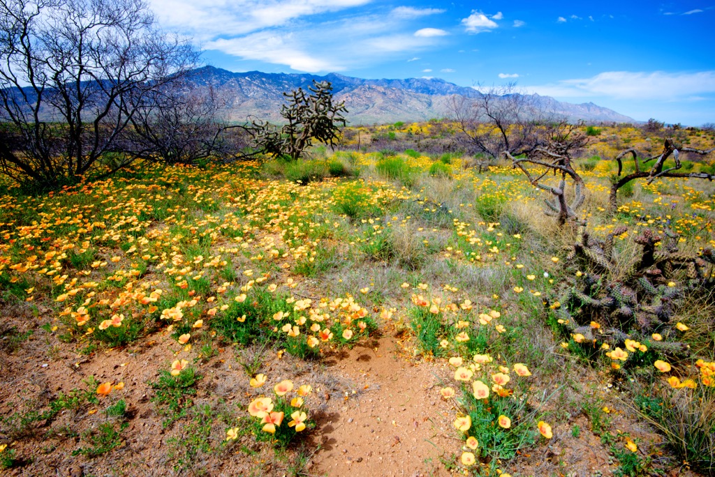
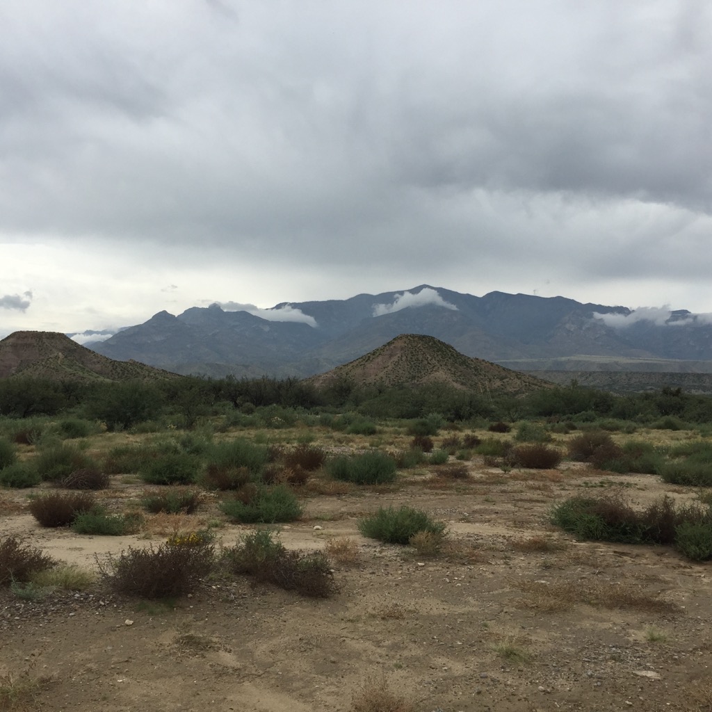
One impressive feature of the super prominent Pinaleno Mountains is the diverse habitats they support. The Sonoran Desert habitat is present up to 4,000 ft (1,220 m). This includes saguaro, palo verde, ocotillo, prickly pear, barrel cactus, mesquite, acacia, ironwood, creosote bush, bursage, jojoba, desert hackberry, and shrubby buckwheat.
Desert grasslands thrive between 3,500 ft and 5,400 ft (1,065 m and 1,645 m). Here gramas, spider grasses, and tanglehead are a few of the most common species. Historically this landscape has been severely degraded by overgrazing and invasive nonnative species such as buffelgrass.
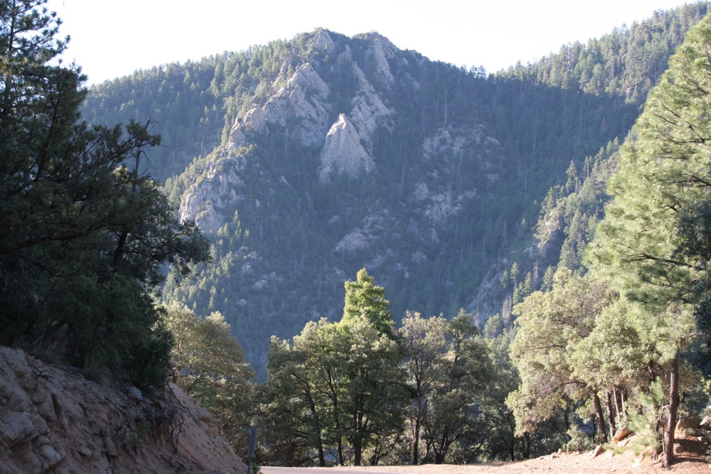
Open oak woodland grows between 3,600 ft and 6,400 ft (1,100 m and 1,950 m). Numerous oak species thrive here including Mexican blue oak, Emory oak, netleaf oak, Arizona white oak, Mexican gray oak, and silverleaf oak. This habitat is often called by its Spanish name encinal. The upper reaches support alligator juniper, Mexican piñon, border piñon, Chihuahua pine, and Apache pine.
Pines begin to grow as elevation increases, temperatures decrease, and precipitation increases. Chihuahua, Apache, and ponderosa pine appear as the ecosystem transitions from pine-oak woodland to pine-oak forest and then to pine forest. Yucca, agave, beargrass, and prickly pear cactus also grow in pine-oak woodland, and aspen and maples are present in pine forests up to 9,600 ft (2,925 m). Subalpine meadows such as Hospital Flat and Chesley Flat boast wildflowers in the summer.
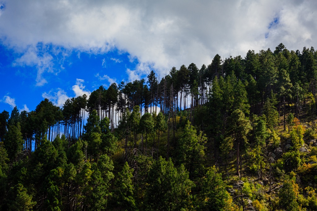
At the highest elevations, one will find montane fir forests with douglas and white fir, and subalpine forests with corkbark fir, douglas fir, and thin leaf alder. Along canyons, riparian habitats support cottonwoods, sycamores, willows, soapberry, alders, and maples. A few plants that are endemic to the range or region include Erigeron heliographis, Hieracium rusbyi, Potentilla albiflora.
These diverse habitats provide homes to a wide range of wildlife. This includes mountain lions, black bears, coyotes, mule deer, Coues white-tailed deer, bobcats, foxes, ringtails, badgers, coati, weasels, raccoons, skunks, javelinas, porcupines, bighorn sheep, and a number of squirrel species including the Mount Graham red squirrel.
Many raptors thrive in the range such as hawks, falcons, owls, and turkey vultures. Other birds present include roadrunners, ravens, quails, wrens, sparrows, jays, nuthatches, and thrushes. The streams house Arizona’s two native species of trout – the Gila and Apache trout.
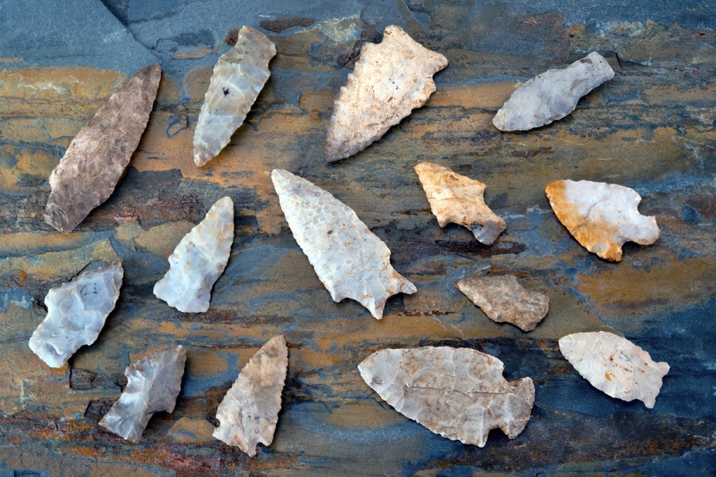
Southeastern Arizona has housed humans for thousands of years. Stone points from the Clovis Culture have been found that date back 11,200 years. Later grinding tools from the Cochise Culture indicate early humans adapted to changing climate and decreasing megafauna by broadening their diet.
Following these early cultures came cultures such as the Mogollon and Hohokam that made pottery and practiced more agriculture. In the 1400s, the Apache, an Athabascan-speaking tribe, migrated in from the north.
The Pinaleno Mountains occupy the northern edge of the Chiricahua Apache territory and the southern limits of the Western Apache land. Mount Graham is one of the top four holiest mountains for the Western Apache.
The Chiricahua divided into four bands – the Bedonkohe, Chokonen, Chihenne, and Nehndi. Geronimo and Cochise are two of the Chihuahua's most famous leaders.
Beginning in the mid-1500s, Spanish conquistadors and missionaries began to arrive in the region. For several centuries, conflict between Native groups and foreign explorers and settlers increased.
The end of the Mexican-American War in 1848 shifted things dramatically. The Treaty of Guadalupe Hidalgo granted most of New Mexico and Arizona to the United States. This new territory opened up opportunities for rapid westward expansion and the area quickly saw the creation of new railroads and stage routes.

Tensions continued to grow and efforts for peace ultimately failed. The Chiricahua were forced from their land in 1886 after Geronimo’s defeat.
The region enticed miners and cattle ranchers. By 1900, there was growing interest by locals to escape the summer heat and recreate in the Pinaleno Mountains and other natural spots now protected by the Coronado National Forest. In the 1930s, the Civilian Conservation Corps built trails, campgrounds, and picnic areas through the mountains.
Although there is a road leading to the summit of Mount Graham (Forest Road 507) the upper portions are off-limits to unauthorized visitors because it crosses into the Mount Graham Red Squirrel Refugium.
The Heliograph Trail #328A is a one mile trail (1.6 km) with about 800 ft (245 m) elevation gain but can be made into a four mile (6.4 km) loop. From Arcadia Trail #328, the trail to the summit separates about a mile before Shannon Campground. From the top, return along Heliograph Road to Swift Trail (AZ 366) to reach Shannon Campground.
Heliograph Peak (10,013 ft/3,052 m) has an interesting history. In 1886, the US Army used mountain peaks for heliographs (communicating via flashing mirrors) in their campaign against the Apaches. Although Heliograph Peak was not used at this time, it came into use in 1889 as part of a larger experiment with the technology.
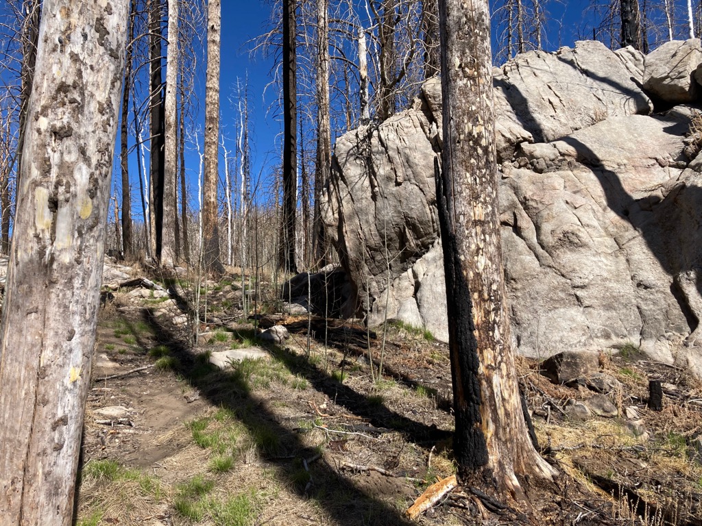
The program was eventually scrapped. In 1933, the Civilian Conservation Corps built a fire lookout tour on the summit that is still used in early summer during peak fire season.
The Webb Peak Trail #345 is a popular short trail through the forest with good views at the end. It begins at the Columbine corrals along Swift Trail (AZ 366). The trail to Webb Peak (10,007 ft/3,050 m) runs one mile (1.6 km) to a lookout tower and gains a little over 800 ft (245 m) in elevation. Slightly before the tower, the Webb Peak Trail cuts to the right, going 1.7 mi (2.7 km) to Ash Creek Trail #307. From this intersection, it is 0.5 mile (0.8 km) back to the Columbine corrals.
The Swift Trail, also known as Arizona Highway 366, is an incredibly scenic drive that is comparable to driving from Mexico to Canada for the life zones it crosses. Climbing from desert to alpine meadows and forests, the winding mountain road climbs over 7,000 ft (2,135 m) in elevation.
It passes near notable points such as Heliograph Peak, Hospital Flat with many wildflowers in the summer, and Treasure Park where rumor says gold and silver were buried by Mexican banditos. These spots can be visited by short jaunts from the Swift Trail road. There are also a number of campsites and trails accessible from the road.
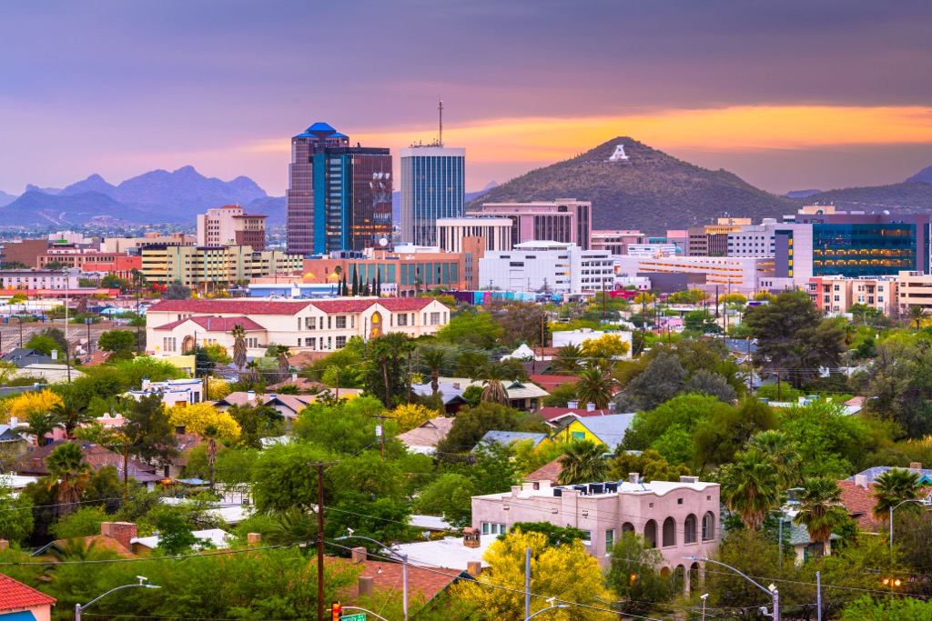
The Pinaleno Mountains have a number of campsites that can be used by those hoping to stay directly in the range. Those traveling to the mountains or looking to stay somewhere with more amenities can check out Tucson or Phoenix, three and four hours drive away respectively.
Tucson has a population of 543,000 people and is about three hours southwest of the mountains. Situated in the Sonoran Desert, visitors can learn more about the region’s ecology at Tohono Chul, the Tucson Botanical Gardens, and the Arizona-Sonora Desert Museum. More active options include exploring the Seven Falls hike in Sabino Canyon or Saguaro National Park.
If you’re interested in history, stop by one of Tucson’s many museums to learn more about the city’s Native heritage and cultures, Spanish influence on the region, or the area’s military and aerospace history.
Tucson is the first UNESCO City of Gastronomy. Drawing on indigenous, Spanish, and Mexican influence, many chefs incorporate local ingredients like prickly pear, chiles, mesquite, and native seeds and grains into their dishes. Depending on your budget, you can stay over in a luxury resort, hip downtown hotel, guest ranch, or at a rustic campsite or RV park.
With a population of 1.625 million people, Arizona’s capital does not lack for things to do. A few top spots to check out while in town are Camelback Mountain with its panoramic views and Papago Park with miles of trails winding through impressive red rock formations.
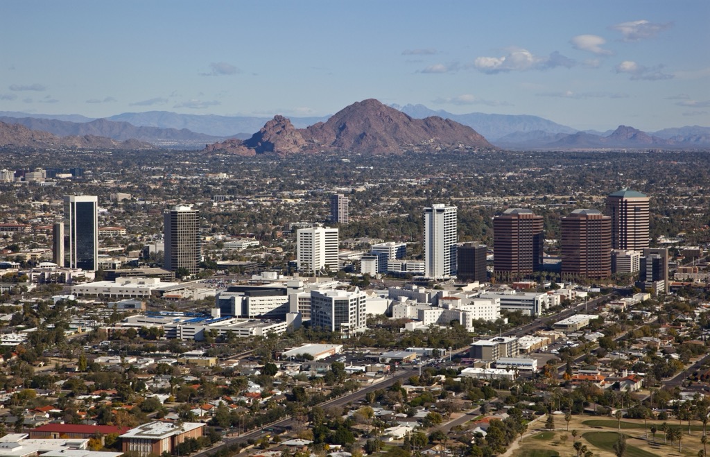
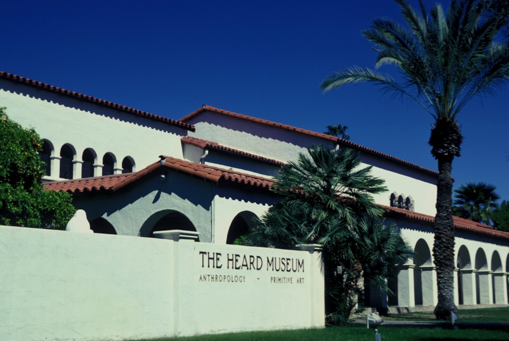
For a taste of culture, head to the Heard Museum to learn about the nearly two dozen tribes who have called the area home. Visit Taliesin West, Frank Lloyd Wright’s winter home, or the impressive Musical Instrument Museum. For a less structured experience, explore the city’s unique neighborhoods such as the Roosevelt Row Arts District and Heritage Square.
Phoenix has a robust dining scene with excellent Mexican and southwestern food, a variety of ethnic cuisines, and everything from taco trucks to fine dining. There’s a wide range of lodging options from resorts and spas to budget motels to campgrounds and RV parks near the city.


ultra
arizona-10ers
southern-arizona-hiking-club
southern-arizona-hiking-club-coronado-12
arizona-ultras
arizona-10ers
arizona-fire-lookouts
arizona-20-20-challenge
southern-arizona-hiking-club
arizona-10ers
arizona-fire-lookouts
arizona-20-20-challenge
southern-arizona-hiking-club
southern-arizona-hiking-club-emblem


