Scan the QR code and open PeakVisor on your phone
The Mount Bennett Hills, also known as the Bennet Mountain Hills, are a small collection of peaks situated in the south-central region of the US state of Idaho. The small subrange is marked by rugged canyons and 27 craggy peaks. The tallest and most prominent peak in the range is Bennett Mountain at 7,418 ft (2,261 m) in elevation and with 1,955 ft (596 m) of prominence.
The Mount Bennett Hills stretch for approximately 60 miles (97 km) from east to west. Though the peaks are referred to as hills, the range is actually quite rugged when compared to the surrounding terrain.
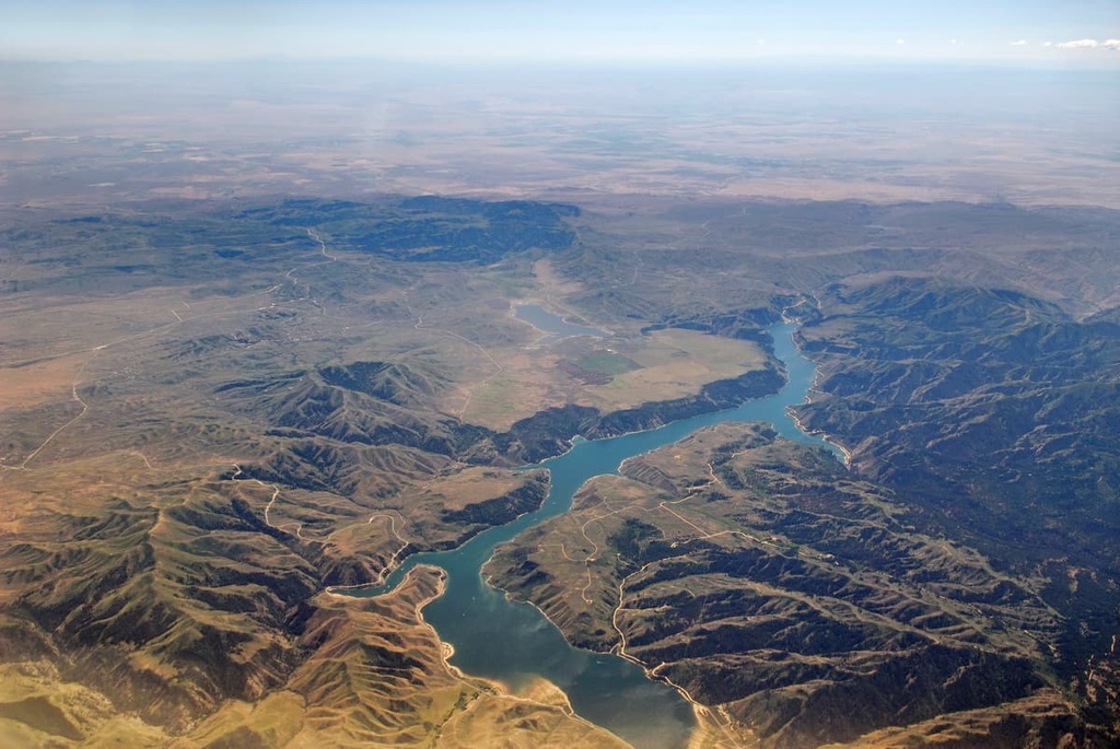
The Snake River Plain marks the southern and southwestern borders of the Mount Bennett Hills, while the Camas Prairie lies to the north. Within the range lie five wilderness study areas.
The rugged landscape can be divided into three subranges: western, central, and eastern hills. Many of the tallest peaks in the range can be found in the Western Mount Bennett Hills, including Bennett Mountain.
This western region is similar in terrain to the nearby Boise Mountains. Patches of forest can be seen throughout the region along with alpine ridges. Bennett Mountain, in particular, has steep slopes on its northern, western, and southern sides while the eastern slope is far more gradual.
The Central Mount Bennett Hills are less forested than the hills to the west. Here, elevations change abruptly from the Camas Prairie and Snake River Plain as the landscape rises up to the ridgeline of the mountains.
The Eastern Mount Bennett Hills are home to even more rugged terrain. In this part of the range, rolling hills covered in sagebrush are dotted with cliffs and abrupt ridges. Rocky peaks make it difficult for a wide variety of flora to thrive in this part of the Mount Bennett Hills. Rock formations known as hoodoos can also be found in this region.
Besides the wilderness areas within the range, the Mount Bennett Hills are surrounded by numerous parks and forests. The Sawtooth National Forest and Sawtooth National Recreation Area lie to the north, Boise National Forest to the northwest, and the Craters of the Moon National Monument and Preserve to the east.
The Mount Bennett Hills mark the southernmost extent of the Idaho-Bitterroot Rocky Mountains, which is a subrange of the greater Rocky Mountains.
The rugged landscape of the Mount Bennett Hills formed alongside the rest of the Rockies. A combination of tectonic plates collisions, volcanic activity, and glaciation helped shape the range into what we see today.
The Laramide orogeny, which took place about 80 to 55 million years ago, was the primary mountain building event responsible for the formation of these peaks. During this event, the Farallon plate subducted beneath the west coast of North America. Immense pressure from the collision led to layers of crust being thrust on top of each other, forming the peaks.
After, magma rose up through the crust, and large amounts of volcanic activity added to the creation of the mountainous landscape. The peaks mark the southern region of the Idaho batholith.
Made up of intrusive igneous rock, the Idaho batholith was formed between about 98 to 43 million years ago. The cooling of magma led to the creation of plutons of granite and granodiorite. Over the course of millions of years, the plutons were pushed to the surface, giving way to the abrupt changes in elevation that are visible today.
Glaciation occurred in the region throughout the Pleistocene. Vast glaciers covered much of the land during this time, carving out the many valleys that we see in the range to this day.
Major peaks within the Mount Bennett Hills include Bennett Mountain, Davis Mountain, The Knob, Twin Peaks, and Teapot Dome.
The westernmost peaks of the Mount Bennett Hills are marked by patches of Douglas-fir, aspen, and juniper. Many of the hillsides are covered in vast sections of sagebrush, bluegrass, cheatgrass.
The central and eastern stretches of the range are also dominated by sagebrush and various grasses. In these regions, populations of cottonwoods, willows, and quaking aspen can be spotted, especially in the shaded sections of canyon.
Though there are minimal amounts of flora found throughout much of the range, many animals still call the region home. Some of the more common species include elk, coyote, and mule deer.
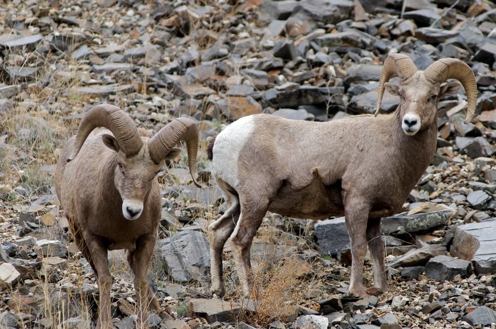
Other animals found in the range include bighorn sheep, mountain goats, wolves, mountain lions, and black bears. It is more common for these animals to be in the westernmost region of the range because this area is more heavily forested.
Many species of birds fly above the rugged and hilly landscape found in the Mount Bennett Hills. Golden eagles are fairly common, as are magpies, sandhill cranes, and greater sage-grouse.
Humans have inhabited the region surrounding the Mount Bennett Hills for thousands of years. Artifacts from human settlement found near Sawtooth National Forest date back approximately 12,000 years, and today, there are numerous cultural and heritage sites located throughout the region.
The region is the ancestral homelands of many Indigenous peoples, including the Shoshone and Bannock. The Shoshone originated in the Great Basin while the Bannock originated in what is now eastern Oregon. Members of both tribes often lived near the Snake River and its many tributaries.
After horses were introduced and domesticated in the region, cooperative buffalo hunts became more widespread. Settlers and colonizers of European descent arrived during the early 1800s along a route that would later become known as the Oregon Trail.
Communities grew in the greater Boise area after Fort Boise was established near the confluence of the Snake and Boise rivers. The fort was abandoned in 1854. A new fort was later established in 1863 along the Oregon Trail.
Populations in the region continued to rise as fur trading and the promise of gold brought more people to the area. The growing settlement of Boise was later established as a city in 1863. Just one year later, Boise became the capital of the territory of Idaho.
Further resistance to the settlers by the Shoshone and the Bannock led to the Bannock War of 1878. After the war, the United States military began further restricting the movements of the Bannock people, particularly after the establishment of the Fort Hall Reservation.
The wilderness study areas within the Mount Bennett Hills were established throughout the 1990s and early 2000s. Today, much of the land within the range is still privately owned.
The Mount Bennett Hills are home to a few hiking trails. Here are some of the most popular hiking areas in the region:
The Teapot Dome Trail is situated on the western edge of the Mount Bennett Hills. The route is 1.7 miles (2.7 km) long with 774 ft (236 m) of elevation gain. This gradual out-and-back trail leads hikers to the top of the iconic Teapot Dome. From the summit, hikers have views of nearby Bennett Mountain and the Snake River Plain.
The Little City of Rocks Loop is the most popular hike in the region. The route is 5 miles (8 km) long round trip with 836 ft (255 m) of elevation gain. The trail winds through the Little City of Rocks Wilderness Study Area. Towering rock formations can be seen throughout the hike, as can sagebrush-filled canyons.
The Gooding City of Rocks Loop offers similar views to the Little City of Rocks Loop. Located near one another, this trail is slightly shorter at just 3.7 miles (6 km) roundtrip, with 485 ft (148 m) of elevation gain. Along the hike, you can see towering rock formations, small ponds, and a creek.
The Dead Horse to Tea Kettle Cave Trail can be accessed by hiking or driving in an off-roading vehicle. The route is 3.7 miles (6 km) long with just 200 ft (61 m) of elevation gain. Once inside the cave, visitors can look up to see a large hole in the ceiling. The opening allows for water to enter the cave during the rainy months.
Looking for a place to stay near the Mount Bennett Hills? Here are some of the best cities and villages to check out in the region:
Located to the northwest of the range lies Boise, the capital of Idaho and the most populous city in the state. The Boise River runs through the city while the Boise National Forest lies to the north.
Despite being the largest city in the state, Boise is home to many local shops and restaurants. The city has also become a hub for outdoor recreation. Hiking, biking, off-roading, and rock climbing are all within close proximity to the city. Boise is also home to many of the major museums in the state of Idaho.

Twin Falls lies to the south of the Mount Bennett Hills within the Magic Valley region. The city has a population of around 50,000 people, making it the most populous city in Twin Falls County.
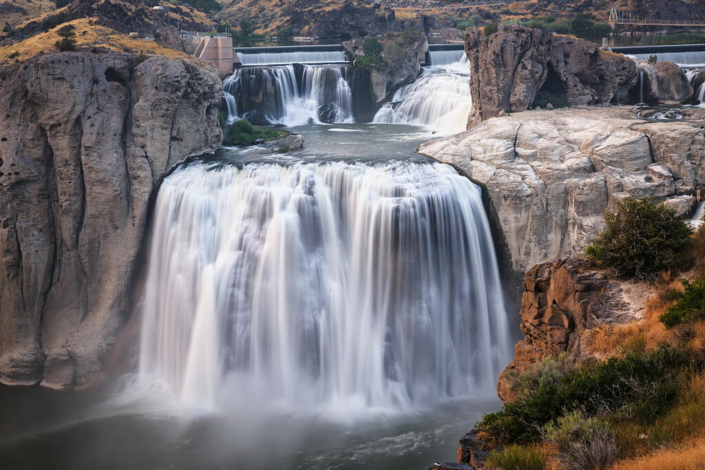
The Snake River winds through the city, cutting out a deep canyon at many points. Twin Falls is known for being the location where Evel Knievel attempted to use a rocket to jump across the canyon in 1974.