
Scan the QR code and open PeakVisor on your phone
The Horse Heaven Hills include 30 named peaks. The highest is Lone Pine Butte at 1,441 m. Other notable peaks include Bickleton Ridge, Mule Butte and The Island.
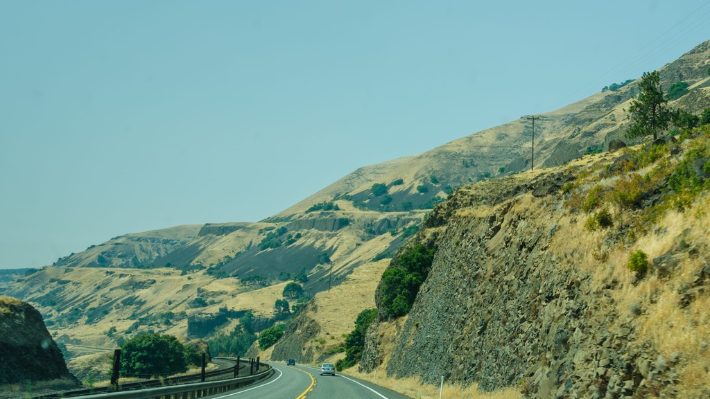
The Horse Heaven Hills are a range of rolling hills situated in the south central region of the US state of Washington. The range marks one of the hottest and driest places within the entire state. There are 30 named peaks in the range with the tallest and most prominent being Lone Pine Butte at 4,728 feet (1,441 m) tall with 1,607 feet (490 m) of prominence.
The Horse Heaven Hills mark a range of rolling hills in the south central region of the US state of Washington. This rolling landscape spans across Klickitat, Yakima, and Benton counties.
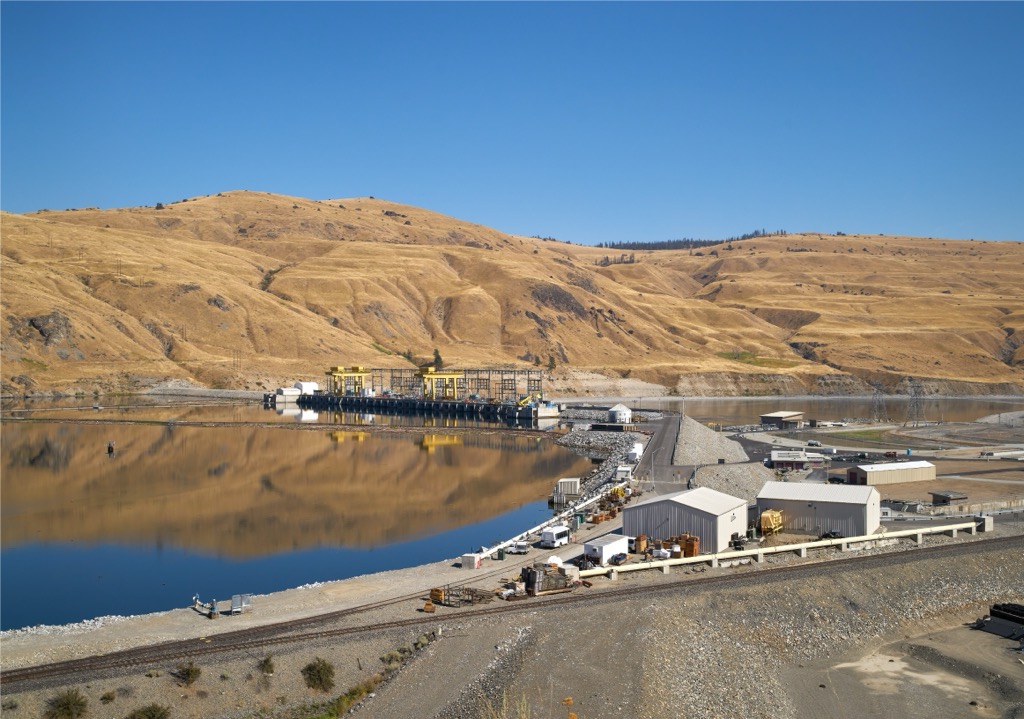
These hills are bound by Satus Creek to the west while the Columbia River extends along the eastern and southern stretches of the range. The Yakima River runs roughly along the northern stretches of the Horse Heaven Hills.
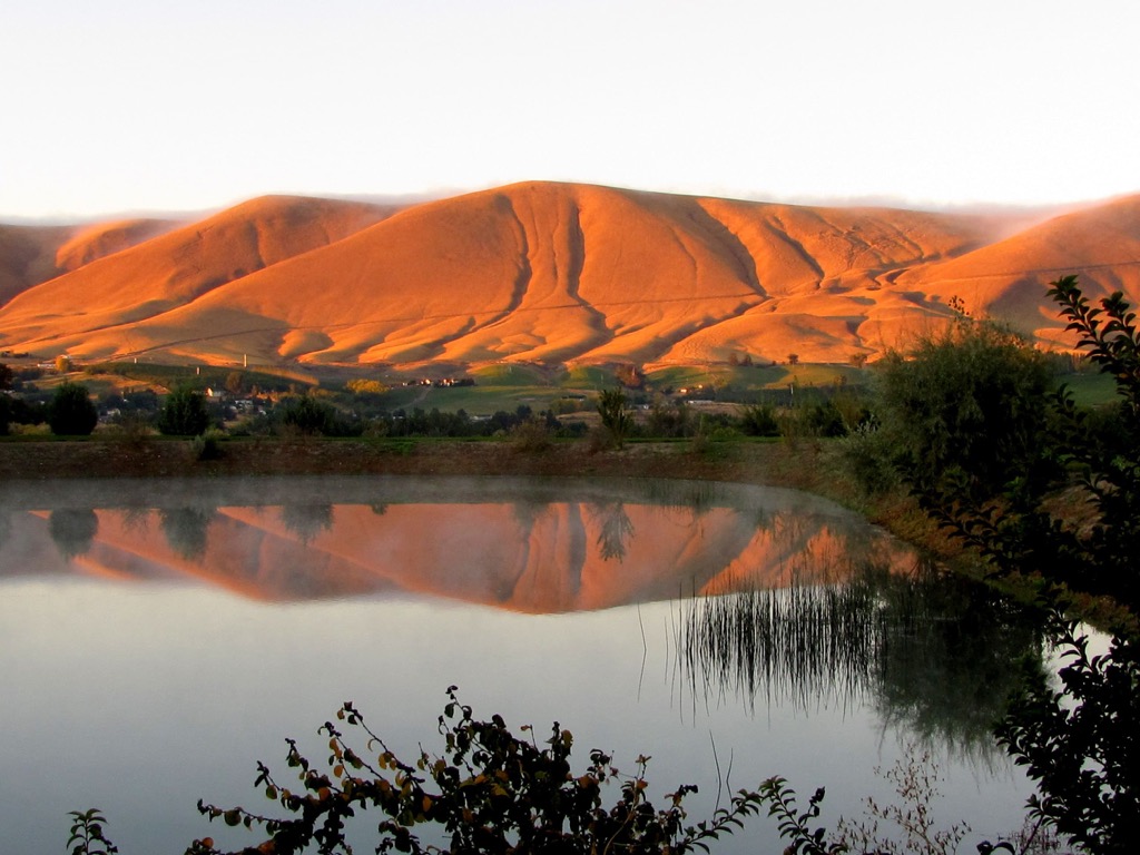
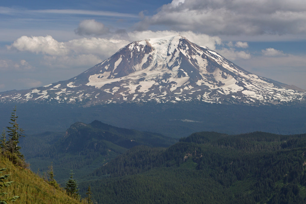
Further west of the range lies the Simcoe Mountains and the Cascade Range. Northern slopes tend to feature steeper terrain than the southern slopes. Horse Heaven Hills form the southern edge of the Yakima River Valley.
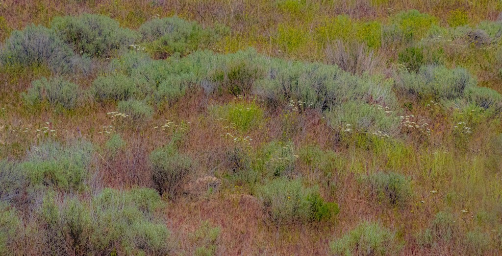
The landscape is dominated by low growing grasses and shrubs with little to no patches of trees. Elevations range from the banks of the Columbia River up to the summit of Lone Pine Butte.
Lack of rainfall and extreme temperatures make it difficult for much plant or animal life to thrive in the region. The Horse Heaven Hills mark one of the hottest and driest regions in the state of Washington.
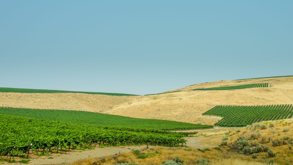
The entire range lies in the rain shadow of the Cascade Range, contributing to its arid climate. Rainfall averages just 9 inches (230 mm) per year in the lower parts of the range. The Horse Heaven Hills are populated with wineries and other agricultural farms, marking one of the driests wheat growing regions in the entire world.
Nearby areas for outdoor recreation include the Hanford Reach National Monument to the north, along with Ahtanum State Forest and Okanogan-Wenatchee National Forest to the northwest. West of the range lies Mount Adams Wilderness, Gifford Pinchot National Forest, and Soda Springs Wildlife Area. Along the western edge of the range lies the Brooks Memorial State Park and Simcoe Mountain Wildlife Area.
The Horse Heaven Hills are classified as an anticline ridge, situated along the Yakima Fold Belt. North-south compressions of lava flows in the Columbia River Basalt Group helped from the base for this region.
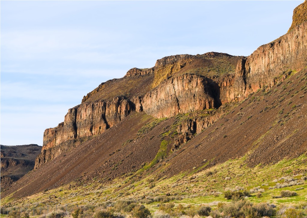
The Columbia River Basalt Group was formed roughly 15 million years ago. Over 300 lava flows covered the surrounding region, erupting from fissures in present-day Oregon and Idaho. These continual lava flows created a 5,900 feet (1,798 m) layer, causing the Earth’s crust in the region to subside.
Continued compression slowly forced the Horse Heaven Hills upwards. Near the end of the last glacial maximum, the Cordilleran Ice Sheet formed a vast dam along the Clark Fork. This dam eventually led to the formation of the Glacial Lake Missoula.
Roughly 15,000 years ago, the dam broke with the water being sent towards the Pacific Ocean. These massive floods further shaped the range and the Columbia River Gorge. Glacial erratics can be found throughout the region, having been deposited in the area during the last glacial maximum.
Major peaks within the Horse Heaven Hills include Lone Pine Butte, Badger Mountain, Jump Off Joe, and Red Mountain.
A majority of the Horse Heaven Hills are populated by native grasses and low growing shrubs along with some flowering plants. The treeless terrain features large patches of sagebrush.
This region once supported large populations of animals though many were hunted to the point of extinction. Wild horses roamed the range though they were removed to make way for agriculture and farming.
Today a small population of deer still inhabits the region. In recent years pronghorn sheep have been reintroduced.

Humans have inhabited the land surrounding the Horse Heaven Hills for thousands of years. This range lies within traditional territory of the Umatilla Tribe, marking the southern boundary of the Yakama Tribal Nation. Land northeast of the range was traditionally part of the Walla Walla Tribe.
The surrounding Tribes all spoke dialects of the Sahaptin language and shared similar customs and traditions with one another. Traditionally hunters and gatherers, the Indigenous peoples of the area worked harmoniously with the land.
Descendants of these tribes are represented by the Umatilla Indian Reservation in Oregon and the Yakama Tribal Nation located to the north in Yakima, Washington.
The first recorded contact between the Indigenous peoples of the region and people of European descent was in the early nineteenth century. Members of the Lewis and Clark Expedition traveled down the Snake River near present-day Pasco, Washington in 1805.
Americans of European descent began arriving in large numbers during the 1850s. At first relations between the settlers and Indigenous peoples were relatively friendly. However, in 1855 the Walla Walla Council decided to forcibly remove the Indigenous peoples from their native homelands onto reservations.
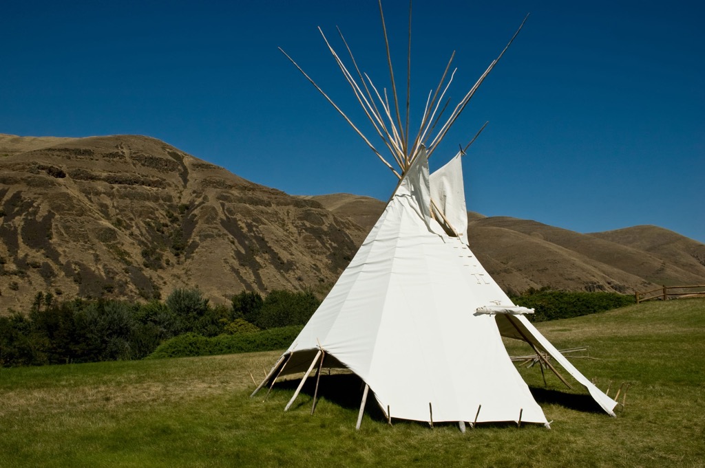
The name “Horse Heaven Hills” was given by James Gordon Kinney, who noted how the long native grasses supplied the horses with ample amounts of food, calling it a “horse heaven”. More settlers began arriving in the region and farming the surrounding land, establishing many towns and cities in the following decades.
Drywheat continues to grow throughout the surrounding region. In recent decades, the region has also grown to support numerous wineries. In 2005 the Horse Heaven Hills American Viticulture Area was established.
A majority of the Horse Heaven Hills is rather desolate with large portions being used for farming and agriculture purposes. Below are a few trails in the region, with most routes being located along the edges of the range near towns and cities:
Located along the northeastern edge of the range, the McBee Hill Loop is one of the most popular trails in the region. The route begins by climbing steeply up to the summit of the hill. The low growing grasses offer hikers panoramic views of nearby Benton City and the Horse Heaven Hills. Once hikers reach the summit the trail slowly descends back towards the trailhead. This loop is 4.1 miles (6.6 km) and features 1,138 feet (347 m) of total elevation gain.
This wildlife refuge is situated at the northern edge of the range. The relatively flat trail winds through the refuge, while the Horse Heaven Hills extend to the south. On a clear day, hikers also have views of Mount Adams located to the west in the Cascade Range. This loop is 1 mile (1.6 km) long and features just 13 feet (4 m) of elevation gain.
This loop route is located along the southern banks of the Yakima River, just outside the city of Prosser along the northern edge of the range. The rolling hills extend to the south while farmlands and wineries extend in nearly every direction. This loop is 4 miles (6.4 km) long and features 1,049 feet (320 m) of elevation gain.

Looking for a place to stay near the Horse Heaven Hills? Here are some of the best cities and villages to check out in the region.
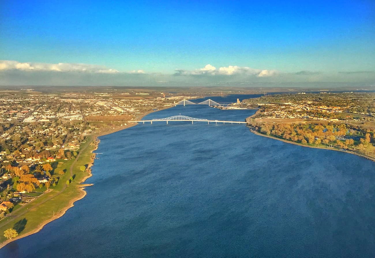
The Tri-Cities lie along the eastern edge of the Horse Heaven Hills. The term “Tri-Cities” refers to three close cities; Kennewick, Pasco, and Richland. These three cities sit at the confluence of the Snake, Yakima, and Columbia Rivers as they flow into the Columbia River Gorge.
Home to roughly 245,000 residents, the Tri-Cities mark the most populous area in south central Washington. The region is surrounded by wineries and often referred to as the “Heart of Washington Wine Country”. Throughout the Tri-Cities lie numerous paved and unpaved paths for recreation purposes.
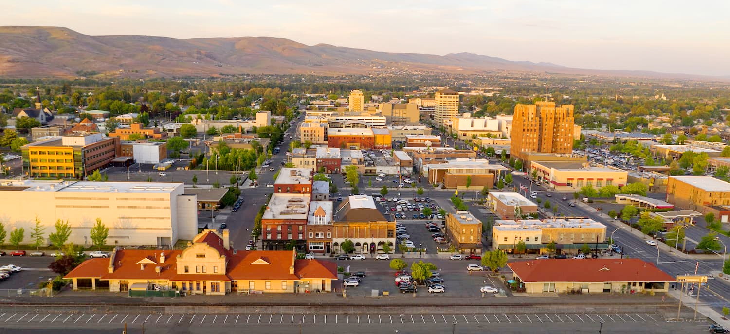
The city of Yakima lies north of the range, situated in the fertile Yakima Valley. The valley helps produce over 75 percent of all hops grown in the US and is named after the Yakama Nation Native American Tribe, with their reservation located just south of the city.
The Yakima River runs through the city and features trails along the river banks for running, biking, or hiking. Home to roughly 97,000 residents, it marks the second most populous city in the region following the nearby Tri-Cities.


The highest peak in the Horse Heaven Hills is Lone Pine Butte, at 1,441 m.
The Horse Heaven Hills have 30 named peaks.


