
Scan the QR code and open PeakVisor on your phone
The Simcoe Mountains include 28 named peaks. The highest is Indian Rock at 1,775 m. Other notable peaks include Simcoe Mountain, Potato Butte and Stagman Butte.
The Simcoe Mountains is a volcanic field is a group of lava flows and cinder cones located in Washington state and spans 1,000 square miles. The Simcoe Mountains are in the south-central region of the state just east of Mount Adams. There are 26 named mountains in Simcoe Mountains. The highest and most prominent mountain is Indian Rock, a basaltic shield, at 5,823 feet. The northern section of the volcanic field is located in the Yakama Indian Reservation. The Simcoe Mountains are near the Cascade Range but are actually older than this range of peaks. The Simcoe Mountains are home to an estimated 223 extinct eruptive units.
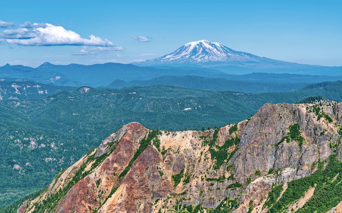
The Simcoe Mountains are located in the Yakima Fold Belt within the Columbia River Basalt Group. Eruptions in this area started occurring 4.2 million years ago with the most recent eruption estimated to have taken place 1 million years ago. The most recent eruption, that helped form the Simcoe Mountains was named the “Trachybasalt of Pretty Swamp”. All of the volcanoes within the region are now extinct. While the state of Washington is often known for the lush forests and domed mountain peaks, the Simcoe Mountains are a unique addition and worth a visit.
Much of the Simcoe Mountains are inaccessible due to it being owned for timber logging or located on the Yakama Indian Reservation. Nearby hikes can be found in the following places:
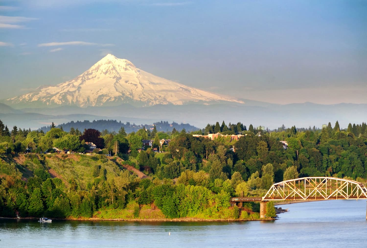
The Simcoe Mountains are located just 1:45 minutes northeast of Portland, OR. With a population of over 600,000 people, Portland is the largest city within the state of Oregon. Known for its vast food scene, many people often forget that Portland is also a hiker’s paradise. The city is home to Forest Park, 5,200 acres of trails within the city, it is just two hours away from both Mount Adams and Mount Hood, and an hour from Tillamook National Forest.
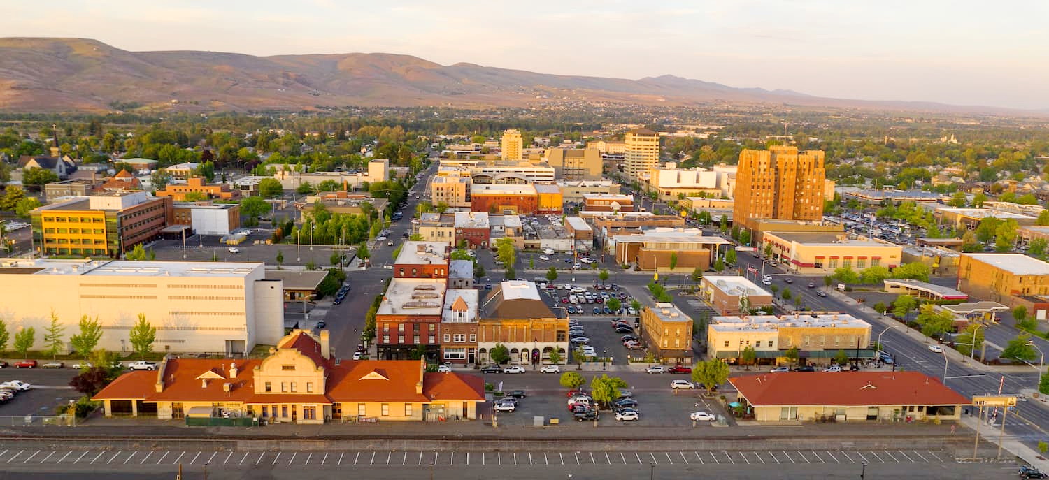
Located in the fertile Yakima Valley of central Washington, the city of Yakima is known for its wineries and apple orchards. At about 1:45 minutes north of the Simcoe Mountains, the city is a great place to stay or stop by when you are in the area. The Yakima Valley produces over 75% of all hops grown in the United States. The name Yakima comes from the Yakama Nation Native American tribe, with their reservation located just south of the city. The Yakima River runs through the city and offers a 10-mile trail along the edge for running, hiking, or biking.
Located in the fertile Yakima Valley of central Washington, the city of Yakima is known for its wineries and apple orchards. At about 1:45 minutes north of the Simcoe Mountains, the city is a great place to stay or stop by when you are in the area. The Yakima Valley produces over 75% of all hops grown in the United States. The name Yakima comes from the Yakama Nation Native American tribe, with their reservation located just south of the city. The Yakima River runs through the city and offers a 10-mile trail along the edge for running, hiking, or biking.


The highest peak in the Simcoe Mountains is Indian Rock, at 1,775 m.
The Simcoe Mountains have 28 named peaks.


