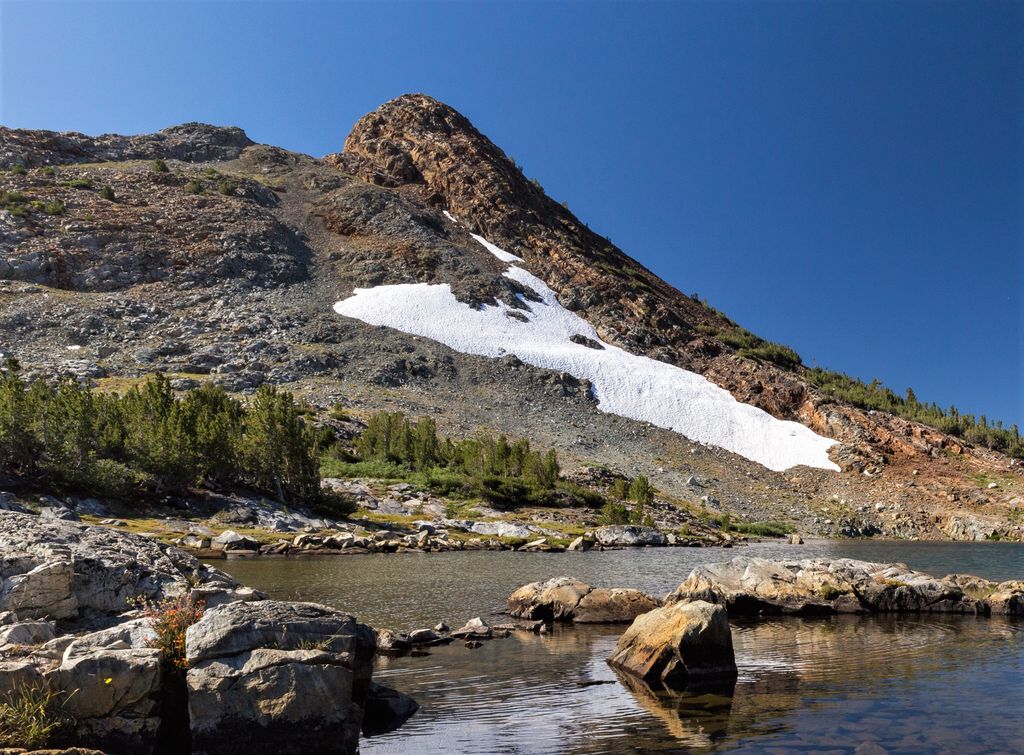
Gaylor Peak is an 11,004-foot-elevation (3,354 meter) mountain summit located on the crest of the Sierra Nevada mountain range in northern California, United States. The peak is situated on the common boundary shared by Yosemite National Park with Inyo National Forest, as well as the border shared by Mono County with Tuolumne County. It rises immediately above the park's Tioga Pass entrance station and Tioga Lake. Topographic relief is significant as the summit rises approximately 1,400 feet (430 meters) above the lake in one-half mile (0.80 km). The peak is a popular hiking destination on summer weekends due to easy access via the two-mile Gaylor Lakes Trail from State Route 120 which traverses the east base of the peak.
By elevation Gaylor Peak is
# 64 out of 215 in Yosemite National Park # 18 out of 82 in Inyo National Forest # 51 out of 226 in Tuolumne County # 99 out of 197 in Mono County
By prominence Gaylor Peak is
# 76 out of 215 in Yosemite National Park # 31 out of 82 in Inyo National Forest # 85 out of 226 in Tuolumne County # 95 out of 197 in Mono County
We use GPS information embedded into the photo when it is available.
3D mountains overlay
Adjust mountain panorama to perfectly match your photos because recorded by camera photo position might be imprecise.
Move tool
Rotate tool
Zoom
More customization
Choose which peak labels should make into the final photo and what photo title should be.
Next
Photo Location
Satellitte
Flat map
Relief map
Latitude
Longitude
Altitude
OR
Latitude
°'''
Longitude
°'''
Apply
Register Peak
Peak Name
Latitude
Longitude
Altitude
Register
Teleport
PeakVisor
This 3D model of Sagarmatha National Park in Nepal was made using the PeakVisor app topographic data. The mobile app features higher precision models worldwide, more topographic details, and works offline. Download PeakVisor maps today.
Download OBJ model
PeakVisor
The download should start shortly. If you find it useful please consider supporting the PeakVisor app.
PeakVisor for iOS and Android
Be a superhero of outdoor navigation with state-of-the-art 3D maps and mountain identification in the palm of your hand!