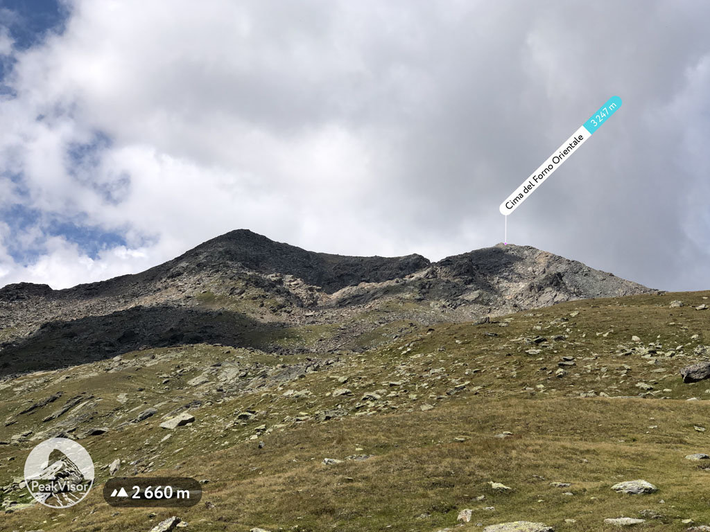
At an elevation of 3247 m (10,653 ft.), and with a prominence of 109 m (358 ft.), Cima del Forno Orientale forms part of the Southern Rhaetian Alps. It is situated near the city of Bormio, in the Sondrio province of Lombardy, Italy.
On the west of the mountain is the Forno Glacier, the longest valley glacier in Italy. “Cima del Forno,” can be roughly translated as “top of the oven,” a name that is quite ironic for a mountain with a glacier.
Cima del Forno can be hiked together with Cima di Rosso. Along the route is the Pizzini-Frattola Refuge, which can accommodate 135 visitors and is equipped with hot water, central heating, and a sauna.
By elevation Cima del Forno Orientale is
# 91 out of 425 in the Ortler Alps # 93 out of 370 in Parco Nazionale dello Stelvio - Nationalpark Stilfser Joch
By prominence Cima del Forno Orientale is
# 96 out of 370 in Parco Nazionale dello Stelvio - Nationalpark Stilfser Joch
We use GPS information embedded into the photo when it is available.
3D mountains overlay
Adjust mountain panorama to perfectly match your photos because recorded by camera photo position might be imprecise.
Move tool
Rotate tool
Zoom
More customization
Choose which peak labels should make into the final photo and what photo title should be.
Next
Photo Location
Satellitte
Flat map
Relief map
Latitude
Longitude
Altitude
OR
Latitude
°'''
Longitude
°'''
Apply
Register Peak
Peak Name
Latitude
Longitude
Altitude
Register
Teleport
PeakVisor
This 3D model of Sagarmatha National Park in Nepal was made using the PeakVisor app topographic data. The mobile app features higher precision models worldwide, more topographic details, and works offline. Download PeakVisor maps today.
Download OBJ model
PeakVisor
The download should start shortly. If you find it useful please consider supporting the PeakVisor app.
PeakVisor for iOS and Android
Be a superhero of outdoor navigation with state-of-the-art 3D maps and mountain identification in the palm of your hand!