
Scan the QR code and open PeakVisor on your phone
Whiskeytown-Shasta-Trinity National Recreation Area - Whiskeytown Unit has 7 named peaks. The highest is Shasta Bally at 1,883 m. Other notable peaks include Little Bally, South Fork Mountain and Buckhorn Bally.
The Whiskeytown-Shasta-Trinity National Recreation Area – Whiskeytown Unit is a protected area situated in the northern part of the US state of California, just to the west of the city of Redding. The tallest and most prominent peak in the Whiskeytown Unit is Shasta Bally at 6,178 ft (1,883 m) in elevation and with 1,631 ft (497 m) of prominence.
The Whiskeytown-Shasta-Trinity National Recreation Area is a federally protected area that’s divided into three distinct units. Combined, these units span 246,087 acres (99,588 ha) across northern California. The Whiskeytown Unit is the only of the three units that’s not surrounded by the Shasta-Trinity National Forest.
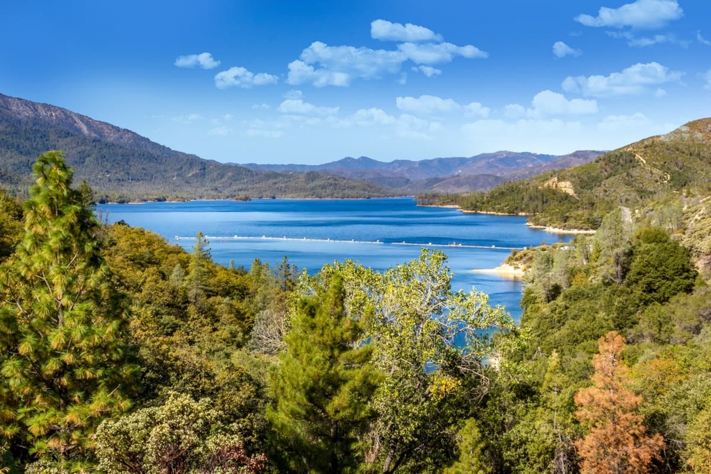
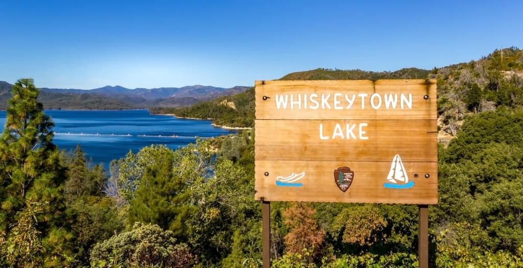
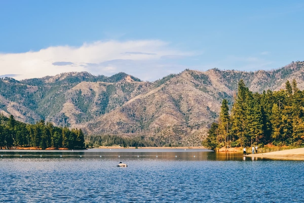
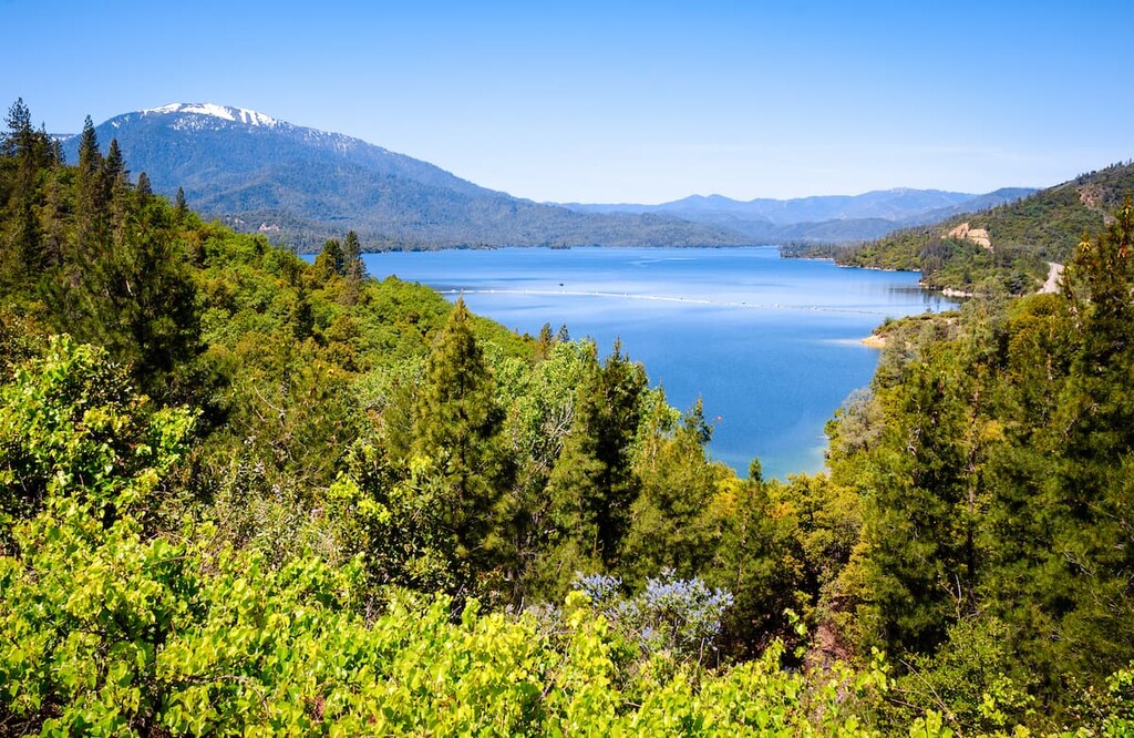
The Whiskeytown Unit encompasses Whiskeytown Lake and the surrounding landscape. While the lake spans 3,200 acres (1,300 ha), the unit includes 39,000 acres (16,000 ha) of land.
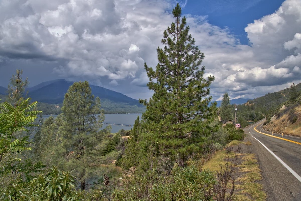
The human-made Whiskeytown Lake reservoir was created by diverting the Trinity River toward the Sacramento River. Today, the lake is surrounded by densely forested hills that are full of hiking trails and service roads.
Located just off Highway 299, the Whiskeytown Unit is the most accessible and visited of the three units in the national recreation area. Though the surrounding hills are steep, they are actually the southeastern foothills of the Klamath Mountains.
The surrounding mountains are also home to various creeks, streams, and waterfalls, making for breathtaking hiking views throughout much of the year. The unit is ideal for a wide range of outdoor activities that allow visitors to immerse themselves in the region’s biodiverse forests.
Although the Whiskeytown-Shasta-Trinity National Recreation Area – Whiskeytown Unit is not located within a national forest, it is surrounded by various other parks, forests, and wilderness areas.
To the north lies the recreation area’s Trinity Unit while the Shasta Unit is situated to the northeast. Meanwhile, the Trinity Alps Wilderness is located to the northwest, Shasta-Trinity National Forest is located to the east, and the Yolla Bolly-Middle Eel Wilderness is located to the southwest.
The peaks within the Whiskeytown-Shasta-Trinity National Recreation Area are part of the much larger Klamath Mountains. The range spans throughout the western coast of northern California and southern Oregon.
The geological history of the peaks within the recreation area dates back hundreds of millions of years. The Klamath Mountains were once part of an island chain that was located off the coast of present day North America. These islands were formed by fragments of existing continents and continual volcanic activity.
Rocks from these islands date back to the Paleozoic, nearly 500 million years ago. During this time, the Farallon plate began moving eastward before eventually colliding with the west coast of the North American plate.
This collision and subduction of the Farallon plate moved the islands eastward around 250 to 130 million years ago. This subduction caused the metamorphosis of the existing rock as magma formed beneath the Earth’s crust.
Lava flows continued to form throughout the western coast of what is now North America in the Cascade Range for tens of millions of years. Erosion later carved out the landscape, leaving behind steep hillsides and deep valleys which would eventually be filled by various rivers, streams, and lakes.
Major peaks within the Whiskeytown-Shasta-Trinity National Recreation Area – Whiskeytown Unit include Shasta Bally, Little Bally, Buckhorn Bally, Mule Mountain, and Kanaka Peak.
The Whiskeytown-Shasta-Trinity National Recreation Area is full of conifer trees, including coast Douglas fir, ponderosa pine, Lawson’s cypress, mountain hemlock, red fir, pacific yew, coast redwood, and sugar pine.
Other tree species in the region include black oak, gray pine, along with low growing shrubs and various wildflowers. A more diverse array of flora can be found just west of the recreation area where the landscape receives higher amounts of rainfall.
Despite the high number of visitors to the region, the vast forests surrounding the recreation area provide the ideal habitat for a wide range of fauna. However, most of the region’s larger animal species are more common in the land west of the Whiskeytown Unit.
Mammals in the area include black bears, mountain lions, red fox, grey fox, racoons, bobcats, martens, northern flying squirrels, and deer.
Bird species in the recreation area include band-tailed pigeons, bald eagles, woodpeckers, golden eagles, and various species of hawks and owls. The spotted owl inhabits the forested regions surrounding the Whiskey Unit as well much of the west coast of the United States.
Humans have lived on the land surrounding the Whiskeytown Unit for thousands of years. In particular, long before European settlers arrived, the Wintu and their ancestors lived in the Sacramento Valley.
The Wintu are also sometimes referred to as the Wintun, a name that also encompasses the Nomlaki and Patwin peoples. The traditional territory of the Wintu includes much of the land along the western edge of the Sacramento Valley, extending out towards the Coast Range.
The first recorded contact between the Wintu people and people of European descent occurred in 1826. This encounter was followed by another expedition to the region in 1827.
Just a few years later, in the early 1830s, new settlers in the region were responsible for a malaria outbreak amongst the Wintu people, which ultimately led to the death of nearly 75 percent of the Wintu community. The influx of settlers to the region only worsened with the arrival of the California Gold Rush in the 1840s.
A decade later, in the 1850s, the settlers in the region organized a so-called friendship feast for local tribal members. During this feast, the settlers served the tribes poisoned food, which led to over 100 deaths. Not long afterward, in an event known as the Bridge Gulch Massacre, settlers killed about 150 Wintu near the South Fork of the Trinity River.
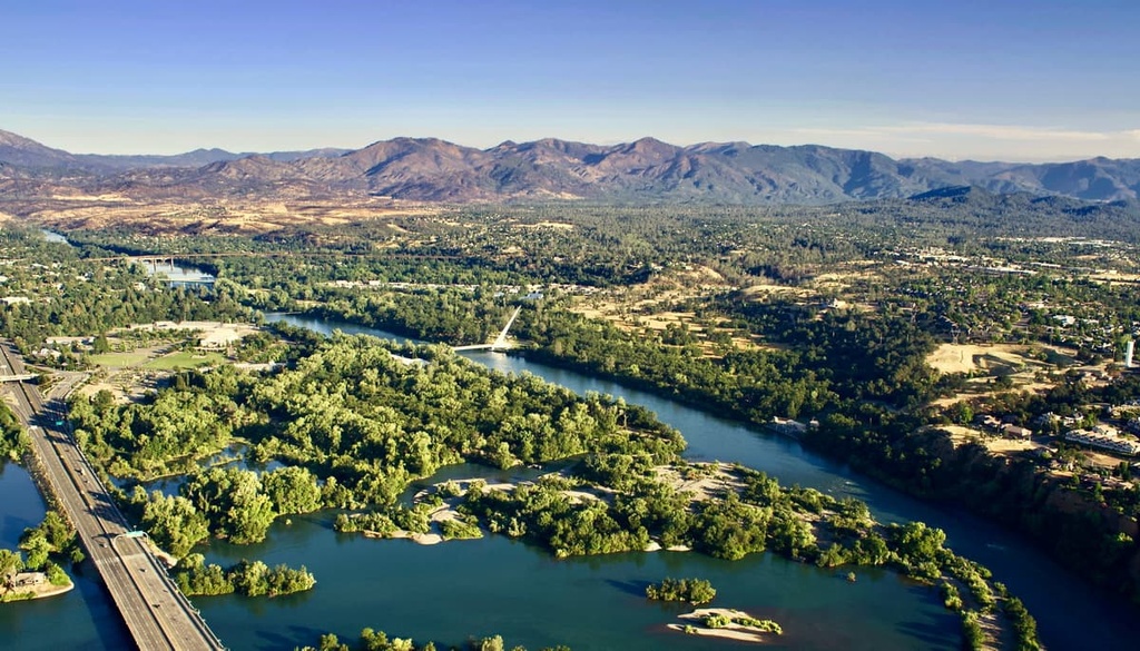
Around the same time, a settlement was established in what would later become Redding, California. As settler communities continued to grow during the Gold Rush, the railroad came to Redding, too.
The construction of the Shasta Dam allowed the economy of Redding to flourish during the 1930s and 1940s. Whiskeytown Dam, which formed the Whiskeytown Reservoir that’s now located within the recreation unit, was completed in 1963.
In 1965, the Whiskeytown-Shasta-Trinity National Recreation Area was established in order to protect the landscape of the region.
The Whiskeytown-Shasta-Trinity National Recreation Area –Whiskeytown Unit is home to numerous hiking trails. Here are some of the most popular hiking areas in the recreation area:
The Whiskeytown Falls Trail is one of the most popular hikes in the region. This out-and-back trail is 2.7 miles (4.3 km) long with 761 feet (232 m) of elevation gain. The route winds its way through dense forests along a rocky footpath. After climbing the trail, hikers reach the falls that cascade down the rocky cliffside.
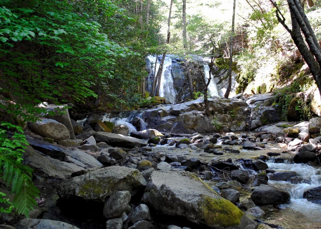
The Crystal Creek Falls Trail is a shorter route that still allows hikers to reach a waterfall. The route is 1 mile (1.6 km) long with just 60 feet (18 m) of elevation gain. At the bottom of the falls lies a shallow pool that can be used for swimming during the warmer months of the year.
The Mount Shasta Mine Loop Trail is a popular hiking route near the southeastern edge of the Whiskeytown Reservoir. The loop is 3 miles (4.8 km) long with 538 feet (164 m) of elevation gain. Hikers walk through the forest amidst patches of wildflowers during the summer months. Along the route, there are also views of the lake and the abandoned mine.
Looking for a place to stay near the Whiskeytown-Shasta-Trinity National Recreation Area – Whiskeytown Unit? Here are some of the best cities and villages to check out in the region:
Redding is the nearest major city to the Whiskeytown Unit. With a population of around 93,000 people, Redding is both the economic and cultural capital of the region. The Sacramento River runs through Redding while mountains tower above the city.
With over 300 days of sunshine each year, Redding is the ideal location for outdoor recreation. Trails can be found just outside the city, providing ample opportunities for hiking, biking, and running. Meanwhile, a plethora of nearby lakes and reservoirs allow for swimming, kayaking, canoeing, and boating. Redding is also known for its world-class fishing opportunities.
Just west of Whiskeytown Unit lies the town of Weaverville. The town has a population of just 3,600 people and was established during the California Gold Rush.
In the years since its founding, Weaverville has retained many of its original buildings, though most of them have been refurbished. The Trinity Alps Wilderness Area lies just outside of the town, making it a great location for hiking, backpacking, watersports, biking, and trail running.


The highest peak in Whiskeytown-Shasta-Trinity National Recreation Area - Whiskeytown Unit is Shasta Bally, at 1,883 m.
Notable peaks in Whiskeytown-Shasta-Trinity National Recreation Area - Whiskeytown Unit include Shasta Bally, Little Bally, South Fork Mountain, Buckhorn Bally and Kanaka Peak.


