
Scan the QR code and open PeakVisor on your phone
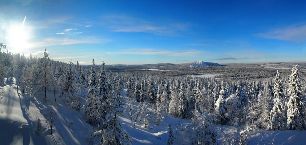
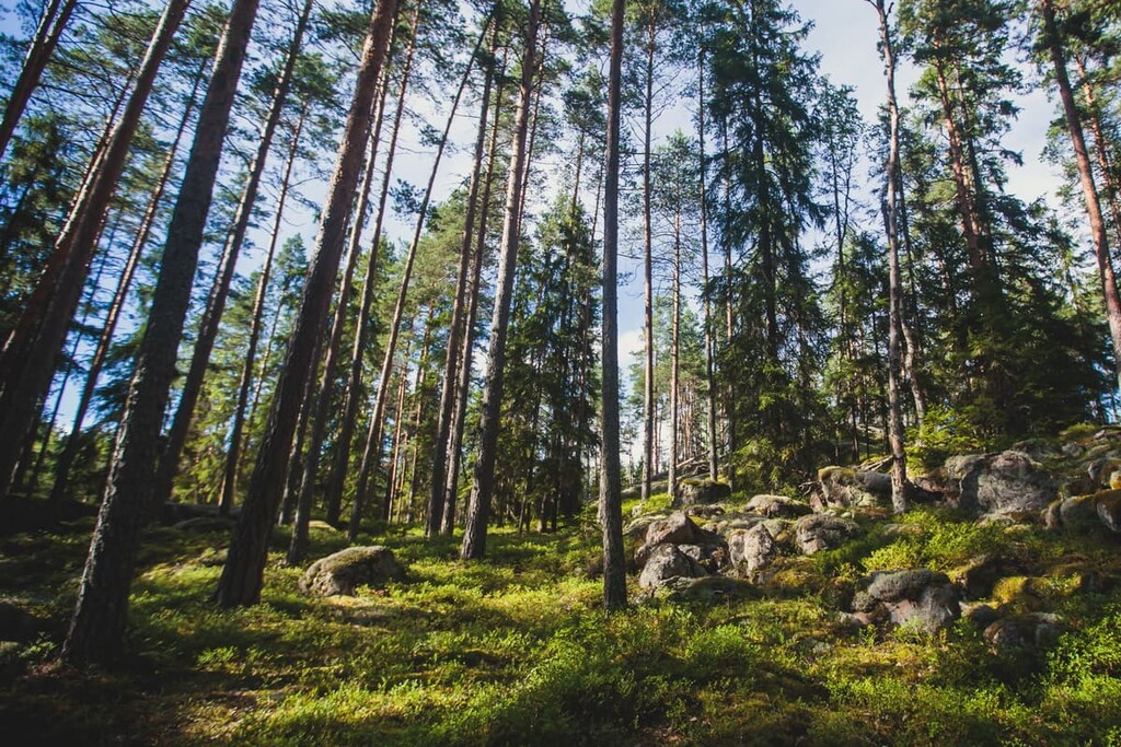
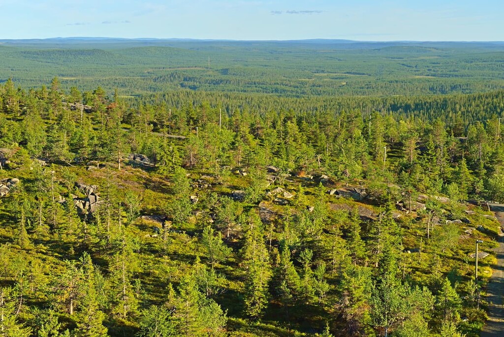
Syöte National Park is one of Finland’s 40 national parks. It is located in the northern part of the country in the Northern Ostrobothnia and the Lapland regions. The park is known for its wild wooded hills that feature old-growth pines and spruces. It’s also famous for its heavy snowfall, which creates the postcard-perfect scenery for which Finland’s nature is well-known. There are 23 named mountains in the Syöte National Park, the highest and the most prominent of which is Pyhitys (412 m / 1,381 ft).
Syöte National Park is named after Iso-Syöte mountain (430 m / 1,411 ft). It is considered the southernmost of the 1,462 mountains and hills in Lapland.
The exact meaning of the word “syöte” is unknown, but for sure it comes from the language of the local native Sámi people, and it means “sacred place.” When the ancestral Sámi inhabited this area, they considered Iso-Syöte a place of worship and sacrifice like many other fells in the region.
The Sámi still maintain their traditional hunting traditions, so many other place names
in Syöte are related to hunting, such as:
Some of these words come from the modern Finnish language, as well.
It is also interesting that Syöte is one of the newest national parks in Finland, having been founded in 2000. I remember a time when there were about 35–37 parks and now there are 40. Finns just love creating national parks!
It is also one of the most popular national parks. For example, in 2020 the park was visited by 113,500 people. In comparison, the most popular park Pallas-Yllästunturi hosted 563,100 people—five times more, while the most "unpopular" park, Bothnian Bay National Park (Perämeri National Park), hosted only 5,000 people.
Syöte National Park consists of four distinct areas, which have a total area of 300 sq. km (115.8 sq. mi). These areas are scattered around in the north of the Northern Ostrobothnia region in the municipalities of Pudasjärvi, Posio, and Taivalkoski, and the neighboring region of Lapland. It is about 150 km (92.3 mi) from the park to the Arctic Circle.
To get to the park's visitor center from Helsinki by car, it takes about 8.5–9 hours of driving over a course of about 747 km (164 mi). The route passes through the major cities of Jyväskylä in the center of the country and Oulu on the shore of the Baltic Sea, where the nearest airport and train station are accessible from Helsinki.
In summer, there is a bus between Pudasjärvi, the main town in the area, and the Syötekylä village, which is located closer to the park. You need to get off the bus before the park’s boundaries and walk about 4 km (2.4 mi) to the park. In winter, there are direct shuttles from Oulu to the park for skiers and snowboarders.
In the south, Syöte National Park borders the equally famous Iso-Syöte National Hiking Area, where there are six other mountains. It is one of seven such areas for hiking in Finland and other family-friendly activities.
Other national parks located near Syöte include Hossa to the southeast and Riisitunturi to the northeast.
Geologically, the entire territory of Scandinavia, including Finland, is located on the Baltic Shield (a segment of the Earth’s crust), which is 1.5 to 3 billion years old.
The main rocks here are various kinds of granite, gneisses, shales, and quartzites, some of which are among the oldest in Europe. There are also many substantial boulders distributed around this region, most of which are remnants of the glaciers that once covered all of northern Europe.
In particular, the meltwater from the melting glaciers created long channels as they made their routes through what is now the Maaselkä area in the park. These long channels are now known as the Vattukuru and Portinkuru ravines. In some places, the ravines are as deep as 20 m (65.6 ft).
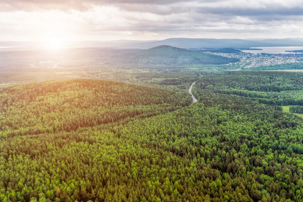
The main feature of the Syöte National Park’s landscape is that it is located on the boundary of two large natural areas of Finland: The forests of central and southern parts of the country and the low hills and mountains of Lapland, which are home to some particularly rare vegetation. In the park, we see both—the southernmost hills of Lapland, which are covered by old-growth pines and spruces.
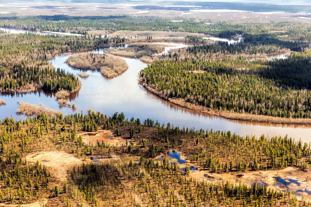
There are also many swamps of different types in the park, which occupy one-quarter of its total territory, such as the Aapa mires. In summer, these areas are difficult to walk on as you can easily fall through the water if you step off the path. But in winter and spring, you can walk through them if there is enough snow. You can also admire it from the tops of one of the park's 23 hills.
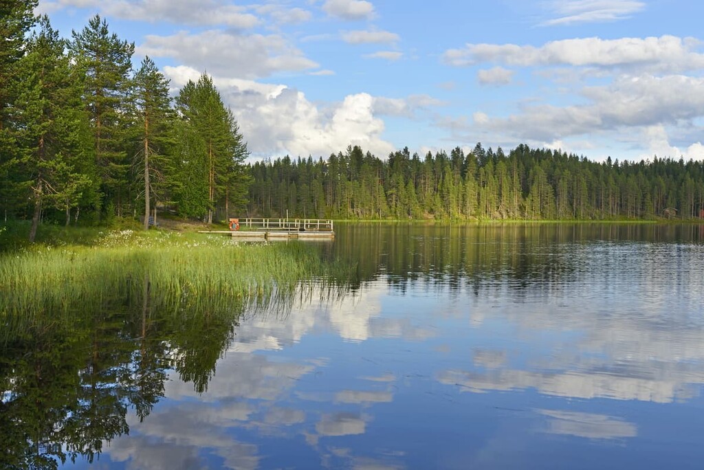
There are no large lakes in the park, but on the borders, there are many of them. There are carp, perch, pike, and other fish swimming in these lakes, too.
All these elements of the park's landscape are painted on the park's logo, which features a forest hut with smoke coming out of its chimney, indicating that someone made a fire at sunset after a hard day of walking through the forests, swamps, and uplands of the park. All 40 parks in Finland have such logos depicting their main features, which can include everything from flora and fauna to a human-made landscape.
The old trees of the Syöte National Park provide shelter for a large number of other plant and animal species. For example, on the massive rocky hillsides of the aforementioned ravines, we can find rare zygodon mosses, which are in danger of extinction.
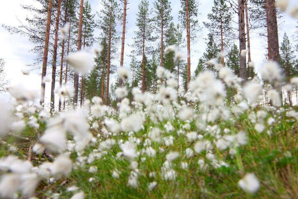
Every year, starting in the early summer, the park's swamps are covered with hare's tail cottongrass—beautiful white fluffy flowers that look like cotton, a plant common throughout the north. I’ve seen it a couple of times and, while it's not a gorgeous bright plant, there's something simple and exciting about them.
In the summer and fall, you can also collect many berries (red cranberries, golden cloudberries, bilberries, lingonberries) and mushrooms.
The fauna of the park is presented by some rare birds such as the tiny red-flanked bluetail. It is well-heard because of its strong singing during the summer mating season, but is difficult to see not only because of its size but also because the bird inhabits only here and also in the eastern regions of Finland known as Kainuu and Kuusamo.
The most common birds in the park are a Siberian jay, Siberian tit, capercaillie, and a red-crowned black woodpecker.
A Siberian flying squirrel is worth looking out for in the park's forests, too. However, to see them you will probably need a lot of patience, time, observation, and a camera with fantastic zoom capabilities. They are found not only in Syöte National Park, but also in Nuuksio National Park near Helsinki, where the Siberian flying squirrel also has a place of honor on the park's emblem.
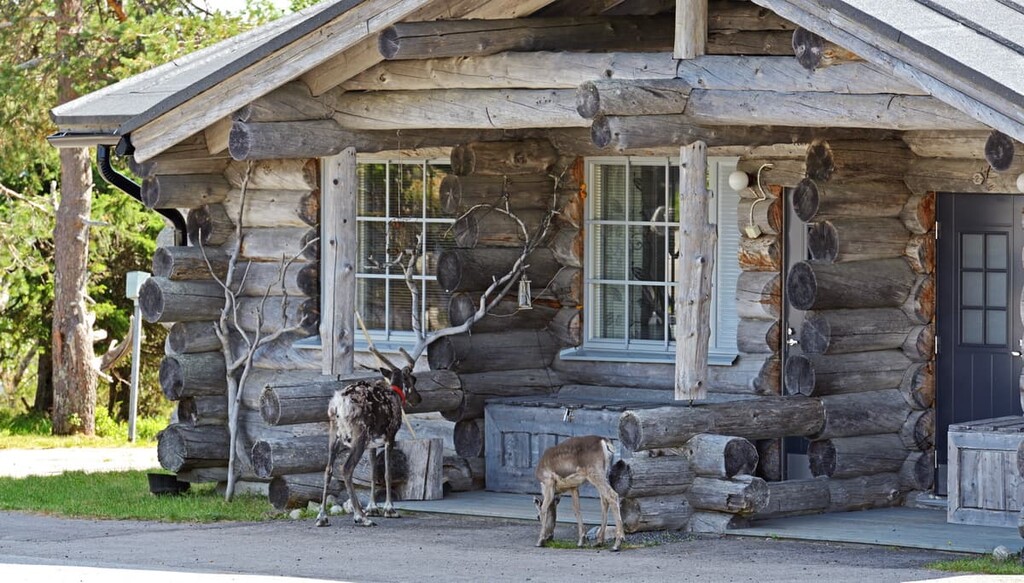
Of large predators, in addition to the fairly common fox, and other similar animals, the park is home to the rare wolverine, after which the Ahmavaara Fell gets its name (“The Wolverine Hill”). You can also find reindeer and moose in the park.
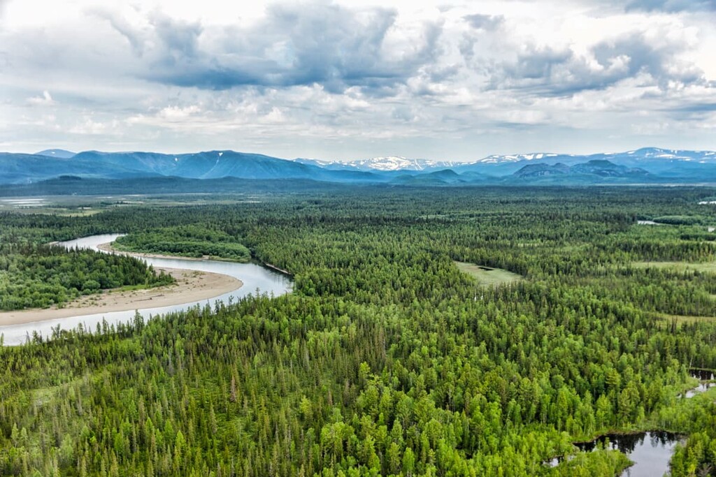
The territory of the Finnish part of Lapland is a vast area of land with small mountains, or hills, or fells, as they are called, up to 1,000 m (3,280 ft) in elevation.
The fells are the remnants of very ancient mountains, the Karelides, that were in Finland some 2 to 3 billion years ago. During this time, they extended as far south as the Finnish part of the Karelia region, which is now divided into North Karelia and South Karelia in the southeastern part of the country.
Nowadays, we can only see the bases of these giant mountains. But when they were at their highest, they were as tall as the modern-day Alps, where the highest mountain is Mont Blanc (4,807 m / 15,774 ft).
The highest peak in the park is Pyhitys Fell or Pyhitysvaara (412 m / 1,381 ft), and the lowest of the park's 23 mountains is Vanhakangas (256 m / 840 ft).
As I said before, the names of these and other mountains in the park and Lapland, in general, refer to its history. In particular, on Pyhitys Fell one can find stones stacked in a special way that were used as tables for sacred sacrifices of animals to pagan gods in the hope of successful hunting and fishing.
From the top of the fell, you can enjoy the view of the Kostonjärvi Lake. It is possible to climb the hill during the summer. It is a 2 km (1.2 mi) trip from the parking area of the Visitor Center. One should prepare for a steep climb, as the path rises 160 m (524 ft) over a distance of just 1.5 km (0.9 ft.).
The other nine highest peaks in the park after Pyhitys are:
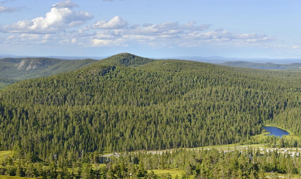
On the topic of the most important mountains of the park, it's impossible to overlook the Iso-Syöte Fell. Although it’s actually a part of the Iso-Syöte Hiking Area, it is located nearby and it’s well worth checking out.
The Syöte National Park has 122 km (75.8 mi) of marked hiking trails of varying lengths, from half-day hikes to multi-day backpacking hikes in the wilderness. They are marked with yellow paint signs on trees and wooden signposts.
The Iso-Syöte Top Fell Trail is a short but fascinating route from the Visitor Center of the park to the southernmost hill in Finland. From the observation deck at the top, you will have a stunning view of the entire park, from there you can look out for places for longer walks. I would add another hour to the route to spend at the top. There are a lot of bare rocks there, most of which make for a great place to have a picnic.
The Wolverine’s Trail, which is named after one of the park's most famous animals, leads to Ahmakallio Observation Tower on Ahmavaara (329 m / 1,286 ft) through various swamps and dense spruce forests. You will also pass over the Pärjä River on this hike.
There are several day-trip huts along the trail where you can rest and eat. On the trail, before the final 3 km (1.8 mi) to the tower, there is also a reservable wilderness hut, the cozy Ahmatupa Hut, where you can spend the night if you are not in a hurry and have an extra day to spare.
Also, from my experience, I can say that it is possible to walk 17 km (10.5 mi) in a day, but it requires some effort. The terrain of the trail itself is also quite challenging for unprepared hikers: The route includes steep sections with climbs and descents up to 100 m (328 ft). Park officials also point out that the duckboards in the swamps are in poor condition, so be careful as you hike.
The park's longest trail, the Tenant Farmer’s Trail is an adventure of about 38 km (23.8 mi) in length. The trail is so named because it provides not only a fascinating view into the area's rich natural landscapes but also a glimpse of the region’s long-standing agricultural history.
The main attraction of the trail is “The Crown Tenant Farm,” which was built in 1852 at the Rytivaara Fell (204 m / 669 ft). It is an open-air museum reconstructed by the Metsähallitus—the main Forestry Agency of Finland, right in the middle of the park. It allows seeing the living conditions of the tenant farmers of past days.
On the way to the farm you will pass through forests and swamps and climb Päätuore Fell (381 m / 1,250 ft), the highest point of the trail, as well as the Observation Tower on top of Ahmakallio.
The route includes several wilderness huts (Rytitupa right on the farm, Ahmatupa, and Annintupa), which provide excellent accommodation for an overnight stay, as well as a warm sauna. This distinguishes Finnish wilderness huts from the mountain hust (rifuges) in the Alps, where there is usually no shower, or it has to be paid for separately at a price of €1 per liter (0.2 gallons).
In addition to hiking and backpacking in the Syöte National Park, you can do other sports and outdoor activities, such as mountain biking (80 km/48 mi of marked trails), fishing, birdwatching, canoeing (22 km/13 mi of routes), geocaching and some other types of sports.
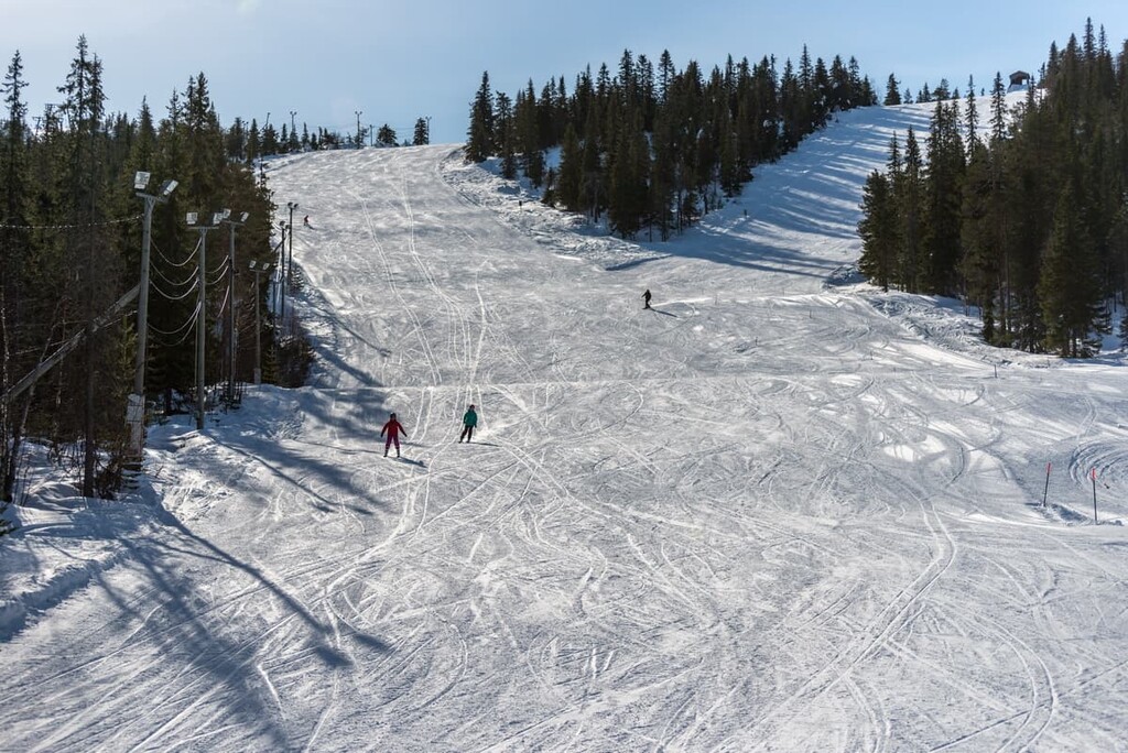
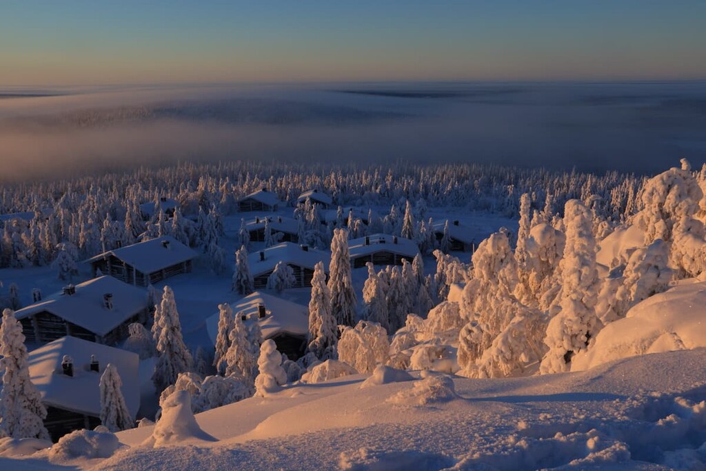
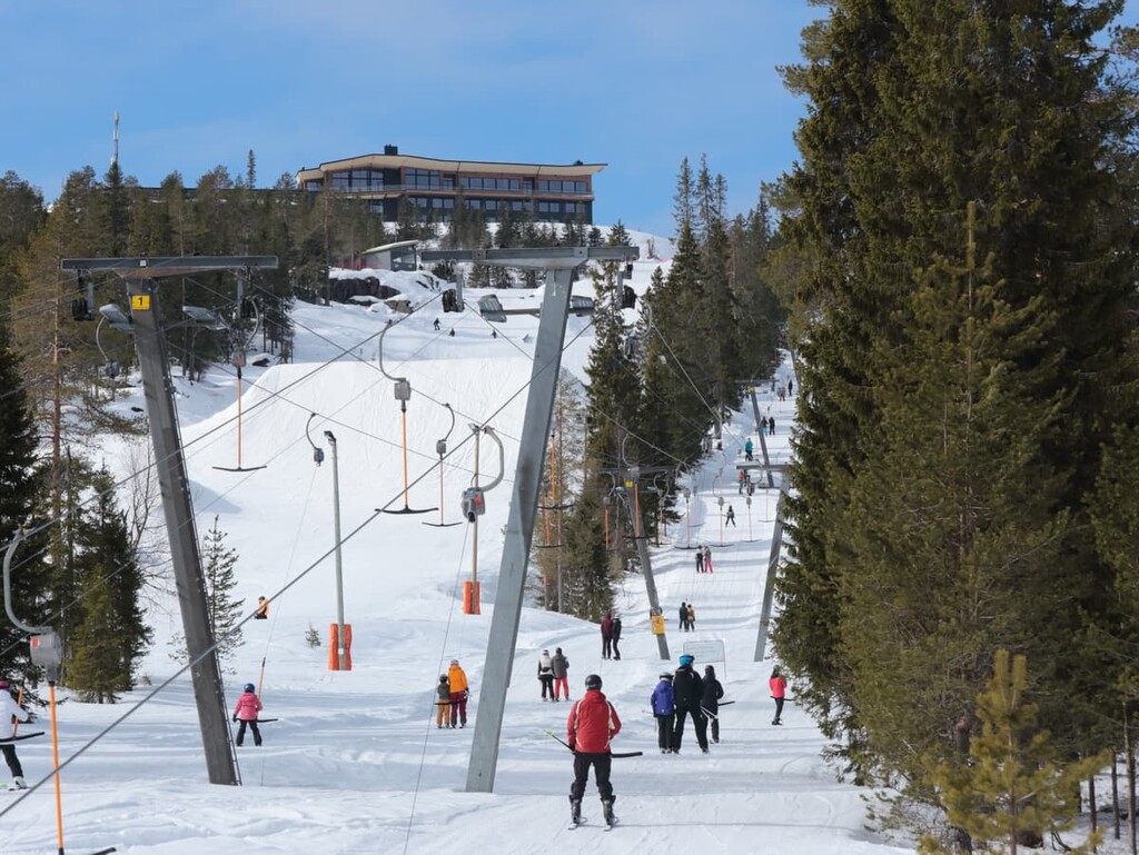
In winter, there is a Syöte Ski Resort with two skiing areas located on the Iso-Syöte and Pikku-Syöte fells. There are 17 slopes and 10 ski lifts in the region. In addition to mountain skiing, there are more than 100 km (62.1 mi) of cross-country skiing trails for those who love longer rides.
Finally, you can also walk in the park during the winter using the snowshoes. Two marked snowshoe routes are 4.5 km (2.7 mi) and 2 km (1.2 mi) long.
The park’s visitor center is located right at the foot of Iso-Syöte Fell in the Syöte Resorts area. It has a permanent “Lastuja selkosilta” (“Flakes of Wilderness”) exhibition where you can learn the history of the interaction between man and nature in the backwoods of Syöte, watch some nature films, and get useful hiking tips from the local staff.
In fact, be sure to ask the staff something because it's still a very convenient way to navigate—person to person—that we often forget about with all these modern gadgets.
Syöte Visitor Centre
Erätie 1, 93280б Syöte (Pudasjärvi), Finland
Opening hours: all-year-round with different timetables from 10 am to 4–5 pm, closed from October 26 to November 30 and from December 24–26.
+358206396550
In Finland’s national parks, there are some simple rules of conduct and responsible travel that are important to know and follow:
You can:
You can also do the following, but with some restrictions:
You can’t:
When hiking in Finland’s national parks, you can stay overnight in one of several basic types of temporary accommodation. In total, there are about a dozen of them. They differ in terms of conditions and rules, quantity, and cost.
In the Syöte National Park, there are eight open wilderness huts with free beds for 1–2 nights, and seven lean-to shelters. This is a kind of shelter with a roof and with no doors or windows, but it is possible to sleep in them during warm summer nights from the end of July to September.
There are also three reservable wilderness huts with a total number of 20 beds each costing €11 a person/night and three rental huts for €50–60/day. Don’t forget that another option for overnight stays here is to camp in a tent.
You can find out more about overnight stays in the parks in the “Services” section of each park’s page on the official website of the national parks of Finland.
For sure, before and after the hike, you can find different kinds of accommodation (hotels, cabins, camping, etc,) in the closest villages to the park such as, for example, Syötekylä. There are also two caravan sites at Syöte Resort to those who travel this way.
Pudasjärvi is the closest town to the park, located some 60 km (37.2) to the south. This small-looking settlement is the second-largest city in Finland in terms of total area (5,867.23 sq km/2,265.35 sq mi), after the Lapland capital Rovaniemi.
It is good to know that over 200 sq. km (77.2 sq. mi) of the Pudasjärvi area is covered by wetlands. It is also one of the most marshy areas of the country. Locals have tried, however, to drain many of these marshes to get areas for harvesting timber.
The town is located both on the shores of the picturesque Iijoki River (second longest in Finland, (370 km/230 mi) and the large Pudasjärvi Lake, into which the river flows on its way from the Kuusamo region to the Gulf of Bothnia of the Baltic Sea. The city is named after the lake. Near the city, there are also two other large lakes—in other words, plenty of water here.
The town has 7,760 inhabitants as of 2021. Nowadays, many of the residents in the region work in the tourism sector of the Syöte, helping to accommodate the region’s many tourists. But until the early twentieth century, the village survived only through hunting, fishing, reindeer management, agriculture, and forestry.
The town of Pudasjärvi is also known as a place with unique geology. Remember the ancient granites, which I told you about at the beginning of the story? Well, the oldest dated rock formations within Europe—the gneiss rocks of 3,5 billion years old, were found right here. Who knew?
The official tourist site of Pudasjärvi is Pudasjarvi.fi.


