Scan the QR code and open PeakVisor on your phone
Qixingshan Special Scenic Area (七星山自然文化景觀核心特別景觀區) holds a bevy of natural wonders and beauty, such as steaming fumaroles, overgrown verdant peaks, ancient hiking trails that were once old passageways for transport, serene ponds, imposing waterfalls, peaceful and relaxing hot springs, and a dense bamboo forest.
Qixingshan Special Scenic Area is situated in the vicinity of Yangmingshan National Park (陽明山國家公園) in northern Taiwan. There are 35 named mountains in the Qixingshan Special Scenic Area, the highest and most prominent being Qixingshan Main Peak (七星山) at 1,118 metres (3,668 ft).
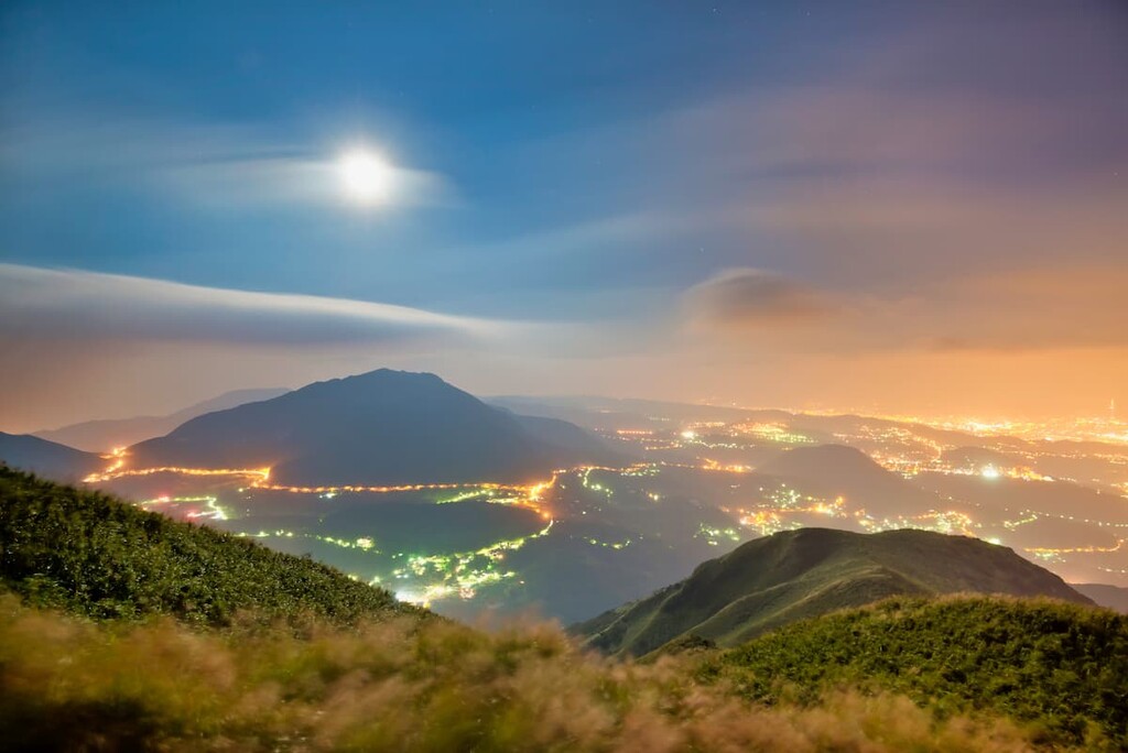
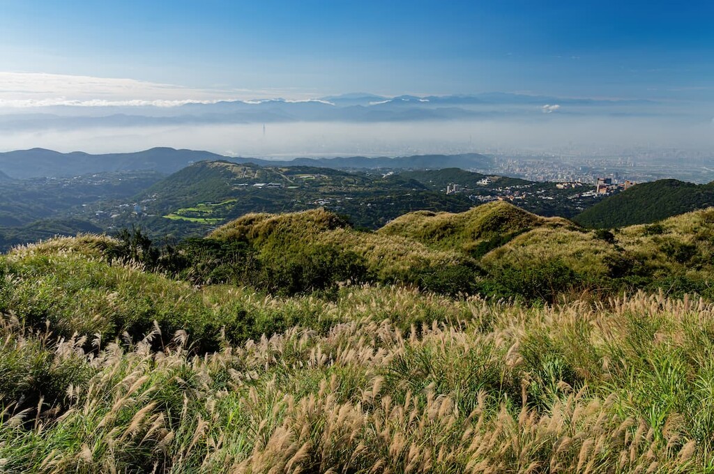
Qixingshan Special Scenic Area (七星山自然文化景觀核心特別景觀區) is in the Beitou (北投區) and Shilin (士林區) districts of Taipei City (臺北市). Qixingshan Special Scenic Area rests on the northern border of Taipei City. Taipei City forms a basin against which Qixingshan and surrounding mountains loom over, walling the city within a rugged backdrop.
Qixingshan is not only the highest peak in the area, but it is also the tallest dormant volcano in the region. However, it hasn’t erupted since about 700,000 BCE. Seven peaks emerged from the volcanic activity, giving Qixingshan its name, which means ‘Seven Star Mountain.’
Qixingshan is composed of four peaks: Qixingshan Main Peak (七星山), Qixingshan East Peak (七星山東峰), Qixingshan North Peak (七星山北峰), and Qixingshan South Peak (七星山南峰).
Other notable mountains found in Qixinghsan Special Scenic Area are Qigushan (七股山), Shitishan (石梯山), Dingshan (頂山), Zhugaoshan (竹篙山), and Qingtiangangshan (擎天崗山).
Bordering the Qixingshan Special Scenic Area is Datunshan (大屯山) to the west, Zhuzishan (竹子山) to the north, Huangzuishan Nature Reserve (磺嘴山生態保護區) to the east, and Longfenggu Park (龍鳳谷公園) to the south, all of which are located in the premises of Yangmingshan National Park.
Qixingshan lies within the range of the Datun Volcano Group (大屯火山群), which is a strip of volcanoes situated in the north of Taiwan, where volcanic activity is most apparent. The volcanoes comprising the Datun Volcano Group resulted from episodic volcanism between 200,000 and 1 million years ago.
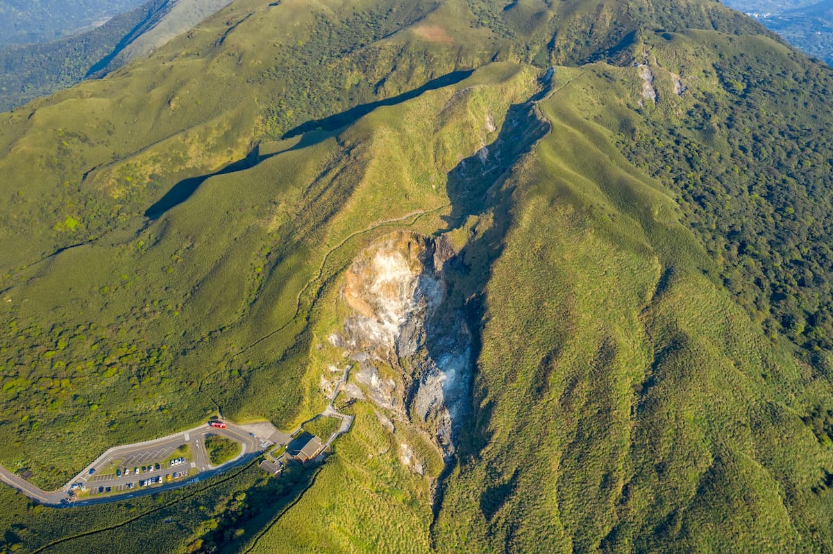
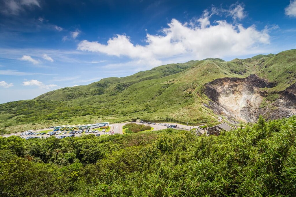
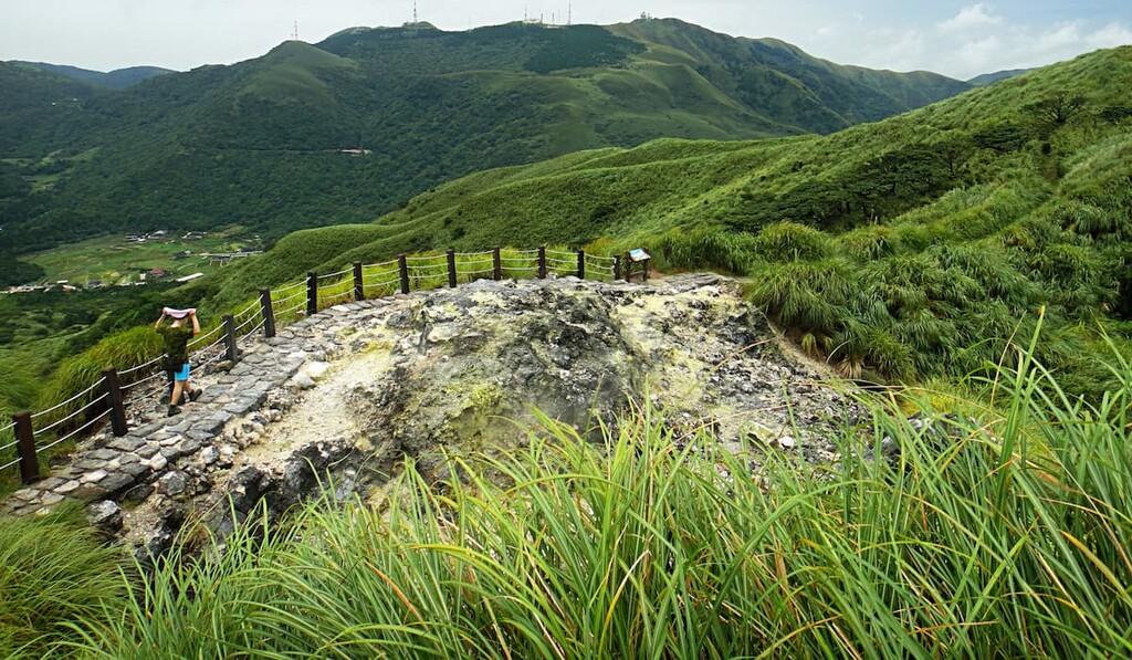
Post-volcanic activity is still present in the Qixingshan Special Scenic Area in the form of fumaroles and hot springs. Xiaoyoukeng (小油坑), located on the west side of Qixingshan Main Peak, emits smoky fumaroles from its earthy pit.
Visitors can clearly locate the wafting steam of heated sulphur evaporate from the earthen vents into the fresh air. Fumaroles can also be found in the north of Qixingshan in Macao (馬槽) and the western area of Dayoukeng (大油坑).
The mountain rock strata are mainly composed of igneous and sedimentary rock. Igneous rock in the region most formed from volcanic activity during the Pleistocene epoch.
This type of rock is composed of andesite, and its mode of formation is from the lava flow, volcanic mudflow, agglomerate and tuff, and basaltic magma associated with the region’s volcanic activity. Andesite rocks can be found in the Macao Creek, showing a red hue due to the oxidation from the river water.
Sedimentary rock in this region was formed from the accumulation of sediments in the shallow sea during the late Oligocene to Pliocene Era. The mountain rock of Shitishan (石梯山) is such an example. Sedimentary mud and sand mixed with sulphuric gases form sulphuric granules, which later transform into sulphur deposits. Such deposits are present in the Lengshuikeng area of Qixingshan Special Scenic Area.
The volcanic history of Qixighshan is present in the soil, which is highly acidic in nature. In addition to this, the influence of the blistering northeast monsoon winds lowers the general temperature of the Qixingshan area in contrast to its surrounding areas. Thus, the vegetation present in the Qixingshan area is notably different from vegetation sharing the same latitude.
Medium- to high-elevation plants featured in the Qixingshan Special Scenic Area, such as temperate evergreen broadleaf forest, grassy mountain plains, and even alpine plants found on lofty ridges of the Central Mountain Range (中央山脉).
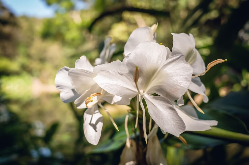
Broadleaf forests are found between 500 to 900 metres (1,640 to 2,953 ft) above sea level in the park. Laurel plants such as red nanmu and large-leaf Machilus flourish in this area together with Formosan sweet gum, Taiwan cherry, and shrubberies like the purple wood nettle and narrow-petaled hydrangea.
The topsoil of peaks can be intensely acidic due to past volcanic activity; therefore, the quality of the soil is primarily thin and loose, and it is unable to nurture the growth of needy plants. Thus, hardy and resilient types of plants, such as silvergrass, grow in this environment. Silvergrass is known to prosper in less fertile terrains if consistently exposed to sunlight.
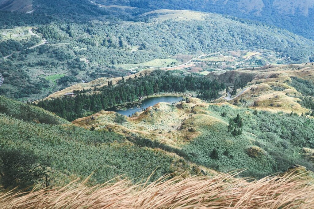
Aquatic plants found along with ponds and crater marshes also feature in the area’s ecology. Menghuan Pond (夢幻湖) sits in the shadow of Qixingshan, at 880 metres (2,887 ft) above sea level. The rarest type of aquatic fern, known as Isoetes taiwanesnsis, is found in its waters. Japanese spikerush, rough-seed bulrush, and Chinese water chestnut are other aquatic plants of the pond.
Arrow bamboo, which is found just north of Qixingshan, grows between one to two meters (3 to 6.5 ft) in height, extending along the sheltered inclines at 800 metres (2,625 ft) above sea level. Of the three types of bamboo in Taiwan, the Pseudosasa usawai cane is the type of bamboo that grows in the Qixingshan Special Scenic Area.
The heavy presence of human activity in and around the Qixingshan Special Scenic Area has disrupted the animal habitats in the region. Formosan sika deer once inhabited the area of Qixingshan; however, the region mainly contains animal life in the form of butterflies, birds, reptiles, and amphibians.
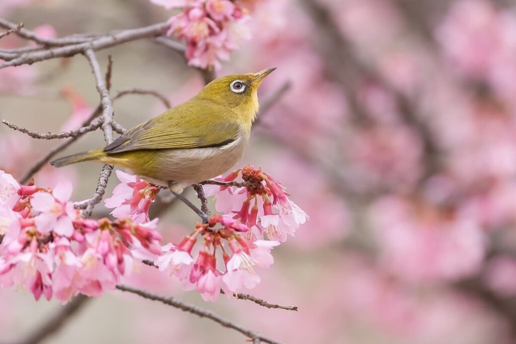
Over 122 bird species have been recorded in the Qixingshan area, with October to March being the best for birdwatching due to the influx of migratory birds visiting from the north. Birds to frequent Qixingshan area the Japanese white-eye, red-headed babbler, and white-eyes nun babbler found in the forests. Meanwhile, the yellow-bellied Prinia and vinous-throated parrotbill can be seen along the grassy plains of Qingtiangang.
There are over 165 species of butterflies that glide in the azure skies of the park. Spring and summer are the best times to view butterflies, such as common peacocks and red helens from the Papilionidae family, blue tiger and blue-banded king crow from the Danaidae family, and Indian fritillary and common map from the Nymphalidae family.
The area around Menghuan Pond is where most of the amphibians and reptiles will be found. Common amphibians that are sighted in the area are Taipei tree frogs, frogs of the family Ranidae, and ornate chorus frogs.
Reptiles inhabiting the park range from harmless lizards such as yellow-mouthed Japalura polygonata xanthostoma and Indian forest skink to venomous snakes such as Chinese green tree viper, Taiwan habu, and Chinese cobra. Visitors should be wary when following the footpaths for the off chance that a poisonous snake could be slithering by. Generally, trails in the park are mainly safe, but in the unmarked territories and off the main paths, there is more chance of facing a venomous snake.
The Qixingshan Special Scenic Area area was inhabited as early as 2,000 to 3,000 years ago by the Yuanshan tribe. Indeed, archaeologists have found numerous ancient tools while studying the region. However, due to the volcanic activity of this area, it was deemed uninhabitable, and the Yuanshan tribe eventually left the area.
Some 600 to 1,000 years ago, traces of human activity surfaced again in the Qixingshan area by the Shihsanhang tribe, who used the region for hunting and gathering and mining sulphur used for trading.
The 1700s brought the emergence of the Han Chinese settlers who made a home in Qixingshan. The Han settlers brought crafts and practices such as indigo dye, stone masonry, charcoal production, and agricultural activities such as rice farming. Tea plantations developed from trading with British merchants.
During the Japanese Occupation Era, the Qixingshan Special Scenic Area, together with Datunshan and Guanyinshan, was established as Daiton National Park in 1937. This area was rezoned in 1963 to include the Jinshan (金山區) and Sanzhi (三芝區) districts of New Taipei City (新北市), and on 16 September 1985, Yangmingshan National Park was established.
The most popular hike in Qixingshan Special Scenic Area is that to the summit of Qixingshan; however, there are many other attractive options to discover once you’ve summitted Qixingshan. Her are some of the other adventures that you can check out in the park:
There are two trailheads to ascend Qixingshan located at Xiaoyoukeng (小油坑) or Miaopu (苗圃). The climb from Xiaoyoukeng is 2.2 km (1.4 mi) to Qixingshan Main Peak (七星山), while it is a 3.5 km (2 mi) trek from Miaopu. The total distance from Xiaoyoukeng to Miaopu is 5.7 km (3.5 mi) for hikers wishing to complete the whole trail.
The more popular journey is from Xiaoyoukeng, as visitors can witness the steaming fumaroles that emit a putrid egg smell. At the start of the climb from Xiaoyoukeng, visitors can marvel at the geothermal activity of the fuming vents as they ascend the steep trail lined with a combination of wooden and stoned steps and observe the changing vegetation. Silvergrass adorns the mountain’s plant cover, with green maple and red nanmu flowers showering the mountain in shades of violet and crimson in the summer months.
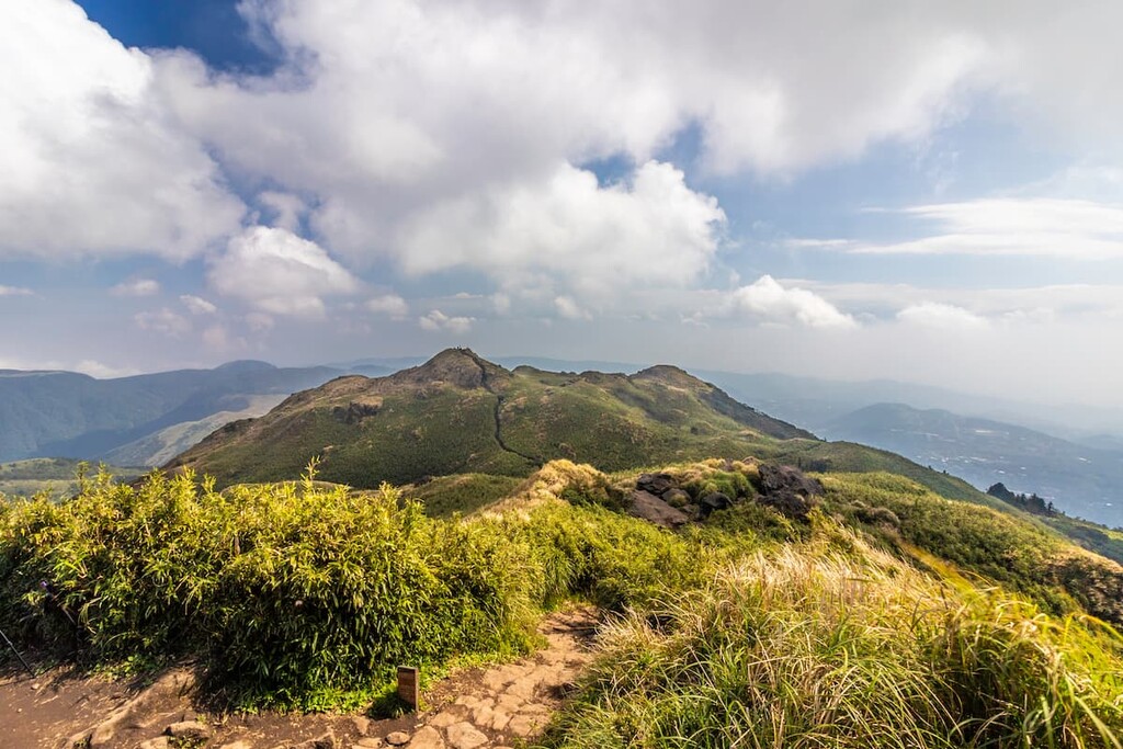
Hikers will summit Qixingshan Main Peak first before following Qixingshan East Peak, a short walk away. Hikers can bask in the glory of looking into the depths of the Taipei Basin, standing tall on the highest peak in the entire Taipei area. Hikers can either make their way down the mountain by retracing their steps from Xiaoyoukeng or continuing onwards, descending the hill to reach the Miaopu Trailhead.
For hikers wishing to begin their climb from Miaopu Trailhead, the trail starts near the Yangmingshan Bus Terminal and right next to the Yangmingshan National Park Visitor Centre.
The trail from Miaopu is more shaded and covered than from Xiaoyoukeng; thus, it may be a better option to ascend from this starting point on scorching hot sunny days. After 2 km (1.2 mi) of a steep uphill climb, Qixing Park stands at 880 metres (2,887 ft) elevation, which offers excellent views of the cityscape of downtown Taipei.
Qixingshan East Peak will be reached first after a challenging incline, after which hikers will reach Qixingshan Main Peak. From here, hikers can either follow the trail down to Xiaoyoukeng Trailhead or return to Miaopu Trailhead.
Spanning north to south of Qixingshan, the Arrow Bamboo Forest Trail (箭竹林步道) has a total length of 4.5 km (2.8 mi). The trail begins north of Qixingshan at the Yangmingshan Bus Station.
![]()
Hikers will then head toward the Xiaoyoukeng Visitor Centre before journeying on the route of the path that leads around the base of Qixingshan, heading south towards the Yangmingshan Headquarters Visitors Centre.
Bamboo lines the trail in thin stems that loom some 2 metres (6.5 ft) high, forming a natural windbreak in the valley. The appearance of aged pointed sheaths layered around bamboo joints looks like a shape of an arrow, which is how Arrow Bamboo Forest Trail got its name.
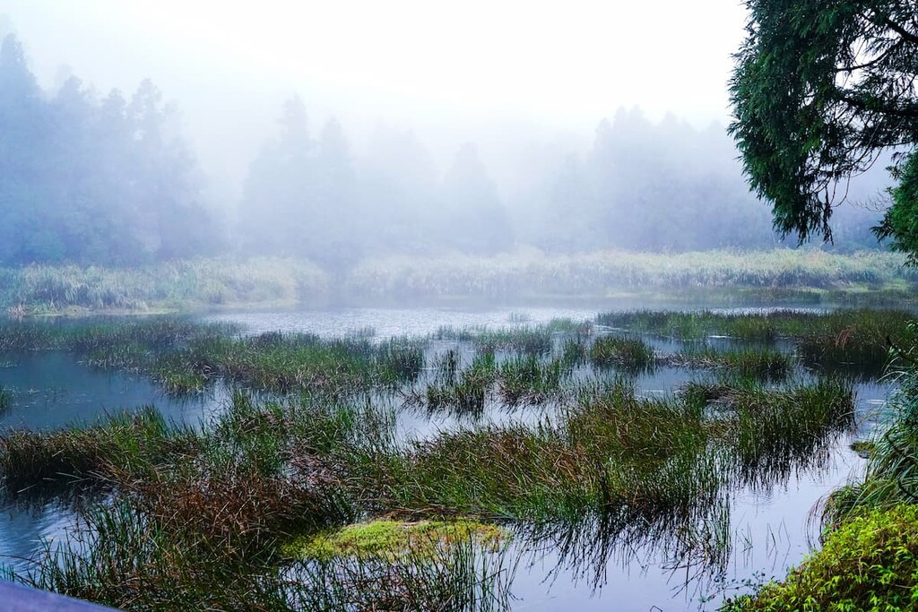
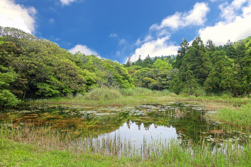
Menghuan literally means ‘dream’ in English, and this dreamlike pond, situated in the east valley of Qixingshan, is usually delicately enveloped in a hazy mist.
Resting at an elevation of 880 metres (2,887 ft), Menghuan Pond (夢幻湖) houses some very rare aquatic plants. In fact, the plant Taiwan isosetes only grows in the waters of Menghuan Pond, and nowhere else in the world, a testament to the uniqueness of the pond itself.
This 2.5 km (1.6 mi) unchallenging trail uncovers the picturesque beauty of the misty valley with the lofty mountains of Qixingshan, Qigushan, and Menghuanhushan skirting around the circular route. Walking along the Menghuan Pond Trail instils a wash of calmness and serenity, and time seems to stand still as one appreciates the stirring magnificence of the natural environment.
Juansi Waterfall Trail (絹絲瀑布步道) is situated in the Lengshuikeng area, southeast of Menghuan Pond and Qixingshan. This 2.2 km (1.4 mi) trail follows a shaded path towards Juansi Waterfall, a magnificent 20-meter (66 ft) cascading shower of white water furiously flowing down the high rock cliff.
An observation deck is located about 100 metres (328 ft) from the trailhead at Qingtiangang Visitor Centre, affording hikers with grand views over the meadowy grassland plains of grazing cows of Qingtiangang.
Lengshuikeng (冷水坑) is translated as ‘cold water valley’ and lies on the east gorge of Qixingshan. It houses geothermal springs with a water temperature of 86 to 104°F (30 to 40°C), significantly lower than the standard temperature for hot springs.
Due to the ‘colder’ temperature of the water, this served as inspiration for naming the area Lengshuikeng. In addition to this, the milky appearance of the water due to the fusion of white and yellow sodium bicarbonate is how the water valley gained its other name, Milk Pond.
In Lengshuikeng, hikers can head towards Qixingshan on a 4.1 km (2.5 mi) journey, incorporating the beautiful valley of Lengshuikeng into their hike, or they can embark on a leisurely stroll of 1.8 km (1 mi) to the grassy plains of the Qingtiangang region. Both trails are relatively easy with a gentle gradient.
Hikers heading toward Qixingshan will encounter a hot spring bath just 300 metres (984 ft) from the Lengshuikeng Visitor Centre at the start of their trek. The trail crosses past the route to Menghuan Pond and later passes the trailhead for the Arrow Bamboo Forest until reaching the Qixingshan Bus Stop by the Maiopu Trailhead.
Hikers cross the 50-metre (164 ft) long Jingshan Suspension Bridge, which straddles a sea of evergreen forest, a mere 200 metres (656 ft) into their trek before arriving at an observation deck that allows hikers to enjoy the forest green views of verdant hills and grassy plains. After a 1.1 km (0.7 mi) easy walk, hikers will finally enter the Qingtiangang area.
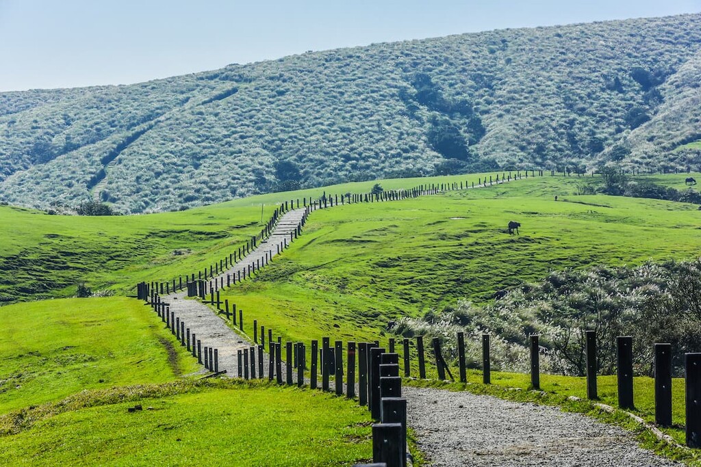
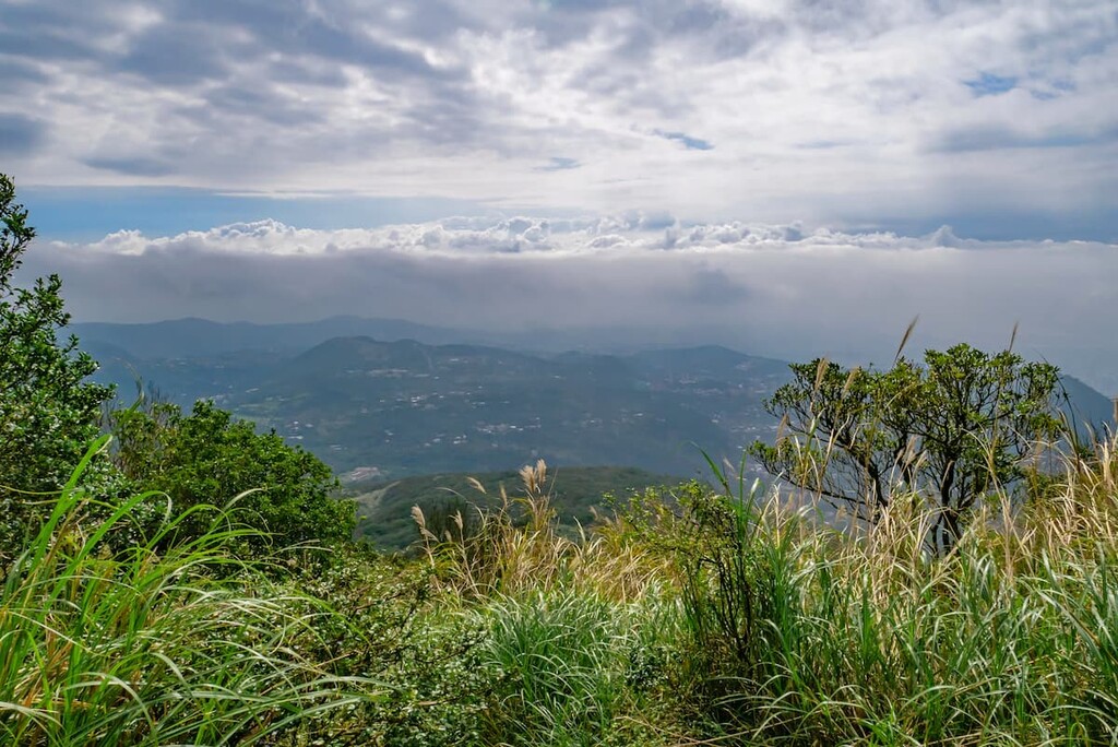
The highlight of Qingtiangang (擎天崗) is the expansive low-lying area of grassy plains that dance in the breeze. Qingtiangang lies southeast of Qixingshan, and a few peaks over 800 metres (2,625 ft) surround this grassy valley.
This generally flat area allows hikers a laidback journey through the open meadows dotted with grazing cows. The Qingtiangang Circular Trail is a 2.4 km (1.5 mi) loop around the area, starting and finishing at Qingtiangang Lingtounie. The trail runs across the trailhead to the cone-shaped volcano of Zhugaoshan, which looms over the valley.
Qingtiangang is a focal point in the Qixingshan Special Scenic Area as many trails lead either to or from this verdant valley.
The Dingshan Shitiling Trail (頂山石梯嶺步道) spans 6.4km (4 mi) from east to west of the Qixingshan Special Scenic Area along a leisurely trail of carpet grass and peacock pine forests. Hikers can either begin the course from Qingtiangang or the other end at Fengguikou.
The trail summits two mountains, Dingshan and Shitishan, while passing through shady forests, steep inclines, and even partially walking on a motorway.
The views from Dingshan and Shitishan offer 360-degree panoramic scenes of Qixingshan and Qingtiangangshan in the Qixingshan Special Scenic Area and nearby mountains of Huangzuishan, Dajianshan, and Dajianhoushan of Yangmingshan National Park. Slight glimpses of Zhuzishan and Xiaoguanyinshan can be established between the overgrown forests and verdant plains.
Forest vegetation is a particular highlight of this trail, especially in the spring months, as the tracks burst in colour from bright to pastel flowers. White hardy ginger flowers bloom with deep red berries sprouting forth, lilac Formosan beauty berries sprinkle the paths, and a dash of indigo blooms from carpet grass, lining the trail in deep hues of lavender blue.
A forest of rich, fragrant cedar is located on the incline of Shitishan, allowing hikers to savour in the tranquil atmosphere set by the sprawling lofty trees touching the skies of the Qixingshan Special Scenic Area.
This 2.3 km (1.4 mi) trail is set along two historic canals, Old Pingding Canal and New Pingding Canal, both of which were built more than 150 years ago before diverging into a forest. This trail is situated in the neighbourhood of Pindeng in the Shilin district of Taipei.
The Pingding Canals usage was threefold: to transport goods, deliver irrigation, and to provide drinking water for the Pingdeng community. Still, to this day, Pingdeng villagers heavily rely on the canals for household water supply.
The trailhead is situated on Lane 95 of Pingding Street, which gradually ascends to the Qingfeng Pavilion, doubling as a stamp pavilion, just 170 metres (558 ft) past the trailhead. The Old Pingding Canal emerges soon after, and red Chinese characters of ‘Old Pingding Canal’ are carved into the wooden canal head.
Hikers can appreciate the historical waterways of this trail while enjoying the aquatic ecosystem dotted with a plethora of various species. Giant elephant ears, red nanmu, Chinese soapberry, Piper kadsura, and bamboo are featured along this ancient trail.
Hikers follow the moss-covered path crossing the Taozaijiao Bridge before reading the end of the trail on Zhishan Road right after the Tianweizi Bridge.
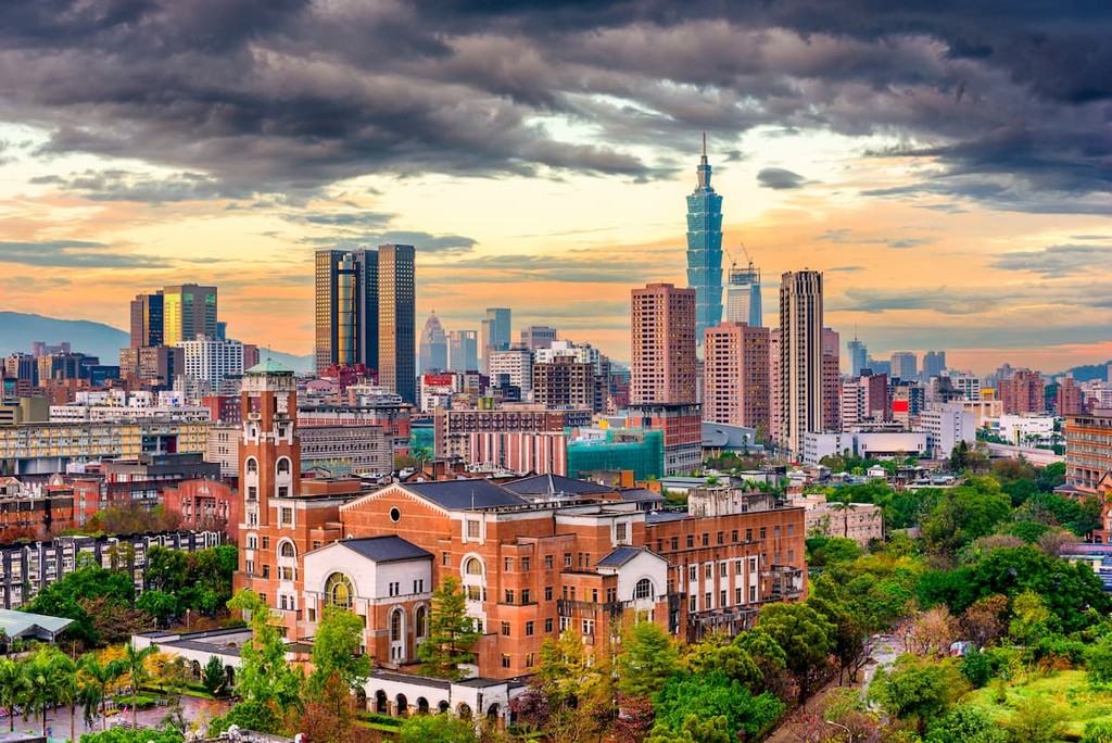
Qixingshan Special Scenic Area is located a stone throw to the north of Taipei, the capital city of Taiwan, which is known for its exciting nightlife, thrilling attractions, all while still retaining a beautiful natural feel. Situated close to Taipei is New Taipei City, which allows visitors to bask in the wondrous backyard of Taipei proper. Here are some of the best places to check out in the region:
Perched south of Qixingshan Special Scenic Area, Taipei is a fascinating city brimming with exhilarating night markets, an intriguing and lively street food scene, and intricately ornate temples that are juxtaposed against exciting futuristic elements of this bustling city.
The lotus-inspired Taipei 101 towers above the dense moped streets, with the nearby Elephant Mountain, otherwise known as Xiangshan, offering pristine views of the iconic tower and surrounding districts of the capital.
The famous Shilin Night Market is an absolute must-visit when touring the city of Taipei. The streets are lined with charming food vendors selling delightful snacks and obscure delicacies. The wander through the market alone is intriguing enough, with a mixture of titillating smells drifting through the street with exotic foods openly displayed at the limitless food stalls.
For a historical viewpoint of Taipei, a trip to the stately National Palace Museum, the grand National Chiang Kai-shek Memorial Hall, and the captivatingly beautiful Longshan Temple will enthral and educate tourists on history, culture, and religion in Taiwan.
The lively and trendy area of Ximending is electrifying, with a wash of fluorescence and luminous billboards. Known as the ‘Harajuku of Taiwan’, this fun shopping area pulses with an effervescent vibe, as creativity and absurdity create a perfect mesh in these buzzing, uninhibited streets.
Also known as Xinbei to locals, New Taipei City offers tourists a glimpse into ancient times as it includes the charming old Japanese hillside mining city of Jiufen, the ancient mining post of Pingxi where Chinese lanterns are lit over disused railway tracks, and the stunning Shifen waterfall set along a nature trail.
Houtong Cat Village is connected by trainline to the above areas, which features a large population of feline inhabitants lounging around the quarters of this village. Other areas of interest in New Taipei City are Yehliu Geopark and its striking collection of rock formations, the coastal Teapot Mountain Trail, the scenic beach stretch of Baisha Bay, and the moss-covered shore of Laomei Green Reef.

To get to the Qixingshan Special Scenic Area, visitors need to start their journey from Taipei. Taipei Main Station can be reached via the Taiwan High Speed Rail (HSR) and express train (TRA) from all of the major cities in Taiwan, including New Taipei City.
From Taipei Main Station, take the red line to Jiantan MRT Station where the 260 shuttle bus and R5 bus will take you to the entrance of Yangmingshan National Park. From here, you can board the Yangmingshan 108 bus which will transport you around the main areas of Qixingshan Special Scenic Area, such as Qixingshan, Lengshuikeng, and Qingtiangang.
Alternatively, you can take the S15 bus from Jiantan MRT Station which shall transport you to Lengsuikeng, and you can either walk to Qixingshan or board the Yangmingshan 108 bus to Qixingshan.
Qixingshan Special Scenic Area is also just a 27.5 km (17.1 mi) trip from Taipei City if you wish to hire a car or scooter for the journey.