
Scan the QR code and open PeakVisor on your phone
Karwendel Nature Park has 513 named peaks. The highest is Birkkarspitze at 2,749 m. Other notable peaks include Mittlere Ödkarspitze, Östliche Ödkarspitze and Kaltwasserkarspitze.
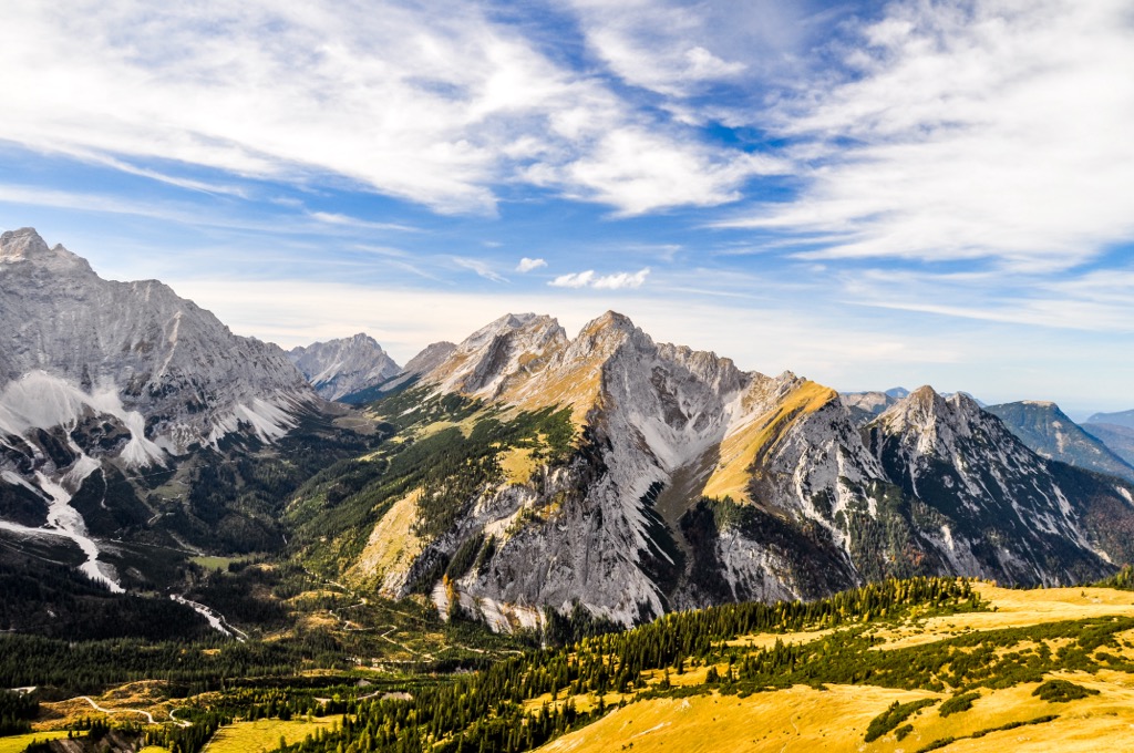
Karwendel Nature Park (German: Naturpark Karwendel) is a mountainous park located in western Austria, along the country’s border with Germany. The park marks the largest nature park in the country of Austria. The tallest and most prominent peak is Birkkarspitze at 2,749 m (9,019 ft) tall with 1,565 m (5,135 ft) of prominence.
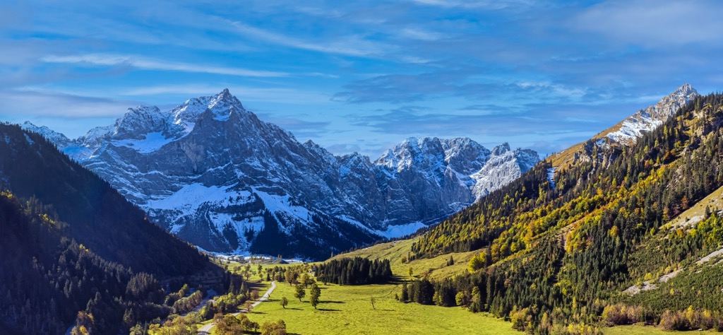
Karwendel Nature Park (German: Naturpark Karwendel) is situated in western Austria, along its northern border with Germany. The nature park encompasses nearly all of the Karwendel Alps, which are part of the greater Northern Limestone Alps.
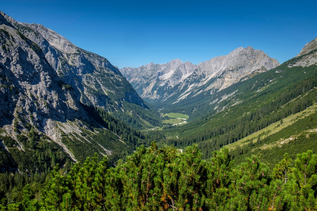
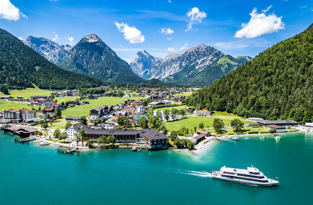
The park features some forested hillsides which quickly give way to alpine terrain, lush meadows, and craggy peaks. Park boundaries are marked by the German border to the north, Achensee to the east, River Inn to the south, and the Isar river to the west.
This mountainous nature park covers 737 square kilometers (284 sq. miles) across the mountain range, and features 11 landscape conservation areas. The sheer size of the park enables it to encompass a wide range of vegetation zones.
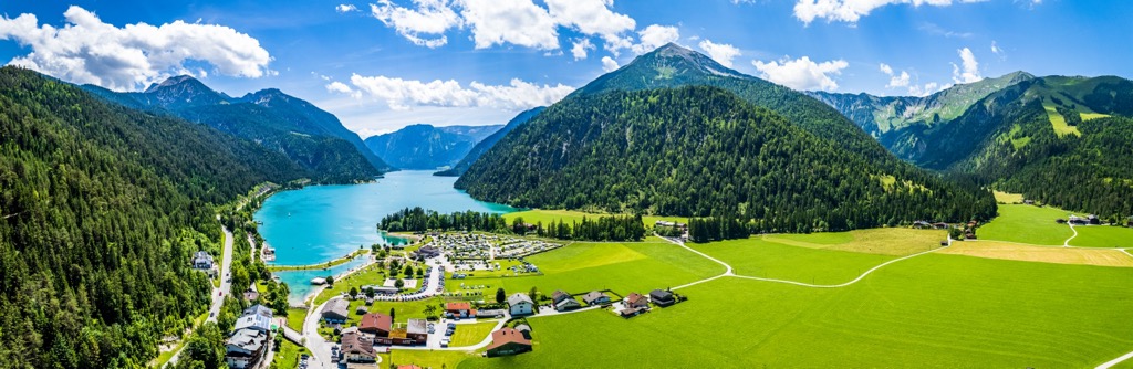
The Lower Inn Valley, which features the River Inn, lies along the southern edge of the park and mountain range. Karwendel Nature Park lies entirely within the state of Tyrol (Tirol).
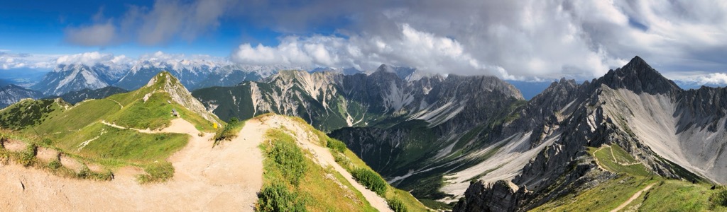
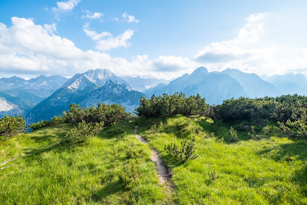
Amidst the mountainous landscape lie numerous alpine huts and hiking trails, making the region popular amongst hikers, backpackers, and skiers. The region has been under protection for nearly 100 years, helping preserve the natural landscape of the region while other surrounding regions have been more drastically affected by logging.
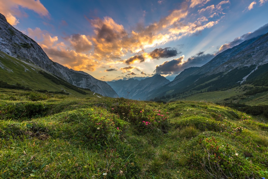
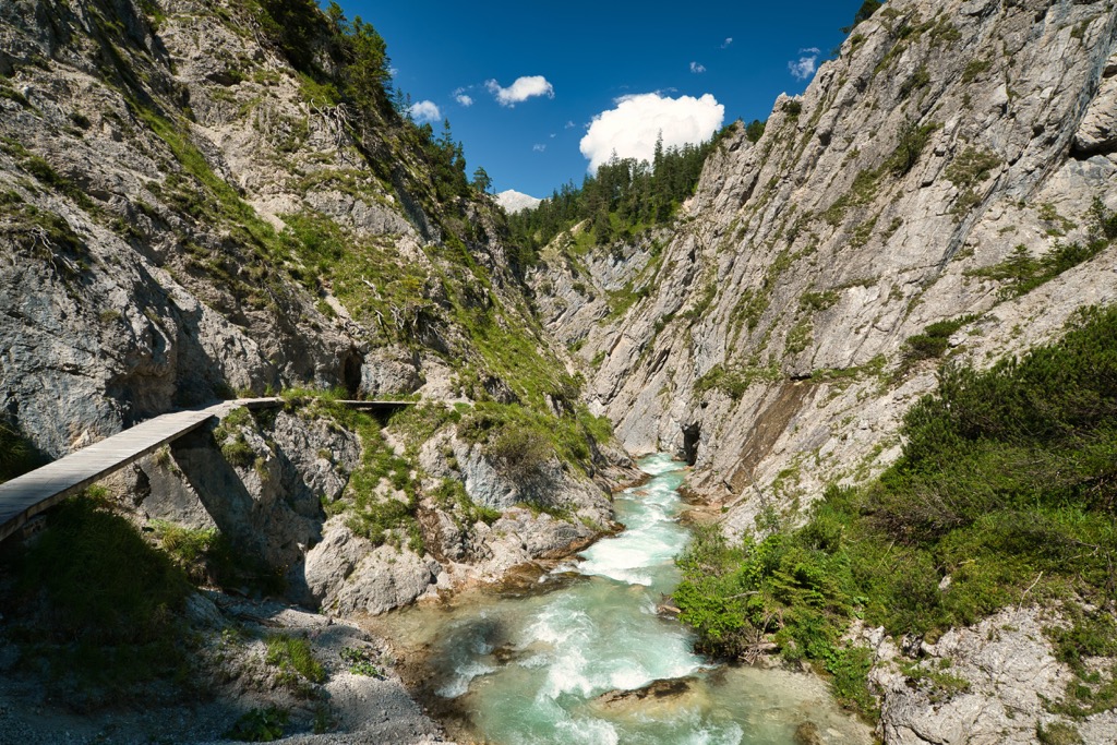
Numerous mountain creeks and streams run throughout the nature park. The highest elevations in the park are free of flora, opening up to rocky ridgelines, peaks, and alpine meadows full of wildflowers and low growing grasses.
Karwendel Nature Park is located near numerous other areas for outdoor recreation. To the north, in Germany, lies the Karwendel und Karwendelvorgebirge. To the south lies Schutzzone Rothirsch/reh and Schutzzone Birkhuhn/Auerhuhn. The Ammergauer Alpen Nature Park is situated to the northwest within Germany, while the High Tauern National Park lies to the southeast.
Peaks in the park are part of the Karwendel Alps, which in turn are part of the larger Northern Limestone Alps, spanning across Austria and Germany. The Northern Limestone Alps mark a subrange of the greater European Alps.
Elevations in the park range from around 570 m (1,870 feet) within the Lower Inn Valley, up to the summit of Birkkarspitze. The geological history of the region is similar to that of the larger Alps.
These peaks began forming during the Alpine orogeny, a major mountain building period that formed numerous major ranges across Europe and Asia. The collision of the African and Eurasian plates forced the upheaval of the Earth’s crust, giving rise to a massive chain of mountains.
True to their name, the Northern Limestone Alps consist primarily of limestone. Other rocks found throughout the range include dolomite, sandstone, and marl. The surrounding region once marked the bed of an ancient seafloor. Mineral deposits that were left behind were continually folded on top of one another, helping form the sandstone structure of the range.
Bedrock in the region was eroded over the course of millions of years, leaving the deep river. Glacial retreating further carved out the brittle rock, giving the range its distinct rugged peaks, ridgelines, and cirques.
Major peaks within the park include Birkkarspitze, Großer Bettelwurf, Östliche Karwendelspitze, Hochkarspitze, and Hafelekarspitze.
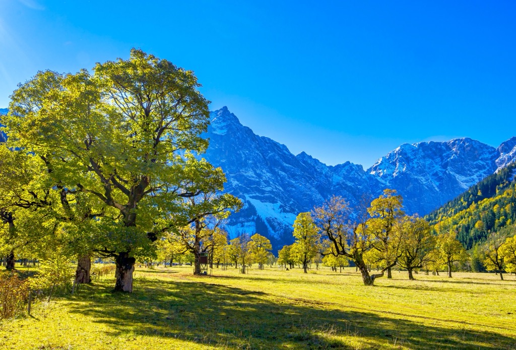
Karwendel Nature Park is home to a wide variety of both plant and animal species. Pine, sycamore, spruce, birch, and fir trees quickly give way to the alpine terrain.
German tamarisk can be found throughout the park along with wild orchid and various other wildflowers. Low growing grasses and shrubs inhabit sections of the park amidst the scree fields and glacial cirques. Ancient sycamore maple trees still flourish amidst the mountainous region.
The terrain is ideal for animal species such as ibex, red deer, and golden eagles. Other birds commonly found include the three-toed woodpecker, woodcock, owls, and the common sandpiper.
Cattle grazing is still in practice amidst the alpine pastures of the region. Hikers may also spot the alpine newts near the waterways in the region.
Humans are thought to have inhabited this mountainous region since the early Stone Age. Various groups of people have lived and ruled in the area since the Roman era.
The army station Veldidena was established by the Romans during the fourth century in present-day Innsbruck, along the southern edge of the park. During this time an important commercial road ran along the southern edge of the Karwendel Alps.
Innsbruck marked an important crossing point of the River Inn. In 1180, Innsbruck was acquired by the Counts of Andechs before being passed to the Counts of Tyrol in 1248. Brenner Pass, which lies south of the nature park, marked an important link between northern and southern Europe as it was the easiest mountain pass to cross in the Alps.
During the fifteenth century, Innsbruck became an important center for European politics. Innsbruck soon became the capital city of Tyrol, with the Emperor Maximilian I residing in the city.
During the sixteenth and seventeenth centuries, the region was ruled by a branch of the Habsburg dynasty. The University of Innsbruck was founded in 1669 and is still functioning today.
The region was ceded to Bavaria during the Napoleonic Wars. The Battle of Bergisel marked a victory for the peasant army of the region though Innsbruck was under Bavaria until 1814 and later restored to Austria following the Vienna Congress.
During World War II, Austria was annexed by Nazi Germany. Between 1943 and 1945, the Innsbruck region suffered twenty-two air raids by Germany, resulting in immense damage to the city and its people.
The Karwendel Nature Park was established in 1928 to protect the natural landscape of the region. Today it is recognized as the oldest nature reserve in all of Europe.
Karwendel Nature Park is home to a plethora of hiking trails. Here are some of the most popular trails in the park:
This loop trail begins near the summit of Hafelekarspitze. Hikers can take a cable car from the nearby city of Innsbruck up to a scenic viewpoint. From here lie a plethora of hiking trails that lead into the mountain range.
This loop climbs steadily throughout before reaching the summit of the peak and its surrounding ridgeline. Hikers have panoramic views of the southern portion of the nature park and the city of Innsbruck. The loop is 5 km (3.1 miles) long and features 474 m (1,555 feet) of total elevation gain.
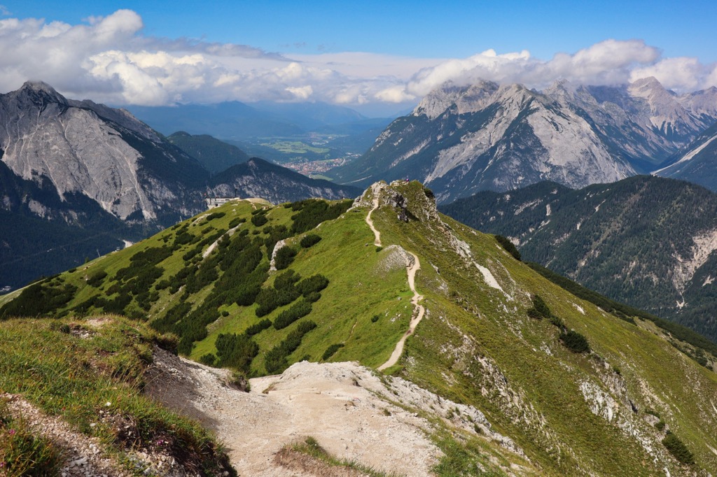
This stunning hike lies just north of Innsbruck along the southern edge of the nature park. The trail follows along the Nördkette ridge amidst the sprawling alpine terrain. Hikers have views throughout the trail while following along the rocky path.
Proper hiking footwear is recommended as some parts of the trail contain loose rock and steep drop offs. Hikers can turn around once reaching the Pfeishütte mountain hut or book it to spend the evening. The out and back hike is 10.4 km (6.5 miles) in length and features 770 m (2,526 feet) of total elevation gain. Access to this route begins by taking a cable car.
The Karwendel High Trail is a multi-day hut to hut route situated in the western half of the Karwendel Nature Park. This entire route covers roughly 60 kilometers (37 miles) and features 7,000 meters (22,966 feet) of total elevation gain and loss.
The alpine route travels along some of the most stunning peaks and ridgelines found in the entire park. Hikers can experience the secluded nature near the heart of the park along with panoramic views, alpine meadows, and wildlife. Each stage of the hike varies in difficulty.
Looking for a place to stay near Karwendel Nature Park? Here are some of the best cities and villages to check out near the park:
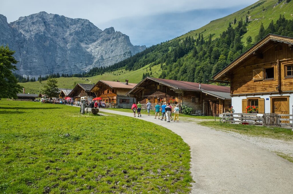
Eng is a settlement situated near the center of Karwendel Nature Park, marking the most remote settlement in the Alps and much of Central Europe. The only road access to Eng is through Bavaria, with no roads connecting it to Innsbruck or the southern side of the park.
During the winter months the road access is closed due to avalanche danger. However, during the summer months, Eng offers a quaint escape into the heart of the Karwendel Alps.
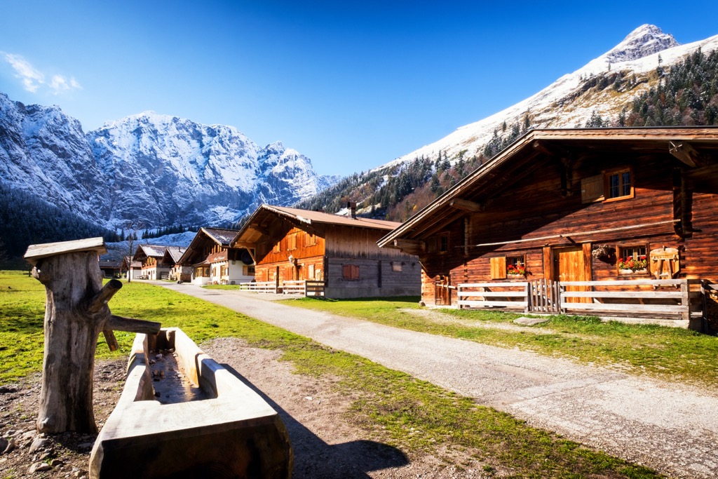
Enger Bergkäse (English: Eng Mountain Cheese) is produced from the cows that graze throughout the surrounding meadows. Visitors can explore the cheese factory, a 300 year old timber chapel and of course the surrounding nature park. Eng also features a traditional Tyrolean restaurant that specializes in local cuisine.
The city of Innsbruck lies along the southern edge of Karwendel Nature Park along the River Inn. Home to around 132,000 residents, it marks the capital of Tyrol and the fifth largest city in the country.
Nestled in a valley, the Karwendel Alps lie directly north while Patscherkofel and Serles lie to the south. The region is a hub for both summer and winter outdoor activities, having hosted the 1964 and 1976 Winter Olympics.
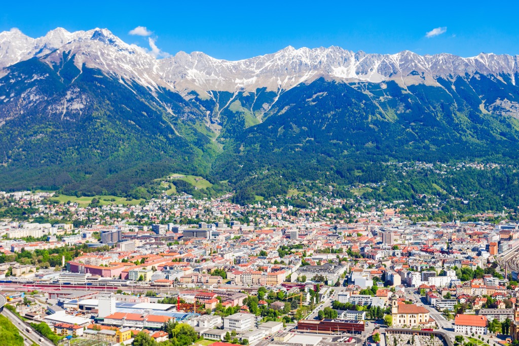
Besides its plethora of natural beauty, Innsbruck is home to numerous historical sites. Visitors can explore the Old Town district, Town Tower, the Hofkirche church, and the Cathedral of St. James. The Tirol Panorama is a newer museum showcasing the history of Tyrol.
Nearby ski resorts include Nordkette, Axamer Lizum, Muttereralm, Patscherkofel, Igls, Seefeld, Tulfes and Stubai Valley.


The highest peak in Karwendel Nature Park is Birkkarspitze, at 2,749 m.
Notable peaks in Karwendel Nature Park include Birkkarspitze, Mittlere Ödkarspitze, Östliche Ödkarspitze, Kaltwasserkarspitze and Großer Bettelwurf.


