Scan the QR code and open PeakVisor on your phone
Mount Greylock State Reservation, situated in the far northwestern corner of the US state of Massachusetts, offers numerous outdoor activities, historic trails and sweeping views from the tallest mountains in the state.
There are 10 named mountains in Mount Greylock State Reservation. The highest and most prominent is Mount Greylock at 3,488 ft (1,063 m).
Mount Greylock State Reservation covers 12,500 acres (5,058 ha) in Berkshire County, Massachusetts, most notably the summits of Mount Greylock and Saddle Ball Mountain, the only two peaks above 3,000 ft (914 m) in the state.
The park sits near the Vermont and New York borders, sandwiched between the Berkshires and the Taconic and Hoosac Ranges.
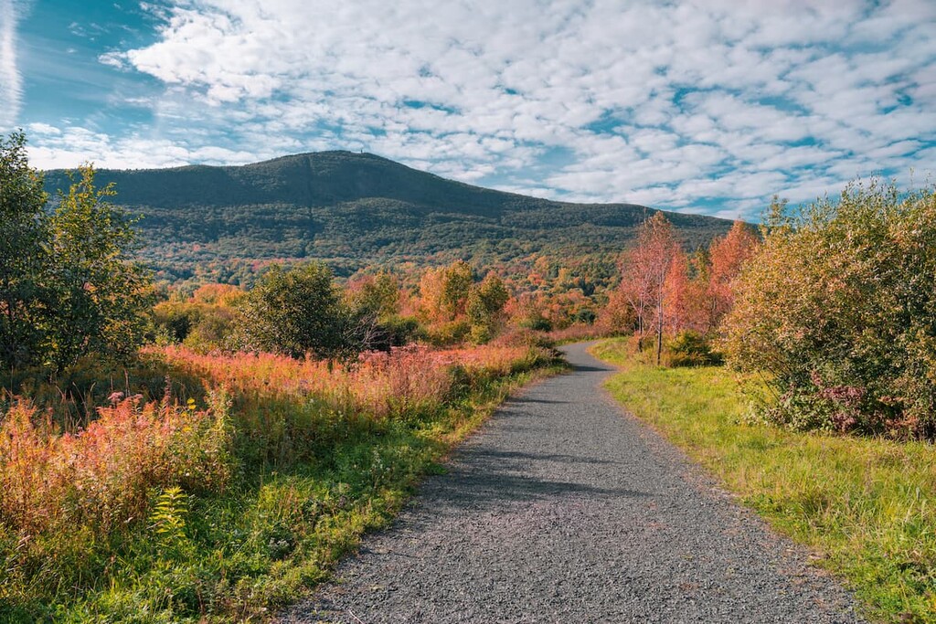
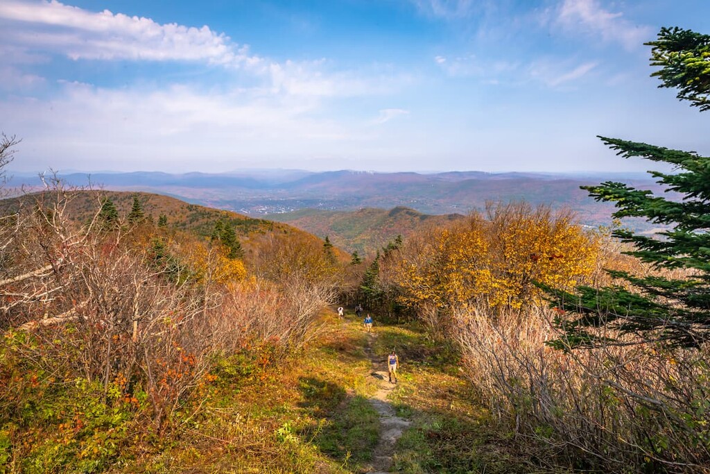
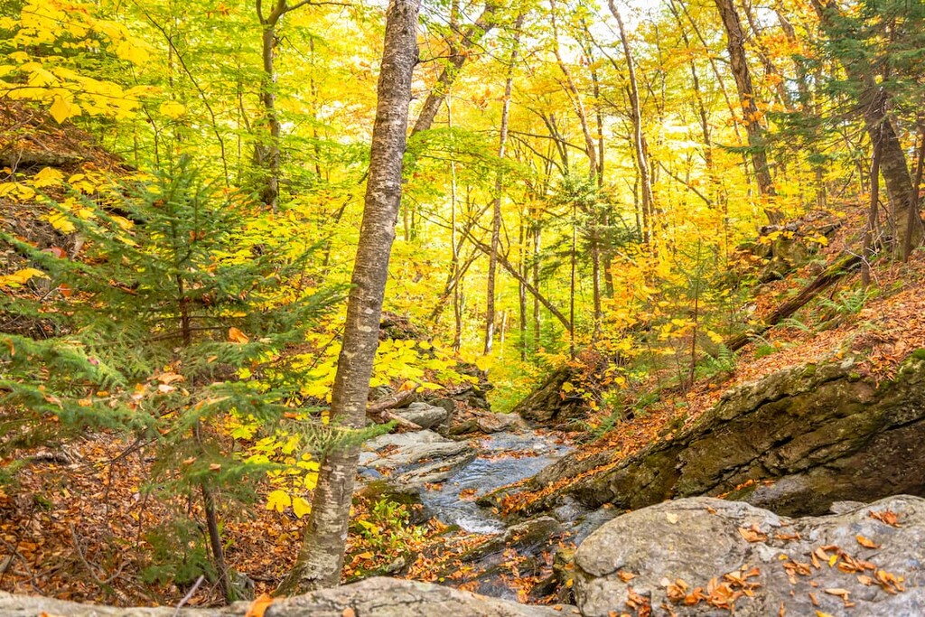
There are over 70 miles (113 km) of trails in the reservation, including 11.5 miles (18.6 km) of the Appalachian Trail. The area is used for hiking, mountain biking, snowshoeing, skiing and snowmobiling.
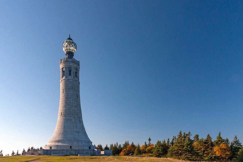
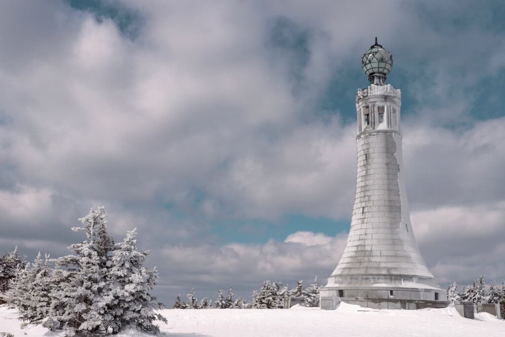
The summit of Greylock is home to the most southerly taiga-boreal forest in New England, the start of the legendary Thunderbolt backcountry ski trail, and the 90-foot-tall (27 m) Massachusetts Veterans War Memorial Tower. The peak is accessible by an auto road in the summer months or snowmobile in winter.
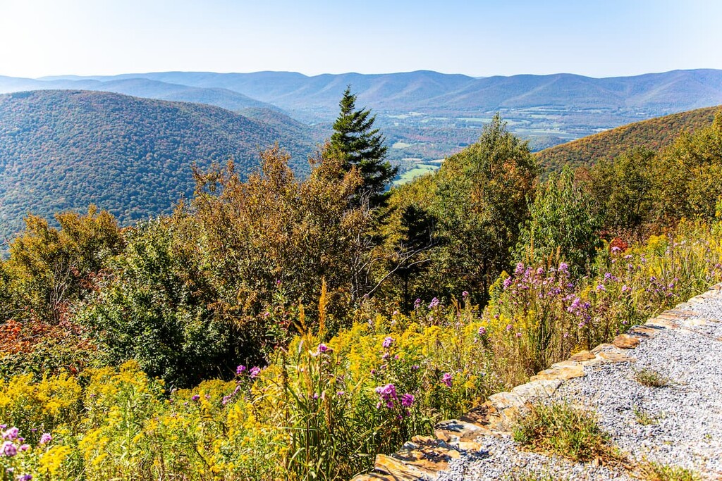
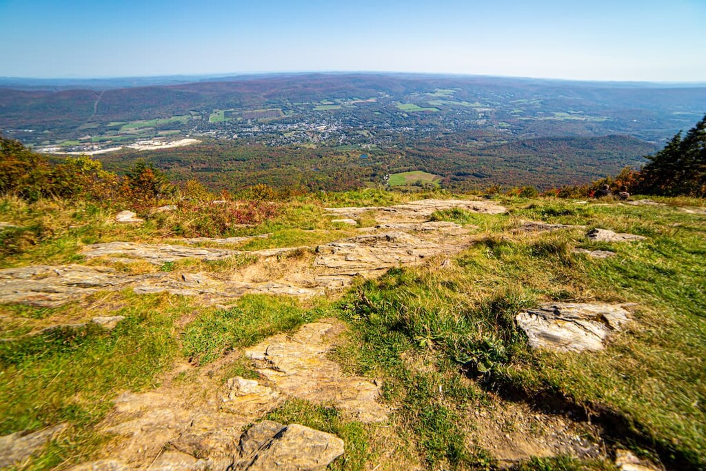
Mount Greylock rises about 2,000 ft (610 m) above the river valleys that surround it and 1,000 ft (300 m) over the nearest mountains in the Berkshires and Taconics, so views from the top are spectacular. On a clear day, you can see up to 90 miles (145 km) into the neighboring states of New York, Vermont, New Hampshire and Connecticut.
Other hiking opportunities near Mount Greylock State Reservation include the Taconic Ridge State Forest, Savoy Mountain State Forest, and Green Mountain National Forest in Vermont.
The peaks of Mount Greylock State Reservation are frequently associated with the Berkshires, but they’re actually part of a separate 11-mile (18 km) long island-like most closely related to the Taconic Mountains.
Mount Greylock and the nearby mountains were formed by thrust faulting, a process where older rock is pushed up past younger rock at a break in Earth’s crust. The mountains are mostly Ordovician phyllite, a metamorphic rock. Beneath these layers are younger deposits of metamorphosed sedimentary rock, especially marble, some of which has been quarried in nearby towns.
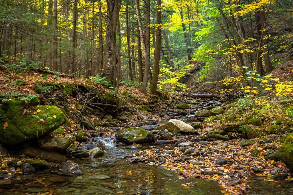
Glaciation is also a major factor in the landscape of Mount Greylock State Reservation. About 20,000 years ago, the Laurentide Ice Sheet covered the area in ice up to a kilometer thick, which ground down the mountains and carved U-shaped valleys around Mount Greylock.
The Hopper, a glacially-carved amphitheater (called a cirque) on the western side of Mount Greylock is the southernmost feature of its kind in New England.
Watersheds in the reservation drain into the Hoosic and eventually the Hudson River on the northwestern side, and the Housatonic River on the southern side.
Like much of New England, the area of the Mount Greylock State Reservation was heavily deforested by the 1800s. The forest has recovered since preservation and now most of the lower areas of the park are covered by northern hardwood forest.
The western side of Mount Greylock is designated as a National Natural Landmark and contains stands of old growth Hemlock and 200-year-old Red Spruce, including the largest spruce in Massachusetts.
Higher up on the ridgeline lies the only taiga-boreal forest in Massachusetts. This stand of subalpine conifers on the ridgeline is the farthest south of its kind in New England. The high-elevation forest features balsam fir and red spruce trees.
Because of this unique forest habitat, the reservation is designated as an important bird area. Blackpoll warblers, which do not normally breed in Massachusetts, can be found on the mountain, along with Swainson’s Thrushes, White-Throated Sparrows and Dark-Eyed Juncoes. The reservation is also home to white-tailed deer and bears.
The original inhabitants of the area around the Mount Greylock State Reservation were the Mohican people, an Algonquin-speaking tribe active in parts of New York, Vermont, Massachusetts and Connecticut.
Members of the Mohican tribe fought in the Stockbridge Militia, the first group of Native Americans to align with American revolutionary forces, and they defended the nearby town of Stockbridge from insurgents during Shays’ Rebellion. After the war, however, the Mohicans were pushed off their land in Massachusetts and eventually forced to resettle in Wisconsin with members of Lenape tribes as the Stockbridge-Munsee Community.
The Mohawk Trail, an important trade route connecting the Native American tribes of the Atlantic region to those in Upstate New York, crossed under the northern flank of Mount Greylock. Today, one of the main throughways in the area, scenic Route 2, parallels the traditional route.
After the arrival of colonists, the lands of the Mount Greylock State reservation were used for logging and clear cut for farming. By the mid-19th century though, the area was recognized as a mountain destination, visited by authors including Nathaniel Hawthorne, William Cullen Bryant, and Henry David Thoreau. The view of Greylock from Herman Melville’s house in Pittsfield is said to have inspired Moby Dick.
In 1885, a group of local businessmen concerned about logging and overuse bought 400 acres (162 ha) at the summit of Mount Greylock. They rebuilt tourist facilities and charged a ten cent fee to access the carriage road to the top of the mountain, but had trouble making enough money to keep the venture afloat.
In order to ensure more permanent protection for the area, the Massachusetts state legislature created the Mount Greylock State Reservation in 1898, making it the first protected forest land in the state.
In the 1930s, the Civilian Conservation Corps cut the Thunderbolt Trail, one of New England’s classic backcountry ski runs. The trail hosts annual downhill skiing races.
There are numerous trails traversing all areas of the park. Hikers can approach the Mount Greylock summit from just about any corner of the reservation, but the quickest trails to the top lead off from Adams and Route 7.
For a comprehensive list of trails, check the parks’ official map or trail mileage chart.
For a strenuous day hike, you can pick up the Appalachian Trail from Outlook Avenue in Cheshire and head north 6.8 miles (11 km) to the summit of Mount Greylock. You can also start on the Bellows Pipe Trail at the Notch Road gate for a slightly shorter 5.5 mile (8.9 km) hike. Both hikes gain over 2,000 ft (607 m) of elevation.
The fastest way to the summit in this area is the 2.7 mile (4.3 km) Gould Trail from West Mountain Road.
On the north side of the park, you can access the Appalachian Trail from Pattinson Road. Distance to the summit of Mount Greylock from here is 5.4 miles (8.7 km). The Bernard Farm Trail also starts in this area. It meets the Appalachian Trail in 3.0 miles (4.8 km) on the ridge between Mount Fitch and Mount Williams.
If you’re looking for a challenging day or overnight hike that will take you over the highest peaks in the Mount Greylock State Reservation, you can string together trails connecting Mount Williams, Mount Fitch, Mount Greylock, and Stony Ledge for a 12.4 mile (20 km) loop with 3,015 ft (919 m) of elevation gain.
The loop starts on Money Brook trail and passes a waterfall, then follows the Appalachian Trail south to the Hopper Trail. From Stony Ledge, you can take the Haley Farm Trail back to the parking lot.
If you’re looking for the quickest trail to the summit of Mount Greylock, the Hopper Trail gets you to the top in only 1.7 miles (2.7 km), but with a tough 1,312 ft (400 m) of climbing.
At the southern end of the park, hikers can stop in to the visitor center for park exhibits, maps and information. This area is farther away from high points on the ridgeline, so it’s not the best if you’re looking for a shorter day hike over Greylock. There is a great 1.8 mile (2.9 km) loop leaving from the visitor center called the Bradley Farm Interpretive Trail, which is good for a mellow walk.
For a forest reservation, Mount Greylock is relatively developed, with lots of amenities for visitors of all kinds. The auto road to the summit is especially popular during fall foliage season and has several scenic pull offs.
Bascom Lodge offers a unique option for rustic lodging in the area. The old-school mountain lodge, built in 1932 with stone and timber from Greylock, has basic private rooms and bunk beds with special discounts for Appalachian Trail thru-hikers.
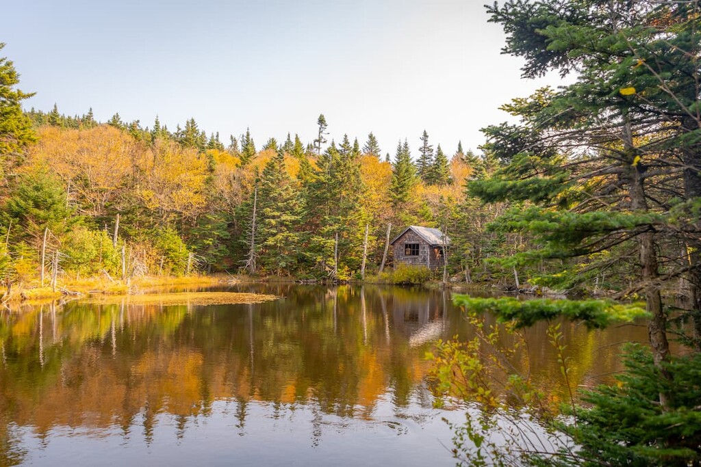
There are five trailside shelters for backpackers in the Mount Greylock State Reservation, as well as a designated campground. Sperry Road Campground is a primitive, reservation-only campsite that can only be accessed via a 1.3 mile (2.1 km) walk. There’s no direct vehicle access to any camping area in the park.
Numerous snowshoeing and skiing opportunities can be found in the reservation, with trailheads at each of the main access points to the park. Refer to the winter use trail map on the second page for more information about Greylock in winter.
Backcountry skiers heading for the Thunderbolt Trail are advised to take the Bellows Pipe Trail to the summit. The Thunderbolt is very steep for climbing, and it can be dangerous to climb where other skiers are descending. The top section is also closed to hikers in the summer to control erosion.
Properly permitted hunting is allowed on reservation land, although no hunting is allowed between May 20th and Columbus Day.
Greylock Glen, a low lying area on the eastern side of the reservation, has about 15 miles of existing single and double track trails, with plans for much more on the way. These trails are multi-use, so riders should be prepared for pedestrians on the trail.
During the winter, the auto roads to the Mount Greylock summit close to cars and they’re open to snowmobiling. The Adams Sno Drifters Club maintains trails in the reservation and nearby.
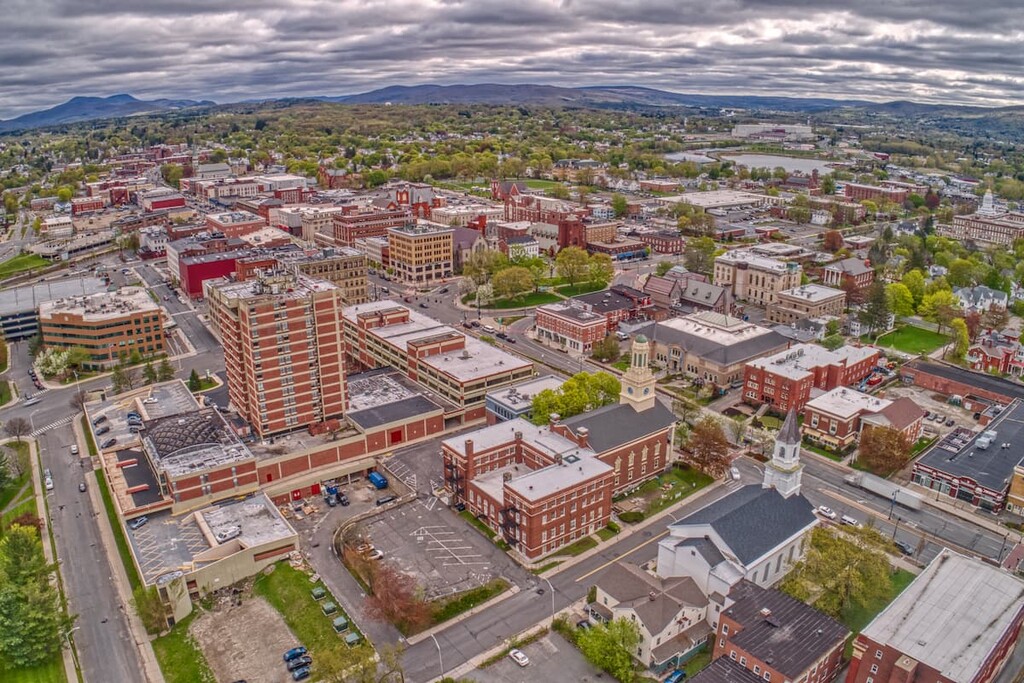
Despite its status as a small town of 13,000 people, North Adams is a renowned center for the arts in the northeast. The Massachusetts Museum of Contemporary Art (MassMoCA) in North Adams is the one of the largest museums of contemporary art in the county. There are also numerous galleries in town and several historic mills that have been converted to artists’ spaces.
North Adams is located just north of the reservation, right in the shadow of Mount Greylock. The town puts on lots of events throughout the year, including a fall foliage festival, summer concerts and several street festivals.
During the annual Eagle Street Beach Party, the town covers an entire street in 250,000 pounds of sand and stages an all-day party, with family-friendly activities during the day and an “adult oriented fiesta” at night.
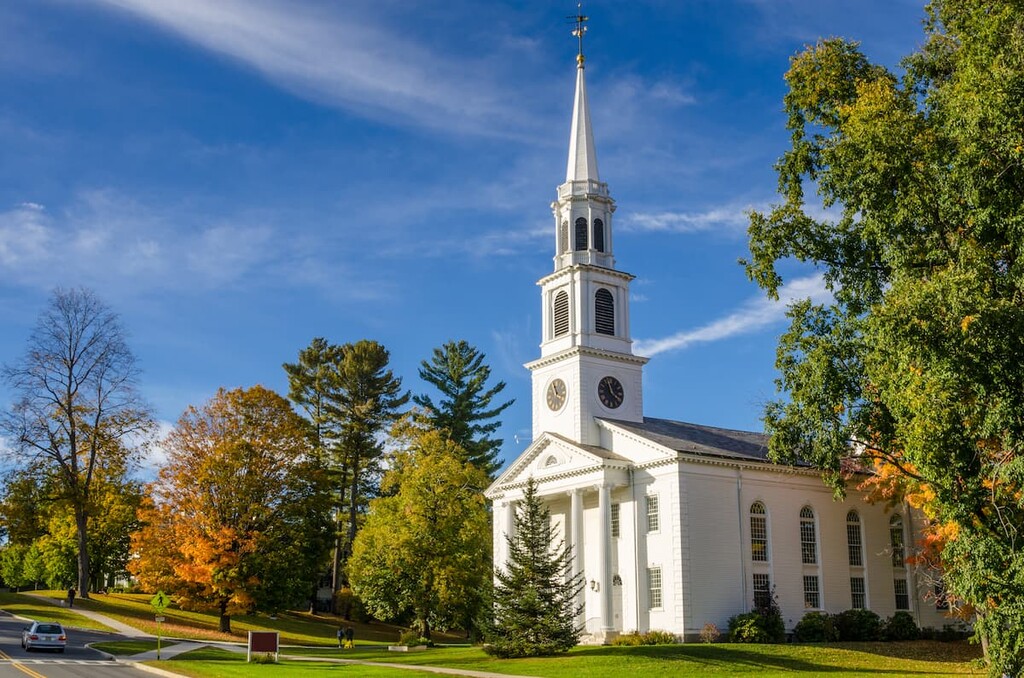
Located in the very far corner of the state, bordering New York and Vermont, Williamstown is a historic Berkshire destination. The 7,700 person town is home to Williams College and the Clark Art Institute.
Williamstown is located right at the northern edge of Mount Greylock State Reservation, so it’s a great basecamp for hiking in the park. Incorporated in 1765, the town has lots of historic buildings and quaint inns. It also hosts a Tony-award winning theater festival in the summer.
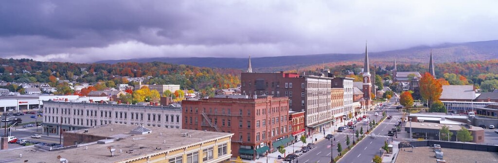
Pittsfield is located about 10 miles south of the Mount Greylock State Reservation visitor center. It’s the county seat and largest town in Berkshire County, home to about 45,000 people. Pittsfield is a regional hub for the whole Berkshire area. The Tanglewood outdoor music venue in nearby Lennox, where the Boston Symphony Orchestra plays in the summer, is a major draw to the area.
Pittsfield is a vibrant small community with good dining options and numerous historic buildings, including the century old Colonial Theater. The town is home to the Berkshire Museum and renowned Barrington Stage Company.