
Scan the QR code and open PeakVisor on your phone
In the grassy flatlands of northern Taiwan’s Yangmingshan National Park (陽明山國家公園) lies the Dayoukeng and Jinbaoli Road Historic Preservation Area (大油坑與金包里大路史蹟保存區). There are 4 named mountains in the area, the highest and most prominent of which is Qingtiangangshan (擎天崗山) at 798 meters (2,618 ft) in elevation.
The Dayoukeng and Jinbaoli Road Historic Preservation Area is located in the Shilin District (士林區) of northern Taipei City (臺北市). The hills of Qingtiangangshan, Qingtiangangshan East Peak (擎天崗山東峰), Dayoukengshan (大油坑山), and Direkou (地熱口) are all closely clustered together in the historic preservation area.
The extensive 11,338 ha (28,017 ac)re Yangmingshan National Park is divided into five smaller regions, each with a key feature:
As the park is located just to the north of the city of Taipei, the weather changes dramatically throughout the year.
Summer is humid and warm, but the onset of the annual typhoons brings intense wind and flooding to the area. Winter is cool and mild; however, the northeast monsoon disrupts the harmoniously pleasant winter with another rainstorm. For this reason, rainfall levels in Dayoukeng and Jinbaoli Road Historic Preservation Area are high at an average of 4,000 mm (157 in) per year.
While the elevation range of Yangmingshan National Park is between 200 to 1,118 meters (656 to 3,669 ft), Dayoukeng’s elevation range is much smaller at 200 to 798 meters (656 to 2,618 ft).
The region around Yangmingshan National Park and Dayoukeng is immensely popular year-round among tourists; however, it is surrounded by other exciting and intriguing places of interest that are also worth checking out.
For example, Taiwan’s electrifying capital, Taipei, is located to the south of the park, while the sought-after Beitou Hot Springs (北投溫泉) are situated to the east. The striking outcrops of Yehliu Cape Nature Reserve (野柳岬自然保護區) are located the west, and the Laomei Green Reef (老梅綠石槽) is situated to the north, too.
Dayoukeng’s hills are part of the Datun Volcano Group (大屯火山群), a series of dormant volcanoes located in northern Taiwan.
Consisting of a cluster of 20 volcanoes, the volcano group formed as a result of the eruption of andesite lava from volcanoes between 200,000 to 1 million years ago. Several fumaroles and hot springs have appeared in recent millennia, too.
The main rocks found in the area are andesite and various sedimentary rocks that date back to the Pleistocene epoch.
Dayoukeng’s grassland prairie is generally flat; thus, tall plants struggle to thrive here as the northeast monsoon winds uproot any high growth. A mixture of carpet grass and the long, silky silver grass (Miscanthus sinensis) grow on the fertile fields of the historic preservation area.
In the lower, sheltered elevations, a wide variety of ferns flourish, such as chestnut ferns, cinnamon ferns, and the old world forked ferns. The Japanese ash also grows in Dayoukeng’s plains.
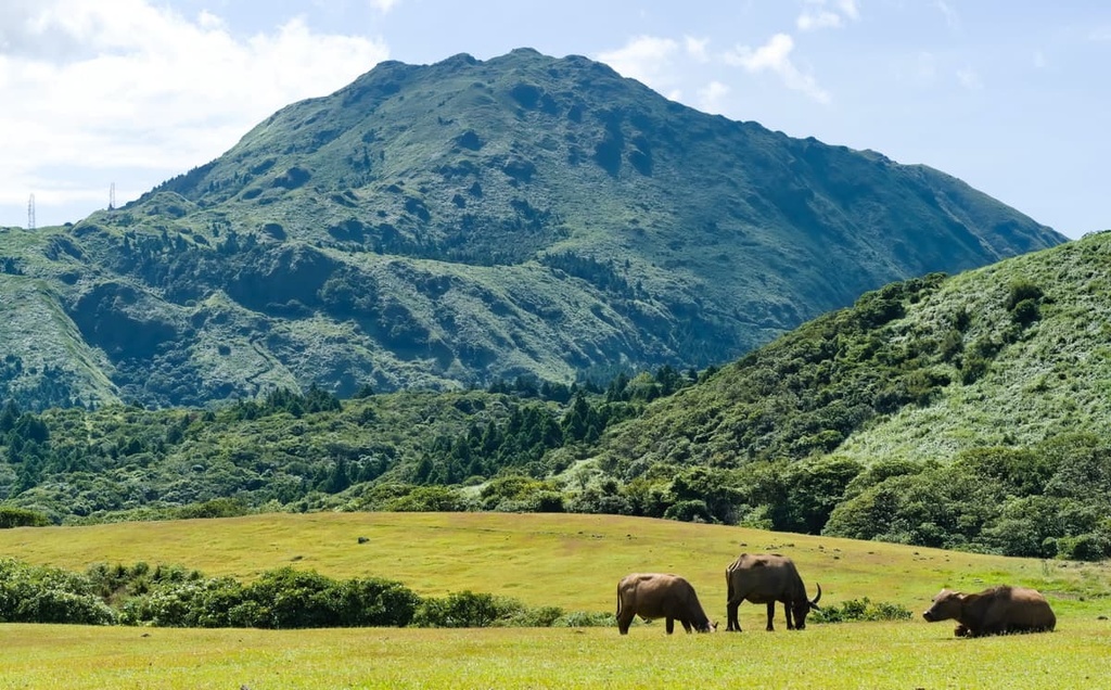
Cattle, Dayoukeng’s predominant wildlife species, can be seen grazing in the region’s green pastures. Hares, weasels, and badgers are other mammal species that frequent Dayoukeng’s lush, carpeted meadows.
Additionally, many bird species visit the region and are easily spotted by keen birdwatchers due to the vast, open nature of the landscape. The bamboo chicken, crested lark, and swallow are all bird species that are commonly spotted in the area.
During the Japanese Occupation Era in 1934, Dayoukeng’s lawn was used as a grazing field for cattle and was named the Daling Pass Ranch. After the Second World War, the Taiwanese government established Yangmingshan Ranch, which included the old Daling Pass Ranch and the nearby Lengshuikeng area.
The farm was located in parts of Taipei City’s Shilin and Beitou Districts (北投區) and New Taipei City’s (新北市) Jinshan District (金山區). As a result farmers from these areas tended to the cattle on the ranch. During this time, Dayoukeng’s farming fields were once brimming with livestock. The livestock numbers have decreased over time, especially with the onset of farming machinery and the reduction of cattle breeding.
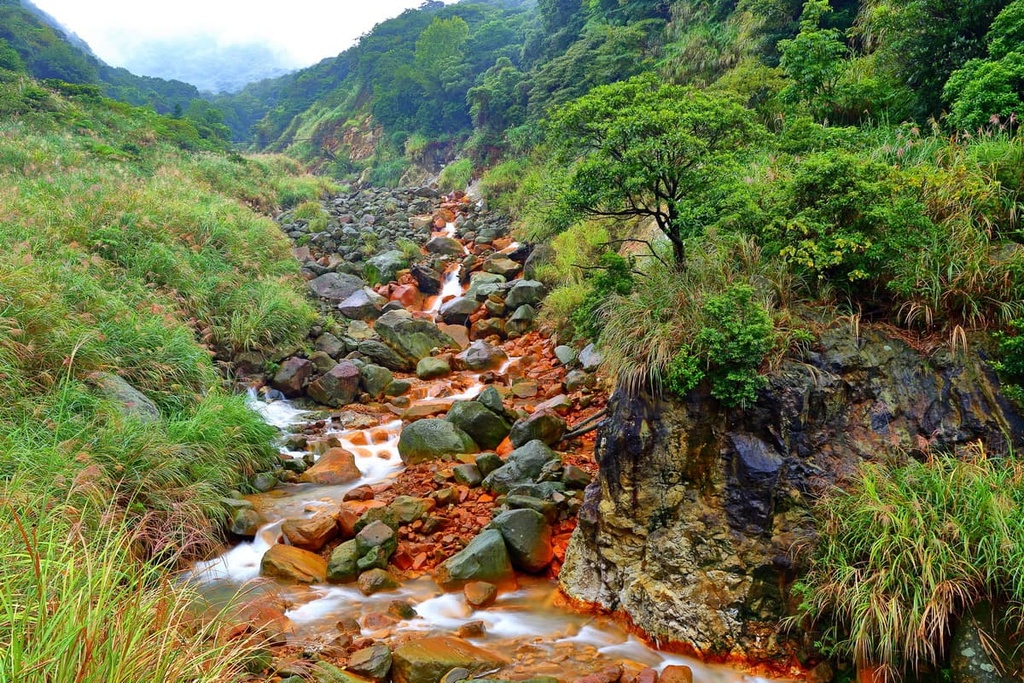
Located near the grazing fields is Dayoukeng’s old sulfur mining site. Due to the density of Yangmingshan’s dormant volcanoes, many old sulfur mining sites can be found across the park. During the Japanese Occupation Era, Japanese officials managed the mines, which became a lucrative business. In 1971, these mines ceased operation due to rising production costs and competition of imported sulfur.
The area that is now Dayoukeng also formed part of the Jinbaoli Ancient Road, which crossed the grassy plains to transport goods to the local Shilin residents. Anglers from the coastal Jinshan District would take this path into Yangminshan and across Dayoukeng to trade their freshest seafood catch. Thus, this path is also locally referred to as ‘The Fisherman’s Trail.’
Here’s a quick look at some of the most popular hiking trails and areas in and around Dayoukeng and Jinbaoli Historic Preservation Area.
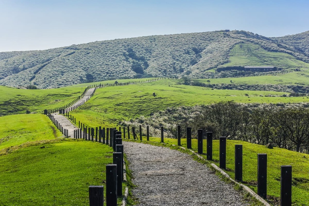
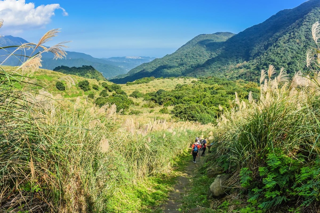
Quite possibly Yangmingshan’s most beginner-friendly terrain, the Qingtiangang Circular Trail has an elevation gain of only 74 meters (273 ft) throughout its 2.4 km (1.5 mi) long course. As people of all ages frequent this path, you’ll likely see people flying kites, families picnicking on the flat lawns, and people walking the track at their own pace.
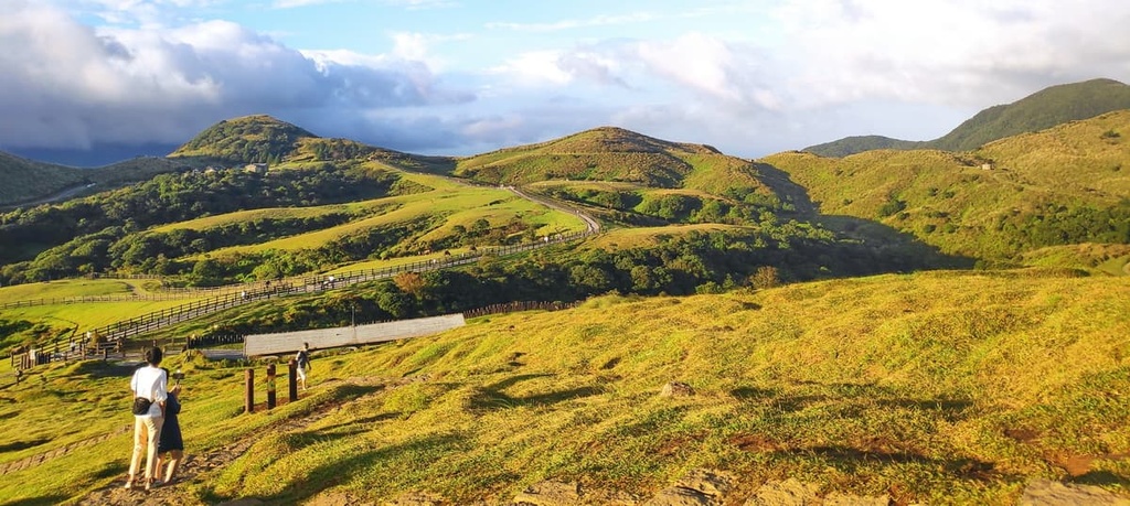
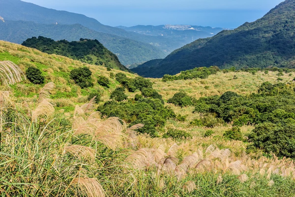
While the terrain is primarily flat with an elevation no higher than 798 meters (2,618 ft), it still gives you a chance to admire the sweeping views of the Taipei basin and the fertile Jinshan Plain in New Taipei City. Indeed, Qingtiangang retains its rustic charm as an old ranch with grazing cows in the fertile valley, all of which you can see from the trail.
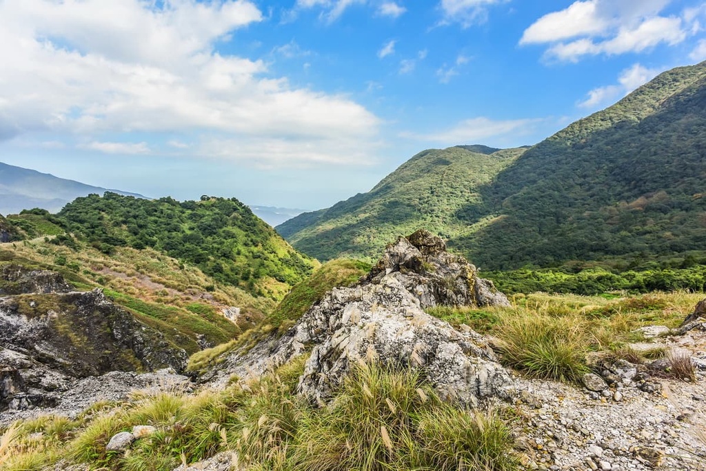
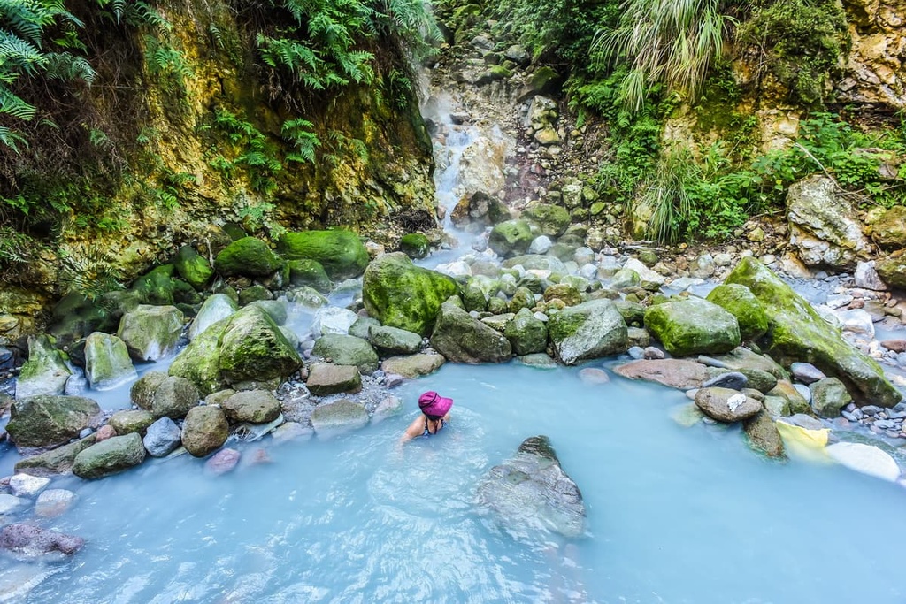
Taiwan’s largest fumarole, Dayoukeng, lies to the south of Dayoukengshan. Here, sulfurous steam rises from the ashen Earth with an overbearingly pungent odor. This 2.2 km (1.3 mi) trail begins at the foothills of Dayoukengshan, and it makes its way over the hill toward the caldera.
From Dayoukengshan’s summit, you can gaze at Dajianhou Shan (大尖後山) and Huangzuishan (磺嘴山) to the east and Qigushan (七股山) to the west.
Dayoukeng’s fumarole is dangerously hot, as the steam that it emits hovers at a temperature of around 120°C (248°F). Once a sulfur mining spot, the mines had to cease operations with the establishment of Yangmingshan National Park; however, old mining tools and equipment are still scattered near the crater and they offer a glimpse into Dayoukeng’s past.
This trail takes you along part of the 3.7 km (2.3 mi) Jinbaoli Ancient Road, which follows the longer 6.6 km (4 mi) Yulu Ancient Road to bring you into the Dayoukeng and Jinbaoli Historic Preservation Area.
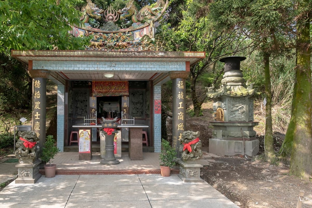
Many relics from when the road was still active are well-preserved along the route. For example, Hanbing Cuodi’s old structure, a trading post that operated during the Qing dynasty selling utensils, crockery, and straw sandals, still stands. Another historic site on this trail includes the dilapidated remains of the Xuyuan Bridge, which was built in 1896 to distribute and sell tea. This old crossing was wrecked during a flood, and a newer bridge was constructed in its place.
You will then pass through the smoking earth of Dayoukeng, following the trail of another historic path, the Sulfur Picking Road. Along the way, you can admire Yangmingshan’s expansive dormant volcanoes, which stand in stark contrast to the surrounding grassy green landscape.
Located in the foothills of Qixingshan is Lengshuikeng Hot Spring (冷水坑溫泉), a natural bicarbonate spring with a water temperature of 40°C (104°F). Interestingly, the temperature of the Lengshuikeng Hot Spring is considerably lower than the temperatures of other nearby hot springs, which are normally around 75°C (167°F), so it’s a good place to visit if you want to soak in some cooler water.
After a long day of hiking, many visitors flock to Lengshuikeng to unwind and soak in the hot spring. As you relax, you can enjoy the views from the hot spring, which include vistas of Dayoukeng, Qixingshan, and the rippling network of smaller, grassy hills in the distance.
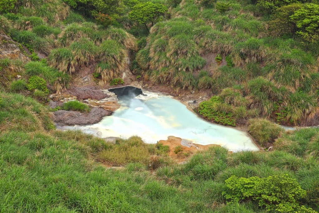
Situated in the area between Qingtiangangshan, Qigushan, Menghuanhu Shan (夢幻湖山) and Qixingshan lies the murky Milk Lake (牛奶湖). The sulfuric soil of the area transforms the water color of Milky Lake into an opaque milky white—especially once rainwater falls on the pond.
A viewing platform along the trail to the lake offers the best view of the area. In springtime, the forest is illuminated with pops of color from scarlet rhododendrons, powder blue gentians, and magenta peach blossoms. Butterflies also flutter across the landscape in the summertime, which is a true wonder to behold.
As it is situated in Taipei’s backyard, visitors to Dayoukeng and Jinbaoli Historic Preservation Area can base themselves in Taipei if they want a mix of city and nature-based adventures. Alternatively, you could stay in the nearby New Taipei City, which is located just a short journey from the park.
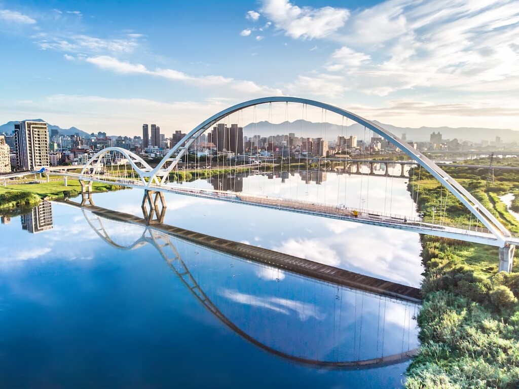
To experience a fusion of electrifying ambience, leafy gardens, and Taiwan’s cultural melting pot, head to Taipei City, Taiwan’s exciting and scenic capital. The city is home to countless attractions and places to visit, so it’s a great basecamp for any adventure in the northern part of the island.
A magnet for locals and tourists alike, the city’s National Palace Museum holds an extensive collection of 655,000 Chinese artifacts that Chiang Kai-shek brought over from China (中国) in 1949. The museum contains official documents, artwork, furniture, and books that are between 70 and 5,000 years old.
Another place where you can find hordes of tourists and locals in the city are the bustling Taiwanese night markets. Shilin Night Market (士林夜市) and Raohe Night Market (饒河夜市) are two of Taipei’s prime spots to sample Taiwanese delicacies, inhale the irresistible mix of freshly prepared food, and soak in the effervescent energy of all your senses igniting at once.

A local hotspot, especially on weekends, is Beitou Hot Spring, which is situated in the outskirts of Yangmingshan. During the Japanese Occupation Era, the Japanese privatized the area and constructed resorts so that they could enjoy the pristine, peaceful environment overnight. Thus, the lush, sheltered 70°C (158°F) hot springs have many simplistic wooden Japanese architectural structures that add character to the mountainside.
Once the world’s tallest building between 2004 and 2010, Taipei 101 stands at 508 meters (1,667 ft) tall and it has 101 floors. Now, the world’s eleventh tallest building, Taipei 101, offers unrivaled views of the capital. One of the best places to admire this lotus-shaped structure is from nearby Elephant Mountain (象山), from where you get a unique view of the Taipei City skyline.
Finally, for a slice of the outdoors in metropolitan Taipei, head to the verdant 26 ha (64 ac) Da’an Forest Park (大安森林公園). Clusters of camphor, ficus, and maple trees thrive in the gardens of the park, which are sometimes known as the ‘lungs of Taipei’. Locals enjoy strolling through the luscious trails and picnicking on the manicured lawns, especially on the weekend.
New Taipei City encircles the entire Taipei metropolis. It boasts an amazing array of natural wonders from seaside geological sculptures, coastal hills, jungly wilderness, and bustling fishing ports.
For a chance to feel like you have landed on another planet, visit Yehliu Cape Nature Reserve. The rocky shoreline boasts the most striking and unusually shaped crags, such as the Queen’s Head, which is a mushroom rock weathered into a regal side profile. A total of 180 highly eroded and picturesque rocks are located along this strip of coastline, and they are all worth checking out.
If you want to venture into the hills around the city, take a wander around Juifen’s (九份) maze-like alleyways. Once an old Japanese mining town, Juifen retains its old-world charm with its litany of wooden Japanese architecture and an abundance of tea houses. A-Mei Teahouse is particularly photogenic, as the three-story wooden structure overflows with plant life from each windowsill and is illuminated with strips of red Chinese lanterns. It offers the most scenic views of undulating hills and the vast Pacific Ocean.
Another of New Taipei City’s top attractions is Shifen Waterfall (十分大瀑布), which is known as the ‘Little Niagara of Taiwan.’ It is Taiwan’s widest waterfall as it is nearly 40 meters (131 ft) across. There’s also a conveniently placed viewing deck near the falls where you can cool down in the shade and feel the soft shower of water spritz from the 20-meter (66 ft) high waterfall.
Alternatively, visit the Wulai Scenic Area’s fertile valley for a scenic escape. Wulai has it all from winding, sapphire rivers and dense, overgrown forests to a 80-meter (262 ft) waterfall and steamy hot springs. Wulai Scenic Area is the perfect blend of adventure and serenity, which is why it has long been a popular getaway spot for people from Taipei.
Finally, New Taipei City’s Tamsui Fisherman’s Wharf (淡水漁人碼頭) boasts an esplanade of fishing boats, floating piers, seafood markets, and a 300-meter (984 ft) path that traces the waterfront. Sunrise and sunset are breathtaking at the wharf as the still Tamsui River reflects the golden sky. While there, grab a table at one of the numerous seafood restaurants on the wharf to enjoy the freshest catch of the day.

From Taipei Main Station, board the MTR Red Line to Jiantan MTR Station and then take the R5 bus to Yangmingshan National Park. Once in the park, the Yangmingshan 108 bus will drop you at the Qingtiangang stop. From here, you can start your journey into the Dayoukeng and Jinbaoli Historic Preservation Area.
You can also make the 25 km (16 mi) journey from the city to the Dayoukeng and Jinbaoli Historic Preservation Area by car or scooter.


