
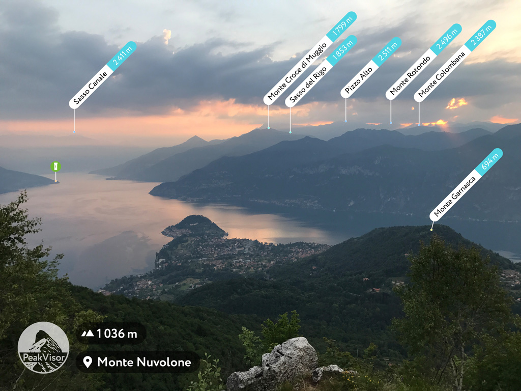
The Earth’s mountains having a proper name are over one million now, so it is really handy to have a pocket encyclopaedia devoted to the landscape defining features. Here, at PeakVisor, we are into the third year of making such a global resource. During the period we learned a lot about the mountains and have some insights to share.
How were Mountains Created?
The mountains form when Earth's tectonic plates meet each other in a process of diastrophic movement. The Himalaya in Asia formed from one such a massive clash about 55 million years ago. That mega collision produced the world’s highest mountains. Most notorious eight-thousanders are found in the Himalaya, including Mount Everest, K2, and Annapurna.
But if you measure the height from top to bottom then Everest is not the leader. The tallest mountain in this approach is Mauna Kea, an inactive volcano in the Pacific Ocean. Mauna Kea rises 10,204 m (33,474 ft) from the base, though only 4,205 m (13,796 ft) of it are above the sea level.
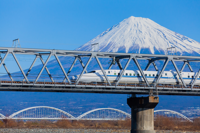
Another type of mountains is volcanic. They form when molten rock erupts through the crust and piles up on itself. Some of the most well-known mountains are volcanoes. Mount Rainier in the US, Mount Fuji in Japan, Mount Etna and Vesuvius in Italy. Volcanoes can even create a land! The islands of Hawaii were formed by undersea volcanoes, and the islands seen above water today are the remaining volcano tops.
One more type of mountains forms when stresses within and between the tectonic plates lead to cracking and faulting of the Earth's surface, which forces its parts up and down.
The Harz Mountains in Germany with the highest mountain called Brocken is an example. Some might argue about the span of your vision, but it is considered to be the point with the highest number of castles visible at the same time.
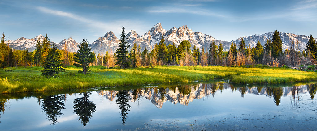
Another example from the US is the Tetons in Wyoming. Between six and nine million years ago, stretching and thinning of the Earth's crust caused the movement along the Teton fault. The west block along the fault line rose to form the Teton Range, creating the youngest mountain range in the Rocky Mountains. Grand Teton is the highest point of the range. Nearby Signal Mountain offers one of the best outlooks of the whole range.
Mountain Classification
Not all mountains were created equal. Some of them are beautiful, some of them gorgeous, some of them breathtaking. Yet, there are much more formal classification tactics. There are hundreds of various techniques. The Mountain Encyclopaedia task is to provide the most comprehensive classification result for any particular mountain. Here are just a few parameters which are already available for you (and we regularly add new types):
- Elevation is the most obvious one but a high mountain in the UK and in Nepal are two completely different stories. For example, mountains in Scotland with a height of over 914 m / 3 000 ft bear a special name, the Munros. In the US, special interest is dedicated to the Fourteeners (14ers) - mountains higher than 4 267 m / 14 000 ft. And Nepal together with China and Pakistan boast the eight-thousanders, the peaks of the more than 8,000 metres / 26,247 ft high.
- Topographic Prominence is less obvious one. It allows distinguishing 1,515 Ultra mountains in the world - the ones with more than 1,500 meters of prominence.
- Geological origin - mountain / volcano / plate fault.
- Cultural specifics - many mountaineering clubs and organisations have their own lists of mountains having great cultural impact on the region.
Using prominence we can figure out a topographical parent for any mountain leading up to the highest mountain Everest. For example, let’s take Matterhorn. Here is its tree: Matterhorn <= Weisshorn <= Monte Rosa <= Mont Blanc <= Everest.
Administrative Boundaries
Another challenge of the encyclopaedia is to have precise data on the administrative location of a mountain, split them into small buckets per province, region, and country. Luckily, nowadays the borders are stable yet there are N countries, NN regions, NNN provinces, and about a million peaks to match them. But, there’s one complication. It appears that some borders are disputed as well as the mountains themselves. You may read more about famous and disputed mountains in our recent article.
Even more, it is important to properly name the mountains according to the country where the outdoor enthusiast is from. For example, it is crucial to call the Matterhorn - il Cervino when you are on the Italian side, especially when looking from the south, because everything there is Cervino related. At the same time you may always heard French pronunciation of Mont Blanc but from the east it is more common to hear Monte Bianco.
Mountain Ranges and Subranges
Mother Nature doesn’t care a thing about human-built borders, countries, and regions. It has its own way. Wise people spent dozens of years (and hundreds) researching the topic and coming up with many options to render a structured approach. A mountain range is a series or a chain of mountains that are close together. There are many systems allowing splitting vast mountain areas into ranges, subranges, chains, and massives.
Let’s take Mount Elbert, the highest point of Colorado, for example. It is a part of the Sawatch Range. The Sawatch Range is part of the Southern Rocky Mountains which are, obviously, the part of the Rocky Mountains spanning over 5,000 km.
Another example from Europe is Monte Rosa, the second highest mountain in the Alps, and a massif as well. But the Alps themselves are stretching approximately 1,200 km. So, it is convenient to divide it into parts. According to the SOIUSA classification Monte Rosa is the highest mountain in the Pennine Alps.
Future of the Mountain Encyclopaedia
Open data initiatives by governments of many countries allow building a much better and precise mountain world directory, yet it requires enormous effort to process all that data into a common format and link entities across various sources.
If you’d like to help improve the encyclopaedia you could do the following:
- Let us know about any inaccuracies in the data
- Send photos of the mountains and specific information about them
- Spread the word, so we together can draw a much more detailed picture
We appreciate all the contributions from outdoor enthusiasts all over the world and take great care of the shared info as we manually process all the inputs.