
Scan the QR code and open PeakVisor on your phone
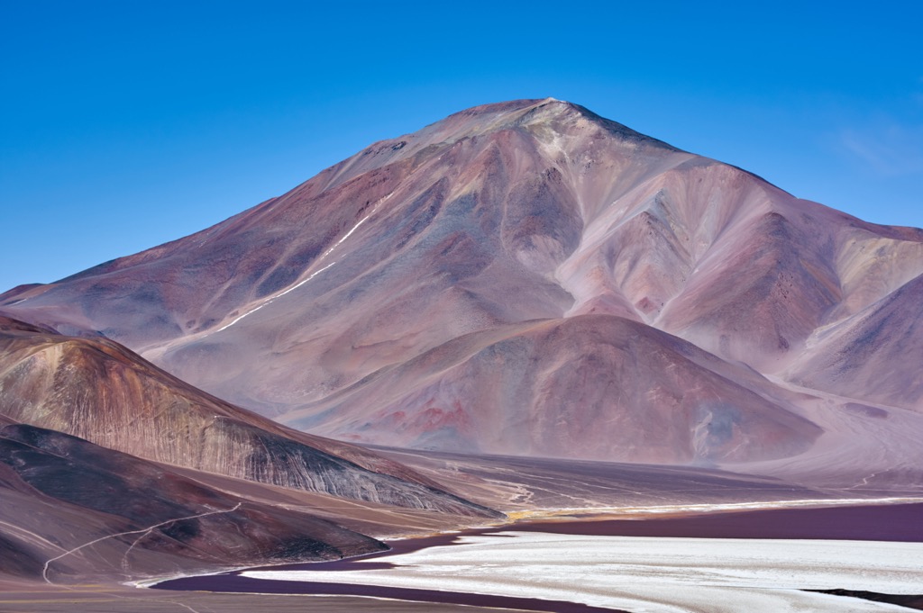
La Rioja is one of the western provinces in Argentina. The landscape is dominated by the arid Andes Mountains and the semi-arid agricultural valleys between the ranges. There are nearly 377 named peaks in La Rioja, of which Monte Pissis (6,795 m/22,293 ft) is the tallest in the province and the third tallest peak in the western hemisphere.
La Rioja is one of the 23 provinces of Argentina, and it is the fourth least populated province. The capital and largest city in the province is called La Rioja and Chilecito is the other major city in the province.
The western border of the province is shared with Chile, and it is determined by the watershed of the Andes Mountains, which dominate the landscape of La Rioja. The adjacent provinces are Catamarca along the northern border and Córdoba to the east. San Luis is south of La Rioja and San Juan is located to the southwest.
The Andes Mountains are the major mountain range of the province, and the peaks of La Rioja are considered part of the Southern Andes. Some of the major mountain ranges in La Rioja are Sierra de los Llanos, Sierra de La Punilla, Sierra del Torro Negro, Sierra de Famatina, Sierra de Sangosta, Sierra de Velasco, and Sierra de Ambato.
La Rioja has many beautiful areas where visitors can hike through the Andes or other incredible natural features. The following are some of the wildlife and natural areas in La Rioja:
The geology of La Rioja is certainly dominated by the Andes Mountains which form the western border of the province. The Andes are the longest continental mountain range is the world, forming the 8,900 km (5,530 mile) long backbone of South America. Furthermore, the Andes contain the highest mountain outside of Asia, Argentina’s Aconcagua, which rises 6,961 m (22,838 ft) above sea level.
The western rim of South America has been the place of orogenic events since the Precambrian. Since that time, several microcontinents and terranes have collided with the primary South American cratons that form the eastern parts of South America. The effects of these mountain formation events can be seen in the neighboring Sierras de Córdoba.
However, the Andes started uplifting much later, during the Cretaceous. Indeed, the uplift of the Andes and the uplift of the ranges along the west coast of North America, such as the Rockies, occurred around the same time and for essentially the same reason.
It was tectonic plates under the Pacific Ocean that were subducting beneath the continent that gave rise to the mountain ranges along the west coast of the Americas. In La Rioja, it was the subduction of the Nazca Plate that caused the uplift of the Andes Mountains.
As the plate subducted it caused the uplifting, faulting, and folding of the layers of metamorphic and sedimentary rocks of the ancient eastern cratons. The rise of the Andes is inconsistent across the range and as such different areas have different degrees of tectonic activity and uplift.
However, a difference between the Andes Mountains and the mountains along the west coast of Canada is that the northern orogenic event has essentially concluded, whereas the Andean orogeny is ongoing.
It was only during the Cenozoic that the Andean orogeny uplifted the adjacent Sierras de Córdoba to their present height, and major volcanoes such as Incapillo are part of active volcanic zones. Volcanic activity can help to show when and where tectonic stresses are occurring.
For example, Monte Pissis is a large volcanic complex along the provincial border between La Rioja and Catamarca which formed over 6 million years ago and volcanism in the area stopped about 2 million years ago. However, Incapillo formed after Monte Pissis had stopped erupting and seismic and hydrothermal activity likely continue to this day.
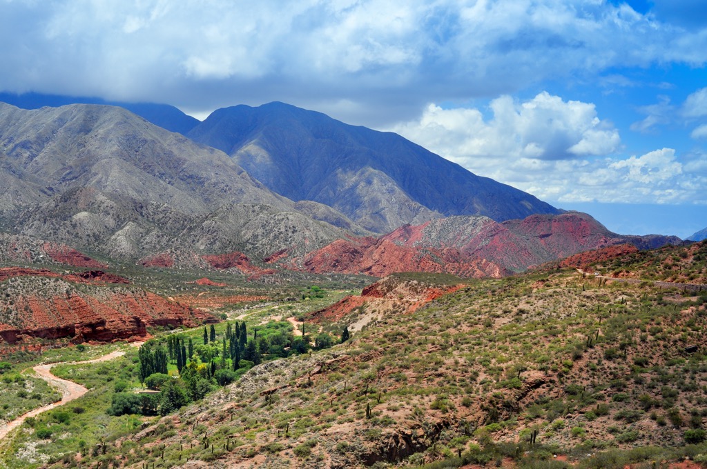
The province is continental semi-arid and mountain arid, which means this mountainous province is quite dry compared to the Pampas in the east and the western slopes of the Andes in Chile. The prevailing winds in La Rioja come from the south Atlantic and by the time they reach the province they have dropped most of their moisture.
As such, the dominant natural vegetation has adapted to the nearly waterless conditions. Most of the vegetation are shrubs and only several natural trees. Some of the trees that do grow in La Rioja are different species of carob trees, the mistol del monte, and the aguaribay.
All the towns and cities are built along the meager rivers that supply the province with water. Most of the rivers have variable flow and are typically dry or nearly dry for part of the year if it weren’t for human intervention and the creation of dams.
Furthermore, except for the Desaguadero River, all the rivers of La Rioja are part of an endorheic basin, which means there is no fluvial outlet to the ocean. For clarification, in La Rioja, the Desaguadero River is known locally as first the Oro River, then as the Bonete River, the Jagüé River, and finally the Vinchina River.
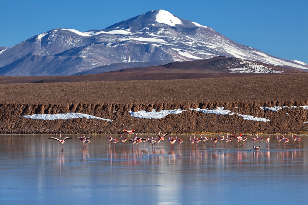
Around 10,000 years ago, at least parts of La Rioja had plenty of rainfall which allowed lush vegetation to grow and attracted wildlife. This is learned from petroglyphs that were left in places such as Parque Nacional Talampaya. Around this time, the abundant wildlife and plants made for a relatively easy time for the hunters and gatherers that inhabited La Rioja and the surrounding areas.
At the time of the Spanish Conquest, La Rioja was inhabited by indigenous groups referred to as the Olongastas, Capayanes, and the Diaguitas. In general, these people had formed agricultural societies that farmed terraced fields and used irrigation. Some of the major crops were corn, pumpkin, potato, and quinoa.
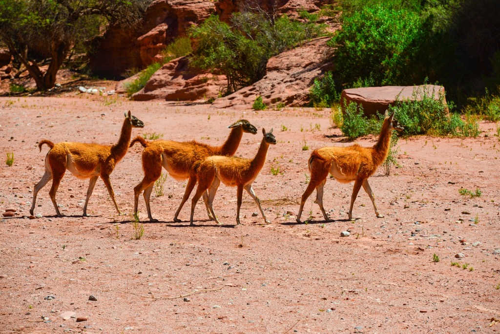
Furthermore, these indigenous groups domesticated llamas and spun the wool of llamas and guanaco to produce fabrics. They knew metallurgy and they crafted and decorated ceramic items.
While associated with the Diaguitas, the Olongastas and Capayanes were separate peoples and are considered essentially extinct as of the eighteenth century. This is due to their relatively low populations at the time of the Spanish arrival and the further wars which led to their ultimate downfall and dilution into the general population.
There is more information regarding the Diaguitas, who inhabited territory across northern Chile and northwestern Argentine, including La Rioja. As a culture, the Diaguita people started around 1000 CE and lasted until the middle of the sixteenth century, at which time the Hispanic culture became dominant.
Major groups of Diaguita inhabited the different valleys of the Andes, including those in La Rioja. In general, it is believed that the Diaguita people were not unified, and they had different languages or at least dialects between the different groups.
The Incan Empire encroached upon the Diaguitas; however, they were considered an independent people at the time the Spanish arrived in their territory. It took several long wars and over 110 years for the Spanish to consider the Diaguita people subjugated and conquered.
Indeed, the city of La Rioja and many of the cities in northwest Argentina were established as strategic points to combat the indigenous people. At the time of the establishment of the city of La Rioja in 1591, the territory of the modern province had been part of the Government of Tucumán, which was a Spanish territory under the Viceroyalty of Peru.
A major reform occurred in Argentina in 1776 when the Viceroyalty of Rio de la Plata succeeded the Viceroyalty of Peru. At this time, there were estimated less than 10,000 people inhabiting La Rioja. The reformation made Argentina more dependent upon decisions from a centralized Spanish government, which ultimately led to revolution and the independence of Argentina.
Unfortunately, the reformation also destabilized La Rioja and other parts of Argentina during the beginning of the nineteenth century, until the Argentine Republic was established. This period included the deposing of governors, a military uprising, the separation of La Rioja from Córdoba, and a time of anarchy until Facundo Quiroga was able to stabilize Nicolás Dávila in government in 1821.
Instability continued throughout Argentina until it became a republic in 1853. La Rioja was one of the thirteen signatory provinces of the Argentine Constitution of 1853 which established the Republic of Argentina.
In general, La Rioja attracted fewer immigrants than the rest of the country from the late nineteenth century through the early twentieth century. While those of European descent established themselves through many areas of Argentina, it was mainly immigrants from Syria and Lebanon that settled in La Rioja.
Of the families that settled in La Rioja, the Menem family is among the most well-known. Carlos Menem was a lawyer who gained popularity first as Governor of La Rioja and later as the President of Argentina. Identifying as a Peronist, Menem was removed from office and imprisoned during the military coup in 1976 and his confinement lasted until 1980.
When democracy was restored in 1893, Menem once again became the governor of La Rioja. He was elected president in 1988 and served until 1999. During those years he was able to push ahead with public works projects in La Rioja; however, the province is still one of the least developed in the nation.
Agriculture and ranching were among the original industries in La Rioja, as well as mining. However, due to limited water resources only about 190 square kilometers (73 square miles) of land is cultivated. The major crops produced are grapes, nuts, olives, and cotton. Vineyards are the major agricultural producer in the province, producing over 8 million liters of wine per year.
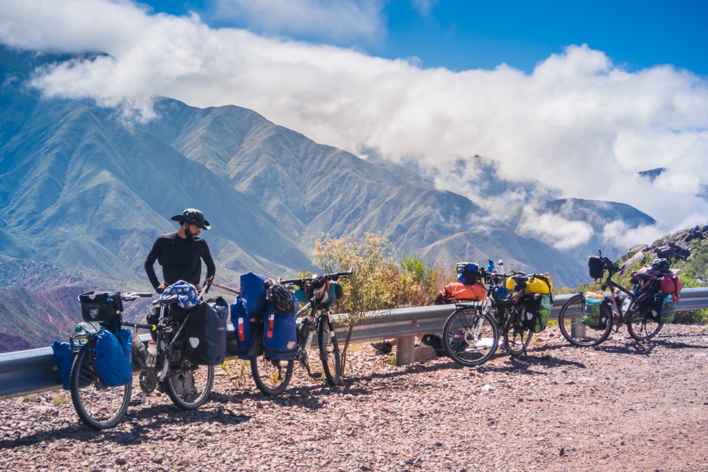
Manufacturing increased under the tenure of Menem and tourism has expanded in the province. Visitors are likely to visit Talampaya National Park as well as cultural centers and tourist towns such as Chilecito and Villa Sanagasta, and other places like Cerro de La Cruz, and the Termas de Santa Teresita hot springs.
La Rioja is a beautiful province that is in the Andes Mountains of western Argentina. The climate is dry and hot, the terrain is mountainous and rugged, and the people are incredible. The following are some of the major attractions and activities in La Rioja.
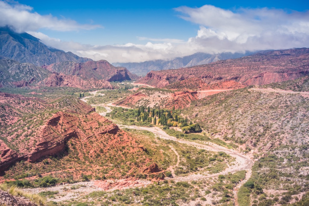
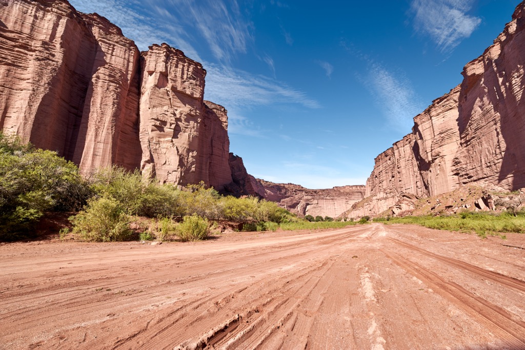
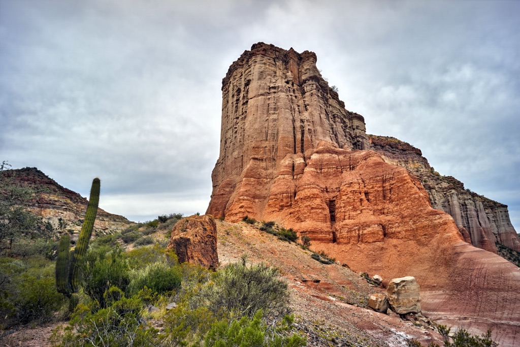
Talampaya National Park is situated along the western border of La Rioja and is connected to Parque Provincial Ischigualasto in San Juan. The national park was established to preserve important geological, archeological, and paleontological sites in La Rioja.
The park is part of a Triassic aged geological basin and is home to one of the most important geological sites in Argentina. Indeed, the park has rocks that document over 45 million years of the plant’s evolution, including the division of Pangea.
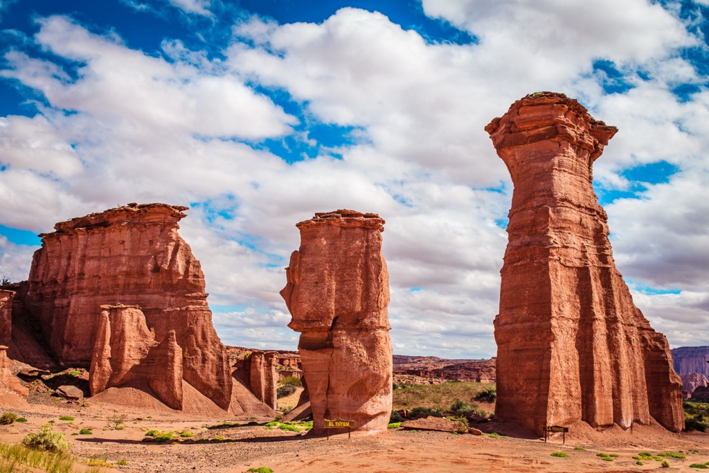
Furthermore, there are an abundance of fossils in the park that help scientists understand what was occurring during the Triassic. Lagosuchus talampayensis, one of the first archosaurs to inhabit the earth 250 million years ago and fossils of 210-million-year-old turtles have been discovered in the park.
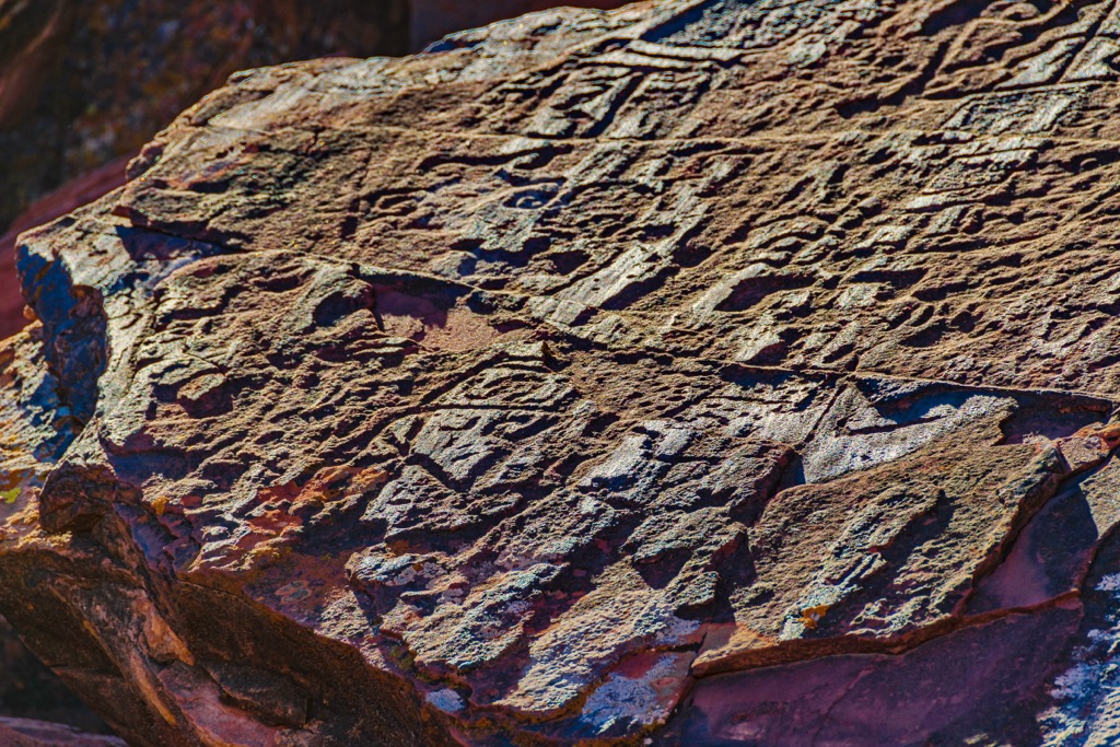
Finally, the park contains the remains of ancient cultures that inhabited the region before the arrival of the Spanish. The archeological sites contain the remnants of houses, stone walls, as well as fragments of pottery, and stone tool material. An important site, called Los Pizarrones is a section of rock along a river bed that is covered with petroglyphs.
Dique Los Sauces is an incredible oasis among the arid mountains of La Rioja. It is a popular location for hiking, camping, and enjoying the hot summer days in La Rioja.
The site is overlooked by Monte El Peñón and Cerro De la Cruz which form the ravine where the dam was built. The slopes are covered in the characteristic desert vegetation such as chañares, algarrobos, quebrachos, tuscas, willows, and jarillares.
On the way to the oasis, visitors can tour past Las Padercitas Church, Tinkunako Monument, and Cochangasta. Las Padercitas Church was constructed over 500 years ago and the Tinkunako Monument is where the “gathering” of the Huarpe and Spanish cultures is celebrated annually. Cochangasta is a neighborhood that was formerly some of the major olive and walnut tree estates in La Rioja.
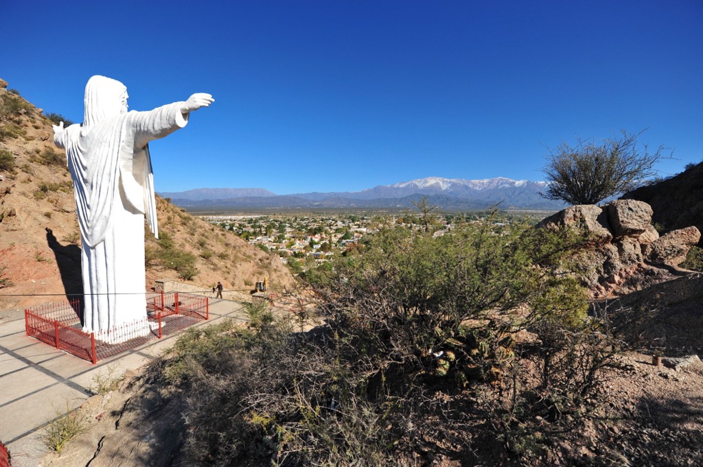
Located about 26 km (15.6 mi) from the city of La Rioja, Cerro de La Cruz is a popular destination for visitors. From the summit there are incredible views of the city, the ravine, the lake, and the vast plains in the valley.
The peak is accessible via National Route 75 and there is a wooden cross along the path to the summit, for which the mountain was named.
Furthermore, the peak is an excellent location for hang gliding and paragliding practice. Indeed, there is even a launch track upon the mountains where national and international competitions are held.
Located in the city of La Rioja, the Inca Huasi Archaeological Museum is dedicated to the archeology of northwestern Argentina. The museum was founded in 1926 by Father Bernardino Gómez, of the Franciscan Order.
The first pieces of the collection at the museum were those that Father Bernardino had discovered himself while exploring and excavating various pre-Columbian settlements in La Rioja and Catamarca.
While there were fewer than 100 objects in the collection in 1926, as word of the collection spread, many people brought pieces from their homes and children brought items they found while playing and exploring the mountains. By 1946 there were around 8,000 pieces in the collection and the museum is currently recognized by UNESCO due to the richness of its heritage.
El Chiflon Provincial Park is about 150 km (90 mi) from the city of La Rioja, in an area similar to Talampaya National Park. The park preserves incredible geological and archeological areas.
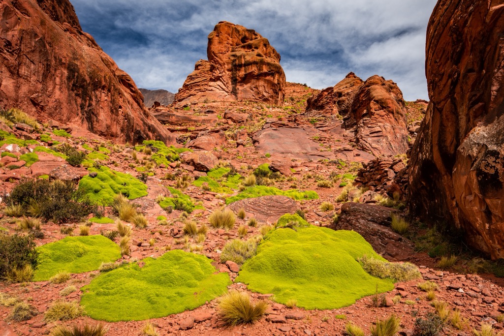
There is evidence of Paleozoic, Carboniferous, and Triassic aged geological formations. There are also traces of petrified wood which generally date back to the Triassic, scattered across the park. Furthermore, there are many fascinating formations caused by erosion that the locals have named.
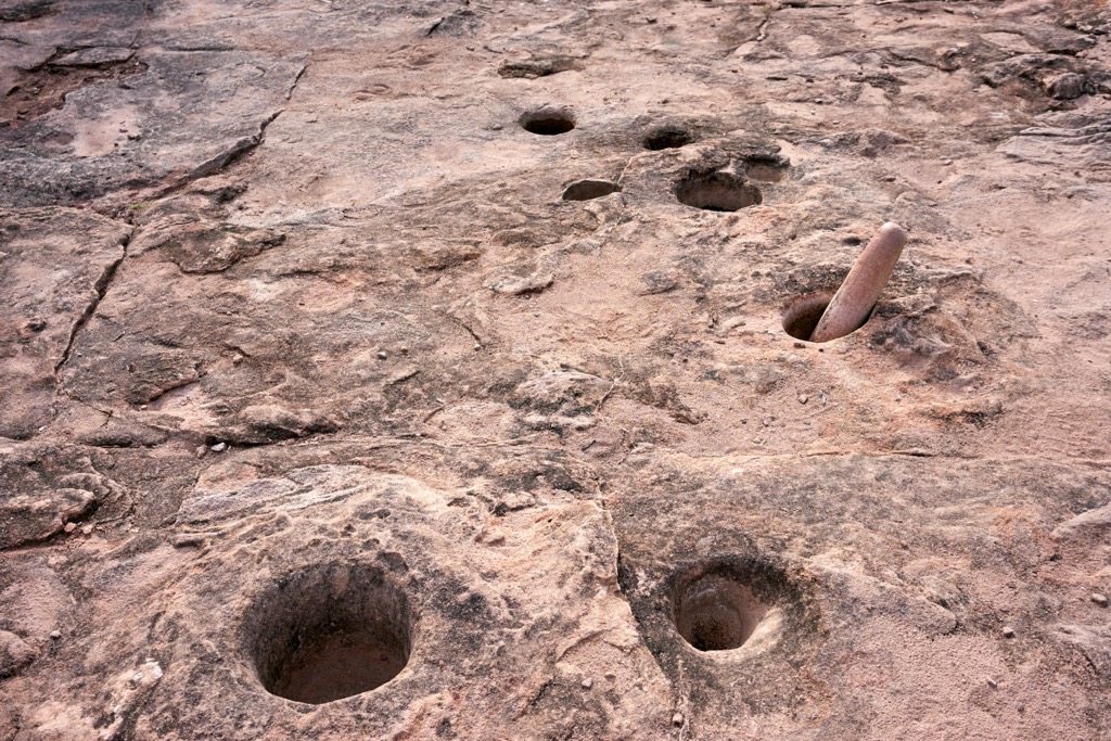
Among the archeological sites, there are areas with community mortars carved into the stone, multiple structures, petroglyphs, and a pucará. A pucará is Quechua term to describe the fortifications constructed by the indigenous people of the Andes. The estimated surface area of the stone fortifications on the park are an impressive 4,000 square meters (43,000 square feet).
There are three main routes through the park, part of which can be driven while the remainder are easy and moderate hikes. Locals act as baqueanos, who guide visitors through the park and help give meaning and understanding of the area and culture to visitors.
Located in the eastern slopes and ranges of the Andes Mountains, La Rioja is one of the least populated provinces in Argentina. The province has incredible beauty and an amazing cultural history to discover. The following are the major cities of La Rioja:
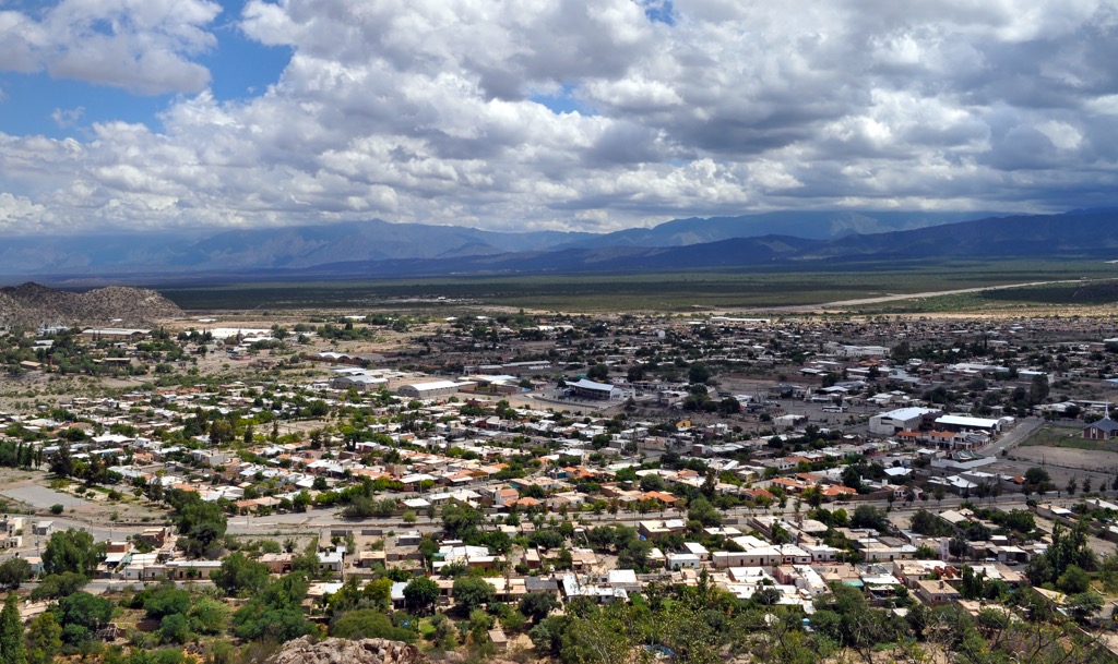
The city of La Rioja is the capital and largest city of the province. It is situated along the La Rioja River at the foot of the Sierras de Velasco, about 1200 km (720 mi) from Buenos Aires and 430 km (258 mi) from Córdoba.
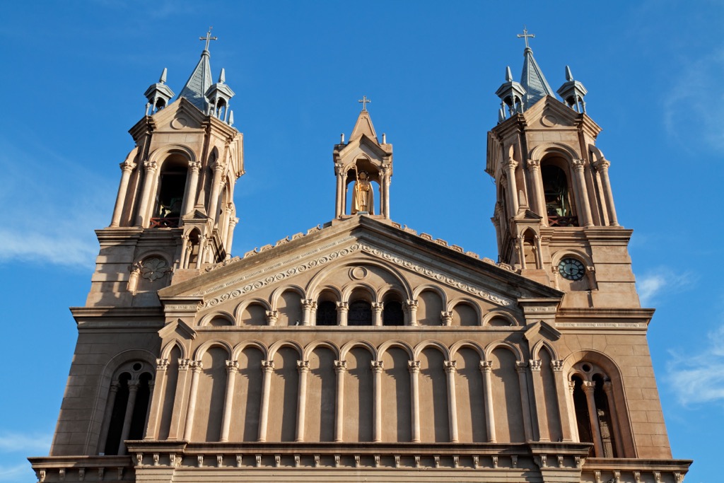
The city was first established in 1591 by Spanish explorers looking for gold and silver. For most of its history, the city has remained a small administrative center that was close to deposits of copper, silver, and lead in the Andes Mountains.
The original city was essentially destroyed in an earthquake in 1894, which led to reconstructing the city in a modern way. The city is home to many great places to visit, eat, and stay.
While in La Rioja, visitors can take a walk through the Plaza de 25 de Mayo or learn about the pre-Columbian cultures at the Inca Huasi Archaeological Museum. Visitors can also walk the Religious Circuit in the historic downtown and the Castros Barros Cultural Walk.
Near the city is Dique Los Sauces where visitors can hike, fish, and play in the water and on their way admire Las Padercitas, the Tinkunako Monument, and Cochangasta. Further travels can bring visitors to the incredible landscapes and history of Talampaya National Park and El Chiflón Provincial Park. There are certainly many adventures to be had while visiting La Rioja.
Located in the Antinaco-Los Colorados Valley, Chilecito is the second largest city in the province of La Rioja. The stunning Sierra de Velasco rises east of the city and the Sierra de Famatina rises west of the city.
While the city was only founded in 1715, it contains the ruins of Tamberias del Inca, an Inca site that managed the mining of gold and silver from Cerro General Belgrano. As such, the city has a long history of mining, which can also be seen in the preserved cableway of La Mejicana mine on Cerro General Belgrano.
There are many opportunities to explore the religious history of the city as well as the mining and cultural history. Furthermore, visitors of Chilecito can explore nearby attractions such as Cuesta de Miranda which is a beautiful mountain road, Chirau Mita Botanical Garden which is considered “the most beautiful garden in Argentina”, and Nonogasta which is a nearby historical area.


ultra
volcano
andes-6000ers
argentina-ultras
ultra
volcano
andes-6000ers
argentina-ultras


