
Scan the QR code and open PeakVisor on your phone
KwaZulu-Natal is home to 2,019 named mountains. The highest is Mafadi at 3,450 m.
KwaZulu-Natal is a province located on the eastern coast of South Africa. There are 2019 named mountains in KwaZulu-Natal. Mafadi is the highest point, measuring 3,450 meters (11,320 ft). The most prominent mountain is Ingeli Mountain, at 2,268 meters (7,441 ft).
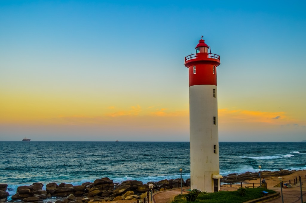
KwaZulu-Natal, commonly known as KZN, is a coastal province in the southeastern region of South Africa. It shares borders with three other provinces: Mpumalanga to the north, Free State to the west, and Eastern Cape to the southwest. Internationally, it borders the countries of Lesotho to the west and Eswatini to the north. The Indian Ocean comprises the province's eastern boundary, bessing it with an extensive and beautiful coastline.
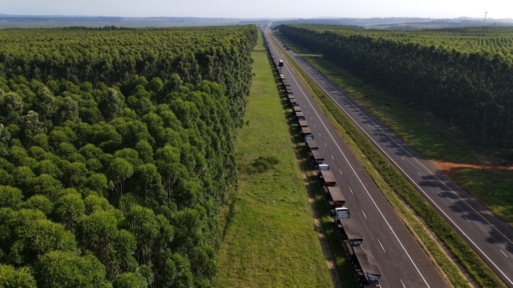
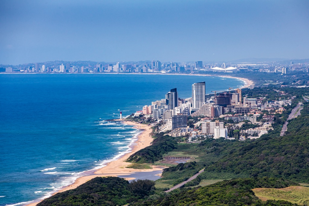
One of the most distinctive features of KwaZulu-Natal's geography is its varied landscape. The coastal region is dominated by a narrow, subtropical coastal plain, home to several large cities, including Durban, the largest in the province. Moving inland, the terrain transitions into the Midlands' undulating hills and fertile valleys. This region is known for its rich agricultural lands, where farmers grow sugarcane, various fruits, and even timber.
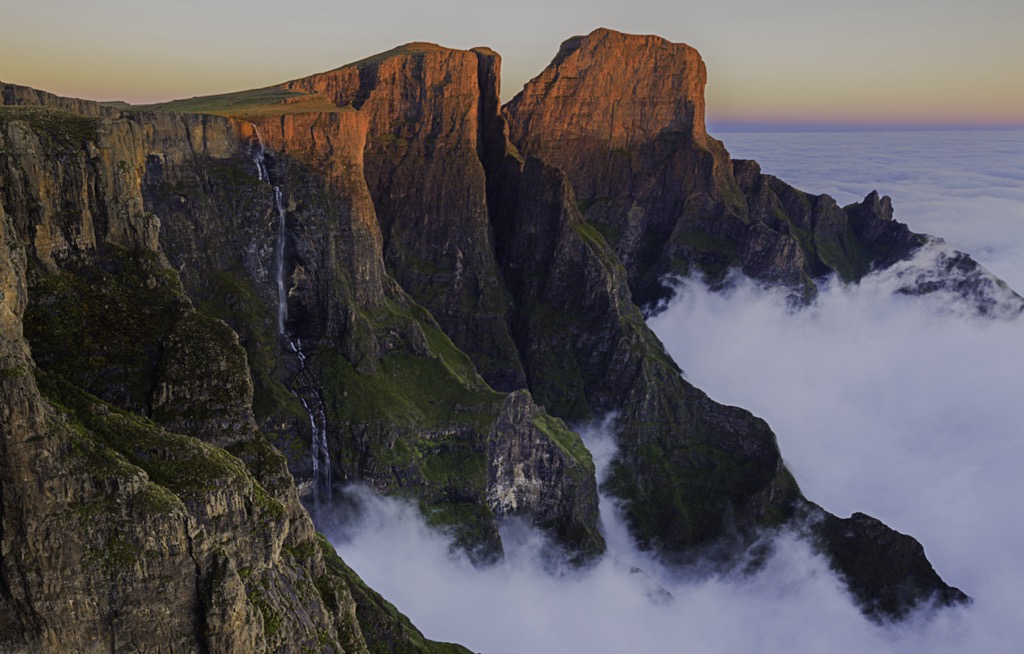
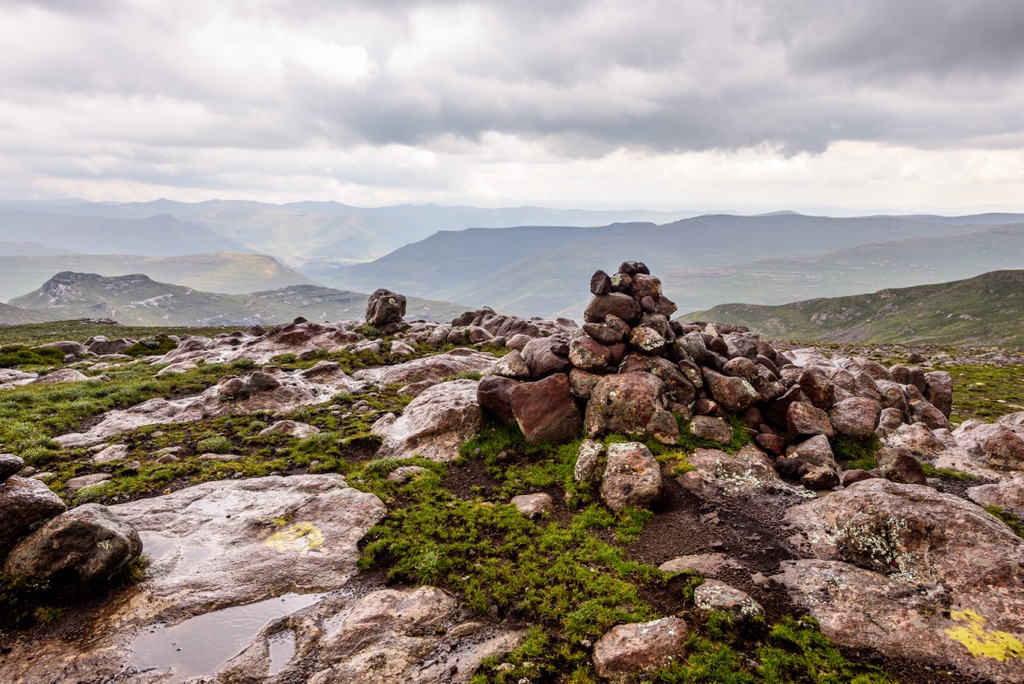
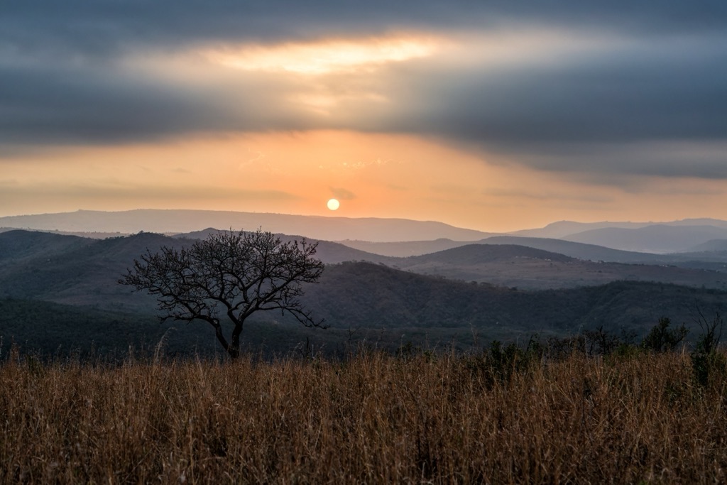
Further inland, the geography becomes increasingly rugged as the land rises into the Drakensberg Mountains, the highest mountain range in Southern Africa. The Drakensberg, also known locally as uKhahlamba, is a UNESCO World Heritage Site with some peaks exceeding 3,000 meters (9,843 ft).
Kwa-Zulu Natal experiences a subtropical climate along the coast, with warm, humid summers and mild, dry winters. The inland areas, particularly the Midlands, have a more temperate climate with cooler temperatures. Due to its high elevation, the Drakensberg region receives winter snowfall. Rainfall varies significantly across the province; coastal areas receive high precipitation, especially during summer, while inland regions receive less rainfall.
The province’s rivers play a crucial role in its geography. Major rivers such as the Tugela, Mhlatuze, and Umgeni flow through the province, providing essential water resources for both agricultural and urban areas. The Tugela River, in particular, is noteworthy as it is the longest river in Kwa-Zulu Natal. Its headwaters begin in the Drakensberg Mountains, eventually flowing into the Indian Ocean. These rivers have shaped the landscape over millennia, creating valleys and providing fertile floodplains that support various ecosystems and human settlement, especially agriculture.
The region's geology is marked by ancient Archean rocks from the Kaapvaal Craton, among the oldest on Earth. These rocks mainly comprise granite-greenstone terrains that offer insights into early continental formation.
Central and northern Kwa-Zulu Natal are dominated by the Natal Group's late Paleozoic to early Mesozoic sedimentary rocks. Overlying these are the Karoo Supergroup rocks, with vast deposits from the late Carboniferous to early Jurassic periods, formed under diverse conditions from glacial to desert. This group includes significant coal seams in the Ecca Group, which have been mined extensively.
The Drakensberg Mountains on Kwa-Zulu Natal’s western boundary are formed of Jurassic basaltic lavas linked to the Gondwana breakup around 180 million years ago. They create a striking landscape with features like columnar jointing. Along the coast, Cenozoic sediments reflect a more recent geological history shaped by sea-level changes and coastal processes, forming dunes, terraces, and estuaries.
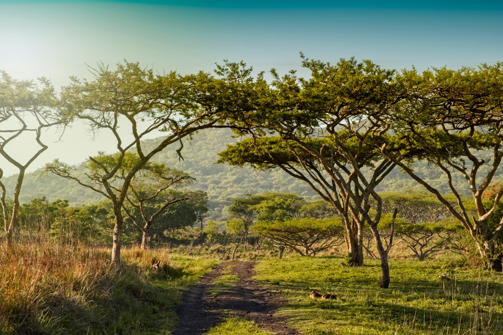
Kwa-Zulu Natal showcases diverse landscapes, including coastal plains, mountain ranges, and forests that nurture a wide array of flora and fauna across multiple ecosystems.
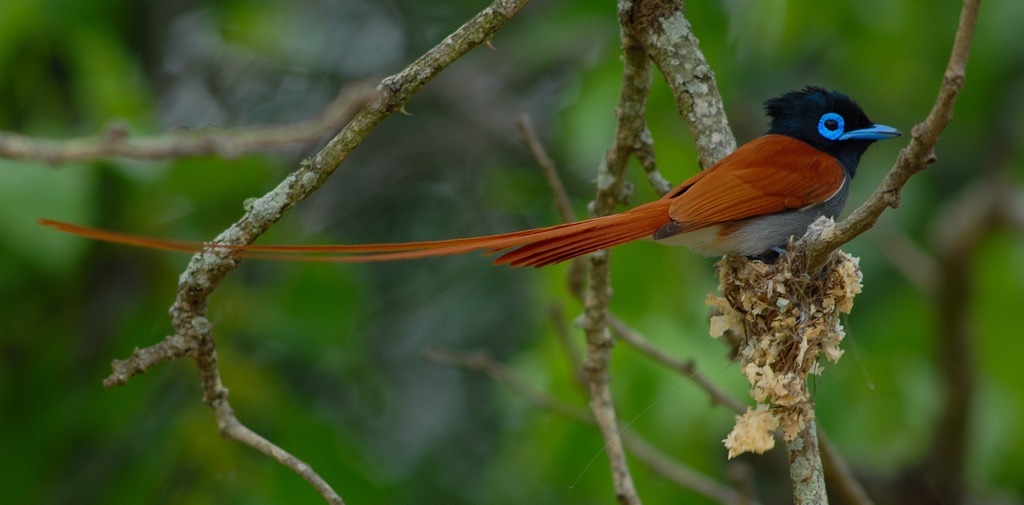
Coastal and wetland areas feature mangroves in estuaries alongside hardy grasses and shrubs on dunes. Inland, extensive grasslands include savannas with acacias and marulas, and montane grasslands in the Drakensberg Mountains. Coastal and midland indigenous forests showcase yellowwood and wild fig trees, while Afromontane forests in the Drakensberg are replete with evergreens.
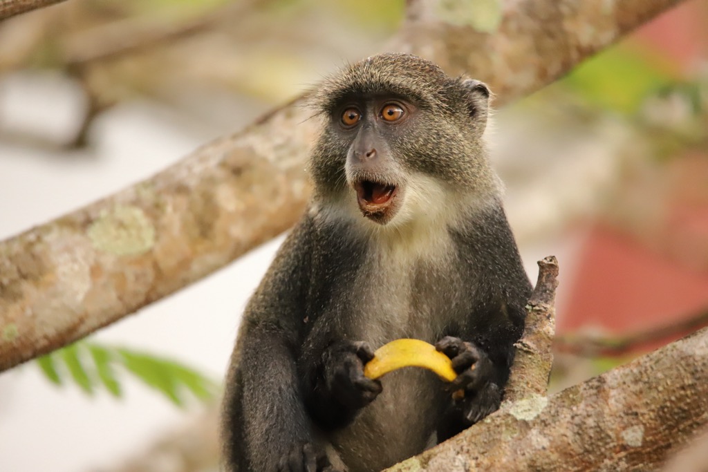
The province supports a rich wildlife diversity. Game reserves like Hluhluwe-iMfolozi and Phinda Private Game Reserve shelter the Big Five animals: lion, elephant, buffalo, leopard, and rhinoceros. Endemic species such as the Samango monkey (Cercopithecus mitis albogularis) and the endangered Oribi antelope thrive here. Marine mammals like dolphins and whales are found along the coast.
The earliest known inhabitants of KwaZulu-Natal were the San people, hunter-gatherers who lived in the region for thousands of years. Bantu-speaking groups arrived around the 3rd century CE, bringing advanced farming and ironworking skills. They formed chiefdoms with distinct social structures.
In the early 19th century, the Zulu Kingdom rose under King Shaka Zulu, known for military innovations. By 1828, it was a dominant force in the region, despite European exploration since the late 15th century. British settlers arrived in the early 19th century, leading to tensions culminating in the Anglo-Zulu War of 1879. The war reshaped the region, ending Zulu independence.
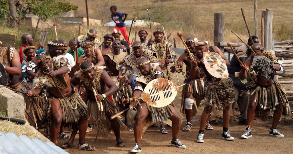
During apartheid, KwaZulu-Natal faced segregation, with the Zulu people in designated homelands, exacerbating social disparities. The province played a key role in the anti-apartheid struggle, with the African National Congress and Inkatha Freedom Party prominent. Post-apartheid, KwaZulu-Natal transitioned into democratic South Africa, focusing on reconciliation and economic growth.
The uKhahlamba / Drakensberg Park, a UNESCO World Heritage Site, is renowned for its biodiversity and cultural significance. Hikers aiming to summit the highest peak in Kwa-Zulu Natal can take several routes on the Mafadi Hiking Trails. From Mafadi, they can observe sweeping views of the South Africa-Lesotho border and the Red Wall, Western Triplet, and Middle Triplet peaks.
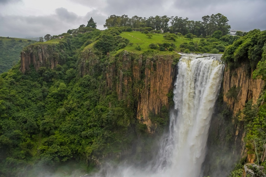
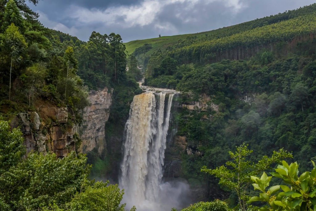
The Amphitheatre Hiking Trail spans 14.5 km (9 mi) and reaches the top of the Drakensberg escarpment via chain ladders, offering a view of Tugela Falls, the world's second-highest waterfall. Though challenging, the 19 km (12 mi) Cathedral Peak hike provides stunning views of Bell, Outer Horn, and Puddings from the summit of Cathedral Peak. For those seeking a longer, less strenuous hike, the Giant's Cup Trail extends 60 km (37 mi) over five days, traversing grasslands, forests, and river valleys.
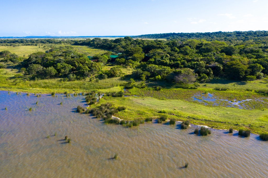
iSimangaliso Wetland Park offers a variety of hiking trails that exhibit diverse landscapes spanning coastal dunes, swamps, savannas, lakes, and coral reefs.
Highlights include the 7 km (4.3 mi) Ingwe Trail, which traces the Mflozi River and offers wildlife sightings of crocodiles, hippos, and waterbirds. The trail also ascends uphill for views of the Indian Ocean and the coastal hills of Mjakaja, Sokhulu, and Red Hill.
The Kosi Bay Trail network explores lakes and estuaries, showcasing traditional fish traps and local Tsonga culture. On the eastern shores, the iNgwe Beach Walk is an easy 3.5 km (2.2 mi) route that offers sightings of dolphins and whales in a coastal environment of sand dunes and estuary mouth.
Hluhluwe–iMfolozi Park, Africa's oldest proclaimed nature reserve, features diverse hiking trails that showcase its landscapes and wildlife.
One of the most popular options is the Imfolozi Big 5 Wilderness Walking Trails, where participants can encounter the Big Five wildlife while trekking along rivers and through thorn savannah.
The Primitive Trail offers a basic wilderness experience with minimal equipment, water collection from springs or rivers, and river bathing. The Short Wilderness Trail and Extended Short Wilderness Trail cater to different durations, allowing visitors to explore the bush, observe wildlife, and enjoy the natural surroundings.
Oribi Gorge Nature Reserve offers a range of hiking trails. The 7 km (4.3 mi) Hoopoe Falls Hike features forest walks and impressive views of the gorge with its towering sandstone cliffs, culminating in an ascent of 250 meters (823 ft). The shorter Nkonka Hike, covering 5 km (3 mi), leads downstream along the Mzimkulwana River. For a longer trek, the 9 km (5.5 mi) Mziki Hike traverses steep, undulating terrain, providing scenic vistas and a total ascent of 403 meters (1,325 ft).
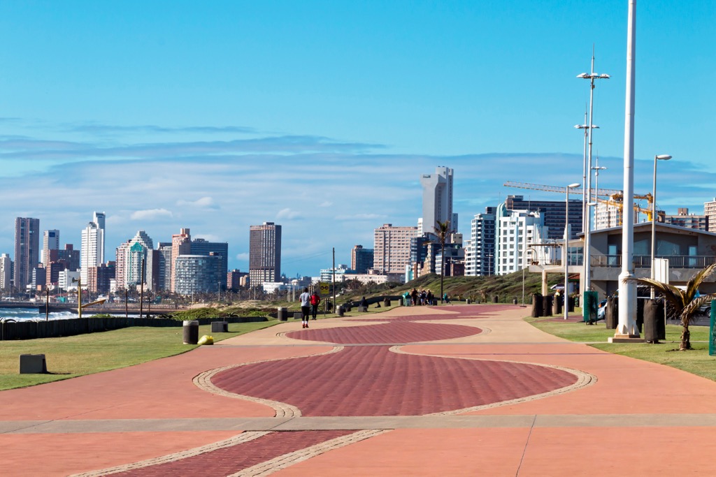
Durban is renowned for its pleasant climate, beaches, and cultural diversity. The city enjoys a subtropical climate, making it a popular destination for those seeking outdoor activities. The cultural landscape is influenced by Indian, Zulu, and colonial heritage, evident in its cuisine and architecture.
The Golden Mile, a beachfront promenade in Durban, is popular for walkers, runners, and water sports enthusiasts. It offers opportunities for surfing, paddleboarding, and kite surfing all year round.
Durban's cultural richness is reflected in its attractions. The Inanda Heritage Route takes visitors through significant historical sites, including Mahatma Gandhi's house and the Ohlange Institute, both pivotal in South Africa's struggle against apartheid.
For adventure seekers, Durban offers activities like the Big Rush Big Swing at Moses Mabhida Stadium, the world's tallest swing jump. The stadium also features SkyCar rides, providing panoramic views of the city and coastline.
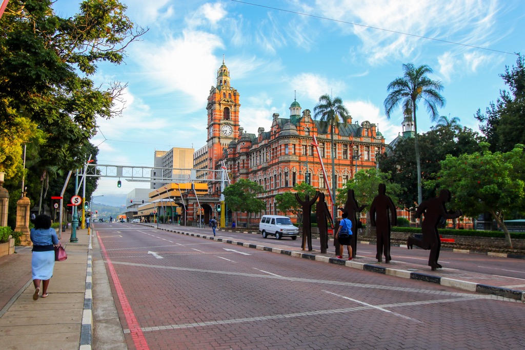
Pietermaritzburg once served as the capital of Natal Province before the formation of KwaZulu-Natal. It has a rich history influenced by the Zulu, Boer, and British colonial periods. Similarly to Durban, Pietermaritzburg reflects a mix of Zulu, Indian, and European cultures.
Pietermaritzburg is known for its lush parks and gardens. The KwaZulu-Natal National Botanical Garden on the city's eastern slopes showcases indigenous flora and offers tranquil walking trails.
Outdoor enthusiasts will find plenty to do in and around Pietermaritzburg. The Albert Falls Dam and Game Reserve, a short drive away, offers picnicking, fishing, and wildlife viewing with zebra, giraffe, and various bird species.
Nature lovers can explore the Umgeni Valley Nature Reserve's hiking trails, which offer stunning views of the Umgeni River and diverse birdlife. Tala Private Game Reserve, nearby, provides safari experiences with rhinos and wildebeests. Queen Elizabeth Park in the city center offers well-maintained gardens and historical memorials.


Yes. KwaZulu-Natal has 2,019 named mountains. The highest is Mafadi at 3,450 m.
The highest mountain in KwaZulu-Natal is Mafadi, at 3,450 m.
KwaZulu-Natal has 2,019 named mountains.


