Scan the QR code and open PeakVisor on your phone
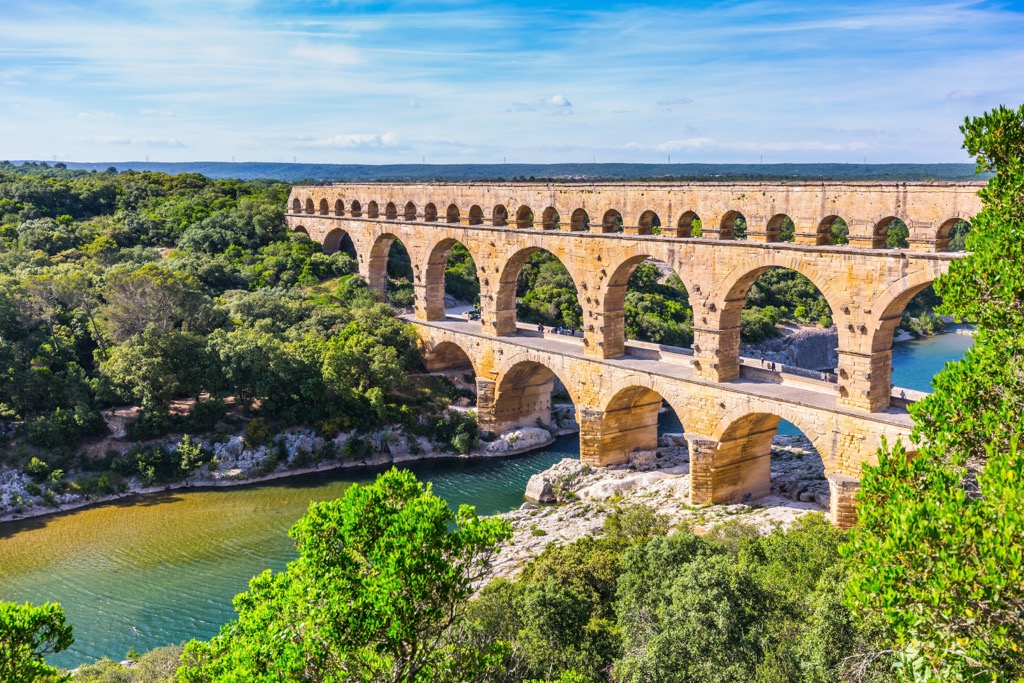
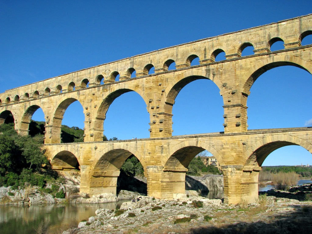
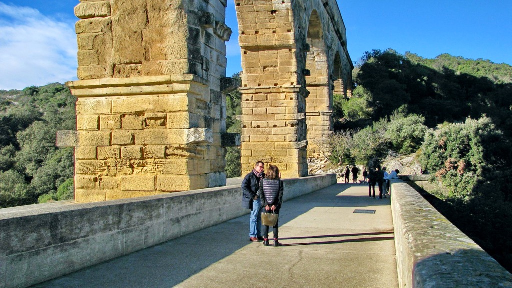
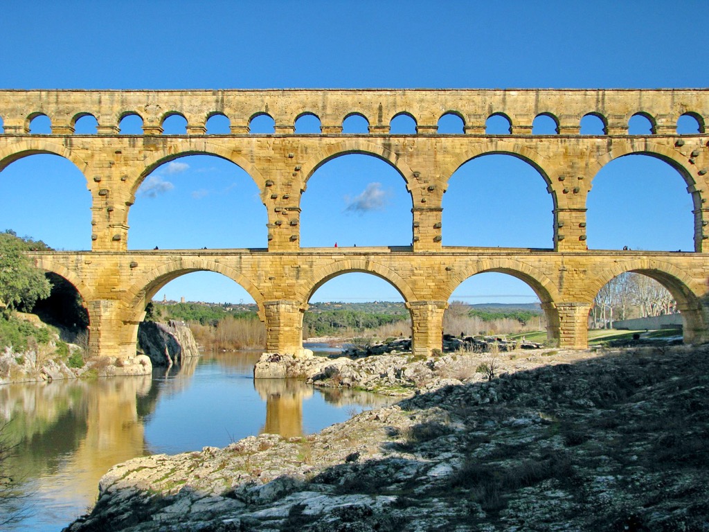
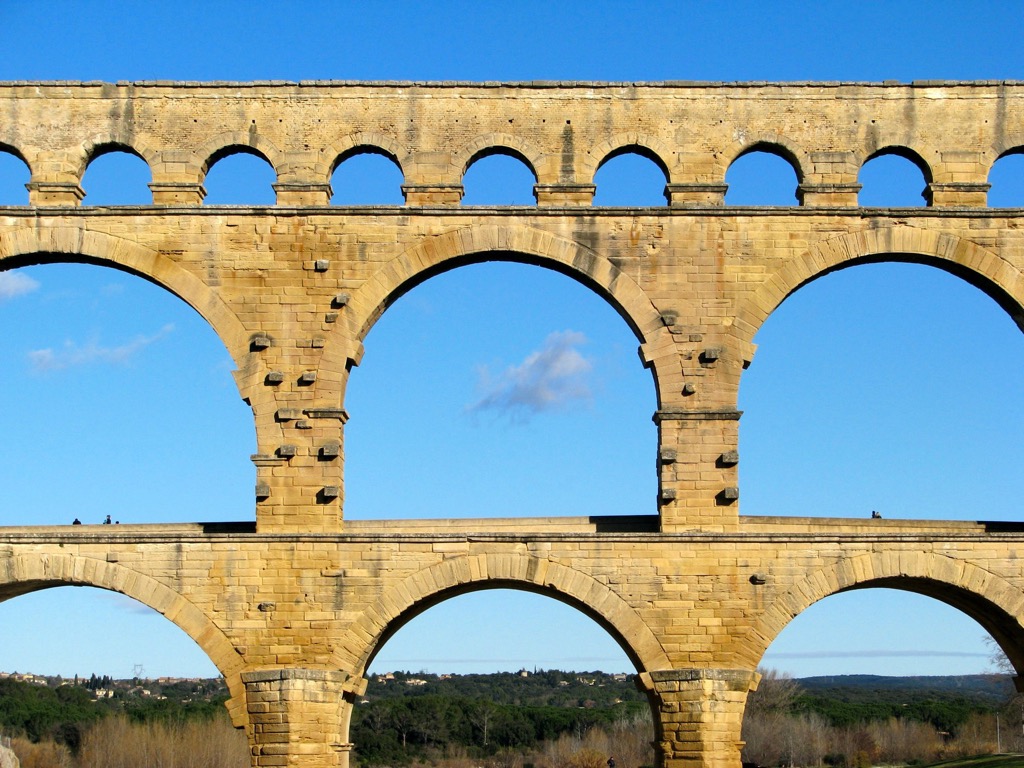
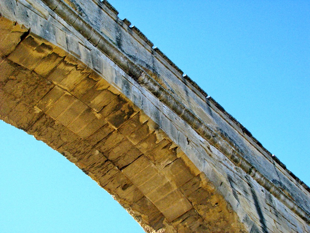
The Gard is one of 101 departments of France, including overseas territories, located in the Occitania region in the south of the country. The main feature of the Gard mountains is Cévennes Range, one of eight within the larger Massif Central, essentially France's only inland mountain system between the Pyrenees and the Alps, which it shares with the others. But the department is much better known for the Gard or Gardon River, from which it takes its name, including the Gorges du Gardon and the highest Roman aqueduct in the world, Pont du Gard, a UNESCO World Heritage Site. The Gard also has access to the Mediterranean Sea with its many places of interest. In total there are 372 named mountains in the Gard. Mont Aigoual (1,567 m / 5,141 ft) is the highest point. The most prominent mountain is Guidon du Bouquet (628 m / 2,060 ft).
The department gets its name from the river Gard, also known as Gardon.
This is a very old word that is found in many other languages throughout Europe: gård (Danish), garðr (Norse), gardaz (Proto-Germanic), and others. In turn, it probably means "yard, court, fence, enclosure, garden", and the like, and refers to the rich agro-pastoral history of this region dating back over three thousand years, as evidenced by the numerous megaliths found in its territory.
Today it is also a UNESCO site under the precise title “The Causses and the Cévennes, Mediterranean Agro-pastoral Cultural Landscape” (Les Causses et Les Cévennes, paysage culturel de l’agro-pastoralisme méditerranéen), where the first part, Causses, is a group of limestone plateaus in the same Massif Central, ideal for animal husbandry and agriculture.
The Gard is the easternmost of the 13 departments of Occitania, a region in the southeast of France between the Mediterranean Sea and the Alps. It borders three other departments of the region: Hérault to the southwest, Aveyron to the northwest, and Lozère to the north. To the east of the Gard lies the Bouches-du-Rhône and Vaucluse departments in the Provence-Alpes-Côte d’Azur region.
On a physical map, the Gard encompasses three distinct natural areas, which are the main features of its landscape, containing also many unique man-made attractions:
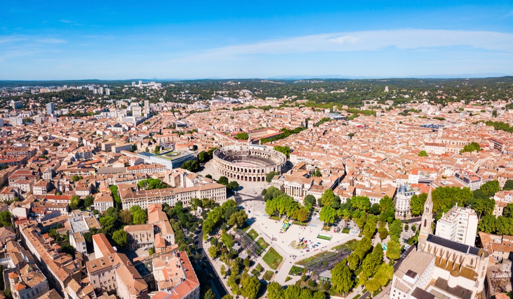
The central part of the region on both sides of the Gard River is more flat, but it is far from being a true plain, it is an area with many uplands. Here is also located the main city of Gard—Nimes, a former Roman colony, which is even often referred to as the “French Rome”, thanks to its main architectural landmark—the Arena of Nîmes (Arènes de Nîmes) or Roman amphitheater, very similar to the Colosseum in Rome itself or, say, the Arena of Verona.
It should also be noted that the northeast of the department captures part of the French natural and cultural region of Provence with its famous Lovanda fields, vineyards, and other beauties.
The easiest and fastest way to reach the Gard mountains is from two major regional centers, Montpellier to the west and Marseille to the east. Both have international airports. The distance from them to Nîmes is 50 and 120 km (31 and 75 mi), respectively.
Personally, I arrived in Nîmes in just half a day by the TGV high-speed train from Paris from the main French railway company SNCF, whose ticket could be bought at Sncf-connect.com. However, the booking system is quite difficult. My VISA credit card issued in Russia just didn’t work on the site even in 2014, not speaking about nowadays. These trains are also quite expensive. A good alternative to SNCF is Ouigo.com.
Further, from Nîmes throughout all the department, you can travel by local buses Lio.laregion.fr. The Pont du Gard is just 24 km (15 mi) from the city. The buses also reach all the distant villages at the foot of the mountains, including Anduze, and others, which I will name further.
If you are traveling by your own or rented car, or even better by bicycle, do not miss the most scenic mountain road in the region, the Corniche des Cévennes (D907), from Saint-Jean-du-Gard and Florac, which is 50 km (31 mi) long. You can return by taking the parallel road B983 or N106, making a circle—that is 100 km (62 mi) in total — a great distance for a whole day behind the wheel or in the bike’s saddle.
As I said before, most of the 372 named mountains in the Gard department, including the highest of them, are concentrated in its northwestern part in the Cévennes Range, one of eight within the larger Massif Central. It is the main mountain system in all of France, and the only one located entirely in its territory. Surprisingly, it is hardly known outside the country, remaining in the shadow of the Alps and even the Pyrenees. But, whoever does find it on their travel map will make a real discovery, as I did in December-January 2013–2014. It was my second stop after Paris, where I returned after circling the entire country through the Pyrénées-Atlantiques, and Normandy after 3.5 months.
In particular, the highest peak of the Gard in the Cévennes, Mont Aigoual (1,567 m / 5,141 ft), is located deep in the range in the Buffer Zone of the Cevennes Biosphere Reserve (Zone tampon de la réserve de biosphère des Cévennes) in Cevennes National Park on the border with Lozère department hosting the highest peak of the entire Cévennes, Mont Lozère also known as Sommet de Finiels (1,701 m / 5,580 ft).
It is a large and relatively gentle peak, and is one of the most famous, and consistently popular viewpoints in the region because a road leads to its summit. The mountain has hosted several Tour de France finishes, including most recently in 2020. But it can also be climbed on foot along a marked trail from the nearby villages. At the top you will find one of the oldest meteorological stations in France, collecting among other things data on rainfall in the wettest region of all of France. Speaking more of water, the mountain also gives rise to the Hérault River, another major water artery. It surpasses the Gard River by more than 20 km (12 mi) and flows from north to south.
Besides Mont Aigoual, there is only one other peak in the Gard department above 1,500 m (4,921 ft)—Croix de l’Hermite (1,508 m / 4,947 ft), located in the same area.
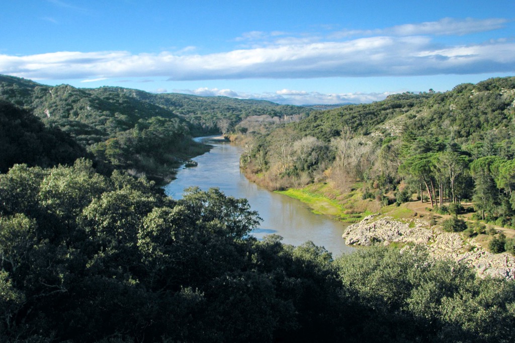
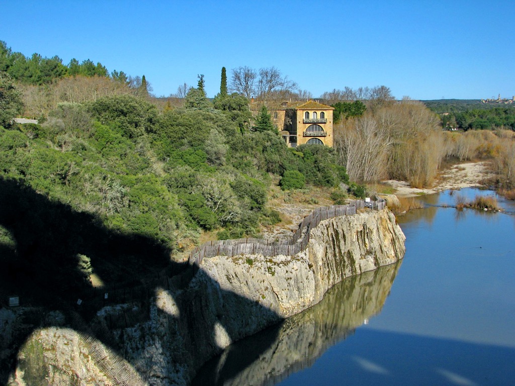
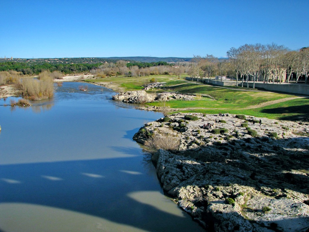
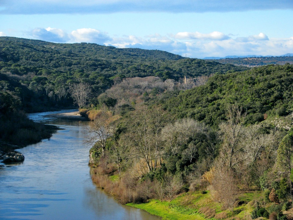
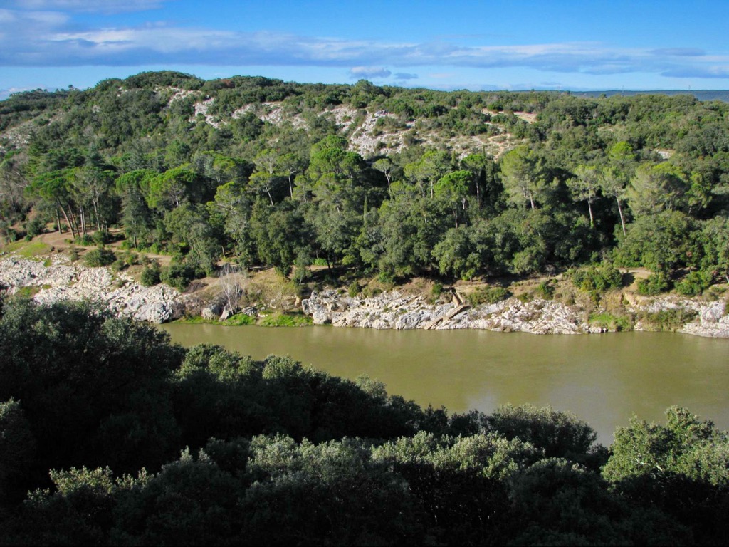
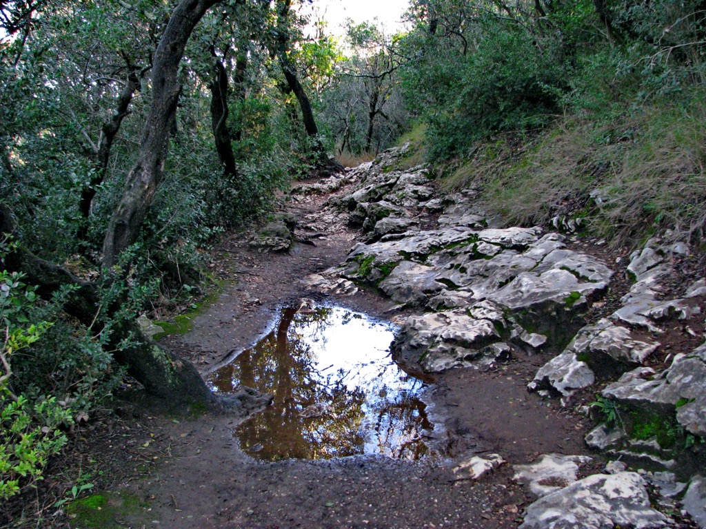
The rest of the region is not devoid of elevations up to 1,000 m (3,280 ft). For example, all along the banks of the Gard River, which in some places reaches more than 100 m (328 ft), you will find many cliffs that you can climb while hiking to view the riverbed and its picturesque surroundings from above and get a more complete panoramic view. Particularly around the settlement of Collias, one of the main ones on the river and closest to the Pont du Gard, there are three nearby cliffs of Brazza (115 m / 377 ft), Bimbo (106 m / 347 ft), and L’oeuf (96 m / 314 ft). If you want to climb a bit higher, there is also Silence (150 m / 492 ft), a separate peak, just west of these three.
But even if you don't go to the most famous bridge of France (although it's still hard to believe), visiting one of the department’s towns you are also likely to find yourself on the hill. Say one of the largest cities after Nimes, Uzes, where I lived for two weeks, is located at an altitude of 167 m (547 ft). It is a cozy French town in which you can feel the real spirit of this country, different from the Parisian one, which is familiar to many. From the walls of the medieval city fortress, Duché Palace, named after the Dukes of Uzès, opens a beautiful view of the green surroundings, which can be explored on one of several marked hiking trails. The town is also famous for being the nearest one to the spring from which the Romans transported water to Nîmes via the Pont du Gard.
At the opposite end of the list of the highest peaks of Gard is La Montagnole of 80 m (262 ft) high—confirming what I said about the lack of a real plain here. It can only be found in the very south of the department, where it crosses into the Mediterranean Sea.
The main hiking areas in the Gard department coincide with its three main natural regions. They are Cevennes National Park in the northwest, Pont du Gard and Gorges du Gardon, a UNESCO site and nature reserve, in the center, and Camargue Nature Park in the south, which although devoid of high mountains, has many marked hiking trails, too.
Along with Mont Aigoual, the second popular hiking spot in Cevennes National Park is the Cirque de Navacelles. As the name implies, it is a giant mountain circus or canyon around a tiny village of no more than a dozen houses, deep in a valley in the southern part of the massif on the border with the department of Hérault. It is also another of the Grand Sites of France in the region. The circus can be explored on a series of marked hiking and biking trails, including the main one at the bottom of the canyon, the namesake “Cirque de Navacelles Ring” (Randofiche le cirque de Navacelles) of 10 km (6 mi) or 3:30 hours long, which can be extended as desired further as it is connected to other trails going hundreds of kilometers (mile) to the other attractions of Cevennes National Park.
The Pont du Gard area is also full of trails. From here, the bridge is not only suitable for a day trip from Nîmes (but also for the more distant Montpelier and Marcelles), but also for a real hiking adventure. Namely, there are five main options here:
The main hiking area in the south of the department, the Camargue Regional Natural Park (Parc naturel régional de Camargue), including the Cooperation Area of the Camargue Biosphere Reserve (Aire de coopération de la réserve de biosphère de Camargue) in the neighboring Provence-Alpes-Côte d'Azur, also offers more than a dozen marked trails ranging in length from 1:30 to 4 hours in different parts of the park. In particular, there are great loop trails from its three main towns on its borders: Arles in the north, as well as Saintes-Maries-de-la-Mer and Port-Saint-Louis-du-Rhône in the south, by the sea, which can also be reached by car, bus or bicycle. The main route in the interior of the park is around the huge Vaccarès Pond (Étang de Vaccarès) where thousands of wild birds winter or live permanently, including the magnificent pink flamingos.
For skiing and snowboarding enthusiasts, there are no ski resorts in the Gard department but there are more than 10 ski resorts in the Massif Central, which are located throughout the range. It is also one of the main areas for skiing in France.
The largest ski resort in the Massif Central is Le Lioran with more than 60 km (37.2 mi) of slopes and more than 15 ski lifts.
Other major areas for skiing in the Massif Central with more than 10 km (6.2 mi) of slopes and more than 5 ski lifts each include the following in descending order of size: SuperBesse (Puy de Sancy—the highest peak of the massif of 1,885 m (6,184 ft), Le Mont-Dore, and Chastreix (Puy de Sancy), which are located close to each other and connected by ski lifts (in this case the area is superior to Le Lioran), as well as Chalmazel and Laguiole in other parts of the range.
The main ski resorts near Nimes are Prat Peyrot-Mont Aigoual and Bleymard Mont Lozère with more than 5 km (mi) of slopes and more than several ski lifts—yes, both mountains are good not only for hiking but for skiing, even if they are quite small compared to others above.
Check the Occitania and France ski resorts maps in the World Mountain Lifts section of the site. It includes information about open ski lifts / slopes in Occitania and France in real-time with opening dates and hours. There are also year-round cable cars, funiculars, cog railways, aerial tramways, and all other types of mountain lifts.
Before or after hiking in the Garda Mountains, visit one of the region's official tourist offices, the main one being located in Nîmes:
Nîmes Tourist Office (Nîmes Tourisme)
6 Bd des Arènes, 30000, Nîmes, Gard, Occitania, France
+33466583800
Several basic types of accommodation are available in the Gard department: standard hotels, B&Bs, and campsites, among others. The large presence of the latter both in the mountains and in the seaside is a peculiarity of France.
But if you are a hiker and not a camper, look separately for “gîtes d’etape”, which literally means “a home to rest on the road”. Yes, the name most likely comes from “gypsies,” as the Europeans came to call the first natives of northern India, mistaking them for Egyptians (their real name is Romani people). In particular, there are still many of them in France. However, it refers to the travelers in general.
So in France, gîtes could mean completely different types of accommodation, including all three of the above, but at their core are mountain huts or old farms deep in the countryside converted into more modern housing, where there may be not only overnight accommodation in a common or separate room but also meals. Although some gîtes on the contrary may not have, say, bedding—as in bivouacs. So the main tip: Before choosing a place to stay, try to find out exactly what it is, where it is, and which types of services you will get.
They are collected and rated by the eponymous association Fédération Nationale des Gîtes de France, which gives the appropriate label to a particular hotel since 1955. Hence, if you see that word in the name and the green logo on its doors (virtual—on the hotels websites or social networks, and the real ones, of course), you know what to expect. They are usually located on long hiking trails (Grande Randonnée in French).
Here’s a list of basic lodging options in all the main parts of the Gard department:
Mont Aigoual
Pont du Gard
Port Camargue
I have already named the main cities and resorts of the Gard department along the way, but here they are again if you are only interested in this section, as well as a few new ones.
The main and largest city is Nimes, the “French Rome”. The second most important city in the center of the region is a small town Uzes to the north of it, which I recommend visiting even more, because it has more of a sense of the spirit of the real provincial, rather than metropolitan France. Or at least there will be fewer tourists there, and in the off-season in winter, even locals.
In the Pont du Gard area there are no cities but there are many towns and villages such as Collias, Vers-Pont-du-Gard, Saint-Bonnet-du-Gard, Poulx, and many others.
The main bases for hiking at the foot of the Cévennes mountains are Alès, Saint-Jean-du-Gard (remember that the river originated in the mountains? hence the name), Anduze, Val-l'Aigoual, Le Vigan, Saint-Martin-de-Valgalgues, Saint-Ambroix.
There are also no major cities on the coast, but there are many resorts, too, including Palavas-Les-Flots, Le Grau-du-Roi, Saintes-Maries-de-la-Mer, Port-Saint-Louis-du-Rhône, as well as Fos-sur-Mer and Port-de-Bouc in the neighboring Bouches-du-Rhône department of the Provence-Alpes-Côte d'Azur region.
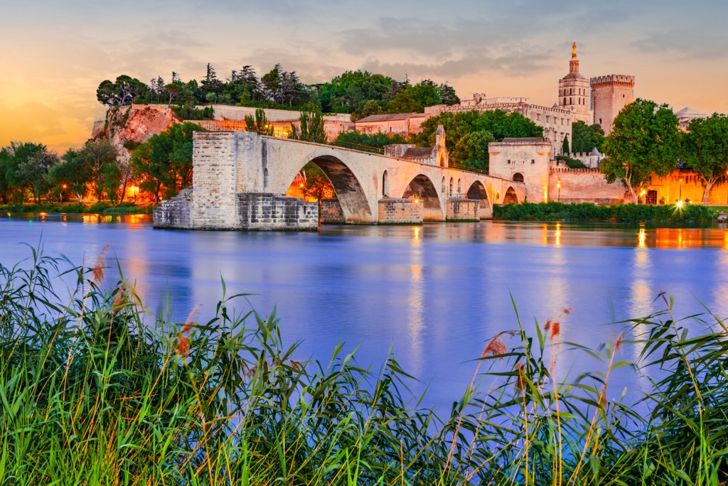
On a separate note are Avignon, Arles, and Saint-Rémy-de-Provence which are literally on the border of the two regions. The latter two in particular are famous as the place where Vincent van Gogh lived for a long time and painted many of his most famous paintings, including the “Starry Night”.