
Share

Scan the QR code and open PeakVisor on your phone
Scan the QR code and open PeakVisor on your phone
Adventure seekers and hikers will love scaling the many challenging peaks Wales has to offer. With lush valleys, serene lakes, and dozens of snow capped peaks, Wales is ideal for getting lost in nature. Wales is home to three national parks—Snowdonia National Park, Brecon Beacons National Park, and Pembrokeshire Coast National Park. You’ll find 136 official mountains in Wales, the majority of which are inland stretching from Snowdonia National Park, through the Cambrian Mountains, down to Brecon Beacon National Park.
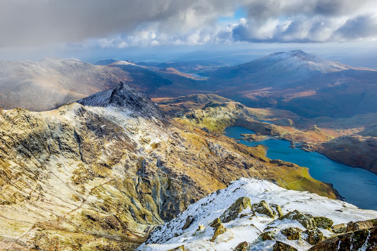
Wales contains 15 Furth Munros, which are located in Snowdonia National Park, the largest national park in the country. The nine mountain ranges which constitute Snowdonia National Park are generally referred to as the Snowdonia Mastiff. Due to the peaks of this mastiff, Wales has the most summits over 900 meters in the UK outside of Scotland. The tallest mountain in Snowdonia National Park and Wales is Snowdon (1,085 m). Other notable peaks within Snowdonia National Park include Garnedd Ugain (1,065 m), Carnedd Llewelyn (1,064 m), and Carnedd Dafydd (1,044 m).
At the other end of the country in South Wales is Brecon Beacons National Park. Within this vast wilderness are four different mountain ranges— the Black Mountains, the Black Mountain Range, Fforest Fawr, and the Brecon Beacons. These glacial peaks are popular with hikers as they afford stunning views of the park's serene lakes and the surrounding countryside. Despite having similar names, the Black Mountains and the Black Mountain Range are separate ranges.
One of the most popular hikes in the Brecon Beacons National Park is Pen y Fan (885 m), the tallest of the Brecon Beacons and the county top of Brecknockshire. Other notable peaks within Brecon Beacons National Park are Fan Brycheiniog (799 m), the tallest of the Black Mountain Range, and Waun Fach (811 m), the highest point in the Black Mountains.
Separating the Brecon Beacons and Snowdonia ranges are the Cambrian Mountains. This range runs for 40 miles down the spine of Wales in the most sparsely populated region of the country. At either end of the Cambrian Mountains are the Dyfi and Tywi Valleys. These two valleys separate Snowdonia and Brecon Beacon National Parks from the Cambrian Mountains. While the Cambrian Mountains are an extensive range, hikers without prior knowledge of the area shouldn't attempt to climb in this region due to its isolated nature and lack of trails. The highest peak in the Cambrian Mountains is Pumlumon Fawr (750 m).
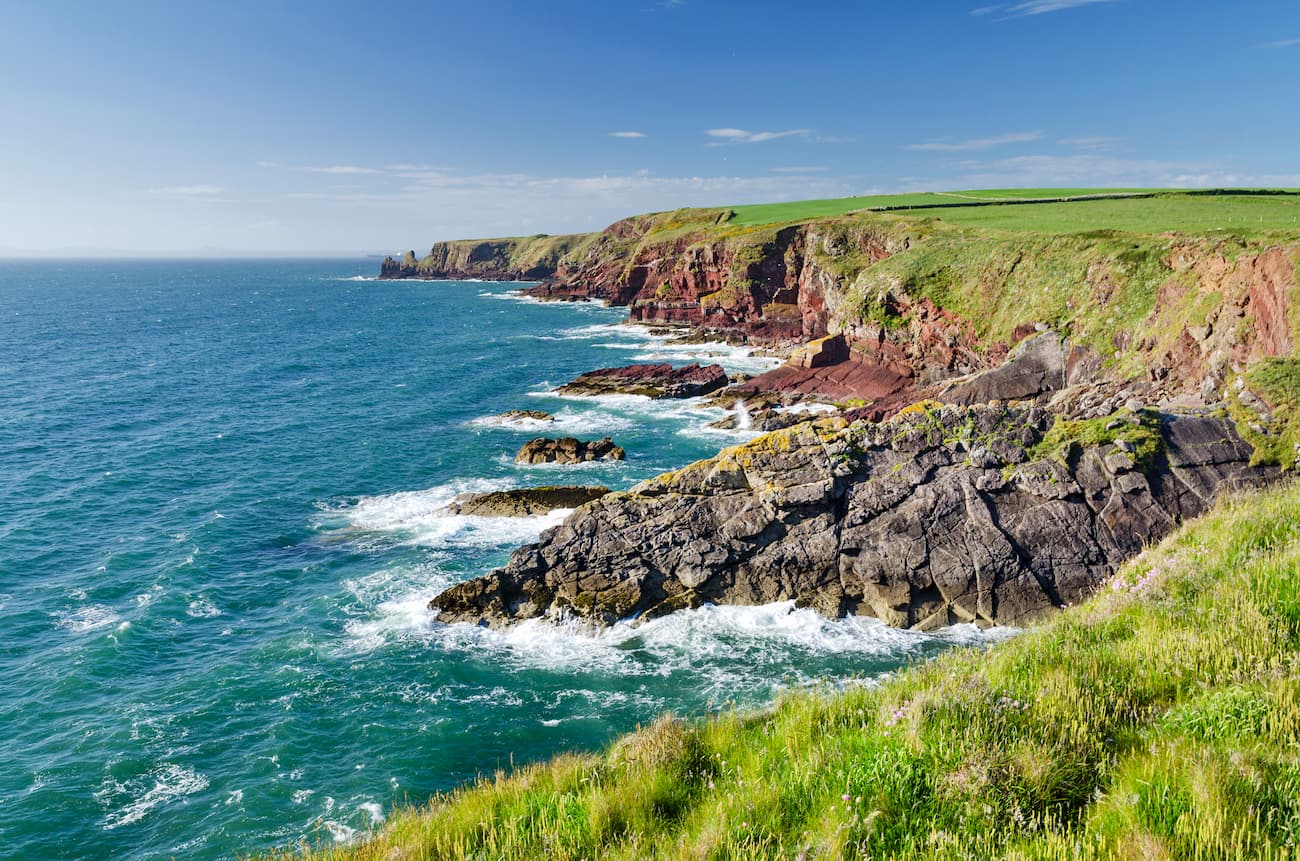
On Wales' southwestern tip is the Pembrokeshire Coast National Park. The smallest national park in the UK, Pembrokeshire Coast features a picturesque coastline and with plenty of unique historic and natural sights such as the Pentre Ifan, St. Govan's Chapel, and the Green Bridge of Wales. One of the most popular hikes in Wales is the Pembrokeshire Coast Path, which runs for over 180 miles along the coast. The path rises and falls over 10,500 m, greater than the height of Mount Everest.
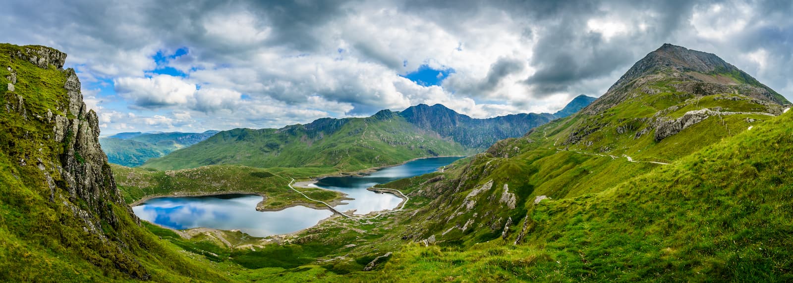
Any keen mountain climber won't be able to resist scaling Snowdon. The highest mountain in the UK outside of the Scottish Highlands, Snowdon is a difficult and dangerous climb that shouldn't be undertaken lightly. Before setting out on your hike, ensure you bring along the appropriate equipment and warm clothing. Due to the popularity of Snowdon, there are six different routes up to the summit. This particular route up Snowdon is one of the more strenuous but is still manageable for experienced hikers. It's a 7.5-mile trip and takes around 5 hours to complete.
You can start climbing Snowdon from the Pen-y-Pass car park along the A4086. Take the Miner's Track to the left of the car park. The path is well signposted and easy to follow. Continue along the track, which turns into a causeway. There are some interesting sights along this section of the walk, including two disused mines and the Llyn Llydaw and Llyn Glaslyn lakes. From Llyn Glaslyn, you'll start your ascent. The Miner's Track here snakes up a steep incline between boulders and rocky outcrops. Decent footwear is important in this section, as scrambling may be necessary.
The Miner's Track will become more defined here and joins the Pyg Track, which leads to the summit. This part of the walk features stark steps, and so take caution. Snowdon's precipice boasts some of the best panoramas in the UK, with nearby peaks like Crib Goch (923 m) and Y Lliwedd (874 m), creating a breathtaking backdrop. To descend Snowdon, head down the Pyg Track. The descent affords stunning beautiful views of the two Llyns, Crib Goch, and the Miner's Track.
The climb up Moel Tryfan (425 m) and Moel Smytho (340 m) is one of the most popular treks in Snowdonia National Park. Despite being smaller peaks than the likes of Snowdon or Garnedd Ugain, this is still a challenging climb. The walk is around 8 and a half miles and takes approximately 5 hours.
You can pick the trail from Cae'r Gors Heritage Center. North of the cottage, you'll see a narrow road which you need to follow. The top of this hill is Moel Smytho, a beautiful mound covered in vibrant heather. After admiring the view, head south towards the peak of Mynydd Mawr (696 m), being mindful of steep cliffs along the way. From atop Mynydd Mawr, you'll be able to spot the snow capped peaks on Snowdon.
Continue southwest along a reservoir towards Moel Tryfan. This heavily mined peak is very steep in places, and scrambling may be required, especially if you stray off the beaten path. Complete the loop by heading north and descending back towards your starting point in Rhosgadfan.
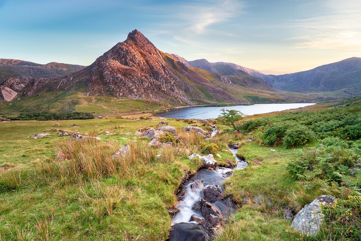
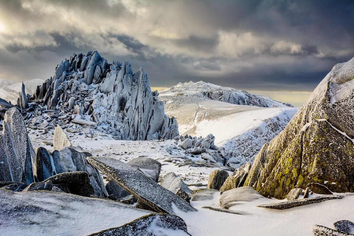
These sister peaks are highly regarded amongst the climbing community due to their challenging ascents and the various routes you can take up to the summits. Glyder Fawr (1,000 m) is the highest mountain in the Glyderau range, while Glyder Fach (994 m) was included the Great Outdoors Britain's 'Top 40 Mountains'. One of the best routes to take to explore both these mountains at once is via the Devil's Kitchen near Ogwen. This walk is around 7.5 miles, takes about 5 hours, and ascends 855 m. This hike is challenging due to sheer cliffs and loose scree, so use caution and come well-prepared.
Start this walk from Glan Dena along the A5 road. Begin to walk toward Ogwen valley and visitor's center, locating the well-made stone path up into the mountains on your left. At Llyn Idwal, head right, before ascending to the Devil's Kitchen. Take the steps which lead up the cliffs, which afford panoramas of the lake and the countryside. From here, the climb becomes difficult, with a 300 m ascent up loose scree. Steep cliffs flank the scree, making this a dangerous area to traverse. Try to bear slightly to the left, but stay in the middle to avoid the cliffs if you're unsure of the best route.
The final 100 m climb to the summit of Glyder Fawr is easier as the scree relents and turns to rocky terrain. From the top of Glyder Fawr, follow the cairn-marked paths northeast to Glyder Fach. The path descends, passing below the summit of Castell y Gwynt (961 m). Past Castell y Gwynt, head left on a path between boulders towards the top of Glyder Fach. Due to the sheer cliffs and rocky outcrops of Glyder Fach, it is difficult for hikers to reach the summit. Instead, you're better off heading to the stunning cantilever plateau and begin your descent via Bristly Ridge. On the right of this ridge, you can find your way on to the Miner's Track. This section of the Miner's Track is steep and disappears from time to time. The path will eventually take you on the southern ridge of Tryfan, where you can descend back to Glan Dena and the A5.
Pen y Fan is the highest peak in South Wales and the Brecon Beacons. Pen y Fan is a very popular hiking destination and is suitable for intermediate and experienced hikers. The easiest way to climb Pen y Fan is via the Storey Arms, an activity center situated at the mountain's foot. This hike is around 5 miles long, ascends 556 m, and takes between 3 and 4 hours.
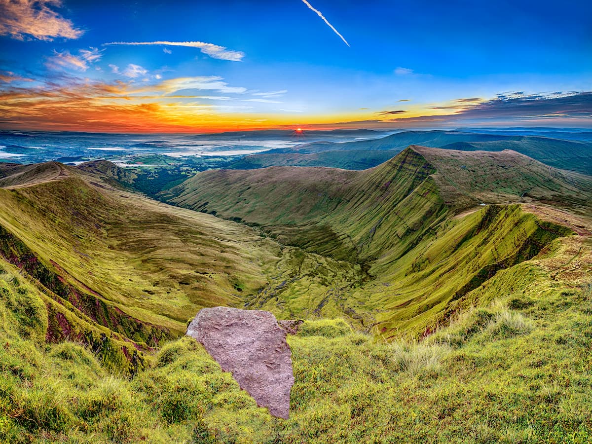
After parking at the Storey Arms, head down the signposted footpath to the left of the visitor's center. When the pathway ends, descend and cross the Blaen Taf Fawr river. The river is usually very shallow and easy to cross. Once on the other side, you'll see the path again after a short walk, which ascends up the mountains to the Craig Cwm Llwch ridge. From here, the trail bears right, up to the summit of Corn Du (871 m).
Continue along the path, which will dip slightly before ascending another 100 m or so up to the pinnacle of Pen y Fan. The descent down the mountain is fairly simple—just continue following the path back to the Storey Arms.
Until recently, Fan Brycheiniog and the rest of the Black Mountain Range were incredibly isolated. Over the past few decades, the Black Mountain Range has become one of the most popular hiking destinations in Brecon Beacons National Park thanks to its stunning glacial mountain terrain. This 9-mile hike ascends 651 m and should take around 5 hours.
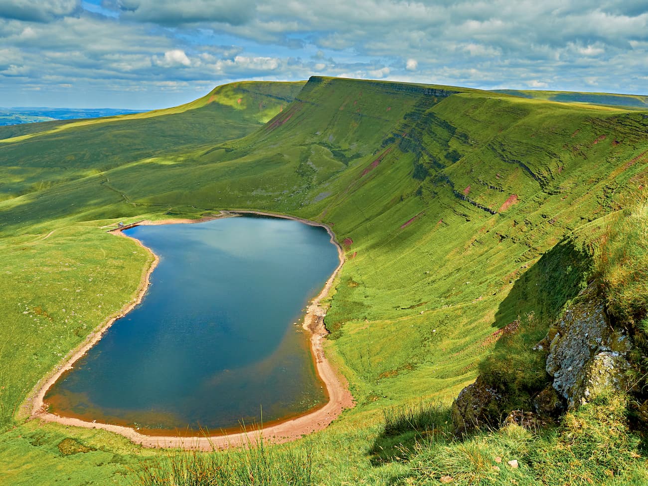
You can start by parking along the road east of Llyn y Fan Fawr. Cross the River Tawe and walk for the southern edge of the lake. Along this section of the lake, you'll spot a steep worn path with steps leading up into the mountains. Follow this path onto the saddle between Fan Brycheiniog and Fan Hir (758 m), known as Bwlch Giedd.
Once atop the saddle, head to the right, keeping the mountain's ridge to your right. From here, you'll have a great view of the serene Llyn y Fan Fawr below. The summit of Fan Brycheiniog is marked with a stone shelter, where you can stop for a break. If you want to make this walk shorter, you can descend from the Bwlch Blaen Twrch ridge, or continue on to Picws Du (747 m) for views of the range's other lake, Llyn Fan Fach. From Picws Du, you'll head to head southwest towards the lake along the ridge.
As the ridge begins to turn to the north, descend towards the lake. At the bottom of the hill, you'll see a shelter and a dam. From the shelter, locate the south side of the lake, and head east to get back to the road you started on.
Hikers looking to explore Wales' coastline should explore the stretch of the Pembroke Coast Path. This path winds from St Dogmaels for 186 miles down the coast to Amroth. While this coastal walk is far too long for most travelers, you can choose to hike along a small stretch and still see a few of the coastline's best cultural and natural sights. One of the best walks is from Stack Rocks to St Govan's Chapel. This walk is roughly 6.5 miles and takes 2 to 3 hours.
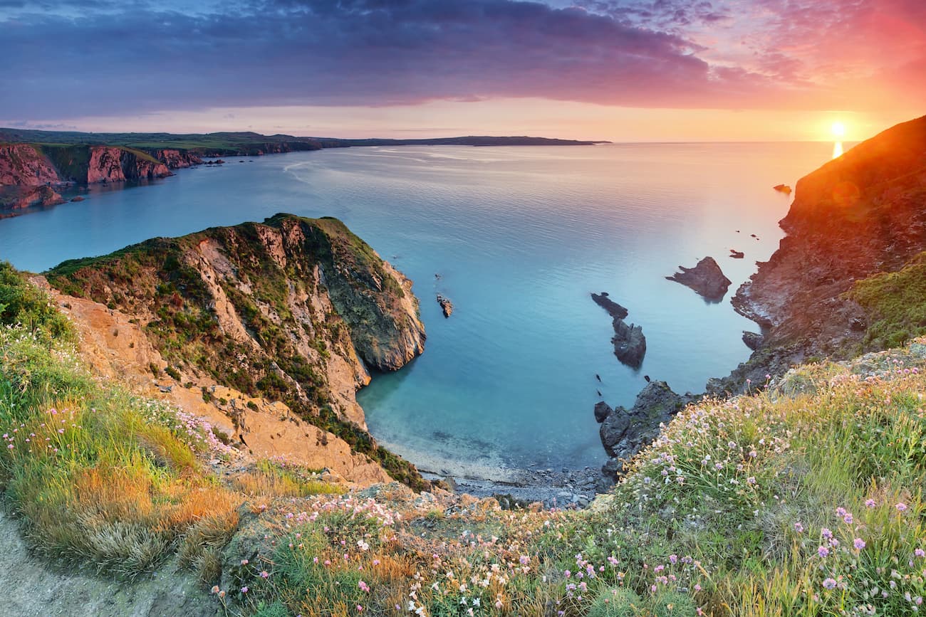
Park up at the Stack Rocks car park, around 8 miles southwest of Pembroke. This walk is popular due to Stack Rocks, two large limestone columns that jut out of the ocean. These stacks are superb for birdwatching, with razorbills, kittiwake, and guillemots nesting on the cliffs. Along your walk, you'll also come across a large limestone arch known as the Green Bridge. At the far end of the walk is St Govan's Chapel, 6th century Irish chapel with a legendary history.
The hike is easy to follow thanks to the well signposted Coastal Path. To reach the St Govan's car park, you'll need to stay left of the Iron Age fort and follow the wider path on the other side. If you reach a fork in the road, stay to the right, You should eventually walk through a gate, where you'll want to head left.
For skiing and snowboarding enthusiasts, there are more than 5 ski resorts in Wales—all with dry slopes or covered by artificial snow, which are located throughout the country.
The largest ski resort in Wales is Llandudno Ski and Snowboard Center with more than 0.2 km (0.1 mi) of slopes and one ski lift. Other major areas for skiing in Wales include Pontypool Ski Center, Pembrey Ski Slope, Cardiff Ski and Snowboard Center, and others. The latter is also the main ski resort near Cardiff, the largest city in Wales.
Check the Wales ski resorts map on the larger UK ski resorts map in the World Mountain Lifts section of the site. It includes information about open ski lifts / slopes in Wales in real-time with opening dates and hours. There are also year-round cable cars, funiculars, cog railways, aerial tramways, and all other types of mountain lifts.
Cardiff is the capital of Wales and the largest city in the country. You'll find plenty to do in Cardiff, from uncovering the secrets of Cardiff Castle to learning about the region's history at the Wales Millennium Centre. Cardiff is also known for its great shopping opportunities and excellent eateries. If you're searching for a hotel in Cardiff, there are lots of reasonable options, such as the Clayton Hotel Cardiff, Hotel Indigo, and Park Plaza Cardiff.

Situated on Wales' southern coast, Cardiff affords travelers access to Brecon Beacons National Park, which is just 35 miles north of the city center. You'll have easy access to Pembrokeshire Coast National Park, which is around 105 miles to the west. Cardiff is Wales' main transport hub thanks to Cardiff Airport, which provides international flights to Doha, Amsterdam, Malta, and more.
Swansea is Wales' second city and a popular tourist destination thanks to its vibrant nightlife and beautiful coastline. There's plenty to do in Swansea City, with historic monuments like Oystermouth Castle and high-class museums like Swansea Museum. Swansea boasts some luxurious seaside hotels for hikers to get a good night's sleep. Popular options include The Music Fable Hotel and The Swansea Marriott.

Positioned further west along the coast than Cardiff, Swansea provides superior access to Pembrokeshire Coast National Park and Brecon Beacons National Park. Pembrokeshire is 65 miles away, while the Brecon Beacons is 35 miles from Swansea.
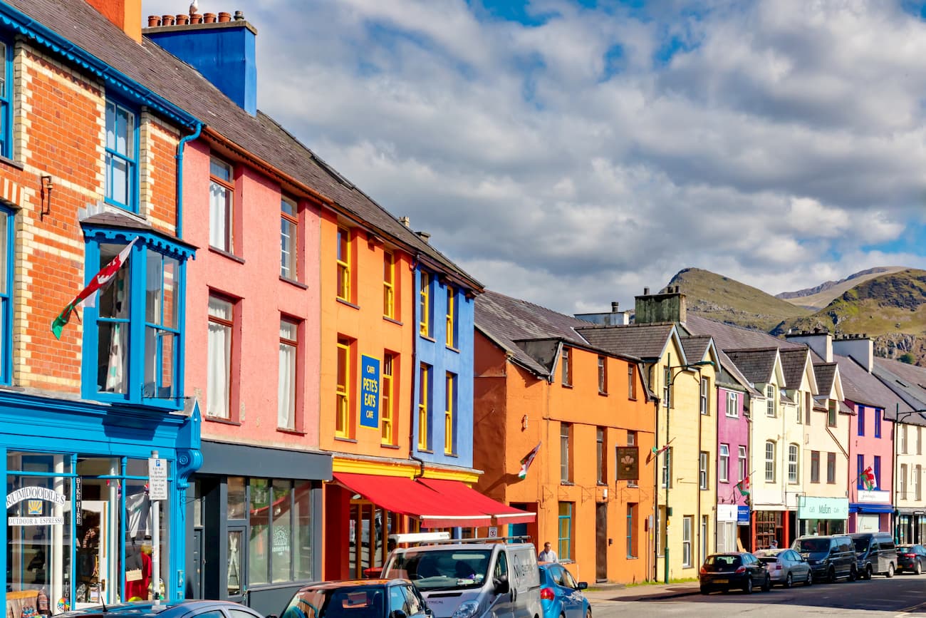
Located in the northwestern corner of Wales near Anglesey is the city of Bangor. This small cathedral city is one of the largest settlements in the area and provides a great base for exploring Snowdonia National Park, which is just 20 miles to the southeast. Bangor is notable for having the longest high street in Wales, at 365 m. While in Bangor, check out the Neo-Norman Penrhyn Castle or take your kids for a family day out at the GreenWood Family Park. You'll find plenty of cozy hotels in Bangor, such as The Menai Hotel, Bulkeley Arms, and OYO Waverley Hotel.

Mountain climbers looking to avoid large settlements and stay as close to the action as possible will love Llanberis. This small village is situated right at the foot of Snowdon, making it a popular spot for travelers looking to swap stories from their latest hiking adventures. Visitors can enjoy lakeside walks around Llyn Padarn, or ride the Snowdon Mountain Railway and see Snowdon from a new perspective. Llanberis is home to a pub and some restaurants serving up local cuisine if you need to warm up after trekking up Snowdon. There are a couple of upscale hotels in Llanberis—the Padarn Hotel Gwynedd and the Royal Victoria Hotel.
Explore Wales with the PeakVisor 3D Map and identify its summits.


tgo40
nuttalls
hewitts-gb
marilyns-gb
nuttalls
hewitts-gb
furths-ew
marilyns-gb
nuttalls
hewitts-gb
furths-ew
marilyns-gb
tgo40
nuttalls
hewitts-gb
furths-ew
tgo40
nuttalls
hewitts-gb
marilyns-gb
nuttalls
hewitts-gb
furths-ew
marilyns-gb
tgo40
nuttalls
hewitts-gb
marilyns-gb
nuttalls
hewitts-gb
furths-ew
marilyns-gb
tgo40
nuttalls
hewitts-gb
marilyns-gb
tgo40
nuttalls
hewitts-gb
marilyns-gb

