Scan the QR code and open PeakVisor on your phone
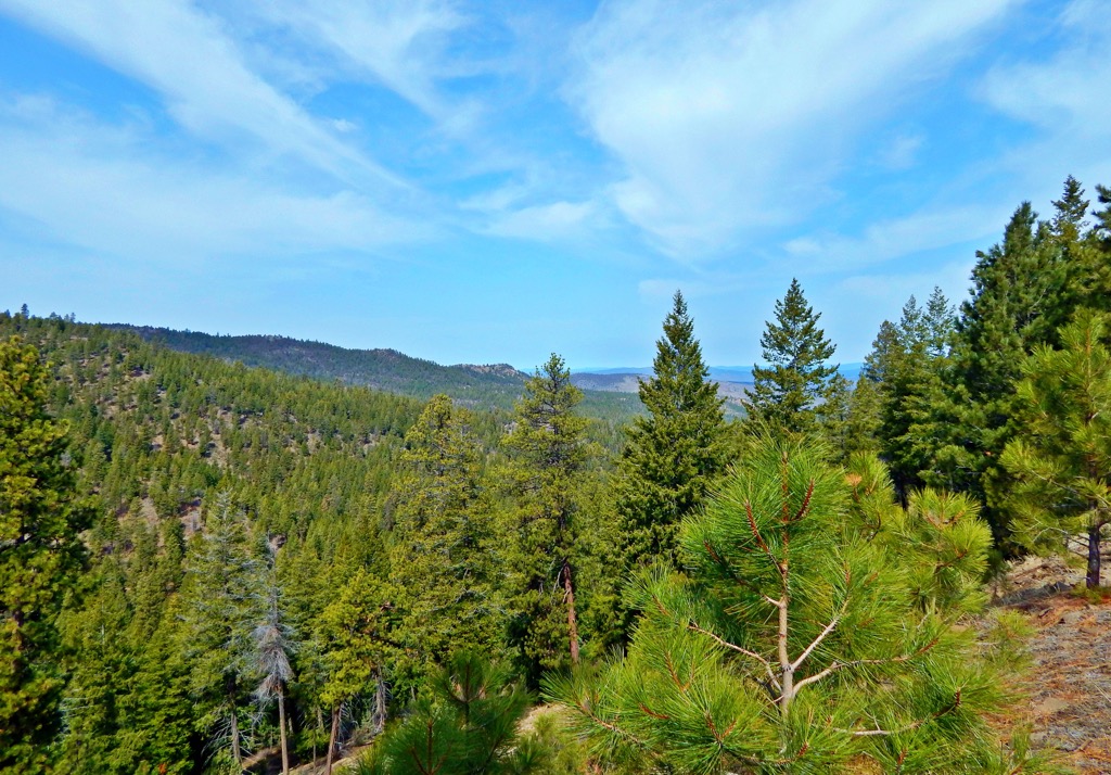
The Maury Mountains are a small range located on the Columbia Plateau in central Oregon in the northwestern United States. Somewhat dwarfed by the larger nearby Ochoco Mountains and part of the Ochoco National Forest, the Maury Mountains are slightly under 20 mi (30 km) long with peaks ranging from 3,175 ft (970 m) to 6,263 ft (1,909 m) on Drake Butte. Drake Butte is the tallest of the range’s 46 mountains, and Powell Buttes (5,217 ft/1,590 m) is the most prominent (1,716 ft/523 m).
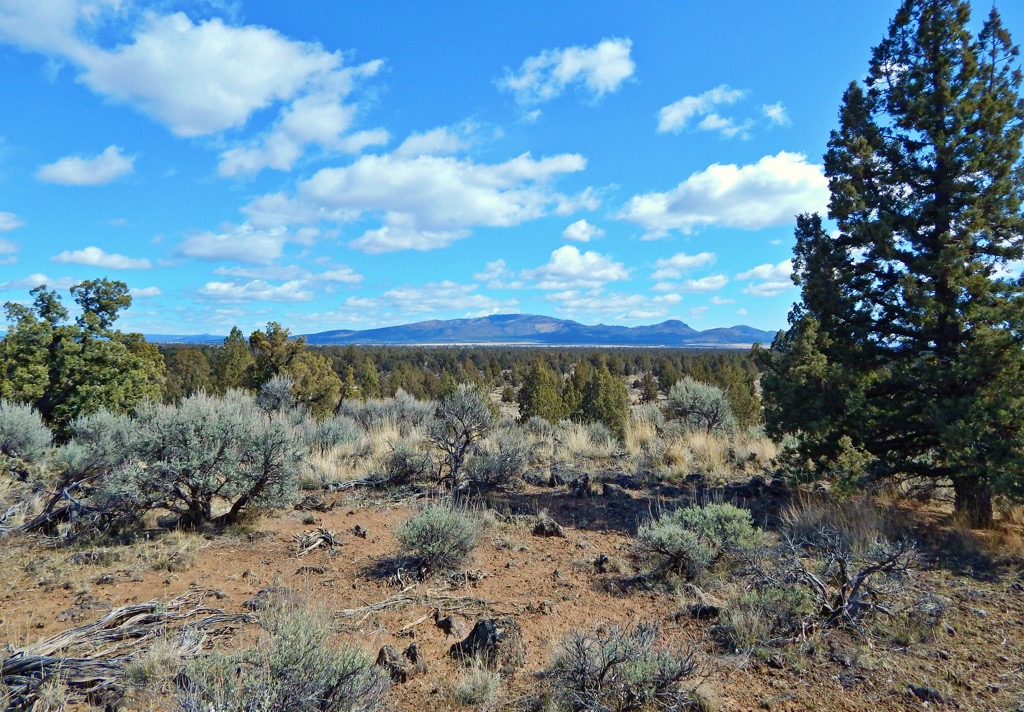
Located in Crook and Deschutes county in central Oregon, the Maury Mountains are situated on the Columbia Plateau within the boundaries of the Ochoco National Forest. The small range, a little under 20 mi (30 km) long, is often overlooked for the larger neighboring Ochoco Mountains. However, the mountains offer several campgrounds, solitude on the trails, and is a popular spot for rockhounding for moss agates.
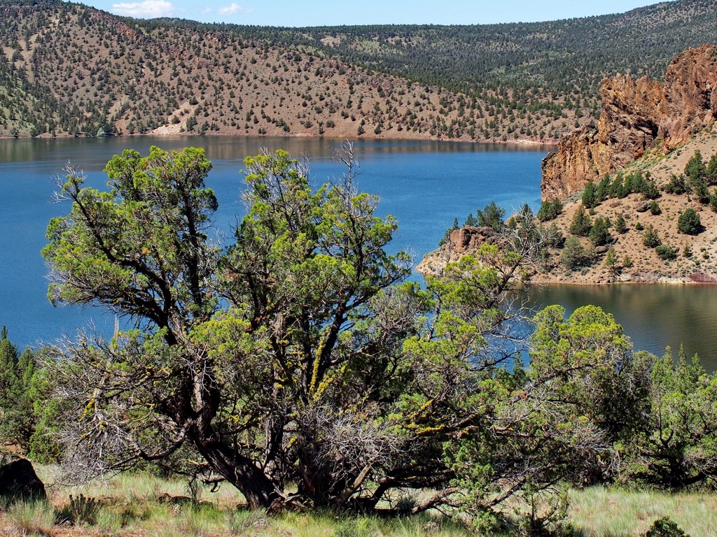
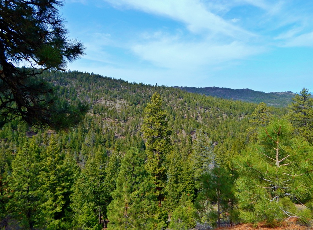
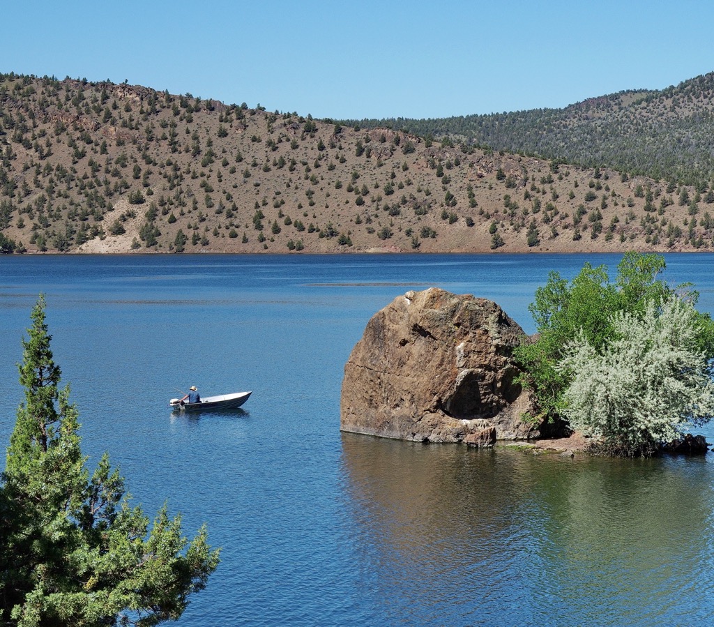
The Ochoco National Forest protects the headwaters of the North Fork of the Crooked River and encompasses part of an old volcanic region that has experienced uplift and erosion. There are four campgrounds within the Maury Mountains. One lies on the south side of the mountains along Antelope Flat Reservoir, a little known but great fishing spot. Elkhorn Campground is only 1.5 mi (2.4 km) from the Agate Bed, a prime spot for scoring some of the mountains’ red, green, or gold moss agates.
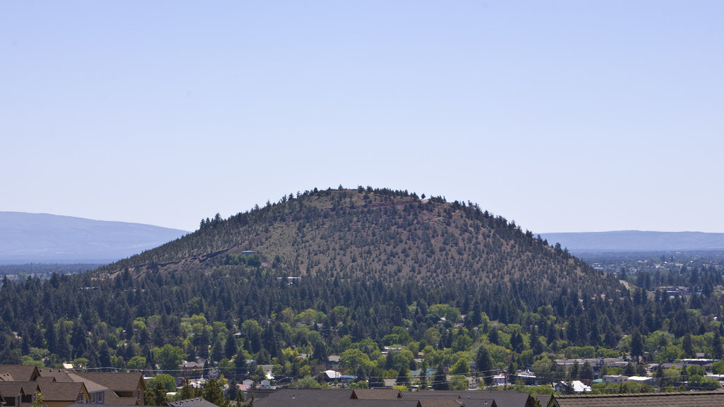
Pilot Butte State Scenic Viewpoint is located on the westernmost edge of the range. It has trails and an interpretive guide for visitors to Pilot Butte, an extinct cinder cone.
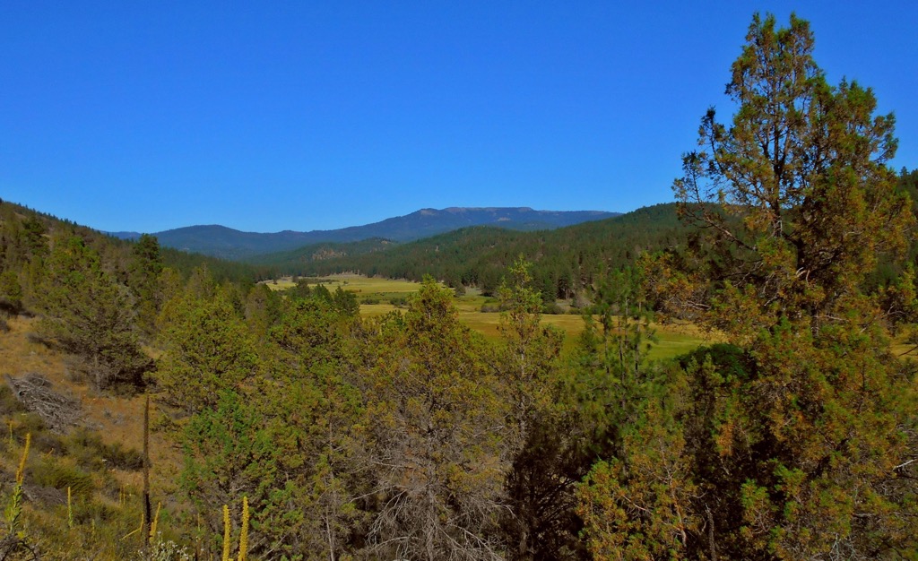
The Maury Mountains are part of the Columbia Plateau. The plateau formed between 16 and 6 million years ago from successive basalt flows. The Columbia River lava is the range’s most extensive formation, spanning a large portion of the higher plateaus and ridges. In general, the range consists of tertiary sequences of folded lavas and soft sediment, with quaternary deposits of terrace gravels and valley alluvium.
Rivers and streams have carved out parts of the valleys between the plateau’s ranges. Valleys are narrower and V-shaped where they have been cut out the more resistant Columbia River lava. Where the water has eroded the weaker John Day and Clarno formation tuffs, valleys are wider with terraces leveled into the sides.
On the western boundary of the range, Pilot Butte is a well-known landmark. The extinct cinder cone formed during an eruption around 188,000 years ago. The light soil at the top of the cinder cone contains ash from the eruption of Mount Mazama about 7,700 years ago.
The Maury Mountain Mines extracted mercury during the mid and late 20th century but this range didn’t possess the same mineral resources as other ranges in Oregon.
The ecosystem around the Maury Mountains is semi-arid, with some of its slopes supporting desert vegetation. Sagebrush, bitterbrush, rabbitbrush, and red currant grow well, with the fruits of the red currant serving as a favored food source for deer and birds. Some areas are also dominated by the non-native cheatgrass. Wildflowers bloom in spring, including sand lily, rock cress, penstemon, paintbrush, buckwheat, yarrow, blazing star, mariposa lily, lupine, and monkeyflower.
Western juniper grows around Pilot Butte. This tree has proliferated following Euro-American settlement in the area as grazing and wildfire suppression altered previous conditions. Higher elevations support ponderosa pine forest.
Mule deer, black bear, coyotes, beavers, porcupines, ground and tree squirrels, cottontails, jack rabbits, and badgers are some of the main wildlife that make their home in this area.
Signs of early human presence in central Oregon date back more than 9,000 years. In more recent history, the Columbia Plateau was home to the Cayuse, Umatilla, and Nez Perce tribes. The Northern Paiute also occupied the southern portion of the plateau, sometimes coming into conflict with tribes from the north. People would travel a fairly large distance to access the region’s diverse resources depending on the time of year.
Disease and trade from Europeans and Americans began to affect indigenous populations before settlers began arriving in large numbers. By the 1800s, setters were rapidly moving in and establishing mining, lumber, and livestock industries in the region.
The Maury Mountains were named after Army Colonel R.F. Maury in 1864. Historic sites from previous centuries remain around the mountains of obsidian quarries and wagon trails such as the Meek Wagon Trail and the Huntington Road.
The Maury Mountains offer a more secluded mountain experience than the nearby Ochoco Mountains. Within the main section of the range, rockhounding, camping, and short hikes are common. Along the range’s western periphery, Pilot Butte is a popular landmark.
There are two trails to the summit of Pilot Butte at the Pilot Butte State Scenic Viewpoint. Many choose to make the mile (1.6 km) long nature trail and mile (1.6 km) long paved road into a loop. Keep an eye out for vehicles while on the road. The views from the top take in the Cascade Range.
Although not a hike, the Maury Mountain Agate Bed is a popular site for rockhounding and is located 1.5 mi (2.4 km) from the Elkhorn Campground. People come to collect the red, green, and gold moss agates.
The Hammer Creek Trail #840 is the only official trail in the Maury Mountains, outside of the peripheral Pilot Butte. The trail is not well maintained and may be hard to follow in some spots. The trail is 9.3 mi (15 km) and ranges in elevation from 4,500 ft (1,370 m) to 5,200 ft (1,585 m).
A few notes about the trail – at one point a fence was constructed a few hundred feet past the trailhead. However, this is still public land and is open to hikers. There are also range permits issued in the area so you may encounter cattle while hiking.
There are four campgrounds in and around the Maury Mountains. Bend is a city about 1.5 hours drive away and Portland is four hours away by car. Those looking for a stop over between the two could look into staying in Eugene.
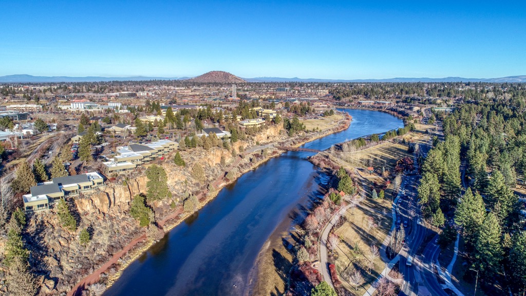
Bend, Oregon is an hour and a half drive from the Maury Mountains and has a population just over 100,000 people. It’s surrounded by popular outdoor spots including the Deschutes River, the Three Sisters Wilderness, and an extensive urban trail system. The surrounding area offers numerous hiking, mountain biking, camping, skiing, and snowboarding opportunities.
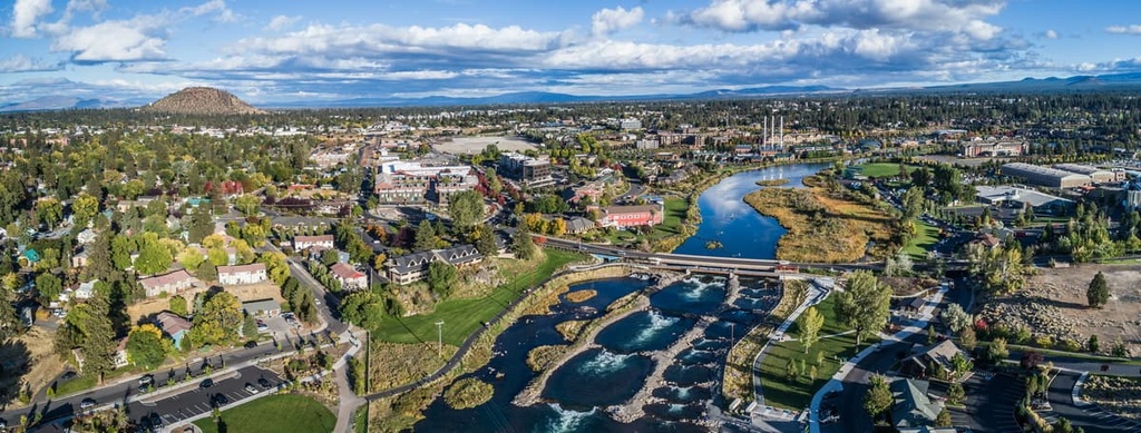
The High Desert Museum, highlighting the natural and cultural history of the area, is popular with visitors and local families alike. The downtown hosts events like art walks, beer festivals, and live music. With food trucks, breweries, and various international cuisines, the food scene offers a wide selection. Lodging around the city includes hotels, motels, resorts, B&Bs, campgrounds, and RV parks, not to mention plenty of dog-friendly options.
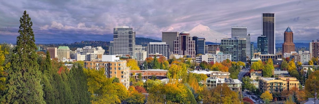
Four hours away by car, Portland, Oregon has a population of 640,000 people. Visit the Portland Art Museum, the Center for Native American Art, or the World Forestry Center Discovery Museum. Step outside into one of the city’s more than 200 parks and gardens. Forest Park is an extensive urban forest with more than 80 mi (130 km) of trails. The Oaks Bottom Wildlife Refuge houses a wetland that is a favorite among bird watchers. Mount Hood is less than a two hour drive away.
Portland is known as being a big food city with an emphasis on fresh and local ingredients. The city boasts a popping food market scene, farmers markets, breweries, and a wide range of cuisines. A wide range of accommodation is available in the city for all budgets, including hotels, hostels, B&Bs, and campsites.