
Scan the QR code and open PeakVisor on your phone
Located in central Oregon, the Ochoco Mountains form the western end of the Blue Mountains province, a 23,984 square-mile ecoregion that contains a diverse complex of valleys, plateaus, and mountain ranges.
The Ochoco Mountains were formed by 300 to 200-million-year-old rock that was slowly uplifted by volcanic eruptions. During the Eocene epoch, roughly 50 to 37 million years ago, central Oregon volcanoes deposited layers or lava and ash up to 1,000 feet deep over the Ochoco Mountain region. Large mudflows, or lahars, covered the landscape, forming massive fossil beds. Today, the Ochoco Mountains are home to a variety of fossilized plants and animals, including prehistoric trees and rhinoceros.
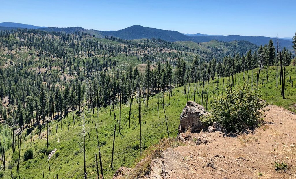
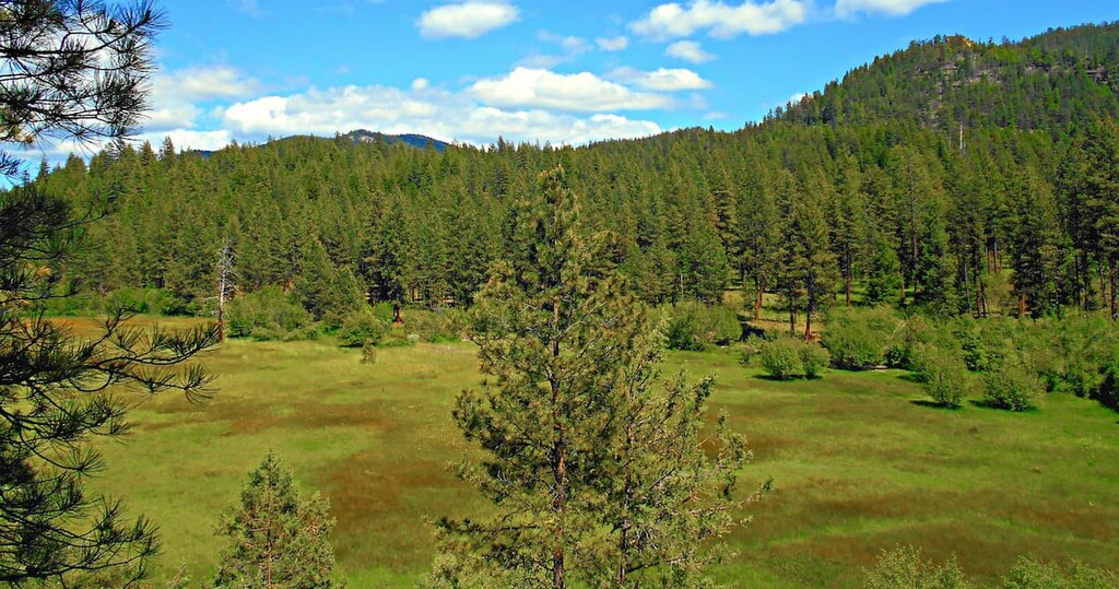
The highest points in the Ochoco Mountains are Lookout Mountain, Spanish Peak, and Mount Pisgah. Old-growth ponderosa pine dominates the western slopes of the range, while western juniper and sagebrush are more prevalent on the eastern end of the range. Big Summit Prairie, a large high mountain meadow, covers 20 square miles of the Ochoco Mountains and is notorious for its seasonal display of wildflowers.
Though most of the Ochoco Mountains are public lands administered by the United States Forest Service, there are several protected areas scattered throughout the region. The western Ochoco Mountains are largely administered by the Ochoco National Forest, which contains the Bridge Creek Wilderness, Black Canyon Wilderness, and Mill Creek Wilderness. The southeastern part of the range is part of the Malheur National Forest.
Hiking, camping, fishing, horseback riding, bird watching, and hunting are all popular activities in the Ochoco region.
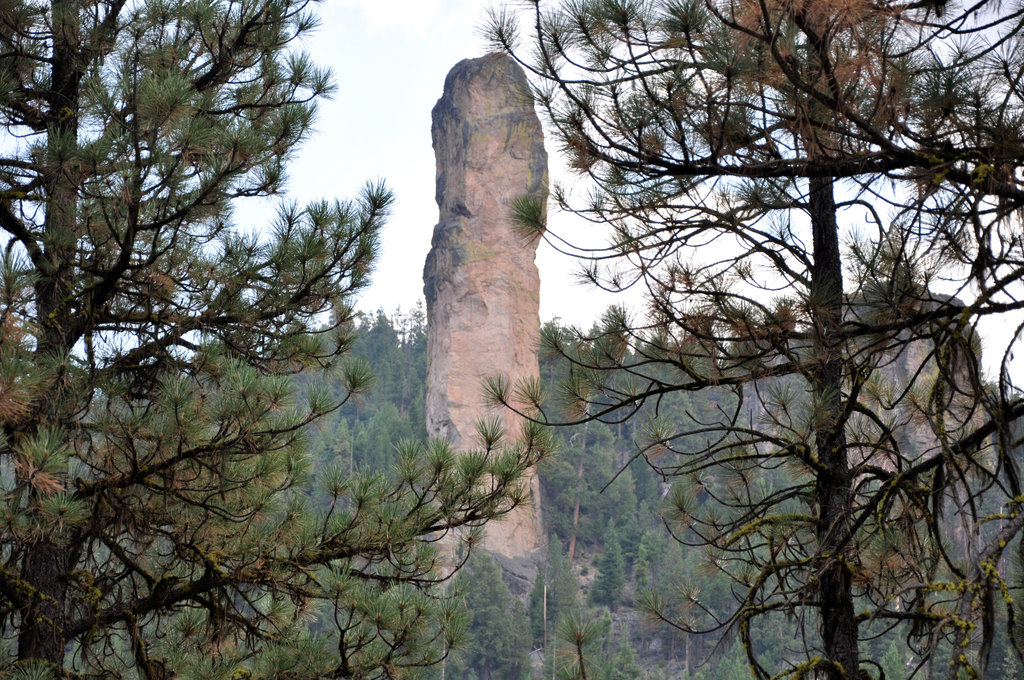
The Ochoco National Forest encompasses roughly 850,000 acres of rimrock, canyons, pine forest, and high desert terrain. Home to the tallest peaks in the Ochoco Mountains, the Ochoco National Forest boasts some of the region’s most iconic attractions, including Lookout Mountain, the Steins Pillar Trail, Round Mountain, and Green Mountain.
The Ochoco National Forest is home to a variety of historic and prehistoric archaeological sites, historical trails, cabins, railroads, and campsites. The Forest also contains three unique wilderness areas: The Bridge Creek Wilderness, Black Canyon Wilderness, and Mill Creek Wilderness.
Covering just 5,400 acres, the Bridge Creek Wilderness is Oregon’s smallest wilderness area. This remote area receives few visitors and is characterized by barren plateaus and steep, forested slopes. There are no maintained trails in the Bridge Creek Wilderness, so visitors are expected to be self-sufficient and proficient in backcountry travel.
The Black Canyon Wilderness encompasses 13,400 acres of dense forest and steep basalt cliffs. Like Bridge Creek, the Black Canyon Wilderness is a remote wilderness, and a wide range of wildlife frequents the area, including deer, elk, and black bear. However, there are 18 miles of maintained trails that provide access through the park.
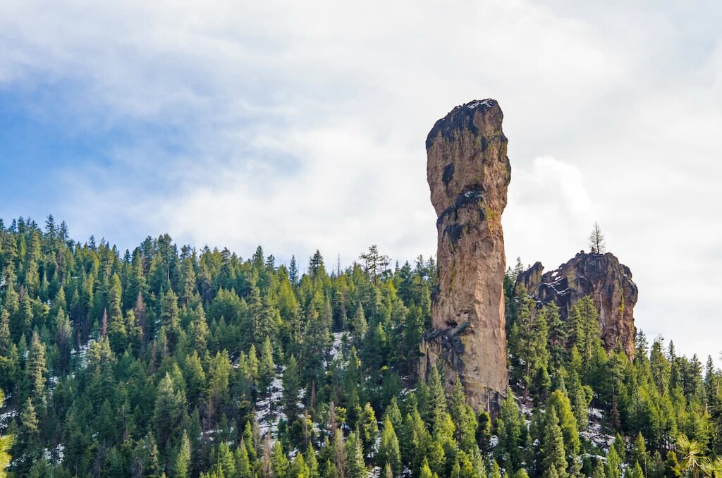
Characterized by deep canyons and towering pinnacles, the Mill Creek Wilderness is the largest protected wilderness in the Ochoco National Forest. Mill Creek is home to an iconic pair of volcanic plugs, the Twin Pillars, and boasts roughly 21 miles of hiking trails.
There are a number of camping areas located in and around the Ochoco Mountains and Ochoco National Forest, including sites in the Crooked River National Grassland region, near Maury Mountain, and scattered throughout the eastern and western portion of Ochoco National Forest.
The largest major city to the Ochoco Mountains is Bend. Bend lies along the Deschutes River, roughly 1.5 hours from the Ochoco Mountains. Bend is central to a variety of outdoor recreation, including the illustrious Cascades and Mount Bachelor Ski Resort, the Newberry National Volcanic Monument, and Smith Rock State Park.
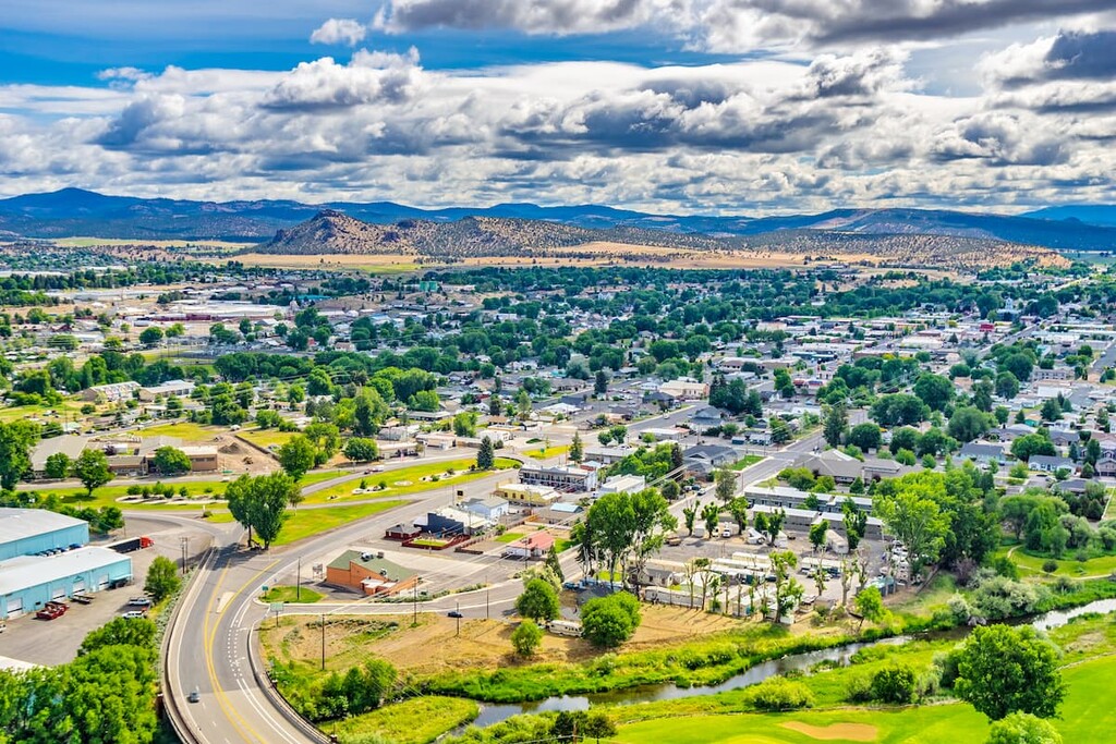
Between Bend and the Ochoco Mountains, the historic city of Prineville is also an idyllic basecamp for outdoor enthusiasts. Prineville holds the unofficial title of Rockhound Capital of the U.S. thanks to a variety of precious gemstones that have been found in central Oregon. This charming town lies along the Crooked River and accommodates thousands of anglers, boaters, sightseers and hikers each year.


_(jefDB1523).jpg)


