
Scan the QR code and open PeakVisor on your phone
Located in the Ochoco National Forest, the Mill Creek Wilderness protects 17,400 acres of towering stone pinnacles, steep canyons, barren ridge tops, and high elevation meadows. The Wilderness was established in 1984 and is the largest and most heavily used wilderness area in the Ochoco National Forest.
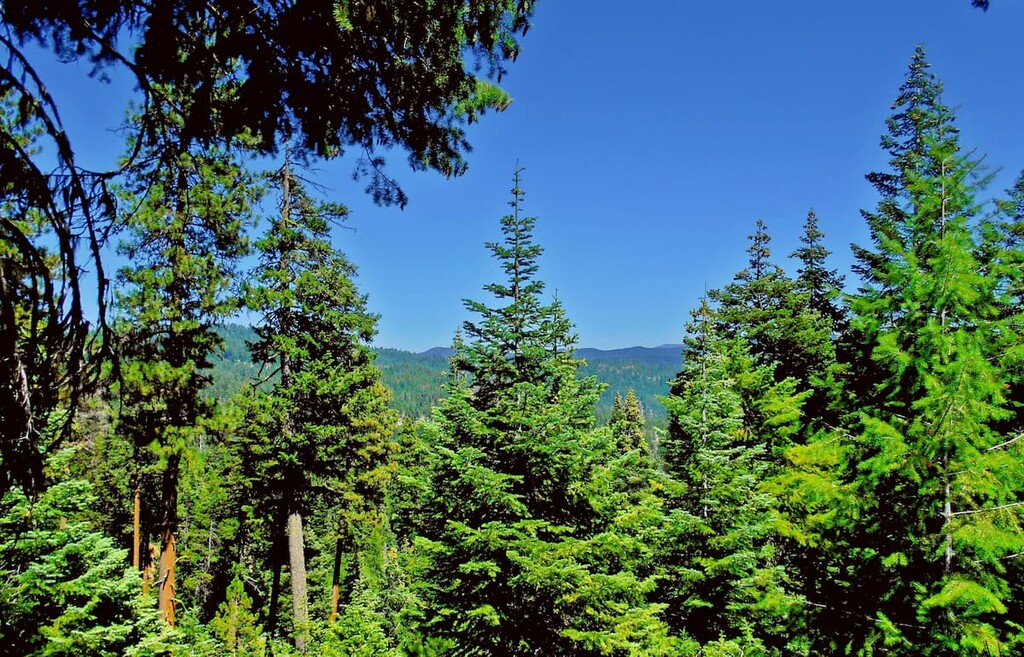
Roughly 85% of the Mill Creek Wilderness is made up of the southwest-trending drainage of Mill Creek, with Marks Creek accounting for the difference. Both creeks are tributaries of the Ochoco Creek, a 30-mile arm to the Crooked River, and contain small trout. Steep, fragmented ridges plummet into Mill Creek and rise again to Bingham Prairie, a virtually flat plateau with open meadows and a lodgepole pine forest.
In 2005, two members of the Oregon Department of Geology and Mineral Industries unexpectedly stumbled upon evidence of an ancient volcano and named the feature the Wildcat Mountain Caldera. When the Wildcat Mountain Caldera erupted 40 million years ago, it would have been a cataclysmic event. Fortunately, today, the underlying volcano, which is believed to measure 10 miles in diameter, is extinct.
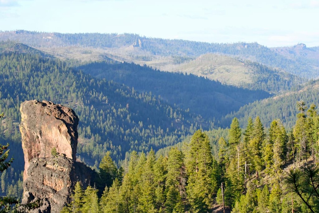
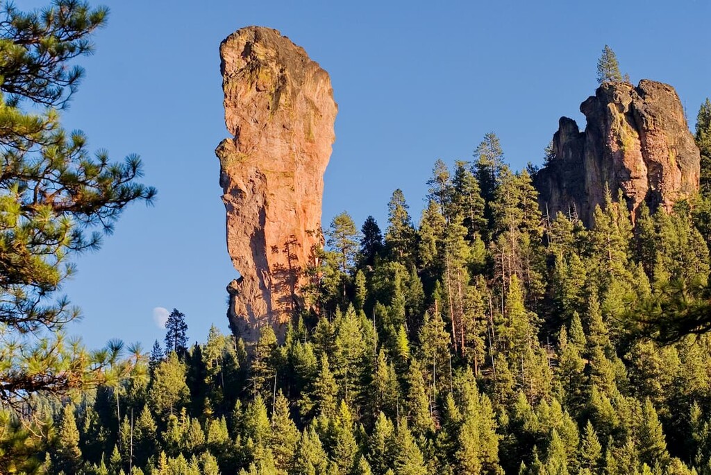
Arguably the most unique features of the Mill Creek Wilderness are the Twin Pillars, a pair of volcanic plugs that rise abruptly above the surrounding forest. The Twin Pillars are impressive rhyolite intrusions into the Wildcat Mountain Caldera. 400-foot Steins Pillar, another impressive volcanic feature, lies just outside of the southwestern Wilderness boundary and is an erosional remnant of the Tuffs of Steins Pillar that once filled the caldera basin. Steins Pillar is considered to be one of the most striking geographic wonders of the region.
Desolation Canyon, another remarkable natural feature, runs through the heart of the Mill Creek Wilderness. Located along the southern slopes of the Ochoco Mountains, most of Desolation Canyon was scoured by the Hash Rock Fire in 2000. Fortunately, local flora and fauna have since made an extraordinary comeback.
There are four trailheads in the Mill Creek Wilderness that provide access to roughly 18 miles of trail. Limited resources are available in the area, however, and trails are primitive. Visitors may encounter downed trees or heavy brush on segments of trail in the park and there are no bridges to facilitate stream crossings. Visitors are expected to have experience traveling in rugged wilderness conditions and should be prepared for the technical challenges they will encounter on trail.
Park trails can be accessed via the Twin Pillars North, Twin Pillars South, Wildcat North, and Wildcat South trailheads.
The Twin Pillars North trailhead is located at the east edge of the rustic Bigham Springs Campground, while the Twin Pillars South trailhead sits in the parking area of the Wildcat Campground. These trails both provide access to the Twin Pillars trail, an 8.3-mile (one way) trail that leads hikers directly into the heart of the Wildcat Mountain Caldera and the Twin Pillars.
The Wildcat North trailhead is located uphill from Whistler Campground and the Wildcat South trailhead can be found at the White Rock Campground. These trailheads provide access to the Wildcat Mountain trail, an 8.5-mile trail that traces the eastern rim of the Wildcat Mountain Caldera.
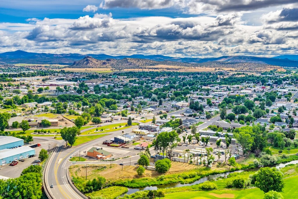
The historic city of Prineville is also an idyllic basecamp for outdoor enthusiasts. Prineville holds the unofficial title of Rockhound Capital of the U.S. thanks to a variety of precious gemstones that have been found in central Oregon. This charming town lies along the Crooked River and accommodates thousands of anglers, boaters, sightseers and hikers each year.
Known as the ‘gateway to the painted hills,’ Mitchell is surrounded by breathtaking landscapes, diverse geology, and stunning vistas. Visitors to Mitchell can hike, bike, ride, or drive through Oregon’s interior, exploring canyons, backroads, mountains, and ghost towns along the way. Though Mitchell isn’t a large city by any stretch of the imagination, it has plenty to offer travelers looking to explore central Oregon’s hidden gems.


