
Scan the QR code and open PeakVisor on your phone
The Elk Mountains (Idaho) include 44 named peaks. The highest is Elk Mountain at 2,687 m. Other notable peaks include Red Point, White Elephant Butte and Red Elephant Butte.
The Elk Mountains span from Owyhee and Twin Falls Counties in southern Idaho into northeastern Elko County Nevada in the United States. The range lies within Humboldt National Forest in Nevada. The tallest peak is Elk Mountain or Red Point (8,816 ft/2,687 m), and Red Point is the most prominent (1,243 ft/379 m).
Located in Elko County Nevada, and in Owyhee and Twin Falls Counties in Idaho, the Elk Mountains are part of the Great Basin Ranges. They are considered a sub-range of the Jarbidge Mountains.
Part of the mountains are encompassed by the Humboldt-Toiyabe National Forest. This enormous national forest protects 6.3 million acres (2.5 million ha) in total and consists of large but non-contiguous sections in Nevada and eastern California.
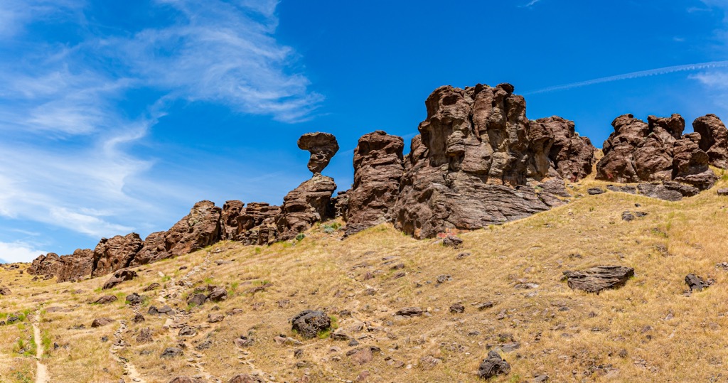
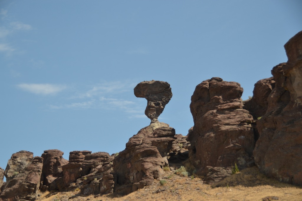
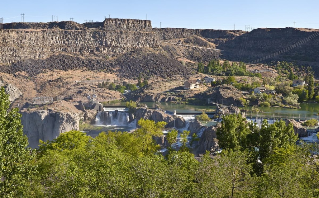
The range is located north of the Jarbidge Mountains and Jarbidge Wilderness Area, and east of the Bruneau-Jarbidge Rivers Wilderness. One notable landmark within the range is Balanced Rock. Not far from Twin Falls, Idaho, this nearly 50 ft (15 m) tall rock weighing 40 tons balances on a surface about 3 ft by 17 inches (0.9 m by 0.4 m).
The Elk Mountains are composed of a granitic core, primarily granodiorite, that is surrounded by sedimentary rock and then layers of lava. The core dates back to around the Cretaceous Period and contains plagioclase, orthoclase, quartz, hornblende, biotite, titanite, sphene, magnetite, and apatite. The granodiorite is exposed only in the southwestern part of the mountains where there has been deep erosion of the sedimentary rock.
The sedimentary rocks date back to the Paleozoic Period and are primarily limestone, quartzite, shale, and slate. The lavas, dating from the Tertiary Period, are mainly rhyolite.
Minerals have been found in the range including copper, gold, silver, and some gangue and garnet. Ore minerals such as malachite, azurite, chalcopyrite, bornite, and chrysocolla are also present.
As part of the Great Basin Ranges, the region has been shaped by tectonic plate extension, uplift, glaciation, and erosion.
The ecosystem around the Elk Mountains supports sagebrush and smaller trees such as juniper and mountain mahogany at lower elevations, and conifers such as limber pine and alpine fir higher up. Aspens also grow here, and cottonwoods and willows grow along the waterways.
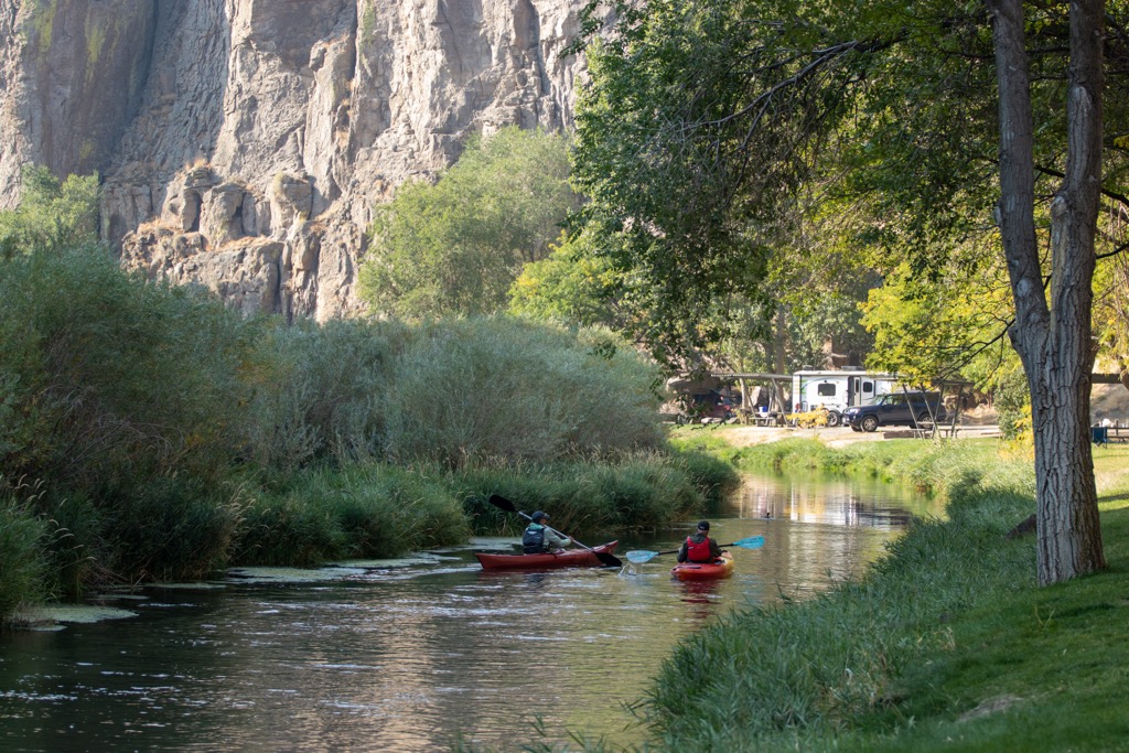
Rainbow and brook trout live in many of the creeks and rivers, making good fishing destinations. The range is home to a number of birds including sage grouse, bald eagles, hawks, falcons, and many songbirds. Other species that live here include bighorn sheep, elk, mule deer, pronghorn, black bears, mountain lions, bobcats, coyotes, raccoons, badgers, kangaroo rats, rabbits, and otters.
There is not much evidence from the region but signs of early human inhabitation date back 10,000 years, possibly further. This archeological evidence is divided into Paleoindian, Archaic, Prehistoric, Numic, and Historic periods. Agriculture is difficult with the area’s conditions so the region has mainly supported hunting-gathering lifestyles. Over thousands of years, humans went from hunting large game to smaller game and gathering, utilizing bows and arrows.
The Numic Period lasted from about AD 1300 to 1850. During this time, the Paiute and Shoshone came to call the region home. The tribes would shift seasonally to take advantage of natural resources and had rich cultures of basketry and pottery.
The name for the neighboring Jarbidge Mountains is actually an anglicization of the Shoshone language. It comes from the Shoshone word meaning “weird beastly creature” or along the lines of “monster in the canyon”. This dates back to stories the Shoshone told of an evil creature that lived in one of the range’s canyons.
Spanish explorers began arriving in Idaho just before 1600. Lewis and Clark passed through Idaho in the early 1800s, and soon after French-Canadian fur trappers arrived. Later, ranching and mining rose as profitable industries in the region.
Around 1900, many migratory sheep herders shifted between southern Idaho and northern Nevada. The sheep mainly belonged to Basque herders and tensions arose with ranchers in Nevada who grazed their cattle on the same land.
The Forest Service was called in to create reserves and bring some order to the situation. The Humboldt National Forest came from a complicated series of consolidations of forest reserves and redesignations. It was first officially established in 1908 and expanded in following years.
The Elk Mountains lie near taller ranges and do not have many popular trails. That being said, those who want to do some exploring and are comfortable navigating will enjoy all the solitude these mountains have to offer.
Getting to Elk Mountain is best done with a high clearance vehicle. Coming from Jarbidge Road, the road to the trailhead will take you through a cattle gate. At a certain point, the road from Google Maps may end, but it can be spotted using Google Earth. Park along the road and then the hike itself is quite short. It is only about 0.5 mi (0.8 km) one way with about 250 ft (76 m) elevation gain.
From the road, head west across a meadow. From there you’ll spot a clear game trail leading up the mountain. Near the summit, bushwack for a straight shot to the top. The scenic views sweep across the surrounding landscape and it is a perfect spot to appreciate the area’s remoteness.
Slightly west of Twin Falls, Idaho, Balanced Rock is a popular spot to visit and snap a photo. A 48-ft (14.6 m) tall, 40 ton rock balances on a point about 3 ft by 17 in (0.9 m by 0.4 m). There is free camping nearby and great spots for fishing and picnicking. It lies near Salmon Falls Creek.
Twin Falls, Idaho is the closest small city to the range. Boise, Idaho, and Salt Lake City, Utah are both several hours away depending on what part of the range you are coming from.
Twin Falls has a population of 53,000 people. There are many outdoor spots to check out while visiting including Snake River Canyon, Shoshone Falls (especially in spring and early summer), Auger Falls, and the 7 mi (11.3 km) long Canyon Rim trail.
The Downtown Commons is lively with art and music, and there is a big brewery scene for those hoping to grab a drink after a day outside. The restaurant scene is modest, with a decent selection of international cuisines and the usual range of pubs, grills, and pizza joints. Hotels are available for all budgets, and campgrounds and RV parks can be found just outside the city.
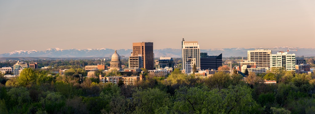
Boise has a population of 237,000 people. It’s a great gateway to exploring Idaho’s natural beauty whether it be by biking, fishing, hiking, paddling, or skiing and snowboarding. A popular hike near the city is Table Rock Trail – 3.4 mi (5.5 km) one way with 1,000 ft (305 m) of elevation gain and great views from the top.
Learn more about the region’s history and culture by visiting the Boise Art Museum, Basque Museum and Cultural Center, and Idaho Black History Museum. If you’re looking for a bite to eat, check out the Warehouse Food Hall for a variety of options. You’ll also find food trucks, grills, pubs, and pizza. You’ll find accommodation ranging from hotels to vacation rentals, to campgrounds and RV parks.
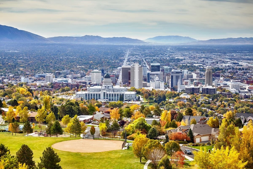
Salt Lake City is home to 200,000 people. A must-do in the city is a visit to the Great Salt Lake where you can enjoy walking, biking, and paddling. Other cool spots to check out around the city include the 2002 Winter Olympic venues, the botanical Red Butte Garden, and the butterfly biosphere.
The city offers a robust restaurant scene with a range of restaurants from budget to fine dining, and flavors that run from familiar to experimental. Stay over in a luxurious mountain resort, cozy B&B, convenient hotel or motel, or rustic campground and RV park outside the city.


The highest peak in the Elk Mountains (Idaho) is Elk Mountain, at 2,687 m.
The Elk Mountains (Idaho) have 44 named peaks.


