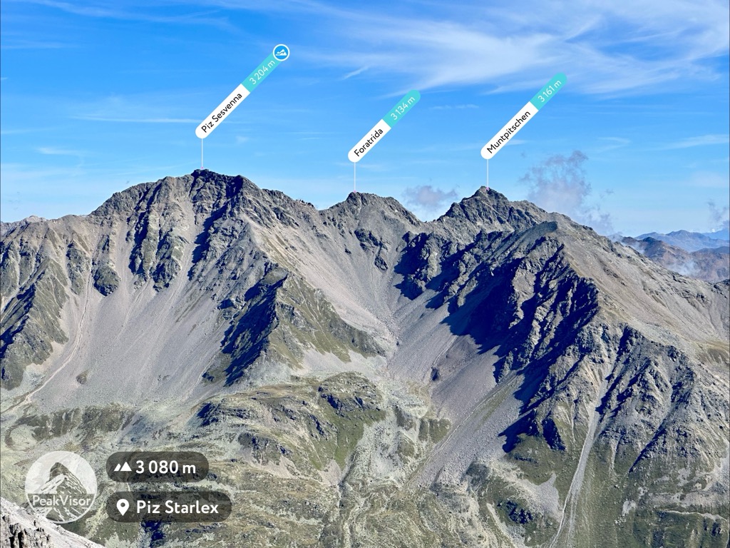
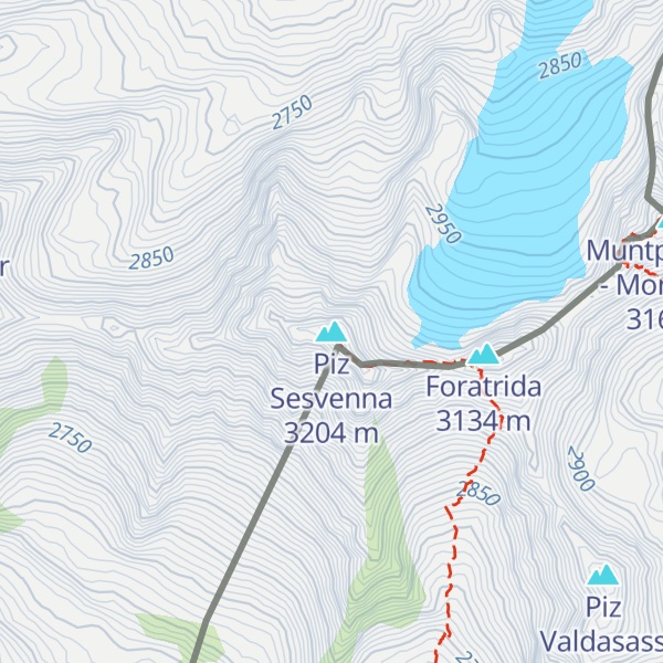
Piz Sesvenna is the highest mountain in the Sesvenna Range of the Alps. It lies between the Swiss canton of Graubünden and the Italian region of South Tyrol. The summit is located within Switzerland, very close to the Italian border and main watershed.
On the north side of Piz Sesvenna lies a glacier named Vadret da Sesvenna.
The closest locality is S-charl, south of Scuol in the Engadin valley.
There's a demanding alpine trail (T5) leading to the summit.
The nearest mountain hut is Jöchl-Hütte located 1 973m/6 474ft SSW of the summit.
By elevation Piz Sesvenna is
# 17 out of 414 in Region Engiadina Bassa/Val Müstair # 1 out of 170 in the Sesvenna Range
By prominence Piz Sesvenna is
# 10 out of 2797 in the Western Rhaetian Alps # 10 out of 2367 in Grisons # 1 out of 414 in Region Engiadina Bassa/Val Müstair # 91 out of 42694 in Italy # 20 out of 3872 in Trentino-Alto Adige/Südtirol # 7 out of 2178 in South Tyrol # 28 out of 10817 in Switzerland # 1 out of 170 in the Sesvenna Range
We use GPS information embedded into the photo when it is available.
3D mountains overlay
Adjust mountain panorama to perfectly match your photos because recorded by camera photo position might be imprecise.
Move tool
Rotate tool
Zoom
More customization
Choose which peak labels should make into the final photo and what photo title should be.
Next
Photo Location
Satellitte
Flat map
Relief map
Latitude
Longitude
Altitude
OR
Latitude
°'''
Longitude
°'''
Apply
Register Peak
Peak Name
Latitude
Longitude
Altitude
Register
Teleport
PeakVisor
This 3D model of Sagarmatha National Park in Nepal was made using the PeakVisor app topographic data. The mobile app features higher precision models worldwide, more topographic details, and works offline. Download PeakVisor maps today.
Download OBJ model
PeakVisor
The download should start shortly. If you find it useful please consider supporting the PeakVisor app.
PeakVisor for iOS and Android
Be a superhero of outdoor navigation with state-of-the-art 3D maps and mountain identification in the palm of your hand!