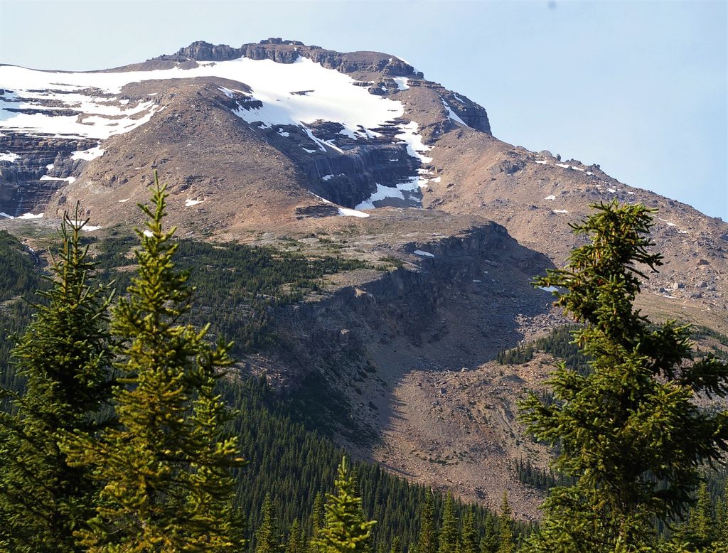
At an elevation of 2,962 m (9,718 ft.), and with a prominence of 433 m (1,421 ft.), Mumm Peak is on the border of British Columbia and Alberta, in Canada.
Mumm Peak was named after. Arnold L. Mumm (1859 – 1928), who explored the Canadian Rockies and other mountains worldwide. He was also a member of the Alpine Club of Canada, and wrote and published books on his explorations. (Books: Five Months in the Himalaya: A Record of Mountain Travel in Garhwal and Kashmir – 1909. The Alpine Club Register - 1857-1863.) J. Norman Collie was so kind as to name the mountain in 1910 after Mr. Mumm.
By elevation Mumm Peak is
# 55 out of 394 in Regional District of Fraser-Fort George # 29 out of 97 in Mount Robson Provincial Park
We use GPS information embedded into the photo when it is available.
3D mountains overlay
Adjust mountain panorama to perfectly match your photos because recorded by camera photo position might be imprecise.
Move tool
Rotate tool
Zoom
More customization
Choose which peak labels should make into the final photo and what photo title should be.
Next
Photo Location
Satellitte
Flat map
Relief map
Latitude
Longitude
Altitude
OR
Latitude
°'''
Longitude
°'''
Apply
Register Peak
Peak Name
Latitude
Longitude
Altitude
Register
Teleport
PeakVisor
This 3D model of Sagarmatha National Park in Nepal was made using the PeakVisor app topographic data. The mobile app features higher precision models worldwide, more topographic details, and works offline. Download PeakVisor maps today.
Download OBJ model
PeakVisor
The download should start shortly. If you find it useful please consider supporting the PeakVisor app.
PeakVisor for iOS and Android
Be a superhero of outdoor navigation with state-of-the-art 3D maps and mountain identification in the palm of your hand!