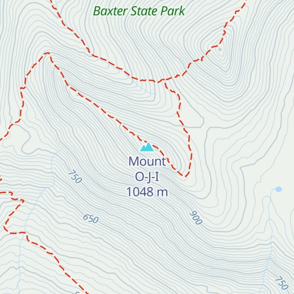
Mount OJI, or O-J-I, is located in Baxter State Park in the U.S. state of Maine, with an elevation of 3419 feet (1042 m). The mountain is named after a rock face which once formed the letters O-J-I but was mostly destroyed by the Great New England Hurricane of 1938. This is the last in a series of peaks connected to Mount Katahdin and proceeding west from the mountain. On its back side is a large unvisited spruce flat called the Klondike. The elevation of the Klondike is 2900 feet, and it is shaped like a triangle, with O-J-I at its southwestern vertex. Prior to the 1938 hurricane, the shapes of the landslides on O-J-I spelt out OJI. They have become more nondescript since then.
The principal trees are coniferous: white pine and some red pine, balsam fir, red spruce, jack pine and American yew. Deciduous trees include sugar maple, red maple and moose maple (the only nonoriental stripe-barked maple), paper birch and yellow birch, beech, aspens, bayberry, mountain-ash and black ash. Diapensia and several endemics, including sedges, rhodora and tiny willows are found in these mountains. Flowers include Cornus canadensis, Canadian lily and trillium. Wildlife includes deer, moose, bear, lynx, bobcat, raccoon, fishers, porcupine, brook trout and salmon, as well as birds such as gulls, herons, bitterns, terns, horned and barred owls, bald eagles, red-tailed hawks, Cooper's hawks, hawk owls, grouse and partridge, loons and various songbirds, such as the Bicknell's thrush.
There's a trail called OJI Trail leading to the summit.
By elevation Mount O-J-I is
# 23 out of 67 in Baxter State Park # 25 out of 269 in Piscataquis County # 74 out of 2903 in Maine # 58 out of 683 in the Longfellow Mountains
We use GPS information embedded into the photo when it is available.
3D mountains overlay
Adjust mountain panorama to perfectly match your photos because recorded by camera photo position might be imprecise.
Move tool
Rotate tool
Zoom
More customization
Choose which peak labels should make into the final photo and what photo title should be.
Next
Photo Location
Satellitte
Flat map
Relief map
Latitude
Longitude
Altitude
OR
Latitude
°'''
Longitude
°'''
Apply
Register Peak
Peak Name
Latitude
Longitude
Altitude
Register
Teleport
PeakVisor
This 3D model of Sagarmatha National Park in Nepal was made using the PeakVisor app topographic data. The mobile app features higher precision models worldwide, more topographic details, and works offline. Download PeakVisor maps today.
Download OBJ model
PeakVisor
The download should start shortly. If you find it useful please consider supporting the PeakVisor app.
PeakVisor for iOS and Android
Be a superhero of outdoor navigation with state-of-the-art 3D maps and mountain identification in the palm of your hand!