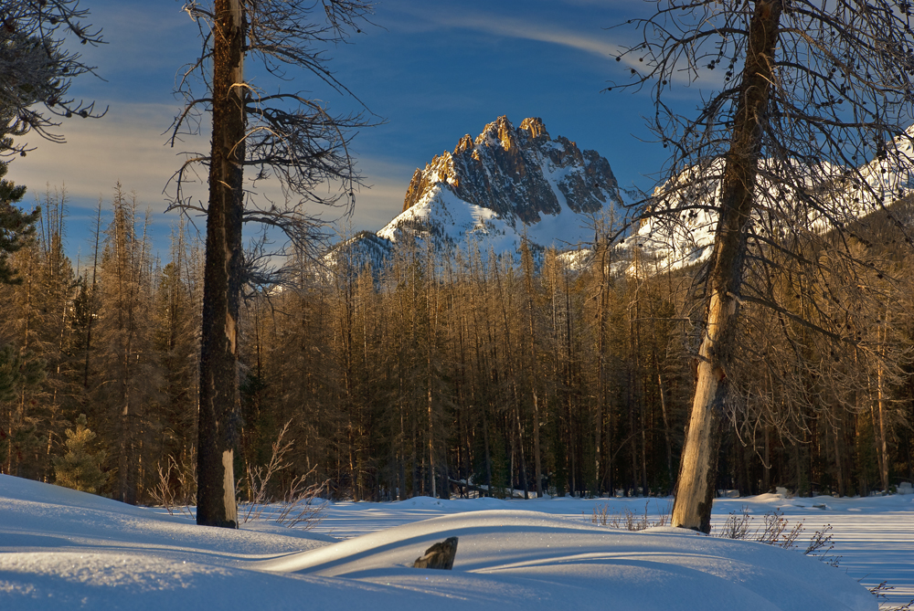
Mount Heyburn, at 10,229 feet (3,118 m) is one of the many 10,000-foot (3,050 m) peaks in the Sawtooth Range of central Idaho. Mount Heyburn is located in Custer County and within the Sawtooth Wilderness portion of the Sawtooth National Recreation Area. The town of Stanley is located eight miles (13 km) north-northeast of Mount Heyburn. Grand Mogul, 9,733 ft (2,967 m), and Mount Heyburn are the two signature peaks that frame the southwest end of Redfish Lake (6,547 ft (1,996 m)); all are in the Salmon River watershed.
Redfish Lake and Little Redfish Lake and the visitor services at these locations are only a few miles north of Mount Heyburn. While there are no trails to the top of Mount Heyburn, there are trails around both sides of Redfish Lake, and a boat service that ferries hikers the five miles (8 km) from Redfish Lake Lodge on the north end of the lake to the south end at regular intervals, for a round trip fee of $22. The drop-off point at the south end is a campground at the base of Mount Heyburn. The best time to climb Mount Heyburn is in the summer (July, August, or September); all routes to up Mount Heyburn are class 5.
Mount Heyburn was named for Weldon Heyburn, a U.S. Senator from Idaho from 1903 until his death in 1912.
The nearest mountain hut is Bench Hut located 1 851m/6 074ft E of the summit.
By elevation Mount Heyburn is
# 75 out of 193 in Custer County # 26 out of 67 in Sawtooth Wilderness Area # 26 out of 72 in the Sawtooth Range
By prominence Mount Heyburn is
# 36 out of 67 in Sawtooth Wilderness Area # 40 out of 72 in the Sawtooth Range
We use GPS information embedded into the photo when it is available.
3D mountains overlay
Adjust mountain panorama to perfectly match your photos because recorded by camera photo position might be imprecise.
Move tool
Rotate tool
Zoom
More customization
Choose which peak labels should make into the final photo and what photo title should be.
Next
Photo Location
Satellitte
Flat map
Relief map
Latitude
Longitude
Altitude
OR
Latitude
°'''
Longitude
°'''
Apply
Register Peak
Peak Name
Latitude
Longitude
Altitude
Register
Teleport
PeakVisor
This 3D model of Sagarmatha National Park in Nepal was made using the PeakVisor app topographic data. The mobile app features higher precision models worldwide, more topographic details, and works offline. Download PeakVisor maps today.
Download OBJ model
PeakVisor
The download should start shortly. If you find it useful please consider supporting the PeakVisor app.
PeakVisor for iOS and Android
Be a superhero of outdoor navigation with state-of-the-art 3D maps and mountain identification in the palm of your hand!