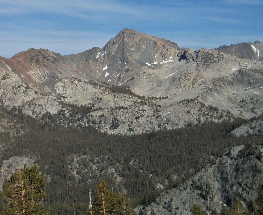
Mount Henry is a 12,196-foot-elevation (3,717-meter) mountain summit located in the Sierra Nevada mountain range, in Fresno County of northern California, United States. It is situated on the Le Conte Divide, along the shared boundary of John Muir Wilderness and Kings Canyon National Park, and 3.7 miles (6.0 km) northwest of Emerald Peak, the nearest higher neighbor. Topographic relief is significant as the east aspect rises 3,800 feet (1,200 meters) above South Fork San Joaquin River in two miles. The John Muir Trail passes to the northeast, providing an approach option.
By prominence Mount Henry is
# 32 out of 183 in Kings Canyon National Park # 61 out of 372 in Fresno County # 41 out of 205 in John Muir Wilderness
We use GPS information embedded into the photo when it is available.
3D mountains overlay
Adjust mountain panorama to perfectly match your photos because recorded by camera photo position might be imprecise.
Move tool
Rotate tool
Zoom
More customization
Choose which peak labels should make into the final photo and what photo title should be.
Next
Photo Location
Satellitte
Flat map
Relief map
Latitude
Longitude
Altitude
OR
Latitude
°'''
Longitude
°'''
Apply
Register Peak
Peak Name
Latitude
Longitude
Altitude
Register
Teleport
PeakVisor
This 3D model of Sagarmatha National Park in Nepal was made using the PeakVisor app topographic data. The mobile app features higher precision models worldwide, more topographic details, and works offline. Download PeakVisor maps today.
Download OBJ model
PeakVisor
The download should start shortly. If you find it useful please consider supporting the PeakVisor app.
PeakVisor for iOS and Android
Be a superhero of outdoor navigation with state-of-the-art 3D maps and mountain identification in the palm of your hand!