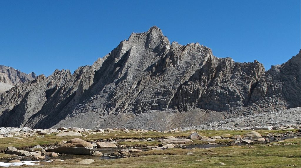
Mount Carl Heller is a 13,211-foot-elevation (4,031 meter) mountain summit located on the crest of the Sierra Nevada mountain range in California. It is situated on the common border shared by Tulare County with Inyo County, as well as the shared boundary of Sequoia National Park and John Muir Wilderness. It is set 13.5 miles (21.7 km) west of the community of Lone Pine, 1.9 miles (3.1 km) north of Mount Whitney, and 0.6 miles (0.97 km) northwest of Tunnabora Peak, the nearest higher neighbor. Mount Carl Heller ranks as the 105th-highest summit in California. Topographic relief is significant as the west aspect rises approximately 1,755 feet (535 meters) above Wallace Lake in 0.38 miles (0.61 km).
We use GPS information embedded into the photo when it is available.
3D mountains overlay
Adjust mountain panorama to perfectly match your photos because recorded by camera photo position might be imprecise.
Move tool
Rotate tool
Zoom
More customization
Choose which peak labels should make into the final photo and what photo title should be.
Next
Photo Location
Satellitte
Flat map
Relief map
Latitude
Longitude
Altitude
OR
Latitude
°'''
Longitude
°'''
Apply
Register Peak
Peak Name
Latitude
Longitude
Altitude
Register
Teleport
PeakVisor
This 3D model of Sagarmatha National Park in Nepal was made using the PeakVisor app topographic data. The mobile app features higher precision models worldwide, more topographic details, and works offline. Download PeakVisor maps today.
Download OBJ model
PeakVisor
The download should start shortly. If you find it useful please consider supporting the PeakVisor app.
PeakVisor for iOS and Android
Be a superhero of outdoor navigation with state-of-the-art 3D maps and mountain identification in the palm of your hand!