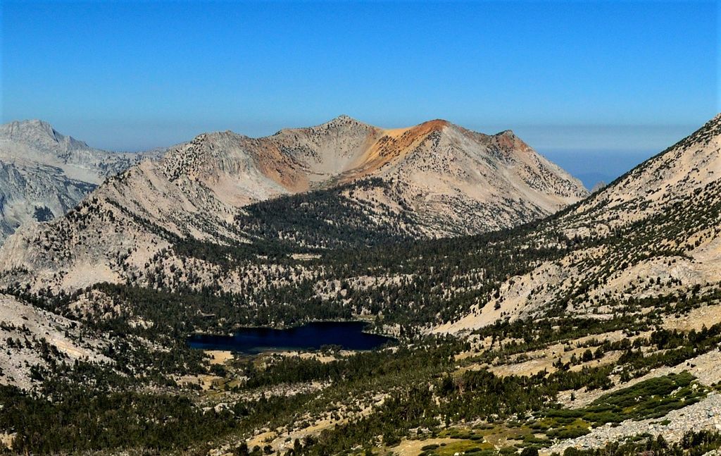
Mount Bago is an 11,870-foot-elevation (3,620-meter) mountain summit located west of the crest of the Sierra Nevada mountain range, in the southeast corner of Fresno County, in northern California. It is situated in Kings Canyon National Park, 14 miles (23 km) west of the community of Independence, 2.3 miles west of the Kearsarge Pinnacles, and 2.4 miles southwest of Mount Rixford. Topographic relief is significant as the south aspect rises 3,675 feet (1,120 meters) above Junction Meadow in one mile. The John Muir Trail passes to the northeast of this remote geographical feature. The first ascent of the summit was made July 11, 1896, by Joseph Nisbet LeConte and Wilson S. Gould.
By prominence Mount Bago is
# 21 out of 183 in Kings Canyon National Park # 41 out of 372 in Fresno County
We use GPS information embedded into the photo when it is available.
3D mountains overlay
Adjust mountain panorama to perfectly match your photos because recorded by camera photo position might be imprecise.
Move tool
Rotate tool
Zoom
More customization
Choose which peak labels should make into the final photo and what photo title should be.
Next
Photo Location
Satellitte
Flat map
Relief map
Latitude
Longitude
Altitude
OR
Latitude
°'''
Longitude
°'''
Apply
Register Peak
Peak Name
Latitude
Longitude
Altitude
Register
Teleport
PeakVisor
This 3D model of Sagarmatha National Park in Nepal was made using the PeakVisor app topographic data. The mobile app features higher precision models worldwide, more topographic details, and works offline. Download PeakVisor maps today.
Download OBJ model
PeakVisor
The download should start shortly. If you find it useful please consider supporting the PeakVisor app.
PeakVisor for iOS and Android
Be a superhero of outdoor navigation with state-of-the-art 3D maps and mountain identification in the palm of your hand!