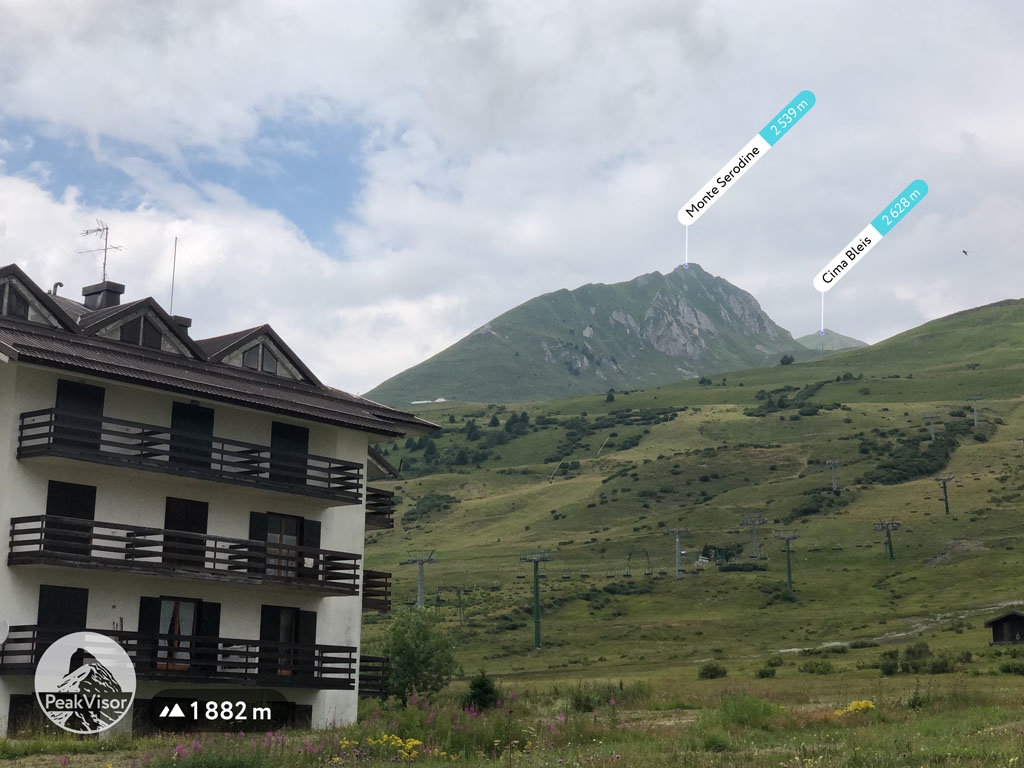
At an elevation of 2,539 m (8330 ft.), and with a prominence of 79 m (259 ft.), Monte Serodine forms part of the Southern Rhaetian Alps. It is situated close to the city of Brescia, in the province of Brescia, in Lombardy, Italy.
From the parking lot, follow the dirt road along trail No. 63, which leads to the chairlift, and further, to Malga Negritella. From Malga Negritella, keep going along the dirt road that turns widely to the right. Alternatively, climb directly up the ski slope to the right of the canal that flows through the central valley. Expect to reach a grassy plateau, from where the upper station of the chairlift is visible, just below the Bleis pond.
Upon turning left, visitors will see an old military path (characterized by the remains of stone walls), which goes up to the northern ridge of the mountain. From this point, approach Monte Serodine from the east side or the west side. Near the summit, there is a ridge. Continue from there on the path of small humps and troughs until it reaches a steep grassy stretch with loose stones and a small wooden cross.
Special Note: Hikers and climbers may need an ice ax and crampons during the winter months. Proceed cautiously due to the possibility of ice and loose rocks.
The nearest mountain hut is Rifugio Capanna Bleis located 582m/1 910ft N of the summit.
We use GPS information embedded into the photo when it is available.
3D mountains overlay
Adjust mountain panorama to perfectly match your photos because recorded by camera photo position might be imprecise.
Move tool
Rotate tool
Zoom
More customization
Choose which peak labels should make into the final photo and what photo title should be.
Next
Photo Location
Satellitte
Flat map
Relief map
Latitude
Longitude
Altitude
OR
Latitude
°'''
Longitude
°'''
Apply
Register Peak
Peak Name
Latitude
Longitude
Altitude
Register
Teleport
PeakVisor
This 3D model of Sagarmatha National Park in Nepal was made using the PeakVisor app topographic data. The mobile app features higher precision models worldwide, more topographic details, and works offline. Download PeakVisor maps today.
Download OBJ model
PeakVisor
The download should start shortly. If you find it useful please consider supporting the PeakVisor app.
PeakVisor for iOS and Android
Be a superhero of outdoor navigation with state-of-the-art 3D maps and mountain identification in the palm of your hand!