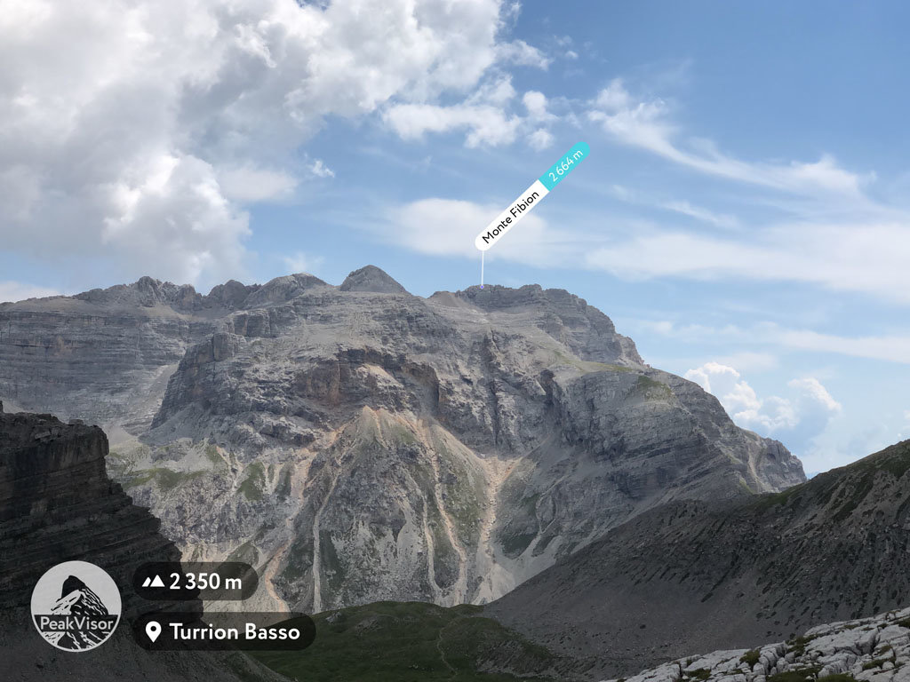
At an elevation of 2,664 m (8,470 ft.), and with a prominence of 128 m (420 ft.), Monte Fibion forms part of the Southern Rhaetian Alps. It is situated in
the province of South Tyrol, Italy.
Monte Fibion, although not very difficult to climb, requires a degree of fitness. The route from the base of the mountain starts with a very gradual slope, although visitors are advised to watch for loose gravel and moving rocks. The incline gradually becomes steeper and steeper.
The best time to climb Monte Fibion is during August and September when the weather is pleasant, skies are clear, and there is minimum precipitation to hamper your progress.
The nearest mountain hut is Malga Spora located 1 295m/4 248ft S of the summit.
By elevation Monte Fibion is
# 64 out of 207 in the Brenta group
By prominence Monte Fibion is
# 56 out of 207 in the Brenta group # 80 out of 307 in Parco naturale dell'Adamello-Brenta
We use GPS information embedded into the photo when it is available.
3D mountains overlay
Adjust mountain panorama to perfectly match your photos because recorded by camera photo position might be imprecise.
Move tool
Rotate tool
Zoom
More customization
Choose which peak labels should make into the final photo and what photo title should be.
Next
Photo Location
Satellitte
Flat map
Relief map
Latitude
Longitude
Altitude
OR
Latitude
°'''
Longitude
°'''
Apply
Register Peak
Peak Name
Latitude
Longitude
Altitude
Register
Teleport
PeakVisor
This 3D model of Sagarmatha National Park in Nepal was made using the PeakVisor app topographic data. The mobile app features higher precision models worldwide, more topographic details, and works offline. Download PeakVisor maps today.
Download OBJ model
PeakVisor
The download should start shortly. If you find it useful please consider supporting the PeakVisor app.
PeakVisor for iOS and Android
Be a superhero of outdoor navigation with state-of-the-art 3D maps and mountain identification in the palm of your hand!