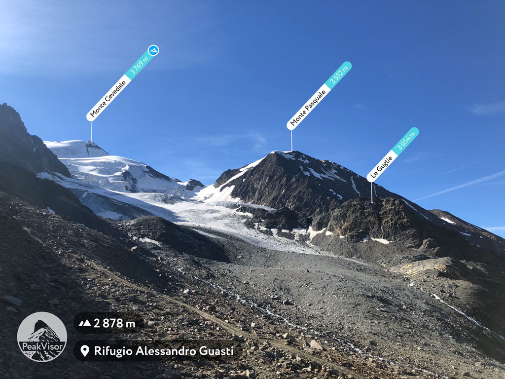
At an elevation of 3,054 m (10,020 ft.), and with a prominence of 25 m (82 ft.), Le Guglie forms part of the Southern Rhaetian Alps. It is situated close to the town of Sondrio, in the province of Sondrio, in Lombardy, Italy.
This mountain is more of a slope on the way to other mountains such as Punta Graglia (3,391 m) and Cima di Solda (3,372 m), which is an interesting extension to any mountain climbing expedition for those who feel up to the challenge.
Le Guglie is not a particularly challenging mountain to climb, yet it is advisable to wear robust mountain boots and appropriate clothing.
Hikers can stop for a breather at Rifugio Gianni Casati at an altitude of 3,269 m. The best time to visit Le Guglie is during August and September.
The nearest mountain hut is Rifugio Gianni Casati located 1 276m/4 187ft NNE of the summit.
We use GPS information embedded into the photo when it is available.
3D mountains overlay
Adjust mountain panorama to perfectly match your photos because recorded by camera photo position might be imprecise.
Move tool
Rotate tool
Zoom
More customization
Choose which peak labels should make into the final photo and what photo title should be.
Next
Photo Location
Satellitte
Flat map
Relief map
Latitude
Longitude
Altitude
OR
Latitude
°'''
Longitude
°'''
Apply
Register Peak
Peak Name
Latitude
Longitude
Altitude
Register
Teleport
PeakVisor
This 3D model of Sagarmatha National Park in Nepal was made using the PeakVisor app topographic data. The mobile app features higher precision models worldwide, more topographic details, and works offline. Download PeakVisor maps today.
Download OBJ model
PeakVisor
The download should start shortly. If you find it useful please consider supporting the PeakVisor app.
PeakVisor for iOS and Android
Be a superhero of outdoor navigation with state-of-the-art 3D maps and mountain identification in the palm of your hand!